


Weather Details and Aloha Paragraphs
Posted by GlennJuly 26-27 2006
Air Temperatures – The following maximum temperatures were recorded across Hawaii Wednesday:
Lihue, Kauai – 86F
Honolulu, Oahu – 88
Kaneohe, Oahu – 85
Kahului, Maui – 86
Hilo, Hawaii – 84
Kailua-Kona, Hawaii – 86
Temperatures early Thursday morning ranged between these warmest and coolest spots near sea level at the 4 a.m. hour:
KAILUA-KONA – 77
HILO AIRPORT – 68
Precipitation Totals – The following numbers represent the largest precipitation totals (inches) during the last 24 hours (as of Thursday morning) on each of the major islands:
0.77 MOUNT WAIALEALE, KAUAI
0.13 WILSON TUNNEL, OAHU
0.00 MOLOKAI
0.00 LANAI
0.00 KAHOOLAWE
0.08 WEST WAILUAIKI, MAUI
0.50 LAUPAHOEHOE, BIG ISLAND
Weather Chart – Here’s the latest (automatically updated) weather map…showing a relatively strong 1034 millibar high pressure system located to the NNE of our islands. This high pressure cell will keep moderately strong trade winds blowing…locally quite strong and gusty during the afternoons. Here’s a Weather Map Symbol page for clarification about what all those weather symbols mean on the map.
Hawaii’s Mountains – Here’s a link to the live webcam on the summit of near 14,000 foot Mauna Kea on the Big Island of Hawaii. The tallest peak on the island of Maui is the Haleakala Crater, which is near 10,000 feet in elevation. These two webcams are available during the daylight hours here in the islands…and when there’s a big moon rising just after sunset for an hour or two! Plus, during the nights and early mornings you will be able to see stars, and the sunrise too…depending upon cloud conditions.
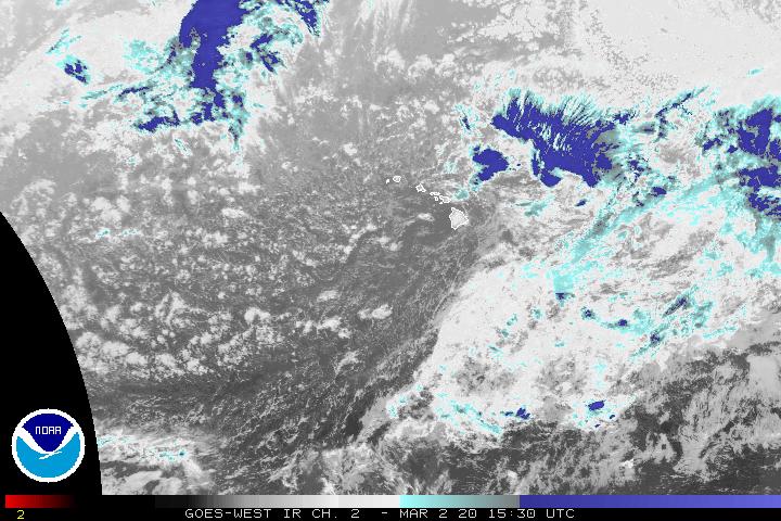
Satellite Images – To view the cloud conditions we have here in Hawaii, please use the following satellite links, starting off with the Infrared Satellite Image of the islands to see all the clouds around the state during the day and night. This next image is one that gives close images of the islands only during the daytime hours, and is referred to as a Close-up visible image. This next image shows a larger view of the Pacific…giving perspective to the wider ranging cloud patterns in the Pacific Ocean…out from the islands. To help you keep track of where any showers may be around the islands, here’s the latest animated radar image.
Tropical Cyclone Activity – The eastern Pacific hurricane season runs from May 15 through November 30…while the central Pacific (where Hawaii is) runs from June 1 through November 30. The latest storm information for the eastern Pacific can be found by clicking here. A storm tracking map for both the central and eastern areas can be found by clicking here . For the central Pacific, the latest storm information can be found by clicking here.

The golden glow of Kona…
Photo Credit: Konaboy
Favorably inclined trade wind weather will continue across the Hawaiian Islands through Thursday. Skies will be quite clear to partly cloudy in general. Many rain gauges around the state have remained dry during the last 24 hours, although some windward biased showers will fall at times. The trade winds will be quite light during the morning hours, then getting stronger and more gusty during the afternoons as usual.
Tropical disturbance Daniel continues to wind down approximately 700 miles ESE of Hilo, Hawaii early Wednesday evening. Looking at what is left of this former tropical depression, using this lastest satellite image, we can see that there is a swirl of low clouds to the ESE of the Big Island. This vortex, or remnant tropical low pressure system, is expected to move by south of Hawaii Friday into Saturday. At this point, it looks like we would see an increase in showers when the northern fringe of these clouds arrive, especially over the Big Island, with locally strong and gusty trade winds blowing for a time. This tropical system is now officially finished, as the Central Pacific Hurricane Center issued its final advisory late Wednesday morning.
It’s early Wednesday evening here in Kula, Maui, as I start this sunset commentary. Wednesday was another nice day, although there were a few more clouds around than the previous couple of days. Those clouds dropped more showers too, although most of those were restricted to the windward sides of the islands. The winds in Kihei, after being calm during most of the morning hours, kicked up their heels quite a lot during the afternoon. The latest information about former tropical system Daniel is contained in the paragraph above. There is still a fairly impressive swirl of lower level clouds, which are quite shallow. Nonetheless, there is still the chance, as noted above, for locally showery and windy weather to move through the state during the day Friday into Saturday. I think it would still be a good idea, for folks, especially on Maui and the Big Island, to pay attention to weather changes that might occur during that time frame. I will continue to monitor the situation, and present my latest thoughts several times each day. I’m not worrying about this area of disturbed weather, although I’m remaining cautious and keeping an eye out for any unexpected changes. I hope you have a great Wednesday night. I’ll be back early Thursday morning for the next narrative. Aloha for now…Glenn.
By the way, you may notice that the activity pages on this website look renewed again, thanks to Bumpnetworks, who are both my friends, and also my valued website host! The team at Bump Networks provides custom software solutions, web solutions and hardware interfaces for a variety of clients. They’ve built software and web solutions for clients in many industries including high-tech, entertainment, travel, tour operator, GPS, disaster prevention and management, and government/DOD.
I want to highlight another of the advertisers on my website today, this time its Jim Sanders Realty. Maui is one of the world’s most popular vacation destinations. It has also recently become accepted as not only a wonderful place to visit or retire but also a great place to live and raise a family. Maui’s attractiveness to vacationers, retirees and families has fueled incredible demand for our real estate. Short supply and high demand make for a very dynamic Real Estate market. MauiRealEstate.com provides you with four excellent ways to stay up to date with the Valley Island’s fast-paced real estate market: Let Billy Jalbert help you with all your Maui Realty needs!