


Weather Details & Aloha Paragraphs
Posted by GlennApril 22-23 2006
Air Temperatures – The following maximum temperatures were recorded across Hawaii Saturday:
Lihue, Kauai – 77F
Honolulu, Oahu – 81
Kaneohe, Oahu – 78
Kahului, Maui – 82
Hilo, Hawaii – 80
Kailua-Kona, Hawaii – 83
Temperatures early Sunday morning ranged between these warmest and coolest spots near sea level at the 5 a.m. hour:
Kailua-kona – 71
Kahului, Maui airport – 67
Precipitation Totals – The following numbers represent the largest precipitation totals during the last 24 hours (as of Sunday morning) on each of the major islands, including:
2.33 MOUNT WAIALEALE, KAUAI
0.29 MANOA LYON ARBORETUM, OAHU
0.08 MOLOKAI
0.00 LANAI
0.00 KAHOOLAWE
0.39 HANA AIRPORT, MAUI
0.70 HONOKAA, BIG ISLAND
Weather Chart – Here’s the latest (automatically updated) weather map…showing high pressure systems far to the NE and NNW of Hawaii. This pressure configuration will keep moderate to locally strong and gusty trade winds blowing today through Monday. Here’s a Weather Map Symbol page for clarification about what all those funny weather symbols mean.
Hawaii’s Mountains – Here’s a link to the live webcam on the summit of near 14,000 foot Mauna Kea on the Big Island of Hawaii. The tallest peak on the island of Maui is the Haleakala Crater, which is near 10,000 feet in elevation. These two webcams are only available during the daylight hours here in the islands…that is unless there’s a big moon rising just after sunset for an hour or two!
Satellite Images – To view the cloud conditions we have here in Hawaii, please use the following satellite links, starting off with the Infrared Satellite Image of the islands to see all the clouds around the state during the day and night. This next image is one that gives close images of the islands only during the daytime hours, and is referred to as a Close-up visible image. This next image shows a larger view of the Pacific…giving perspective to the wider ranging cloud patterns in the Pacific Ocean…out from the islands. To help you keep track of where any showers may be around the islands, here’s the latest animated radar image.

There’s no end in sight for the trade winds, which are blowing across the Hawaiian Islands now….cool ones too in places. Wind speeds will vary in strength, increasing now into Sunday. All these trade wind breezes are arriving thanks to moderately strong high pressure systems located far to the NE and NW of the Aloha state. The winds will be strongest during the days, and lightest during the nights…with the strongest gusts occurring around Maui and the Big Island as is often the case during the spring months.
The reason our trade winds mellowed out briefly, is that a cold front moved by to the north of the state recently. This mid-latitude frontal cloud band won’t bring any clouds or showers to our area however. It will stay a good distance away, although as the front moves away, our local winds will increase in some areas. As this cold front moves away to the east, a new trade wind producing high pressure system will appear…increasing our local trade wind speeds into the new week.
As far as showers go, the windward sides will be where most of whatever few incoming showers fall. These showers won’t have anything to do with the cold front, as noted above…but will just be from clouds carried in on the trade winds. These north and east facing windward slopes have seen lots showers lately. There has been some drying out recently, which is good news for those windward locations. This drier reality will last through the weekend, into the first part of the new week…with a possible increase in showers again around next Wednesday.
The leeward sides of all the islands will have pleasant weather, with none of those passing showers around. Those south and west facing coasts will find less wind in general too, which will keep the air temperatures 5-10 degrees warmer than the cooler and breezy windward sides. All the recent high cirrus clouds, which was dimming and filtering our sunshine, seems to be thinner now. This is opening up the way for mostly sunny weather, with fine conditions for all beach activities. The morning hours will be best, as the winds will be lighter.
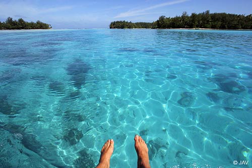
It’s early Saturday evening here in Kula, Maui, as I start today’s sunset commentary. I just got back from Haiku, over in the West Kuiaha Rd. area, where I visited some friends, and got a haircut. It was on and off lightly showering over there, but quite warm. Now that I’m back upcountry, I find that it’s pretty breezy at the moment, with my wind chimes singing sweetly…which were clanging together in the stronger winds later in the evening. The drizzly mist is just down the road, although here it’s dry thus far, as are the leeward towns of Lahaina and Kihei. It’s just now a few minutes after sunset, which is about 645pm. There’s a thin bank of high cirrus clouds lighting up nicely, which I’m sure is a nice treat for the folks down on the beaches along the south and west facing beaches. Maybe some of them have a tropical drink in hand, with their feet ankle deep in the warm waters of the Pacific…at least that’s what I might want to be doing if I was on vacation! It’s been a nice day personally, filled with lots of communication with my neighbors and friends. I’m listening to internet radio as I write these words, with Huey Lewis and The News – Stuck With You at the moment, which brings back memories of the past. This particular station is called Club 921, coming out of London, England. I hope you have a great Saturday night! I’ll be back Sunday morning with more weather updates. Aloha for now…Glenn.
p.s. this is an interesting scientific link