


July 12-13, 2010
Air Temperatures – The following maximum temperatures were recorded across the state of Hawaii Monday afternoon:
Lihue, Kauai – 84
Honolulu, Oahu – 88
Kaneohe, Oahu – 85
Kaunakakai, Molokai – 85
Kahului, Maui – 89
Hilo, Hawaii – 83
Kailua-kona – 82
Air Temperatures ranged between these warmest and coolest spots near sea level – and on the highest mountain tops too…as of 5pm Monday evening:
Honolulu, Oahu – 84
Molokai airport – 77
Haleakala Crater – 55 (near 10,000 feet on Maui)
Mauna Kea summit – 48 (near 14,000 feet on the Big Island)
Precipitation Totals – The following numbers represent the largest precipitation totals (inches) during the last 24 hours on each of the major islands, as of Monday afternoon:
0.11 Kilohana, Kauai
0.24 Manoa Valley, Oahu
0.01 Molokai
0.00 Lanai
0.00 Kahoolawe
0.26 West Wailuaiki, Maui
0.40 Kealakekua, Big Island
Marine Winds – Here’s the latest (automatically updated) weather map showing a 1035 millibar high pressure cell to the northeast…which will keep the trade winds blowing…becoming lighter into Wednesday.
Satellite and Radar Images: To view the cloud conditions we have here in Hawaii, please use the following satellite links, starting off with this Infrared Satellite Image of the islands to see all the clouds around during the day and night. This next image is one that gives close images of the islands only during the daytime hours, and is referred to as a Close-up visible image. This next image shows a larger view of the Pacific…giving perspective to the wider ranging cloud patterns in the Pacific Ocean. Finally, here’s a Looping IR satellite image, making viewable the clouds around the islands 24 hours a day. To help you keep track of where any showers may be around the islands, here’s the latest animated radar image.
Hawaii’s Mountains – Here’s a link to the live webcam on the summit of near 14,000 foot Mauna Kea on the Big Island of Hawaii. The tallest peak on the island of Maui is the Haleakala Crater, which is near 10,000 feet in elevation. These two webcams are available during the daylight hours here in the islands…and when there’s a big moon rising just after sunset for an hour or two! Plus, during the nights and early mornings you will be able to see stars, and the sunrise too…depending upon weather conditions.
Tropical Cyclone activity in the eastern and central Pacific – Here’s the latest weather information coming out of the National Hurricane Center, covering the eastern north Pacific. You can find the latest tropical cyclone information for the central north Pacific (where Hawaii is located) by clicking on this link to the Central Pacific Hurricane Center. Here’s a tracking map covering both the eastern and central Pacific Ocean. A satellite image, which shows the entire ocean area between Hawaii and the Mexican coast…can be found here. Of course, as we know, our hurricane season won’t begin again until June 1st here in the central Pacific.
Aloha Paragraphs
Looks like more good weather coming up!
As the computer models have been suggesting since last week, the trade winds have eased off quite a bit today, at least compared to what they were all last week. The trade winds like to blow in the moderately strong category during the summer month of July. They were doing just that last week, and as we start off this new work week, they are down into the light to locally moderate range. The winds are down due to several factors, including an out of season cold front to the northeast, reduced strength of our trade wind producing high pressure system to the northeast…and an upper level low pressure system passing over the state from east to west.
These weather features are all working together to soften our winds, which may get even lighter over the next several days. As this weather map shows, the high is far away, and weighing-in at only 1035 millibars. We can also see the curved dashed line to our northeast, representing what we call a shearline, or a cloud band separating lighter winds ahead of it…from stronger winds behind it. Our winds will remain lighter than normal until later Thursday, at which point the shearline will arrive, bringing a moderately strong surge of fresh trade winds into play. This will help eliminate any mugginess that develops between now and then.
In terms of precipitation, it will be rather limited for the time being, as our overlying atmosphere remains on the dry and stable side. The majority of the rainfall that we’ve been seeing, almost all of it as a matter of fact, has been falling along the windward sides of the islands lately. None of these windward biased showers have been heavy for a while, while the leeward sides for the most part, have remained nearly bone dry. This has been the way it’s been of late, thus the very dry drought stricken conditions that prevail, over those south and west facing coasts and slopes. As the winds come down now, we’re moving into what can be called a modified convective weather pattern, although with still some vestiges of the trade winds around too…thus the modified qualifier.
The showers will begin to shift over to the leeward slopes during the afternoons, perhaps most generously on the larger islands of Maui and the
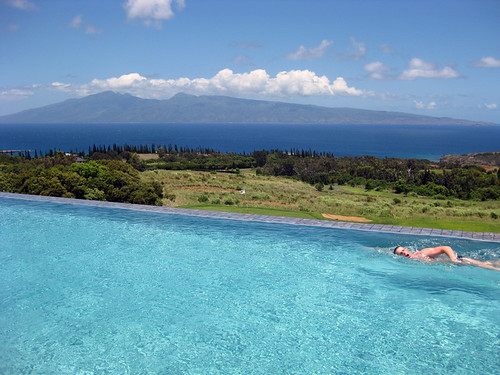
It’s Monday evening as I begin writing this last section of today’s narrative update. As noted above, our winds will continue, although be considerably lighter than anytime lately. Rainfall has continued to be present along our windward sides, although starting soon, some showers will begin to fall over the interior slopes during the afternoons locally. This modified convective weather pattern will also provide some muggy weather down near the coasts. Later in the week, as mentioned in the first paragraph above, an out of season cold front will edge down into our area. This won’t be an official cold front by then however, and will be termed a shearline, or just a line of clouds with showers. At the same time, this band will usher in the return of stronger trade winds as well. ~~~ Here in Kihei, Maui, at a little past 5pm, skies were clear to partly cloudy. The afternoon clouds got dark along the Haleakala Crater slopes, although I didn’t see any showers falling, perhaps by Tuesday afternoon. The winds are still a bit too strong to allow the clouds to grow very tall, with the strongest gust here on Maui still reaching 30 mph…at the Kahului airport early this evening. The afternoon clouds are already quickly dissipating, and I expect generally clear skies overnight, although after glancing at this IR satellite image, and with the trade winds still blowing, the windward sides will find some clouds and a few showers yet. I’ll be back early Tuesday morning with your next new weather narrative from paradise, I hope you have a great Monday night until then! Actually, It’s now 745pm, and I just finished dinner, and came upstairs to my weather tower. I was out on my weather deck just now, and spotted the absolute thinnest crescent moon in the western horizon…heading down into the still orange end of sunset, how beautiful! Again, see you in the mornin’. Aloha for now…Glenn.
Interesting: Ten countries worldwide, including five African nations, are at "extreme risk" because of limited access to clean, fresh water, according to a new global water security index. And the effects of climate change and population growth will exacerbate the stress on these water supplies, potentially threatening stability in many regions, according to the analysis by Maplecroft, a UK-based consulting group.
Among the nations most at risk are Somalia, Mauritania, Sudan, Niger, and Iraq. Other nations at extreme risk — including Pakistan, Egypt, and Uzbekistan — are already facing internal and border tensions because of limited water supplies.
"There is a risk of water stress exacerbating future risks of conflict, although there is evidence that water scarcity may also help foster cooperation instead," said Anna Moss, a Maplecroft environmental analyst.
The index evaluates the water security of 165 nations in four key areas: access to clean water and sanitation; availability of renewable water and reliance on external sources; the compatability of supply and demand; and the dependence of the nation’s economy on water supplies. The most vulnerable regions include Africa, the Middle East and the Central Asian states of the former Soviet Union. The most secure nations include Iceland and Norway.
Interesting2: Exporters, livestock feeders and ethanol makers are going through the U.S. corn stockpile faster than farmers can grow the crops. Despite record crops in two of the past three years and another record within reach this year, the Agriculture Department estimated the corn carryover will shrink to the lowest level since 2006/07.
In a monthly look at crop supply and usage, USDA estimated 1.478 billion bushels of corn will be in U.S. bins on August 31, when this marketing year ends, and 1.373 billion bushels will be on hand at the end of 2010/11.
The carryover figures are sharply lower from USDA’s previous estimates — down 8 percent for this year and down 12 percent for next year — but slightly larger than traders expected. "The number is definitely a negative, when you look at the carryout numbers," said Don Roose, analyst with U.S. Commodities in West Des Moines, Iowa.
The report was anticlimactic after USDA last week shocked markets with data that showed corn plantings were smaller than expected this year and corn consumption through June 1 was far larger than expected. That data had spurred U.S. corn futures up 16 percent to a two-month high but prices are still far below 2010’s peak above $4.25 a bushel seen in early January.
Wheat futures fell 2 percent on Friday, weighed by USDA estimates of a 2.2 billion-bushel U.S. crop, up 7 percent from its previous estimate and a surplus equal to six months’ use. Wheat for September delivery ended the day at the Chicago Board of Trade at $5.38 a bushel, down 2 percent. August soybeans rose 1 percent for the day, closing at $9.93-1/4 a bushel. September corn ended at $3.83-1/2, down 2 cents a bushel.
Interesting3: The passage of smoking bans in two large Minnesota cities was not associated with job losses at bars and may in fact have contributed to higher employment in restaurants, according to new research. The study is the first to examine the economic effects of clean indoor air policies on bars and restaurants as independent types of businesses, the researchers said.
Consistent with previous published studies of the economic impact of smoking bans, this analysis did not find significant economic effects on the hospitality industry as a whole. In both Minneapolis and St. Paul, the policies were associated with an increase of at least 3 percent in employment at restaurants over a 2 ½-year span following adoption of a local clean indoor air policy.
Employment in Minneapolis bars increased more than 5 percent after passage of that city’s smoking ban, while in St. Paul, bar employment had a non-significant decrease of 1 percent — a decrease that cannot be statistically distinguished from zero, or no change in employment.
The researchers noted that the broad look at total bar and restaurant employment at the city level over time means that this study is not able to describe potential changes at the neighborhood or individual business level. Opponents to smoking bans have argued against enactment of these policies with predictions of large revenue losses, worker layoffs and business closures in the hospitality industry, and at bars in particular because of known correlations between drinking and tobacco use.
Proponents of such policies say smoking bans promote a healthful workplace atmosphere for workers and patrons. According to the U.S. Department of Health and Human Services, exposure to secondhand smoke increases nonsmokers’ risks of developing lung cancer, heart disease, respiratory conditions and other diseases.
"These clean indoor air policies are designed to protect workers from exposure to secondhand smoke," said Elizabeth Klein, assistant professor of health behavior and health promotion at Ohio State University and lead author of the study. "We are evaluating business employment because employment is an objective measure of the overall economic health of these businesses.
What we have found is that there isn’t a significant economic effect for bars, and in fact for restaurants, there is some positive change in employment. These findings underscore that nothing economically catastrophic happened for bars or restaurants in the Twin Cities as a result of banning smoking in these environments."
Interesting4: Approximately 1 out of every 4 people observed in a public setting failed to cover their mouth when they coughed or sneezed according to research presented July 12 at the International Conference on Emerging Infectious Diseases. Even more concerning, less than 5 percent of people covered their mouth using methods recommended by public health officials.
"We were surprised to find that this was the first study of directly observed respiratory hygiene behavior that we could identify," says Nick Wilson of Otago University Wellington in New Zealand, an author on the study.
In the midst of the H1N1 influenza pandemic that started in 2009, public health officials around the world were urging individuals to take action to avoid spreading the infection. One of the simplest actions recommended was that individuals cover their mouth when they cough or sneeze, preferably with a tissue or into their elbow, to avoid getting the virus on their hands and spreading it to nearby surfaces.
To determine if people were heeding the advice of public health agencies, Wilson and his colleagues conducted an observational survey in 3 public areas in New Zealand’s capital city of Wellington: A train station, a hospital and a shopping mall.
Local public health authorities had already been conducting an educational campaign with posters and radio and newspaper advertisements recommending people cover their mouth when they cough or sneeze, using a tissue or their elbow. Using medical students as observers they recorded the incidence of coughs and sneezes and the individual response to the respiratory event.
Wilson and his colleagues observed 5.5 coughs and sneezes per observed-person-hour of which 26.7% went uncovered and only 4.7% were covered by a tissue, handkerchief or elbow (the method recommended by public health officials). The most common behavior, observed in 64.4% of cases, was to cover the mouth with the hands. Use of a handkerchief or covering the mouth with the elbow were the least common behaviors.
"This study showed a low prevalence of recommended respiratory hygiene behaviors suggesting that hygiene messages promoted in mass media campaigns have not been seen and/or have not been readily adopted by the public in this city," says Wilson. Subsequent work they have done indicates that there has actually been a drop off in some hygiene behaviors since the pandemic in the New Zealand winter of 2009. This is based on regular monitoring of public use of a hand sanitizer station at the entrance to the hospital near where they work.
Susan Douglass Says:
What is the weather typically like in late May, early June~~~Susan, the weather is typically nice, with the trade winds blowing…warm to very warm during the days, and relatively warm at night near sea level. Aloha, Glenn
Frank Parrino Says:
Aloha. 6/10″ of RAIN….mid afternoon Monday…Leeward Molokai. Rained quite hard for quite a while!
Mahalo to the “shearline”!!!~~~Hi Frank, thanks for the on the spot report from Molokai…actually the shearline won’t be here until Thursday night or so. Aloha, Glenn