


June 23-24, 2010
Air Temperatures – The following maximum temperatures were recorded across the state of Hawaii Wednesday afternoon:
Lihue, Kauai – 83
Honolulu, Oahu – 86
Kaneohe, Oahu – 82
Kaunakakai, Molokai – 83
Kahului, Maui – 84
Hilo, Hawaii – 83
Kailua-kona – 81
Air Temperatures ranged between these warmest and coolest spots near sea level around – and on the highest mountains…as of 5pm Wednesday evening:
Barking Sands, Kauai – 84
Hilo, Hawaii – 73
Haleakala Crater – 57 (near 10,000 feet on Maui)
Mauna Kea summit – 43 (near 14,000 feet on the Big Island)
Precipitation Totals – The following numbers represent the largest precipitation totals (inches) during the last 24 hours on each of the major islands, as of Wednesday afternoon:
1.90 Mount Waialaele, Kauai
0.11 Manoa Valley, Oahu
0.05 Molokai
0.00 Lanai
0.00 Kahoolawe
1.05 West Wailuaiki, Maui
0.95 Waiakea Uka, Big Island
Marine Winds – Here’s the latest (automatically updated) weather map showing a 1029 millibar high pressure system to the north of the islands. This will keep strong trade winds blowing through Thursday…beginning to ease up a little later Friday.
Satellite and Radar Images: To view the cloud conditions we have here in Hawaii, please use the following satellite links, starting off with this Infrared Satellite Image of the islands to see all the clouds around during the day and night. This next image is one that gives close images of the islands only during the daytime hours, and is referred to as a Close-up visible image. This next image shows a larger view of the Pacific…giving perspective to the wider ranging cloud patterns in the Pacific Ocean. Finally, here’s a Looping IR satellite image, making viewable the clouds around the islands 24 hours a day. To help you keep track of where any showers may be around the islands, here’s the latest animated radar image.
Hawaii’s Mountains – Here’s a link to the live webcam on the summit of near 14,000 foot Mauna Kea on the Big Island of Hawaii. The tallest peak on the island of Maui is the Haleakala Crater, which is near 10,000 feet in elevation. These two webcams are available during the daylight hours here in the islands…and when there’s a big moon rising just after sunset for an hour or two! Plus, during the nights and early mornings you will be able to see stars, and the sunrise too…depending upon weather conditions.
Tropical Cyclone activity in the eastern and central Pacific – Here’s the latest weather information coming out of the National Hurricane Center, covering the eastern north Pacific. You can find the latest tropical cyclone information for the central north Pacific (where Hawaii is located) by clicking on this link to the Central Pacific Hurricane Center. Here’s a tracking map covering both the eastern and central Pacific Ocean. A satellite image, which shows the entire ocean area between Hawaii and the Mexican coast…can be found here. Of course, as we know, our hurricane season won’t begin again until June 1st here in the central Pacific.
Aloha Paragraphs
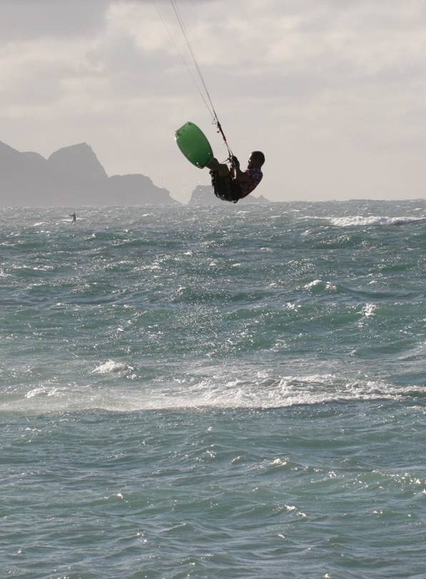
Trade winds…and south shore surf Thursday
Trade winds will continue, strengthening some into Thursday, before backing off some during the weekend…remaining somewhat lighter than normal into early next week. Small craft wind advisories are active in all our major channels…and in all coastal waters Wednesday afternoon. This latest weather map shows a moderately strong 1029 millibar high pressure system to the north of the
The windward sides will see a few showers…most notably during the night and early morning hours. As this IR satellite image shows, there are lots of clouds around the islands…although most of which are offshore from the windward sides of the islands. This looping radar image shows scattered showers moving across the state…the majority of which are taking aim on the islands from Oahu down through the
The eastern
It’s Wednesday evening as I begin writing this last section of today’s narrative update. The main thing now in our weather here in the islands, is the stronger than normal trade wind flow. As the numbers below show, we have some strong gusts Wednesday evening:
Kauai – 35 mph
Oahu – 42
Molokai – 42
Lanai – 18 – partially blocked from the strong trade winds
Kahoolawe – 43
Maui – 45
Big Island 37
Looking out the window here in Kihei it’s quite cloudy, in just about all directions, and especially up the slopes of the Haleakala Crater. I’m about ready to jump in my car for the drive back upcountry to Kula. I must say, that I’m looking forward to getting home, and relaxing a little, as it’s been a big day at work. I’ll be up very early Thursday morning again though, back at my computer to produce your next new weather narrative, available here around 6am HST. I hope you have a great Wednesday night until then! Aloha for now…Glenn.
Interesting: A magnitude-5.0 earthquake struck at the Ontario-Quebec border region of Canada on Wednesday, the U.S. Geological Survey said, and homes and businesses were shaken from Canada’s capital in Ottawa on south to an arc of U.S. states. There were no immediate reports of injuries or damage. The midday quake was felt in Canada and in a number of U.S. states, including Indiana, Michigan, Ohio, Pennsylvania, West Virginia, Vermont, New Hampshire, New Jersey and New York.
The USGS said the quake occurred at a depth of about 12 miles (19.2 kilometers). The agency initially said the quake had a 5.5 magnitude, but later reduced it to a magnitude-5.0. The quake occurred at 1:41 p.m. EDT (1741 GMT), the USGS said.
The tremors, which lasted about 30 seconds, rattled buildings in Ottawa and Toronto, as well as government offices across the Ottawa River in Gatineau, Quebec. The Parliament building in Ottawa was evacuated, with workers sent home while the building was inspected. Workers also left buildings in Toronto.
The quake came just ahead of the weekend summit of G-20 and G-8 world leaders in Toronto and Huntsville, Ontario. Chris Cornell, 46, who works in downtown Toronto, said desks and furniture shook as he sat at his desk in a finance office. Shirley Pelletier, 27, said a prolonged tremor shook bookshelves and caused paintings on walls to shake in her office just outside downtown Toronto.
Residents of a number of states in the Midwest and Northeast reported feeling the earthquake. In Ohio, people reported the sound of plaster cracking in Cleveland and buildings in Cincinnati gently swaying. In Cleveland, James Haselden says his office in a renovated 19th century brick building swayed and he heard plastic cracking but saw no damage.
The Pittsburgh Post-Gazette reported on its website that the Canadian quake was felt by some residents in the western Pennsylvania area. The quake also was felt in New Jersey, where the Bergen County administration building in Hackensack was evacuated after employees reported they felt a tremor. Bergen County Police Lt. Christine Francois said numerous people in the Hackensack and Englewood areas called police to report earth tremors.
In Michigan, residents from suburban Detroit to Port Huron and Saginaw reported feeling the earthquake. Detroit police spokeswoman Yvette Walker told The Associated Press that police personnel on the upper floors of the downtown headquarters building reported feeling the quake.
In New York state, people from Buffalo to Albany and north to Massena on the St. Lawrence River said pets were startled and plates rattled when the quake hit. David French, 53-year-old state worker from Cicero, New York, said he was at his computer inside his home near Syracuse when he felt his chair shake. "I thought the chair was breaking or something," he said. "I looked over and my filing cabinet was moving."
The quake prompted several calls to state police in the Adirondacks area. "A little shake, nothing too big," is how Trooper Mark Revette described the temblor. "It happens. We get a couple of these a year." Kellie Tassone, 40, was at home on Oneida Lake in Cicero. "My dog picked his head up just before it happened and kind of looked at me," she said. Then the sliding door started to rattle "and the house was shaking."
The USGS said the two largest quakes in western Quebec occurred in 1935 at magnitude-6.1 and in 1732 at a magnitude of 6.2, where it caused significant damage in Montreal. The agency said earthquakes cause significant damage in the region about once a decade. Smaller earthquakes are felt three or four times a year.
Interesting2: There are many ships at work right now in the Gulf of Mexico responding to the devastating consequences of the Deepwater Horizon explosion. Some are skimming the water to collect oil, some are burning off the oil. Some are busy digging a relief well. However, there is at least one vessel that is using this tragedy as an opportunity to conduct scientific research. The National Oceanic and Atmospheric Administration’s (NOAA) ship, Thomas Jefferson, is using acoustic and fluorometric scanning to detect oil under the surface.
The ship set off from Galveston, Texas on an eight day mission into the Gulf of Mexico, and returned to port on June 11. The purpose was to investigate the distribution and presence of subsurface oil coming from the rig explosion. Water samples were collected and analyzed by agency officials and scientists from the University of New Hampshire and the Woods Hole Oceanographic Institution.
"NOAA is extremely concerned about the health of the Gulf of Mexico and the well-being of the millions of people who depend on these waters for their livelihoods and pleasure," said Jane Lubchenco, Ph.D., under secretary of commerce for oceans and atmosphere and NOAA administrator. "I’m pleased that agency and academic scientists continue to innovate and explore ways to bring the absolute best science to inform the response and recovery efforts."
First, the science team would sweep the underlying waters with acoustic and fluorometric sensors to detect aberrations in the water column. Then they would take water samples to determine if the aberration was actually oil. An acoustic sensor uses sound waves and is often referred to as SONAR which is used commonly in submarines. Passive acoustic sensors listen to the sounds in the water.
Active sensors emit pulses of sound and then listen for the echo. An oil plume would have different sound reverberation than the water. Fluorometric sensors use light waves to determine the shape of an oil plume.
A beam of light, usually ultraviolet light, is scanned throughout the water. The light can excite electrons of certain molecules and cause them to emit their own light at a lower energy. This is the same concept behind glow-in-the-dark posters or stars that can stick onto a wall. The oil would have different fluorescence than the water.
The Thomas Jefferson made several initial observations including:
1. Subsurface oil was found 7.5 nautical miles southwest of the wellhead at 1,100 meters in depth by observing high fluorescence and reduced dissolved oxygen.
2. An acoustic anomaly was also found in the same area.
3. Natural gas was also found in an area of known gas seepage southwest of the spill site.
4. Fluorometric sensors have shown to be an extremely effective method to detect water masses in shallow waters.
Another expedition is underway for the ship, Thomas Jefferson to gather more data in the coastal zone. Any information on subsurface masses discovered in the coastal zone would be shared with other researchers and emergency responders.
The situation in the Gulf requires an all-hands-on-deck approach, and NOAA is doing its part to provide accurate data on where the oil is. Knowing where to find oil is just as important as cleaning up the oil. The work is sure to be difficult and ongoing.
Interesting3: While there is room for improvement in every country, the U.S. stands out for not getting good value for its health care dollars, ranking last despite spending $7,290 per capita on health care in 2007 compared to the $3,837 spent per capita in the Netherlands, which ranked first overall. Provisions in the Affordable Care Act that could extend health insurance coverage to 32 million uninsured Americans have the potential to promote improvements to the United States’ standing when it comes to access to care and equity, according to Mirror Mirror On The Wall: How the Performance of the U.S. Health Care System Compares Internationally 2010 Update, by Commonwealth Fund researchers Karen Davis, Cathy Schoen, and Kristof Stremikis.
The United States’ low marks in the quality and efficiency dimensions demonstrate the need to quickly implement provisions in the new health reform law and stimulus legislation that focus on realigning incentives to reward higher quality and greater value, investment in preventive care, and expanding the use of health information technology.
"It is disappointing, but not surprising that, despite our significant investment in health care, the U.S. continues to lag behind other countries," said Commonwealth Fund President and lead author Karen Davis. "With enactment of the Affordable Care Act, however, we have entered a new era in American health care.
We will begin strengthening primary care and investing in health information technology and quality improvement, ensuring that all Americans can obtain access to high quality, efficient health care." Earlier editions of the report, produced in 2004, 2006, and 2007, showed similar results. This year’s version incorporates data from patient and physician surveys conducted in seven countries in 2007, 2008, and 2009.