Air Temperatures – The following maximum temperatures (F) were recorded across the state of Hawaii Sunday along with the low temperatures Sunday:
82 – 73 Lihue, Kauai
84 – 73 Honolulu, Oahu
83 – 72 Molokai AP
85 – 72 Kahului AP, Maui
84 – 72 Kailua Kona
82 – 71 Hilo AP, Hawaii
Here are the latest 24-hour precipitation totals (in inches) for each of the islands as of Sunday evening:
4.31 Mount Waialeale, Kauai
1.71 Manoa Lyon Arboretum, Oahu
1.02 Molokai
0.06 Lanai
0.00 Kahoolawe
4.13 Puu Kukui, Maui
3.67 Saddle Quarry, Big Island
The following numbers represent the strongest wind gusts (mph) as of Sunday evening:
28 Lihue, Kauai
39 Oahu Forest NWR, Oahu
28 Molokai
31 Lanai
37 Kahoolawe
30 Maalaea Bay, Maui
39 South Point, Big Island
Hawaii’s Mountains – Here’s a link to the live webcam on the summit of our tallest mountain Mauna Kea (nearly 13,800 feet high) on the Big Island of Hawaii. This webcam is available during the daylight hours here in the islands, and at night whenever there’s a big moon shining down. Also, at night you will be able to see the stars — and the sunrise and sunset too — depending upon weather conditions.
Aloha Paragraphs

There are two storm low pressure systems active in the Gulf of Alaska, far north of Hawaii, with an associated cold front well offshore to our north and northwest

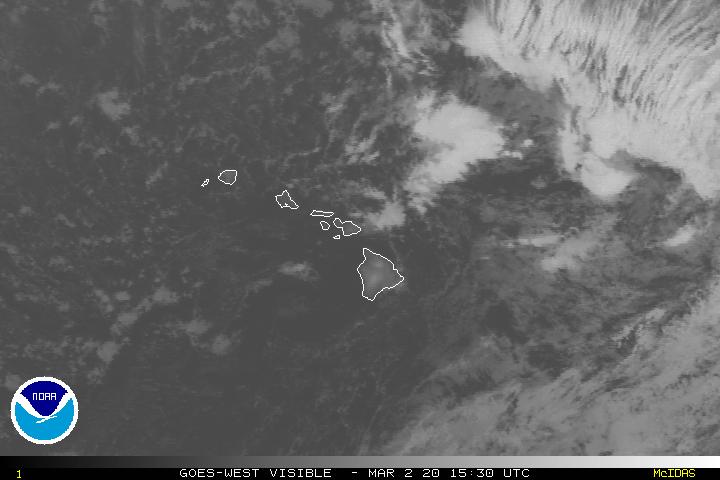
High cirrus (the brighter white clouds) are mostly to our west and south, although extending over the islands locally at times, with thunderstorms well south

A mix of high and low clouds are contributing to partly to mostly cloudy skies…although some clear areas as well

Showers falling locally – Looping radar image
Small Craft Advisory…all Hawaiian coasts and channels – starting this evening
High Surf Advisory…east facing shores of Kauai, Oahu, Molokai, Maui and the Big Island
Gale Watch…Maalaea Bay, Pailolo and Alenuihaha Channels, leeward and southeastern waters around the Big Island – starting Tuesday morning
~~~ Hawaii Weather Narrative ~~~
The gusty trade winds will continue through the next week, increasing Tuesday onward. Here’s the latest weather map, showing a near 1026 millibar high pressure system, about a 900 miles to the north-northeast of Hawaii. This in turn will keep our trade winds active, with no end in sight from this vantage point. The strongest trade wind speeds through the next week will occur Tuesday through Friday. This windy weather will likely bring 50+ mph wind gusts to some parts of the island chain, with wind advisories over the islands, and gale warnings over Hawaiian waters locally at their peak. These blustery winds should begin to ease up some by next weekend, although continue from the trade wind direction into the following week.
Here’s a wind profile of the offshore waters around the islands – and a closer look
Here’s the Hawaiian Islands Sulfate Aerosol animated graphic, showing vog forecast
Windward showers locally, while the leeward sides remain in better shape for the most part. An old cold front is losing its influence, with fewer showers statewide now. However, moisture from the old front, still located upwind of the islands, will be carried back over the windward sides, first over Maui County and the Big Island tonight, then Oahu and Kauai Monday into Tuesday morning. The longer range outlook continues to suggest that the Thanksgiving holiday will see wet trade wind conditions, with drier weather arriving next weekend.
Marine environment details: The Small Craft Advisory (SCA) remains in effect for most Hawaiian coastal waters through tonight due to a combination of strong trade winds and rough seas. Winds will weaken slightly later tonight and Monday, which should allow the winds and seas to drop slightly below advisory levels across the Kauai waters and the leeward Oahu and Maui County waters.
The latest model guidance remains in good agreement over the next several days, depicting the subtropical ridge becoming oriented from east to west over the eastern Pacific. A large batch of strong easterlies extending from the west coast to the islands by mid week can be expected. A combination of the locally generated seas and trade wind swell will translate to advisory level surf along east facing shores as early as Monday night, which should persist through the rest of the week. SCA conditions will likely be expanded to all coastal waters by Tuesday due to a combination of winds and seas. In some of the channels, winds will approach gale force levels Tuesday through Wednesday, then reach gale strength beginning as early as Thursday.
Surf along north and west facing shores will remain below advisory levels all week. Small northwest swells are expected Tuesday through Wednesday and again Friday through Saturday.
Recent activity across the Tasman Sea in the southern hemisphere may result in a slight increase in surf along the south shores of our islands by the mid-week period, due to a small south-southwest swell. Another gale is forecast to setup southeast of New Zealand through the early portion of the upcoming week, which could translate to another small southerly source by the end of next weekend.
~~~ An inspiring, although challenging National Geographic film called Before the Flood…with Leonardo DiCaprio (full screen best viewing)
~~~ Friday Evening Film: those of you who were following my recent travelogue know that I’ve been seeing most of the current films, at least the ones that appealed to me. This evening I’m going to see the new one called Arrival, starring Amy Adams, Jeremy Renner, Forest Whitaker, Michael Stuhlbarg, Tzi Ma…among many others! The synopsis, when mysterious spacecraft touch down across the globe, an elite team…lead by expert linguist Louise Banks (Amy Adams)…are brought together to investigate. As mankind teeters on the verge of global war, Banks and the team race against time for answers–and to find them, she will take a chance that could threaten her life, and quite possibly humanity. The critics are being very generous with this film, so I had high hopes. In addition, many of my close friends have seen this film, and are giving high grades as well.
I enjoyed this emotional sci-fi, although it wasn’t an easy film to figure out along the way. The alien invaders were certainly unique, like nothing else I’ve seen. One critic wrote, “one of the premier extra-terrestrail films of the century.” I appreciated the fact that this film didn’t blow up Intelligent Life, but rather emphasized communication and focused listening instead. It was both robust and delicate in equal measure, which isn’t common in most films I see these days. It asked the audience to imagine how we might respond, emotionally rather than militarily…in the event of an arrival from outer space. In case this strokes your imagination and interest, here’s the trailer.

Windy with showers arriving at times, mostly along our windward sides…although not exclusively
World-wide tropical cyclone activity…
![]()
>>> Atlantic Ocean: No active tropical cyclones
Here’s a satellite image of the Atlantic Ocean
>>> Caribbean:
Tropical Depression 16L is now active over the southwestern Caribbean Sea, here’s the NHC graphical track map, with a satellite image, and what the computer models are showing
>>> Gulf of Mexico: No active tropical cyclones
Here’s a satellite image of the Caribbean Sea…and the Gulf of Mexico
Here’s the link to the National Hurricane Center (NHC)
>>> Eastern Pacific: No active tropical cyclones
Here’s a wide satellite image that covers the entire area between Mexico, out through the central Pacific…to the International Dateline.
Here’s the link to the National Hurricane Center (NHC)
>>> Central Pacific: No active tropical cyclones
Here’s a link to the Central Pacific Hurricane Center (CPHC)
>>> South Pacific Ocean: No active tropical cyclones
>>> North and South Indian Oceans / Arabian Sea: No active tropical cyclones
Here’s a link to the Joint Typhoon Warning Center (JTWC)
Interesting: Corals Survived Caribbean Climate Change – Half of all coral species in the Caribbean went extinct between 1 and 2 million years ago, probably due to drastic environmental changes. Which ones survived? Scientists working at the Smithsonian Tropical Research Institute (STRI) think one group of survivors, corals in the genus Orbicella, will continue to adapt to future climate changes because of their high genetic diversity.
“Having a lot of genetic variants is like buying a lot of lottery tickets,” said Carlos Prada, lead author of the study and Earl S. Tupper Post-doctoral Fellow at STRI. “We discovered that even small numbers of individuals in three different species of the reef-building coral genus Orbicella have quite a bit of genetic variation, and therefore, are likely to adapt to big changes in their environment.”
“The implications of these findings go beyond basic science,” said Monica Medina, research associate at STRI and the Smithsonian’s National Museum of Natural History and associate professor at Pennsylvania State University. “We can look forward to using similar approaches to predict demographic models to better manage the climate change-threatened Orbicella reefs of today.”
To look back in time, the team of researchers working at the Smithsonian’s Bocas del Toro Research Station and Naos Molecular and Marine Laboratories collected fossils from ancient coral reefs and used high-resolution geologic dating methods to determine their ages. They compared the numbers of fossilized coral species at different time points. One of the best-represented groups in the fossil collections were species in the genus Orbicella. In addition to the fossil collections, they also used whole genome sequencing to estimate current and past numbers of several Orbicella species.
Within a single individual there are two copies of their genetic material, and in some instances, one copy is different than the other and is called a genetic variant. The authors first assembled the full genomic sequence of an individual from Florida and then, using it as an anchor, reconstructed the genetic variation contained within single individuals. Depending on the amount of the genetic variation at certain intervals across the genome, the authors were able to recover the population sizes of each species at different times in the past.
Between 3.5 to 2.5 million years ago, numbers of all coral species increased in the Caribbean. But from 2 to 1.5 million years ago, a time when glaciers moved down to cover much of the northern hemisphere and sea surface temperatures plunged, the number of coral species in the Caribbean also took a nosedive. Sea levels fell, eliminating much of the original shallow, near-shore habitat.
“Apart from the species that exist today, all species of Orbicella that survived until 2 million years ago suddenly went extinct,” write the authors. When huge numbers of species die out, it makes room for other species to move in and for new species to develop to occupy the space the others held.
Two species that grow best in shallow water doubled in number at about the same time that their sister species and competitor, the organ pipe Orbicella (O. nancyi) disappeared.
When a species declines during an extinction event, it loses more and more genetic variation and sometimes does not have much to work with during the recovery period. Scientists call this a genetic bottleneck. Orbicella was able to recover after the bottleneck.
“It’s incredible how predictions from genetic data correlated so well with observations from the fossil and environmental record,” said Michael DeGiorgio, assistant professor of biology at Pennsylvania State University.
“We see hope in our results that Orbicella species survived a dramatic environmental variation event,” said Prada. “It is likely that surviving such difficult times made these coral populations more robust and able to persist under future climatic change.”


 Email Glenn James: