


Air Temperatures – The following maximum temperatures (F) were recorded across the state of Hawaii Wednesday along with the low temperatures Wednesday:
86 – 77 Lihue, Kauai
87 – 76 Honolulu, Oahu
86 – 76 Molokai AP
87 – 76 Kahului AP, Maui
87 – 76 Kailua Kona
82 – 71 Hilo AP, Hawaii
Here are the latest 24-hour precipitation totals (in inches) for each of the islands as of Wednesday evening:
0.14 Mount Waialeale, Kauai
0.03 Waihee Pump, Oahu
0.01 Molokai
0.00 Lanai
0.00 Kahoolawe
0.59 West Wailuaiki, Maui
1.75 Papaikou Well, Big Island
The following numbers represent the strongest wind gusts (mph) as of Wednesday evening:
24 Port Allen, Kauai
45 Oahu Forest NWR, Oahu
27 Molokai
29 Lanai
32 Kahoolawe
30 Kahului AP, Maui
32 Kawaihae, Big Island
Hawaii’s Mountains – Here’s a link to the live webcam on the summit of our tallest mountain Mauna Kea (nearly 13,800 feet high) on the Big Island of Hawaii. This webcam is available during the daylight hours here in the islands, and at night whenever there’s a big moon shining down. Also, at night you will be able to see the stars — and the sunrise and sunset too — depending upon weather conditions.
Aloha Paragraphs

A dynamic cold front to our north, with the associated major storm about to bring heavy rain and very gusty winds to the west coast

A couple of weak tropical disturbances located well southwest and south of the state

Clouds are over the windward sides, generally clear to partly cloudy leeward areas, with high cirrus clouds and thunderstorms well southeast of Hawaii

Showers falling locally, especially windward areas – Looping radar image
Small Craft Advisory…all marine zones across the state
High Surf Advisory…north and west shores of Niihau, Kauai, Oahu, Molokai, and north shores of Maui
~~~ Hawaii Weather Narrative ~~~
The trade winds will increase in strength now, remaining active through the rest of this week. Here’s the latest weather map, showing high pressure systems to the northwest and east-northeast of Hawaii. There’s a high pressure ridge connecting these two high pressure systems. I don’t see an end to our trade wind weather pattern this week, although there may be some disruption early next week.
Here’s a wind profile of the offshore waters around the islands – and a closer look
Here’s the Hawaiian Islands Sulfate Aerosol animated graphic, showing vog forecast
Satellite imagery shows scattered clouds arriving along the windward sides. A typical trade wind weather pattern will prevail through the rest of this week, along with the usual windward showers at times locally. Looking even further ahead, we may see an area of tropical moisture arriving around next Tuesday.
Marine environment details: Robust trade winds are expected over the islands through at least Friday, before slightly backing off over the weekend. These winds combined with building seas, will support a small craft advisory through Friday over all marine waters. Winds and seas will trend slightly down over the weekend.
Overlapping northwest swells will keep the surf up along north and west facing shores through the remainder of the week, and into the weekend due to a very active pattern across the northwest Pacific. Another reinforcement is expected tonight through Thursday, which will be large enough to generate advisory-level surf along the exposed north and west facing shores of the smaller islands. Although additional pulses will be expected through the period, the surf should lower below advisory levels Friday, through the upcoming weekend along north and west facing shores.
A small to moderate south swell associated with a recent area of gale winds over the Tasman Sea in the southern hemisphere, is expected to fill in later today through tonight, and hold through Friday night before lowering. The peak of this event will be through the day Thursday at levels that should remain below advisory criteria.
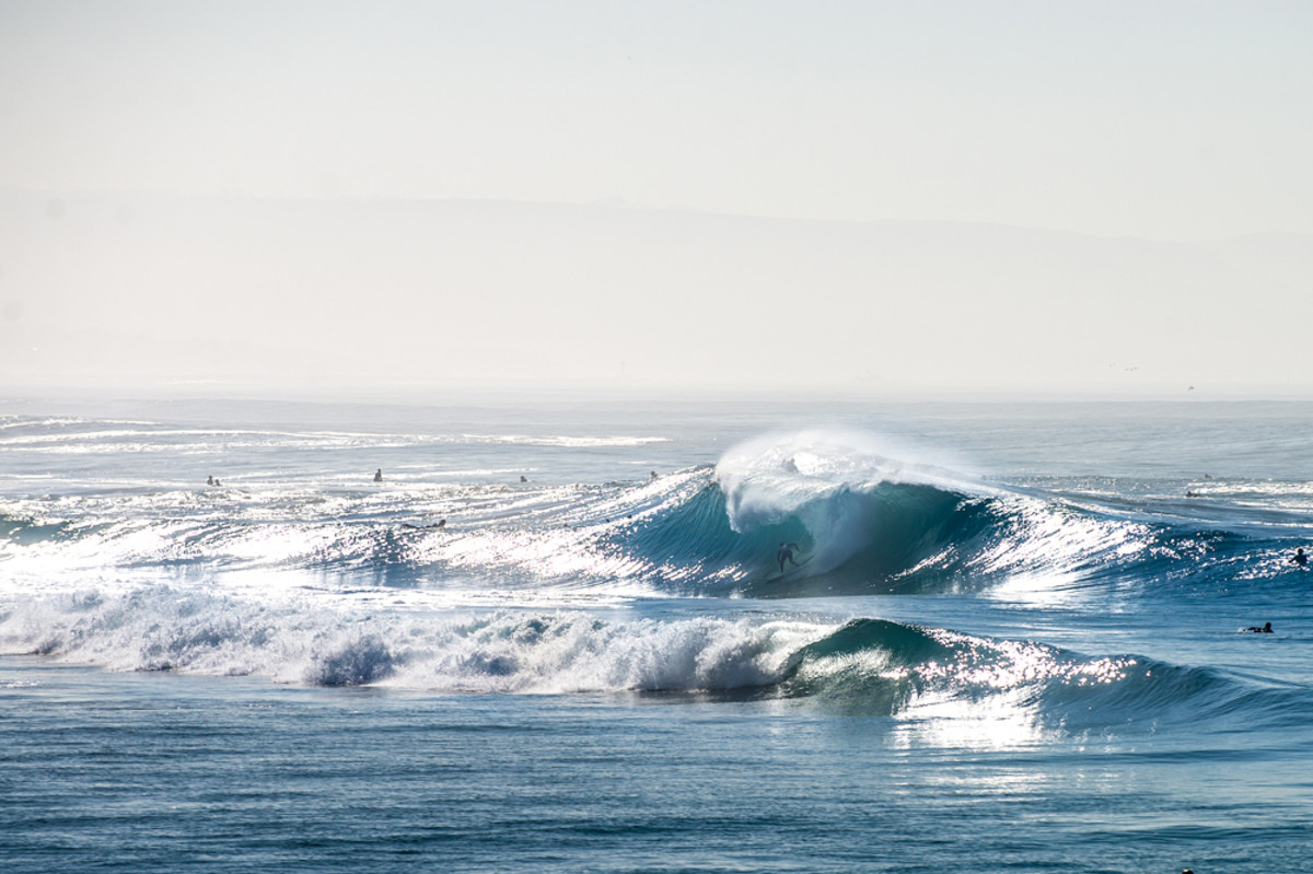
Surf along the north and west shores will remain active
World-wide tropical cyclone activity…
![]()
>>> Atlantic Ocean:
Hurricane 15L (Nicole) remains active over the Atlantic. Here’s the NHC graphical track map, a satellite image, and what the computer models are showing
Here’s a satellite image of the Atlantic Ocean
>>> Caribbean
>>> Gulf of Mexico: No active tropical cyclones
Here’s a satellite image of the Caribbean Sea…and the Gulf of Mexico
Here’s the link to the National Hurricane Center (NHC)
>>> Eastern Pacific: No active tropical cyclones
Here’s a wide satellite image that covers the entire area between Mexico, out through the central Pacific…to the International Dateline.
Here’s the link to the National Hurricane Center (NHC)
>>> Central Pacific: No active tropical cyclones
Here’s a link to the Central Pacific Hurricane Center (CPHC)
Tropical Depression 22W (Aere) will be dissipating over Vietnam. Here’s the JTWC graphical track map, a satellite image – Final Warning
Tropical Storm 24W remains active, heading towards the Philippines. Here’s the JTWC graphical track map, a satellite image, and what the computers models are showing
>>> South Pacific Ocean: No active tropical cyclones
>>> North and South Indian Oceans / Arabian Sea: No active tropical cyclones
Here’s a link to the Joint Typhoon Warning Center (JTWC)
Interesting: Climate Change Has Doubled Western U.S. Forest Fires – A new study says that human-induced climate change has doubled the area affected by forest fires in the U.S. West over the last 30 years. According to the study, since 1984 heightened temperatures and resulting aridity have caused fires to spread across an additional 16,000 square miles than they otherwise would have—an area larger than the states of Massachusetts and Connecticut combined. The authors warn that further warming will increase fire exponentially in coming decades. The study appears today in the journal Proceedings of the National Academy of Sciences.
“No matter how hard we try, the fires are going to keep getting bigger, and the reason is really clear,” said study coauthor Park Williams, a bioclimatologist at Columbia University’s Lamont-Doherty Earth Observatory. “Climate is really running the show in terms of what burns. We should be getting ready for bigger fire years than those familiar to previous generations.”
Fires in western forests began increasing abruptly in the 1980s, as measured by area burned, the number of large fires, and length of the fire season. The increases have continued, and recently scientists and public officials have in part blamed human-influenced climate change. The new study is perhaps the first to quantify that assertion. “A lot of people are throwing around the words climate change and fire—specifically, last year fire chiefs and the governor of California started calling this the ‘new normal,’ ” said lead author John Abatzoglou, a professor of geography at the University of Idaho. “We wanted to put some numbers on it.”
Warmth drives fire by drying out the land. Warmer air can hold more moisture, and the air ends up sucking it out of plants, trees, dead vegetation on the ground, and soil. Average temperatures in forested parts of the U.S. West have gone up about 2.5 degrees F since 1970, and are expected to keep rising. The resulting drying effect is evident in the rise of more fires. Williams published a study last year showing how climate-driven removal of moisture from land worsened the recent California drought, which was accompanied by widespread fires.
The overall increase in fire since the 1980s is about twice what the researchers attribute to climate change; the rest is due to other factors, they say. One has been a long-term natural climate oscillation over the Pacific Ocean that has steered storms away from the western United States. Another: firefighting itself. By constantly putting out fires, authorities have allowed areas they “saved” to build up more dry fuel, which later ignites, causing ever more catastrophic blazes, the researchers say. The costs of fire fighting have risen sharply in step; last year the federal government alone spent more than $2.1 billion. “We’re seeing the consequence of very successful fire suppression, except now it’s not that successful anymore,” said Abatzoglou.
The authors teased out the effects of climate warming from other factors by looking at eight different systems for rating forest aridity; these included the Palmer Drought Severity Index, the MacArthur Forest Fire Danger Index and the Canadian Forest Fire Danger Rating System. They then compared such measurements with observations of actual fires and large-scale climate models that estimate man made warming. The crunched data showed that 55 percent of the increase in fuel aridity expected to lead to fires could be attributed to human-influenced climate change. Climate’s role in increasing such aridity has grown since 2000, the researchers say, and will continue to do so.
Williams and Abatzoglou say they do not account for some factors that could be offshoots of climate warming, and thus they may be understating the effect. These include millions of trees killed in recent years by beetles that prefer warmer weather, and declines in spring soil moisture brought on by earlier snow melt. There is also evidence that lightning—the usual initial spark—may increase with warming.
The study does not cover western grasslands. These have seen more fires too, but there is little evidence that climate plays a role there, said Abatzoglou; rather, the spread of highly flammable invasive grasses appears to be the main driver.
Mike Flannigan, a fire researcher at the University of Alberta, said that previous studies have tried to understand the effects of climate on fires in parts of Canada, but that nothing had been done for the United States on this scale. “What’s great about this paper is that it quantifies this effect, and it does it on a national scale,” he said.
Worldwide, wildfires of all kinds have been increasing, often with a suspected climate connection. Many see a huge fire that leveled part of the northern city of Fort McMurray, Alberta, this May as the result of a warming trend that is drying out northern forests. Fires have even been spreading beyond, into the tundra, in places where blazes have not been seen for thousands of years. That said, fires are not expected to increase everywhere. “Increased fire in a lot of places agrees with the projections,” said Jeremy Littell, a research ecologist with the U.S. Geological Survey in Anchorage, Alaska. “But in many woodlands, the relationship between climate and fire is not as tidy.”
So far, this year has seen huge, though not record, fires. Over the summer, some 3 million acres burned across the United States, mostly in the West, from Washington state across to the Dakotas and down into Texas. Some scientists say the worst could be yet to come; in some places, the most dangerous conditions often occur from September to December, when desert winds interact with fuels that have been drying for five or six months.
The effects go beyond loss of trees and other vegetation. A 2012 study estimates that smoke from fires worldwide causes long-term health effects that kill some 340,000 people each year, mainly in sub-Saharan Africa and southeast Asia. Carbon released to the air adds to the burden of greenhouse gases already there, thus producing even more warming. Soot settling on snow and ice causes them to absorb more heat and melt faster.
Many scientists studying the issue believe the growth in U.S. western fires will continue for many years. Williams and others say that eventually, so many western forests will burn, they will become too fragmented for fires to spread easily, and the growth in fire will cease. But, he says, “there’s no hint we’re even getting close to that yet. I’d expect increases to proceed exponentially for at least the next few decades.” In the meantime, he said, “It means getting out of fire’s way. I’d definitely be worried about living in a forested area with only one road in and one road out.”