


Air Temperatures – The following maximum temperatures (F) were recorded across the state of Hawaii Monday along with the low temperatures Monday:
86 – 77 Lihue, Kauai
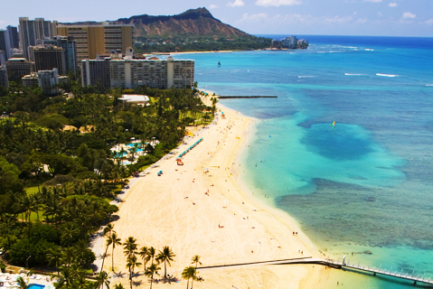
85 – 73 Honolulu, Oahu
86 – 74 Molokai AP
88 – 75 Kahului AP, Maui
87 – 73 Kona AP
83 – 68 Hilo AP, Hawaii
Here are the latest 24-hour precipitation totals (in inches) for each of the islands as of Monday evening:
0.61 Kilohana, Kauai
1.86 Manoa Lyon Arboretum, Oahu
0.44 Molokai
0.00 Lanai
0.00 Kahoolawe
0.94 West Wailuaiki, Maui
0.20 Honaunau, Big Island
The following numbers represent the strongest wind gusts (mph) as of Monday evening:
24 Waimea Heights, Kauai
48 Oahu Forest NWR, Oahu
30 Molokai
29 Lanai
31 Kahoolawe
32 Kaupo Gap, Maui
28 Puu Mali, Big Island
Hawaii’s Mountains – Here’s a link to the live webcam on the summit of our tallest mountain Mauna Kea (nearly 13,800 feet high) on the Big Island of Hawaii. This webcam is available during the daylight hours here in the islands, and at night whenever there’s a big moon shining down. Also, at night you will be able to see the stars — and the sunrise and sunset too — depending upon weather conditions.
Aloha Paragraphs

An early season cold front is breaking apart to our north

Thunderstorms in the deeper tropics southwest through southeast

Clear to partly cloudy

Showers, mostly offshore from the leeward sides of Kauai and Oahu – Looping radar image
Small Craft Advisory…Maalaea Bay, Maui, Pailolo and Alenuihaha Channels, Big Island leeward and southeast waters
~~~ Hawaii Weather Narrative ~~~
The trade winds will remain moderate to strong during this work week. Here’s the latest weather map, showing high pressure systems well to our northeast and northwest, the source regions of our trade wind flow. As we get into the weekend time frame, our trades will veer to the east-southeast or even southeast. This will result is lighter winds, which may carry volcanic haze (vog) over the smaller islands then, although shouldn’t last long.
Here’s a wind profile of the offshore waters around the islands – with a closer view
Here’s the Hawaiian Islands Sulfate Aerosol animated graphic, showing vog forecast
A fairly typical trade wind weather pattern will move over the island through the remainder of the work week. As we push into the upcoming weekend, some of the models are suggesting a change arriving from the east and southeast. This may eventually bring an increase in showers associated with what will very likely be retired tropical cyclone 19E (Seymour), currently located 1125 miles east-southeast of the Big Island, as it moves closer to the islands with time.
Marine environment details: A Small Craft Advisory (SCA) remains in effect for the typically windy marine zones around the Big Island and Maui through Wednesday, and will likely need to be extended through the week.
Surf will be small through most of the next week. A series of mainly small pulses of southern hemisphere swell will continue to bring small surf to south facing shores. A pair of small northwest and north swells will continue into Tuesday, although resulting surf along north and west facing shores will be small. Fresh to strong trade winds will drive moderate surf along east facing shores for most of this week, with a chance that surf approaches advisory levels by the weekend.
Some windward showers, otherwise a nice week is expected
World-wide tropical cyclone activity…
![]()
>>> Atlantic Ocean: No active tropical cyclones
1.) Showers and thunderstorms continue in association with a well-organized tropical wave located about 475 miles east-southeast of Barbados. However, the low appears to lack a closed circulation at this time. Environmental conditions are favorable for continued development, and a tropical depression or tropical storm could form later today or tonight while the system moves westward to west- northwestward at 15 to 20 mph. Interests in the eastern and central Caribbean Sea, including the northern coast of South America, should monitor the progress of this disturbance, since warnings and watches could be required at any time. Regardless of whether the system is a tropical wave or tropical cyclone, heavy rains and wind gusts to tropical storm force are expected to spread over the Windward Islands and portions of the southern Lesser Antilles, beginning tonight and continuing into Wednesday. An Air Force Reserve reconnaissance aircraft is scheduled to investigate the disturbance this afternoon.
* Formation chance through 48 hours…high…90 percent
* Formation chance through 5 days…high…90 percent
This area of disturbed weather is being referred to as Invest 97L, here’s a satellite image…and what the computer models are showing
2.) Disorganized showers and thunderstorms over the southwestern Gulf of Mexico are associated with a trough of low pressure that is drifting westward. Upper-level winds are not expected to be conducive for significant development before this system moves inland over Mexico during the next day or so.
* Formation chance through 48 hours…low…10 percent
* Formation chance through 5 days…low…10 percent
Here’s a satellite image of the Atlantic Ocean
>>> Caribbean: No active tropical cyclones
>>> Gulf of Mexico: No active tropical cyclones
1.) Widespread cloudiness and thunderstorms over the southwestern Gulf of Mexico are associated with a trough of low pressure that is drifting westward. Upper-level winds are not expected to be conducive for significant development before this system moves inland over northeastern Mexico during the next day or so.
* Formation chance through 48 hours…low…10 percent
* Formation chance through 5 days…low…10 percent
Here’s a satellite image of the Caribbean Sea…and the Gulf of Mexico
Here’s the link to the National Hurricane Center (NHC)
>>> Eastern Pacific:
Tropical Storm 18E (Roslyn) remains active, located approximately 575 miles west-southwest of the southern tip of Baja California. Here’s the NHC graphical track map, a satellite image, and what the computer models are showing
1.) An area of low pressure is expected to form several hundred south or south-southeast of the southern tip of the Baja California peninsula in a couple of days. Environmental conditions are expected to be conducive for gradual development of this system late this week and this weekend while the low moves west-northwestward.
* Formation chance through 48 hours…low…near 0 percent
* Formation chance through 5 days…medium…40 percent
Here’s a wide satellite image that covers the entire area between Mexico, out through the central Pacific…to the International Dateline.
Here’s the link to the National Hurricane Center (NHC)
>>> Central Pacific:
Tropical Storm 19E (Ulika) remains active, located approximately 1120 miles east-southeast of Hilo, Hawaii.. Here’s the CPHC graphical track map, a satellite image, and what the computer models are showing
Here’s a link to the Central Pacific Hurricane Center (CPHC)
Typhoon 20W (Megi) remains active, located approximately 82 NM west-southwest Taipei, Taiwan. Here’s the JTWC graphical track map, a satellite image…and what the computer models are showing
>>> South Pacific Ocean: No active tropical cyclones
>>> North and South Indian Oceans / Arabian Sea: No active tropical cyclones
Here’s a link to the Joint Typhoon Warning Center (JTWC)
Interesting: Millions of Trees are Dying Across the US – Throughout the U.S., trees are dying at an astonishing rate. The reasons for the die-off vary from location to location — drought, disease, insects and wildfires – but the root cause in many of these cases is the same: climate change.
The epidemic is even threatening the oldest white oak tree in America, a 600-year-old giant in New Jersey that predates Columbus’ visit to the Americas.
The effect is particularly apparent in mountain states like California, where 66 million trees have simply disappeared from the Sierra Nevada range since 2010. The Forest Service blames the years-long drought in the area and the spread of pine beetles.
In northern California, the ominously named “Sudden Oak Death” is infecting hundreds of different plants, from massive redwoods to backyard oaks. The disease is transmitted through water, so it can easily be spread by wind and rain over long distances. In fact, the spread already spans more than half the length of the state.
The presence of so many dead trees would be a tragedy anywhere, but in the mountains of the West, it’s particularly dangerous because the trees provide fuel for forest fires. It’s impossible for forest workers to chop down and remove millions of trees, so the majority of them are still standing.
In some cases, death and disease have overtaken entire mountainsides. Some researchers estimate that we could lose all needle leaf evergreens in the Southwest U.S. within the next hundred years.
In Hawaii, the islands are losing their once-abundant ohi’a trees at an alarming rate. Over the past six years, the big island has lost nearly 50,000 acres to a previously unknown disease that causes rapid death over the course of just a few short weeks. Because it’s unlike anything scientists have ever seen before, researchers are unsure how to treat it. While the plague is affecting only a limited area now, locals worry it will spread and collapse the entire native ecosystem.
The disease is caused by a fungus, which grows through the vascular system of the trees, preventing them from drawing water from the ground. Though researchers have examined other plant fungi in an attempt to trace the disease’s origins, it appears to be an entirely new strain. There is still no cure for the fungus, so right now the priority is containing the spread of the disease rather than treating it.
In Seattle, tree deaths are even hitting city parks. Pine beetles, once confined to a small part of the country, have spread throughout the U.S., apparently beyond our forests. More than 500 trees have been lost this summer alone — a normal year would see only about 130 trees culled.
While there’s some controversy over whether pine beetles are destroying forests or simply culling unhealthy trees, the fact remains that these tree deaths are a major warning sign.
And it isn’t just the Western U.S. that’s been affected by the epidemic. In recent years, reports of dying forests have come in from every part of the country. Throughout New England, fro instance, hemlock trees have been slowly dying from invasive insect infestations, forever altering the composition of local forests. Again, climate change seems to be enabling the spread of the pests in a way ecologists have never seen before.
Of course, this phenomenon isn’t limited to the U.S.: similar stories are playing out in forests all over the world. And that’s a terrifying thought.
Forests are one of the Earth’s most important protections again climate change. The trees themselves act as carbon sinks, sequestering nearly a quarter of carbon dioxide emissions from the air. When they die, that carbon is released back into the air.
In an interview last year with Rolling Stone, Richard Birdsey of the U.S. Forest Service explained, “if the carbon sink in forests fails, a simple speculation is that global temperatures would increase proportionally to the increase of CO2 concentration, so about 25 percent above current climate projections.”