


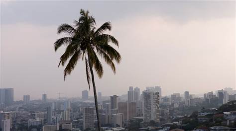
Air Temperatures – The following maxiumum temperatures (F) were recorded across the state of Hawaii Sunday…along with the low temperatures Sunday:
82 – 74 Lihue, Kauai
88 – 75 Honolulu, Oahu
84 – 74 Molokai AP
87 – 71 Kahului AP, Maui
88 – 74 Kona AP
85 – 70 Hilo AP, Hawaii
Here are the latest 24-hour precipitation totals (inches) for each of the islands…as of Sunday evening:
1.15 Mount Waialeale, Kauai
0.88 Nuuanu Upper, Oahu
0.70 Puu Alii, Molokai
0.00 Lanai
0.03 Kahoolawe
0.52 Ulupalakua, Maui
2.09 Saddle Quarry, Big Island
The following numbers represent the strongest wind gusts (mph)…as of Sunday evening:
21 Port Allen, Kauai
32 Kuaokala, Oahu
13 Molokai
25 Lanai
24 Kahoolawe
18 Maalaea Bay, Maui
27 Kohala Ranch, Big Island
Hawaii’s Mountains – Here’s a link to the live web cam on the summit of near 13,800 foot Mauna Kea on the Big Island of Hawaii. This web cam is available during the daylight hours here in the islands…and when there’s a big moon shining down during the night at times. Plus, during the nights you will be able to see stars, and the sunrise and sunset too…depending upon weather conditions.
Aloha Paragraphs

Hurricane Darby is spinning far to the east of Hawaii, with Tropical Storm Estelle…active closer to Mexico / along with former Celia moving by northeast and north of Hawaii

Hurricane Darby…heading towards the Hawaiian Islands, although it will continue weakening as it gets closer

Category 1 Hurricane Darby…having peaked in strength
![]()
What the models show for Hurricane Darby

Tropical Storm Estelle heading into higher latitudes…not a threat for Hawaii

Tropical Storm Estelle…becoming a hurricane today
![]()
What the models are showing for soon to be Hurricane Estelle

We see former Celia to our north…which will move by Hawaii through Tuesday

Former Celia…with its low cloud swirl spinning by the islands

Former Celia…with most of its showers offshore to the north of Hawaii

Showers will be falling locally…some locally generous – Looping radar image
High Surf Advisory…for east shores of Kauai, Oahu, Molokai, Maui and the Big Island
Small Craft Advisory…Rough seas exposed areas around Kauai and Oahu tonight
Gale Warning…Hawaii’s offshore waters – beyond 40 nautical miles
~~~ Hawaii Weather Narrative ~~~
Our local winds will be turning lighter…with varying directions and speeds today into Tuesday. Here’s the latest weather map, showing a very strong near 1041 millibar high pressure system in the area far north of Hawaii. At the same time, we see former tropical depression Celia not far to the northeast of our islands. Our trade winds are expected to become lighter, and from variable directions…ushering in sultry summertime conditions. This easing of the winds should occur, as whats left of Celia passes by the islands a couple of hundred miles to our north. Thereafter, cooling and more refreshing trade winds will return for a couple of days, before we see more muggy air arriving…as whatever is left of tropical cyclone Darby likely moves by south of the state Friday into the weekend. This may trigger a period of stronger trade winds for several days then.
Here’s a wind profile…of the offshore waters around the islands – with a closer view
Here’s the Hawaiian Islands Sulfate Aerosol animated graphic – showing vog forecast
Showers will be on the increase, generally along our windward sides…then over the interior sections during the afternoons. Former tropical depression Celia will help to bring deep tropical moisture our way into the middle of the week. Relative humidity levels will remain quite high into the first half of the new week as well, as former Celia continues to bring enhanced moisture across the island chain. High relative humidity will bring quite uncomfortable conditions, especially as the trade winds diminish. The southern periphery of what’s left of Celia, as it moves by to our northeast and north, will bring locally heavy rains to Hawaii. Meanwhile, as Darby moves by to the south of Hawaii towards next weekend, we could see the northern periphery of this system bringing possible rains our way then as well…stay tuned.
Marine environment details: A high surf advisory is in effect for east facing shores through Monday, as a result of swell generated by former Celia. The latest buoy observations support the continuation of the advisory. An extended period of high surf along east facing shores appears to be in the works, as the Celia-related swell is expected to persist through at least Monday, and swells from distant Hurricane Darby are expected to be arriving after Monday.
The current south-southwest swell will gradually subside over the next couple of days, with another south swell Wednesday through Friday, supplying below advisory level surf to south facing shores of all islands.
The center of Celia’s remnant low will pass within a couple hundred miles north of the islands over the next couple of days, causing trade winds to become northerly today, and gradually weaken, before becoming light and variable Monday and Tuesday. While winds are expected to be below small craft advisory (SCA) criteria the next couple of days, there is still a chance combined seas may reach the criteria for SCA in Kauai and Oahu waters later tonight and Monday.
As the Celia remnant low moves northwest of Kauai on Tuesday, trade winds will increase from east to west across the island chain, potentially becoming strong Thursday and Friday…with the forecast hinging on the future track of what is expected to be a significantly weakened Darby.
Warm and humid weather…lighter breezes – stay cool
Here on Maui – Early Sunday morning is dawning mostly clear, with clouds along the windward sides…with showers falling from them locally. The air temperature here at my place in upcountry Kula, was a cool 49.2F degrees at 541am. Meanwhile, at about the same time, the Kahului airport was reporting partly cloudy skies, with a temperature of 72 degrees, while Hana was the same, Maalaea Bay was 75…with the summit of the Haleakala Crater was reporting 43 degrees. / Late Sunday morning, and with the winds turning more northerly, as former Celia moves closer…and then by to the northeast to north, our winds are increasing locally. This is certainly the case here in upcountry Kula, where it’s getting noticeably gusty.
– Early afternoon, with showers arriving along the windward sides, and I can feel a few sprinkles being blown over here to my place in Kula. It’s windy too…
– The winds are coming in from a more northerly direction for the moment, and they feel a little cooler than normal. However, don’t get used to it, as these breezes will be faltering, and with higher humidity moving over us soon, it’s going to become sultry, humid, muggy…you get the idea! Finally, look for a nice sunset this evening, with some good colors.
World-wide tropical cyclone activity –
Tropical Cyclones in the Pacific: Hurricane Darby remains active, remaining a category 1 storm. It’s too early to know for sure, although some of the computer models bring whatever that’s left of Darby moving by to the south of the islands later in the week. Meanwhile, Tropical Storm Estelle remains active in the eastern Pacific…and should become a Hurricane Monday. She should take a track well northeast of the islands, limiting any threat for Hawaii.
>>> Atlantic Ocean: No active tropical cyclones
Tropical cyclone formation is not expected during the next 5 days
Here’s a satellite image of the Atlantic Ocean
>>> Caribbean Sea: No active tropical cyclones
Tropical cyclone formation is not expected during the next 5 days
>>> Gulf of Mexico: No active tropical cyclones
Here’s a satellite image of the Caribbean Sea…and the Gulf of Mexico
Here’s the link to the National Hurricane Center (NHC)
>>> Eastern Pacific:
Hurricane Darby continues offshore from Mexico…located about 1565 miles east of Hilo, Hawaii. Here’s the NHC graphical track map, along with a satellite image of this area…and the computer models are showing.
Tropical Storm Estelle is active well offshore from Mexico…located about 485 miles southwest of the southern tip of Baja California. Here’s the NHC graphical track map, along with a satellite image of this area…and the computer models are showing.
1.) A low pressure area is expected to form well south of the Gulf of Tehuantepec in a couple of days in association with a tropical wave that is currently located over the far eastern Pacific. Environmental conditions are forecast to be conducive for gradual development of the low, and a tropical depression could form by late this week while it moves west-northwestward at about 10 mph.
* Formation chance through 48 hours…low…near 0 percent
* Formation chance through 5 days…medium…50 percent
2.) A trough of low pressure located several hundred miles south-southwest of Acapulco, Mexico, is producing disorganized shower activity. Some slow development of this system is possible later this week while it moves westward at about 10 mph.
* Formation chance through 48 hours…low…near 0 percent
* Formation chance through 5 days…low…20 percent
Here’s a wide satellite image that covers the entire area between Mexico, out through the central Pacific…to the International Dateline.
Here’s the link to the National Hurricane Center (NHC)
>>> Central Pacific: No active tropical cyclones
Here’s a link to the Central Pacific Hurricane Center (CPHC)
>>> South Pacific Ocean: No active tropical cyclones
>>> North and South Indian Oceans / Arabian Sea:
Tropical Cyclone 01S (Abela) remains active in the South Indian Ocean…located about 440 miles north-northeast of Port Louis, Mauritius. Here’s the JTWC graphical track map, along with a satellite image of this area…and what the computer models are showing
Here’s a link to the Joint Typhoon Warning Center (JTWC)
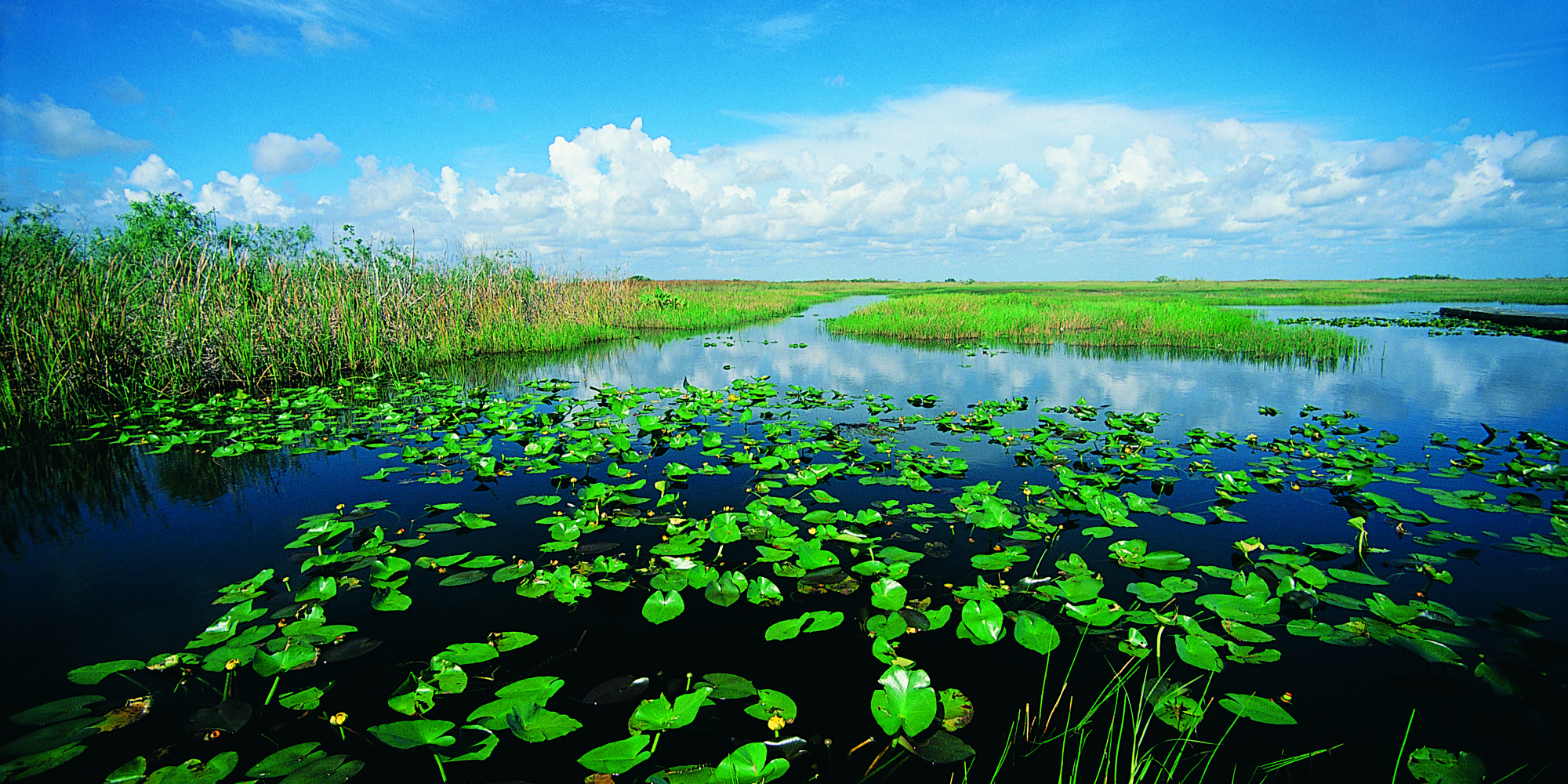
Interesting: Rising Seas Push Too Much Salt Into The Florida Everglades – The Florida Everglades is a swampy wilderness the size of Delaware. In some places along the road in southern Florida, it looks like tall saw grass to the horizon, a prairie punctuated with a few twisted cypress trees. The sky is the palest blue.
But beneath the surface a different story is unfolding. Because of climate change and sea level rise, the ocean is starting to seep into the swampland. If the invasion grows worse, it could drastically change the Everglades, and a way of life for millions of residents in South Florida.
An experiment is going on here to help scientists understand more about what’s likely to happen as the ocean invades. “We’re making, basically, artificial seawater here,” a guy wearing a mosquito net over his face tells me, as he stirs water in a vat the size of a hot tub.
The guy in the mosquito net is Joe Stachelek — a collaborator with Tiffany Troxler, from Florida International University. They’re making salt water and pumping it out into the wetland — dosing the plants and soil with their briny mix as a preview of what the ocean could do.
“As sea level rises,” Troxler explains, “the saltwater wedge moves inland.” And it infiltrates the bedrock.
“Our underlying rock is limestone,” Troxler says. “That limestone is very porous; it’s almost like Swiss cheese in some areas.”
We walk out into the test site — through the saw grass and the underlying peat, which is a fancy name for muck. It’s rich stuff, full of nutrients and microorganisms that feed this river of grass. And, like the plants, the peat also is affected by salt water.
The team has laid out a metal boardwalk, so you can walk around the muck without sinking up to your waist. Out here the grass is patchier, and in some places the peat is slumping — collapsing.
Troxler says there’s lots of this slumping going on. “When we start to lose the structure of the plants,” she explains, “essentially this peat, which is otherwise held together by roots, becomes a soupy pond.”
In response to the salt, the plants actually pull up some of their roots — out of the peat. The roots look like teeth protruding from receding gums.
This could be the future of the Everglades, Troxler says. And here’s the thing: The Everglades acts like sponge, feeding off the Biscayne aquifer — a giant cell of freshwater that lies underneath the land.
“We get over 90 percent of our freshwater from the Biscayne aquifer,” Troxler says, “we” meaning millions of people in South Florida.
As seawater seeps up from underneath, through the limestone bedrock, it is contaminating the aquifer and the Everglades above it.
That’s starting to worry some people. Like Julie Hill-Gabriel, who directs Everglades policy for the National Audubon Society in Florida. She says she tells people in South Florida, “What we do in the Everglades is 100 percent going to affect you in your neighborhood — [and whether] when you turn on the tap water, you have enough fresh clean water.”
For millennia, fresh water flowed south to the Everglades, making it the largest flooded grassland in America. But over the past several decades, that water was diverted to irrigate agricultural fields, and to keep homes from flooding. Environmental groups like Audubon have been trying to restore the natural flow to the Everglades, mostly to preserve wildlife.
Now, Hill-Gabriel says, there’s a new reason for that restoration — to repel the invading sea. Putting more freshwater back into the sponge that is the Everglades could create a kind of “back pressure” to keep seawater out.
“It just really compounds the urgency to move that freshwater south,” says Hill-Gabriel.
At least that’s the theory.
When it comes to climate change in South Florida, much of the focus until now has been about protecting property with pumps and barriers. But James Cason, the Republican mayor of the city of Coral Gables, says he hopes his constituents can understand the importance of protecting the Everglades as well.
“It’s not just so they can see the alligators,” Cason says. “It’s because they’ll want to make sure the drinking water on which we all depend is not contaminated.”
Robie Says:
hi glenn
vorticity was beautiful, thanks.
wow, my wife and i have been
reading the Cloud spotters guide and really
enjoyed the footage.
~~~ Hi Robie, and your wife too of course, glad you enjoyed that short film…so did I!
Aloha, Glenn