


Air Temperatures – The following maximum temperatures (F) were recorded across the state of Hawaii Tuesday:
81 Lihue, Kauai
85 Honolulu, Oahu
83 Molokai
85 Kahului, Maui
84 Kona, Hawaii
82 Hilo, Hawaii
Air Temperatures ranged between these warmest and coolest spots near sea level – and on the highest mountain tops on Maui and the Big Island…as of 743pm Tuesday evening:
Kailua Kona – 79
Hilo, Hawaii – 71
Haleakala Summit – 46 (near 10,000 feet on Maui)
Mauna Kea Summit – 34 (13,000+ feet on the Big Island)
Hawaii’s Mountains – Here’s a link to the live web cam on the summit of near 13,800 foot Mauna Kea on the Big Island of Hawaii. This web cam is available during the daylight hours here in the islands…and when there’s a big moon shining down during the night at times. Plus, during the nights you will be able to see stars, and the sunrise and sunset too… depending upon weather conditions. Here’s the Haleakala Crater webcam on Maui – if it’s working.
Aloha Paragraphs
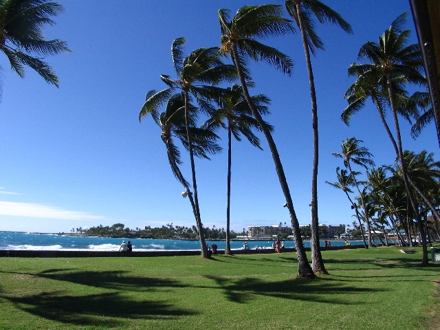
Trade winds lasting through Wednesday, locally quite strong and gusty…
then turning southeast later Thursday through Saturday – locally voggy
Clear to partly cloudy, with cloudy periods, a few windward showers…
afternoon showers increasing locally over the slopes starting Thursday,
with chance of heavy rains/thunderstorms Sunday morning into
early next week…first on Kauai
Small Craft Wind Advisory…parts of Maui County
and the Big Island
The following numbers represent the most recent top wind gusts (mph), along with directions as of Tuesday evening:
17 Poipu, Kauai – NE
44 Waianae Valley, Oahu – NE
27 Molokai – ENE
39 Lanai – NE
31 Kahoolawe – E
31 Kahului, Maui – NE
32 South Point, Big Island – NE
Here are the latest 24-hour precipitation totals (inches) for each of the islands as of Tuesday evening:
0.17 Wainiha, Kauai
0.54 Oahu Forest NWR, Oahu
0.03 Molokai
0.00 Lanai
0.00 Kahoolawe
0.08 Hana airport, Maui
0.10 Lower Kahuku, Big Island
We can use the following links to see what’s going on in our area of the north central Pacific Ocean. Here’s the latest NOAA satellite picture – the latest looping satellite image… and finally the latest looping radar image for the Hawaiian Islands.
~~~ Hawaii Weather Narrative ~~~
Locally strong and gusty trade winds will last through mid-week, then becoming southeast…before turning south to southeast Friday into the weekend. Here’s the latest weather map, showing the Hawaiian Islands, and the rest of the Pacific Ocean. We find a near 1032 millibar high pressure system far to the northeast of the state, with a second high pressure cell to the north of Hawaii, with their associated ridges to the northeast of the central islands. At the same time we see a low pressure system far to our north, with an associated cold front just offshore to the north of our islands. Trade winds will remain quite gusty tonight into Wednesday…with small craft wind advisories over those windiest coasts and channel waters around Maui County and the Big Island. As we get into the Thursday through Saturday period, the winds will falter again, becoming softer from the south to southeast. As these winds swing around into the southeast direction…there will be volcanic haze being carried up over the smaller islands.
We’ll find a few showers along our windward sides while the trades are blowing…then shifting over to the leeward slopes during the afternoons…as the lighter southeasterly flow arrives later this week. Satellite imagery shows very few low level clouds scattered around the state, and over the offshore waters as usual. There are also some high level cirrus clouds offshore to the northeast of the Big Island. The islands from Kauai and Oahu down to Maui County to the Big Island, are clear to partly cloudy at the time of this writing. Here’s the looping radar image, showing almost the entire state is dry as we head into the night…just few a few showers heading towards the Big Island and east Maui.
Our weather will be pleasant over the next couple of days…albeit on the windy side locally. We’ll then shift into a lighter wind regime, as they veer around to the southeast after mid-week. This change will be caused by the approach of a cold front, although it will stall before arriving. This lighter wind period, with afternoon clouds with just a few showers around the mountains, and in the leeward upcountry areas, will last into the early part of the weekend. Thereafter, the models are pointing out a rather significant change in our local weather conditions. A re-invigorated frontal system will move into our area from the northwest Sunday morning, into early next week. This is forecast to bring localized heavy rains, and possible flooding, along with a chance of thunderstorms…first on the Kauai end of the chain. This outlook will need fine tuning as we get closer to its arrival, which I’ll be doing on a daily basis. I’ll be back with your next new weather narrative early Wednesday morning, I hope you have a great Tuesday night wherever you’re spending it! Aloha for now…Glenn.
World-wide tropical cyclone activity:
Atlantic Ocean: The Atlantic hurricane season runs from June 1st through November 30th…and has now ended
Here’s a satellite image of the Atlantic Ocean
Caribbean Sea:
Gulf of Mexico:
Here’s a satellite image of the Caribbean Sea…and the Gulf of Mexico.
Here’s the link to the National Hurricane Center (NHC)
Eastern Pacific: The Eastern Pacific hurricane season runs from May 15th through November 30th…and has now ended. Here’s the 2013 hurricane season summary
Here’s a wide satellite image that covers the entire area between Mexico, out through the central Pacific…to the International Dateline.
Central Pacific Ocean: The Central Pacific hurricane season runs from June 1st through November 30th…and has now ended. Here’s the 2013 hurricane season summary
Here’s a link to the Central Pacific Hurricane Center (CPHC)
Western Pacific Ocean: There are no active tropical cyclones
South Pacific Ocean: There are no active tropical cyclones
North and South Indian Oceans: Tropical cyclone 06B (Madi) remains active in the north Indian Ocean. Here’s the JTWC graphical track map…along with a satellite image.
Here’s a link to the Joint Typhoon Warning Center (JTWC)
Interesting: Good News for African Elephants – Representatives from 30 countries came together to discuss the poaching crisis and potential measures to save Africa’s elephants at the African Elephant Summit. As the summit convened, new numbers were released by the Convention in International Trade in Endangered Species (CITES), which found that if poaching continues at its current rate, Africa will likely see at least a fifth of its elephants disappear in the next ten years.
Heartbreaking stories of entire elephant families dying continue to make the news, while poachers continue to sink to ruthless new lows to take them out, including using cyanide to kill them. The level of horror caused by poachers was recently highlighted by a gut-wrenching recording from the Wildlife Conservation Society that accidentally captured the sounds of elephants being killed as they tried to escape from their killers.
According to the latest figures, an estimated 15,000 elephants were killed in 2012 at 42 sites across 27 African countries that are participating in the Monitoring the Illegal Killing of Elephants (MIKE) program, which is run by CITES. An analysis of those numbers led to the conclusion that an estimated 22,000 elephants were illegally killed throughout the continent last year. So far, this year doesn’t look like it will be much better.
“With an estimated 22,000 African Elephants illegally killed in 2012, we continue to face a critical situation. Current elephant poaching in Africa remains far too high, and could soon lead to local extinctions if the present killing rates continue. The situation is particularly acute in Central Africa, where the estimated poaching rate is twice the continental average,” said John E. Scanlon, CITES Secretary-General.
According to CITES, the 18 large-scale seizures have been conducted this year already represent the greatest quantity of ivory confiscated over the last 25 years for this type of seizure, but it’s still unclear whether the seizures are the result of better law enforcement or an increase in trade that’s being driven by poverty, corruption and high demand in Asia.