February 2010
Monthly Archive
Posted by Glenn
No Comments
February 8-9, 2010
Air Temperatures – The following maximum temperatures were recorded across the state of Hawaii Monday afternoon:
Lihue, Kauai – 78
Honolulu, Oahu – 83
Kaneohe, Oahu – 79
Kaunakakai, Molokai – 79
Kahului, Maui – 81
Hilo, Hawaii – 81
Kailua-kona – 81
Air Temperatures ranged between these warmest and coolest spots near sea level around the state – and on the highest mountains…at 5pm Monday afternoon:
Honolulu, Oahu – 80F
Lihue, Kauai – 75
Haleakala Crater – 48 (near 10,000 feet on Maui)
Mauna Kea summit – 41 (near 14,000 feet on the Big Island)
Precipitation Totals – The following numbers represent the largest precipitation totals (inches) during the last 24 hours on each of the major islands, as of Monday afternoon:
0.06 Mount Waialaele, Kauai
0.00 Oahu
0.00 Molokai
0.00 Lanai
0.00 Kahoolawe
0.00 Maui
0.03 Glenwood, Big Island
Marine Winds – Here’s the latest (automatically updated) weather map showing three high pressure systems located north to the northeast, with an associated ridge extending back to the northwest of Kauai. This will keep trade winds blowing into Tuesday, lighter from the southeast Wednesday.
Satellite and Radar Images: To view the cloud conditions we have here in Hawaii, please use the following satellite links, starting off with this Infrared Satellite Image of the islands to see all the clouds around the state during the day and night. This next image is one that gives close images of the islands only during the daytime hours, and is referred to as a Close-up visible image. This next image shows a larger view of the Pacific…giving perspective to the wider ranging cloud patterns in the Pacific Ocean. Finally, here’s a Looping IR satellite image, making viewable the clouds around the islands 24 hours a day. To help you keep track of where any showers may be around the islands, here’s the latest animated radar image.
Hawaii’s Mountains – Here’s a link to the live webcam on the summit of near 14,000 foot Mauna Kea on the Big Island of Hawaii. The tallest peak on the island of Maui is the Haleakala Crater, which is near 10,000 feet in elevation. These two webcams are available during the daylight hours here in the islands…and when there’s a big moon rising just after sunset for an hour or two! Plus, during the nights and early mornings you will be able to see stars, and the sunrise too…depending upon weather conditions.
Tropical Cyclone activity in the eastern and central Pacific – Here’s the latest weather information coming out of the National Hurricane Center, covering the eastern north Pacific. You can find the latest tropical cyclone information for the central north Pacific (where Hawaii is located) by clicking on this link to the Central Pacific Hurricane Center. Here’s a tracking map covering both the eastern and central Pacific Ocean. A satellite image, which shows the entire ocean area between Hawaii and the Mexican coast…can be found here.
Aloha Paragraphs

The beauty of the Hawaiian Islands
A ridge of high pressure is northwest of the Hawaiian Islands Monday night, with the trade winds continuing through the next several days…along with dry weather conditions. As we have high pressure at the surface to our north, and overhead as well, our local weather will be just fine. We’ll find this week generally quite nice, with the trade winds bringing pleasantly warm air temperatures. There will be just a few windward showers, while the leeward sides remain mostly clear and dry.
The trade winds will gradually become lighter, and perhaps turn to the southeast later Wednesday. This swinging around of the winds, and their easing up in strength, will be prompted by the approach of our next cold front. The computer models are showing this front stalling somewhere near Kauai or Oahu Wednesday evening into Thursday morning. Following in the wake of the frontal boundary, will be NE and ENE trade winds. We could see some showers arriving into Thursday, providing the windward sides with some moisture for a day or two.
As we move into Friday and the upcoming weekend, we’ll see another cold front approaching the Aloha state. This cold front is expected to be even weaker than the one we see brushing Kauai at mid-week. It may cause another temporary easing up of the trade winds, but likely not much else. There seems to be a change going on here, with even less influential cold fronts coming our way, and more well established trade winds coming into play…as we move further into this winter month of February.
It’s Monday evening, as I begin writing the last section of today’s narrative. Monday was a lovely day, just like Sunday, and very likely…similar to what we’ll find Tuesday. The day was almost absolutely dry, with lots of generally clear skies. As we can see using this satellite image, there are hardly any clouds around at the moment. It appears that the next week will remain rather benign, in terms of any significant rainfall. Winter isn’t over with us yet though, so that we’ll be having more wet weather, although I don’t see on the weather horizaon at this time. ~~~ Thanks to the trade winds, our air temperatures have come back up to more normal levels. Most of the airport weather stations rose up into the low 80F’s today, with the highest temperature being reported in the big city of Honolulu…with 83 degrees. I expect fairly warm, or what we could consider seasonable air temperatures near sea level overnight, with most coastal areas rising into the lower 80’s again Tuesday afternoon. Just nice weather, and more nice weather is happening now, which most of us appreciate very much. The only draw back to this dry weather is the ongoing drought conditions that plague many areas, especially around Maui County, and the Big Island. ~~~ I hope that you have a great Monday night, wherever you happen to be spending it! I’ll be back early Tuesday morning with your next new weather narrative. Aloha for now…Glenn.
Interesting: The chemical composition of our oceans is not constant but has varied significantly over geological time. In a study published in Science, researchers describe a novel method for reconstructing past ocean chemistry using calcium carbonate veins that precipitate from seawater-derived fluids in rocks beneath the seafloor. The research was led by scientists from the University of Southampton’s School of Ocean and Earth Science (SOES) hosted at the National Oceanography Centre, Southampton (NOCS).
"Records of ancient seawater chemistry allow us to unravel past changes in climate, plate tectonics and evolution of life in the oceans. These processes affect ocean chemistry and have shaped our planet over millions of years," said Dr Rosalind Coggon, formerly of NOCS now at Imperial College London.
"Reconstructing past ocean chemistry remains a major challenge for Earth scientists, but small calcium carbonate veins formed from warm seawater when it reacts with basalts from the oceanic crust provide a unique opportunity to develop such records," added co-author Professor Damon Teagle from SOES.
Calcium carbonate veins record the chemical evolution of seawater as it flows through the ocean crust and reacts with the rock. The composition of past seawater can therefore be determined from suites of calcium carbonate veins that precipitated millions of years ago in ancient ocean crust.
The researchers reconstructed records of the ratios of strontium to calcium (Sr/Ca) and magnesium to calcium (Mg/Ca) over the last 170 million years. To do this, they analyzed calcium carbonate veins from basaltic rocks recovered by several decades of scientific deep-ocean drilling by the Integrated Ocean Drilling Program (IODP) and its predecessors.
"The carbonate veins indicate that both the Sr/Ca and Mg/Ca ratios of seawater were significantly lower than at present prior to about 25 million years ago. We attribute the increases in seawater Sr/Ca and Mg/Ca since then to the long-term effects of decreased seafloor volcanism and the consequent reduction in chemical exchange between seawater and the ocean crust," said Professor Teagle.
Interesting2: Republican politicians and conservative activists are launching a ballot campaign to suspend California’s landmark global-warming law, in what they hope will serve as a showcase for a national backlash against climate regulations. Supporters say they have "solid commitments" of nearly $600,000 to pay signature gatherers for a November initiative aimed at delaying curbs on the greenhouse gas emissions of power plants and factories until the state’s unemployment rate drops. GOP gubernatorial candidates and Tea Party organizers paint the 2006 law, considered a model for other state and federal efforts, as a job-killing interference in the economy.
Talk radio is flailing at what John Kobylt and Ken Chiampou, drive-time hosts on a Los Angeles radio station, call "the global-warming final solution act" promoted by "fascist, Nazi" officials. "We are on fire," said GOP Assemblyman Dan Logue, a sponsor of the proposed initiative. "People are calling from all over the country. This will be the most intense campaign the state has seen in 50 years."
Interesting3: "Rises and falls in sea level over relatively short periods do not testify to a long-term trend. It is early yet to conclude from the short-term increases in sea level that this is a set course that will not take a change in direction," explains Dr. Sivan.
The rising sea level is one of the phenomena that have most influence on humankind: the rising sea not only floods the littoral regions but also causes underground water salinization, flooded effluents, accelerated coastal destruction, and other damage.
According to Dr. Sivan, the changing sea level can be attributed to three main causes: the global cause — the volume of water in the ocean, which mirrors the mass of ice sheets and is related to global warming or cooling; the regional cause — vertical movement of the earth’s surface, which is usually related to the pressure placed on the surface by the ice; and the local cause — vertical tectonic activity. Seeing as Israel is not close to former ice caps and the tectonic activity along the Mediterranean coast is negligible over these periods, it can be concluded that drastic changes in Israel’s sea levels are mainly related to changes in the volume of water.
Interesting4: Climate change is transforming the Arctic environment faster than expected and accelerating the disappearance of sea ice, scientists said in giving their early findings from the biggest-ever study of Canada’s changing north. The research project involved more than 370 scientists from 27 countries who collectively spent 15 months, starting in June 2007, aboard a research vessel above the Arctic Circle.
It marked the first time a ship has stayed mobile in Canada’s high Arctic for an entire winter. "(Climate change) is happening much faster than our most pessimistic models expected," said David Barber, a professor at the University of Manitoba and the study’s lead investigator, at a news conference in Winnipeg.
Models predicted only a few years ago that the Arctic would be ice-free in summer by the year 2100, but the increasing pace of climate change now suggests it could happen between 2013 and 2030, Barber said. Scientists link higher Arctic temperatures and melting sea ice to the greenhouse gas emissions blamed for global warming.
The Arctic is considered a type of early-warning system of climate change for the rest of the world. "We know we’re losing sea ice — the world is all aware of that," Barber said. "What you’re not aware of is that it has impacts on everything else that goes on in this system."
Interesting5: The new record-holder for the most precise timekeeper could tick off the 13.7-billion-year age of the universe to within 4 seconds. The optical clock monitors the oscillation of a trapped atom of aluminium-27. It is more than twice as precise as an earlier version, reported in 2008, and was built at the National Institute of Standards and Technology in Boulder, Colorado.
"It’s extremely impressive," says Patrick Gill of the UK’s National Physical Laboratory, who was not involved with the work. The second is currently defined by caesium atomic clocks, but optical clocks promise higher precision because their atoms oscillate at the frequencies of light rather than in the microwave band, so they can slice time into smaller intervals. Such clocks could help spot tiny changes in physical constants over time.
Interesting6: China has an estimated 50 or fewer tigers left living in the wild, but efforts to stabilize one population in the bleak northeast are starting to pay off, a conservationist said on Monday. Tigers once roamed huge swathes of China, right up to the now booming east coast. Their population has collapsed due to habitat destruction on the back of rapid economic development and poaching for tiger products to use in traditional medicine.
About 10 still live in the southwestern province of Yunnan, some 15 in Tibet, and 20 or so in northwestern Jilin and Heilongjiang provinces, said Xie Yan, China Country Program Director of the Wildlife Conservation Society. The South China Tiger is probably already extinct, she told the Foreign Correspondents Club of China, ahead of the Chinese Lunar New Year of the Tiger, which starts on Sunday.
"The number of wild tigers left in China is very depressing," Xie said. "We have less than 50 individuals in the wild. The populations in Tibet and in the south are still dropping. "The northeast tiger is now stable, and maybe increasing a little, but the number is still very small," she added.
Conservationists say the trade in skin and bones is booming in countries such as China, which has banned the use of tiger parts in medicine but where everything from fur and whiskers to eyeballs and bones are still used. Skins sell as rugs and cloaks on the black market, fetching up to $20,000 for a single pelt.
Interesting7: As the promise of electric cars grows, so too does the potential of electric planes. These aircraft, whose motors are far more efficient, reliable and quiet than internal combustion engines, could help transform how we fly – if a few problems could be solved. Electric motors are three to four times better than internal combustion engines at driving an airplane propeller.
And the reliability of electric motors is "perhaps 10 times or even 20 times that of a piston engine," said Brien Seeley, president of the Comparative Aircraft Flight Efficiency (CAFE) Foundation, an independent flight test agency which hosts NASA’s Centennial Challenges for Aeronautics. Because electric motors could be up to 95 percent efficient – compared to the 18 to 23 percent efficiency of regular engines – means they waste much less energy in the form of heat.
As such, "they don’t need anywhere near the same amount of cooling air flowing over them that internal combustion engines do, which is a very big deal with airplanes" and accounts for a significant part of the drag they experience that can slow them down, Seeley said. Their boosted efficiency also means electric planes could be much quieter than regular planes.
As such, the military is pursuing them for stealth applications, Seeley said. "Military contractors are spending significant investment in investigating electric-powered unoccupied air vehicles." Quieter planes also means civilian airports can be located much closer to where people want to go without bothering local residents. Weaning planes off fossil fuels is also good for the environment.
"You have the climate change issue, the air quality issue from smog, and the energy independence issue," Seeley said. The one great Achilles’ heel of electric airplanes, however, is battery life. Airplanes need to be light in order to stay up in the air, but batteries are notorious for being heavy for the amount of energy they carry.
As a result, many engineers and materials scientists are experimenting with radical aircraft and designs and new, lightweight materials. "We’re seeing truly extraordinary sailplane designs with 70-to-1 lift-drag ratios, which can greatly reduce the amount of power needed, and super-lightweight carbon fiber construction techniques, all of which means that even modest battery packs can take you potentially 100 or 200 miles on a flight," Seeley said.
A San Jose-based company called Nanosolar is also experimenting with thin and flexible solar panels that could be applied to the wing surfaces of airplanes to allow for recharging during flights or when on the ground. "There are major breakthroughs coming with the limitations of battery energy density as well," Seeley told TechNewsDaily.
"Nanotechnology may be able to increase their potential maybe 10- or 20-fold." Seeley doesn’t expect all planes to shift to electric. Military fighter aircraft will still rely on jet engines over electric motors in the future, given how they need to remain small, fast and maneuverable. Jet engines will likely also be the way to go when it comes to long flights or ones with many passengers, due to their range and weight constraints.
Still, Seeley sees electric planes offering major advantages when it comes to travel of 250 miles or less. "If we look at statistics for door-to-door travel times, in current aviation, for trips of under 250 miles, the speed is below 55 mph, and that’s much worse for certain metro areas or if traffic jams happen," Seeley explained.
"So you have a 525 mph airliner on a 250-mile trip with a net speed of 55 mph, and that isn’t good. The obvious implication then is, you then drive a car to get there just as fast, but the truth is that due to gridlock, the car door-to-door trip speed is on the order of 30 mph." The solution for these jaunts is to go electric, he suggested.
The unprecedented quietness of electric planes means airports can be built closer to destinations, and they are capable of extremely short takeoffs since they don’t have to gradually accelerate to liftoff speeds. "We’re exploring the concept of pocket airports, maybe lots of them, each just two acre parcels, that you can take, say, at 150 mph to another pocket airport," Seeley said.
"It’s a transformative concept." The crossover with the automotive world, "which is going to transition to electric cars and thus process enormous numbers of battery sets and motors and so forth, could be a game changer for electric planes," he added. Today’s gas engines become less efficient the smaller they are, but electric motors don’t suffer from this limitation.
As a result, electric planes could use several small motors mounted at the edge of wings that blow air directly over them, "potentially leading to much greater efficiency," said NASA aerospace engineer Mark Moore. Internationally, there is growing interest in electric planes, CAFE’s Seely said.
"The company Yuneec just constructed a 260,000 square foot factory in China to build electric-powered aircraft—really, the first large production of such aircraft." NASA’s annual Green Flight Challenge, which is managed by CAFE, is also pushing planes to fly faster than 100 mph while exceeding a fuel efficiency of 200 passenger miles per gallon or that equivalent in electricity. "This event now has nine very high-quality teams enrolled, drawing on the latest technology from around the world," Seeley said. "The goal of the challenge also meets the sweet spot of the 250-mile range or so one would want for electric planes."
Posted by Glenn
[2] Comments
February 7-8, 2010
Air Temperatures – The following maximum temperatures were recorded across the state of Hawaii Sunday afternoon:
Lihue, Kauai – 77
Honolulu, Oahu – 83
Kaneohe, Oahu – 79
Kaunakakai, Molokai – 78
Kahului, Maui – 81
Hilo, Hawaii – 81
Kailua-kona – 80
Air Temperatures ranged between these warmest and coolest spots near sea level around the state – and on the highest mountains…at 5pm Sunday evening:
Port Allen, Kauai – 81F
Lihue, Kauai – 74
Haleakala Crater – 48 (near 10,000 feet on Maui)
Mauna Kea summit – 36 (near 14,000 feet on the Big Island)
Precipitation Totals – The following numbers represent the largest precipitation totals (inches) during the last 24 hours on each of the major islands, as of Sunday afternoon:
0.10 Lihue, Kauai
0.04 Waimanalo, Oahu
0.00 Molokai
0.00 Lanai
0.00 Kahoolawe
0.13 Oheo Gulch, Maui
0.21 Kapapala Ranch, Big Island
Marine Winds – Here’s the latest (automatically updated) weather map showing a 1021 millibar high pressure system, currently far to the northeast, with its ridge extending back to the north of Kauai. This will keep trade winds blowing into Tuesday.
Satellite and Radar Images: To view the cloud conditions we have here in Hawaii, please use the following satellite links, starting off with this Infrared Satellite Image of the islands to see all the clouds around the state during the day and night. This next image is one that gives close images of the islands only during the daytime hours, and is referred to as a Close-up visible image. This next image shows a larger view of the Pacific…giving perspective to the wider ranging cloud patterns in the Pacific Ocean. Finally, here’s a Looping IR satellite image, making viewable the clouds around the islands 24 hours a day. To help you keep track of where any showers may be around the islands, here’s the latest animated radar image.
Hawaii’s Mountains – Here’s a link to the live webcam on the summit of near 14,000 foot Mauna Kea on the Big Island of Hawaii. The tallest peak on the island of Maui is the Haleakala Crater, which is near 10,000 feet in elevation. These two webcams are available during the daylight hours here in the islands…and when there’s a big moon rising just after sunset for an hour or two! Plus, during the nights and early mornings you will be able to see stars, and the sunrise too…depending upon weather conditions.
Tropical Cyclone activity in the eastern and central Pacific – Here’s the latest weather information coming out of the National Hurricane Center, covering the eastern north Pacific. You can find the latest tropical cyclone information for the central north Pacific (where Hawaii is located) by clicking on this link to the Central Pacific Hurricane Center. Here’s a tracking map covering both the eastern and central Pacific Ocean. A satellite image, which shows the entire ocean area between Hawaii and the Mexican coast…can be found here.
Aloha Paragraphs

Trade winds prevail…generally fine weather continuing
A ridge of high pressure is north of Kauai Sunday evening, with the trade winds continuing through the next several days…along with pleasant weather conditions. This ridge has bounced back to our north, as a cold front has moved by north of the state during the afternoon. This leaves the islands in great shape, with generally clear skies, and dry weather through the next couple of days. There will be just a few windward showers, while the leeward sides remain mostly clear and dry. Air temperatures will be seasonable, running just about what we would expect this time of year.
The trade winds will gradually become lighter, and perhaps turn to the southeast later Tuesday into Wednesday. This swinging around of the winds, and their easing up in strength, will be prompted by the approach of our next cold front. The computer models are now showing this next cold front stalling somewhere near Kauai or Oahu Wednesday. Following in the wake of the frontal boundary, will be NE and ENE trade winds, which will become quite blustery. These showers may keep the windward sides off and on showery for a day or two.
It’s Sunday evening, as I begin writing the last section of today’s narrative. Today was one of those perfectly gorgeous days here in Hawaii. There was abundant sunshine, and warm trade winds blowing, with hardly a shower anywhere. The volcanic haze, which we saw in our skies locally Saturday, has now all been blown away by the fresh trade winds. I anticipate that Monday and Tuesday will continue this lovely string of days that are gracing our islands during this winter period. ~~~ I didn’t leave home today for a second, and the closest to my car that I got, was to just check the oil briefly this afternoon…which was just where it was suppose to be on the dip stick. I learned a long time ago, that’s its important to keep clean oil in the car, as it preserves the engine effectively. At any rate, I hung out at home and did some domestic chores. I bbq’d some organic chicken thighs, and sauteed a bunch of organic vegetables, which I’ll have as dinners during the upcoming work week. Perhaps the most fun of the day, was hanging out with the neighbors on three sides of my house. We all worked together to get some wiring arranged for internet connectivity issues. It’s always fun and stimulating to hang with these people, as they all happen to be in the top of their various fields of endeavor. ~~~ It’s so nice out, I plan to hang out on the deck after finishing the last little bit of this narrative update. I hope you have a great Sunday night, and perhaps will be able to stop by again on Monday. I’ll have your next new weather narrative ready and waiting early Monday morning. Aloha for now…Glenn.
Interesting: Despite the frightening regularity of humanitarian disasters like the earthquake in Haiti, international responses remain fragmented and must be improved, argue a group of trauma surgeons on the British Medical Journal website. They warn that an uncoordinated push to get people and equipment into the affected zone as soon as possible can worsen the situation and reduce the effectiveness of relief efforts. They also advise anyone thinking about volunteering to join an established group and obtain appropriate training to enable them to function in a disaster zone.
Many health care professionals from developed countries do not know what to do when faced with the horrors of a major humanitarian disaster, so proper preparation is key to providing prompt relief, write Dr Charles Krin and colleagues. In the US, volunteers are required to undertake a National Incident Management System (NIMS) course so that they are aware of the likely systems and where they will fit in to the system.
Other countries run similar programs. Passports and immunizations also need to be kept up to date. Medical volunteers should have a basic understanding of field and trauma medicine, be able to treat wounds and fractures with limited equipment and in non-sterile conditions, and know basic field sanitation and water purification techniques. These measures will help avoid well intentioned but sometimes misguided help from uncoordinated and untrained people that can hamper relief efforts, say the authors.
Surely, we have learnt enough from the natural disasters of the last few decades to allow us to set priorities and offer a reasonably coordinated international relief effort the next time this happens, say the authors. They call for international dialogue to explore ways to improve the response to these events.
"We have a perfect opportunity in Haiti to work towards true international cooperation, they conclude. "The Haitians will benefit from a long-term commitment to rebuilding, and the world medical community will benefit from the lessons learned when next we are called upon to provide disaster relief."
Interesting2: Communicating why biodiversity loss matters for people is essential for reversing it. The failed UN climate talks in Copenhagen in December could hardly have been a less promising prelude to the International Year of Biodiversity, which opened last month (January). As with climate change, the threat of large-scale biodiversity loss — and the need for global political action to stop it — is growing every day.
At a meeting about biodiversity organized by the British government in London in January, Robert Watson, former head of the Intergovernmental Panel on Climate Change (IPCC), warned that damage to the natural environment was approaching "a point of no return", a familiar phrase in the climate change debate.
Both issues face formidable challenges in persuading political leaders and the public of the urgent need to take action. The reasons are complex. But at root is the conflict between the need to radically change our use of natural resources and the desire to maintain current forms of economic growth in both developed and developing countries.
The solutions are equally complicated. Part of the answer, in each case, lies in enhancing the media’s ability to communicate messages emerging from the underlying science, so that these accurately reflect both the urgency of the situation, and how ordinary people’s lives may be affected.
Interesting3: Extensive commercial fishing endangers dolphin populations in the Mediterranean. This has been shown in a new study carried out at the University of Haifa’s Department of Maritime Civilizations. "Unfortunately, we turn our backs to the sea and do not give much consideration to our marine neighbors," states researcher Dr. Aviad Scheinin.
The study, which was supervised by Prof. Ehud Spanier and Dr. Dan Kerem, examined the competition between the two top predators along the Mediterranean coast of Israel: the Common Bottlenose Dolphin (Tursiops truncatus) and bottom trawlers. (Trawling is the principal type of commercial fishing in Israel and involves dragging a large fishing net through the water, close to the sea floor, from the back of a boat.)
These two predators off the coast of Israel trap similar types of fish near the sea floor, so the researchers decided to examine the nature of the competition between the two. Commercial trawling in the Mediterranean off the coast of Israel targets codfish, red mullet and sole, three commercial and sought-after types of fish.
The Department of Fisheries in Israel’s Ministry of Agriculture has data showing that over the years the amount of fish from the sea floor looted by Israel’s commercial trawling is larger than the amount of fish that nature provides, indicating that the sea floor fish population dropped between the years 1949 and 2006.
Would this decline in fish supply necessarily cause direct harm to the dolphins, seeing as their diet might also include other types of fish? In order to verify this, the researcher examined the contents of the stomachs of 26 dolphins that died and landed on the beach, or that had been caught by mistake.
He also examined the behavior of living dolphins by carrying out 232 marine surveys over more than 3,000 km. along the central coast of Israel. The dolphins’ stomachs contained mainly non-commercialized fish, suggesting that they perhaps do not compete directly with the commercial trawlers, and that the commercial fishing does not directly affect the dolphins’ nutrition.
Interesting4: Sure, some delicacies might taste just like chicken, but they usually feel and look much different. Soy meat alternatives, such as the soy burger, have become more popular recently, with increased sales of eight percent from 2007 to 2008. Now, scientists at the University of Missouri have created a soy substitute for chicken that is much like the real thing.
The new soy chicken also has health benefits, including lowering cholesterol and maintaining healthy bones. Fu-Hung Hsieh, an MU professor of biological engineering and food science in the College of Agriculture, Food and Natural Resources and the College of Engineering, is leading the project to create a low-cost soy substitute for chicken.
His research, funded by the U.S. Department of Agriculture and the Illinois-Missouri Biotechnology Alliance, has led to a process that does more than just add color and flavor to soy. Hsieh has developed a process that makes the soy product simulate the fibrous qualities of a chicken breast.
"Early tests provided some of the fibrous texture to the final product, but it tasted more like turkey," Hsieh said. "In order to produce a more realistic product, we had to tweak the process and add extra fiber to give the soy a stringy feeling that tears into irregular, coarse fibers similar to chicken." To create the soy chicken, Hsieh starts with a soy protein extracted from soy flour.
The soy then goes through an extrusion cooking process that uses water, heat and pressure while pushing the mixture through a cylinder with two augers. "This particular soy substitute is different because we are working with a higher moisture content, which is up to 75 percent," Hsieh said. "The high moisture content is what gives the soy a very similar texture to chicken — in addition to the appearance."
Along with pleasing the senses, Hsieh’s soy chicken provides health benefits for consumers. Soy foods contain important nutrition components, some of which help maintain healthy bones and prevent prostate, breast and colorectal cancers. Soy foods also are a good source of essential fatty acids and contain no cholesterol.
The FDA has approved a claim that encourages 25 grams of soy protein in a daily diet low in saturated fat and cholesterol to help reduce cholesterol that is at or above moderately high levels.
Interesting5: Southern Brazil should feel relief from the intense heat by Monday, but temperatures will remain hot through the weekend. High temperatures on Thursday reached 100 degrees F in Port Alegre. Pelotas also recorded a high of 102 F during the day on Wednesday. While beach goers have enjoyed the heat, nights of oppressive warmth has been problematic for several Brazilians.
The demand for energy has reached the state record for Rio Grande do Sul after Tuesday’s temperatures. This is likely due to an increased demand in air conditioning and other cooling devices. Neighboring Argentina helped fill Brazil’s electricity demand Wednesday by exporting 500 megawatts of power, according to the Wall Street Journal.
Interesting6: Scant ice over the Arctic Sea this winter could mean a "double whammy" of powerful ice-melt next summer, a top U.S. climate scientist said on Thursday. "It’s not that the ice keeps melting, it’s just not growing very fast," said Mark Serreze, director of the U.S. National Snow and Ice Data Center. In January, Arctic sea ice grew by about 13,000 square miles a day, which is a bit more than one-third the pace of ice growth during the 1980s, and less than the average for the first decade of the 21st century.
Arctic ice cover is important to the rest of the world because the Arctic is the globe’s biggest weather-maker, sometimes dubbed Earth’s air-conditioner for its ability to cool down the planet. More melting Arctic sea ice could affect this weather-making process; it is unlikely to lead to rising sea levels, any more than an ice cube melting in a glass of water would make the glass overflow.
If Arctic ice fails to build up sufficiently during the dark, cold winter months, it is likely to melt faster and earlier when spring comes, Serreze said by telephone from Colorado. "We’ve grown back ice in the winter, but that ice tends to be thin and that’s the problem," he said.
"You set yourself up for a world of hurt in summer. The ice that is there is also thinner than it was before and thinner ice simply takes less energy to melt out the next summer." With less of the Arctic sea covered in ice in winter, and with the existing ice thinner and more fragile than before, "you’ve got a double whammy going on," Serreze said.
Posted by Glenn
[2] Comments
February 6-7, 2010
Air Temperatures – The following maximum temperatures were recorded across the state of Hawaii Saturday afternoon:
Lihue, Kauai – 77
Honolulu, Oahu – 79
Kaneohe, Oahu – 80
Kaunakakai, Molokai – 81
Kahului, Maui – 83
Hilo, Hawaii – 81
Kailua-kona – 80
Air Temperatures ranged between these warmest and coolest spots near sea level around the state – and on the highest mountains…at 3pm Saturday afternoon:
Kahului, Maui – 82F
Kaneohe, Oahu – 77
Haleakala Crater – 52 (near 10,000 feet on Maui)
Mauna Kea summit – 41 (near 14,000 feet on the Big Island)
Precipitation Totals – The following numbers represent the largest precipitation totals (inches) during the last 24 hours on each of the major islands, as of Saturday afternoon:
0.24 Anahola, Kauai
0.10 Punaluu Pump, Oahu
0.00 Molokai
0.00 Lanai
0.00 Kahoolawe
0.04 Oheo Gulch, Maui
0.12 Piihonua, Big Island
Marine Winds – Here’s the latest (automatically updated) weather map showing a 1022 millibar high pressure system, currently to the northeast, moving east-northeast away from the islands, with southeast to south winds…gradually becoming northeast Sunday, then trade winds into Monday.
Satellite and Radar Images: To view the cloud conditions we have here in Hawaii, please use the following satellite links, starting off with this Infrared Satellite Image of the islands to see all the clouds around the state during the day and night. This next image is one that gives close images of the islands only during the daytime hours, and is referred to as a Close-up visible image. This next image shows a larger view of the Pacific…giving perspective to the wider ranging cloud patterns in the Pacific Ocean. Finally, here’s a Looping IR satellite image, making viewable the clouds around the islands 24 hours a day. To help you keep track of where any showers may be around the islands, here’s the latest animated radar image.
Hawaii’s Mountains – Here’s a link to the live webcam on the summit of near 14,000 foot Mauna Kea on the Big Island of Hawaii. The tallest peak on the island of Maui is the Haleakala Crater, which is near 10,000 feet in elevation. These two webcams are available during the daylight hours here in the islands…and when there’s a big moon rising just after sunset for an hour or two! Plus, during the nights and early mornings you will be able to see stars, and the sunrise too…depending upon weather conditions.
Tropical Cyclone activity in the eastern and central Pacific – Here’s the latest weather information coming out of the National Hurricane Center, covering the eastern north Pacific. You can find the latest tropical cyclone information for the central north Pacific (where Hawaii is located) by clicking on this link to the Central Pacific Hurricane Center. Here’s a tracking map covering both the eastern and central Pacific Ocean. A satellite image, which shows the entire ocean area between Hawaii and the Mexican coast…can be found here.
Aloha Paragraphs

Returning trade winds soon…generally fine weather
A ridge of high pressure is near Kauai Saturday evening, with light southeast winds, bringing voggy weather back into our area temporarily. This ridge has been pushed over the islands by a cold front to the northwest. This frontal cloud band won’t reach the 50th state, gliding by to the north. We can look at this cold front by using this big satellite image, provided by the University of Washington. We can see that the bulk of whatever showers that are associated with this front, will remain well to the north of Hawaii. The light winds today, coupled with the daytime heating, caused some afternoon clouds to form around the mountains. As the front moves by to our north Sunday, our winds will pick up in strength from the trade wind direction.
The winds will remain trade winds Monday…then gradually become lighter and from the southeast later Tuesday. This swinging around of the winds, and their easing up in strength, will be prompted by the approach of our next cold front. The computer models are now showing this next cold front stalling somewhere near Kauai or Oahu Wednesday. Following in the wake of the frontal boundary, will be NE and ENE trade winds, which may continue the showers for a while on the windward sides. It’s too early to know what will be on tap later during the new week ahead, although given the dry conditions, it would be good to see some precipitation taking aim on our state.
It’s Saturday evening, as I begin writing the last section of today’s narrative. Saturday was a very nice day, although there was some volcanic haze around locally. There were a minimum amount of showers, with lots of nice warm sunshine beaming down. This satellite image shows the nature of this fine weather that I’m referring to. The volcanic haze will be around through the night, although should be clearing the state during the day Sunday, as the winds pick up from the northeast. ~~~ Friday evening after work I saw a new film called A Single Man (2009), starring Julianne Moore and Colin Firth…among others. The Yahoo critics are giving this film a B+ grade, while the Yahoo users gave it an A-…which is pretty darn good. A brief synopsis of this film is: In Los Angeles 1962, at the height of the Cuban missile crisis George Falconer, a 52 year old British college professor is struggling to find meaning to his life after the death of his long time partner, Jim. George dwells on the past and cannot see his future as we follow him through a single day, where a series of events and encounters, ultimately lead him to decide if there is a meaning to life. The director and producer of this new film is Tom Ford, a well known person in the fashion industry. – I had mixed feelings about this film, and wouldn’t want to steer anyone to it personally. I first of all noticed in a big way, that the film was playing in the smallest theatre at this mexaplex, and when I walked in, there was no one else there! Just before the film started four people walked in, so at least I wasn’t alone, although that wouldn’t have bothered me. It was a different kind of film than I’ve ever seen before, and quite honestly wasn’t quite what I expected. I was glad I saw it, as it sort of stretched me, but I could have missed it, and that would have been alright. If I was to give it a grade, I would say C maybe C+. There were some good parts, and it certainly was very artistic, which was engaging, on the positive side. As I continue to think back about the film, I want to like it better, and it wasn’t a bad film by any means. Perhaps I could raise the grade to C+ or B-…trying to be less judgemental. Just in case you have some curiousity about this film, here’s a trailer. ~~~ I had a haircut in Paia this morning, and went down to Baldwin beach, which was packed, for a walk and swim while I was on that side. I’m about ready to leave again, as I have a dinner invitation in Kihei. I’ll be back here again on Sunday, I hope you have a great Saturday night! Aloha for now…Glenn.
Interesting: Despite the frightening regularity of humanitarian disasters like the earthquake in Haiti, international responses remain fragmented and must be improved, argue a group of trauma surgeons on the British Medical Journal website. They warn that an uncoordinated push to get people and equipment into the affected zone as soon as possible can worsen the situation and reduce the effectiveness of relief efforts. They also advise anyone thinking about volunteering to join an established group and obtain appropriate training to enable them to function in a disaster zone.
Many health care professionals from developed countries do not know what to do when faced with the horrors of a major humanitarian disaster, so proper preparation is key to providing prompt relief, write Dr Charles Krin and colleagues. In the US, volunteers are required to undertake a National Incident Management System (NIMS) course so that they are aware of the likely systems and where they will fit in to the system.
Other countries run similar programs. Passports and immunizations also need to be kept up to date. Medical volunteers should have a basic understanding of field and trauma medicine, be able to treat wounds and fractures with limited equipment and in non-sterile conditions, and know basic field sanitation and water purification techniques. These measures will help avoid well intentioned but sometimes misguided help from uncoordinated and untrained people that can hamper relief efforts, say the authors.
Surely, we have learnt enough from the natural disasters of the last few decades to allow us to set priorities and offer a reasonably coordinated international relief effort the next time this happens, say the authors. They call for international dialogue to explore ways to improve the response to these events.
"We have a perfect opportunity in Haiti to work towards true international cooperation, they conclude. "The Haitians will benefit from a long-term commitment to rebuilding, and the world medical community will benefit from the lessons learned when next we are called upon to provide disaster relief."
Interesting2: Communicating why biodiversity loss matters for people is essential for reversing it. The failed UN climate talks in Copenhagen in December could hardly have been a less promising prelude to the International Year of Biodiversity, which opened last month (January). As with climate change, the threat of large-scale biodiversity loss — and the need for global political action to stop it — is growing every day.
At a meeting about biodiversity organized by the British government in London in January, Robert Watson, former head of the Intergovernmental Panel on Climate Change (IPCC), warned that damage to the natural environment was approaching "a point of no return", a familiar phrase in the climate change debate.
Both issues face formidable challenges in persuading political leaders and the public of the urgent need to take action. The reasons are complex. But at root is the conflict between the need to radically change our use of natural resources and the desire to maintain current forms of economic growth in both developed and developing countries.
The solutions are equally complicated. Part of the answer, in each case, lies in enhancing the media’s ability to communicate messages emerging from the underlying science, so that these accurately reflect both the urgency of the situation, and how ordinary people’s lives may be affected.
Interesting3: Extensive commercial fishing endangers dolphin populations in the Mediterranean. This has been shown in a new study carried out at the University of Haifa’s Department of Maritime Civilizations. "Unfortunately, we turn our backs to the sea and do not give much consideration to our marine neighbors," states researcher Dr. Aviad Scheinin.
The study, which was supervised by Prof. Ehud Spanier and Dr. Dan Kerem, examined the competition between the two top predators along the Mediterranean coast of Israel: the Common Bottlenose Dolphin (Tursiops truncatus) and bottom trawlers. (Trawling is the principal type of commercial fishing in Israel and involves dragging a large fishing net through the water, close to the sea floor, from the back of a boat.)
These two predators off the coast of Israel trap similar types of fish near the sea floor, so the researchers decided to examine the nature of the competition between the two. Commercial trawling in the Mediterranean off the coast of Israel targets codfish, red mullet and sole, three commercial and sought-after types of fish.
The Department of Fisheries in Israel’s Ministry of Agriculture has data showing that over the years the amount of fish from the sea floor looted by Israel’s commercial trawling is larger than the amount of fish that nature provides, indicating that the sea floor fish population dropped between the years 1949 and 2006.
Would this decline in fish supply necessarily cause direct harm to the dolphins, seeing as their diet might also include other types of fish? In order to verify this, the researcher examined the contents of the stomachs of 26 dolphins that died and landed on the beach, or that had been caught by mistake.
He also examined the behavior of living dolphins by carrying out 232 marine surveys over more than 3,000 km. along the central coast of Israel. The dolphins’ stomachs contained mainly non-commercialized fish, suggesting that they perhaps do not compete directly with the commercial trawlers, and that the commercial fishing does not directly affect the dolphins’ nutrition.
Interesting4: Sure, some delicacies might taste just like chicken, but they usually feel and look much different. Soy meat alternatives, such as the soy burger, have become more popular recently, with increased sales of eight percent from 2007 to 2008. Now, scientists at the University of Missouri have created a soy substitute for chicken that is much like the real thing.
The new soy chicken also has health benefits, including lowering cholesterol and maintaining healthy bones. Fu-Hung Hsieh, an MU professor of biological engineering and food science in the College of Agriculture, Food and Natural Resources and the College of Engineering, is leading the project to create a low-cost soy substitute for chicken.
His research, funded by the U.S. Department of Agriculture and the Illinois-Missouri Biotechnology Alliance, has led to a process that does more than just add color and flavor to soy. Hsieh has developed a process that makes the soy product simulate the fibrous qualities of a chicken breast.
"Early tests provided some of the fibrous texture to the final product, but it tasted more like turkey," Hsieh said. "In order to produce a more realistic product, we had to tweak the process and add extra fiber to give the soy a stringy feeling that tears into irregular, coarse fibers similar to chicken." To create the soy chicken, Hsieh starts with a soy protein extracted from soy flour.
The soy then goes through an extrusion cooking process that uses water, heat and pressure while pushing the mixture through a cylinder with two augers. "This particular soy substitute is different because we are working with a higher moisture content, which is up to 75 percent," Hsieh said. "The high moisture content is what gives the soy a very similar texture to chicken — in addition to the appearance."
Along with pleasing the senses, Hsieh’s soy chicken provides health benefits for consumers. Soy foods contain important nutrition components, some of which help maintain healthy bones and prevent prostate, breast and colorectal cancers. Soy foods also are a good source of essential fatty acids and contain no cholesterol.
The FDA has approved a claim that encourages 25 grams of soy protein in a daily diet low in saturated fat and cholesterol to help reduce cholesterol that is at or above moderately high levels.
Interesting5: Southern Brazil should feel relief from the intense heat by Monday, but temperatures will remain hot through the weekend. High temperatures on Thursday reached 100 degrees F in Port Alegre. Pelotas also recorded a high of 102 F during the day on Wednesday. While beach goers have enjoyed the heat, nights of oppressive warmth has been problematic for several Brazilians.
The demand for energy has reached the state record for Rio Grande do Sul after Tuesday’s temperatures. This is likely due to an increased demand in air conditioning and other cooling devices. Neighboring Argentina helped fill Brazil’s electricity demand Wednesday by exporting 500 megawatts of power, according to the Wall Street Journal.
Interesting6: Scant ice over the Arctic Sea this winter could mean a "double whammy" of powerful ice-melt next summer, a top U.S. climate scientist said on Thursday. "It’s not that the ice keeps melting, it’s just not growing very fast," said Mark Serreze, director of the U.S. National Snow and Ice Data Center. In January, Arctic sea ice grew by about 13,000 square miles a day, which is a bit more than one-third the pace of ice growth during the 1980s, and less than the average for the first decade of the 21st century.
Arctic ice cover is important to the rest of the world because the Arctic is the globe’s biggest weather-maker, sometimes dubbed Earth’s air-conditioner for its ability to cool down the planet. More melting Arctic sea ice could affect this weather-making process; it is unlikely to lead to rising sea levels, any more than an ice cube melting in a glass of water would make the glass overflow.
If Arctic ice fails to build up sufficiently during the dark, cold winter months, it is likely to melt faster and earlier when spring comes, Serreze said by telephone from Colorado. "We’ve grown back ice in the winter, but that ice tends to be thin and that’s the problem," he said.
"You set yourself up for a world of hurt in summer. The ice that is there is also thinner than it was before and thinner ice simply takes less energy to melt out the next summer." With less of the Arctic sea covered in ice in winter, and with the existing ice thinner and more fragile than before, "you’ve got a double whammy going on," Serreze said.
Posted by Glenn
[2] Comments
February 5-6, 2010
Air Temperatures – The following maximum temperatures were recorded across the state of Hawaii Friday afternoon:
Lihue, Kauai – 76
Honolulu, Oahu – 79
Kaneohe, Oahu – 77
Kaunakakai, Molokai – 79
Kahului, Maui – 81
Hilo, Hawaii – 77
Kailua-kona – 81
Air Temperatures ranged between these warmest and coolest spots near sea level around the state – and on the highest mountains…at 5pm Friday evening:
Kawaihae, Big Island – 79F
Lihue, Kauai – 72
Haleakala Crater – 48 (near 10,000 feet on Maui)
Mauna Kea summit – 39 (near 14,000 feet on the Big Island)
Precipitation Totals – The following numbers represent the largest precipitation totals (inches) during the last 24 hours on each of the major islands, as of Friday afternoon:
0.38 Kapahi, Kauai
0.18 Oahu Forest NWR, Oahu
0.00 Molokai
0.00 Lanai
0.00 Kahoolawe
0.05 West Wailuaiki, Maui
0.15 Kawainui Stream, Big Island
Marine Winds – Here’s the latest (automatically updated) weather map showing a 1020 millibar high pressure system, currently to the northeast, moving eastward away from the islands, with southeast to south winds…gradually becoming northeast Sunday.
Satellite and Radar Images: To view the cloud conditions we have here in Hawaii, please use the following satellite links, starting off with this Infrared Satellite Image of the islands to see all the clouds around the state during the day and night. This next image is one that gives close images of the islands only during the daytime hours, and is referred to as a Close-up visible image. This next image shows a larger view of the Pacific…giving perspective to the wider ranging cloud patterns in the Pacific Ocean. Finally, here’s a Looping IR satellite image, making viewable the clouds around the islands 24 hours a day. To help you keep track of where any showers may be around the islands, here’s the latest animated radar image.
Hawaii’s Mountains – Here’s a link to the live webcam on the summit of near 14,000 foot Mauna Kea on the Big Island of Hawaii. The tallest peak on the island of Maui is the Haleakala Crater, which is near 10,000 feet in elevation. These two webcams are available during the daylight hours here in the islands…and when there’s a big moon rising just after sunset for an hour or two! Plus, during the nights and early mornings you will be able to see stars, and the sunrise too…depending upon weather conditions.
Tropical Cyclone activity in the eastern and central Pacific – Here’s the latest weather information coming out of the National Hurricane Center, covering the eastern north Pacific. You can find the latest tropical cyclone information for the central north Pacific (where Hawaii is located) by clicking on this link to the Central Pacific Hurricane Center. Here’s a tracking map covering both the eastern and central Pacific Ocean. A satellite image, which shows the entire ocean area between Hawaii and the Mexican coast…can be found here.
Aloha Paragraphs

Large surf along the north shores Saturday
Friday was a pleasant day in terms of weather, with generally clear to partly cloudy skies prevailing…along with some added volcanic haze locally. The winds are coming in from the classic easterly trade wind direction, although had begun shifting to the southeast. There’s certainly no lack of cloudiness around the islands, over the ocean to our east…in particular. This IR satellite image shows this well. These clouds, despite their appearance, generally consist of the dry stratus and stratocumulus variety. If we put that satellite image in motion, we see that already the winds are trying to take on a more south and southeasterly orientation. The high resolution visible satellite imagery from the U.S. Navy shows volcanic emissions being carried over the central islands from the Big Island vents.
This wind shift from the trade wind direction, to the southeast and south, is being caused by the approach of another cold front, situated to the northwest of the islands. This front, according to the latest computer forecast models, won’t reach Kauai, with the front skating by to the north of Hawaii. We can look at this cold front by using this big satellite image, provided by the University of Washington. The bulk of whatever showers that are associated with the cold front, are located well to the north of Hawaii. Another way we can check out this frontal boundary, is to look at it using this latest weather map. The parent low pressure system, to the north of Kauai, will be moving northeast, pulling its cloud band with it. This faltering of the trade winds will be the primary influence we see this weekend. It’s not totally out of the question that we might see a couple of showers along our leeward slopes Saturday afternoon, or on the windward sides Sunday…but they won’t amount to much.
Looking a bit further ahead, the northeast winds Sunday, will gradually turn to the east, SE, and south through Monday and Tuesday. This swinging around of the winds, and their easing up in strength, will be prompted by the next cold front. The computer models have been swinging back and forth, between having the front stall near Kauai, and working its way down through the state. Given the dry conditions on Maui and the Big Island, we would like to see this front dig down through the entire state, bringing showers with it. It may take another day or two, before we know for sure which way the coin will fall in this matter. The thing that is clear though, is that the winds will be rather blustery starting Thursday for several days. Since these winds will be coming from the NE and ENE trade wind direction, they may provide showers to the windward sides. ~~~~ About the same time, by Tuesday night into Wednesday and Thursday coming up, we’ll find a possible high surf warning level NW or WNW swell arrive.
It’s Friday evening, as I begin writing the last section of today’s narrative. As described above, our weather was nice today, and I anticipate it remaining that way generally through the upcoming weekend. There may be a couple of showers around, but nothing that anyone has to worry about. Looking out the window here in Kihei, before I take the drive to Kahului, I see some vog having snuck in during the afternoon, on the southeast breezes. Otherwise, it looks fine, with clear to partly cloud skies for the most part. ~~~ I’m excited about going to see a new film tonight, one that I’ve heard will be a good one. It’s called A Single Man (2009), starring Julianne Moore and Colin Firth…among others. The Yahoo critics are giving this film a B+ grade, while the Yahoo users gave it an A-…which is very good in my humble opinon. A brief synopsis of this film is: In Los Angeles 1962, at the height of the Cuban missile crisis George Falconer, a 52 year old British college professor is struggling to find meaning to his life after the death of his long time partner, Jim. George dwells on the past and cannot see his future as we follow him through a single day, where a series of events and encounters, ultimately lead him to decide if there is a meaning to life. The director and producer of this new film is Tom Ford, a famous person in the fashion industry. Just in case you have some curiousity about this noteworthy film, here’s a trailer. ~~~ I’m through working for the day, I hope you had a good Friday, and that you might join me here again on Saturday, when I’ll be back with your next new weather narrative in the morning. Aloha for now…Glenn.
Interesting: Despite the frightening regularity of humanitarian disasters like the earthquake in Haiti, international responses remain fragmented and must be improved, argue a group of trauma surgeons on the British Medical Journal website. They warn that an uncoordinated push to get people and equipment into the affected zone as soon as possible can worsen the situation and reduce the effectiveness of relief efforts. They also advise anyone thinking about volunteering to join an established group and obtain appropriate training to enable them to function in a disaster zone.
Many health care professionals from developed countries do not know what to do when faced with the horrors of a major humanitarian disaster, so proper preparation is key to providing prompt relief, write Dr Charles Krin and colleagues. In the US, volunteers are required to undertake a National Incident Management System (NIMS) course so that they are aware of the likely systems and where they will fit in to the system.
Other countries run similar programs. Passports and immunizations also need to be kept up to date. Medical volunteers should have a basic understanding of field and trauma medicine, be able to treat wounds and fractures with limited equipment and in non-sterile conditions, and know basic field sanitation and water purification techniques. These measures will help avoid well intentioned but sometimes misguided help from uncoordinated and untrained people that can hamper relief efforts, say the authors.
Surely, we have learnt enough from the natural disasters of the last few decades to allow us to set priorities and offer a reasonably coordinated international relief effort the next time this happens, say the authors. They call for international dialogue to explore ways to improve the response to these events.
"We have a perfect opportunity in Haiti to work towards true international cooperation, they conclude. "The Haitians will benefit from a long-term commitment to rebuilding, and the world medical community will benefit from the lessons learned when next we are called upon to provide disaster relief."
Interesting2: Communicating why biodiversity loss matters for people is essential for reversing it. The failed UN climate talks in Copenhagen in December could hardly have been a less promising prelude to the International Year of Biodiversity, which opened last month (January). As with climate change, the threat of large-scale biodiversity loss — and the need for global political action to stop it — is growing every day.
At a meeting about biodiversity organized by the British government in London in January, Robert Watson, former head of the Intergovernmental Panel on Climate Change (IPCC), warned that damage to the natural environment was approaching "a point of no return", a familiar phrase in the climate change debate.
Both issues face formidable challenges in persuading political leaders and the public of the urgent need to take action. The reasons are complex. But at root is the conflict between the need to radically change our use of natural resources and the desire to maintain current forms of economic growth in both developed and developing countries.
The solutions are equally complicated. Part of the answer, in each case, lies in enhancing the media’s ability to communicate messages emerging from the underlying science, so that these accurately reflect both the urgency of the situation, and how ordinary people’s lives may be affected.
Interesting3: Extensive commercial fishing endangers dolphin populations in the Mediterranean. This has been shown in a new study carried out at the University of Haifa’s Department of Maritime Civilizations. "Unfortunately, we turn our backs to the sea and do not give much consideration to our marine neighbors," states researcher Dr. Aviad Scheinin.
The study, which was supervised by Prof. Ehud Spanier and Dr. Dan Kerem, examined the competition between the two top predators along the Mediterranean coast of Israel: the Common Bottlenose Dolphin (Tursiops truncatus) and bottom trawlers. (Trawling is the principal type of commercial fishing in Israel and involves dragging a large fishing net through the water, close to the sea floor, from the back of a boat.)
These two predators off the coast of Israel trap similar types of fish near the sea floor, so the researchers decided to examine the nature of the competition between the two. Commercial trawling in the Mediterranean off the coast of Israel targets codfish, red mullet and sole, three commercial and sought-after types of fish.
The Department of Fisheries in Israel’s Ministry of Agriculture has data showing that over the years the amount of fish from the sea floor looted by Israel’s commercial trawling is larger than the amount of fish that nature provides, indicating that the sea floor fish population dropped between the years 1949 and 2006.
Would this decline in fish supply necessarily cause direct harm to the dolphins, seeing as their diet might also include other types of fish? In order to verify this, the researcher examined the contents of the stomachs of 26 dolphins that died and landed on the beach, or that had been caught by mistake.
He also examined the behavior of living dolphins by carrying out 232 marine surveys over more than 3,000 km. along the central coast of Israel. The dolphins’ stomachs contained mainly non-commercialized fish, suggesting that they perhaps do not compete directly with the commercial trawlers, and that the commercial fishing does not directly affect the dolphins’ nutrition.
Interesting4: Sure, some delicacies might taste just like chicken, but they usually feel and look much different. Soy meat alternatives, such as the soy burger, have become more popular recently, with increased sales of eight percent from 2007 to 2008. Now, scientists at the University of Missouri have created a soy substitute for chicken that is much like the real thing.
The new soy chicken also has health benefits, including lowering cholesterol and maintaining healthy bones. Fu-Hung Hsieh, an MU professor of biological engineering and food science in the College of Agriculture, Food and Natural Resources and the College of Engineering, is leading the project to create a low-cost soy substitute for chicken.
His research, funded by the U.S. Department of Agriculture and the Illinois-Missouri Biotechnology Alliance, has led to a process that does more than just add color and flavor to soy. Hsieh has developed a process that makes the soy product simulate the fibrous qualities of a chicken breast.
"Early tests provided some of the fibrous texture to the final product, but it tasted more like turkey," Hsieh said. "In order to produce a more realistic product, we had to tweak the process and add extra fiber to give the soy a stringy feeling that tears into irregular, coarse fibers similar to chicken." To create the soy chicken, Hsieh starts with a soy protein extracted from soy flour.
The soy then goes through an extrusion cooking process that uses water, heat and pressure while pushing the mixture through a cylinder with two augers. "This particular soy substitute is different because we are working with a higher moisture content, which is up to 75 percent," Hsieh said. "The high moisture content is what gives the soy a very similar texture to chicken — in addition to the appearance."
Along with pleasing the senses, Hsieh’s soy chicken provides health benefits for consumers. Soy foods contain important nutrition components, some of which help maintain healthy bones and prevent prostate, breast and colorectal cancers. Soy foods also are a good source of essential fatty acids and contain no cholesterol.
The FDA has approved a claim that encourages 25 grams of soy protein in a daily diet low in saturated fat and cholesterol to help reduce cholesterol that is at or above moderately high levels.
Interesting5: Southern Brazil should feel relief from the intense heat by Monday, but temperatures will remain hot through the weekend. High temperatures on Thursday reached 100 degrees F in Port Alegre. Pelotas also recorded a high of 102 F during the day on Wednesday. While beach goers have enjoyed the heat, nights of oppressive warmth has been problematic for several Brazilians.
The demand for energy has reached the state record for Rio Grande do Sul after Tuesday’s temperatures. This is likely due to an increased demand in air conditioning and other cooling devices. Neighboring Argentina helped fill Brazil’s electricity demand Wednesday by exporting 500 megawatts of power, according to the Wall Street Journal.
Interesting6: Scant ice over the Arctic Sea this winter could mean a "double whammy" of powerful ice-melt next summer, a top U.S. climate scientist said on Thursday. "It’s not that the ice keeps melting, it’s just not growing very fast," said Mark Serreze, director of the U.S. National Snow and Ice Data Center. In January, Arctic sea ice grew by about 13,000 square miles a day, which is a bit more than one-third the pace of ice growth during the 1980s, and less than the average for the first decade of the 21st century.
Arctic ice cover is important to the rest of the world because the Arctic is the globe’s biggest weather-maker, sometimes dubbed Earth’s air-conditioner for its ability to cool down the planet. More melting Arctic sea ice could affect this weather-making process; it is unlikely to lead to rising sea levels, any more than an ice cube melting in a glass of water would make the glass overflow.
If Arctic ice fails to build up sufficiently during the dark, cold winter months, it is likely to melt faster and earlier when spring comes, Serreze said by telephone from Colorado. "We’ve grown back ice in the winter, but that ice tends to be thin and that’s the problem," he said.
"You set yourself up for a world of hurt in summer. The ice that is there is also thinner than it was before and thinner ice simply takes less energy to melt out the next summer." With less of the Arctic sea covered in ice in winter, and with the existing ice thinner and more fragile than before, "you’ve got a double whammy going on," Serreze said.
Posted by Glenn
1 Comment
February 4-5, 2010
Air Temperatures – The following maximum temperatures were recorded across the state of Hawaii Thursday afternoon:
Lihue, Kauai – 72
Honolulu, Oahu – 76
Kaneohe, Oahu – 75
Kaunakakai, Molokai – 74
Kahului, Maui – 76
Hilo, Hawaii – 77
Kailua-kona – 83
Air Temperatures ranged between these warmest and coolest spots near sea level around the state – and on the highest mountains…at 5pm Thursday evening:
Kailua-kona – 80F
Lihue, Kauai – 69
Haleakala Crater – 50 (near 10,000 feet on Maui)
Mauna Kea summit – 37 (near 14,000 feet on the Big Island)
Precipitation Totals – The following numbers represent the largest precipitation totals (inches) during the last 24 hours on each of the major islands, as of Thursday afternoon:
0.06 Mount Waialaele, Kauai
0.02 Waimanalo, Oahu
0.00 Molokai
0.00 Lanai
0.00 Kahoolawe
0.05 West Wailuaiki, Maui
0.38 Laupahoehoe, Big Island
Marine Winds – Here’s the latest (automatically updated) weather map showing a high pressure system, currently to the north, moving into the area east of the islands, with breezes from the northeast…becoming lighter gradually Friday into Saturday.
Satellite and Radar Images: To view the cloud conditions we have here in Hawaii, please use the following satellite links, starting off with this Infrared Satellite Image of the islands to see all the clouds around the state during the day and night. This next image is one that gives close images of the islands only during the daytime hours, and is referred to as a Close-up visible image. This next image shows a larger view of the Pacific…giving perspective to the wider ranging cloud patterns in the Pacific Ocean. Finally, here’s a Looping IR satellite image, making viewable the clouds around the islands 24 hours a day. To help you keep track of where any showers may be around the islands, here’s the latest animated radar image.
Hawaii’s Mountains – Here’s a link to the live webcam on the summit of near 14,000 foot Mauna Kea on the Big Island of Hawaii. The tallest peak on the island of Maui is the Haleakala Crater, which is near 10,000 feet in elevation. These two webcams are available during the daylight hours here in the islands…and when there’s a big moon rising just after sunset for an hour or two! Plus, during the nights and early mornings you will be able to see stars, and the sunrise too…depending upon weather conditions.
Tropical Cyclone activity in the eastern and central Pacific – Here’s the latest weather information coming out of the National Hurricane Center, covering the eastern north Pacific. You can find the latest tropical cyclone information for the central north Pacific (where Hawaii is located) by clicking on this link to the Central Pacific Hurricane Center. Here’s a tracking map covering both the eastern and central Pacific Ocean. A satellite image, which shows the entire ocean area between Hawaii and the Mexican coast…can be found here.
Aloha Paragraphs

Our local beaches will be lovely Friday
The overlying atmosphere over our islands is dry and stable now, providing another round of generally dry weather, after some good showers from the recent cold front…and it’s associated prefrontal precipitation. There were quite a few clouds around today, although they consisted mostly of the non-rain bearing stratus variety…as this IR satellite image shows. These are often referred to as pancake-like clouds, usually dropping mist or drizzle at best, along the windward sides. These clouds will stack-up against the north and northeast facing slopes for the most part. These low clouds may pass right over the smaller islands, although both Maui and the Big Island are way too elevated…with the clouds passing around their flanks instead. This scant moisture will be carried along in the cool northeast breezes, which were quite blustery in some of those exposed areas.
Looking around at the island observations early this evening, the dew point temperatures are lower than usual…ranging in the 40F’s to 50’s. This simply shows that our air mass is dry, with not much moisture in it. At the same time, coupled with the locally gusty wind speeds, we have some wind chill factor active as well. As the low dew point temperatures team up with the quick paced winds…our local residents and visitors alike, were still feeling a bit of wintery coolness again Thursday. Meanwhile, and not helping very much, the air temperatures at sea level were pretty steady in the 70F’s…which is on the cool side. The one exception, like it was yesterday, was the 82 degree reading in Kailua-kona, which is blocked from the cool northeast winds, by the tall mountains behind. Temperatures were cool last night, and it will feel cool enough to have that extra blanket on the bed again tonight.
Glancing ahead, we see some changes coming up, which is quite normal during the winter month of February. Speaking of February, it is according to climatology, the coolest month of the year here in the islands…although not by much over January. As we move into Friday, the wind direction will change from the cool NE, to a warmer ENE and easterly direction. This will take the edge off our tropical cool snap, as the air moving in our direction, will be traveling over warmer sea surface temperatures before arriving. Winds will become quite light on Saturday, ahead of a cold front, which isn’t expected to make it as far south and southeast as Kauai. These breezes will come up from the south and southeast though, that infamous direction…which brings up volcanic haze to the smaller islands, from the Big Island vents. These south to SE breezes will be even warmer and more humid, so we could see some afternoon convective clouds forming over and around the mountains, with a couple of upcountry showers.
As we get into the second half of the upcoming weekend, our winds will shift from southeast to south, as the cold front moves by to the north of the islands…to the north and northeast. This will bring in another short bit of cooler weather, before the trade winds warm things up during the first day or two of early next week. The computer forecast models haven’t been totally clear in their prognostications for another cold front around the middle of next week. The latest iteration by the models though, now brings a frontal cloud band down into the state, with the chance of more showers then. Considering how dry that we are, especially in Maui County and Big Island end of the chain, we need more water. Kauai and Oahu have seen more rainfall, although the NWS puts the southern Islands, at least parts of them, in an extremely dry state of affairs…as this recently issued drought graphic shows! Therefore, we continue to require more water falling from the sky, with no end to this drought in sight at the moment…far from it in fact!
It’s Thursday evening, as I begin writing the last section of today’s narrative. As described above, we are dry now, perhaps even dry as a bone. What’s adding to the dry weather conditions, is the extra dry dew point temperatures. This makes the slightly cool air temperatures, feel cooler than the numbers show. Those low clouds wil continue to blanket the windward sides, although won’t do much rain dropping. The leeward sides will be generally fine, although still on the cool side tonight. ~~~ I worked from home, here in Kula, Maui today, and found nice weather, after a very chilly night, with the thermometer rocketing down to 44.1F degrees at the coldest point Thursday morning. I know that that doesn’t sound very cool to you folks on the mainland, where the real cold weather occurs, but for here in the tropics, even here on the slopes of the Haleakala Crater…it feels downright freezing! I expect that it will definitely drop into the 40’s again tonight, up here that is. I would imagine that the areas near sea level will dip into the 60’s, with the outside chance of one or two high 50’s…maybe in Kahului, Maui early Friday morning. My thought is that this weekend will be quite nice, that is if you don’t mind a little volcanic haze in some places later Saturday into Sunday morning. The only rain should be, and I should actually call it light showers…might break out over the mountain slopes Saturday afternoon, here and there. The beaches will be nice, although the north and west shores will have high surf breaking. ~~~ Ok, that’s about it for today’s work schedule, as I’m going to take a walk before dinner. I hope you have a great Thursday night, and that you can drop by again on Friday! One more thing, when I hit the hay tonight, I’ll be reading a couple of books that two of the readers of this website sent me in the mail. The first is a lovely book called At Ease Breathing…a users guide to the Breathing Body, by Miriam C. Trahan. The other, is called In Love…Celebrating the Seasons of Intimate Relationships, by Jack Adam Weber. I am thoroughly enjoying both of them! Aloha for now…Glenn.
Interesting: A new "underwater plane" will plunge wealthy riders down into the ocean depths for a hefty fee. U.K. company Virgin Limited Edition recently announced the Necker Nymph, a three-person "aero-submarine" that can dive to depths of 36,000 feet – which is deeper than Mount Everest is tall.
The Necker Nymph vehicle is designed and built by San Francisco-based Hawkes Ocean Technologies and is based on the company’s DeepFlight series of submersibles. Virgin bills the Necker Nymph as a "a new class of high-performance, positively buoyant vehicles which safely extend the overall capabilities of scuba, while offering the unique experience of underwater flight."
Unlike conventional subs, which use ballast to sink in the water, the Necker Nymph uses "uses downward ‘lift’ on the wings to fly down to depth," Virgin explained in a statement. Each dive can last up to two hours, during which time the "hydrobatic" Necker Nymph can perform dolphin-like flips underwater.
An open cockpit provides a near 360-degree viewing experience. Virgin says the Necker Nymph has "near-zero" environmental impact: "Its positive buoyancy prevents the sub from landing on a reef, and its low light and noise emissions ensure the fragile ocean ecosystems remain undisturbed." But unless you’re incredibly wealthy, don’t expect to experience a ride aboard the Necker Nymph anytime soon.
The craft is only available if you rent Necker Belle, Virgin’s 105-foot (32-meter) luxury catarmaran. The boat’s weekly charter rate is U.S. $88,000. Rent the Necker Nymph will cost an additional U.S. $25,000 per week. Virgin and its founder Sir Richard Branson have a reputation for building extreme vehicles. Virgin Galactic recently unveiled a space plane, called SpaceShipTwo, that will ferry tourists to suborbital space.
Interesting2: NASA’s new proposed budget will in part shift the space agency’s focus from landing people on the moon back to Earth, with more money slated to go to projects that will help us understand our planet’s climate and even plans to re-launch the carbon observatory that failed to launch last year. The 2011 proposed budget for NASA, announced on Monday, cancels the Constellation program to build new rockets and spacecraft optimized for the moon, but increases NASA’s overall budget by $6 billion over the next five years.
Of that $6 billion, about $2 billion will be funneled into new and existing science missions, particularly those aimed at investigating the Earth sciences, particularly climate. "That’s about 27 percent of the overall budget over the next five years of the agency [that] will be dedicated to science," said Edward Weiler, head of NASA’s Science Mission Directorate at the agency’s headquarters in Washington, D.C.
The Earth and climate science division will get the bulk of the money allocated to science, and that money will bolster Earth science missions that are either already in the works or proposed, "NASA will be able to turn its considerable expertise to advancing climate-change research and observations," Weiler said today in a press briefing. In particular, NASA’s budget will allow the agency to re-fly the Orbiting Carbon Observatory (OCO), which crashed into the ocean near Antarctica just after launch almost a year ago.
NASA has decided to give the mission a second chance, because it "is critical to our understanding of the Earth’s carbon cycle and its effect on climate change," Weiler said. OCO was the first satellite built exclusively to map carbon dioxide levels on Earth and help scientists understand how humanity’s contribution of the greenhouse gas is affecting global climate change. Climate scientist Ken Caldeira of Stanford University welcomed the news.
"The Orbiting Carbon Observatory is a key piece [of] the monitoring system that we need to keep track of our changing Earth, so that we might better understand the complex interplay of Earth’s climate system and carbon cycle, and therefore help to better inform the difficult climate-related decisions that we will need to make over the coming years and decades," he said.
Interesting3: Stephen Schafer, the kite surfer killed by a swarm of sharks off the coast of Florida Wednesday, was the victim of a terrifying but rare attack. Globally there are a few dozen shark attacks a year, with 4 deaths in 2008 (official numbers for 2009 have yet to be compiled). In Florida, there were 32 shark attacks in 2008 and the same number in 2007, with no fatalities.
The overall number of attacks had risen slightly in recent years, largely because more people go into the water where sharks are, but that trend has reversed of late. The recession has meant fewer people vacationing at places where they might swim and become shark bait. Sharks don’t generally eat people. The attacks on humans are accidental, experts say.
A paddling surfer looks a lot like dinner from below. Often, victims are able to get away after a shark realizes it has not found its normal food. New Zealand girl Lydia Ward, waist-deep in water earlier this week, beat off a shark with her boogie board after it attacked her hip.
The risk of being bit by a shark is about the same as the chances of getting bit by animals in New York City, hit by lightning or being attacked by an alligator, according to officials at the International Shark Attack File (ISAF). Of course, if you don’t ever go in the water, your chances are zero.
The shark attack capital of the United States is New Smyrna, Fla., sort of, according to the ISAF. The beach is in a county that has logged 210 attacks on humans. No. 2 is North Shore, Oahu, Hawaii and Long Beach Island in New Jersey gets the No. 3 spot. Meanwhile, by some estimates, 73 million sharks are killed every year, often just for their fins, and that’s taking a bite out of their ability to attack humans.
Interesting4: Incorporating 17,000 tropical islands, Indonesia is one of the world’s richest areas of biodiversity. However, according to the Jakarta Post, over half of this biodiversity remains unrecorded with only 20 of the more than 400 regencies in the country recording species.
Indonesia is one of the 17 largest biodiversity hotspots on the planet, but we have not recorded most of it," the deputy assistant of biodiversity conservation at the State Environment Ministry, Utami Andayani, told The Jakarta Post, adding that, "it is difficult for us to complain if other countries exploit our biodiversity for commercial purposes such as medicine because of the lack of data to prove the species are from Indonesia," Many of these species may vanish without ever being known.
Indonesia’s forests, and in turn its species, are facing unparalleled pressures. Rampant deforestation for tropical wood, oil palm plantations, mining, and fuel have taken a great toll on Indonesia’s environment. Fifty years ago 82 percent of Indonesia was covered with forests. As of 2005 that percentage has dropped to 48 percent. Illegal logging is a huge issue in the nation: even its protected areas have been infiltrated in the past.
Interesting5: A Malthusian catastrophe was originally foreseen to be a forced return to subsistence level conditions once population growth had outpaced agricultural production. The catastrophe is that in doing so, many people will starve. Sometime around 2050, there are going to be nine billion people roaming this planet two billion more than there are today. It’s a safe bet that all those folks will want to eat.
Still, not everyone’s convinced that feeding nine billion people is a totally impossible task. A Malthusian catastrophe has been predicted before to happen and has not yet done so. A new paper published this week in Science written by Britain’s chief scientific adviser John Beddington along with others, outlines a way this could actually be done. Thomas Malthus was a political economist who died in 1834 who is credited with the original theory.
What he had not anticipated was the industrial revolution, advances in medicine and advances in agricultural production that has so far prevented this catastrophe on a global basis. What might have to be done in the future is another matter. Though the world population has increased radically in the last 2 centuries some are predicting a leveling off by around 2100.
The British Science study suggests several changes in how people eat as well as produce new food to help adjust to the new population levels. Some of the discussed items include: Boosting crop yields: This has been done before with new fertilizers, new crop seed and pesticides. To do may mean new types of genetically modified foods and new pesticides. Both have their potential downsides in long term potential hazards.
There are also many small farmers in the developing world that could get more out of their land right now with better training, finances, or currently available technology. Stop wasting food: The study estimates that 30 percent to 40 percent of the world’s food is thrown out each year. In poorer countries, this typically happens because transfer and storage facilities are inadequate or poorly organized.
In wealthier countries, the causes of waste are a a matter of lifestyle choices such as supersized portions, restaurant waste, and conservative "use by dates" when the food still is edible. Fixing all this will require changing our eating habits, food portions and in some cases the underlying regulations. Less meat: Reducing meat consumption will allow more and less expensive use of vegetable food sources.
Again this is a lifestyle choice based on what the culture perceives as normal and acceptable. Then again better and more productive meat production methods may be found that use less land and time in producing. There are also other competing demands for the raw organics that eventually go into the food supply. These are bio fuels for example. The more biofuel that is used instead of a petroleum based fuel means there is potentially that much less available for food supplies.
Again this is related to lifestyle choices such as driving a car instead of mass transportation where it is available. Finally there are pending climate changes such as global warming that will affect total food production in the upcoming century. In some places more food will be produced and in other places there will be less food produced.
What is certain is that Malthus could not predict neither can anybody else with certainty. What is clear is that lifestyle choices will be changing as the world’s population grows and increased agricultural, processing and transportation improvements will be necessary.
Posted by Glenn
[3] Comments
February 3-4, 2010
Air Temperatures – The following maximum temperatures were recorded across the state of Hawaii Wednesday afternoon:
Lihue, Kauai – 73
Honolulu, Oahu – 75
Kaneohe, Oahu – 74
Kaunakakai, Molokai – 69
Kahului, Maui – 77
Hilo, Hawaii – 76
Kailua-kona – 82
Air Temperatures ranged between these warmest and coolest spots near sea level around the state – and on the highest mountains…at 5pm Wednesday evening:
Kailua-kona – 78F
Lihue, Kauai – 68
Haleakala Crater – 45 (near 10,000 feet on Maui)
Mauna Kea summit – 35 (near 14,000 feet on the Big Island)
Precipitation Totals – The following numbers represent the largest precipitation totals (inches) during the last 24 hours on each of the major islands, as of Wednesday afternoon:
0.08 Kokee, Kauai
0.84 Schofield Barracks, Oahu
1.60 Molokai
0.01 Lanai
0.25 Kahoolawe
0.90 Kihei, Maui
1.08 Laupahoehoe, Big Island
Marine Winds – Here’s the latest (automatically updated) weather map showing a cold front dissipating to the southeast of the Big Island. A new high pressure system will be moving into the area north of the islands…with cool breezes from the northeast through Thursday, becoming trade winds Friday.
Satellite and Radar Images: To view the cloud conditions we have here in Hawaii, please use the following satellite links, starting off with this Infrared Satellite Image of the islands to see all the clouds around the state during the day and night. This next image is one that gives close images of the islands only during the daytime hours, and is referred to as a Close-up visible image. This next image shows a larger view of the Pacific…giving perspective to the wider ranging cloud patterns in the Pacific Ocean. Finally, here’s a Looping IR satellite image, making viewable the clouds around the islands 24 hours a day. To help you keep track of where any showers may be around the islands, here’s the latest animated radar image.
Hawaii’s Mountains – Here’s a link to the live webcam on the summit of near 14,000 foot Mauna Kea on the Big Island of Hawaii. The tallest peak on the island of Maui is the Haleakala Crater, which is near 10,000 feet in elevation. These two webcams are available during the daylight hours here in the islands…and when there’s a big moon rising just after sunset for an hour or two! Plus, during the nights and early mornings you will be able to see stars, and the sunrise too…depending upon weather conditions.
Tropical Cyclone activity in the eastern and central Pacific – Here’s the latest weather information coming out of the National Hurricane Center, covering the eastern north Pacific. You can find the latest tropical cyclone information for the central north Pacific (where Hawaii is located) by clicking on this link to the Central Pacific Hurricane Center. Here’s a tracking map covering both the eastern and central Pacific Ocean. A satellite image, which shows the entire ocean area between Hawaii and the Mexican coast…can be found here.
Aloha Paragraphs

Sunny leeward skies Thursday…still on the cool side
The cold front that dropped down through the island last evening and overnight, continues moving away…to the southeast of the Big Island early Wednesday evening. The bulk of the rain fell in association with the prefrontal area of clouds out ahead of the cold front. We certainly needed the rain, and it brought quite a lot to many areas from Kauai down through Maui…and even the Big Island got some! The cold front itself dropped some showers too, which certainly helped to push the drought conditions back to some extent. The main thing today was the chilly weather that filled in behind the departing frontal cloud band. Air temperatures Wednesday afternoon were in the low to middle 70F’s near sea level. The Kona coast got into the much warmer 80’s, shielded from these cool breezes by the big mountains on that island. The long and short of this was that, the Hawaiian islands had a wintery day!
These cooler than normal north winds were coming our way thanks to a 1023 millibar high pressure system, following in the wake of the cold front. This anticyclone will push into the area north-northwest of our Hawaiian Islands tonight…at is tracks more or less eastward. Here’s a weather map, showing this situation. These northerlies will gradually give way to northeasterly winds during the day Thursday, as the high moves into the area north of Kauai. Northeasterly breezes aren’t known for their warmth either, so that the tropical cool snap will extend into Thursday as well. Local residents and visitors alike were sporting sweaters and sweat shirts today, and likely stayed away from those beach areas…which had brisk winds blowing the ocean surface into white caps. The winds around the state quite easily qualified as blustery. Most areas exposed to these stiff breezes reported gusts to 30 mph, or over that on many of the islands. Winds will remain up through Thursday, although slightly different places will have the strongest air blowing…depending upon their orientation to the wind direction.
Looking a bit further ahead, the previously forecast cold front for this weekend, is now predicted to remain to our north…missing us altogether. This doesn’t mean that it won’t have its subtle influence on our islands however. As we move into Friday, the long lost trade winds will reappear briefly, helping to warm things up then. Those trade winds won’t last long though, as the cold front, despite it’s not dropping down over us, will push a high pressure ridge over the Aloha state on Saturday. This in turn will swing us back into a light and variable wind condition. It will depend upon just how far into the state this ridge gets, whether any volcanic haze spreads up over the smaller islands…from the vents on the Big Island. The main thing however will be the convective weather pattern that develops. This typically manifests as clear cool mornings, with some afternoon clouds forming around the interior sections…with just a few showers. Then…the models are trying to send us another cold front around the middle of next week, but that outlook isn’t totally clear yet. We’d better revisit this in a day or two, I say bring it on, as we need all the precipitation we can get our hands on…despite the recent rains!
It’s Wednesday evening, as I begin writing the last section of today’s narrative.
As described above, Wednesday was anything but a warm day here in Hawaii! Air temperatures were restricted to the 70F’s near sea level, with just two exceptions. The Kona coast on the Big Island reached 81 degrees, due to the blocking of the chilly northerly breezes…by the tall mountains there. Then, back on the cool side, the Molokai airport topped out at only 69 degrees, not even able to reach 70 today! As the winds continue blowing tonight, it will keep our overnight minimum temperatures from plunging too terribly low. That doesn’t mean its not going to be feeling cold however. As I sometimes say during winter, "drag that extra blanket out before going to bed"…maybe two! Thursday should be slightly warmer, as there will be generally fewer clouds, at least on the sunny leeward sides of the islands. ~~~ Here in Kula, at 558pm, my thermometer was reading a chilly 55.2 degrees…with blustery winds, and light mist being blown over from the north shore! [It’s now 8pm, and the temperature has fallen to 53.8 degrees]. I’ve been working from home this week, as I tweaked my lower back recently, although its getting better now. At any rate, during the day today, I was here sitting in my weather tower all day, and only twice, briefly…did the temperature reach 60.2 degrees. I must admit that I love these winterized days of February, the coolest month of the year here in the islands. ~~~ I’ll be back Thursday morning with your next new weather narrative, from chilly paradise. I hope you have a great Wednesday night until then, tucked deeply under your covers! Aloha for now…Glenn.
Interesting: A key deadline for countries to submit emission reduction goals to the United Nations as part of the recently negotiated Copenhagen Accord passed last Sunday. The U.N. received commitments from 55 nations, but 139 countries remain unsupportive of the political statement, leading the international body to push back the commitment deadline indefinitely.
Since the high-level climate change summit in Copenhagen concluded in December, global climate talks have been in a state of confusion. Two parallel tracks are already under way – one that includes the United States and one that omits this significant world emitter.
The Copenhagen Accord, some say, threatens to introduce a third procedural track, complicating the already tense deliberations. The Accord, a non-binding political statement introduced at the 11th hour of the Copenhagen summit, has been praised by some for garnering stronger commitments from major developing nations, which could in turn deliver a binding global climate treaty.
Yet its formulation has also threatened to destabilize the nearly 20-year old process developed under the U.N.’s Framework Convention on Climate Change (UNFCCC), the leading international body for climate change negotiations. The United States, Brazil, South Africa, India and China formulated the Accord with the understanding that the text would later be adopted by all 194 nations.
But many participants considered this outcome to be undemocratic and a departure from a U.N. process meant to offer equal voice to every nation. Many had hoped that the Copenhagen conference would deliver a legally binding international treaty on climate change, or at least provide direction on many of the core components under negotiation.
But the Accord itself contains little of these details and provides instead for countries to set their own emission reduction targets unilaterally. Among other elements, it states that 2 degrees centigrade is the target above which global temperatures must not rise; it proposes the mobilization of $30 billion by 2012 and $100 billion by 2020 for developing countries to address climate change; and it calls on developed and developing countries to submit their national actions on climate change to the U.N. by January 31, a deadline that has now been postponed "indefinitely."
Interesting2: Southern Brazil is in the midst of an intense heat wave that has been burning up the region since the weekend. High temperatures for Wednesday are set to reach 102F degrees in Port Alegre, and peaked at 102.7F on Tuesday during the day in Campo Bom. Pelotas also recorded a high of 102F during the day on Wednesday.
According to Metsul, Tuesday’s high in Campo Bom was a February record, not seen in the city since 2003 when a past heat wave brought temperatures reaching 103F. While no major high temperature records have been broken, temperatures are some of the hottest Southern Brazil has recorded for a February since the late 1920s.
The heat wave could be peaking Wednesday morning, but Rio de Janiero and most of Southern Brazil will continue to see temperatures in the high 90’s late week and through the upcoming weekend. While beach goes have enjoyed the heat, nights of oppressive warmth has been problematic for several Brazilians.
The demand for energy has reached the state record for Rio Grande do Sul after Tuesday’s temperatures. This is likely due to an increased demand in air conditioning and other cooling devices.
Interesting3: Why America’s Favorite Seafood Is a Health and Environmental Nightmare. The environmental impact of shrimp can be horrific. But most Americans don’t know where their shrimp comes from or what’s in it. Americans love their shrimp. It’s the most popular seafood in the country, but unfortunately much of the shrimp we eat are a cocktail of chemicals, harvested at the expense of one of the world’s productive ecosystems.
Worse, guidelines for finding some kind of "sustainable shrimp" are so far nonexistent. In his book, Bottomfeeder: How to Eat Ethically in a World of Vanishing Seafood, Taras Grescoe paints a repulsive picture of how shrimp are farmed in one region of India.
The shrimp pond preparation begins with urea, superphosphate, and diesel, then progresses to the use of piscicides (fish-killing chemicals like chlorine and rotenone), pesticides and antibiotics (including some that are banned in the U.S.), and ends by treating the shrimp with sodium tripolyphosphate (a suspected neurotoxicant), Borax, and occasionally caustic soda.
Upon arrival in the U.S., few if any, are inspected by the FDA, and when researchers have examined imported ready-to-eat shrimp, they found 162 separate species of bacteria with resistance to 10 different antibiotics. And yet, as of 2008, Americans are eating 4.1 pounds of shrimp apiece each year — significantly more than the 2.8 pounds per year we each ate of the second most popular seafood, canned tuna. But what are we actually eating without knowing it?
And is it worth the price — both to our health and the environment? Understanding the shrimp that supplies our nation’s voracious appetite is quite complex. Overall, the shrimp industry represents a dismantling of the marine ecosystem, piece by piece. Farming methods range from those described above to some that are more benign.
Problems with irresponsible methods of farming don’t end at the "yuck," factor as shrimp farming is credited with destroying 38 percent of the world’s mangroves, some of the most diverse and productive ecosystems on earth.
Mangroves sequester vast amounts of carbon and serve as valuable buffers against hurricanes and tsunamis. Some compare shrimp farming methods that demolish mangroves to slash-and-burn agriculture. A shrimp farmer will clear a section of mangroves and close it off to ensure that the shrimp cannot escape.
Then the farmer relies on the tides to refresh the water, carrying shrimp excrement and disease out to sea. In this scenario, the entire mangrove ecosystem is destroyed and turned into a small dead zone for short-term gain. Even after the shrimp farm leaves, the mangroves do not come back.
Interesting4: Three-quarters of nurses providing private and public care experienced workplace violence, but only one in six incidents were formally reported, according to study published in the February issue of the Journal of Clinical Nursing. The majority (92%) said they had been verbally abused, 69% had been physically threatened and 52% had been physically assaulted.
A total of 2,354 incidents were reported to the research team, with nurses facing an average of two to 46 incidents a year. "Many of the nurses who took part in the research said that they did not report incidents because they felt that workplace violence was just part of the job" says lead author Dr Rose Chapman, from Curtin University of Technology in Perth, Western Australia.
The 113 nurses who took part in the study were mainly female, in their early 40s and had been in the profession for between six months and 40 years, with an average service of just under 18 years. Nearly two-thirds worked part-time.
Posted by Glenn
1 Comment
February 2-3, 2010
Air Temperatures – The following maximum temperatures were recorded across the state of Hawaii Tuesday afternoon:
Lihue, Kauai – 78
Honolulu, Oahu – 74
Kaneohe, Oahu – 76
Kaunakakai, Molokai – 72
Kahului, Maui – 74
Hilo, Hawaii – 85
Kailua-kona – 83
Air Temperatures ranged between these warmest and coolest spots near sea level around the state – and on the highest mountains…at 4pm Tuesday afternoon:
Kailua-kona – 81F
Molokai airport – 69
Haleakala Crater – 39 (near 10,000 feet on Maui)
Mauna Kea summit – 30 (near 14,000 feet on the Big Island)
Precipitation Totals – The following numbers represent the largest precipitation totals (inches) during the last 24 hours on each of the major islands, as of Tuesday afternoon:
1.01 Makaha Ridge, Kauai
1.77 Schofield South, Oahu
1.30 Molokai
0.39 Lanai
0.00 Kahoolawe
0.50 Kihei, Maui
0.10 Pohakuloa West, Big Island
Marine Winds – Here’s the latest (automatically updated) weather map showing a cold front is moving through the state. A new high pressure system will be moving into the area north of the islands…with cooler breezes from the north to northeast.
Satellite and Radar Images: To view the cloud conditions we have here in Hawaii, please use the following satellite links, starting off with this Infrared Satellite Image of the islands to see all the clouds around the state during the day and night. This next image is one that gives close images of the islands only during the daytime hours, and is referred to as a Close-up visible image. This next image shows a larger view of the Pacific…giving perspective to the wider ranging cloud patterns in the Pacific Ocean. Finally, here’s a Looping IR satellite image, making viewable the clouds around the islands 24 hours a day. To help you keep track of where any showers may be around the islands, here’s the latest animated radar image.
Hawaii’s Mountains – Here’s a link to the live webcam on the summit of near 14,000 foot Mauna Kea on the Big Island of Hawaii. The tallest peak on the island of Maui is the Haleakala Crater, which is near 10,000 feet in elevation. These two webcams are available during the daylight hours here in the islands…and when there’s a big moon rising just after sunset for an hour or two! Plus, during the nights and early mornings you will be able to see stars, and the sunrise too…depending upon weather conditions.
Tropical Cyclone activity in the eastern and central Pacific – Here’s the latest weather information coming out of the National Hurricane Center, covering the eastern north Pacific. You can find the latest tropical cyclone information for the central north Pacific (where Hawaii is located) by clicking on this link to the Central Pacific Hurricane Center. Here’s a tracking map covering both the eastern and central Pacific Ocean. A satellite image, which shows the entire ocean area between Hawaii and the Mexican coast…can be found here.
Aloha Paragraphs
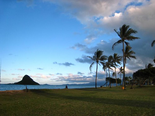
Cooler…north to northeast breezes

Larger waves along our north and west facing beaches too
The approach of this latest cold front brought showers to Kauai and Oahu, and has reached down to Maui County. These showers, called prefrontal precipitation, have been locally heavy enough, so that the NWS in Honolulu had to issue periodic flood advisories during the day Tuesday. This satellite image shows these clouds over Maui County Tuesday evening, heading towards the Big Island…having cleared Kauai and Oahu. Here’s a closer view, showing more detail of the islands, using this satellite image. The cold front itself will bring another round of much lighter showers, as it moves down through the island chain quickly during the night into Wednesday morning. The air flow is coming in from the southwest Kona direction ahead of the cold front. Here’s the looping radar image, which will help us keep track of the showers moving through the island chain tonight. The winds will quicken their pace, and be cooler and drier from the north and northeast…in the wake of the frontal passage into Wednesday. Satellite data shows that Wednesday should be a chilly day, although with less clouds and showers, and more sunshine in fact…except on the Big Island perhaps.
The computer models had shown all of the above, followed by a long lasting trade wind episode, now they’ve changed their tune…showing another couple of cold fronts arriving over the next week. Nonetheless, we will still see this two day cool snap after the cold front moves through our area. The latest idea includes another weak cold front late this weekend, followed by yet another around the middle of next week. At any rate, we’re still in our winter season, and so we expect these kinds of changeable conditions, it’s what makes following the weather so interesting! The changes presented by the computer models now show the trade winds, which will blow during the day Thursday, faltering already on Friday. As a matter of fact, the winds will shift all the way around to the southeast again, and probably to the south and southwest Kona directions, ahead of the next cold front later this weekend. Then, as has become so common this season, our winds will become north and northeast, and finally towards the ENE and easterly directions. Then, (there seems to be so many then’s this year) yet another cold front will arrive around next Tuesday or Wednesday…preceded by Kona winds, and followed by what else, other than more north to northeast breezes. We’re beginning to sound a bit like a broken record here! Although with that said, we’re happy to have any rainfall on any of our islands…as things remain drier than normal this winter.
It’s Tuesday evening, as I begin writing the last section of today’s narrative.
As described above, the majority of the remaining showers, some at least medium in intensity, if not a little more than that…are passing over Maui County. The showers, and most of the clouds have clear Kauai and Oahu, with just the rather insignificant cold front destined to pass quickly through tonight into Wednesday. This looping radar image
once again shows this situation well. I’m personally hoping that the Big Island, which has been particularly dry this winter, will get some of these showers soon! ~~~ Here in Kula this evening, it’s totally socked in with clouds above, and pea soup fog below…with still the Kona breezes blowing ahead of the frontal passage. The air temperature at a little past 5pm, was a chilly 59.5F degrees. Even down at Kapalua, near sea level, on Maui’s upper west side, at the same time…it was a chilly 70 degrees. What with the cooler breezes moving our way soon, the next day or day and a half, are going to be what winter is all about here in the tropics. We’ve had several of these cool snaps over the last several weeks. I know that many folks don’t appreciate these wintery outbreaks, and I can’t blame them, coming from colder places around the world. I grew up in southern California, and it never seemed to get cold enough for me there, so I sort of live for winter here in the tropics, so I can cool down once in a while. ~~~ Before anyone gets too nervous, this cool weather won’t last long, and already by later Thursday into Friday…our winds will swing around to the east and southeast even, carrying warmer air our way then. I’ll be back early Wednesday morning with your next new weather narrative from paradise, yes it is still paradise, despite the recent showers and cooler weather. I hope you have a great Tuesday night, and will be inclined to stop by for another visit soon! Aloha for now…Glenn.
Interesting: Humans and human activities have clearly altered the Earth’s landscape and oceans in countless ways, often to the detriment of other plants and animals. But a new report published online on January 28th in Current Biology, a Cell Press publication, shows just what a tangled food web we’ve woven. Two species of Mediterranean seabirds change their every move based on the activities of local fisheries and, in particular, the fish that people toss away.
The seabirds’ shifting movement patterns can be seen at the regional scale. "We show that human activities in the natural environment can promote critical transitions in the spreading properties of foraging animals by locally changing the predictability and availability of their resources," said Frederic Bartumeus of Princeton University and Institut Català de Ciències del Clima in Spain.
"Our study suggests an elementary but often disregarded connection between human local resource exploitation and global movement patterns of organisms." The findings may have important implications for conservation biology and the study of invasive species, the researchers said. The work also provides a solid statistical framework for quantifying movement patterns across ecological scales, which can now be applied to other species and other circumstances.
Bartumeus’ team took advantage of existing satellite data on the Cory’s shearwater and the Balearic shearwater, which tracked the seabirds’ movement over multiple foraging trips. Each trip typically lasts less than two days and covers distances anywhere from 10 to 1000 kilometers. Because the fisheries don’t operate on holidays and weekends, the researchers were able to characterize the birds’ activities in the presence and in the absence of the fisheries’ trawling activities.
When the fisheries don’t operate, seabirds essentially combine local searching with very large traveling distances, Bartumeus explained. Such a multi-scale search pattern generates what he calls super-diffusive movement properties, meaning that the birds spread out from one another at a rate that accelerates over time.
"Such a movement pattern allows for efficient explorations when the birds are looking for their natural prey of small fish and squid, which are highly mobile and unpredictably distributed in space and time," he said. In contrast, when fishermen are discarding fish, seabirds perform local searches around the boats, which act as an "attracting force."
As a result of such confined movement, the spreading of scavenging seabirds in the seascape decelerates with time, and movement patterns involve well-defined spatial scales related to the fishery activity. In a nutshell, says Bartumeus: "Fishery activities impact the foraging ecology of seabirds at much larger spatiotemporal scales than one might expect intuitively. The macroscopic spreading properties of seabirds through the seascape are directly influenced by the presence of fishermen’s boats discarding fish."
Interesting2: Speed is not a word typically associated with trees; they can take centuries to grow. However, a new study in the Proceedings of the National Academy of Sciences has found evidence that forests in the Eastern United States are growing faster than they have in the past 225 years. The study offers a rare look at how an ecosystem is responding to climate change. For more than 20 years forest ecologist Geoffrey Parker has tracked the growth of 55 stands of mixed hardwood forest plots in Maryland.
The plots range in size, and some are as large as 2 acres. Parker’s research is based at the Smithsonian Environmental Research Center, 26 miles east of the nation’s capital. Parker’s tree censuses have revealed that the forest is packing on weight at a much faster rate than expected. He and Smithsonian Tropical Research Institute postdoctoral fellow Sean McMahon discovered that, on average, the forest is growing an additional 2 tons per acre annually.
That is the equivalent of a tree with a diameter of 2 feet sprouting up over a year. Forests and their soils store the majority of the Earth’s terrestrial carbon stock. Small changes in their growth rate can have significant ramifications in weather patterns, nutrient cycles, climate change and biodiversity. Exactly how these systems will be affected remains to be studied. Parker and McMahon’s paper focuses on the drivers of the accelerated tree growth.
The chief culprit appears to be climate change, more specifically, the rising levels of atmospheric CO2, higher temperatures and longer growing seasons. Assessing how a forest is changing is no easy task. Forest ecologists know that the trees they study will most likely outlive them. One way they compensate for this is by creating a "chronosequence" — a series of forests plots of the same type that are at different developmental stages.
At SERC, Parker meticulously tracks the growth of trees in stands that range from 5 to 225 years old. This allowed Parker and McMahon to verify that there was accelerated growth in forest stands young and old. More than 90% of the stands grew two to four times faster than predicted from the baseline chronosequence. By grouping the forest stands by age, McMahon and Parker were also able to determine that the faster growth is a recent phenomenon.
If the forest stands had been growing this quickly their entire lives, they would be much larger than they are. Parker estimates that among himself, his colleague Dawn Miller and a cadre of citizen scientists, they have taken a quarter of a million measurements over the years. Parker began his tree census work Sept. 8, 1987 — his first day on the job. He measures all trees that are 2 centimeters or more in diameter. He also identifies the species, marks the tree’s coordinates and notes if it is dead or alive.
By knowing the species and diameter, McMahon is able to calculate the biomass of a tree. He specializes in the data-analysis side of forest ecology. "Walking in the woods helps, but so does looking at the numbers," said McMahon. He analyzed Parker’s tree censuses but was hungry for more data. It was not enough to document the faster growth rate; Parker and McMahon wanted to know why it might be happening.
"We made a list of reasons these forests could be growing faster and then ruled half of them out," said Parker. The ones that remained included increased temperature, a longer growing season and increased levels of atmospheric CO2. During the past 22 years CO2 levels at SERC have risen 12%, the mean temperature has increased by nearly three-tenths of a degree and the growing season has lengthened by 7.8 days.
The trees now have more CO2 and an extra week to put on weight. Parker and McMahon suggest that a combination of these three factors has caused the forest’s accelerated biomass gain. Ecosystem responses are one of the major uncertainties in predicting the effects of climate change.
Parker thinks there is every reason to believe his study sites are representative of the Eastern deciduous forest, the regional ecosystem that surrounds many of the population centers on the East Coast. He and McMahon hope other forest ecologists will examine data from their own tree censuses to help determine how widespread the phenomenon is.
Interesting3: NASA’s Hubble Space Telescope has observed a mysterious X-shaped debris pattern and trailing streamers of dust that suggest a head-on collision between two asteroids. Astronomers have long thought the asteroid belt is being ground down through collisions, but such a smashup has never been seen before. Asteroid collisions are energetic, with an average impact speed of more than 11,000 miles per hour, or five times faster than a rifle bullet.
The comet-like object imaged by Hubble, called P/2010 A2, was first discovered by the Lincoln Near-Earth Asteroid Research, or LINEAR, program sky survey on Jan. 6. New Hubble images taken on Jan. 25 and 29 show a complex X-pattern of filamentary structures near the nucleus. "This is quite different from the smooth dust envelopes of normal comets," said principal investigator David Jewitt of the University of California at Los Angeles.
"The filaments are made of dust and gravel, presumably recently thrown out of the nucleus. Some are swept back by radiation pressure from sunlight to create straight dust streaks. Embedded in the filaments are co-moving blobs of dust that likely originated from tiny unseen parent bodies." Hubble shows the main nucleus of P/2010 A2 lies outside its own halo of dust. This has never been seen before in a comet-like object.
The nucleus is estimated to be 460 feet in diameter. Normal comets fall into the inner regions of the solar system from icy reservoirs in the Kuiper Belt and Oort Cloud. As a comet nears the sun and warms up, ice near the surface vaporizes and ejects material from the solid comet nucleus via jets. But P/2010 A2 may have a different origin. It orbits in the warm, inner regions of the asteroid belt where its nearest neighbors are dry rocky bodies lacking volatile materials.
This leaves open the possibility that the complex debris tail is the result of an impact between two bodies, rather than ice simply melting from a parent body. "If this interpretation is correct, two small and previously unknown asteroids recently collided, creating a shower of debris that is being swept back into a tail from the collision site by the pressure of sunlight," Jewitt said. The main nucleus of P/2010 A2 would be the surviving remnant of this so-called hypervelocity collision.
"The filamentary appearance of P/2010 A2 is different from anything seen in Hubble images of normal comets, consistent with the action of a different process," Jewitt said. An impact origin also would be consistent with the absence of gas in spectra recorded using ground-based telescopes. The asteroid belt contains abundant evidence of ancient collisions that have shattered precursor bodies into fragments.
The orbit of P/2010 A2 is consistent with membership in the Flora asteroid family, produced by collisional shattering more than 100 million years ago. One fragment of that ancient smashup may have struck Earth 65 million years ago, triggering a mass extinction that wiped out the dinosaurs.
But, until now, no such asteroid-asteroid collision has been caught "in the act." At the time of the Hubble observations, the object was approximately 180 million miles from the sun and 90 million miles from Earth. The Hubble images were recorded with the new Wide Field Camera 3 (WFC3).
Interesting4: Brazil’s government has granted an environmental license for the construction of a controversial hydroelectric dam in the heart of the Amazon rainforest, the Environment Minister said on Monday. The $17 billion project on the Xingu River in the northern state of Para is to help the fast-growing Latin American country cope with soaring demand for electricity but has raised concern over its likely impact on the environment and on native Indians.
"It may have been the slowest and most complicated process under my management, after all, it is the third largest in the world … and a very controversial project," Environment Minister Carlos Minc told reporters in Rio de Janeiro. The 11,000-megawatt Belo Monte dam is part of Brazil’s largest concerted development plan for the Amazon since the country’s military government cut highways through the rain forest to settle the vast region during its two-decade reign starting in 1964.
Dams, roads, gas pipelines and power grids worth more than $30 billion are being built to tap the region’s vast raw materials, and transport its agricultural products in coming years. Minc said 96.5 sq miles of land would be flooded by the Belo Monte dam and that this had been reduced from 5,000 in the original plans for ecological reasons. Environmental groups say the Belo Monte project, which also includes creating a waterway to transport agricultural commodities grown in the Amazon, would damage the sensitive ecosystem with the flooding and threaten some fish species.
Posted by Glenn
1 Comment
February 1-2, 2010
Air Temperatures – The following maximum temperatures were recorded across the state of Hawaii Monday afternoon:
Lihue, Kauai – 78
Honolulu, Oahu – 80
Kaneohe, Oahu – 80
Kaunakakai, Molokai – 80
Kahului, Maui – 85
Hilo, Hawaii – 82
Kailua-kona – 81
Air Temperatures ranged between these warmest and coolest spots near sea level around the state – and on the highest mountains…at 5pm Monday evening:
Kahului, Maui – 81F
Lihue, Kauai – 76
Haleakala Crater – 46 (near 10,000 feet on Maui)
Mauna Kea summit – 41 (near 14,000 feet on the Big Island)
Precipitation Totals – The following numbers represent the largest precipitation totals (inches) during the last 24 hours on each of the major islands, as of Monday afternoon:
0.03 Poipu, Kauai
0.19 Wilson Tunnel, Oahu
0.05 Molokai
0.01 Lanai
0.00 Kahoolawe
0.47 Oheo Gulch, Maui
0.78 Glenwood, Big Island
Marine Winds – Here’s the latest (automatically updated) weather map showing a weak high pressure near Kauai, moving southward. Meanwhile, a cold front is approaching from the northwest. Winds will be south to southwest ahead of the front…then cooler from the north to northeast in its wake.
Satellite and Radar Images: To view the cloud conditions we have here in Hawaii, please use the following satellite links, starting off with this Infrared Satellite Image of the islands to see all the clouds around the state during the day and night. This next image is one that gives close images of the islands only during the daytime hours, and is referred to as a Close-up visible image. This next image shows a larger view of the Pacific…giving perspective to the wider ranging cloud patterns in the Pacific Ocean. Finally, here’s a Looping IR satellite image, making viewable the clouds around the islands 24 hours a day. To help you keep track of where any showers may be around the islands, here’s the latest animated radar image.
Hawaii’s Mountains – Here’s a link to the live webcam on the summit of near 14,000 foot Mauna Kea on the Big Island of Hawaii. The tallest peak on the island of Maui is the Haleakala Crater, which is near 10,000 feet in elevation. These two webcams are available during the daylight hours here in the islands…and when there’s a big moon rising just after sunset for an hour or two! Plus, during the nights and early mornings you will be able to see stars, and the sunrise too…depending upon weather conditions.
Tropical Cyclone activity in the eastern and central Pacific – Here’s the latest weather information coming out of the National Hurricane Center, covering the eastern north Pacific. You can find the latest tropical cyclone information for the central north Pacific (where Hawaii is located) by clicking on this link to the Central Pacific Hurricane Center. Here’s a tracking map covering both the eastern and central Pacific Ocean. A satellite image, which shows the entire ocean area between Hawaii and the Mexican coast…can be found here.
Aloha Paragraphs

Clouds…some showers Tuesday-Wednesday
Our weather here in the islands turned out pretty good Monday, although clouds and a few showers formed over the mountains during the afternoon. The next event in our Hawaiian Island weather picture will be the approach of the next cold front. This satellite image shows fairly cloud free weather, althoguh with high cirrus clouds spreading into our area from the southwest…along with the cold front to our northwest. Here’s a closer view, showing more detail of the islands, using this satellite image. The state started off the day with mostly clear skies, although that changed locally during the second half of the day. The light winds, coupled with the daytime heating of the islands, caused clouds to form over and around the mountains, although very few showers fell. As our winds take on a more southern tack, we’ll see more volcanic haze extending up the island chain…from the Big Island vents.
Looking a bit further ahead, the computer models show this next cold front getting into the state later Tuesday into Wednesday. As this next frontal boundary gets closer, our winds will pick up a little on the southwest Kona breezes. There’s a good chance of prefrontal showers arriving ahead of the front. The bulk of those showers, arriving tonight into Tuesday, will take aim on the islands of Kauai and Oahu. The front itself is scheduled to arrive later Tuesday over Kauai, bringing a short period of showers with it, as it slides down through the state overnight into Wednesday. Following the frontal passage, we’ll find cool northerly and northeasterly breezes, which may be quite gusty. This two day cool snap will be followed by warmer easterly trade winds…into the weekend and beyond. Those trades will likely bring the usual windward biased showers, although without any upper air trough overhead then, those showers won’t amount to all that much.
It’s Monday evening, as I begin writing the last section of today’s narrative.
As described above, Monday was a nice day, with just those afternoon clouds around the slopes. ~~~ As we get into Tuesday, the remnant clouds from the last cold front, now to the southwest of Kauai and Oahu, will be carried our way on the Kona winds. Here’s a looping radar image, so we see those showers moving towards Kauai and Niihau. The classic windward sides, on the north and east facing shores, should have decent weather extending into Tuesday, with most of the clouds and showers concentrating their efforts along the south and west facing leeward coasts and slopes. ~~~ The cold front itself isn’t expected to be all that impressive, although some showers will arrive with its passing. We will see a brief period of chilly weather surge in over the state…on the brisk north to northeast winds Wednesday into Thursday. Then, warmth will return on the easterly trade winds into the weekend, with generally good weather prevailing just about everywhere. The windward sides will have some showers, but with a relatively dry atmosphere then, they shouldn’t be too overbearing by any means. ~~~ Looking out the windows of my Kula, Maui, weather tower this evening, it’s cloudy up here. There’s a swath of high cirrus clouds that have been carried over the southern part of the state, on the upper winds aloft. This may add some color to our skies as the sunset occurs. At the same time, there’s some vog that has been carried our way on the surface breezes, which are very light today…from the south. ~~~ I’m about to get out there for my evening walk, but will be back early Tuesday morning with your next new weather narrative, I hope you have a great Monday night until then! Aloha for now…Glenn.
Interesting: Despite a decade of efforts worldwide to curb its release into the atmosphere, NOAA and university scientists have measured increased emissions of a greenhouse gas that is thousands of times more efficient at trapping heat than carbon dioxide and persists in the atmosphere for nearly 300 years. The substance HFC-23, or trifluoromethane, is a byproduct of chlorodifluoromethane, or HCFC-22, a refrigerant in air conditioners and refrigerators and a starting material for producing heat and chemical-resistant products, cables and coatings.
"Without the international effort to reduce emissions of HFC-23, its emissions and atmospheric abundance would have been even larger in recent years," said Stephen Montzka, a NOAA research chemist and lead author of the collaborative study between NOAA and university scientists. "As it was, emissions in 2006-2008 were about 50 percent above the 1990-2000 average." HFC-23 is one of the most potent greenhouse gases emitted as a result of human activities.
Over a 100-year time span, one pound of HFC-23 released into the atmosphere traps heat 14,800 times more effectively than one pound of carbon dioxide. To date, the total accumulated emission of HFC-23 is small relative to other greenhouse gases, making this gas a minor (less than one percent) contributor to climate change at present. Because HFC-23 is such a potent greenhouse gas, the United Nations Framework Convention on Climate Change (UNFCCC) has facilitated the destruction of substantial quantities of HFC-23 in developing countries since 2003.
The study by Montzka and colleagues shows for the first time that even with these actions HFC-23 emissions from developing countries remained substantial compared to recent years. The Montreal Protocol, which is the international agreement that phases out ozone-depleting substances, requires the end of HCFC-22 production by 2020 in developed countries and 2030 in developing counties for uses that result in the HCFC-22 escaping to the atmosphere.
This Protocol does not restrict HCFC-22 production in the synthesis of fluoropolymers or the HFC-23 that is co-produced. The future atmospheric abundance of HFC-23 and its contribution to future climate change depends on amounts of HCFC-22 produced and the success of programs to reduce emissions of the co-generated HFC-23. Scientists measured air collected from above the snow surface and down to 380 feet below the snow surface during field studies in Antarctica in 2001, 2005 and 2009.
Using these results, they were able to determine how amounts of HFC-23 and other gases affecting climate and stratospheric ozone have changed in the recent past. The first published measurements of HFC-23 appeared in 1998 but this was the first time scientists examined how HFC-23 emissions have changed since 1996, particularly in developing nations and since the UNFCCC’s projects to reduce emissions began in 2003.
Interesting2: Up to now, the more than 28 desalination plants scattered around the Kingdom have had to rely of fossil fuel, most notably fuel oil, to provide to power to run the equipment used to extract salt and other minerals from sea water. Much of this may be changing, however, as Saudi Arabia is now interested in using solar energy to provide the power needed, instead of oil. According to an article on the UAE Top News media site, the Kingdom is now planning to build solar energy based desalination plants in order to save on energy costs, as well as be in tune with new environmental polices.
This might be to secure membership in the International Renewable Energy Agency, otherwise known as IRENA. Saudi Finance Minister Ibrahim Al Assaf said "desalination is our strategic choice to supply an adequate supply of drinking water to people across the Kingdom." He added that by using solar energy instead of oil, it will focus more on using renewable energy and even become an exporter of this clean form of energy as it has been doing with oil.
A tremendous amount of oil is currently being used to provide power for the country’s desalination plants; around 1.5 million barrels per day. This has caused the price of desalinated water to rise as oil prices have risen. The use of solar energy to power desalination plants is just one of several projects in the Kingdom that are more environmentally friendly. The Kingdom is also embarking of projects to improve its inland transport systems including building a high speed train network to carry pilgrims to and from the annual Hajj pilgrimage in the Holy Cities of Mecca and Medina.
Interesting3: Sometime around 2050 researchers estimate that the global population will level-out at nine billion people, adding over two billion more people to the planet. Since, one billion of the world’s population (more than one in seven) are currently going hungry—the largest number in all of history—scientists are struggling with how, not only to feed those who are hungry today, but also the additional two billion that will soon grace our planet.
In a new paper, published in Science, researchers make recommendations on how the world may one day feed nine billion people—sustainably. The difficulties are many and large, according to the paper: "growing competition for land, water and energy, and the over-exploitation of fisheries, will affect our ability to produce food, as will the urgent requirement to reduce the impact of the food system on the environment."
The finiteness of arable land and freshwater will be further strained by what the authors call "higher purchasing power", which increases the demand in the developing world for "processed food, meat, dairy and fish, all of which adds pressure to the food supply system." Further complicating the problem of limited—and over-stretched resources—will be the need to adapt to a changing climate.
Interesting4: A study that looked at how people behave during pandemics has identified key demographic and psychological factors that may predict protective behaviors. The study is published online January 30 2010, in the British Journal of Health Psychology. Dr Alison Bish and Professor Susan Michie at the Health Psychology Unit, University College London, investigated the results of a number of studies into how people behave during pandemics, such as the recent swine flu outbreak, to better understand protective behavior and to improve interventions and communication in the future.
The review included the results of 26 published studies on associations between demographic factors, attitudes and behavioral measures during outbreaks including SARS (Severe Acute Respiratory Syndrome) between November 2002 and July 2003, Bird Flu (Avian influenza) in 1997, and Swine Flu (in 2009). Dr Bish said: "These illnesses have far reaching effects because of how easily they are transmitted. When an outbreak occurs however, people can choose to take steps to protect themselves.
Protective behaviors can be preventative, avoidant or disease management, such as hand washing, avoiding public places, or taking antiviral medication. We wanted to discover the groups of people that are most likely to take such steps, and the attitudes that are associated with these behaviors." Many of the studies found significant gender differences in protective behaviors. Studies in Hong Kong and Singapore, the UK and the USA found that women were more likely than men to carry out protective behaviors such as washing their hands, wearing a mask or following quarantine restrictions.
Older people were also found to be more likely to carry out such protective behaviors. Dr Bish explains: "These patterns could be explained in terms of perceived risk, with women and older people feeling that they may be more susceptible to disease than men, or younger people do." In fact, greater perceived susceptibility to disease was found to be a strong predictor of protective behaviors in studies carried out in the UK, Hong Kong, Australia and the Netherlands, with those people who felt they were more at risk carrying out more protective behaviors such as good hygiene, vaccination, and disinfecting the home.
In studies investigating SARS and swine flu, greater perceived susceptibility was associated with avoidant behavior such as avoiding public places. Having a high level of trust in authorities was found to be associated with compliance with preventative, avoidant and management of illness behaviors. Dr Bish explains: "As trust is a key emotion relevant to risk behavior, people who trust in authorities are more likely to follow their advice.
The issue of trust becomes weightier in uncertain situations, making this an important factor in whether people follow government advice during pandemics." Dr Bish concluded: "We hope that this insight into the demographic and psychological variables associated with protective behavior during a pandemic can be used in future pandemic situations to encourage behavior that will reduce the spread and impact of disease."
« Previous Page


