Air Temperatures ranged between these warmest and coolest spots near sea level around the state – and on the highest mountains…at 5pm Thursday afternoon:
Honolulu, Oahu – 79F
Hilo, Hawaii – 67
Haleakala Crater – 48 (near 10,000 feet on Maui)
Mauna Kea summit – 36 (near 14,000 feet on the Big Island)
Precipitation Totals–The following numbers represent the largest precipitation totals (inches) during the last 24 hours on each of the major islands, as of Thursday afternoon: 0.06 Mount Waialaele, Kauai 0.04 Waimanalo, Oahu
0.00 Molokai
0.00 Lanai
0.00 Kahoolawe
0.03 Puu Kukui, Maui
0.08 Honokaa, Big Island
Marine Winds – Here’s the latest (automatically updated)weather mapshowing a 1023 millibar high pressure system to the northwest…along with its associated ridge moving eastward into the area north of Kauai. This pressure configuration will bring the NE winds around to the ENE and east into the weekend.
Satellite and Radar Images:To view the cloud conditions we have here in Hawaii, please use the following satellite links, starting off with thisInfrared Satellite Imageof the islands to see all the clouds around the state during the day and night. This next image is one that gives close images of the islands only during the daytime hours, and is referred to as aClose-up visible image. This next image showsa larger view of the Pacific…giving perspective to the wider ranging cloud patterns in the Pacific Ocean. Finally, here’s aLooping IR satellite image, making viewable the clouds around the islands 24 hours a day. To help you keep track of where any showers may be around the islands, here’s the latest animatedradar image.
Hawaii’s Mountains – Here’s a link to the live webcam on the summit of near 14,000 foot Mauna Kea on the Big Island of Hawaii. The tallest peak on the island of Maui is the Haleakala Crater, which is near 10,000 feet in elevation. These two webcams are available during the daylight hours here in the islands…and when there’s a big moon rising just after sunset for an hour or two! Plus, during the nights and early mornings you will be able to see stars, and the sunrise too…depending upon weather conditions. Tropical Cyclone activity in the eastern and central Pacific– Here’s the latest weather information coming out of theNational Hurricane Center, covering the eastern north Pacific. You can find the latest tropical cyclone information for the central north Pacific (where Hawaii is located) by clicking on this link to the Central Pacific Hurricane Center. Here’s atracking mapcovering both the eastern and central Pacific Ocean. A satellite image, which shows the entire ocean area between Hawaii and the Mexican coast…can be found here.
Aloha Paragraphs
Kauai Art…Pierre Bouret
A dry and stable air mass over the islands will limit rainfall through the weekend…into early next week.
The leeward sides will be in good shape, with quite a bit of daytime sunshine, along with little if any rainfall. The windward sides will find a few showers falling at times, although even there…nothing significant is expected. This IR satellite imageshows the rather extensive low stratocumulus clouds, which are covering most of the windward areas…and well upstream from there. These clouds will diminish some during the day, although usually increase again during the night. If we look at an even larger view of the central Pacific, using this IRsatellite picture, we can see a vast area of high cirrus clouds to our south. These cirrus clouds are associated with a large area of disturbed weather in the deeper tropics, far to Hawaii’s south. This area of thunderstorms is traveling eastward, with a low chance of becoming a tropical cyclone.
The trade winds will be blowing in the light to moderately strong range, gradually becoming lighter later this weekend…into early next week. These trade winds will ensure pleasant weather conditions over our tropical latitudes. If we check out this weather map, we see a
1025 millibar high pressure system located to the northwest of Kauai. This high pressure cell has a ridge of high pressure extending eastward…to the north of Kauai. This high and ridge is the source of our trade winds now. Our winds will become lighter from the southeast later this weekend into early next week…ahead of the next cold front around next Wednesday. We may begin to see some volcanic haze drifting up over parts of the island chain by Sunday. The lighter winds from there through into the new week, will likely cause some afternoon clouds, and a few light showers in the upcountry areas. The next cold front will arrive with some showers around the middle of next week…followed by chilly north to northeast winds again.
It’s Thursday evening, as I begin writing the last section of today’s narrative.As noted in the paragraphs above, our weather will be nice, and finally beginning to warm up later Friday into the weekend. The dew point temperatures are still in the 50F’s this evening, with air temperatures, despite their being the 60’s and 70’s…feeling cooler than that in some cases. This is true especially where the wind chill factor is still in place, with the locally gusty breezes from the northeast still blowing. The air mass over the islands remains very dry and stable, which simply means that any rainfall will be restricted to the windward sides, and what little bit of that…generally falling during the night and early morning hours. A friend here in Kihei has invited me for a freshly made pizza pie dinner, so I’ll be getting home to Kula after dark for a change. I’ll still have plenty of time to get to bed before 9pm though, in order to get enough sleep, before my alarm goes off at 430am Friday morning. I hope you have a great Thursday night, and can join me here again on Friday! Aloha for now…Glenn.
Interesting: Overuse of nitrogen fertilizers in China is leading to rapid soil acidification and is causing lasting damage to ecosystems, according to soil study. Nitrogen fertilizers used to increase crop yields in China are having "extreme" environmental consequences, according to a study from leading soil scientists.
Scientists from China, the UK and the United States measured the pH of soil samples taken from agricultural land across China in the 1980s and 2000s and found widespread acidification caused by nitrogen fertilizers. On average, the pH of soil across the country had decreased by 0.5 in 20 years.
In parts of Hunan province, in south China, the pH of the soil had dropped to between 3 and 4. Most crops are suited to a neutral range between pH 6 and pH 8.
Interesting2: A five-year research project has come up with a way of generating green energy from a humble everyday grass. Researchers at Teesside University’s Contaminated Land and Water Centre began the project in 2004 to see which plants could best be grown on brownfield sites as a way of improving unsightly blots on the landscape.
Now, the research by the BioReGen (Biomass, Remediation, re-Generation) project team has revealed that reed canary grass can be turned into an excellent fuel for biomass power stations and, on a smaller scale, boilers in buildings like schools. The native British grass is turned into bricks and pellets. These not only burn well but also don’t add to greenhouse gases or contribute to global warming.
The team experimented with four types of plant, willow trees, the current favorite for biomass power stations, and the miscanthus, reed canary and switch grasses. Tests were carried out on sites around the region with work supported by a 1.2m Euros grant from the European Union’s LIFE-Environment research program.
Dr Richard Lord, Reader in Environmental Geochemistry and Sustainability, said: "We have narrowed the plants down to reed canary grass because it grows well on poor soils and contaminated industrial sites.
That is significant because in areas like Teesside, and many similar ones around the country, there are a lot of marginal or brownfield sites on which reed canary grass can be grown. "Selecting such sites means that the grass can be grown without taking away land which would otherwise be used in food production, a key concern for those involved in the biomass and biofuel sectors."
Having reached maturity, which takes two years, reed canary grass is harvested and baled up before being turned into bricks and pellets. Dr Lord said: "The test burnings have shown that reed canary grass produces a good, clean fuel without picking-up contamination from the soil.
"Reed canary grass has great potential because it offers a suitable use for unsightly brownfield sites while producing an excellent fuel at a time when the world is crying out for new ways of producing green energy.
"Our research also suggests that the end product is improved soil quality and biodiversity at the greened-up sites. "We are now examining ways in which we can commercialize this idea and are already talking to a number of major biomass power station operators."
Interesting3:A heat wave is a prolonged period of excessively hot weather, which may be accompanied by high humidity. There is no universal definition of a heat wave. One of the longest heat waves on record was the one at Marble Bar in Australia, where from October 31, 1923 to April 7, 1924 the temperature broke the 100.0 °F benchmark (160 days).
An example of a recent heat wave in the Balkans happened in June 2008. A period of extremely warm temperatures started and lasted three weeks. Temperatures stayed over or around 40 degrees Celsius (104 degrees Fahrenheit). To make the situation even more difficult for the population, this period was also marked by tropical nights where temperatures stayed above 20 or even 30 degrees Celsius overnight.
In a recent study it was found that there were significant heat wave or temperature changes across the western Balkans, southwestern and western Turkey, and along the southern Black Sea coastline. Since the 1960s, the mean heat wave intensity, heat wave length and heat wave number across the eastern Mediterranean region have increased by about a factor of 7.6, 7.5 and 6.2 respectively. These findings suggest that the heat wave increase in this region is higher than previously reported.
Interesting4:A study by scientists from the U.S.’s National Climatic Data Center refutes claims from climate change skeptics that data from U.S. weather stations was seriously flawed and exaggerated the rate of temperature increases. The study, published in the Journal of Geophysical Research, says that U.S. weather stations may have actually slightly underestimated temperature increases.
Anthony Watts, a former meteorologist who publishes the WattsUpWithThat blog, compiled photo evidence of what he considered poorly located weather stations across the U.S., including locations that could be influenced by artificial heat, such as those near parking lots and air conditioning systems. Watts concluded that the U.S. records were unreliable, and thus called into question the data used in climate research worldwide.
But scientists at the National Climatic Data Center suggest that the data collected at the stations Watts classified as poor were actually more likely to be cooler since they generally used sophisticated measuring equipment known as a Maximum-Minimum Temperature System (MMTS), which tends to be biased toward marginally cooler readings. The Balkans are located in south east Europe.
A new data set of high quality daily maximum and minimum summer air temperature series from 246 stations in the eastern Mediterranean region (including Albania, Bosnia-Herzegovina, Bulgaria, Croatia, Cyprus, Greece, Israel, Romania, Serbia, Slovenia, Turkey) has been developed and used to quantify changes in heat length and intensity between 1960 and 2006. Daily temperature analyses suggest that many instrumental measurements in the 1960s are warm biased, correcting for these biases regionally averaged heat wave trends are up to 8% higher.
Air Temperatures ranged between these warmest and coolest spots near sea level around the state – and on the highest mountains…at 5pm Wednesday evening:
Honolulu, Oahu – 77F
Princeville, Kauai – 68
Haleakala Crater – 46 (near 10,000 feet on Maui)
Mauna Kea summit – 36 (near 14,000 feet on the Big Island)
Precipitation Totals–The following numbers represent the largest precipitation totals (inches) during the last 24 hours on each of the major islands, as of Wednesday afternoon: 0.25 Kokee, Kauai 0.07 Makaha Stream, Oahu
0.10 Molokai
0.00 Lanai
0.00 Kahoolawe
0.07 Wailuku, Maui 0.12 Kawainui Stream, Big Island
Marine Winds – Here’s the latest (automatically updated)weather mapshowing a cold front dissipating to the southeast of the Big Island. A new high pressure system is moving into the area northwest of Kauai. This pressure configuration will keep NE to ENE winds blowing through Friday.
Satellite and Radar Images:To view the cloud conditions we have here in Hawaii, please use the following satellite links, starting off with thisInfrared Satellite Imageof the islands to see all the clouds around the state during the day and night. This next image is one that gives close images of the islands only during the daytime hours, and is referred to as aClose-up visible image. This next image showsa larger view of the Pacific…giving perspective to the wider ranging cloud patterns in the Pacific Ocean. Finally, here’s aLooping IR satellite image, making viewable the clouds around the islands 24 hours a day. To help you keep track of where any showers may be around the islands, here’s the latest animatedradar image.
Hawaii’s Mountains – Here’s a link to the live webcam on the summit of near 14,000 foot Mauna Kea on the Big Island of Hawaii. The tallest peak on the island of Maui is the Haleakala Crater, which is near 10,000 feet in elevation. These two webcams are available during the daylight hours here in the islands…and when there’s a big moon rising just after sunset for an hour or two! Plus, during the nights and early mornings you will be able to see stars, and the sunrise too…depending upon weather conditions. Tropical Cyclone activity in the eastern and central Pacific– Here’s the latest weather information coming out of theNational Hurricane Center, covering the eastern north Pacific. You can find the latest tropical cyclone information for the central north Pacific (where Hawaii is located) by clicking on this link to the Central Pacific Hurricane Center. Here’s atracking mapcovering both the eastern and central Pacific Ocean. A satellite image, which shows the entire ocean area between Hawaii and the Mexican coast…can be found here.
Aloha Paragraphs
Hawaiian Hula Dancer
A weakening cold front has passed down the island chain…and is dissipating to the southeast of the Big Island Wednesday evening.
The cold front brought a few showers, although as expected, not many. The mountains on Kauai and Oahu got the most rainfall, although even there, it ended up being around a quarter of an inch at most. This IR satellite imageshows the rather extensive low stratus clouds, which are covering most of the windward areas…having swept in behind the cold front. These clouds diminished quite a bit during the day, although often thicken again during the night. If we look at an even larger view of the central Pacific, using this IRsatellite picture, we can see a vast area of high cirrus clouds to our south-southwest as well. These cirrus clouds are associated with a large area of disturbed weather in the deeper tropics to Hawaii’s south.
The overlying atmosphere is dry and stable now, limiting precipitation…despite the low clouds that will be around locally. These low stratus clouds will likely bring only small drop rainfall (drizzle and mist) to the windward sides. There might be a few light showers sneaking over into the leeward areas…on the cool NE winds. Here’s a looping radar image so we can see where any of these drizzles or mists are occurring.
These winds will warm up and slow down, as they become easterly trade winds Friday into the weekend. Our winds will become lighter from the southeast late this coming Sunday into next Monday…ahead of the next cold front around next Wednesday. The current idea is that next week’s cold front, will act a lot like the one we’ve just seen passing through, followed by more chilly winds.
It’s Wednesday evening, as I begin writing the last section of today’s narrative.As noted in the paragraphs above, there will be clouds, and cool winds, although not very many showers to speak of. Wednesday was a relatively cool day, as air temperatures were restricted to the 70F’s. As if often the case when cool north breezes are blowing however, the Kona coast is sheltered from these winds, by the tall mountains on the Big Island…thus the warmer 82 degrees there this afternoon. Speaking of these winds, they were locally quite gusty today, approaching 40 mph locally at times. At the 5pm hour, winds were still gusting up above 30 mph in a few locations. ~~~ Looking out the window here in Kihei, before I take the drive back home to Kula, it’s generally clear. The Haleakala Crater, or at least the whole western slope of the mountain, was completely cloud free. Looking over towards the windward sides, there are those low clouds that I wrote about above. Kihei is windy, a cool breezy reality, as it has been all day. I talked to my neighbors during the day, up in Kula, and they said that there was a chill wind blowing up there too…with temperatures barely making it into the lower 60’s. I’m going up there right now, to either take a walk, or to take a bike ride, which ever I have time for. I’ll be back early Thursday morning with your next new narrative, I hope you can join me again then! Aloha for now…Glenn.
Interesting: What a difference a rain makes. The nationwide drought that had farmers, communities and entire states fighting to conserve water has reversed in the most dramatic turnaround since federal scientists began keeping records. More than 92% of the country is drought-free — the nation’s best showing since 1999.
"The lack of drought is extraordinary," said Douglas Le Comte, a meteorologist with the federal Climate Prediction Center. At the worst of the USA’s most recent drought — in August 2007 — almost 50% of the country was involved. Currently, about 7% of the country is in a drought, according to federal scientists.
The only part of the USA in "extreme" drought is a small fraction of Hawaii. In 2007, gigantic portions of the Southeast were in the worst drought in more than a century, sparking water wars among Georgia, Alabama and Florida. "It was horrid," said Teresa Hammack of Mars Hill, N.C., whose springs ran dry in August 2007 at the height of the Southeast drought.
Hammack’s home relies entirely on underground springs as a source of water. "Our springs are running rampant, with clean, fresh water," she said. There have been less than half a dozen occasions since the late 1800s when drought has been as sparse as it is now, Le Comte said.
Even before this month’s massive snowfall totals, relief has come in a number of different ways:
• The West has been helped this winter by a Pacific train of storm systems laden with ample moisture. The storms, caused by the ongoing El Niño climate pattern, brought lots of rain and snow to the Southwest, including the normally arid deserts of Southern California and eastern Arizona, according to the U.S. Drought Monitor.
• The southern drought (across Texas, Louisiana and Florida) was eased by a very wet fall and winter, said David Miskus, a meteorologist with the Climate Prediction Center.
• Drought relief in the Southeast started a year or two ago, Miskus said. A number of wet weather systems, including Tropical Storm Fay in August 2008, chipped away at the drought, Le Comte said. By the spring of 2009, a number of soaking weather systems ended the drought in the Georgia area, he said. "I guess it was time for Mother Nature to make up for the long-term subnormal precipitation with deluges," Miskus said.
In drought-plagued California, the "meteorological drought is pretty much over," said Le Comte. However, hydrological drought – meaning a shortfall in water supply – remains a concern in the Golden State. The state is still "looking at a deficit in soil moisture," reports hydrologist Mike Mierzwa of the California Department of Water Resources. "We’re still not caught up yet."
According to the federal Drought Monitor, California reservoir levels, after being down from several consecutive years of subnormal rain and snow, have started to recover, although most reservoirs have not reached normal capacity. "We’ve gone from a very scary situation to an OK situation," said Jeffrey Kightlinger, general manager of the Metropolitan Water District of Southern California. "If it stays wet, we’ll stay in an OK situation."
Interesting2:Chile’s Chaiten volcano has been placed under red alert due to an increase in seismic activity for three weeks, the Chilean government said. The volcano in southern Chile became active in May 2008 after being dormant for more than 9,000 years. Volcanic activity was on the decline in the past few months until picking back up January 21, the Chilean Interior Ministry said in a news release Monday.
The red alert, which indicates activity is above normal levels and an eruption could be imminent, was enacted in large part to protect tourists in the area, said Carmen Fernandez, director of Chile’s National Emergency Office. Underground seismic rumblings 1.2 to 5 miles deep in the area around the volcano and constant gas eruptions in the dome indicate "a high grade of instability," the National Emergency Office said.
Interesting3:Yemeni water trader Mohammed al-Tawwa runs his diesel pumps day and night, but gets less and less from his well in Sanaa, which experts say could become the world’s first capital city to run dry. "My well is now 1,300 feet deep and I don’t think I can drill any deeper here," said Tawwa, pointing to the meager flow into tanks that supply water trucks and companies.
From dawn, dozens of people with yellow jerricans collect water from a special canister Tawwa has set aside for the poor. "Sometimes we don’t have any water for a whole week, sometimes for two days and then it stops again," said Talal al-Bahr, who comes almost daily to supply his family of six.
The West frets that al Qaeda will exploit instability in Yemen to prepare new attacks like the failed December 25 bombing of a U.S. airliner, but this impoverished Arabian peninsula country faces a catastrophe that poses a far deadlier long-term threat. Nature cannot recharge ground water to keep pace with demand from a population of 23 million expected to double in 20 years.
Interesting4:What if it were possible to go to the store and buy a kit to quickly and accurately diagnose cancer, similar to a pregnancy test? A University of Missouri researcher is developing a tiny sensor, known as an acoustic resonant sensor, that is smaller than a human hair and could test bodily fluids for a variety of diseases, including breast and prostate cancers.
"Many disease-related substances in liquids are not easily tracked," said Jae Kwon, assistant professor of electrical and computer engineering at MU. "In a liquid environment, most sensors experience a significant loss of signal quality, but by using highly sensitive, low-signal-loss acoustic resonant sensors in a liquid, these substances can be effectively and quickly detected — a brand-new concept that will result in a noninvasive approach for breast cancer detection."
Kwon’s real-time, special acoustic resonant sensor uses micro/nanoelectromechanical systems (M/NEMS), which are tiny devices smaller than the diameter of a human hair, to directly detect diseases in body fluids. The sensor doesn’t require bulky data reading or analyzing equipment and can be integrated with equally small circuits, creating the potential for small stand-alone disease-screening systems.
Kwon’s sensor also produces rapid, almost immediate results that could reduce patient anxiety often felt after waiting for other detection methods, such as biopsies, which can take several days or weeks before results are known. "Our ultimate goal is to produce a device that will simply and quickly diagnose multiple specific diseases, and eventually be used to create ‘point of care’ systems, which are services provided to patients at their bedsides," Kwon said.
"The sensor has strong commercial potential to be manifested as simple home kits for easy, rapid and accurate diagnosis of various diseases, such as breast cancer and prostate cancer."
Interesting5:NASA tracks asteroids all the time. They are difficult or impossible for the rest of us to ever glimpse. Now, the most prominent asteroid in the sky can be seen with binoculars — and perhaps even the naked eye, if you are in an area with reasonably dark skies at night. Tonight, Wednesday, February 17, Vesta, the second most massive object in the asteroid belt, reaches what astronomers like to call "opposition."
An asteroid (or planet or comet) is said to be "in opposition" when it is opposite to the sun as seen from Earth. In other words, if you were to stand outside with the sun directly above you at high noon, Vesta would be directly below your feet some 131,700,000 miles away. With Vesta at opposition, the asteroid is at its closest point to Earth in its orbit. The asteroid is expected to shine at magnitude 6.1.
That brightness should make it visible to interested parties brandishing telescopes or binoculars, and even those blessed with excellent vision and little or no light pollution or clouds in their vicinity. Vesta will be visible in the eastern sky in the constellation Leo. What makes this space rock so prominent these days? Along with its relative proximity at this point, a full half of the asteroid is being bathed by sunlight when seen from Earth, making it appear brighter.
Another attribute working in the observer’s favor is that Vesta has a unique surface material that is not as dark as most main belt asteroids – allowing more of the sun’s rays to reflect off its surface. If spotting Vesta in the night sky has whetted your appetite for mega-rocks, all we can say is, stay tuned. NASA’s Dawn spacecraft, currently motoring its way through the asteroid belt, will begin its exploration of Vesta in the summer of 2011.
Air Temperatures ranged between these warmest and coolest spots near sea level around the state – and on the highest mountains…at 5pm Tuesday evening:
Kailua-kona – 79F
Lihue, Kauai – 72
Haleakala Crater – 50 (near 10,000 feet on Maui)
Mauna Kea summit – 39 (near 14,000 feet on the Big Island)
Precipitation Totals–The following numbers represent the largest precipitation totals (inches) during the last 24 hours on each of the major islands, as of Tuesday afternoon: 0.01 Port Allen, Kauai 0.04 Waimanalo, Oahu
0.00 Molokai
0.00 Lanai
0.00 Kahoolawe
0.01 Mahinahina, Maui
0.24 Waiakea Uka, Big Island
Marine Winds – Here’s the latest (automatically updated)weather mapshowing a cold front moving into the state from the northwest. A new high pressure system will move into place by Wednesday. This pressure configuration will bring stronger northerly to NE winds, bringing rough ocean conditions…and larger waves along the north shores.
Satellite and Radar Images:To view the cloud conditions we have here in Hawaii, please use the following satellite links, starting off with thisInfrared Satellite Imageof the islands to see all the clouds around the state during the day and night. This next image is one that gives close images of the islands only during the daytime hours, and is referred to as aClose-up visible image. This next image showsa larger view of the Pacific…giving perspective to the wider ranging cloud patterns in the Pacific Ocean. Finally, here’s aLooping IR satellite image, making viewable the clouds around the islands 24 hours a day. To help you keep track of where any showers may be around the islands, here’s the latest animatedradar image.
Hawaii’s Mountains – Here’s a link to the live webcam on the summit of near 14,000 foot Mauna Kea on the Big Island of Hawaii. The tallest peak on the island of Maui is the Haleakala Crater, which is near 10,000 feet in elevation. These two webcams are available during the daylight hours here in the islands…and when there’s a big moon rising just after sunset for an hour or two! Plus, during the nights and early mornings you will be able to see stars, and the sunrise too…depending upon weather conditions. Tropical Cyclone activity in the eastern and central Pacific– Here’s the latest weather information coming out of theNational Hurricane Center, covering the eastern north Pacific. You can find the latest tropical cyclone information for the central north Pacific (where Hawaii is located) by clicking on this link to the Central Pacific Hurricane Center. Here’s atracking mapcovering both the eastern and central Pacific Ocean. A satellite image, which shows the entire ocean area between Hawaii and the Mexican coast…can be found here.
Aloha Paragraphs
Cooler weather into Wednesday…locally windy
Tuesday was a generally clear day, with light winds on most islands.
This favorably inclined weather reality will be changing soon however, as a quickly weakening cold front is moving through the state from the northwest. This IR satellite imageshows both the generally clear skies ahead of the front, and frontal cloud band too. This cold front will be trying to move through the entire state, although its still a coin toss to know exactly how far it will get…during the night. If we look at an even larger view of the central islands, using this IRsatellite picture, we can see a large area of high cirrus clouds far to our southwest as well. These cirrus clouds are associated with a giant area of thunderstorms, with cloud tops all the way up to 55,000+ feet!
Meanwhile, our weather was near perfect Tuesday…ahead of the cold front that is.We saw clouds increase over Niihau and Kauai today, reaching Oahu early this evening. The different computer models have been divided in their forecast for this front…in terms of how far into the tropics, and our island chain…it would progress. Some of the models had been showing it stalling before reaching us, while others showed it making it down through the entire chain. It seems reasonable to assume that the front will get as far as it gets into the day Wednesday. The cold front isn’t all that wet, although some showers are coming along with it through the islands. Then, as the winds come in from northern latitudes in the wake of the front, we’ll see relatively dry air arriving. Although, there will belots of low cloudsin this dry air flow, likely bringing small drop rainfall (drizzle and mist) to the windward sides. There might even be a few showers sneaking over into the leeward areas…on the cool north to NE winds. These winds will warm up and slow down, as they become trade winds Thursday into the weekend.
It’s Tuesday evening, as I begin writing the last section of today’s narrative.As noted in the paragraphs above, our weather is changing now, going through another one of those tropical cooler phases. The winds will become locally rather blustery too, along with some fairly minor showers…most of which will end up along the windward sides. It may in fact be time to remember where that extra blanket is, although Monday night wasn’t exactly not cold was it! Many places near sea level dipped into the 50F’s early Tuesday morning, and into the mid 40’s upcountry in places. ~~~ Looking out the windows here in Kihei, Maui, it’s near totally clear, with both the West Maui Mountains, and the Haleakala Crater…both cloudless just before sunset! Looking at radar, we see some showers associated with the cold front, as evidenced by this looping radar image. The cold front was over Oahu at the time of this writing, and will pass over Maui County tonight…hopefully bringing a few showers to the Big Island Wednesday morning. Speaking of which, I’ll be back early in the morning with your next new weather narrative. I hope you have a great Tuesday night until then! Aloha for now…Glenn.
Interesting: Electric cars have many merits: They are quieter and require less maintenance than cars with internal combustion engines. A network of smartly located charging stations covering the entire Harz region in Germany is designed to make electric cars a regional feature. The Harz region is banking on electric cars.
Electric cars will soon be rolling through Quedlinburg, Werningerode and other cities in the region. Seventeen partners from research, academia and industry have committed themselves to this with their project Harz. ErneuerbareEnergien-mobility or Harz.EE-mobility for short. The success of electric cars will stand or fall with the power supply.
The ability to charge vehicles with green power anytime and anywhere will boost acceptance of this technology. Hence, charging stations will have to be located astutely enough that electric cars will even be able to reach a city sixty kilometers away without any problem. Researchers at the Fraunhofer Institute for Factory Operation and Automation IFF in Magdeburg are determining the optimal locations for charging stations.
Interesting2:Plans to use concentrating solar power plants in the Sahara to generate and export electricity have been on the table for years. Now, it looks as though political will might help move things forward. The logic of the idea would seem obvious to a child: the human race needs to wean itself off fossil fuels, so why don’t we build solar power plants in the world’s deserts, to give us all the energy we need?
This concept has long been promoted by Desertec, a European network of scientists and engineers, which argues that just 1 per cent of the surface area of the world’s deserts could generate as much electricity as the world is now using.
Desertec envisages a massive deployment of solar technology in Middle Eastern and North African countries, exporting electricity to Europe. The vision may seem idealistic, but there have been signs recently that politicians and industry are starting to take the Desertec proposals seriously. Interesting3: Less than two months after it was hastily drafted to stave off a fiasco, the Copenhagen Accord on climate change is in a bad way, and some are already saying it has no future. The deal was crafted amid chaos by a small group of countries, led by the United States and China, to avert an implosion of the UN’s December 7-18 climate summit.
Savaged at the time by green activists and poverty campaigners as disappointing, gutless or a betrayal, the Accord is now facing its first test in the political arena — and many views are caustic. Veterans say the document has little traction and cannot pull the 194-nation UN Framework Convention on Climate Change (UNFCCC) towards a new global pact by year’s end.
Political momentum is so weak that so far only two negotiating rounds have been rostered in 2010, one among officials in Bonn in mid-year, the other in Mexico at ministerial level in December. Worse, the Accord itself already seems to have been quietly disowned by China, India and other emerging economies just weeks after they helped write it, say these sources.
The Accord’s supporters say it is the first wide-ranging deal to peg global warming to 3.6F and gather rich and poor countries in specific pledges for curbing carbon emissions. And it promises money: 30 billion dollars for climate-vulnerable poor countries by 2012, with as much as 100 billion dollars annually by 2020.
Critics say there is no roadmap for reaching the warming target and point out the pledges are voluntary, whereas the Kyoto Protocol — which took effect five years ago next Tuesday — has tough compliance provisions for rich polluters.
Interesting4:A surprising new study finds that during the past century the frequency of fog along California’s coast has declined by approximately three hours a day. Published in the Proceedings of the National Academy of Sciences the researchers are concerned that this decrease in fog threatens California’s giant redwoods and the unique ecosystem they inhabit.
"As fog decreases, the mature redwoods along the coast are not likely to die outright, but there may be less recruitment of new trees; they will look elsewhere for water, high humidity and cooler temperatures," explains coauthor Todd E. Dawson, professor of integrative biology and University of California, Berkeley professor of integrative biology with the Department of Environmental Science, Policy and Management (ESPM).
"What does that mean for the current redwood range and that of the plants and animals with them?" he adds. Evaluating data from airports along the northern California coast, researchers were able to find a steady link in the occurrence of coastal fog and large temperature differences between coast and inland areas.
Then by examining temperature data from 114 stations up and down the Pacific Coast, the researchers found that the temperature contrasts between coast and inland areas had shrunk over the past century leading to a decline in fog. "Since 1901, the average number of hours of fog along the coast in summer has dropped from 56 percent to 42 percent," explains study leader James A. Johnstone, a postdoctoral scholar at UC Berkeley’s Department of Environmental Science, Policy and Management (ESPM).
"A cool coast and warm interior is one of the defining characteristics of California’s coastal climate, but the temperature difference between the coast and interior has declined substantially in the last century, in step with the decline in summer fog." This drop in fog occurrence along with the change in temperature contrasts means that "coast redwood and other ecosystems along the U.S. West Coast may be increasingly drought-stressed, with a summer climate of reduced fog frequency and greater evaporative demand," adds Dawson.
"Fog prevents water loss from redwoods in summer, and is really important for both the tree and the forest. If the fog is gone, we might not have the redwood forests we do now." Johnstone and his colleagues are uncertain whether the temperature changes, and thereby the decline in fog, is apart of a natural cycle or linked to human impacts such as climate change.
But in order to find the answer they plan to next look at redwood tree ring data and stable isotopes from redwood cellulose to construct the past climate of the coast. "Redwoods live for more than 2,000 years, so they could be a very important indicator of climate patterns and change along the coast," Dawson says. Only 5 percent of primary growth redwood forests survive today; the rest has been logged or developed.
According to Save the Redwoods League, eighteen percent of the remaining coastal redwood forests are protected, the rest lies either on private land or in natural forests, which could be logged in the future. Save the Redwoods League, along with Berkeley Atmospheric Sciences, funded the study.
Interesting5:The U.N. panel of climate experts overstated how much of the Netherlands is below sea level, according to a preliminary report on Saturday, admitting yet another flaw after a row last month over Himalayan glacier melt. A background note by the Intergovernmental Panel on Climate Change (IPCC) said a 2007 report wrongly stated that 55 percent of the country was below sea level since the figure included areas above sea level, prone to flooding along rivers.
The United Nations has said errors in the 2007 report of about 3,000 pages do not affect the core conclusions that human activities, led by burning fossil fuels, are warming the globe. "The sea level statistic was used for background information only, and the updated information remains consistent with the overall conclusions," the IPCC note dated February 12 said.
Skeptics say errors have exposed sloppiness and over-reliance on "grey literature" outside leading scientific journals. The panel’s reports are a main guide for governments seeking to work out costly policies to combat global warming. The 2007 report included the sentence: "The Netherlands is an example of a country highly susceptible to both sea level rise and river flooding because 55 percent of its territory is below sea level."
"A preliminary analysis suggests that the sentence discussed should end with: ‘because 55 percent of the Netherlands is at risk of flooding’," the IPCC note said. The Netherlands Environmental Assessment Agency, the original source of the incorrect data, said on February 5 that just 26 percent of the country is below sea level and 29 percent susceptible to river flooding.
Interesting6:An examination of mineral deposits in a coastal cave on the Spanish island of Mallorca shows evidence of rapid rises and declines in sea level as the planet warmed and cooled. Reporting in the journal Science, University of Iowa researchers said that studies of the mineral, calcite — deposited by sea water on the inside of a seaside cave, like rings on a bathtub — showed that roughly 81,000 years ago sea levels jumped by more than 6 feet a century during a warm period, and then dropped during a subsequent cooling cycle at a similar rate — 66 feet per 1,000 years.
CO2 levels during that period were lower than they are today, but temperatures rose because the Earth’s orbit placed it in a position where it received more of the sun’s energy, the study said. Jeffrey Dorale, a geoscientist at the University of Iowa and the lead author of the paper, said that his study underscored similar findings from other researchers about the volatility of sea level rise as the Earth’s ice sheets form and melt.
"It’s fair to say that this means glaciers may change somewhat faster than we once inferred," said Dorale. "It does suggest there can be very fast melting and very fast ice building at times when CO2 levels were lower than now."
Interesting7:Most Americans like the idea of conservation, but few practice it in their everyday lives, according to the results of a national survey released February 16 by researchers at Yale and George Mason universities. A majority of Americans say that it is "very important" or "somewhat important" to turn off unneeded lights (92 percent), to lower the thermostat in winter (83 percent), and to use public transportation or a carpool (73 percent), among other conservation behaviors.
Yet the study found that:
• 88 percent of Americans say it is important to recycle at home, but only 51 percent "often" or "always" do-
• 81 percent say it is important to use re-usable shopping bags, but only 33 percent "often" or "always" do-
• 76 percent say it is important to buy locally grown food, but only 26 percent "often" or "always" do-
• 76 percent say it is important to walk or bike instead of drive, but only 15 percent "often" or "always" do-
• 72 percent of Americans say it is important to use public transportation or carpool, but only 10 percent say they "often" or "always" do.
"There are many possible explanations for the gap between people’s attitudes and their actual behavior," said Anthony Leiserowitz, director of the Yale Project on Climate Change. "For example, public transportation may not be locally available or convenient. Overcoming barriers such as these will make it much easier for people to act in ways consistent with their values."
The survey also found that approximately 33 percent of Americans in the past year rewarded companies that are taking steps to reduce global warming by buying their products, while slightly less refused buying the products of companies that they perceive to be recalcitrant on the issue. Finally, 11 percent of Americans have contacted government officials in the past year about global warming, with seven in 10 urging officials to take action to reduce it.
"When it comes to taking a stand against global warming, concerned Americans are much more likely to take action through consumer purchases rather than as citizens," said Edward Maibach, director of the Center for Climate Change Communication at George Mason University. "This lack of citizen engagement may help to explain why Congress is being so timid in addressing climate change."
The results come from a nationally representative survey of 1,001 American adults, age 18 and older. The sample was weighted to correspond with U.S. Census Bureau parameters. The margin of sampling error is plus or minus 3 percent, with 95 percent confidence. The survey was designed by researchers at Yale and George Mason universities and conducted from December 24, 2009, to January 3, 2010, by Knowledge Networks, using an online research panel of American adults.
Air Temperatures ranged between these warmest and coolest spots near sea level around the state – and on the highest mountains…at 3pm Monday afternoon:
Kaneohe, Oahu – 81F
Lihue, Kauai – 76
Haleakala Crater – 52 (near 10,000 feet on Maui)
Mauna Kea summit – 41 (near 14,000 feet on the Big Island)
Precipitation Totals–The following numbers represent the largest precipitation totals (inches) during the last 24 hours on each of the major islands, as of Monday afternoon: 0.02 Poipu, Kauai 0.03 Waimanalo, Oahu
0.07 Molokai
0.00 Lanai
0.00 Kahoolawe
0.42 West Wailuaiki, Maui
0.99 Kawainui, Big Island
Marine Winds – Here’s the latest (automatically updated)weather mapshowing 1024 millibar high pressure system located far to the northeast. Meanwhile, a cold front is approaching from the northwest. This pressure configuration will keep trade winds blowing through Tuesday...although quite lightly. Stronger northwest to northerly winds arrive later Tuesday afternoon into the night.
Satellite and Radar Images:To view the cloud conditions we have here in Hawaii, please use the following satellite links, starting off with thisInfrared Satellite Imageof the islands to see all the clouds around the state during the day and night. This next image is one that gives close images of the islands only during the daytime hours, and is referred to as aClose-up visible image. This next image showsa larger view of the Pacific…giving perspective to the wider ranging cloud patterns in the Pacific Ocean. Finally, here’s aLooping IR satellite image, making viewable the clouds around the islands 24 hours a day. To help you keep track of where any showers may be around the islands, here’s the latest animatedradar image.
Hawaii’s Mountains – Here’s a link to the live webcam on the summit of near 14,000 foot Mauna Kea on the Big Island of Hawaii. The tallest peak on the island of Maui is the Haleakala Crater, which is near 10,000 feet in elevation. These two webcams are available during the daylight hours here in the islands…and when there’s a big moon rising just after sunset for an hour or two! Plus, during the nights and early mornings you will be able to see stars, and the sunrise too…depending upon weather conditions. Tropical Cyclone activity in the eastern and central Pacific– Here’s the latest weather information coming out of theNational Hurricane Center, covering the eastern north Pacific. You can find the latest tropical cyclone information for the central north Pacific (where Hawaii is located) by clicking on this link to the Central Pacific Hurricane Center. Here’s atracking mapcovering both the eastern and central Pacific Ocean. A satellite image, which shows the entire ocean area between Hawaii and the Mexican coast…can be found here.
Aloha Paragraphs
Hawaiian Art
The trade winds will become lighter into Tuesday, then stronger and cooler from the northwest to north…and finally northeast.The lighter winds now are being prompted by the approach of a weak cold front. Meanwhile, we’ll continue to see favorably inclined weather over the state, with warm sunny weather. The latest thought is that this frontal cloud band will now move down through the entire state, at a very fast clip. A surge of cooler air will arrive ahead of the frontal passage, and then of in its wake from the north and northeast…ushering in a brief period of chilly weather. These winds will help to carry some moisture from the dissipating front down across the windward sides for a day or two. Moving through the rest of the work week, these winds turn to the trade wind direction, with whatever showers that are around diminish going into the weekend. The computer models then show another cold front approaching the state, although perhaps stalling before arriving.
It’s Monday evening, as I begin writing the last section of today’s narrative. Monday turned out to be an exceptionally fine day, which was great, as many folks were off work on this President’s Day holiday. Here’s wishing Mr. Obama the best wishes on his special day of the year. The trade winds were blowing, although were quite a bit lighter, as a high pressure ridge gets pushed down close to the state…by the approaching cold front. As noted above, the front is now expected to keep going, as it moves through the island chain later Tuesday into Wednesday morning. The Hawaiian Islands remain dry, so that any moisture that this frontal cloud band brings, will be very welcome. ~~~ Here in Kula, Maui, near 5pm, my air temperature was nice and warm, at 73.4F degrees. It’s generally clear up here on the slopes of the Haleakala Crater, as it is across most of the islands. I’m just about ready to go for a bike ride with my neighbor, which will be fun. I hope you enjoy the rest of your day, and will meet me here again early in the morning Tuesday! Aloha for now…Glenn.
Air Temperatures ranged between these warmest and coolest spots near sea level around the state – and on the highest mountains…at 4pm Sunday afternoon:
Honolulu, Oahu – 79F
Lihue, Kauai – 74
Haleakala Crater – 52 (near 10,000 feet on Maui)
Mauna Kea summit – 41 (near 14,000 feet on the Big Island)
Precipitation Totals–The following numbers represent the largest precipitation totals (inches) during the last 24 hours on each of the major islands, as of Sunday afternoon: 0.02 Poipu, Kauai 0.04 Oahu Forest NWR, Oahu
0.20 Molokai
0.00 Lanai
0.00 Kahoolawe 0.66 Puu Kukui, Maui 0.34 Glenwood, Big Island
Marine Winds – Here’s the latest (automatically updated)weather mapshowing high pressure systems located far to the northeast and the west-northwest…with a ridge of high pressure running between the two, broken to the north of Kauai. This pressure configuration will keep trade winds blowing through Tuesday...although becoming lighter.
Satellite and Radar Images:To view the cloud conditions we have here in Hawaii, please use the following satellite links, starting off with thisInfrared Satellite Imageof the islands to see all the clouds around the state during the day and night. This next image is one that gives close images of the islands only during the daytime hours, and is referred to as aClose-up visible image. This next image showsa larger view of the Pacific…giving perspective to the wider ranging cloud patterns in the Pacific Ocean. Finally, here’s aLooping IR satellite image, making viewable the clouds around the islands 24 hours a day. To help you keep track of where any showers may be around the islands, here’s the latest animatedradar image.
Hawaii’s Mountains – Here’s a link to the live webcam on the summit of near 14,000 foot Mauna Kea on the Big Island of Hawaii. The tallest peak on the island of Maui is the Haleakala Crater, which is near 10,000 feet in elevation. These two webcams are available during the daylight hours here in the islands…and when there’s a big moon rising just after sunset for an hour or two! Plus, during the nights and early mornings you will be able to see stars, and the sunrise too…depending upon weather conditions. Tropical Cyclone activity in the eastern and central Pacific– Here’s the latest weather information coming out of theNational Hurricane Center, covering the eastern north Pacific. You can find the latest tropical cyclone information for the central north Pacific (where Hawaii is located) by clicking on this link to the Central Pacific Hurricane Center. Here’s atracking mapcovering both the eastern and central Pacific Ocean. A satellite image, which shows the entire ocean area between Hawaii and the Mexican coast…can be found here.
Aloha Paragraphs
Happy Valentines Day!
The trade winds will remain in place through the holiday Monday…although gradually becoming lighter.The placement of a ridge to our north will keep trade winds blowing across our tropical latitudes…although are on a downward trend now. This will be caused by the approach of a cold front into the mid-week time frame. Meanwhile, we’ll continue to see favorably inclined weather over the state, with relatively warm easterly trade winds blowing. The latest thought is that this fast moving frontal cloud band will speed through, although with limited windward biased shower activity. A surge of cooler air will arrive ahead of the frontal passage, and then of in its wake from the north and northeast…ushering in a brief bout of chilly weather.
The surf will remain active along the north and west facing beaches and along the south and east facing shores as well.The north and west shores are on the down trend in size now, although will find another new boost upwards, and new NW swell arrives Monday. The east shores will have some fairly minor waves breaking, generated by the lighter trade winds upstream of the islands. Meanwhile, the southern leeward beaches will find waves breaking, thanks to storms in the far southern hemisphere. These leeward beaches will find the next new impulse arriving Monday, which will keep the surf up, breaking generally in the small to lower medium size range through mid-week.
It’s Sunday evening, as I begin writing the last section of today’s narrative. Sunday has been one of those very special days, with lots of sunshine, and hardly any showers. Air temperatures were balmy today, topping out in the upper 70F’s, into the lower 80’s in those warmest leeward beach areas. Weather conditions will remain quite nice through the next few days.~~~ It’s the Valentine Holiday today, and I’m sure everyone is getting into it, at whatever level it happens to be appropriate and fun. I hope you have had a great Valentines Day! I hung out at home, and had a nice visit with my neighbors. It’s around 5pm Sunday evening, and the air temperature up here in Kula, Maui, was reading a very comfortable 70.9 degrees. I’ll be back on Monday, ready to report about these great weather conditions that will be around on the holiday. I hope you have a great Sunday night until then! Aloha for now…Glenn.
Air Temperatures ranged between these warmest and coolest spots near sea level around the state – and on the highest mountains…at 4pm Saturday afternoon:
Kailua-kona – 81F
Princeville, Kauai – 73
Haleakala Crater – 43 (near 10,000 feet on Maui)
Mauna Kea summit – 41 (near 14,000 feet on the Big Island)
Precipitation Totals–The following numbers represent the largest precipitation totals (inches) during the last 24 hours on each of the major islands, as of Saturday afternoon: 0.01 Port Allen, Kauai 0.24 Oahu Forest NWR, Oahu
0.10 Molokai
0.00 Lanai
0.00 Kahoolawe 1.02 West Wailuaiki, Maui 0.34 Laupahoehoe, Big Island
Marine Winds – Here’s the latest (automatically updated)weather mapshowing high pressure systems located far to the east-northeast and the west…with a ridge of high pressure running between the two, to the north of Kauai. This pressure configuration will keep trade winds blowing through the holiday on Monday.
Satellite and Radar Images:To view the cloud conditions we have here in Hawaii, please use the following satellite links, starting off with thisInfrared Satellite Imageof the islands to see all the clouds around the state during the day and night. This next image is one that gives close images of the islands only during the daytime hours, and is referred to as aClose-up visible image. This next image showsa larger view of the Pacific…giving perspective to the wider ranging cloud patterns in the Pacific Ocean. Finally, here’s aLooping IR satellite image, making viewable the clouds around the islands 24 hours a day. To help you keep track of where any showers may be around the islands, here’s the latest animatedradar image.
Hawaii’s Mountains – Here’s a link to the live webcam on the summit of near 14,000 foot Mauna Kea on the Big Island of Hawaii. The tallest peak on the island of Maui is the Haleakala Crater, which is near 10,000 feet in elevation. These two webcams are available during the daylight hours here in the islands…and when there’s a big moon rising just after sunset for an hour or two! Plus, during the nights and early mornings you will be able to see stars, and the sunrise too…depending upon weather conditions. Tropical Cyclone activity in the eastern and central Pacific– Here’s the latest weather information coming out of theNational Hurricane Center, covering the eastern north Pacific. You can find the latest tropical cyclone information for the central north Pacific (where Hawaii is located) by clicking on this link to the Central Pacific Hurricane Center. Here’s atracking mapcovering both the eastern and central Pacific Ocean. A satellite image, which shows the entire ocean area between Hawaii and the Mexican coast…can be found here.
Aloha Paragraphs
Happy Valentines Day!
The trade winds will remain in place this weekend…through the upcoming holiday on Monday.The trade winds will prevail through the early part of the new week ahead, as they have been the last several days. Thisweather mapshows high pressure centers far to the west, and far to the east-northeast, with a very long ridge extending between the two…running by to the north of Kauai. The placement of this ridge will keep light to moderately strong trade winds blowing across our tropical latitudes. The marine areas around the state continue showing that most of the north and west facing beaches have high surf advisory flags up. At the same time, there were small craft wind advisory flags active locally as well, which weren’t for the trade winds…but rather the rough seas due to wave action.
The computer models suggest that we’ll see little change in the trade wind strength, or direction into the new week.This will keep generally favorably inclined weather over the state, with relatively warm easterly trade winds blowing across our islands. The next change that will influence our local weather conditions, will arrive later this coming Tuesday evening into Wednesday. The computer models want to push a cold front down into our area then. The trade winds look like they will continue to blow, although perhaps a little lighter preceding the frontal passage. Then, we expect a surge of cooler air to arrive from the north and northeast…ushering in a brief bout of chilly weather.The models go on to suggest that these winds will calm down by next weekend, when we may see another cold front arriving in the state.
The surf will remain active along the north and west facing beaches and along the south and east facing shores as well…although it will be smaller there.The north and west shores will be on the receiving end of waves being generated by storms in the north Pacific. The east shores will have some fairly minor waves breaking, generated by the trade winds upstream of the islands. Meanwhile, the southern leeward beaches will find waves breaking, thanks to storms in the far southern hemisphere. This is all good news for our local water sports communities, who will be taking full advantage of these breaking waves and the wind! The surf will be slowly losing size as we move through this weekend, although will be around into the new week too, even on the south facing beaches…which is unusual for this winter month of February.
It’s Saturday evening, as I begin writing the last section of this morning’s narrative. There were more than the normal amount of clouds around Saturday, many of them were shower producers from the Big Island up through Oahu. Kauai remained to the north, and had a good start to the weekend.
~~~ I went to see a new film in Kahului after work Friday evening. I’d been looking forward to seeing this film for a while, called Crazy Heart (2009), starring Jeff Bridges, Maggie Gyllenhaal, Robert Duvall…among others. A short synopsis: Bad Blake (Bridges) is a broken-down, hard-living country music singer who’s had way too many marriages, far too many years on the road, and one too many drinks…way too many times. And yet, Bad can’t help but reach for salvation with the help of Jean (Gyllenhaal), a journalist who discovers the real man behind the musician. As he struggles down the road of redemption, Bad learns the hard way just how tough life can be on one man’s crazy heart.
~~~ I found this piece of work to be classical country western, with all the props that go along with the territory. There was the down and out guy, with his smoking cigarettes, and drinking whiskey constantly, and that great music too. I really got into this film, and enjoyed seeing it very much. There’s a part of me that likes being taken out of my world here on Maui, and transported into a completely different reality…which this film did nicely. I could suggest you see this film, that is if you would enjoy getting out on the road for a while, and having too many drinks, and smoking ciggy’s like crazy. I’d be willing to give this a good solid B+ grade. Here’s atrailer for the film.
~~~ This morning I drove over to Haiku, over on the windward side of Maui. I joined some friends for a morning of zen meditation. Then, I headed down to Paia for a swim, and quite honestly I had to sort of force myself into the water. There was very few people at the beach in the first place, as it was cloudy, breezy, and there had been off and on showers. The sand was wet as I made my way to the waters edge. It was a good thing that I really wanted to have a dip, otherwise I could have easily been turned away by the chilly elements. There was no one else in that choppy ocean, but to tell you the truth, I’m delighted I pushed through my resistance to getting cold. I drove back upcountry to Kula, and found cloudy skies up here too…with a shower just a few minutes ago. Sometimes, well, just about all the time, its good to just do want you want to do, regardless of the weather conditions!
~~~ It’s the Valentine Holiday weekend, and I’m sure everyone is planning on getting into it, at whatever level it happens to be appropriate. I have a friend coming over soon, and will pop a nice bottle of red wine, and serve up a tasty dinner. I’d better get downstairs and get ready. I’ll be back Sunday, although not necessarily at the crack of dawn. I’m trying to get myself to sleep in a little bit on the weekends these days. I hope you have a great Saturday night, leading into a loving Valentines Day! Aloha, Glenn.
Air Temperatures ranged between these warmest and coolest spots near sea level around the state – and on the highest mountains…at 5pm Friday evening:
Kailua-kona – 79F
Lihue, Kauai – 71
Haleakala Crater – 48 (near 10,000 feet on Maui)
Mauna Kea summit – 39 (near 14,000 feet on the Big Island)
Precipitation Totals–The following numbers represent the largest precipitation totals (inches) during the last 24 hours on each of the major islands, as of Friday afternoon: 0.02 Omao, Kauai
0.77 Manoa Valley, Oahu
0.10 Molokai
0.00 Lanai
0.03 Kahoolawe
0.71 Puu Kukui, Maui 0.61 Kawainui Stream, Big Island
Marine Winds – Here’s the latest (automatically updated)weather mapshowing high pressure systems located far to the east-northeast and west-northwest…with a ridge of high pressure to the north of Kauai. This pressure configuration will keep trade winds blowing this weekend.
Satellite and Radar Images:To view the cloud conditions we have here in Hawaii, please use the following satellite links, starting off with thisInfrared Satellite Imageof the islands to see all the clouds around the state during the day and night. This next image is one that gives close images of the islands only during the daytime hours, and is referred to as aClose-up visible image. This next image showsa larger view of the Pacific…giving perspective to the wider ranging cloud patterns in the Pacific Ocean. Finally, here’s aLooping IR satellite image, making viewable the clouds around the islands 24 hours a day. To help you keep track of where any showers may be around the islands, here’s the latest animatedradar image.
Hawaii’s Mountains – Here’s a link to the live webcam on the summit of near 14,000 foot Mauna Kea on the Big Island of Hawaii. The tallest peak on the island of Maui is the Haleakala Crater, which is near 10,000 feet in elevation. These two webcams are available during the daylight hours here in the islands…and when there’s a big moon rising just after sunset for an hour or two! Plus, during the nights and early mornings you will be able to see stars, and the sunrise too…depending upon weather conditions. Tropical Cyclone activity in the eastern and central Pacific– Here’s the latest weather information coming out of theNational Hurricane Center, covering the eastern north Pacific. You can find the latest tropical cyclone information for the central north Pacific (where Hawaii is located) by clicking on this link to the Central Pacific Hurricane Center. Here’s atracking mapcovering both the eastern and central Pacific Ocean. A satellite image, which shows the entire ocean area between Hawaii and the Mexican coast…can be found here.
Aloha Paragraphs
South Point…on the Big Island
Our local weather will remain fairly smooth, with no major changes on our horizon here in the islands, for the time being.The trade winds will prevail through the early part of the new week ahead, as they have been the last several days. Thisweather mapshows high pressure centers far to the west-northwest, and far to the east-northeast…with a very long ridge extending between the two…running just to the north of Kauai. The placement of this ridge will keep our light to moderately strong trade winds blowing across our tropical latitudes. The marine areas around the state this evening are showing that most of the north and west facing beaches have high surf advisory flags up. At the same time, there were small craft wind advisory flags up locally as well, which weren’t for the trade winds…but rather the rough seas due to wave action.
The computer models suggest that we’ll see little change in the trade wind strength or direction into the new week.This will keep generally nice weather over the state, with relatively warm easterly trade winds blowing across our islands. If we check thisforecast weather map, we can see the same pressure configuration exists out 72 hours, or through Monday. At that time, we see a potent 983 millibar storm low pressure system to the northwest of the islands…with a cold front. The models want to push this cold front down into our area Tuesday evening into Wednesday. The trade winds look like they will continue to blow, although the cold front should push the trade wind producing high and ridge down closer to the state…probably slowing them down in the process.
Between now and the cold front’s arrival, we should see off and on passing showers along our windward sides.This precipitation isn’t expected to be heavy, although the islands of Maui and the Big Island may see some enhancement to these showers, as the colder air associated with a trough of low pressure moves close to that eastern side of the island chain. Otherwise, when the trade winds are at their periodic strongest, they may blow a few sprinkles into the leeward sides. The main event, at least in terms of rainfall, will have to wait until the middle of the upcoming week…hopefully. This is of course due to the dry conditions that continue to plague many areas of the state. There will be additional fine tuning of this precipitation event as we move closer to that time. The computer models show a surge of cool north to northeast winds filling in behind the cold front, which will give us another brief taste of winter.
The surf will remain active along the north and west facing beaches and along the south and east facing shores as well…although it will be smaller there.The north and west shores will be on the receiving end of waves being generated by storms in the north Pacific. The east shores will have some fairly minor waves breaking, generated by the trade winds upstream of the islands. Meanwhile, the southern leeward beaches will find waves breaking, thanks to storms in the far southern hemisphere. This is all good news for our local water sports communities, who will be taking full advantage of these breaking waves and wind! The surf will be slowly losing size as we move through the weekend, although will be around next week too…even on the south facing beaches, which is unusual for this winter month of February.
It’s Friday evening, as I begin writing the last section of today’s narrative. As noted above, the trade winds will dominate our local weather picture well into the future. The next interruption to this generally fine weather pattern, would be later next Tuesday into Wednesday. This may bring not only showers, mostly along the windward sides of the islands…but also another one of those brief tropical cool snaps for a couple of days. The computer models show a second showery frontal band of clouds arriving early next weekend. The main thing now though, is the pleasant weather conditions between now and the middle of next week.
~~~ The Beach Boys are playing on Maui this evening, which should be a good outdoor concert. I had wanted to go to see them, as they were one of my favorite bands while I was a kid, being a surfer and all. However, I have an early morning Saturday, as I’m going to join a group of friends who are meditating in Haiku. So, instead I’m going to see a new film in Kahului. I’ve actually been looking forward to seeing film, called Crazy Heart (2009), starring Jeff Bridges, Maggie Gyllenhaal, Robert Duvall…among others. A short synopsis: Bad Blake (Bridges) is a broken-down, hard-living country music singer who’s had way too many marriages, far too many years on the road, and one too many drinks…way too many times. And yet, Bad can’t help but reach for salvation with the help of Jean, a journalist who discovers the real man behind the musician. As he struggles down the road of redemption, Bad learns the hard way just how tough life can be on one man’s crazy heart. Here’s atrailer for this film.
As usual, I’ll let you know what I thought when I get back online early Saturday morning, to prepare your next new weather narrative. I hope you have a great Friday night until then! Aloha for now…Glenn.
Interesting: Yields from some of the most important crops begin to decline sharply when average temperatures exceed about 86 Fahrenheit. Projections are that by the end of this century much of the tropics and subtropics will regularly see growing season temperatures above that level, hotter than the hottest summers now on record.
An international panel of scientists writing in the Feb. 12 edition of the journal Science is urging world leaders to dramatically alter their notions about sustainable agriculture to prevent a major starvation catastrophe by the end of this century among the more than 3 billion people who live relatively close to the equator.
Specifically they urge world leaders to "get beyond popular biases against the use of agricultural biotechnology," particularly crops genetically modified to produce greater yields in harsher conditions, and to base the regulations of such crops on the best available science.
"You’re looking at a 20 percent to 30 percent decline in production yields in the next 50 years for major crops between the latitudes of southern California or southern Europe to South Africa," said David Battisti, a University of Washington atmospheric sciences professor.
He is a coauthor of a Perspectives article in Science that urges food production experts, scientists and world leaders to begin thinking in dramatically different ways to meet food needs in a significantly warmer world. Lead author is Nina Federoff, science and technology adviser to Secretary of State Hillary Rodham Clinton.
"I grow increasingly concerned that we have not yet understood what it will take to feed a growing population on a warming planet," said Federoff, who also is a biology professor at Pennsylvania State University. The challenge is becoming more difficult, the scientists said, because the world’s population is likely to have increased more than 30 percent, to 9 billion people, by 2050.
Even without climate change, feeding all of these people will require doubling the grain production in the tropics, Battisti said, but a warmer climate will reduce yields because the temperature will be too high to achieve the most efficient photosynthesis. That factor, combined with less rainfall in major food-producing regions and increasing pressure from pests and pathogens, is likely to cut major food crop yields a minimum of 20 percent to 30 percent.
The authors advocate developing systems that have the potential to decrease the land, energy and fresh water needed for agriculture and at the same time reducing the pollution associated with agricultural chemicals and animal waste.
Interesting2:Depicting a cause-and-effect scenario that spans thousands of miles, a scientist at Scripps Institution of Oceanography at UC San Diego and his collaborators discovered that ocean waves originating along the Pacific coasts of North and South America impact Antarctic ice shelves and could play a role in their catastrophic collapse. Peter Bromirski of Scripps Oceanography is the lead scientist in a new study published in the journal Geophysical Research Letters that describes how storms over the North Pacific Ocean may be transferring enough wave energy to destabilize Antarctic ice shelves.
The California Department of Boating and Waterways and the National Science Foundation supported the study. According to Bromirski, storm-driven ocean swells travel across the Pacific Ocean and break along the coastlines of North and South America, where they are transformed into very long-period ocean waves called "infragravity waves" that travel vast distances to Antarctica. Bromirski, along with coauthors Olga Sergienko of Princeton University and Douglas MacAyeal of the University of Chicago, propose that the southbound travelling infragravity waves.
"may be a key mechanical agent that contributes to the production and/or expansion of the pre-existing crevasse fields on ice shelves," and that the infragravity waves also may provide the trigger necessary to initiate the collapse process. The researchers used seismic data collected on the Ross Ice Shelf to identify signals generated by infragravity waves that originated along the Northern California and British Columbia coasts, and modeled how much stress an ice shelf suffers in response to infragravity wave impacts.
Bromirski said only recently has technology advanced to allow scientists to deploy seismometers for the extended periods on the ice shelf needed to capture such signals. The study found that each of the Wilkins Ice Shelf breakup events in 2008 coincided with the estimated arrival of infragravity waves. The authors note that such waves could affect ice shelf stability by opening crevasses, reducing ice integrity through fracturing and initiating a collapse.
"(Infragravity waves) may produce ice-shelf fractures that enable abrupt disintegration of ice shelves that are also affected by strong surface melting," the authors note in the paper. Whether increased infragravity wave frequency and energy induced by heightened storm intensity associated with climate change ultimately contribute to or trigger ice shelf collapse is an open question at this point, said Bromirski. More data from Antarctica are needed to make such a connection, he said.
Air Temperatures ranged between these warmest and coolest spots near sea level around the state – and on the highest mountains…at 5pm Thursday evening:
Port Allen, Kauai – 79F
Kapalua, Maui – 68
Haleakala Crater – 50 (near 10,000 feet on Maui)
Mauna Kea summit – 41 (near 14,000 feet on the Big Island)
Precipitation Totals–The following numbers represent the largest precipitation totals (inches) during the last 24 hours on each of the major islands, as of Thursday afternoon: 0.49 Kokee, Kauai 0.46 Oahu Forest NWR, Oahu
0.20 Molokai
0.00 Lanai
0.00 Kahoolawe
0.27 Puu Kukui, Maui
0.87 Kawainui Stream, Big Island
Marine Winds – Here’s the latest (automatically updated)weather mapshowing high pressure systems located far to the east-northeast and west-northwest. At the same time, a dissipating cold front is located around Oahu. This pressure configuration will keep trade winds blowing Friday and Saturday.
Satellite and Radar Images:To view the cloud conditions we have here in Hawaii, please use the following satellite links, starting off with thisInfrared Satellite Imageof the islands to see all the clouds around the state during the day and night. This next image is one that gives close images of the islands only during the daytime hours, and is referred to as aClose-up visible image. This next image showsa larger view of the Pacific…giving perspective to the wider ranging cloud patterns in the Pacific Ocean. Finally, here’s aLooping IR satellite image, making viewable the clouds around the islands 24 hours a day. To help you keep track of where any showers may be around the islands, here’s the latest animatedradar image.
Hawaii’s Mountains – Here’s a link to the live webcam on the summit of near 14,000 foot Mauna Kea on the Big Island of Hawaii. The tallest peak on the island of Maui is the Haleakala Crater, which is near 10,000 feet in elevation. These two webcams are available during the daylight hours here in the islands…and when there’s a big moon rising just after sunset for an hour or two! Plus, during the nights and early mornings you will be able to see stars, and the sunrise too…depending upon weather conditions. Tropical Cyclone activity in the eastern and central Pacific– Here’s the latest weather information coming out of theNational Hurricane Center, covering the eastern north Pacific. You can find the latest tropical cyclone information for the central north Pacific (where Hawaii is located) by clicking on this link to the Central Pacific Hurricane Center. Here’s atracking mapcovering both the eastern and central Pacific Ocean. A satellite image, which shows the entire ocean area between Hawaii and the Mexican coast…can be found here.
Aloha Paragraphs
A nice night in the islands…some windward showers
The cold front that passed over Kauai and Oahu yesterday into the night…tried to push down into Maui County early Thursday afternoon.The frontal boundary is diffuse now, so that it’s difficult to know exactly where it Thursday evening. Thissatellite imageshows the cold front coming into the state from the northwest, and then it opens up and blends together over the entire state. Thiscloser look at the frontshows that its clouds have spread all over the place. There weren’t south and west Kona winds ahead of the front, with north winds in its wake. This time around, there were trade winds ahead of the front, during the frontal passage…and behind the front too. There are some clouds and showers being carried into the state tonight, on the cool northeast winds, as shown on thislooping radar image.
As this front washes out over the state, we’ll find localized brisk trade winds, with trade winds lasting through the weekend…into the first several days of next week.There are showers to the east of the front, which will bring some moisture to the windward sides of the islands through the next several days. As we move into the upcoming weekend we’ll see the trade winds continuing, blowing generally in the moderately strong levels. The leeward sides will be in good shape for the most part, although when the trade winds are particularly gusty, they may carry some showers into those areas as well. Early next week the storm track will buckle, rather than be a zonal flow…sending inclement weather down into our tropical latitudes starting around the middle of next week. The GFS model shows a cold front bringing showers our way around next Wednesday…lasting for a day or two. The models go on to show another area of showers arriving next weekend, although that’s too far out into the future to have much certainty about just yet. The surf remains active along our north, west…and south facing beaches.The waves on the north and west shores are the largest…although will be gradually dropping Friday. The surf along our leeward beaches is considerably smaller, although larger than normal for this season. So, folks should be careful along our south and west facing leeward beaches, as well as the north shores too. The west sides of both the Big Island and Maui will find larger than normal surf conditions…as this particular swell has quite a bit of a westerly component in it. Looking ahead further out to sea, there will be another large northwest swell train of waves arriving around the middle of next week. Meanwhile, storms in the southern hemisphere will remain active, which are expected to continue sending surf northward across the equator…into our south and west facing leeward beaches even into next week. This out of season south swell is unusual during the winter month of February.
It’s Thursday evening, as I begin writing the last section of today’s narrative. As noted above, the trade winds will be part and parcel of our Hawaiian island weather picture through the rest of this week…into the first part of next week. These trade winds will go through their changes, in terms of strength, but generally be in the light to moderately strong range…locally gusty at times. As for the showers, they will fall mostly along the windward sides and around the mountains…with just a few slipping over into the leeward sides here and there on the smaller islands. As for air temperatures, Thursday was a bit on the cool side, what with the leftover clouds from the dissipating cold front, and the slightly chilly northeasterly wind direction. Sea Level temperatures topped out in the 70F’s across the board…although somehow the Kahului airport was able to climb just above 80 degrees during the afternoon. ~~~ I’m about ready to get into my car, for the drive back upcountry to Kula, Maui. It’s been yet another good day of weather work, and I’m ready to be home for the night, to walk, eat, read, and get some shut eye. I will be back very early Friday morning however, with your next new weather narrative. I hope you have a great Thursday night until then! Aloha for now…Glenn.
Extra:Realizing there are no words to convey the wonder and mystery of Antarctica — what it is like to be amidst such an abundance of wildlife that is totally unafraid of humans — I pass along this video, taken on the sub-Antarctic island of South Georgia, showing a remarkable and loving interaction between a young ("weaner") elephant seal (probably weighing 300 pounds) and the lovely young woman who was the "hostess" on a ship (ran all the hotel aspects of the voyage, but also loved to get on land and be with the animals). Video was taken by her husband, who was also their excellent chef. This video was taken last November. This youtube video says it all.
Interesting: The same cold front that brought a dangerous blizzard through the mid-Atlantic is also responsible for bringing some of the first rain to Haiti since the earthquake. The blizzard was so massive for the eastern half of the U.S. that the storm pushed a cold front all the way down to Haiti. "The front moving through is causing rain showers." Port-au-Prince saw heavy rain Wednesday night that will continue through the day on Thursday and into Friday. Highs for the day will linger in the upper 80s.
Temperatures will drop into the upper 60s overnight on Thursday, accompanied by a chilly rain. The showers are drenching earthquake survivors in the tent camps of Port-au-Prince and aggravating the mosquito problem for the area.
The magnitude 7 earthquake rocked the island nation on January 12, killing over 200,000 and displacing millions from their homes. The cold front from the recent blizzard was also responsible for 10 to 15 foot waves washing upon the northern shores of the eastern Caribbean Islands earlier in the week. Haiti could see a similar threat for its northern shores as this front pushes through.
Interesting2:Are warming conditions in the Arctic unprecedented in Earth’s history? It turns out that they are not. The Earth’s climate has gone through warming and cooling times in the past as can be seen in the fossil record that shows tropical species in regions now too cool to support them. These past variations were obviously not caused by the effects of man’s activities.
This does not mean that the current warming trend is not caused, or affected by anthropogenic air pollution. There is now increased evidence that the Arctic could face seasonally ice-free conditions and much warmer temperatures in the future. Scientists have documented evidence that the Arctic Ocean and Nordic Seas were too warm to support summer sea ice during the mid-Pliocene warm period (3.3 to 3 million years ago).
This period is characterized by warm temperatures similar to those projected for the end of this century, and is used as an analog to understand future conditions. The U.S. Geological Survey found that summer sea-surface temperatures in the Arctic were between 50 to 64°F during the mid-Pliocene, while current temperatures are around 32°F. Examining past climate conditions allows for a better understanding of how Earth’s climate system really functions.
USGS research on the mid-Pliocene is the most comprehensive global reconstruction for any warm period. This research will help refine climate models, which currently underestimate the rate of sea ice loss in the Arctic. Loss of sea ice could have varied and extensive consequences, such as contributions to continued Arctic warming, accelerated coastal erosion due to increased wave activity, impacts to large predators (polar bears and seals) that depend on sea ice cover, intensified mid-latitude storm tracks and increased winter precipitation in western and southern Europe, and less rainfall in the American west.
"In looking back 3 million years, we see a very different pattern of heat distribution than today with much warmer waters in the high latitudes," said USGS scientist Marci Robinson. "The lack of summer sea ice during the mid-Pliocene suggests that the record-setting melting of Arctic sea ice over the past few years could be an early warning of more significant changes to come." Global average surface temperatures during the mid-Pliocene were about 5.5°F greater than today and within the range projected for the 21st century by the Intergovernmental Panel on Climate Change.
Interesting3:Climate change has affected Kenyan coffee production through unpredictable rainfall patterns and excessive droughts, making crop management and disease control a nightmare, a researcher said on Thursday. Intermittent rainfall in the 2007/08 crop year, for example, caused a terrible bout of the Coffee Berry Disease that cut Kenyan output 23 percent to 42,000 metric tons as farmers were caught out by rains and did not protect their crop in time.
"We have seen climate change in intermittent rainfall patterns, extended drought and very high temperatures," said Joseph Kimemia, director of research at Kenya’s Coffee Research Foundation (CRF)."Coffee operates within a very narrow temperature range of 19-25 degrees (Celsius).
When you start getting temperatures above that, it affects photosynthesis and in some cases, trees wilt and dry up. We have see trees drying up in some marginal coffee areas." For coffee to flower, for example, it needs a couple of months of dry weather followed by showers.
This year, Kenya had rains in January, normally a very dry month when the bushes undergo what is known as stress before they flower. Because of the unpredictable weather, bushes are flowering when they should not and have coffee berries at different stages of maturity.
This means farmers have to hire labor through most of the year to pick very few kilos of coffee. "You look at a coffee tree and cannot determine the season because it has beans of all ages. That is a problem when it comes to disease management, insect management and the worst problem is in harvesting," he said. "The cost is enormous."
Interesting4:Vancouver Olympics organizers breathed a sigh of relief today as Mother Nature finally cooperated and snow began to fall on the barren hills of Cypress Mountain three days before the moguls competition begins. ‘It’s snowing quite well right now,’ said Stephen Bourdeau, spokesman at the Cypress Mountain Olympic venue. ‘We’ve had a nice little dumping that’s covering the trees. We expect more of this in the next couple of days.’
emperatures hovered just below freezing so the rain that was falling in Vancouver had turned to snow on Cypress, a mountain on the outskirts of the city. ‘It’s just cold enough,’ Bourdeau said. ‘We’re very happy – we’ve been waiting for this for a long time.’ Once the weather failed to provide enough of a snow blanket on Cypress for the freestyle skiing and snowboarding events, Vancouver organizers had to bring snow to the mountain.
After the warmest ever January in Vancouver organizers started moving snow from other areas of Cypress to the competition site and had to resort to trucking snow in from another mountain nearly three hours drive away.
Helicopters were also called into service, flying overhead in constant sorties and filling the air with the loud chop-chop sound of the rotors as they delivered snow to the higher parts of the courses. Trucks were moving snow 24 hours a day and the helicopters were operating constantly during daylight hours, except when skiers were training.
Air Temperatures ranged between these warmest and coolest spots near sea level around the state – and on the highest mountains…at 4pm Wednesday afternoon:
Kailua-kona – 81F
Lihue, Kauai – 70
Haleakala Crater – 57 (near 10,000 feet on Maui)
Mauna Kea summit – 43 (near 14,000 feet on the Big Island)
Precipitation Totals–The following numbers represent the largest precipitation totals (inches) during the last 24 hours on each of the major islands, as of Wednesday afternoon:
0.01 Hanalei River, Kauai 0.03 Waimanalo, Oahu
0.00 Molokai
0.00 Lanai
0.00 Kahoolawe 0.12 Oheo Gulch, Maui 0.02 Glenwood, Big Island
Marine Winds – Here’s the latest (automatically updated)weather mapshowing high pressure systems located far to the east-northeast and west-northwest. At the same time, a weakening cold front will be dissipating near Maui County Thursday. This will keep trade winds blowing…strengthening Thursday into Friday.
Satellite and Radar Images:To view the cloud conditions we have here in Hawaii, please use the following satellite links, starting off with thisInfrared Satellite Imageof the islands to see all the clouds around the state during the day and night. This next image is one that gives close images of the islands only during the daytime hours, and is referred to as aClose-up visible image. This next image showsa larger view of the Pacific…giving perspective to the wider ranging cloud patterns in the Pacific Ocean. Finally, here’s aLooping IR satellite image, making viewable the clouds around the islands 24 hours a day. To help you keep track of where any showers may be around the islands, here’s the latest animatedradar image.
Hawaii’s Mountains – Here’s a link to the live webcam on the summit of near 14,000 foot Mauna Kea on the Big Island of Hawaii. The tallest peak on the island of Maui is the Haleakala Crater, which is near 10,000 feet in elevation. These two webcams are available during the daylight hours here in the islands…and when there’s a big moon rising just after sunset for an hour or two! Plus, during the nights and early mornings you will be able to see stars, and the sunrise too…depending upon weather conditions. Tropical Cyclone activity in the eastern and central Pacific– Here’s the latest weather information coming out of theNational Hurricane Center, covering the eastern north Pacific. You can find the latest tropical cyclone information for the central north Pacific (where Hawaii is located) by clicking on this link to the Central Pacific Hurricane Center. Here’s atracking mapcovering both the eastern and central Pacific Ocean. A satellite image, which shows the entire ocean area between Hawaii and the Mexican coast…can be found here.
Aloha Paragraphs
Trade winds…and lots of surf action Thursday
The trade winds will continue blowing through the rest of this week…into at least early next week. A dissipating cold front has passed over Kauai Wednesday afternoon, and will be crossing Oahu, on its way towards Molokai into Thursday. This frontal cloud band will stall somewhere in Maui County, missing the Big Island once again. This frontal cloud isn’t very productive in bringing showers, and most of those, will fall along the windward sides of the islands. We can see what this cold front looks like by glancing at this IRsatellite image. We can see how spare the moisture is by using this looping radar image. Following this weak front, we’ll find strengthening trade winds into Friday.Our local weather will remain on the good side though, with just those windward showers over all the islands. As we move into Friday and the upcoming weekend we’ll see the trade winds continuing, blowing generally in the moderately strong levels. The leeward sides will be in good shape for the most part, with little, if any showers. Air temperatures will be warm, although with the brisk trade winds coming out of the northeast direction, it may feel a little chilly at first. Nonetheless, near sea level, temperatures will be in the 70F’s and lower 80’s during the day Thursday.
The big news in Hawaii continues to be the large to very large swell…which is breaking along our north and west facing shores now.This northwest swell will gradually become smaller during the day Thursday. Meanwhile, the south shores too will see rising surf into Thursday. The swells arriving along those leeward beaches will come up from the southern hemisphere. This surf may be large enough to trigger high surf advisory flags, which would be unusual for the winter season. So, folks should be careful along our south and west facing leeward beaches too. The west sides of both the Big Island and Maui, will find larger than normal surf conditions…as this particular swell has quite a bit of a westerly component in it. Looking ahead, the surf along most of our shores will remain elevated into next week, with even more of that southerly surf activity coming our way.
It’s Wednesday evening, as I begin writing the last section of today’s narrative. As noted above, the primary focus in our Hawaiian Island weather picture now, includes the high surf, the brisk trade winds, and the generally dry conditions. The windward sides will see some shower activity…perhaps becoming more generous Thursday into the upcoming weekend. The aforementioned cold front is moving very close to the island of Oahu early this evening, again as shown on this satellite image. Because we’ve pulled our view back some, we can also see all that bright white cloudiness to the southwest of the islands. This is called cirrus clouds, and consists of ice crystals. If we put this into motion, using this animated feature we can see the frontal cloud band moving down into the state, and also see that the cirrus isn’t exactly rushing in our direction. We may see a few streaks passing overhead from time to time, in the fast paced tropical jet stream, which is transporting it along. ~~~ Here in Kihei, before I leave for the drive back upcountry, it’s just about totally clear. The entire western flank of the Haleakala Crater is cloud free, which is a nice sight! The trade winds are brisk, and I know from driving by the beach at lunch, that there are waves breaking, and the ocean is filled with white caps. There will be lots of waves around on Thursday, with the best beaches in terms of swimming, likely the east facing shores. ~~~ I’ll be back early Thursday morning with your next new weather narrative, yes from paradise! I hope you have a great Wednesday night until then! Aloha for now…Glenn.
Extra:For you folks who shop at Whole Foods stores
Interesting: The Great Lakes, as well as other aquatic systems, have seen the accidental import of many invasive species. Some, as it turns out, are stronger than the native forms which dramatically changes local conditions and not always for the good. Amidst the public battle over handling of the Asian carp threat in the Great Lakes, there is good news on the invasive species front.
A New York State appellate court dismissed a challenge brought by shipping interests against the state’s tough new ballast water requirements, which are designed to limit the introduction of more invasive species into the Great Lakes. This is the second time that the state, with help from intervening Non-Government Organizations, has successfully defended the ballast water restrictions in court.
The Asian carp is the particular culprit in this case, including the bighead carp and the silver carp. Other species include the quagga mussel that now carpets the bottom of Lake Michigan. The population of prey fish, which sustain big fish like salmon, has dropped to less than 10% of what it was before invasive mussels arrived two decades ago. An invasive species is an animal or plant that moves into a new environment, often badly disrupting it.
Invasive species are becoming more common, in part because of international trade, which allows easy and accidental transport of wildlife from one corner of the world to another, and partly due to climate change, which prompts species to migrate to more hospitable environments, often at the expense of those that already live there. The Asian carp are particularly dangerous. Native to China and parts of Southeast Asia, the freshwater carp have been cultivated for aquaculture for more than 1,000 years, often raised in submerged rice paddies.
Catfish farmers in the U.S. imported the carp decades ago to eat up the algae in their ponds; the fish slowly escaped into the wild and have been making their way up the Mississippi river. Due to the environmental threat posed by invasive species, lawyers from NRDC intervened in the shipping industry lawsuit alongside the State of New York. The Appellate Division of the New York State Supreme Court, Third Judicial Department, rejected shipping industry arguments that the New York ballast water regulations were illegal because they were stricter than the U.S. EPA’s nationwide discharge permit.
“Today’s court decision is an important victory in the ongoing saga to protect our majestic Great Lakes from invasive species.” said Marc Smith, Policy Manager with National Wildlife Federation. “Requiring the shipping industry to install effective protections against these invaders is long over due. Now more than ever do we need aggressive federal action to help reinforce New York’s leadership to ensure a more comprehensive defense policy against invasive species."
The New York court’s ruling that states have authority to adopt ballast water rules that are more protective than federal standards is consistent with the decision last year in a lower state court as well as the federal appeals court in Cincinnati to uphold Michigan’s ballast water rules against a similar shipping industry challenge.
The Great Lakes are a unique ecosystem representing 1/5 of the Earth’s surface fresh water, but the vitality of the ecosystem has been threatened by alien species that have wreaked havoc on native fish and plants. Over 150+ invasive species have been identified in the Great Lakes since the St. Lawrence Seaway opened in 1959. 65% of these invasive species introductions have been attributed to ballast water.
The Canadian and U.S. operators of the St. Lawrence Seaway have begun requiring freighters to flush their ship steadying ballast tanks with ocean saltwater to kill or expel any unwanted organisms before they arrive in the Great Lakes. Marine advocates say the flushing largely has solved the ballast problem, and point to the fact that no new species have been detected in the lakes since late 2006. Others disagree. Interesting2:A fresh coat of paint can change a room from dreary to divine. Stains, sealants, caulks, and adhesives help you build everything from a new bathroom to a bookcase. But all these useful products can also introduce unhealthy chemicals into your home and your body. In low-VOC paint, the biggest culprit is VOCs, or "volatile organic compounds," a large class of chemicals that readily evaporate at room temperature. If you walk into a room and notice that new-paint smell, you’re breathing VOCs.
Paints, stains, sealants, caulks, and adhesives release the highest levels of VOCs when wet. But even when they feel dry to the touch, they may keep releasing these gases for days, weeks, months, even years. Meanwhile your upholstery, carpets, and drapes act like sponges, absorbing VOCs and releasing them over time. While not everyone may be bothered by exposure to these gases, they can be a serious health risk for people with chemical sensitivities, asthma, or other respiratory conditions.
Interesting3:Biodiesel refers to a vegetable oil or animal fat based diesel fuel consisting of long chain alkyl is typically made by chemically these oils with an alcohol. Biodiesel is meant to be used in standard diesel engines and is thus distinct from the vegetable and waste oils used to fuel converted diesel engines. Biodiesel can be used alone, or blended with petro-diesel.
There was a recent White House’s announcement calling for expanded production of bio-fuels, 36 billion gallons by 2022 to be exact. But more bio-fuels is only part of the equation when it comes to reducing greenhouse gas emissions and our reliance on petroleum carbon based fuels.
Vehicles must be ready and sometimes converted to this usage. Enterprise Holdings just announced that it will convert its entire fleet of Alamo Rental Car, Enterprise Rent-A-Car and National Car Rental airport shuttle buses to biodiesel by spring of this year. That’s more than 600 buses throughout more than 50 North American markets.
A system known as the "B" factor is often used to state the amount of biodiesel in any fuel mix. For example fuel containing 20% biodiesel is labeled B20, while pure biodiesel is referred to as B100. Biodiesel can also potentially be used in some boilers or furnaces as a heating fuel in domestic and commercial boilers.
In some cases there may be additional maintenance issues. EPA studied biodiesel air emissions and concluded that that unburned hydrocarbons, particulate matter and carbon monoxide are all significantly reduced. On average a B100 fuel would have 67% less unburned hydrocarbons and 47% less particulates as air emissions.
Starting immediately, Enterprise will use at least B5 (5 percent biodiesel) in all of its shuttle buses, with a higher concentration of biodiesel, B20, being used in nine markets (Boston, Chicago, Denver, Detroit, Los Angeles, Miami, Raleigh/Durham, San Diego and San Antonio).
The company plans to extend the B20 blend to the remaining markets over the next five years, with 50 percent of the change over complete by the end of next year. The carbon reduction in the first year of using biodiesel in the shuttle buses will be the equivalent of retiring 40 buses from Enterprise’s fleet. It will also reduce use of petroleum diesel by about 420,000 gallons in the first year.
Interesting4:A new University of California, Davis, study by a top ecological forecaster says it is harder than experts thought to predict when sudden shifts in Earth’s natural systems will occur — a worrisome finding for scientists trying to identify the tipping points that could push climate change into an irreparable global disaster. "Many scientists are looking for the warning signs that herald sudden changes in natural systems, in hopes of forestalling those changes, or improving our preparations for them," said UC Davis theoretical ecologist Alan Hastings.
"Our new study found, unfortunately, that regime shifts with potentially large consequences can happen without warning — systems can ‘tip’ precipitously. "This means that some effects of global climate change on ecosystems can be seen only once the effects are dramatic. By that point returning the system to a desirable state will be difficult, if not impossible."
The current study focuses on models from ecology, but its findings may be applicable to other complex systems, especially ones involving human dynamics such as harvesting of fish stocks or financial markets. Hastings, a professor in the UC Davis Department of Environmental Science and Policy, is one of the world’s top experts in using mathematical models (sets of equations) to understand natural systems.
His current studies range from researching the dynamics of salmon and cod populations to modeling plant and animal species’ response to global climate change. In 2006, Hastings received the Robert H. MacArthur Award, the highest honor given by the Ecological Society of America. Hastings’ collaborator and co-author on the new study, Derin Wysham, was previously a postdoctoral scholar at UC Davis and is now a research scientist in the Department of Computational and Systems Biology at the John Innes Center in Norwich, England.
Scientists widely agree that global climate change is already causing major environmental effects, such as changes in the frequency and intensity of precipitation, droughts, heat waves and wildfires; rising sea level; water shortages in arid regions; new and larger pest outbreaks afflicting crops and forests; and expanding ranges for tropical pathogens that cause human illness.
And they fear that worse is in store. As U.S. presidential science adviser John Holdren (not an author of the new UC Davis study) recently told a congressional committee: "Climate scientists worry about ‘tipping points’ … thresholds beyond which a small additional increase in average temperature or some associated climate variable results in major changes to the affected system."
Among the tipping points Holdren listed were: the complete disappearance of Arctic sea ice in summer, leading to drastic changes in ocean circulation and climate patterns across the whole Northern Hemisphere; acceleration of ice loss from the Greenland and Antarctic ice sheets, driving rates of sea-level increase to 6 feet or more per century; and ocean acidification from carbon dioxide absorption, causing massive disruption in ocean food webs.
Air Temperatures ranged between these warmest and coolest spots near sea level around the state – and on the highest mountains…at 4pm Tuesday afternoon:
Poipu, Kauai – 82F
Kapalua, Maui – 75
Haleakala Crater – 61 (near 10,000 feet on Maui)
Mauna Kea summit – 46 (near 14,000 feet on the Big Island)
Precipitation Totals–The following numbers represent the largest precipitation totals (inches) during the last 24 hours on each of the major islands, as of Tuesday afternoon:
0.01 Poipu, Kauai 0.00 Oahu
0.00 Molokai
0.00 Lanai
0.00 Kahoolawe
0.01 West Wailuaiki, Maui
0.02 Pohakuloa Keamuku, Big Island
Marine Winds – Here’s the latest (automatically updated)weather mapshowing a 1027 millibar high pressure system located to the northeast, with an associated ridge extending back close to the island of Kauai. This will keep trade winds blowing, although lighter Wednesday…strengthening again Thursday.
Satellite and Radar Images:To view the cloud conditions we have here in Hawaii, please use the following satellite links, starting off with thisInfrared Satellite Imageof the islands to see all the clouds around the state during the day and night. This next image is one that gives close images of the islands only during the daytime hours, and is referred to as aClose-up visible image. This next image showsa larger view of the Pacific…giving perspective to the wider ranging cloud patterns in the Pacific Ocean. Finally, here’s aLooping IR satellite image, making viewable the clouds around the islands 24 hours a day. To help you keep track of where any showers may be around the islands, here’s the latest animatedradar image.
Hawaii’s Mountains – Here’s a link to the live webcam on the summit of near 14,000 foot Mauna Kea on the Big Island of Hawaii. The tallest peak on the island of Maui is the Haleakala Crater, which is near 10,000 feet in elevation. These two webcams are available during the daylight hours here in the islands…and when there’s a big moon rising just after sunset for an hour or two! Plus, during the nights and early mornings you will be able to see stars, and the sunrise too…depending upon weather conditions. Tropical Cyclone activity in the eastern and central Pacific– Here’s the latest weather information coming out of theNational Hurricane Center, covering the eastern north Pacific. You can find the latest tropical cyclone information for the central north Pacific (where Hawaii is located) by clicking on this link to the Central Pacific Hurricane Center. Here’s atracking mapcovering both the eastern and central Pacific Ocean. A satellite image, which shows the entire ocean area between Hawaii and the Mexican coast…can be found here.
Aloha Paragraphs
Much larger surf Wednesday-Thursday…north and west shores
The trade winds were blowing today, which were gusting up to 35 mph on both Kahoolawe and South Point on the Big Island.The trade winds were lighter on Oahu and Kauai Tuesday afternoon, which were closer to the high pressure ridge to the northwest of Kauai. Thisweather mapshows a 1027 millibar high pressure system about half way between the Hawaiian Islands and the west coast of north America. The ridge extending west and southwest from the flank of this anticyclone, extends back just to the northwest of Kauai Tuesday evening. This weather chart also shows three major storm low pressure systems far to the north of Hawaii, to the north of the 50 degree line of latitude, into the Aleutian Islands of Alaska…and the Bering Sea. A very long cold front issues from this deep area of low pressure, which drapes south and southwest into the area northwest and west of the ridge.
This quickly weakening cold front has been quite a challenge for the computer models, varying between sweeping all the way down through the island chain…to stalling before arriving on Kauai.The latest iteration has it making it past Kauai, and Oahu…now stalling around Molokai Thursday morning. At this point it wouldn’t be all that surprising to see it stall around Kauai, or making it all way down to Maui. The long and short of this, won’t make all that much difference in the most important way however. This implies that not all that much precipitation will be involved…and the bulk of those few showers will fall along the windward sides. So we can see what this cold front looks like, here’s a IRsatellite image. As has been the case through most of this winter season, the majority of the showers associated with these frontal cloud bands, has remained to the north of our islands.
The trade winds will become slightly lighter Wednesday, and then pick up again through most of the rest of this week.This slight easing up in strength of the trade winds will be prompted by the approach of this cold front. Following this weak front, we’ll find strengthening trade winds Thursday. Our local weather will remain on the good side though, with just those windward showers. As we move into Friday and the upcoming weekend we’ll see the trade winds continuing. This is a change, as previously the models had suggested that we’d find another cold front approaching, weakening our trade winds then. As we move into early next week, the computer models are showing yet another cold front approaching, which may turn out to be somewhat of a better rainfall producer by mid-week…although we can’t count on that just yet. The big news soon will be the large to very large swell, which will begin breaking along our north and west facing shores tonight into Wednesday.This northwest swell will be large enough,that we already find high surf warnings up for these shores. This should be a signal to our residents and visitors alike, to use caution when getting near the beaches on these sides of the islands. Interestingly enough, the south shores too will begin to see rising surf later Wednesday into Thursday as well. The swells arriving along those leeward beaches will come up from the southern hemisphere. This surf may be large enough to trigger high surf advisory flags, which would be unusual for the winter season. So, folks should be careful along our south and west facing leeward beaches too. Thishigher than normal surfalong our north and west shores will be somewhat rough and choppy due to the increasing trade wind speeds by Thursday.
It’s Tuesday evening, as I begin writing the last section of today’s narrative. As noted in the paragraphs above, the main thing that will catch our eye here in the islands over the next several days, will be the rough surf on all shores, except the eastern beaches. Besides that aspect of our natural environment, the fact that the trade winds are hanging on through the rest of this week…is a bit unusual too. Most sea level locations today got up above 80F degrees, with the Kahului airport leading the charge, with a toasty, at least for winter…83 degrees. Air temperatures will be a little cooler Wednesday morning, as the trade winds slack off ahead of this soon to be dissipating cold front. ~~~ Looking out the window here in Kihei, before I take the drive back upcountry to Kula, it seems quite a bit like summer, rather than the winter season that we still find ourselves in. I can’t wait to get home actually, as I so much feel like getting out for a brisk walk. My lower back was tweaked last week, but is healing fast, and I’m anxious to get fully back into my normal exercise schedule! I’m about 90% there, which is big relief. Ok, I’m on the road, or will be very soon. Although, before I jump in the car, I want to thank you for stopping by, and to invite you back again on Wednesday! Aloha for now…Glenn.
Interesting: A new Chinese government survey of the country’s environmental problems has shown water pollution levels in 2007 were more than twice the government’s official estimate, largely because agricultural waste was ignored. The data, presented by Vice Environment Protection Minister Zhang Lijun, revives persistent questions about the quality of Chinese official statistics and the effectiveness of a government push for cleaner growth after decades of unbridled expansion.
The first national census on pollution sources found that discharge of "chemical oxygen demand" (COD) — a measure of water pollution — in wastewater was 30.3 million metric tons, Zhang said. The government had said in an official paper published two years ago that 2007 was the first year it managed to reduce water pollution, with COD falling 3 percent to 13.8 million metric tons.
The census has been years in the making, in part because it was extremely comprehensive, but possibly also because the contents include painful revelations like this one. Zhang played down the difference between the totals. He said it was explained by the survey’s expanded scope, the inclusion of agricultural sources of wastewater — which contributed some 13.2 million metric tons — and different calculation methods.
Interesting2:Let’s get one thing perfectly clear: hydrogen is not a energy resource. Hydrogen does not exist naturally in any sufficient quantities to make it a viable energy source, at least on this planet. To get hydrogen in any useful quantities, it must be extracted from natural gas, water or biomass, and all of these results in a net loss of energy.
It is more efficient to use these fuels in their original forms. Hydrogen is more like a battery, an energy storage medium. Unfortunately, (for practical purposes) it is a very impractical battery, with an extremely low energy-to-volume ratio.
According to Wikipedia, “The energy density per unit volume of both liquid hydrogen and compressed hydrogen gas at any practicable pressure is significantly less than that of traditional fuel sources, although the energy density per unit fuel mass is higher.”
To be fair, fossil fuels are only energy storage mediums as well, but their energy was accumulated over millions of years, and is readily extracted now in a compact form. Neither hydrogen nor fossil fuels are energy sources, because the energy does not come from them, it came from the sun, the only real energy source we have.
Interesting3:Health authorities should emphasize the positive message that the most successful method used by most ex-smokers is unassisted cessation, despite the promotion of cessation drugs by pharmaceutical companies and many tobacco control advocates, according to a new article. The dominant messages about smoking cessation contained in most tobacco control campaigns, which emphasize that serious attempts at quitting smoking must be pharmacologically or professionally mediated, are critiqued in an essay in PLoS Medicine by Simon Chapman and Ross MacKenzie from the School of Public Health at the University of Sydney, Australia.
This overemphasis on quit methods like nicotine replacement therapy (NRT) has led to the "medicalisation of smoking cessation," despite good evidence that the most successful method used by most ex-smokers is quitting "cold turkey" or reducing-then-quitting. Reviewing 511 studies published in 2007 and 2 008 the authors report that studies repeatedly show that two-thirds to three-quarters of ex-smokers stop unaided and most ex-smokers report that cessation was less difficult than expected.
The medicalisation of smoking cessation is fuelled by the extent and influence of pharmaceutical support for cessation intervention studies, say the authors. They cite a recent review of randomized controlled trials of nicotine replacement therapy (NRT) that found that 51% of industry-funded trials reported significant cessation effects, while only 22% of non-industry trials did.
Many assisted cessation studies — but few if any unassisted cessation studies — involve researchers who declare support from a pharmaceutical company manufacturing cessation products. The authors conclude that "public sector communicators should be encouraged to redress the overwhelming dominance of assisted cessation in public awareness, so that some balance can restored in smokers’ minds regarding the contribution that assisted and unassisted smoking cessation approaches can make to helping them quit smoking."
Interesting4:Young people who have experienced threats and violence feel more insecure than others in urban public spaces, especially when alone. This is one conclusion from researchers at the University of Gothenburg, Sweden. Gabriella Sandstig, researcher at the Faculty of Social Sciences has explored how people perceive threats and risks in urban public places.
More exactly, her research focuses on how a city’s physical environment — for example buildings and streets — interacts with the social environment and people’s perceptions of sharing the city with others. For example, a desolate parking garage in the night hours feels more threatening than the same place during the day when there are lots of people around.
The feeling of being alone is a strong factor behind people’s feelings of insecurity. People feel the most secure when they are together with friends or acquaintances, but being around many strangers, for example on a busy street, also makes people feel secure. In addition, her research shows that cities can be made more secure by creating a sense of community and togetherness.
‘We need to populate public spaces and make it evident that nobody is alone and that somebody cares about our public environment. It may be more effective to invest in more street lights — and make sure they are in working condition — than to pay for crime prevention measures,’ says Sandstig.
The most common reason people feel insecure is personal experience of threats and serious risks, which includes both having been victimized personally and having seen somebody else become a victim. Contrary to previous studies, Sandstig found that young people feel more insecure than old people.


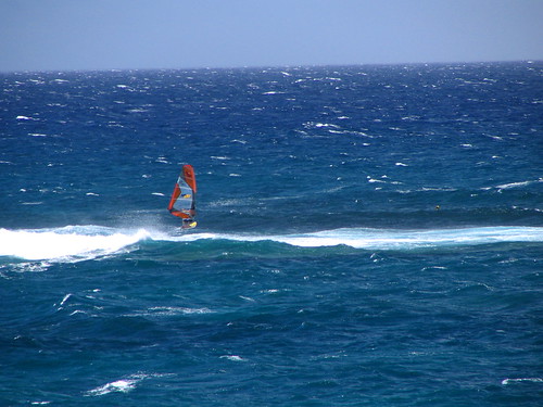


