October 2009
Monthly Archive
Posted by Glenn
No Comments
October 9-10, 2009
Air Temperatures – The following maximum temperatures were recorded across the state of Hawaii Friday afternoon:
Lihue, Kauai – 85
Honolulu, Oahu – 87
Kaneohe, Oahu – 85
Kahului, Maui – 88
Hilo, Hawaii – 85
Kailua-kona – 88
Air Temperatures ranged between these warmest and coolest spots near sea level around the state – and on the highest mountains…at 5 p.m. Friday evening:
Port Allen, Kauai – 90F
Lihue, Kauai – 79
Haleakala Crater – 54 (near 10,000 feet on Maui)
Mauna Kea summit – 43 (near 14,000 feet on the Big Island)
Precipitation Totals – The following numbers represent the largest precipitation totals (inches) during the last 24 hours on each of the major islands, as of Friday afternoon:
0.38 Opaekaa Stream, Kauai
0.25 Waipio, Oahu
0.00 Molokai
0.00 Lanai
0.00 Kahoolawe
0.05 Oheo Gulch, Maui
0.33 Glenwod, Big Island
Marine Winds – Here’s the latest (automatically updated) weather map showing a 1029 millibar high pressure system far to the northeast of the islands, with an approaching 1023 millibar high far to the northwest. A cold front to the north is being pushed southward towards the islands. Light to moderately strong trade winds will prevail this weekend.
Satellite and Radar Images: To view the cloud conditions we have here in Hawaii, please use the following satellite links, starting off with this Infrared Satellite Image of the islands to see all the clouds around the state during the day and night. This next image is one that gives close images of the islands only during the daytime hours, and is referred to as a Close-up visible image. This next image shows a larger view of the Pacific…giving perspective to the wider ranging cloud patterns in the Pacific Ocean. Finally, here’s a Looping IR satellite image, making viewable the clouds around the islands 24 hours a day. To help you keep track of where any showers may be around the islands, here’s the latest animated radar image.
Hawaii’s Mountains – Here’s a link to the live webcam on the summit of near 14,000 foot Mauna Kea on the Big Island of Hawaii. The tallest peak on the island of Maui is the Haleakala Crater, which is near 10,000 feet in elevation. These two webcams are available during the daylight hours here in the islands…and when there’s a big moon rising just after sunset for an hour or two! Plus, during the nights and early mornings you will be able to see stars, and the sunrise too…depending upon weather conditions.
Tropical Cyclone activity in the eastern and central Pacific – Here’s the latest weather information coming out of the National Hurricane Center, covering the eastern north Pacific. You can find the latest tropical cyclone information for the central north Pacific (where Hawaii is located) by clicking on this link to the Central Pacific Hurricane Center. Here’s a tracking map covering both the eastern and central Pacific Ocean. A satellite image, which shows the entire ocean area between Hawaii and the Mexican coast…can be found here.
Aloha Paragraphs

Rising surf along north and west facing shores this weekend
Light to moderately strong trade winds returning this weekend. We have two high pressure systems, one far to the northwest, and another far to the northeast. At the same time, as we see on this latest weather map, a weakening cold front, pushing southward towards the islands. We’re definitely at the end of our near week long period of light winds…with the trade winds right around the corner. We should see these trade winds blowing, once they arrive during the day Saturday, in the light to moderately strong category.
Whatever haze has been around during the last several days, will be quickly ventilated down stream…blown there by the trade wind flow. This ventilating trade wind flow won’t last long though, hopefully for three or four days. This hazy weather will likely return to our Hawaiian Island weather picture, as yet another light wind event will arrive, as we move towards the middle of the new week ahead. Depending up just which way the blows are blowing then, we could begin to see volcanic emissions spreading up the island chain again then.
As the trade winds arrive, whatever showers that are around, will gravitate towards the windward sides. The aforementioned cold front, which is showing up on weather maps now, will likely be pushed down into the state, or even through the state Saturday night or on Sunday. This will probably add some increase in showers to the windward sides then…here’s a satellite image showing the cold front to the north of Kauai Friday night. Looking further ahead, the models are showing another cold front approaching during the new week ahead. Whether it will make it to Hawaii is still a question, but its approach will help to tamp down our winds again by mid-week.
It’s early Saturday evening here in Kihei, Maui, as I begin writing this last section of today’s narrative update. Since it’s Friday evening, I’m going to take in a new film, this one called Surrogates (2009)…starring Bruce Willis and Radha Mitchell, among others. The short synopsis is: "a cop must investigate a murder in a futuristic society where human interaction has been replaced by idealized robotic surrogates." The critics are giving this film a C+, while film goers are giving it a B. I have a couple of friends who have told me that they really liked it. Here’s a trailer if you’re interested in taking a sneak peek. ~~~ I’ll be back early Saturday morning with your next new weather narrative, I hope you have a great Friday night until then! Aloha for now…Glenn.
Interesting: When lobsters swarm up the beach and octopuses try to clamber up fishing lines to get out of the water, you know that something has gone badly wrong in the ocean. Oxygen-starved dead zones have been appearing with increasing frequency around the world, with some 400 identified so far. While most are caused by sewage or fertilizer leaching into the ocean, a possible new driver has appeared in the northwest Pacific: climate change.
Just as land animals need oxygen in the air to breathe, those in the sea need the oxygen dissolved in seawater. Dead zones cover up to 20,000 sq miles each and their borders shift according to wind, current and tide, killing all animal life that cannot escape in time. “Oregon is a little different,” said Jack Barth, of Oregon State University.
“We have an open coastline, so the ability to flush the coast is high and there are no rivers carrying fertilizer. All nutrients appear to come from natural sources.” But for the past four years Professor Barth has been using autonomous underwater robots to monitor worrying developments on a naturally occurring area of low oxygen off the northwest Pacific, on the border of Washington state and Oregon.
“We’ve seen various degrees of oxygen deficiency,” he said. “We’ve seen zero oxygen, known as anoxia.” Camera footage from remotely operated vehicles “showed us just piles of Dungeness crab, dead tube worms. None could flee”. Off South Africa and Namibia, lobsters swarm to the beach when anoxic waters close in. Professor Barth cites reports that octopuses have tried to climb fishing lines to escape.
Low-oxygen areas occur naturally on the west coast of all continents, where nutrient-rich waters well up to the sunlit surface, causing heavy productivity. The upper waters are well mixed by wind and waves but deeper down there is less opportunity to replenish oxygen. When dead plankton drift into this zone in a marine snowfall, they cause a secondary bloom in microscopic animal life that strips away the oxygen. If the oxygen-starved water does not reach the seabed, the effects are usually less severe.
If it does, the animals there are usually unable to escape. Usually winds push the de-oxygenated areas off Oregon out to sea but in recent years they have been coming ever closer to land and shallower water. Professor Barth said that climate-change models show coastal winds changing.
“The forecast is for stronger and less persistent winds and for deeper waters becoming less oxygenated as surface layers warm, isolating the deeper layers more. So it’s a double-whammy we’re seeing off Oregon.” Although Professor Barth does not yet have enough records to prove that climate change is affecting the winds, he is confident that they are not altering as a result of any natural cycles, such as the warm current El Niño.
Interesting2: In the past, the Chinese were insultingly referred to as the yellow peril, an alien breed whose weird ways might corrupt Western civilization and even bring it to its knees. Today the Chinese are looked on as a green peril, an over-productive people whose use of coal and other filthy fossil fuels might pollute Western society and put the whole world on the fast track to irreversible disaster.
The language has changed dramatically in the past 100 years, but there are striking similarities between how some people viewed the Chinese in the early 20th century and how some people view them in the early 21stcentury. The idea of the Chinese as people who – or their ideas or products – might cause harm to the Western world seems to have remained constant over the decades.
In the climate change debate, China is always depicted as being peculiarly dirty. Its monumental economic growth over the past 30 years is rarely discussed in terms of its vast benefits to humanity but is instead denounced for its destructive impact on nature. So we rarely hear the good news about China’s industrial leap forward.
For example, the fact that, where China had 193 cities in 1978, it now has a remarkable 655; or that where life expectancy in China was a paltry 36.5 years when the People’s Republic was established in 1949, it is now 73.4 years. In 1949, China had a population of 542million and only 117,000 students in higher education; today it has a population of 1.3billion and 20.2 million students in higher education – a figure close to the entire population of Australia.
Yet what are we most frequently told about China’s industrialization? That it is dangerous, both for the people of China and for everyone else across the world. An environmentalist writer in Britain says the upshot of China’s "economic miracle" has been "dust, waste and dirty water". Other Western greens tell us that China’s use of coal is turning the country into a "rapidly advancing dystopia where rivers run black". Even worse, China’s growth might end up killing us all.
We are frequently told that China is the world’s biggest emitter of carbon dioxide and, in the words of one green observer, is putting the world on "the fast track to irreversible disaster". Many environmentalists claim that the UN climate summit at Copenhagen in December is our "last chance to save the planet" and therefore we must get China to agree to sign up. This view of China as a peculiarly threatening nation has eerie echoes of the past.
In the late 19th and early 20th centuries, the movement of Chinese workers and goods to the US and other Western nations gave rise to fears of a polluting effect. In his book Orientals: Asian Americans in Popular Culture, Robert L.Gee says Chinese immigrants were seen as "racial, social and physical pollutants" who might provoke the "demise of Western civilization".
This view of the Chinese was revealling, says Lee: "Pollutants are anomalies in the symbolic structure of society, things that are out of place and create a sense of disorder." Today, in the lingo of environmentalism, the Chinese are seen as the harbingers of climatic disorder. According to the academic Monica Chui, the China-bashing dime-store novels of the late 19th century yellow peril era were also packed with images of the Chinese as "filth, pollutants and toxins".
In her book Fit to be Citizens: Public Health and Race in Los Angeles 1879-1939, Natalia Molina describes how some American public health officials depicted the Chinese as "carriers of diseases and pollutants", giving rise to a perception of Chinese people as "a literal as well as metaphorical threat to the health of the body politic".
One concern of the Yellow Peril era was that if Chinese people bred with white people, or even intoxicated them with their strange habits, then the intelligence levels of Western society would be lowered as a result. This idea was rehabilitated during the great Chinese toy scare of 2007.
When it was revealed that some Chinese toys had high levels of lead in them (though not high enough to cause serious harm to children), there were fears in the US that if American kids chewed on the toys for too long, it might harm their IQ levels (some experts believe that exposure to lead can damage children’s intellectual development).
Here, the old idea about strange items from the East damaging the intellectual resources of the West is given a new lease of life through the environmentalist outlook. This is not to argue that contemporary environmentalists are racists. There are vast differences between labeling a people as pollutants and discussing their behavior as polluting.
However, the persistence of the pollutant label in relation to China reveals much about the fin-de-siecle outlook that underpins contemporary climate fears. If we were to take a more humane view, then we would realize that Chinese growth has been vastly and historically beneficial both to the hundreds of millions of people who have been lifted out of absolute poverty, and to those Western societies that were bankrolled in recent years by Chinese credit.
Posted by Glenn
No Comments
October 8-9, 2009
Air Temperatures – The following maximum temperatures were recorded across the state of Hawaii Thursday afternoon:
Lihue, Kauai – 87
Honolulu, Oahu – 87
Kaneohe, Oahu – 86
Kahului, Maui – 88
Hilo, Hawaii – 86
Kailua-kona – 88
Air Temperatures ranged between these warmest and coolest spots near sea level around the state – and on the highest mountains…at 5 p.m. Thursday evening:
Port Allen, Kauai – 86F
Hilo, Hawaii – 79
Haleakala Crater – 55 (near 10,000 feet on Maui)
Mauna Kea summit – 41 (near 14,000 feet on the Big Island)
Precipitation Totals – The following numbers represent the largest precipitation totals (inches) during the last 24 hours on each of the major islands, as of Thursday afternoon:
0.03 Mount Waialeale, Kauai
0.02 Kahuku Training Area, Oahu
0.00 Molokai
0.00 Lanai
0.09 Kahoolawe
0.24 Kaupo Gap, Maui
3.16 Pali 2, Big Island
Marine Winds – Here’s the latest (automatically updated) weather map showing a 1031 millibar high pressure system far to the northeast of the islands. A cold front to the northwest is keeping this high’s ridge down near Kauai Thursday. Our local winds will remain light into Saturday.
Satellite and Radar Images: To view the cloud conditions we have here in Hawaii, please use the following satellite links, starting off with this Infrared Satellite Image of the islands to see all the clouds around the state during the day and night. This next image is one that gives close images of the islands only during the daytime hours, and is referred to as a Close-up visible image. This next image shows a larger view of the Pacific…giving perspective to the wider ranging cloud patterns in the Pacific Ocean. Finally, here’s a Looping IR satellite image, making viewable the clouds around the islands 24 hours a day. To help you keep track of where any showers may be around the islands, here’s the latest animated radar image.
Hawaii’s Mountains – Here’s a link to the live webcam on the summit of near 14,000 foot Mauna Kea on the Big Island of Hawaii. The tallest peak on the island of Maui is the Haleakala Crater, which is near 10,000 feet in elevation. These two webcams are available during the daylight hours here in the islands…and when there’s a big moon rising just after sunset for an hour or two! Plus, during the nights and early mornings you will be able to see stars, and the sunrise too…depending upon weather conditions.
Tropical Cyclone activity in the eastern and central Pacific – Here’s the latest weather information coming out of the National Hurricane Center, covering the eastern north Pacific. You can find the latest tropical cyclone information for the central north Pacific (where Hawaii is located) by clicking on this link to the Central Pacific Hurricane Center. Here’s a tracking map covering both the eastern and central Pacific Ocean. A satellite image, which shows the entire ocean area between Hawaii and the Mexican coast…can be found here.
Aloha Paragraphs

Beautiful beach…Kauai
The fairly typical early autumn light winded convective weather pattern remains in place as we approach the weekend. Our trade wind producing high pressure system is a long ways off Thursday evening, as it has been the last several days. This high’s associated ridge is now over the state, as shown on this latest weather map. At the same time, there are two dynamic low pressure systems to the north-northwest of our islands. The closest low has developing hurricane force winds, while the second is further north, getting ready to cross the Aleutian Islands…into the Bering Sea.
The combination of these two low pressure cells, will not only help to keep our light winds in place, but also send us a fairly large northwest swell train of waves this weekend. The winds blowing across the ocean to our northwest, called a fetch, is long and straight, which will make our surfing community happy later Saturday into Sunday. It looks likely to cause high surf advisory level waves on our north and west facing shores then.
This light wind condition, is keeping muggy conditions in place, along with some haze…some of which is volcanic in origin. This vog isn’t occurring statewide, as it sometimes does. Our winds aren’t exclusively from the southeast, which is the infamous wind direction, for occasions when we often see the thickest voggy weather episodes. There’s also some manmade pollutants too, which will stick around for the next several days as well. It will take the returning trade winds to disperse this pollution.
The latest computer forecast models show the high pressure ridge edging northward enough, to coax the trade wind breezes back in our direction later Saturday. This ventilating trade wind flow won’t last long though, hopefully long enough to clear our atmosphere. This hazy weather won’t take much of a vacation however, as yet another light wind event will take place as we movetowerds the middle of next week. It should be pointed out, as was the case in yesterday’s narrative, that these light wind patterns are quite common during the autumn season.
Looking a bit closer at the synoptic pattern for the islands, we still have a fairly ripe atmosphere in regards possible showers. These upcountry interior showers will persist over the islands through Friday afternoon, or until the light to moderate trade winds return this weekend. As these trades show up, we’re apt to see the return of a few windward biased showers then for a couple of days. Once we get into next week, computer models show a cold front digging southward, from its parent low pressure system to our northwest.
The approach of this next cold front will once again push our high pressure ridge down over the islands. The models don’t show the front getting close enough, at least at this time, to break through the ridge to carry us any rainfall. Speaking of rainfall and cold fronts though, the models go on to show a second frontal boundary actually intruding into the Kauai end of the island chain next weekend…although that’s still a long ways out into the future.
It’s early Thursday evening here in Kihei, Maui, as I begin writing this last section of today’s narrative update. Looking out the window here before I take the drive back upcountry to Kula, I see lots clouds, and quite a bit of vog (volcanic haze) too. This is often the case during the afternoons, under the influence of a convective weather pattern…such as we have going on now. As we move past the sunset hour, the clouds will quickly disappear, as the breezes that that came inland during the day, head back down towards the coasts. I expect mostly clear skies overnight and into Friday morning, although I also would expect hazy skies to prevail as well. During the day Friday, with the daytime heating, and the resultant onshore flowing sea breezes, clouds will form again during the afternoons. These clouds may drop some upcountry showers again then. ~~~ I’ll be back again early Friday morning with your next new weather narrative from paradise. I hope you have a great Thursday night until then! Aloha for now…Glenn.
Interesting: The US will cut its greenhouse gas emissions by 20 per cent by 2020. That is the idea, at least. After weeks of delay, a climate-change bill has finally been introduced into the Senate. It will face stiff opposition. Most Republicans are almost certain to vote against the bill, citing concern for US industry.
Even some with a track record of action on climate change are opposed: former presidential candidate John McCain told Reuters that he would "never, never, never" vote for the bill. Dissent also comes from Democrats representing coal-rich or farming states. Debates are scheduled for later this month, leaving little decision time before the crucial climate summit in Copenhagen, Denmark, in December.
"It is very important to get a vote before December," says Jennifer Morgan, climate and energy programme director at the World Resources Institute in Washington DC. "It would give credibility to the US delegation at the talks."
Interesting2: In today’s world of complex supply chains, international supermarkets and big agribusiness, it has become more and more difficult for small farms to sell their produce directly to local consumers at a reasonable price. But one farm in Germany, Peter-und-Paul-Hof, thinks they may have found a solution: set up vending machines which distribute produce instead of junk food.
The idea is unconventional, to be sure, but it isn’t unprecedented. Back in 2007, a Spanish company based in Barcelona– Lof– also used vending machines to distribute healthy food such as nuts, prepared fruit, ready meals and even gazpacho soup. But the application of vending machines by Peter-und-Paul-Hof is the first time they have been used to deliver local produce.
The effort is part of a collaboration between the farm and vending manufacturer Stuewer, and currently the specialty machines (labeled Regiomats) are set up to dispense fresh milk, eggs, butter, cheese, potatoes and sausage. What more could a hungry German ask for?
Interesting3: Chaotic behavior is the rule, not the exception, in the world we experience through our senses, the world governed by the laws of classical physics. Even tiny, easily overlooked events can completely change the behavior of a complex system, to the point where there is no apparent order to most natural systems we deal with in everyday life.
The weather is one familiar case, but other well-studied examples can be found in chemical reactions, population dynamics, neural networks and even the stock market. Scientists who study "chaos" — which they define as extreme sensitivity to infinitesimally small tweaks in the initial conditions — have observed this kind of behavior only in the deterministic world described by classical physics.
Until now, no one has produced experimental evidence that chaos occurs in the quantum world, the world of photons, atoms, molecules and their building blocks. This is a world ruled by uncertainty: An atom is both a particle and a wave, and it’s impossible to determine its position and velocity simultaneously. And that presents a major problem.
If the starting point for a quantum particle cannot be precisely known, then there is no way to construct a theory that is sensitive to initial conditions in the way of classical chaos. Yet quantum mechanics is the most complete theory of the physical world, and therefore should be able to account for all naturally occurring phenomena.
"The problem is that people don’t see [classical] chaos in quantum systems," said Professor Poul Jessen of the University of Arizona. "And we believe quantum mechanics is the fundamental theory, the theory that describes everything, and that we should be able to understand how classical physics follows as a limiting case of quantum physics."
Astronomers from The University of Western Ontario have released footage of a meteor that was approximately 100 times brighter than a full moon. The meteor lit up the skies of southern Ontario two weeks ago and Western astronomers are now hoping to enlist the help of local residents in recovering one or more possible meteorites that may have crashed in the area of Grimsby, Ontario.
Interesting4: A new report, launched by the UK Energy Research Centre (UKERC), argues that conventional oil production is likely to peak before 2030, with a significant risk of a peak before 2020. The report concludes that the UK Government is not alone in being unprepared for such an event – despite oil supplying a third of the world’s energy.
The report finds that we are entering an era of slow and expensive oil as resources get harder to find, extract and produce. Major new discoveries, such as those announced recently in the Gulf of Mexico, will only delay the peak by a matter of days or weeks. Simply maintaining global production at today’s level would need the equivalent of a new Saudi Arabia every three years.
According to the report’s chief author, Steve Sorrell, senior researcher at UKERC, "In our view, forecasts which delay a peak in conventional oil production until after 2030 are at best optimistic and at worst implausible. And given the world’s overwhelming dependence upon oil and the time required to develop alternatives, 2030 isn’t far away.
The concern is that rising oil prices will encourage the rapid development of carbon-intensive alternatives which will make it difficult or impossible to prevent dangerous climate change." The report defends more optimistic estimates of the size of oil resources but notes that much of this is in smaller less accessible fields which may only be produced relatively slowly and at high cost.
It also highlights the accelerating decline in production from existing fields; more than two thirds of current crude oil production capacity may need to be replaced by 2030 to prevent production from falling.
Interesting5: Can the idea of ‘green motorsport’ actually work? Yes, according to EPSRC funded researcher, Dr Kerry Kirwan at the University of Warwick, who led the research team which designed and built the worldfirst fully sustainable Formula 3 racing car. The car is made from woven flax, recycled carbon fibre, recycled resin and carrot pulp for the steering wheel. It runs on biofuel made from chocolate and animal fats and is lubricated with plant oils. But it’s not just an environmentally friendly car, it is also fast.
The car has a top speed of 135 mph, can achieve 0-60 in 2.5 seconds and is turbo charged to give it more torque. Having got the seal of approval from drivers such as Lewis Hamilton and Adam Carroll as well as F1 team boss Ross Brawn, the car will make its first competitive debut in the Formula 3 Championship final at Brands Hatch on 17th October.
The team hope to prove that high performance, competitive cars can be built from sustainable materials. According to Dr Kirwan the idea behind the project is to show that: "being sustainable and green can be incredibly sexy, fun and fast." He goes on to say that even though people’s perception of motorsport is that it’s wasteful, this project is "aiming to show ways for the future, for people to race and be green."
Posted by Glenn
[3] Comments
October 7-8, 2009
Air Temperatures – The following maximum temperatures were recorded across the state of Hawaii Wednesday afternoon:
Lihue, Kauai – 85
Honolulu, Oahu – 87
Kaneohe, Oahu – 84
Kahului, Maui – 87
Hilo, Hawaii – 82
Kailua-kona – 88
Air Temperatures ranged between these warmest and coolest spots near sea level around the state – and on the highest mountains…at 5 p.m. Wednesday evening:
Port Allen, Kauai – 88F
Hilo, Hawaii – 79
Haleakala Crater – 54 (near 10,000 feet on Maui)
Mauna Kea summit – 41 (near 14,000 feet on the Big Island)
Precipitation Totals – The following numbers represent the largest precipitation totals (inches) during the last 24 hours on each of the major islands, as of Wednesday afternoon:
1.69 Mount Waialeale, Kauai
0.25 Poamoho 2, Oahu
0.00 Molokai
0.00 Lanai
0.00 Kahoolawe
0.01 Oheo Gulch, Maui
1.40 Kahuku Ranch, Big Island
Marine Winds – Here’s the latest (automatically updated) weather map showing a 1030 millibar high pressure system far to the northeast of the islands. A cold front to the northwest is keeping this high’s ridge down near Kauai at mid-week. Our local winds will remain light into Friday.
Satellite and Radar Images: To view the cloud conditions we have here in Hawaii, please use the following satellite links, starting off with this Infrared Satellite Image of the islands to see all the clouds around the state during the day and night. This next image is one that gives close images of the islands only during the daytime hours, and is referred to as a Close-up visible image. This next image shows a larger view of the Pacific…giving perspective to the wider ranging cloud patterns in the Pacific Ocean. Finally, here’s a Looping IR satellite image, making viewable the clouds around the islands 24 hours a day. To help you keep track of where any showers may be around the islands, here’s the latest animated radar image.
Hawaii’s Mountains – Here’s a link to the live webcam on the summit of near 14,000 foot Mauna Kea on the Big Island of Hawaii. The tallest peak on the island of Maui is the Haleakala Crater, which is near 10,000 feet in elevation. These two webcams are available during the daylight hours here in the islands…and when there’s a big moon rising just after sunset for an hour or two! Plus, during the nights and early mornings you will be able to see stars, and the sunrise too…depending upon weather conditions.
Tropical Cyclone activity in the eastern and central Pacific – Here’s the latest weather information coming out of the National Hurricane Center, covering the eastern north Pacific. You can find the latest tropical cyclone information for the central north Pacific (where Hawaii is located) by clicking on this link to the Central Pacific Hurricane Center. Here’s a tracking map covering both the eastern and central Pacific Ocean. A satellite image, which shows the entire ocean area between Hawaii and the Mexican coast…can be found here.
Aloha Paragraphs

Iao Needle…West Maui Mountains
We’re finding another early sign of our autumn season here in the islands, as our local trade winds remain light and variable in direction for the time being. This would be quite unusual during the summer months, although becomes more common as me move towards winter. We can tell quite a bit about what’s happening, by checking out this weather map. We find our trade wind producing high pressure system far to the northeast, offshore from the British Columbian coast of Canada. At the same time, we find two low pressure systems up towards the Aleutian Islands of Alaska. These low pressure cells have cold fronts draped southward in our direction. These frontal boundaries have pushed a ridge of high pressure into the area just northeast of the islands, perhaps stretching over the northern islands of Kauai and Oahu faintly. This close proximity of the ridge is why our trade winds have gone astray…with its subsiding air taking their place.
There have been, and will continue to be several influences involved with this light wind episode. The most striking, and the one that most people would notice first, is the hot and muggy conditions that prevail at low elevations of the islands. High temperatures will remain about as they have been, from about 85F to 90 degrees…but will feel a couple of degrees higher than that! The afternoon shower activity that we’ve seen the last couple of days, has calmed down quite a bit today. This is due to the passage of an upper level trough of low pressure, and its triggering of locally heavy showers…with that flash flood watch which ended yesterday. The air mass is still shower prone enough, that we saw several heavy showers, and even a couple of thunderstorms during afternoon hours on the slopes of the Big Island.
There is relief on the horizon though, but we will have to wait until later this week. This tempering of the hot and sultry weather will occur as the cooling and refreshing trade wind breezes kick in…likely by this weekend. There seems to be at least some light haze building up over some parts of the island chain at mid-week. The two sources of this haze of course are man made, and the volcanic emission from the vent on the BigIsland. It’s difficult to tell which is which, especially when it’s of the light variety. At any rate, the returning trade winds will whisk away whatever is left of this haze. At the same time, the emphasis for showers, now generally over the interior sections during the afternoons, will shift back over to the windward sides this weekend. This re-established trade wind flow is expected to continue into the first several days of next week…at least.
It’s early Wednesday evening here in Kihei, Maui, as I begin writing this last section of today’s narrative update. Today, at least in most places around the state, had drier weather, in terms of rainfall…but not in terms of humidty however. The Big Island was the one exception, where there were still some generous downpours here and there on the volcanic slopes. Looking out the window here in Kihei, before I jump in my car for the drive upcountry to Kula, I see almost totally clear skies, with a bit of haze in the air too. Besides the sultry conditions, our weather should be pretty good through the rest of this work week, before the trade winds return this weekend. ~~~ I’ll be back early Thursday morning with your next new weather narrative, I hope you have a great Wednesday night until then! Aloha for now…Glenn.
Interesting: With just 60 days left before world leaders meet in Copenhagen to thrash out a new global climate deal, how do the chips that are on the table tally up? Not very well. According to the latest estimate of the carbon cuts offered by rich nations, the pledges fall well short of the reductions that climate scientists say are needed to avoid dangerous climate change.
Experts at the World Resources Institute, an environmental think-tank based in Washington, D.C., today published their analysis of pledges that have been made so far by developed nations, and their impact on global emissions. These include commitments from Russia, Australia and the European Union to cut their emissions by up to 15, 25 and 30 per cent respectively by 2020.
The researchers also included estimates of what the US may be able to offer in Copenhagen, based on 20 per cent cuts outlined in a bill due to be discussed in the Senate this month, and other figures mentioned, for instance, in Obama’s election campaign. They found that pledged cuts would result in emissions from the developed world dropping by 10 to 24 per cent below 1990 levels by 2020.
But the Intergovernmental Panel on Climate Change (IPCC) estimates that the same nations need to cut emissions by 25 to 40 per cent by 2020, if atmospheric carbon levels are to stay within 450 parts per million. Many scientists argue that concentrations above this level will trigger severe environmental impacts, including drought and sea level rises that will displace millions of people.
"The reductions will not be enough to meet IPCC recommendations," says Jennifer Morgan, director of the WRI’s climate and energy program. "We urge industrialized countries to bring forward more ambitious pledges to reduce their greenhouse gas emissions." Malte Meinshausen of the Potsdam Institute for Climate Impact Research in Germany says that the gloomy picture painted by the WRI may actually be overly optimistic.
He points out that the WRI’s figure includes the impact of US policies on issues like energy efficiency. These policies will probably result in emissions reductions, but they are not the same as a pledge to meet a specific emissions target. Analyses that consider only specific targets suggest that the developed world will cut its emission by no more than 16 per cent by 2020. There is a "clear gap" between the level of ambition of the developed nations and the IPCC recommendations, says Meinshausen.
Interesting2: Most tropical forests – from Himalayan hill forests to the Madagascan jungle – are controlled by local and national governments. Forest communities own and manage little more than a tenth. They have a reputation for trashing their trees – cutting them for timber or burning them to clear land for farming.
In reality the opposite is true, according to Ashwini Chhatre of the University of Illinois at Urbana-Champaign. In the first study of its kind, Chhatre and Arun Agrawal of the University of Michigan in Ann Arbor compared forest ownership with data on carbon sequestration, which is estimated from the size and number of trees in a forest.
Hectare-for-hectare, they found that tropical forest under local management stored more carbon than government-owned forests. There are exceptions, says Chhatre, "but our findings show that we can increase carbon sequestration simply by transferring ownership of forests from governments to communities".
One reason may be that locals protect forests best if they own them, because they have a long-term interest in ensuring the forests’ survival. While governments, whatever their intentions, usually license destructive logging, or preside over a free-for-all in which everyone grabs what they can because nobody believes the forest will last.
The authors suggest that locals would also make a better job of managing common pastures, coastal fisheries and water supplies. They argue that their findings contradict a long-standing environmental idea, called the "tragedy of the commons", which says that natural resources left to communal control get trashed. In fact, says Agrawal, "communities are perfectly capable of managing their resources sustainably".
Interesting3: The windswept deserts of northern China might seem an odd destination for studying the heavy monsoon rains that routinely drench the more tropical regions of Southeast Asia. But the sandy dune fields that mark the desert margin between greener pastures to the south and the Gobi Desert to the north are a rich source of information about past climates in Asia, says University of Wisconsin-Madison geographer Joseph Mason.
Wetter periods allow vegetation to take root on and stabilize sand dunes. During dry spells, plants die off and the dunes are more active, constantly shifting as sand is blown away and replenished. Such patterns of dune activity provide a history of the area’s climate — if one can read them, Mason says. "When did those periods of stability or activity occur and from that, what can we infer about climate change?"
As reported in a new paper in the October issue of the journal Geology, Mason and colleagues mapped sand dune activity across northern China and found unexpectedly high levels of mobility and change 8,000 to 11,500 years ago, a time period generally thought to have a wetter climate. The result challenges existing ideas about the monsoon’s regional influence and could impact future climate predictions.
Today, the dunes are at the edge of the monsoon region and the scientists expected to find close correlation between precipitation in the dune fields and the strength of the monsoon. What they found instead was rather surprising. "They turn out to be almost completely out of phase," Mason says. "Where we find lots of active dunes turns out to be a time when the monsoon system is supposed to have been stronger in southern and central China."
Part of the explanation may lie in local patterns of atmospheric circulation. At the peak of the summer monsoon, central China experiences both heavy summer rainfall and strong upward airflow. That upward flow tends to be balanced out by more downward air motion — which suppresses precipitation — in areas north and west of the monsoon core.
Give tropical forests back to the people who live in them – and the trees will soak up your carbon for you. Above all, keep the forests out of the hands of government. So concludes a study that has tracked the fate of 80 forests worldwide over 15 years.
Interesting4: How far you can reach beyond your toes from a sitting position – normally used to define the flexibility of a person’s body – may be an indicator of how stiff your arteries are. A study in the American Journal of Physiology has found that, among people 40 years old and older, performance on the sit-and-reach test could be used to assess the flexibility of the arteries.
Because arterial stiffness often precedes cardiovascular disease, the results suggest that this simple test could become a quick measure of an individual’s risk for early mortality from heart attack or stroke. “Our findings have potentially important clinical implications because trunk flexibility can be easily evaluated,” said one of the authors, Kenta Yamamoto.
“This simple test might help to prevent age-related arterial stiffening.” It is not known why arterial flexibility would be related to the flexibility of the body in middle age and older people. But the authors say that one possibility is that stretching exercises may set into motion physiological reactions that slow down age-related arterial stiffening.
Healthy blood vessels are elastic, and elasticity helps to moderate blood pressure. Arterial stiffness increases with age and is a risk factor for cardiovascular disease and death. Previous studies have established that physical fitness can delay age-related arterial stiffness, although exactly how that happens is not understood.
The authors noted that people who keep themselves in shape often have a more flexible body, and they hypothesized that a flexible body could be a quick way to determine arterial flexibility. The researchers studied 526 healthy, non-smoking adults, 20 to 83 years old, with a body mass index of less than 30. They wanted to see whether flexibility of the trunk, as measured with the sit and reach test, is associated with arterial stiffness.
The researchers divided the participants into three age groups:
• young (20-39 years old)
• middle aged (40-59 years old)
• older (60-83 years old)
The researchers asked participants to perform a sit-and-reach test. The volunteers sat on the floor, back against the wall, legs straight. They slowly reached their arms forward by bending at the waist. Based on how far they could reach, the researchers classified the participants as either poor- or high-flexibility.
Interesting5: NYTimes Environmental groups hailed a decision this week by four of the world’s largest meat producers to ban the purchase of cattle from newly deforested areas of Brazil’s Amazon rain forest. At a conference on Monday in São Paulo organized by Greenpeace, the four cattle companies — Bertin, JBS-Friboi, Marfrig and Minerva — agreed to support Greenpeace’s call for an end to the deforestation.
Brazil has the world’s largest cattle herd and is the world’s largest beef exporter, but it is also the fourth largest producer of greenhouse gas emissions. Destruction of tropical forests around the world is estimated to be responsible for about 20 percent of global greenhouse gas emissions. Greenpeace contends that the cattle industry in the Amazon is the biggest driver of global deforestation.
But the Brazilian government, while pushing ambitious goals to slow deforestation in the Amazon, is also a major financer and shareholder in global beef and leather processors that profit from cattle raised in areas of the Amazon that have been destroyed, often illegally, according to Greenpeace. The four cattle producers agreed on Monday to monitor their supply chains and set clear targets for the registration of farms that supply cattle, both directly and indirectly.
They also said they would devise measures to end the purchase of cattle from indigenous and protected areas, and from farms that use slave labor. Environmental groups called the decision a major step forward for climate protection. “This agreement shows that in today’s world someone that wants to be a global player cannot be associated with deforestation and with slave labor,” said Marcelo Furtado, executive director of Greenpeace in Brazil.
The agreement came after the release in June of a report by Greenpeace, “Slaughtering the Amazon,” which detailed the link between forest destruction and the expansion of cattle ranching in the Amazon. The report led some multinational companies, including shoe manufacturers like Adidas, Nike and Timberland, to pledge to cancel contracts unless they received guarantees that their products were not associated with cattle or slave labor in the Amazon.
Beef customers like McDonald’s and Wal-Mart also pressed producers to change their practices in the Amazon, Mr. Furtado said. Blairo Maggi, the governor of Mato Grosso, the Brazilian state with the highest rate of deforestation in the Amazon and the country’s largest cattle herd, said Monday that he would support efforts to protect the Amazon and provide high-resolution satellite imagery to help monitor the region.
Interesting6: The dusty hoop lies some eight million miles from the planet, about 50 times more distant than the other rings and in a different plane. Scientists tell the journal Nature that the tenuous ring is probably made up of debris kicked off Saturn’s moon Phoebe by small impacts. They think this dust then migrates towards the planet where it is picked up by another Saturnian moon, Iapetus.
The discovery would appear to resolve a longstanding mystery in planetary science: why the walnut-shaped Iapetus has a two-tone complexion, with one side of the moon significantly darker than the other. "It has essentially a head-on collision.
The particles smack Iapetus like bugs on a windshield," said Anne Verbiscer from the University of Virginia, US. Observations of the material coating the dark face of Iapetus indicate it has a similar composition to the surface material on Phoebe. The scale of the new ring feature is astonishing. Nothing like it has been seen elsewhere in the Solar System.
The more easily visible outlier in Saturn’s famous bands of ice and dust is its E-ring, which encompasses the orbit of the moon Enceladus. This circles the planet at a distance of just 240,000km. The newly identified torus is not only much broader and further out, it is also tilted at an angle of 27 degrees to the plane on which the more traditional rings sit.
This in itself strongly links the ring’s origin to Phoebe, which also takes a highly inclined path around Saturn. Scientists suspected the ring might be present and had the perfect tool in the Spitzer space telescope to confirm it.
Interesting7: Earth attacks the moon tomorrow, bent on plundering that most precious of resources: water. "Things are looking great. We’re headed right for the target," says Daniel Andrews of NASA’s Ames Research Center, head of the $79 million Lunar Crater Observation and Sensing Satellite (LCROSS) mission. "The very latest data suggest we are headed for one of the very wettest spots on the moon."
If all goes well, on Friday about 7:30 a.m. ET, the two parts of the LCROSS spacecraft will smack into the lunar surface at nearly 6,000 mph, sending up plumes of moon dust — perhaps full of ice — 6.2 miles high above the moon’s Cabeus crater. "There is a very good chance we will see results," says planetary scientist Bernard Foing of the European Space Agency, who is not part of the mission.
"Cabeus crater is perfect. Some areas are always in shadow, so we are quite certain these are some of the coldest places for ice in the solar system," as low as minus 360 degrees Fahrenheit. Tonight, the LCROSS "shepherd" spacecraft should drop its booster rocket and turn to observe its descent. After the booster hits the crater, blasting out a hole 90 feet deep, the shepherd will pass through the plume.
After analyzing the plume, the shepherd then blasts into the crater itself four minutes later, creating a second hole 60 feet deep. "We are trimming the trajectory as we go," Andrews says. Dating back at least to 1999, when a lunar mission detected water signatures from the supposedly bone-dry moon, NASA scientists have pondered whether ice left from comet impacts may have pooled and cooled in the permanently shaded potholes — probably strangers to sunlight for billions of years — dotting the lunar poles. In 2004, when the Bush administration pushed for moon bases, glaciers hidden in those craters looked attractive as water and fuel sources for future moon colonists.
Last month, Science magazine reported evidence of water migrating out of the lunar soil in the solar wind, or streams of gas particles from the sun, and perhaps some of the water ended up in those shaded craters. "What’s still not clear is whether there is enough water there to be meaningful," Andrews says; "meaningful" could be anything from 1% to 10% of the plume containing water. "Water on the moon has haunted us for years," says William Hartmann of the Planetary Science Institute.
"It’s all part of humanity’s quest to understand our nearby cosmic environment." LCROSS should detect whether at least 0.5% of the plume contains water. If the results point to water deposits, Foing says, a next step would be a lander drilling about 6 feet deep into the crater, enough to reveal whether veins of ice lie in exploitable layers on the moon.
The 1967 Outer Space Treaty forbids spacefaring nations from claiming lunar territory but allows research bases while calling for avoiding "harmful contamination." NASA’s Lunar Reconnaissance Orbiter, which launched with LCROSS June 18, will observe the plumes, as will the Hubble Space Telescope and observatories on Earth. Amateur astronomers with a view of the moon should be able to see the impacts with telescopes 10 inches wide or larger.
Posted by Glenn
1 Comment
October 6-7, 2009
Air Temperatures – The following maximum temperatures were recorded across the state of Hawaii Tuesday afternoon:
Lihue, Kauai – 85
Honolulu, Oahu – 87
Kaneohe, Oahu – 84
Kahului, Maui – missing
Hilo, Hawaii – 82
Kailua-kona – 88
Air Temperatures ranged between these warmest and coolest spots near sea level around the state – and on the highest mountains…at 5 p.m. Tuesday evening:
Port Allen, Kauai – 86F
Hilo, Hawaii – 80
Haleakala Crater – 46 (near 10,000 feet on Maui)
Mauna Kea summit – 32 (near 14,000 feet on the Big Island)
Precipitation Totals – The following numbers represent the largest precipitation totals (inches) during the last 24 hours on each of the major islands, as of Tuesday afternoon:
0.51 Hanalei River, Kauai
0.68 Waimanalo, Oahu
0.01 Molokai
0.00 Lanai
0.00 Kahoolawe
1.09 West Wailuaiki, Maui
0.95 Piihonua, Big Island
Marine Winds – Here’s the latest (automatically updated) weather map showing a 1032 millibar strong high pressure system far to the northeast of the islands…moving away towards the northeast. An approaching cold front is pushing this high’s ridge down near Kauai now. Our local winds will remain light into Thursday.
Satellite and Radar Images: To view the cloud conditions we have here in Hawaii, please use the following satellite links, starting off with this Infrared Satellite Image of the islands to see all the clouds around the state during the day and night. This next image is one that gives close images of the islands only during the daytime hours, and is referred to as a Close-up visible image. This next image shows a larger view of the Pacific…giving perspective to the wider ranging cloud patterns in the Pacific Ocean. Finally, here’s a Looping IR satellite image, making viewable the clouds around the islands 24 hours a day. To help you keep track of where any showers may be around the islands, here’s the latest animated radar image.
Hawaii’s Mountains – Here’s a link to the live webcam on the summit of near 14,000 foot Mauna Kea on the Big Island of Hawaii. The tallest peak on the island of Maui is the Haleakala Crater, which is near 10,000 feet in elevation. These two webcams are available during the daylight hours here in the islands…and when there’s a big moon rising just after sunset for an hour or two! Plus, during the nights and early mornings you will be able to see stars, and the sunrise too…depending upon weather conditions.
Tropical Cyclone activity in the eastern and central Pacific – Here’s the latest weather information coming out of the National Hurricane Center, covering the eastern north Pacific. You can find the latest tropical cyclone information for the central north Pacific (where Hawaii is located) by clicking on this link to the Central Pacific Hurricane Center. Here’s a tracking map covering both the eastern and central Pacific Ocean. A satellite image, which shows the entire ocean area between Hawaii and the Mexican coast…can be found here.
Aloha Paragraphs

Waimanalo Beach…Oahu
We’ll find another couple of days of light winds here in the islands, before the trade winds return lightly by Friday…continuing into the weekend. Our trade wind producing high pressure system, now far to the northeast, continues to move further away. Meanwhile, we find a cold front approaching the islands from the northwest. This frontal boundary has pushed our high pressure ridge down near Kauai, ensuring the light wind conditions through mid-week, plus a day or two beyond that.
The overlying atmosphere remains moist and unstable, conditions that may prompt more localized heavy showers for the time being. The instability that’s around now, due to the close proximity of a trough of low pressure, will keep the threat of locally heavy showers around into Wedneday. The NWS forecast office in Honolulu has discontinued the flash flood watch, which has been in effect the last couple of days. There is still lots of tropical moisture in our area, and with the light winds and warm daytime sunshine…we may see more afternoon convective showers popping up here and there.
The greatest threat for those localized heavier showers Wednesday, will remain generally over the interior sections…during the afternoon hours. This looping IR satellite image shows the heaviest showers to the south of the Big Island, and to the north of Kauai and Oahu Tuesday night. Those images show lots of high cirrus clouds coming up over the Big Island, although has cleared Maui County Tuesday evening. Here’s a looping radar image, which will show where the showers are falling.
It’s early Tuesday evening here in Kula, Maui, as I begin writing this last section of today’s narrative update. Despite the discontinuance of the flash flood watch across the state this evening, there’s still the chance of more locally generous showers over the next few days, perhaps even into the first part of the upcoming weekend. All of the necessary ingredients are still in place, like low level moisture, light winds, and all that very warm daytime sunshine. These features may still work together to prompt some showers around, some of which may become locally heavy. ~~~ Meanwhile, the winds have become at least locally southeast. This is certainly happening over Maui County, as our islands have become hazy with vog. As the winds remain light for a couple more days, this volcanic haze is likely to increase a bit more, and may become quite thick. The returning trade winds, which may wait until this weekend to return, will blow this stuff away then. ~~~ I’ll be back early Wednesday morning with your next new weather narrative, I hope you have a great Tuesday night until then! Aloha for now…Glenn.
Interesting: An earthquake measuring 5.6 in magnitude struck at a depth of 6.2 miles some 175 miles southwest of Puerto Vallarta off Mexico’s Pacific Coast on Tuesday, the United States Geological Survey said. There were no immediate reports of damage or injuries from the quake, and the Pacific Tsunami Warning Center in Hawaii did not issue a tsunami warning.
The United States today sent the first installment of a multi-million dollar assistance package to the Indonesian Island of Sumatra, to aid victims of the recent earthquake. Other international organizations and the government of Indonesia have also been providing assistance. However infrastructure damage caused by the earthquake is making it hard to access and distribute aid to some remote villages.
Interesting2: The United States brought in 45 metric tons of plastic sheeting, hygiene kits, and generators to help victims of the Indonesian earthquake. The items will be distributed by the Red Cross. The U.S. has also been using military planes to transport rescue workers and supplies. The United States is one of many countries providing humanitarian assistance.
Australia sent a warship carrying a full medical team. France sent two aircraft with about 23 metric tons of relief supplies. And teams from a number of countries have been assisting in rescue and relief efforts. The United Nations is also involved.
It constructed the first of 250 classroom tents to be built in the city of Padang. Other organizations like World Vision are also focusing on the needs of children. It is setting up 13 centers they call Child-Friendly Spaces, where children can play with other children, and get counseling.
World Vision’s Amelia Merrick, says getting schools back up and running quickly is a top priority, particularly in areas like Pariaman where entire villages were buried by landslides caused by the quake. "In many of other schools we’ve been seeing in Pariaman, the schools were absolutely flat," Merrick said.
"There won’t be any desks we can salvage there. There are no books we can salvage. That would be another quite challenge. But we do hope that the school can resume within the next couple of weeks." Indonesian Search and Rescue Agency spokesman, Gagah Prakoso says infrastructure damage is also hampering efforts to bring aid to some rural areas.
He says mud and rocks are blocking some roads, others are torn up, making it difficult to distribute aid. Authorities are using helicopters to drop aid to isolated areas. But heavy rains are complicating further efforts to reach these areas by land and the weather forecast for the region calls for more storms in the coming days.
Interesting3: The volcano on the Caribbean island of Montserrat shot a plume of ash more than two miles (three kilometers) into the sky Monday, lightly dusting the small Caribbean island. The venting by the Soufriere Hills volcano has been accompanied by more than 30 tiny earthquakes since Sunday night, according to Paul Cole, director of the Montserrat Volcano Observatory.
He said it was the volcano’s first sign of activity in 10 months. "It’s just a reminder that the volcano is still active," said James White Jr., acting director of the Disaster Management Coordination Agency. "It isn’t something for us to panic over."
Ash released in several bursts from the volcano passed south of Old Town and Olveston, leaving only a light coating in the island’s inhabited areas. But the observatory said more ash could fall depending on the wind direction. Soufriere Hills became active in 1995 and killed 19 people when it erupted two years later, burying much of the British territory and prompting half its 12,000 inhabitants to leave.
Interesting4: Volcanologists in Vanuatu are closely monitoring the Gaua volcano to consider whether to move its alert to level two. The volcano located in the centre of the Gaua Island in northern Vanuatu has been spitting gasses and ash since late September and has been on alert level one since the 29th. The highest volcano alert level is five.
A senior vulcanologist at the geohazards department, Douglas Charley, says his team has recorded more activity since last night. “Very late yesterday the team started to observe an increase of a high volcanic high frequency.
The level remains at one and we’ll be trying to observe this until the next 48 hours. If it’s increasing [further], then we’ll be putting it [up] to level two.” Douglas Charley says they have one monitoring station in the field, but are now requesting more to get more reliable data.
Interesting5: Filling rooftops with plants and dirt can help pull a modest amount of heat-trapping carbon dioxide out of the atmosphere, found a new study. While green roofs certainly won’t solve the global warming problem, their ability to sop up greenhouse gases — even just a little bit — bolsters the case for planting them on city buildings, despite extra costs on the front end, said lead researcher Kristin Getter, of Michigan State University in East Lansing.
"The key to fighting global warming is capturing carbon from the atmosphere and storing it in new reservoirs that weren’t storing carbon before," Getter said. "In the whole scheme of things, green roofs are not the one answer to sequestering carbon, but they will certainly help." Green roofs offer a long list of known benefits.
They lower air-conditioning costs in the summer by absorbing and reflecting heat. They lower heating costs in the winter by adding extra insulation. Green roofs appeal to cities because they soak up rainwater, making excess storm water less likely to flood sewage systems and inflate sewage treatment costs. Plant-filled rooftops make urban areas less likely to become heat islands.
They reduce air pollution and noise pollution. And vegetation, even when it’s several stories up, provides habitat for animals. Like any forested or vegetation-covered area, a patch of green on top of a roof should theoretically lower levels of carbon dioxide in the air, as well. Plants breathe in the greenhouse gas like we breathe in oxygen, and they store carbon in their leaves and other tissues. Until now, however, no one had measured how much carbon a green roof could actually take in.
Interesting6: A dorm outfitted with composting toilets and kitchen cabinets made from recycled fence-posts is bringing new meaning to the concept of living "green" at college. The EcoDorm, home to 36 undergraduates at Warren Wilson College in Swannanoa, N.C., was designed to be sustainable from top to bottom, or in this case, from its rainwater-collection system to a permaculture garden.
Residents — who have sworn off hair dryers and gravitate toward acoustic music — see "an integration between their actions and their values," Margo Flood, the executive director of Warren Wilson’s Environmental Leadership Center, told The New York Times Magazine. Across the country, colleges have been looking to become more sustainable and more than 600 schools have already pledged to become carbon neutral. Nationwide, some 90 dorms are LEED certified, but EcoDorm is one of two dorms that have LEED’s platinum rating.
Posted by Glenn
No Comments
October 5-6, 2009
Air Temperatures – The following maximum temperatures were recorded across the state of Hawaii Monday afternoon:
Lihue, Kauai – 85
Honolulu, Oahu – 85
Kaneohe, Oahu – 83
Kahului, Maui – 90
Hilo, Hawaii – 85
Kailua-kona – 87
Air Temperatures ranged between these warmest and coolest spots near sea level around the state – and on the highest mountains…at 5 p.m. Monday evening:
Port Allen, Kauai – 88F
Lihue, Kauai – 77
Haleakala Crater – 48 (near 10,000 feet on Maui)
Mauna Kea summit – 36 (near 14,000 feet on the Big Island)
Precipitation Totals – The following numbers represent the largest precipitation totals (inches) during the last 24 hours on each of the major islands, as of Monday afternoon:
4.90 Wailua, Kauai
6.07 Poamoho 2, Oahu
0.22 Molokai
0.04 Lanai
0.00 Kahoolawe
0.65 Puu Kukui, Maui
0.66 Pahoa, Big Island
Marine Winds – Here’s the latest (automatically updated) weather map showing a 1032 millibar strong high pressure system far to the northeast of the islands…moving away towards the northeast. An approaching cold front is pushing this high’s ridge down over us now. Our local winds will remain light into Wednesday.
Satellite and Radar Images: To view the cloud conditions we have here in Hawaii, please use the following satellite links, starting off with this Infrared Satellite Image of the islands to see all the clouds around the state during the day and night. This next image is one that gives close images of the islands only during the daytime hours, and is referred to as a Close-up visible image. This next image shows a larger view of the Pacific…giving perspective to the wider ranging cloud patterns in the Pacific Ocean. Finally, here’s a Looping IR satellite image, making viewable the clouds around the islands 24 hours a day. To help you keep track of where any showers may be around the islands, here’s the latest animated radar image.
Hawaii’s Mountains – Here’s a link to the live webcam on the summit of near 14,000 foot Mauna Kea on the Big Island of Hawaii. The tallest peak on the island of Maui is the Haleakala Crater, which is near 10,000 feet in elevation. These two webcams are available during the daylight hours here in the islands…and when there’s a big moon rising just after sunset for an hour or two! Plus, during the nights and early mornings you will be able to see stars, and the sunrise too…depending upon weather conditions.
Tropical Cyclone activity in the eastern and central Pacific – Here’s the latest weather information coming out of the National Hurricane Center, covering the eastern north Pacific. You can find the latest tropical cyclone information for the central north Pacific (where Hawaii is located) by clicking on this link to the Central Pacific Hurricane Center. Here’s a tracking map covering both the eastern and central Pacific Ocean. A satellite image, which shows the entire ocean area between Hawaii and the Mexican coast…can be found here.
Aloha Paragraphs

The Hawaiian Islands
A period of light winds will prevail this week…with returning trade winds holding off until the upcoming weekend. Our trade wind producing high pressure system, now far to the northeast, continues to move further away. This weather map shows this 1031 millibar high pressure cell heading up towards the southern part of the Gulf of Alaska. The departure of this high pressure system leaves us in a field of slack winds. We’ll find light sea breezes during the days, with returning land breezes heading back down towards the ocean at night.
A cold front is pushing the departing high’s associated ridge down close to the islands, also taking part in the collapse of our recent trade wind flow. This weather map shows this cold front, draping down from a developing storm far to the north-northwest. Our overlying atmosphere will become sultry as this happens, especially near the coasts. We may see our environment become hazy or even voggy, until the trade winds manage to return as we get close to the weekend. The trade winds will do away with the muggy conditions, and whatever haze that may be around until then.
At the same time we have lighter winds, we will also have an unsettled air mass over us…as we begin this new work week. The instability that’s around now, due to the close proximity of a trough of low pressure, will keep the threat of locally heavy showers in the forecast, as well as a chance of flash flood producing thunderstorms. There were reports of flash flooding Sunday night into early Monday morning. The NWS forecast office in Honolulu is keeping a flash flood watch in effect through the day Tuesday…at least through the late afternoon hours.
Those wettest areas around the state during the last 24 hours, had precipitation totals ranging between 4.00 and 6.00 inches! This looping IR satellite image shows where the heaviest showers are located, that would be those clouds that are brightest and whitest. The most dynamic showers, and thunderstorms, were located to the north of Kauai and Oahu, and southeast of the Big Island. Here’s a looping radar image, which will show where those showers are falling. As we move on into the rest of the week, the threat of flash flooding should fade away. We will however see this convective weather pattern continue, with the best chance of showers, still a few generous ones…during the afternoons in the interior sections.
It’s early Monday evening here in Kihei, as I begin writing this last section of today’s narrative update. As noted in the paragraphs above, the atmosphere remains shower prone, with the chance of more heavy rain, and even a few thunderstorms Monday night into Tuesday. During the day Monday, each of the islands had plenty of clouds stacked-up over them. I could see Molokai, Lanai, West Maui, and east Maui from where I was today, and each one of them had billowing cauliflower-like cumulus clouds growing from their summits. There were some heavy duty showers in places, with the most generous that I saw well established over the island of Oahu. ~~~ As sunset approaches, satellite imagery shows rain producing clouds to the southeast of the Big Island, to the north of Kauai and Oahu, and to the southwest of the islands from Kauai to Maui….as this satellite image points out. ~~~ I’m about ready to head back upcountry to Kula, I see partly cloudy conditions out the window here, although not all that showery looking at the moment. I’ll know more when I get outside, and can check things out during my drive. I’ll be back early Tuesday morning with your next new weather narrative. I hope you have a great Monday night until then! Aloha for now…Glenn.
Interesting: Sitting up straight in your chair isn’t just good for your posture – it also gives you more confidence in your own thoughts, according to a new study. Researchers found that people who were told to sit up straight were more likely to believe thoughts they wrote down while in that posture concerning whether they were qualified for a job.
On the other hand, those who were slumped over their desks were less likely to accept these written-down feelings about their own qualifications. The results show how our body posture can affect not only what others think about us, but also how we think about ourselves, said Richard Petty, co-author of the study and professor of psychology at Ohio State University.
"Most of us were taught that sitting up straight gives a good impression to other people," Petty said. "But it turns out that our posture can also affect how we think about ourselves. If you sit up straight, you end up convincing yourself by the posture you’re in."
Petty conducted the study with Pablo Briñol, a former postdoctoral fellow at Ohio State now at the Universidad Autónoma de Madrid in Spain, and Benjamin Wagner, a current graduate student at Ohio State. The research appears in the October 2009 issue of the European Journal of Social Psychology.
The study included 71 students at Ohio State. When they entered the lab for the experiment, the participants were told they would be taking part in two separate studies at the same time, one organized by the business school and one by the arts school.
They were told the arts study was examining factors contributing to people’s acting abilities, in this case, the ability to maintain a specific posture while engaging in other activities. They were seated at a computer terminal and instructed to either "sit up straight" and "push out [their] chest]" or "sit slouched forward" with their "face looking at [their] knees." While in one of these positions, students participated in the business study, which supposedly investigated factors contributing to job satisfaction and professional performance.
Interesting2: Most gardening books and common wisdom recommend adding fertilizers to soil regularly to help ensure that plants get the major nutrients they need. But Earl Boyd with Lyngso Garden Materials says that adding fertilizer amendments to soil can actually disrupt the balance of nutrients in the soil and destroy trace minerals. A healthy soil can help plants thrive and exchange nutrients.
Fertilizers won’t kill plants, but they won’t support healthy soils either, Boyd said. His company sells a range of composts, mulch, granite and other products for environmentally sustainable gardening, most of which is produced locally in the San Francisco Bay Area. "Soil fertility is a whole system," agreed Jason Diestel, of Diestel Turkey Ranch, which provides premium compost for Lyngso Garden Materials and other landscapers.
A good quality compost can improve the soil far more than other amendments by making it more porous, and balancing the nutrients so that plants can thrive over a longer time. In clay soils like those found around the San Francisco Bay area, adding compost can break up clay so that water can penetrate into the earth, while losing less moisture from run-off.
A healthy soil also allows beneficial insects, earthworms and other creatures to crawl around and work the soil, which opens it up and allows more air to flow through. In turn, this aeration allows the soil to hold more water. This means that people don’t need to water their lawns and gardens as often. Better water retention translates to improving energy efficiency around the house.
It can cool down the home, and help balance temperatures in the yard. This energy efficiency savings is one aspect of getting a home or building LEED-certified, but it’s beneficial even to consumers who don’t need to think about earning points with for LEED. Compost can also provide a time and money-saving benefit, by "healing" the soil over time so that fewer amendments are needed as the years go by, Diestel said.
In contrast, those who use fertilizers may end up needing to add the same amount or more over time as their soils are depleted of minerals. Boyd said the only amendment he recommends to most home gardeners is to add a good compost at the end of the year and a good mulch to help the soil retain moisture. Not all composts are the same, Diestel explained.
For example, city composts created from residents’ yard clippings generally contain large sticks and materials that are clearly not broken down all the way, meaning that the compost doesn’t have as many nutrients available to plants. Cities often don’t let their compost break down all the way, because they’re trying to process such a large volume of material produced by residents. Curbside collection can also get contaminated by junk that people throw in their yard waste containers, Diestel said.
Interesting3: In the wake of the world’s worst mass extinction 250 million years ago, life on Earth was nearly nonexistent. All across the supercontinent Pangea, once lush forests lay in ruins, the corpses of trees poking like matchsticks into the poisoned air. In their place fungus ruled the land, according to a new study. It feasted on defunct wood, spreading across the planet in an orgy of decay.
The finding offers evidence against an alternative theory that rampant algae fed off the dead forests and puts to rest an old idea that an asteroid impact may have had a hand in the massive destruction. "This [fungus] was a disaster species, something that perhaps enjoyed the extinction a little more than it should," Mark Sephton of Imperial College London in the United Kingdom said.
"It proliferated all over the globe." The finding has important implications for the Permian-Triassic extinction, which wiped out a large majority of life on the planet. If the fossils had turned out to be algae, it would’ve suggested a soggy, swampy world dominated by gradual changes in climate and the environment.
Interesting4: Old, "multiyear" ice — the glue that holds the polar ice cap together and forms the Arctic’s defense against encroaching warming — is slowly disintegrating, a process that is plain to see from the air. Thick ice floes used to be miles wide just over a decade ago, said Jim Overland, a sea-ice expert with the U.S. National Oceanic and Atmospheric Administration, who has been surveying the site since the 1990s.
Now the narrow floes — with bright-white tops and a blue underwater glow — are just meters (yards) wide, observed Overland as he studied the patterns from the window of a U.S. Coast Guard C-130 aircraft. The dense, high-quality ice is not coming back, Overland said. "That’s a one-way street," he said "We have the same amount of multiyear ice this year as last year, even though we have a little more ice overall."
Interesting5: A new analysis of climate risk, published by researchers at MIT and elsewhere, shows that even moderate carbon-reduction policies now can substantially lower the risk of future climate change. It also shows that quick, global emissions reductions would be required in order to provide a good chance of avoiding a temperature increase of more than 2 degrees Celsius above the pre-industrial level — a widely discussed target.
But without prompt action, they found, extreme changes could soon become much more difficult, if not impossible, to control. Ron Prinn, co-director of MIT’s Joint Program on the Science and Policy of Global Change and a co-author of the new study, says that "our results show we still have around a 50-50 chance of stabilizing the climate" at a level of no more than a few tenths above the 2 degree target.
However, that will require global emissions, which are now growing, to start downward almost immediately. That result could be achieved if the aggressive emissions targets in current U.S. climate bills were met, and matched by other wealthy countries, and if China and other large developing countries followed suit with only a decade or two delay.
That 2 degree C increase is a level that is considered likely to prevent some of the most catastrophic potential effects of climate change, such as major increases in global sea level and disruption of agriculture and natural ecosystems. "The nature of the problem is one of minimizing risk," explains Mort Webster, assistant professor of engineering systems, who was the lead author of the new report.
That’s why looking at the probabilities of various outcomes, rather than focusing on the average outcome in a given climate model, "is both more scientifically correct, and a more useful way to think about it." Too often, he says, the public discussion over climate change policies gets framed as a debate between the most extreme views on each side, as "the world is ending tomorrow, versus it’s all a myth," he says.
"Neither of those is scientifically correct or socially useful." "It’s a tradeoff between risks," he says. "There’s the risk of extreme climate change but there’s also a risk of higher costs. As scientists, we don’t choose what the right level of risk for society, but we show what the risks are either way."
The new study, published online by the Joint Program in September, builds on one released earlier this year that looked at the probabilities of various climate outcomes in the event that no emissions-control policies at all were implemented — and found high odds of extreme temperature increases that could devastate human societies. This one examined the difference that would be made to those odds, under four different versions of possible emissions-reduction policies.
Interesting6: Norway is the best place in the world to live while Niger is the least desirable, according to an annual report by the United Nations. The 182 countries were ranked according to the quality of life their citizens experienced. Criteria examined included life expectancy, literacy rates, school enrolment and country economies. However the UN human development index used data collected in 2007 – before the global economic crisis.
The UN Development Program said the index highlighted the grave disparities between rich and poor countries. Norway’s consistently high rating for desirable living standards, is, in large part, the result of the discovery of offshore oil and gas deposits in the late 1960s. Niger, however, is a drought-prone country which has sometimes struggled to feed its people.
Other countries to reach the top spots were Australia and Iceland. However, living standards in Iceland have changed since the data was collected, as it was one of the countries worst hit by the credit crunch. The 2008 crisis exposed the Icelandic economy’s dependence on the banking sector, leaving it particularly vulnerable to collapse.
The country’s three major banks were nationalized and Iceland had to seek international support in order to stay afloat. UN deputy director Eva Jespersen told the BBC News website that although the country’s now-reduced gross domestic product figure would "pull Iceland down" next year, its high life expectancy rates and commitment to education would "cushion the decline to some degree".
Afghanistan was regarded the second least desirable place to live, just below Sierra Leone in third from bottom place. The index shows that life expectancy in Niger was 50 years – approximately 30 years shorter than for those living in Norway. For every dollar earned per person in Niger, $85 was earned in Norway. However, the Democratic Republic of Congo has the poorest people, where the average income per person was $298 per year.
hina has become one of the most improved because of rising income levels and life expectancy rates. The United States is rated as the 13th most desirable place to live, while the UK takes the 21st spot. The index also showed that half the people in the poorest 24 nations were believed to be illiterate. The tiny principality of Liechtenstein has the highest GDP per capita at $85,383. Its population is about 35,000.
The report’s author, Jeni Klugman, said: "Many countries have experienced setbacks over recent decades, in the face of economic downturns, conflict-related crises and the HIV and Aids epidemic. "And this was even before the impact of the current global financial crisis was felt."
Posted by Glenn
[4] Comments
October 4-5, 2009
Air Temperatures – The following maximum temperatures were recorded across the state of Hawaii Sunday afternoon:
Lihue, Kauai – 85
Honolulu, Oahu – 89
Kaneohe, Oahu – 84
Kahului, Maui – missing
Hilo, Hawaii – 79
Kailua-kona – 87
Air Temperatures ranged between these warmest and coolest spots near sea level around the state – and on the highest mountains…at 4 p.m. Sunday afternoon:
Kahului, Maui – 87F
Hilo, Hawaii – 75
Haleakala Crater – 50 (near 10,000 feet on Maui)
Mauna Kea summit – 41 (near 14,000 feet on the Big Island)
Precipitation Totals – The following numbers represent the largest precipitation totals (inches) during the last 24 hours on each of the major islands, as of Sunday afternoon:
6.01 Mount Waialaele, Kauai
1.67 Oahu Forest NWR, Oahu
0.04 Molokai
1.51 Lanai
0.03 Kahoolawe
5.91 Puu Kukui, Maui
2.12 Pahoa, Big Island
Marine Winds – Here’s the latest (automatically updated) weather map showing a 1031 millibar strong high pressure system to the northeast of the islands…moving away towards the northeast. Our wind speeds will become lighter Monday into Tuesday.
Satellite and Radar Images: To view the cloud conditions we have here in Hawaii, please use the following satellite links, starting off with this Infrared Satellite Image of the islands to see all the clouds around the state during the day and night. This next image is one that gives close images of the islands only during the daytime hours, and is referred to as a Close-up visible image. This next image shows a larger view of the Pacific…giving perspective to the wider ranging cloud patterns in the Pacific Ocean. Finally, here’s a Looping IR satellite image, making viewable the clouds around the islands 24 hours a day. To help you keep track of where any showers may be around the islands, here’s the latest animated radar image.
Hawaii’s Mountains – Here’s a link to the live webcam on the summit of near 14,000 foot Mauna Kea on the Big Island of Hawaii. The tallest peak on the island of Maui is the Haleakala Crater, which is near 10,000 feet in elevation. These two webcams are available during the daylight hours here in the islands…and when there’s a big moon rising just after sunset for an hour or two! Plus, during the nights and early mornings you will be able to see stars, and the sunrise too…depending upon weather conditions.
Tropical Cyclone activity in the eastern and central Pacific – Here’s the latest weather information coming out of the National Hurricane Center, covering the eastern north Pacific. You can find the latest tropical cyclone information for the central north Pacific (where Hawaii is located) by clicking on this link to the Central Pacific Hurricane Center. Here’s a tracking map covering both the eastern and central Pacific Ocean. A satellite image, which shows the entire ocean area between Hawaii and the Mexican coast…can be found here.
Aloha Paragraphs

Ocean-side Hula, steady gaze into the mountains, receiving and giving appreciation of Hawaii’s beauty…deep nature so close to the watery environment below.
Our trade winds have dropping in strength today, which will continue in that direction into the new work week ahead…returning around next Thursday or Friday. The NWS forecast office in Honolulu has taken down whatever was left of the small craft wind advisory…due to the lighter version of trade winds now. The source of this diminishing trade wind flow can be seen by clicking on this latest weather map. This long lasting high pressure system, is weighing-in at a reduced 1031 millibars, located to the northeast of the islands Sunday evening.
As this trade wind producing high pressure cell gets pushed northeast, by an approaching low pressure system, and its associated cold front…our winds will come down in strength. Our recent strong and gusty trade winds will give way to a light winded convective weather pattern during the upcoming week. As this happens, our winds will gradually turn east-southeast, and eventually southeast locally. This wind direction puts the smaller islands in the wind shadow of the Big Island, and carries volcanic haze up from the vents on that island…up over other parts of the island chain at times.
The best chance for some moisture during the new week will be from afternoon convective clouds, which will drop showers in the upcountry areas…while the light winds prevail. Otherwise, as the trade winds fade, our sense of the early autumn heat will increase during the days, becoming sultry…with cooler early morning hours at the same time. The trade winds are expected to return by Friday or so, into next weekend. As these trade wind breezes move back into our area, we will likely see them begin to carry showers in the direction of the windward sides.
The transition day for our diminishing trade winds, and the lighter winds ahead, was Sunday…with notably lighter winds as we enter the new week. Meanwhile, we see the recent area of high cirrus clouds moving away to our east, with a new batch to the west taking aim on the Big Island and Maui…as shown on this looping IR satellite image. Clouds have been more persistant than usual the last several days, and with more high clouds approaching we may not be out of the woods just yet. Typically, when we have a convective weather pattern, like the one we’re about to move into, we see lots of sunshine during the mornings, giving way to mountain clouds during the afternoons.
It’s late Sunday afternoon here in Kula, as I begin typing out this last paragraph of today’s narrative. The windward sides have been wet lately, very wet in places! Satellite imagery, and local radar images both show an end in all this wet weather. As the trade winds relax, we should see the showers shifting over to the interior sections during the afternoons…some of which may be locally heavy. The main thing, besides that precipitation, will be the muggy conditions that prevail through at least the first half of the new week, and perhaps a day or two longer than that. Depending just where the high pressure ridge ends up, after being pushed over us by an approaching cold front, will help determine how much voggy weather we may have in a couple of days. I expect some, but I’m unsure of how much, and exactly where it will end up just yet. ~~~ Looking out the windows of my weather tower now, I still see quite a few clouds, but it’s generally less cloudy than the last several days at this same time (5pm). ~~~ I just bbq’d some organic chicken thighs, and sauteed organic okra, zucchini, red onion, mushrooms, red pepper, and egg plant, which I’ll plate together for my dinners during the upcoming work week, at least through Thursday night. ~~~ During this work week period, I’ll open a bottle of Cartlidge & Browne 2007 Cabernet Sauvignon, Paso Robles, and have four glasses stretched out through Thursday night…along with dinner. I don’t usually go for Cabernet’s grown that far south, but the person where I buy my wine (Alan) recommended it, and he is almost always right on, and knows my taste. It says on the back of the bottle: Lush and softly textured, it’s brimming with ripe blackberry fruit accentuated by oak spice. I’ll let you know what I think of this particular bottle when I open it after work tomorrow. ~~~ I hope you have a great Sunday night, and that you can join me here again on Monday, when I’ll have your next new narrative waiting. By the way, at 640pm Sunday evening, the rain just started to pelt down, right after some single handed ping pong out on my weather deck, leading up to dark. Aloha for now…Glenn.
Interesting: Efforts to convince rich nations to toughen emissions cuts have failed to make much headway at climate talks in the Thai capital, the U.N. said. Delegates from about 180 nations are meeting in Bangkok to try to narrow differences on ways to broaden and deepen the fight against climate change.
The September 28-October 9 talks are the last major negotiating session before environment ministers meet in Copenhagen to try to seal a tougher global pact to replace the Kyoto Protocol "Progress toward high industrialized world emissions cuts remains disappointing during these talks.
We’re not seeing real advances there," Yvo de Boer, the head of the U.N. Climate Change Secretariat, told reporters. "Movement on the ways and means and institutions to raise, manage and deploy financing support for the developing world climate action also remains slow."
The U.N. climate panel says rich nations should cut emissions between 25-40 percent from 1990 levels by 2020 to avoid dangerous climate change. But the aggregate cuts pledged by industrialized states remains well below this level.
Interesting2: Tiny organisms that covered the planet more than 250 million years ago appear to be a species of ancient fungus that thrived in dead wood, according to new research published October 1 in the journal Geology. The researchers behind the study, from Imperial College London and other universities in the UK, USA and The Netherlands, believe that the organisms were able to thrive during this period because the world’s forests had been wiped out.
This would explain how the organisms, which are known as Reduviasporonites, were able to proliferate across the planet. Researchers had previously been unsure as to whether Reduviasporonites were a type of fungus or algae. By analysing the carbon and nitrogen content of the fossilized remains of the microscopic organisms, the scientists identified them as a type of wood-rotting fungus that would have lived inside dead trees.
Fossil records of Reduviasporonites reveal chains of microscopic cells and reflect an organism that lived during the Permian-Triassic period, before the dinosaurs, when the Earth had one giant continent called Pangaea. Geological records show that the Earth experienced a global catastrophe during this period. Basalt lava flows were unleashed on the continent from a location centered on what is present day Siberia.
Up to 96 per cent of all marine species and 70 per cent of land species became extinct. Traditionally, scientists had thought that land plants weathered the catastrophe without much loss. Today’s findings suggest that much of the vegetation on Pangaea did not survive and that the world’s forests were wiped out, according to the researchers.
Geological records show that there was a massive spike in the population of Reduviasporonites across Pangea as the Permian period came to an end. The scientists suggest that this means that there was in increase in the supply of wood for them to decay.
Professor Mark Sephton, one of the authors of the study from the Department of Earth Science and Engineering at Imperial College London, comments: "Our study shows that neither plant nor animal life escaped the impact of this global catastrophe. Ironically, the worst imaginable conditions for plant and animal species provided the best possible conditions for the fungi to flourish."
The team suggest that the basalt lava, which flowed during Permian-Triassic catastrophe, unleashed toxic gases into the air. The gases had a dual effect, producing acid rain and depleting the ozone layer. The outcome was the destruction of forests, providing enough rotting vegetation to nourish Reduviasporonites so that they could proliferate across Pangaea.
Interesting3: Insecticide treated mosquito nets reduce the chances of developing life-threatening malaria in Africa, however recent research shows that older children are the least well protected by nets in the community. The research, published in the open access journal BMC Public Health, has found that parents and their young children were much more likely to have malaria nets than older children.
"5-19 years olds are a particularly important group for two reasons," said lead researcher Abdisalan M Noor, from the Kenyan Medical Research Institute-Wellcome Trust Research Program and the University of Oxford, "Firstly, they represent a large fraction of the population in most developing African communities. Secondly, while they may have developed a functional immune response against clinical disease before their fifth birthday, they will not have developed an immunity to the Malaria parasite and continue to contribute transmission in the community."
Noor and his colleagues report that, as an unintended consequence of attempting to achieve the targets of the Abuja declaration and Millennium Development Goals, children and adolescents over five are being put at risk. They said: "An estimated 80% of human-mosquito transmission comes from over-fives, with young adolescents and older children the peak age group. As a result, ensuring this age demographic is sufficiently protected from malaria should be viewed as important."
Noor concludes: "Where school attendance is high, the delivery of nets through schools should be considered an approach to reach universal coverage and improve the likelihood of impacting upon parasite transmission."
Interesting4: The devastation of the 1918-1919 influenza pandemic is well known, but a new article suggests a surprising factor in the high death toll: the misuse of aspirin. Appearing in the November 1 issue of Clinical Infectious Diseases and available online now, the article sounds a cautionary note as present day concerns about the novel H1N1 virus run high.
High aspirin dosing levels used to treat patients during the 1918-1919 pandemic are now known to cause, in some cases, toxicity and a dangerous build up of fluid in the lungs, which may have contributed to the incidence and severity of symptoms, bacterial infections, and mortality.
Additionally, autopsy reports from 1918 are consistent with what we know today about the dangers of aspirin toxicity, as well as the expected viral causes of death. The motivation behind the improper use of aspirin is a cautionary tale, said author Karen Starko, MD. In 1918, physicians did not fully understand either the dosing or pharmacology of aspirin, yet they were willing to recommend it.
Its use was promoted by the drug industry, endorsed by doctors wanting to “do something,” and accepted by families and institutions desperate for hope. “Understanding these natural forces is important when considering choices in the future,” Dr. Starko said. “Interventions cut both ways. Medicines can save and improve our lives. Yet we must be ever mindful of the importance of dose, of balancing benefits and risks, and of the limitations of our studies.”
Interesting5: In 1980, Luis Alvarez and his collaborators stunned the world with their discovery that an asteroid impact 65 million years ago probably killed off the dinosaurs and much of the world’s living organisms. But ever since, there has been an ongoing debate about how long it took for life to return to the devastated planet and for ecosystems to bounce back.
Now, researchers from MIT and their collaborators have found that at least some forms of microscopic marine life — the so called "primary producers," or photosynthetic organisms such as algae and cyanobacteria in the ocean — recovered within about a century after the mass extinction. Previous research had indicated the process might have taken millions of years.
It has taken so long to uncover the quick recovery because previous studies looked mostly at fossils in the layers of sediment from that period, and apparently the initial recovery was dominated by tiny, soft-bodied organisms such as cyanobacteria, which do not have shells or other hard body parts that leave fossil traces.
The new research looked instead for "chemical fossils" — traces of organic molecules (compounds composed of mostly carbon and hydrogen) that can reveal the presence of specific types of organisms, even though all other parts of the organisms themselves are long gone.
The new research, published in the Oct. 2 issue of Science, was led by Julio Sepúlveda, an MIT postdoc who carried out part of the work while still a graduate student at the University of Bremen, Germany, and MIT Professor of Geobiology Roger Summons, among others. The team had two major advantages that helped to make the new findings possible.
One was a section of the well-known cliff face at Stevns Klint, Denmark, that happens to have an unusually thick layer of sediment from the period of the mass extinction — about 40 centimeters thick, compared to the few cm thickness of the layers that Alvarez originally studied from that period at Gubbio (Italy) and Stevns Klint (Denmark).
And team members tapped one of the most powerful Gas Chromatograph-Mass Spectrometers (GC-MS) in the world, a device that can measure minute quantities of different molecules in the rock. MIT’s advanced GC-MS is one of only a few such powerful instruments currently available at U.S. universities.
When people look at microfossils in the sediments from the period but are unable to detect the chemical biomarkers with the level of sensitivity the MIT team was able to achieve, they "miss a big part of the picture," Sepúlveda says. "Many of these microorganisms" that were detected through molecular signatures "are at the base of the food chain, but if you don’t look with biochemical techniques you miss them."
The analysis clarified the sequence of events after the big impact. Immediately after the impact, certain areas of the ocean were devoid of oxygen and hostile to most algae, but close to the continent, microbial life was inhibited for only a relatively short period: in probably less than 100 years, algal productivity showed the first signs of recovery.
In the open ocean, however, this recovery took much longer: previous studies have estimated that the global ocean ecosystem did not return to its former state until 1 to 3 million years following the impact. Because of the rebound of primary producers, Sepúlveda says "very soon after the impact, the food supply was not likely a limitation" for other organisms, and yet "the whole ecology of the system remained disrupted" and took much longer to recover.
The findings provide observational evidence supporting models suggesting that global darkness after the impact was rather short. "Primary productivity came back quickly, at least in the environment we were studying," says Summons, referring to the near-shore environment represented by the Danish sediments. "The atmosphere must have cleared up rapidly," he says. "People will have to rethink the recovery of the ecosystems.
It can’t be just the lack of food supply" that made it take so long to recover. The team hopes to be able to study other locations with relatively thick deposits from the extinction aftermath, to determine whether the quick recovery really was a widespread phenomenon after the mass extinction.
These findings seem to rule out one theory about how the global ecosystem responded to the impact, which held that for more than a million years there was a "Strangelove ocean" — a reference to the post-apocalyptic scenario in the movie Dr. Strangelove — in which all the primary producers remained absent for a prolonged period, Summons says.
Posted by Glenn
[2] Comments
October 3-4, 2009
Air Temperatures – The following maximum temperatures were recorded across the state of Hawaii Saturday afternoon:
Lihue, Kauai – 83
Honolulu, Oahu – 89
Kaneohe, Oahu – 83
Kahului, Maui – 85
Hilo, Hawaii – 83
Kailua-kona – 86
Air Temperatures ranged between these warmest and coolest spots near sea level around the state – and on the highest mountains…at 5 p.m. Saturday evening:
Barking Sands, Kauai – 86F
Kapalua, Maui – 77
Haleakala Crater – 46 (near 10,000 feet on Maui)
Mauna Kea summit – 41 (near 14,000 feet on the Big Island)
Precipitation Totals – The following numbers represent the largest precipitation totals (inches) during the last 24 hours on each of the major islands, as of Saturday afternoon:
0.73 Mount Waialaele, Kauai
0.34 Oahu Forest NWR, Oahu
0.13 Molokai
0.00 Lanai
0.06 Kahoolawe
6.47 Puu Kukui, Maui
3.41 Glenwood, Big Island
Marine Winds – Here’s the latest (automatically updated) weather map showing a 1033 millibar strong high pressure system to the northeast of the islands. Our trade wind speeds will maintain moderate levels Saturday…becoming lighter into Monday.
Satellite and Radar Images: To view the cloud conditions we have here in Hawaii, please use the following satellite links, starting off with this Infrared Satellite Image of the islands to see all the clouds around the state during the day and night. This next image is one that gives close images of the islands only during the daytime hours, and is referred to as a Close-up visible image. This next image shows a larger view of the Pacific…giving perspective to the wider ranging cloud patterns in the Pacific Ocean. Finally, here’s a Looping IR satellite image, making viewable the clouds around the islands 24 hours a day. To help you keep track of where any showers may be around the islands, here’s the latest animated radar image.
Hawaii’s Mountains – Here’s a link to the live webcam on the summit of near 14,000 foot Mauna Kea on the Big Island of Hawaii. The tallest peak on the island of Maui is the Haleakala Crater, which is near 10,000 feet in elevation. These two webcams are available during the daylight hours here in the islands…and when there’s a big moon rising just after sunset for an hour or two! Plus, during the nights and early mornings you will be able to see stars, and the sunrise too…depending upon weather conditions.
Tropical Cyclone activity in the eastern and central Pacific – Here’s the latest weather information coming out of the National Hurricane Center, covering the eastern north Pacific. You can find the latest tropical cyclone information for the central north Pacific (where Hawaii is located) by clicking on this link to the Central Pacific Hurricane Center. Here’s a tracking map covering both the eastern and central Pacific Ocean. A satellite image, which shows the entire ocean area between Hawaii and the Mexican coast…can be found here.
Aloha Paragraphs

Hawaiian Orchids
Our trade winds will be dropping in strength Sunday into the new week ahead…returning around Thursday or Friday. The NWS forecast office in Honolulu is keeping the small craft advisory active for the time being, but has pared it back to just those windiest places around Maui and the Big Island Saturday evening. The source of this active trade wind flow can be seen by clicking on this latest weather map. This long lasting high pressure system, is now weighing in at a somewhat reduced 1032 millibars.
As this trade wind producing high pressure cell gets nudged by an approaching low pressure system, and its associated cold front…our winds will come down in strength. Our strong and gusty trade winds will give way to a light winded convective weather pattern during the first half of the upcoming new work week. As this happens, our winds will turn southeast. This wind direction puts the smaller islands in the wind shadow of the Big Island, and carries volcanic haze up from the vents on that island…up over other parts of the island chain at times.
The best chance for some moisture during the first half of the new week would be from afternoon convective clouds, which may drop showers in the upcountry areas while the light winds prevail. Otherwise, as the trade winds fade, our sense of the early autumn heat will increase during the days, becoming sultry…with cooler early morning hours at the same time. The trade winds are expected to return by Thursday or Friday. As these trade wind breezes return after mid-week, we will likely see them begin to carry at least a few showers in the direction of the windward sides.
The transition day for our diminishing trade winds, and the lighter winds ahead, will be Sunday…with notably lighter winds as we enter the new work week. Meanwhile, we see lots of high cirrus clouds to our west, which will be carried over the state at times on the winds aloft…as shown on this looping IR satellite image. The Big Island has be graced with lots of passing showers the last couple of days, perhaps too much rain for folks in those wettest locations! Some of that precipitation has carried up the island chain to Maui and Oahu at times too. Here’s a looping radar image, which will help us see where the showers are falling.
Friday evening I went to see the new film called Paper Heart (2009). An exploration of modern romance and the age-old question: does true love really exist?, starring Charlyne Yi, who Rolling Stone critic Peter Travers described as "an enchantress that he’d follow anywhere", and Michael Cera of "Juno" fame. Hailed by critics as "the most charming, earnest, quirky, indie-comedy to emerge this summer", Roger Ebert gushed it is a "quasi-documentary about love, and the search for true love, that is sweet and true." The film won the 2009 Maui Film Festival Audience Award for Best Comedy, after a laugh-filled screening at the Celestial Cinema. ~~~ I enjoyed the film, but I didn’t think it was as great as some of the other folks in the theatre last evening. Many people clapped at the end, but personally I didn’t. It was a cute film, but not overly impressive in my humble opinion. I could give it a C or a C+, but not much more than that. Here’s a trailer for this film, if you’re interested to take a peek.
It’s early Saturday evening here in Kula, as I begin typing out this last paragraph of today’s weather narrative. It just got through raining here, but had stopped already. The last day or two has been more cloudy than usual, so it’s not surprising to finally see a nice wet shower fall. Those folks over on the windward sides, especially on the Big Island, have had lots of showers lately. I got down to the beach in Paia early this afternoon, which was cloudy, but nice. There was hardly anyone there when I first arrived in the early afternoon, which was unusual. I took the long walk down to baby beach in Sprecks, ending my time there with a nice time in the warm ocean. There were lots of waves, but it was hard to bodysurf, as they were breaking right on the sand. I hung out in the ocean for quite a while, luxuriating in the healing waters of the Pacific. I wasn’t sick by any means, but healing in terms of just promoting well being in life. I use my own peace of mind as a gauge on how I’m doing, and in that regard, things are going well. ~~~ It’s early Saturday evening now, and already beginning to get dark. I’m not going out tonight, and will just hunker in at home, which is a nice feeling. I’ll be back online early Sunday morning with your next new weather narrative. I hope you have a great Saturday night, and if it’s not cloudy where you are, like it is here in many parts of the islands, enjoy that just past full moon! Aloha for now…Glenn.
Simply Red You’ve Got It full moon music…Saturday night on Maui.
Interesting: Efforts to convince rich nations to toughen emissions cuts have failed to make much headway at climate talks in the Thai capital, the U.N. said. Delegates from about 180 nations are meeting in Bangkok to try to narrow differences on ways to broaden and deepen the fight against climate change.
The September 28-October 9 talks are the last major negotiating session before environment ministers meet in Copenhagen to try to seal a tougher global pact to replace the Kyoto Protocol "Progress toward high industrialized world emissions cuts remains disappointing during these talks.
We’re not seeing real advances there," Yvo de Boer, the head of the U.N. Climate Change Secretariat, told reporters. "Movement on the ways and means and institutions to raise, manage and deploy financing support for the developing world climate action also remains slow."
The U.N. climate panel says rich nations should cut emissions between 25-40 percent from 1990 levels by 2020 to avoid dangerous climate change. But the aggregate cuts pledged by industrialized states remains well below this level.
Interesting2: Tiny organisms that covered the planet more than 250 million years ago appear to be a species of ancient fungus that thrived in dead wood, according to new research published October 1 in the journal Geology. The researchers behind the study, from Imperial College London and other universities in the UK, USA and The Netherlands, believe that the organisms were able to thrive during this period because the world’s forests had been wiped out.
This would explain how the organisms, which are known as Reduviasporonites, were able to proliferate across the planet. Researchers had previously been unsure as to whether Reduviasporonites were a type of fungus or algae. By analysing the carbon and nitrogen content of the fossilized remains of the microscopic organisms, the scientists identified them as a type of wood-rotting fungus that would have lived inside dead trees.
Fossil records of Reduviasporonites reveal chains of microscopic cells and reflect an organism that lived during the Permian-Triassic period, before the dinosaurs, when the Earth had one giant continent called Pangaea. Geological records show that the Earth experienced a global catastrophe during this period. Basalt lava flows were unleashed on the continent from a location centered on what is present day Siberia.
Up to 96 per cent of all marine species and 70 per cent of land species became extinct. Traditionally, scientists had thought that land plants weathered the catastrophe without much loss. Today’s findings suggest that much of the vegetation on Pangaea did not survive and that the world’s forests were wiped out, according to the researchers.
Geological records show that there was a massive spike in the population of Reduviasporonites across Pangea as the Permian period came to an end. The scientists suggest that this means that there was in increase in the supply of wood for them to decay.
Professor Mark Sephton, one of the authors of the study from the Department of Earth Science and Engineering at Imperial College London, comments: "Our study shows that neither plant nor animal life escaped the impact of this global catastrophe. Ironically, the worst imaginable conditions for plant and animal species provided the best possible conditions for the fungi to flourish."
The team suggest that the basalt lava, which flowed during Permian-Triassic catastrophe, unleashed toxic gases into the air. The gases had a dual effect, producing acid rain and depleting the ozone layer. The outcome was the destruction of forests, providing enough rotting vegetation to nourish Reduviasporonites so that they could proliferate across Pangaea.
Interesting3: Insecticide treated mosquito nets reduce the chances of developing life-threatening malaria in Africa, however recent research shows that older children are the least well protected by nets in the community. The research, published in the open access journal BMC Public Health, has found that parents and their young children were much more likely to have malaria nets than older children.
"5-19 years olds are a particularly important group for two reasons," said lead researcher Abdisalan M Noor, from the Kenyan Medical Research Institute-Wellcome Trust Research Program and the University of Oxford, "Firstly, they represent a large fraction of the population in most developing African communities. Secondly, while they may have developed a functional immune response against clinical disease before their fifth birthday, they will not have developed an immunity to the Malaria parasite and continue to contribute transmission in the community."
Noor and his colleagues report that, as an unintended consequence of attempting to achieve the targets of the Abuja declaration and Millennium Development Goals, children and adolescents over five are being put at risk. They said: "An estimated 80% of human-mosquito transmission comes from over-fives, with young adolescents and older children the peak age group. As a result, ensuring this age demographic is sufficiently protected from malaria should be viewed as important."
Noor concludes: "Where school attendance is high, the delivery of nets through schools should be considered an approach to reach universal coverage and improve the likelihood of impacting upon parasite transmission."
Interesting4: The devastation of the 1918-1919 influenza pandemic is well known, but a new article suggests a surprising factor in the high death toll: the misuse of aspirin. Appearing in the November 1 issue of Clinical Infectious Diseases and available online now, the article sounds a cautionary note as present day concerns about the novel H1N1 virus run high.
High aspirin dosing levels used to treat patients during the 1918-1919 pandemic are now known to cause, in some cases, toxicity and a dangerous build up of fluid in the lungs, which may have contributed to the incidence and severity of symptoms, bacterial infections, and mortality.
Additionally, autopsy reports from 1918 are consistent with what we know today about the dangers of aspirin toxicity, as well as the expected viral causes of death. The motivation behind the improper use of aspirin is a cautionary tale, said author Karen Starko, MD. In 1918, physicians did not fully understand either the dosing or pharmacology of aspirin, yet they were willing to recommend it.
Its use was promoted by the drug industry, endorsed by doctors wanting to “do something,” and accepted by families and institutions desperate for hope. “Understanding these natural forces is important when considering choices in the future,” Dr. Starko said. “Interventions cut both ways. Medicines can save and improve our lives. Yet we must be ever mindful of the importance of dose, of balancing benefits and risks, and of the limitations of our studies.”
Interesting5: In 1980, Luis Alvarez and his collaborators stunned the world with their discovery that an asteroid impact 65 million years ago probably killed off the dinosaurs and much of the world’s living organisms. But ever since, there has been an ongoing debate about how long it took for life to return to the devastated planet and for ecosystems to bounce back.
Now, researchers from MIT and their collaborators have found that at least some forms of microscopic marine life — the so called "primary producers," or photosynthetic organisms such as algae and cyanobacteria in the ocean — recovered within about a century after the mass extinction. Previous research had indicated the process might have taken millions of years.
It has taken so long to uncover the quick recovery because previous studies looked mostly at fossils in the layers of sediment from that period, and apparently the initial recovery was dominated by tiny, soft-bodied organisms such as cyanobacteria, which do not have shells or other hard body parts that leave fossil traces.
The new research looked instead for "chemical fossils" — traces of organic molecules (compounds composed of mostly carbon and hydrogen) that can reveal the presence of specific types of organisms, even though all other parts of the organisms themselves are long gone.
The new research, published in the Oct. 2 issue of Science, was led by Julio Sepúlveda, an MIT postdoc who carried out part of the work while still a graduate student at the University of Bremen, Germany, and MIT Professor of Geobiology Roger Summons, among others. The team had two major advantages that helped to make the new findings possible.
One was a section of the well-known cliff face at Stevns Klint, Denmark, that happens to have an unusually thick layer of sediment from the period of the mass extinction — about 40 centimeters thick, compared to the few cm thickness of the layers that Alvarez originally studied from that period at Gubbio (Italy) and Stevns Klint (Denmark).
And team members tapped one of the most powerful Gas Chromatograph-Mass Spectrometers (GC-MS) in the world, a device that can measure minute quantities of different molecules in the rock. MIT’s advanced GC-MS is one of only a few such powerful instruments currently available at U.S. universities.
When people look at microfossils in the sediments from the period but are unable to detect the chemical biomarkers with the level of sensitivity the MIT team was able to achieve, they "miss a big part of the picture," Sepúlveda says. "Many of these microorganisms" that were detected through molecular signatures "are at the base of the food chain, but if you don’t look with biochemical techniques you miss them."
The analysis clarified the sequence of events after the big impact. Immediately after the impact, certain areas of the ocean were devoid of oxygen and hostile to most algae, but close to the continent, microbial life was inhibited for only a relatively short period: in probably less than 100 years, algal productivity showed the first signs of recovery.
In the open ocean, however, this recovery took much longer: previous studies have estimated that the global ocean ecosystem did not return to its former state until 1 to 3 million years following the impact. Because of the rebound of primary producers, Sepúlveda says "very soon after the impact, the food supply was not likely a limitation" for other organisms, and yet "the whole ecology of the system remained disrupted" and took much longer to recover.
The findings provide observational evidence supporting models suggesting that global darkness after the impact was rather short. "Primary productivity came back quickly, at least in the environment we were studying," says Summons, referring to the near-shore environment represented by the Danish sediments. "The atmosphere must have cleared up rapidly," he says. "People will have to rethink the recovery of the ecosystems.
It can’t be just the lack of food supply" that made it take so long to recover. The team hopes to be able to study other locations with relatively thick deposits from the extinction aftermath, to determine whether the quick recovery really was a widespread phenomenon after the mass extinction.
These findings seem to rule out one theory about how the global ecosystem responded to the impact, which held that for more than a million years there was a "Strangelove ocean" — a reference to the post-apocalyptic scenario in the movie Dr. Strangelove — in which all the primary producers remained absent for a prolonged period, Summons says.
Posted by Glenn
1 Comment
October 2-3, 2009
Air Temperatures – The following maximum temperatures were recorded across the state of Hawaii Friday afternoon:
Lihue, Kauai – 84
Honolulu, Oahu – 89
Kaneohe, Oahu – 84
Kahului, Maui – 87
Hilo, Hawaii – 80
Kailua-kona – 88
Air Temperatures ranged between these warmest and coolest spots near sea level around the state – and on the highest mountains…at 5 p.m. Friday evening:
Barking Sands, Kauai – 86F
Hilo, Hawaii – 73
Haleakala Crater – missing (near 10,000 feet on Maui)
Mauna Kea summit – 37 (near 14,000 feet on the Big Island)
Precipitation Totals – The following numbers represent the largest precipitation totals (inches) during the last 24 hours on each of the major islands, as of Friday afternoon:
0.64 Mount Waialaele, Kauai
0.32 Manoa Lyon Arboretum, Oahu
0.01 Molokai
0.00 Lanai
0.00 Kahoolawe
0.18 Oheo Gulch, Maui
1.50 Glenwood, Big Island
Marine Winds – Here’s the latest (automatically updated) weather map showing a 1034 millibar strong high pressure system to the northeast of the islands. Our trade wind speeds will maintain moderate to fresh levels Saturday…somewhat lighter Sunday.
Satellite and Radar Images: To view the cloud conditions we have here in Hawaii, please use the following satellite links, starting off with this Infrared Satellite Image of the islands to see all the clouds around the state during the day and night. This next image is one that gives close images of the islands only during the daytime hours, and is referred to as a Close-up visible image. This next image shows a larger view of the Pacific…giving perspective to the wider ranging cloud patterns in the Pacific Ocean. Finally, here’s a Looping IR satellite image, making viewable the clouds around the islands 24 hours a day. To help you keep track of where any showers may be around the islands, here’s the latest animated radar image.
Hawaii’s Mountains – Here’s a link to the live webcam on the summit of near 14,000 foot Mauna Kea on the Big Island of Hawaii. The tallest peak on the island of Maui is the Haleakala Crater, which is near 10,000 feet in elevation. These two webcams are available during the daylight hours here in the islands…and when there’s a big moon rising just after sunset for an hour or two! Plus, during the nights and early mornings you will be able to see stars, and the sunrise too…depending upon weather conditions.
Tropical Cyclone activity in the eastern and central Pacific – Here’s the latest weather information coming out of the National Hurricane Center, covering the eastern north Pacific. You can find the latest tropical cyclone information for the central north Pacific (where Hawaii is located) by clicking on this link to the Central Pacific Hurricane Center. Here’s a tracking map covering both the eastern and central Pacific Ocean. A satellite image, which shows the entire ocean area between Hawaii and the Mexican coast…can be found here.
Aloha Paragraphs

October full moon tonight
The blustery nature of the trade winds will continue into Saturday…before they begin slipping down in strength later Sunday into next week. The NWS forecast office in Honolulu has extended the small craft advisory across the entire state into Saturday. The source of this active trade wind flow can be seen by clicking on this latest weather map. We find this semi-permanent, and large 1034 millibar high pressure system to the northeast of Hawaii again Friday night.
The latest GFS computer model run shows this high pressure cell being squeezed from the west, and pushed eastward as we move into the new week ahead. As this trade wind producing high pressure cell gets pushed away, our winds will come down in strength…in no uncertain terms. Our strong and gusty trade winds, will give way to a light winded convective weather pattern during the upcoming new work week. If this develops as anticipated, there’s a good chance that our winds will turn ESE or even southeast. This wind direction puts the smaller islands in the wind shadow of the Big Island, and carries volcanic haze up from the vents on that island…up over other parts of the island chain.
Glancing at the computer models again, we can count four unique cold fronts swinging down in our direction during the next week. The number is impressive, but the amount of precipitation that any of these early season cloud bands brings our way…isn’t. As a matter of fact, at the moment, the models don’t show any fronts making it to our shores. They however point out that we could see some tropical moisture being carried up our way on the southeast winds. These may be more productive shower producers than the cold fronts are likely to be. The other chance of some showers would be from afternoon convective clouds, which may drop showers in the upcountry areas next week. Otherwise, as the trade winds fade, our sense of the early autumn heat will increase during the days, becoming sultry…with cooler early morning hours at the same time.
As noted above, we’re just about ready to leave the current strong and gusty trade winds behind. This transition day will likely be Sunday, with notably lighter winds as we enter the new work week. Meanwhile, we see lot of high cirrus clouds being carried over the state on the winds aloft…as shown on this looping IR satellite image. That same satellite picture shows lots of lower level clouds taking aim on the Big Island of Hawaii, where locally wet weather has prevailed for the last day or two. By far the largest precipitation totals have been recorded on that southern most island, during the last 24 hours. Looking at the numbers, we see that the most impressive amount being 1.32" at Hakalau. Here’s a looping radar image, which will help us see where the showers are falling.
It’s early Friday evening here in Kihei, Maui, as I begin writing this last paragraph of today’s narrative update. I’m about ready to leave Kihei, for the drive over to Kahului, where I’ll take in the new film called Paper Heart (2009). An exploration of modern romance and the age-old question: does true love really exist?, starring Charlyne Yi, who Rolling Stone critic Peter Travers described as "an enchantress that he’d follow anywhere", and Michael Cera of "Juno" fame. Hailed by critics as "the most charming, earnest, quirky, indie-comedy to emerge this summer", Roger Ebert gushed it is a "quasi-documentary about love, and the search for true love, that is sweet and true." The film won the 2009 Maui Film Festival Audience Award for Best Comedy, after a laugh-filled screening at the Celestial Cinema. Here’s a trailer for this film, which looks pretty good to me. I’ll let you know what I thought Saturday morning, when I’ll be back with your next new narrative. I hope you have a great Friday night until all that full moon light beaming down from above! Aloha for now…Glenn.
Interesting: Efforts to convince rich nations to toughen emissions cuts have failed to make much headway at climate talks in the Thai capital, the U.N. said. Delegates from about 180 nations are meeting in Bangkok to try to narrow differences on ways to broaden and deepen the fight against climate change.
The September 28-October 9 talks are the last major negotiating session before environment ministers meet in Copenhagen to try to seal a tougher global pact to replace the Kyoto Protocol "Progress toward high industrialized world emissions cuts remains disappointing during these talks.
We’re not seeing real advances there," Yvo de Boer, the head of the U.N. Climate Change Secretariat, told reporters. "Movement on the ways and means and institutions to raise, manage and deploy financing support for the developing world climate action also remains slow."
The U.N. climate panel says rich nations should cut emissions between 25-40 percent from 1990 levels by 2020 to avoid dangerous climate change. But the aggregate cuts pledged by industrialized states remains well below this level.
Interesting2: Tiny organisms that covered the planet more than 250 million years ago appear to be a species of ancient fungus that thrived in dead wood, according to new research published October 1 in the journal Geology. The researchers behind the study, from Imperial College London and other universities in the UK, USA and The Netherlands, believe that the organisms were able to thrive during this period because the world’s forests had been wiped out.
This would explain how the organisms, which are known as Reduviasporonites, were able to proliferate across the planet. Researchers had previously been unsure as to whether Reduviasporonites were a type of fungus or algae. By analysing the carbon and nitrogen content of the fossilized remains of the microscopic organisms, the scientists identified them as a type of wood-rotting fungus that would have lived inside dead trees.
Fossil records of Reduviasporonites reveal chains of microscopic cells and reflect an organism that lived during the Permian-Triassic period, before the dinosaurs, when the Earth had one giant continent called Pangaea. Geological records show that the Earth experienced a global catastrophe during this period. Basalt lava flows were unleashed on the continent from a location centered on what is present day Siberia.
Up to 96 per cent of all marine species and 70 per cent of land species became extinct. Traditionally, scientists had thought that land plants weathered the catastrophe without much loss. Today’s findings suggest that much of the vegetation on Pangaea did not survive and that the world’s forests were wiped out, according to the researchers.
Geological records show that there was a massive spike in the population of Reduviasporonites across Pangea as the Permian period came to an end. The scientists suggest that this means that there was in increase in the supply of wood for them to decay.
Professor Mark Sephton, one of the authors of the study from the Department of Earth Science and Engineering at Imperial College London, comments: "Our study shows that neither plant nor animal life escaped the impact of this global catastrophe. Ironically, the worst imaginable conditions for plant and animal species provided the best possible conditions for the fungi to flourish."
The team suggest that the basalt lava, which flowed during Permian-Triassic catastrophe, unleashed toxic gases into the air. The gases had a dual effect, producing acid rain and depleting the ozone layer. The outcome was the destruction of forests, providing enough rotting vegetation to nourish Reduviasporonites so that they could proliferate across Pangaea.
Interesting3: Insecticide treated mosquito nets reduce the chances of developing life-threatening malaria in Africa, however recent research shows that older children are the least well protected by nets in the community. The research, published in the open access journal BMC Public Health, has found that parents and their young children were much more likely to have malaria nets than older children.
"5-19 years olds are a particularly important group for two reasons," said lead researcher Abdisalan M Noor, from the Kenyan Medical Research Institute-Wellcome Trust Research Program and the University of Oxford, "Firstly, they represent a large fraction of the population in most developing African communities. Secondly, while they may have developed a functional immune response against clinical disease before their fifth birthday, they will not have developed an immunity to the Malaria parasite and continue to contribute transmission in the community."
Noor and his colleagues report that, as an unintended consequence of attempting to achieve the targets of the Abuja declaration and Millennium Development Goals, children and adolescents over five are being put at risk. They said: "An estimated 80% of human-mosquito transmission comes from over-fives, with young adolescents and older children the peak age group. As a result, ensuring this age demographic is sufficiently protected from malaria should be viewed as important."
Noor concludes: "Where school attendance is high, the delivery of nets through schools should be considered an approach to reach universal coverage and improve the likelihood of impacting upon parasite transmission."
Interesting4: The devastation of the 1918-1919 influenza pandemic is well known, but a new article suggests a surprising factor in the high death toll: the misuse of aspirin. Appearing in the November 1 issue of Clinical Infectious Diseases and available online now, the article sounds a cautionary note as present day concerns about the novel H1N1 virus run high.
High aspirin dosing levels used to treat patients during the 1918-1919 pandemic are now known to cause, in some cases, toxicity and a dangerous build up of fluid in the lungs, which may have contributed to the incidence and severity of symptoms, bacterial infections, and mortality.
Additionally, autopsy reports from 1918 are consistent with what we know today about the dangers of aspirin toxicity, as well as the expected viral causes of death. The motivation behind the improper use of aspirin is a cautionary tale, said author Karen Starko, MD. In 1918, physicians did not fully understand either the dosing or pharmacology of aspirin, yet they were willing to recommend it.
Its use was promoted by the drug industry, endorsed by doctors wanting to “do something,” and accepted by families and institutions desperate for hope. “Understanding these natural forces is important when considering choices in the future,” Dr. Starko said. “Interventions cut both ways. Medicines can save and improve our lives. Yet we must be ever mindful of the importance of dose, of balancing benefits and risks, and of the limitations of our studies.”
Interesting5: In 1980, Luis Alvarez and his collaborators stunned the world with their discovery that an asteroid impact 65 million years ago probably killed off the dinosaurs and much of the world’s living organisms. But ever since, there has been an ongoing debate about how long it took for life to return to the devastated planet and for ecosystems to bounce back.
Now, researchers from MIT and their collaborators have found that at least some forms of microscopic marine life — the so called "primary producers," or photosynthetic organisms such as algae and cyanobacteria in the ocean — recovered within about a century after the mass extinction. Previous research had indicated the process might have taken millions of years.
It has taken so long to uncover the quick recovery because previous studies looked mostly at fossils in the layers of sediment from that period, and apparently the initial recovery was dominated by tiny, soft-bodied organisms such as cyanobacteria, which do not have shells or other hard body parts that leave fossil traces.
The new research looked instead for "chemical fossils" — traces of organic molecules (compounds composed of mostly carbon and hydrogen) that can reveal the presence of specific types of organisms, even though all other parts of the organisms themselves are long gone.
The new research, published in the Oct. 2 issue of Science, was led by Julio Sepúlveda, an MIT postdoc who carried out part of the work while still a graduate student at the University of Bremen, Germany, and MIT Professor of Geobiology Roger Summons, among others. The team had two major advantages that helped to make the new findings possible.
One was a section of the well-known cliff face at Stevns Klint, Denmark, that happens to have an unusually thick layer of sediment from the period of the mass extinction — about 40 centimeters thick, compared to the few cm thickness of the layers that Alvarez originally studied from that period at Gubbio (Italy) and Stevns Klint (Denmark).
And team members tapped one of the most powerful Gas Chromatograph-Mass Spectrometers (GC-MS) in the world, a device that can measure minute quantities of different molecules in the rock. MIT’s advanced GC-MS is one of only a few such powerful instruments currently available at U.S. universities.
When people look at microfossils in the sediments from the period but are unable to detect the chemical biomarkers with the level of sensitivity the MIT team was able to achieve, they "miss a big part of the picture," Sepúlveda says. "Many of these microorganisms" that were detected through molecular signatures "are at the base of the food chain, but if you don’t look with biochemical techniques you miss them."
The analysis clarified the sequence of events after the big impact. Immediately after the impact, certain areas of the ocean were devoid of oxygen and hostile to most algae, but close to the continent, microbial life was inhibited for only a relatively short period: in probably less than 100 years, algal productivity showed the first signs of recovery.
In the open ocean, however, this recovery took much longer: previous studies have estimated that the global ocean ecosystem did not return to its former state until 1 to 3 million years following the impact. Because of the rebound of primary producers, Sepúlveda says "very soon after the impact, the food supply was not likely a limitation" for other organisms, and yet "the whole ecology of the system remained disrupted" and took much longer to recover.
The findings provide observational evidence supporting models suggesting that global darkness after the impact was rather short. "Primary productivity came back quickly, at least in the environment we were studying," says Summons, referring to the near-shore environment represented by the Danish sediments. "The atmosphere must have cleared up rapidly," he says. "People will have to rethink the recovery of the ecosystems.
It can’t be just the lack of food supply" that made it take so long to recover. The team hopes to be able to study other locations with relatively thick deposits from the extinction aftermath, to determine whether the quick recovery really was a widespread phenomenon after the mass extinction.
These findings seem to rule out one theory about how the global ecosystem responded to the impact, which held that for more than a million years there was a "Strangelove ocean" — a reference to the post-apocalyptic scenario in the movie Dr. Strangelove — in which all the primary producers remained absent for a prolonged period, Summons says.
Posted by Glenn
[2] Comments
October 1-2, 2009
Air Temperatures – The following maximum temperatures were recorded across the state of Hawaii Thursday afternoon:
Lihue, Kauai – 85
Honolulu, Oahu – 89
Kaneohe, Oahu – 84
Kahului, Maui – 86
Hilo, Hawaii – 82
Kailua-kona – 84
Air Temperatures ranged between these warmest and coolest spots near sea level around the state – and on the highest mountains…at 5 p.m. Thursday evening:
Barking Sands, Kauai – 86F
Hilo, Hawaii – 72
Haleakala Crater – 48 (near 10,000 feet on Maui)
Mauna Kea summit – 36 (near 14,000 feet on the Big Island)
Precipitation Totals – The following numbers represent the largest precipitation totals (inches) during the last 24 hours on each of the major islands, as of Thursday afternoon:
0.32 Mount Waialaele, Kauai
0.28 Poamoho 2, Oahu
0.29 Molokai
0.00 Lanai
0.00 Kahoolawe
0.98 Puu Kukui, Maui
0.51 Laupahoehoe, Big Island
Marine Winds – Here’s the latest (automatically updated) weather map showing a 1036 millibar strong high pressure system far to the northeast. Our trade wind speeds will maintain moderate to fresh levels Friday and Saturday.
Satellite and Radar Images: To view the cloud conditions we have here in Hawaii, please use the following satellite links, starting off with this Infrared Satellite Image of the islands to see all the clouds around the state during the day and night. This next image is one that gives close images of the islands only during the daytime hours, and is referred to as a Close-up visible image. This next image shows a larger view of the Pacific…giving perspective to the wider ranging cloud patterns in the Pacific Ocean. Finally, here’s a Looping IR satellite image, making viewable the clouds around the islands 24 hours a day. To help you keep track of where any showers may be around the islands, here’s the latest animated radar image.
Hawaii’s Mountains – Here’s a link to the live webcam on the summit of near 14,000 foot Mauna Kea on the Big Island of Hawaii. The tallest peak on the island of Maui is the Haleakala Crater, which is near 10,000 feet in elevation. These two webcams are available during the daylight hours here in the islands…and when there’s a big moon rising just after sunset for an hour or two! Plus, during the nights and early mornings you will be able to see stars, and the sunrise too…depending upon weather conditions.
Tropical Cyclone activity in the eastern and central Pacific – Here’s the latest weather information coming out of the National Hurricane Center, covering the eastern north Pacific. You can find the latest tropical cyclone information for the central north Pacific (where Hawaii is located) by clicking on this link to the Central Pacific Hurricane Center. Here’s a tracking map covering both the eastern and central Pacific Ocean. A satellite image, which shows the entire ocean area between Hawaii and the Mexican coast…can be found here.
Aloha Paragraphs
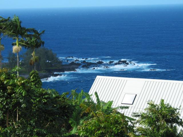
The Hilo coast…on the Big Island
The trade winds will remain active through the rest of this week, easing up some in strength Sunday…onwards into next week. These trade winds are blowing generally in the moderately strong realms Thursday evening, although as usual…there will be those typical variations in strength locally. As this weather map shows, we still have a strong and wide ranging 1036 millibar high system, positioned far to the northeast of Hawaii. The trade winds will begin to get quite a bit lighter after the weekend, as an early season cold front, or two…approach the islands from the northwest.
Looking at the latest GFS model output there remains two different cold fronts heading our way, neither of which is expected to reach the islands…at least not the first one for sure. The southeast movements of these cold fronts however will push our trade wind producing high pressure system eastward. As we move into the middle of next week, the second front will be close to us. This may shift us into a convective weather pattern, with daytime onshore flowing sea breezes, along with returning offshore flowing land breezes at night. We could see volcanic haze and cooler early morning temperatures coming into play then.
The current showery conditions that arrived last evening, continuing into today on the Big Island…will keep showers falling around that southernmost island for a while longer. If the trade winds remain intact as expected, the majority of whatever showers that fall through the rest of this week, will remain pretty closely attached to the windward sides as usual. If the breezes take on a south of east orientation early next week, we could see the smaller islands get into the wind shadow of the Big island, with sultry conditions following closely behind…with maybe even some vog then. As this satellite image shows, we have streaks of high cirrus clouds moving over the island chain tonight. We can look forward to colorful sunsets and sunrises while this high moisture gets carried our way on the winds aloft.
It’s early Thursday evening as I begin writing this last paragraph of today’s narrative update, here in Kihei, Maui. Looking out the window here before I take the drive back upcountry to Kula, I can see lots high cirrus clouds around. This almost certainly will make for a gorgeous sunset, and likely another colorful sunrise on Friday too. By the way, the red flag warning is still active across the leeward sides, until early Friday evening. This simply means that the danger of wild fire remains current, due to the strong trade winds, and low humidities. Have you seen the big almost full moon out there? It will reach its fullest peak late Friday night. ~~~ I’ll be back then with your next new weather narrative from paradise. I’m looking forward to the weekend already, and that new film I’ll be seeing Friday evening after work! I hope you have a great Thursday night from wherever you happen to be now! Aloha for now…Glenn.
Interesting: The increasing use of smart drugs or "nootropics," to boost academic performance, could mean that exam students will face routine doping tests in future, suggests an article in the Journal of Medical Ethics. Despite raising many dilemmas about the legitimacy of chemically enhanced academic performance, these drugs will be near impossible to ban, says Vince Cakic of the Department of Psychology, University of Sydney.
He draws several parallels with doping in competitive sports, where it is suggested that "95%" of elite athletes have used performance enhancing drugs. "It is apparent that the failures and inconsistencies inherent in anti doping policy in sport will be mirrored in academia unless a reasonable and realistic approach to the issue of nootropics is adopted," he claims.
But what this should be is far from clear, especially given the ready availability of these types drugs for therapeutic use, says Mr Cakic, conjuring up the prospect of urine tests for exam students. "As laughable as it may seem, it is possible that scenarios such as this could very well come to fruition in the future.
However, given that the benefits of nootropics could also be derived from periods of study at any time leading up to examinations, this would also require drug testing during non-exam periods," he writes. "If the current situation in competitive sport is anything to go by, any attempt to prohibit the use of nootropics will probably be difficult or inordinately expensive to police effectively," he warns.
Nootropics were designed to help people with cognitive problems, such as dementia and attention deficit disorder, but students with a looming deadline have several options: modafinil (Provigil), methylphenidate (Ritalin), and amphetamine (Dexedrine).
The non-medical use of methylphenidate and amphetamine is as high as 25% on some US college campuses, particularly in colleges with more competitive admission criteria, says Mr Cakic. For boosting memory retention, there’s brahmi, piracetam (Nootropil), donepezil (Aricept) and galantamine (Reminyl).
And for a bit more get up and go, there’s selegiline (Deprenyl). The impact of these drugs is as yet "modest," says Mr Cakic, but more potent versions are in the pipeline. "The possibility of purchasing ‘smartness in a bottle’ is likely to have broad appeal to students" seeking to gain an advantage in an increasingly competitive world, says Mr Cakic.
Interesting2: The optimal way to control swine flu, the new H1N1 virus that emerged as a global threat in 2009, is to vaccinate children with the planned H1N1 flu shot, says the co-director of the University of Alabama at Birmingham (UAB) Division of Pediatric Infectious Diseases. "Children are the highest-risk group for spreading the virus among themselves, and as a consequence, spreading it around their community," says UAB’s David Kimberlin, M.D., one of four U.S. physicians serving on the federal Safety Monitoring Committee reviewing clinical trials of H1N1 vaccines.
The committee is a part of the Division of Microbiology and Infectious Diseases at the National Institute of Allergy and Infectious Diseases. "Like a bull’s-eye, the middle of the target is what you vaccinate so you don’t see infections in the concentric rings around the center," Kimberlin says. "The center of the protection bull’s-eye should be children."
The United States’ prospects for developing and distributing a safe and effective vaccine to prevent infection with the current H1N1 virus are excellent, Kimberlin says. "The National Institutes of Health are conducting a number of studies across the country at special vaccine evaluation sites they’ve had set up for 40-60 years, and they have enrolled several thousand patients into those studies," he says.
"I’m on that federal monitoring board and we look at the vaccine-safety data constantly. These studies are going very well." The reasoning behind making children the highest priority comes from decades of experience with flu transmission, prevention strategies, infection monitoring and many other factors.
Additionally, children younger than age 5 are at higher risk of complications from influenza. Once the vaccine is available, which is expected to be in October, children 6 months of age and older, teenagers and young adults through age 24 will be among the first groups targeted by the Centers for Disease Control Advisory Committee on Immunization Practices to receive the shots.
Pregnant women, adults who have high-risk medical conditions and health-care workers who are direct care providers are among the others who will be given the earliest shots, says Kimberlin, who is a member of the American Academy of Pediatrics Committee on Infectious Diseases and associate editor of the academy’s Red Book, a revered pediatric treatment manual.
Interesting3: In 2007, congestion caused urban Americans to travel 4.2 billion hours more and to purchase an extra 2.8 billion gallons of fuel for a congestion cost of $87.2 billion – an increase of more than 50% over the previous decade. This was a decrease of 40 million hours and a decrease of 40 million gallons, but an increase of over $100 million from 2006 due to an increase in the cost of fuel and truck delay. Small traffic volume declines brought on by increases in fuel prices over the last half of 2007 caused a small reduction in congestion from 2006 to 2007.
Delay per traveler – the number of hours of extra travel time that commuters spend during rush hours – was 1.3 hours lower in 2007 than 2005. This change would be more hopeful if it was associated with something other than rising fuel prices (which occurred for a short time in 2005 and 2006 before the sustained increase in 2007 and 2008) and a slowing economy.
Interesting4: Lisa Jackson, administrator of the U.S. Environmental Protection Agency (E.P.A.), is proposing a major change in the way the federal government regulates tens of thousands of chemicals in consumer products, one that would place more of a responsibility on industry to prove that the compounds are safe. Jackson is proposing an overhaul of a 1976 toxics law that she called "inordinately cumbersome and time-consuming" and said that her agency will immediately begin analyzing and regulating six widely-used chemicals found in countless consumer products.
Among the six are bisphenol A, used in plastic bottles; phthalates, found in vinyl and cosmetics; and perfluorinated compounds used in making non-stick coatings and food packaging. Many scientists say these chemicals can mimic hormones and hurt development of fetuses and children, as well as possibly causing reproductive problems and cancer. "As more and more chemicals are found in our bodies and the environment, the public is understandably anxious and confused," said Jackson. "Many are turning to government for assurance that chemicals have been assessed using the best available science."
Interesting5: More than half of babies born in rich nations today will live to be 100 years old if current life expectancy trends continue, according to Danish researchers. Increasing numbers of very old people could pose major challenges for health and social systems, but the research showed that may be mitigated by people not only living longer, but also staying healthier in their latter years.
"Very long lives are not the distant privilege of remote future generations – very long lives are the probable destiny of most people alive now in developed countries," Kaare Christensen of the Danish Ageing Research Centre wrote in a study in the Lancet medical journal.
The study used Germany as a case study and showed that by 2050, its population will be substantially older and smaller than now – a situation it said was now typical of rich nations. This means smaller workforces in rich nations will have to shoulder an ever-greater burden of ballooning pension and healthcare requirements of the old.
Many governments in developed nations are already making moves toward raising the typical age of retirement to try to cope with ageing populations. The researchers said this was an important strategy and added that if part-time work was considered for more of the workforce, that could have yet more benefits.
"If people in their 60s and early 70s worked much more than they do nowadays, then most people could work fewer hours per week," they wrote. "Preliminary evidence suggests that shortened working weeks over extended working lives might further contribute to increases in life expectancy and health."
Huge increases in life expectancy – of more than 30 years – had been seen in most developed countries over the 20th Century. And death rates in nations with the longest life-expectancy, such as Japan, Sweden and Spain, suggest that, even if health conditions do not improve, three-quarters of babies will live to celebrate their 75th birthdays. "But should life expectancy continue to improve at the same rate, most babies born in rich nations since 2000 can expect to live to 100 years," they wrote.
« Previous Page


