September 2009
Monthly Archive
Posted by Glenn
No Comments
September 10-11, 2009
Air Temperatures – The following maximum temperatures were recorded across the state of Hawaii Thursday afternoon:
Lihue, Kauai – 84
Honolulu, Oahu – 92
Kaneohe, Oahu – 85
Kahului, Maui – 91
Hilo, Hawaii – 81
Kailua-kona – 87
Air Temperatures ranged between these warmest and coolest spots near sea level around the state – and on the highest mountains…at 5 p.m. Thursday evening:
Honolulu, Oahu – 85F
Hilo, Hawaii – 73
Haleakala Crater – 54 (near 10,000 feet on Maui)
Mauna Kea summit – 57 (near 14,000 feet on the Big Island)
Precipitation Totals – The following numbers represent the largest precipitation totals (inches) during the last 24 hours on each of the major islands, as of Thursday afternoon:
0.04 Kapahi, Kauai
0.12 Ahuimanu Loop, Oahu
0.00 Molokai
0.00 Lanai
0.00 Kahoolawe
0.36 West Wailuaiki, Maui
1.42 Mountain View, Big Island
Marine Winds – Here’s the latest (automatically updated) weather map showing weak high pressure systems to the northeast, and far to the west-northwest Trade winds will be active through Friday…although becoming gradually lighter into the weekend.
Satellite and Radar Images: To view the cloud conditions we have here in Hawaii, please use the following satellite links, starting off with this Infrared Satellite Image of the islands to see all the clouds around the state during the day and night. This next image is one that gives close images of the islands only during the daytime hours, and is referred to as a Close-up visible image. This next image shows a larger view of the Pacific…giving perspective to the wider ranging cloud patterns in the Pacific Ocean. Finally, here’s a Looping IR satellite image, making viewable the clouds around the islands 24 hours a day. To help you keep track of where any showers may be around the islands, here’s the latest animated radar image.
Hawaii’s Mountains – Here’s a link to the live webcam on the summit of near 14,000 foot Mauna Kea on the Big Island of Hawaii. The tallest peak on the island of Maui is the Haleakala Crater, which is near 10,000 feet in elevation. These two webcams are available during the daylight hours here in the islands…and when there’s a big moon rising just after sunset for an hour or two! Plus, during the nights and early mornings you will be able to see stars, and the sunrise too…depending upon weather conditions.
Tropical Cyclone activity in the eastern and central Pacific – Here’s the latest weather information coming out of the National Hurricane Center, covering the eastern north Pacific. You can find the latest tropical cyclone information for the central north Pacific (where Hawaii is located) by clicking on this link to the Central Pacific Hurricane Center. Here’s a tracking map covering both the eastern and central Pacific Ocean. A satellite image, which shows the entire ocean area between Hawaii and the Mexican coast…can be found here.
Aloha Paragraphs

Wonderful Hawaiian Waterfall
Light to moderately strong trade winds will continue, with daytime sea breezes along the leeward sides this weekend…into next week. We find high pressure systems located far to the northeast, and west-northwest of the islands Thursday evening, the source of our trades. These trade winds will remain locally light to moderately strong into Friday, then drop down in strength into the light levels this weekend. The light winds will make our local atmosphere feel very warm and sultry during the days…and slightly cooler than normal at night.
A few passing showers along the windward coasts and slopes…with typical dry weather for the most part along the south and west facing leeward sides. A deep storm, as shown on this weather map, in the Gulf of Alaska, will push an early season cold front in our direction, although it won’t reach our islands. It’s approach however will help to weaken our trade wind producing ridge of high pressure, the reason our local trade winds will be lighter soon. Meanwhile, this storm has generated a northwest swell in our direction…keeping our surf up along the north and west facing beaches.
As the winds calm down during the next few days, we’ll slide into a modified convective weather pattern. This simply means relatively clear, slightly cool mornings, giving way to afternoon cloudy periods…with a few localized upcountry showers on the leeward slopes. It will take the return of stronger trade winds to bring us around full circle, to a normal trade wind pattern, perhaps by the end of next week or so. As noted above, we’ll begin feeling rather hot and muggy during the days this weekend through much of next week.
We still have quite a long time before we begin to see autumn weather conditions…as summer hangs on down here in the tropics. Here’s another look at that weather map, which I placed above. I want to draw your attention this time to the big red L in the Gulf of Alaska. This deep storm will bring true autumn weather conditions to the coast of Alaska, in no uncertain terms! They will have gales, and storm force winds in the marine environment, and wind advisories over the inland areas. There will be lots of heavy rain involved in this storm too, ending the summer season in the north country.
It’s Thursday evening here in Kihei, Maui, as I begin writing this last section of today’s narrative. As we can see on this looping satellite image, we seen lots of high cirrus clouds moving in our direction from the west today. These icy high clouds will likely make for a colorful sunset, and if they are still around Friday morning…more striking colors then. A trough of the south of Maui is keeping Maui and parts of the Big Island cloudier than normal now. As this next satellite image shows, the high cirrus clouds are hiding the cloudiness arriving as this trough slowly moves by to our south.
~~~ As mentioned above, the trade winds are still blowing Thursday evening. As a matter of fact, they are quite strong locally, with 30 mph gusts at Kapalua and Kahului, Maui, and 35 mph at the windy Maalaea Bay. These trade winds will persist Friday, and then as an early season cold front draws near, our winds will tumble in strength this weekend, lasting well into next week. I’ll be back early Friday morning with your next new weather narrative. I hope you have a great Thursday night until then! Aloha for now…Glenn.
Cute youtube cat video: when you need a drink…you need a drink!
Interesting Live Science article: Arctic may be changed forever…study finds
Interesting: For many of the types of fish we buy in stores or order in restaurants, the chance that an individual dies from fishing is several times higher than dying of natural causes. This may seem obvious to most (they had to get to our table somehow), but what may not be apparent is that the relentless pursuit of consumer-friendly fish product is having a massive impact on fish populations around the world.
By repeatedly choosing only the biggest fish, or only those found in certain habitats, the fisheries industry may be permanently altering the genetic composition of fish populations. What are the long-term evolutionary implications of prolonged fishing for the fish that humans and, perhaps more importantly, diverse ecosystems so depend on?
A group of concerned international scientists convened at the 2008 American Fisheries Society Annual Meeting to address this issue, and contributions to the symposium are now available online in an August 2009 special issue of Evolutionary Applications.
Several groups of scientists focused on teasing apart how much of the shift in fish morphology, development and behavior that has been documented over the years is due to genetic versus non-genetic changes. Long-term genetic changes may be more problematic since these may not be reversible and they make predicting the composition of fish stocks in the future very difficult.
Equally contentious among scientists was distinguishing between changes that were caused by artificial selection due to fishing per se, versus environmental influences such as habitat destruction or climate change.
Interesting2: Analysis of a rock type found only in the world’s oldest oceans has shed new light on how large animals first got a foothold on Earth. A scientific team led by Professor Robert Frei at the University of Copenhagen in Denmark, and including scientists from Newcastle University, UK, and universities in Uruguay and Southern Denmark, have for the first time managed to plot the rise and fall of oxygen levels in the Earth’s atmosphere over the last 3.8 billion years.
By analyzing the isotopes of chromium in iron-rich sediments formed in the ancient oceans, the team has found that a rise in atmospheric oxygen levels 580 million years ago was closely followed by the evolution of animal life. Published today in the academic journal Nature, the data offers new insight into how animal life – and ultimately humans – first came to roam the planet.
"Because animals evolved in the sea, most previous research has focused on oceanic oxygen levels," explains Newcastle University’s Dr Simon Poulton, one of the authors of the paper. "Our research confirms for the first time that a rise in atmospheric oxygen was the driving force for oxygenation of the oceans 580 million years ago, and that this was the catalyst for the evolution of large complex animals."
Interesting3: Interim results from an international research project which looks at bilingual education reveal that children can learn a second language as early as preschool. The University of Hertfordshire is one of nine European partners in ELIAS (Early Language and Intercultural Acquisition Studies) which was awarded €300,000 by the European Union last year to research bilingual education and intercultural awareness in children through observational studies and language assessments in six project preschools.
The researchers use a concept called ‘immersion teaching’, whereby children are addressed in each language by the respective native speaker and asked to respond in that language. The study focuses on bilingual preschools in Germany, Sweden and Belgium, where the staff members are teachers from the respective country, but at least one teacher is a native speaker of English.
Data is also collected from nurseries in Hertfordshire and the bilingual nursery of the German school in London. Children’s progress in English is measured through a receptive vocabulary test and a grammar task that was designed within the project. So far, 266 preschool children aged between three and five took part in the tests.
The researchers found that although not all the preschool groups performed equally well in the tests, and there was a large amount of individual variation in children’s comprehension of vocabulary and grammatical phenomena, there was clear evidence that it is feasible for children to start to learn a second language in a preschool context, using immersion methods.
Interesting4: By extracting dissolved carbon dioxide from seawater and combining it with hydrogen stripped from water molecules, Navy chemists hope to one day secure a cheap and steady fuel source for its fleet of jets. "The U.S. Navy is surrounded by seawater and the Navy needs jet fuel," said Robert Dorner, a scientist at the Naval Research Laboratory in Washington, D.C. who works on the technology.
"In the seawater you have CO2 and you have hydrogen. The question is how do you convert that into jet fuel." The answer, according to Dorner, is a modified version of the chemical reaction known as the Fischer-Tropsch process.
Interesting5: Like the robotic rovers Spirit and Opportunity, which wheeled tirelessly across the dusty surface of Mars, a new robot spent most of July traveling across the muddy ocean bottom, about 25 miles off the California coast. This robot, the Benthic Rover, has been providing scientists with an entirely new view of life on the deep seafloor.
It will also give scientists a way to document the effects of climate change on the deep sea. The Rover is the result of four years of hard work by a team of engineers and scientists led by MBARI project engineer Alana Sherman and marine biologist Ken Smith.
About the size and weight of a small compact car, the Benthic Rover moves very slowly across the seafloor, taking photographs of the animals and sediment in its path. Every 10 to 16 feet the Rover stops and makes a series of measurements on the community of organisms living in the seafloor sediment.
These measurements will help scientists understand one of the ongoing mysteries of the ocean—how animals on the deep seafloor find enough food to survive. Most life in the deep sea feeds on particles of organic debris, known as marine snow, which drift slowly down from the sunlit surface layers of the ocean.
But even after decades of research, marine biologists have not been able to figure out how the small amount of nutrition in marine snow can support the large numbers of organisms that live on and in seafloor sediment. The Benthic Rover carries two experimental chambers called "benthic respirometers" that are inserted a few centimeters into the seafloor to measure how much oxygen is being consumed by the community of organisms within the sediment.
This, in turn, allows scientists to calculate how much food the organisms are consuming. At the same time, optical sensors on the Rover scan the seafloor to measure how much food has arrived recently from the surface waters. MBARI researchers have been working on the Benthic Rover since 2005, overcoming many challenges along the way.
The most obvious challenge was designing the Rover to survive at depths where the pressure of seawater is about 420 kilograms per square meter (6,000 pounds per square inch). To withstand this pressure, the engineers had to shield the Rover’s electronics and batteries inside custom-made titanium pressure spheres.
Interesting6: An extremely rare bird seen only a dozen times in the past 150 years has finally been spotted at sea. But the news for the critically-endangered Fiji petrel is not good. Even in optimal conditions – the best season, best location and using the most pungent-smelling bait – only eight birds have been sighted.
Fijians have long appreciated the rarity of the chocolate-colored gull, featuring it on a bank note and protecting it under law. Known for its elusiveness, it was first identified on Fiji’s Gau island by British surveyors in 1855 and was not seen again for 130 years.
Since 1984 there have been a handful of reports of petrels injured after crashing into village roofs on Gau but never have the birds been seen at sea until now. "Finding this bird and capturing such images was a fantastic and exhilarating experience," Hadoram Shirihai, who led the two-week search by the British Ornithologists’ Club, said.
A paper published this week is the first ever to detail how the species behaves, with the team hoping it could hold the key to the bird’s survival. "The present evidence is that very few Fiji petrels survive and that immediate efforts to find the nest sites are needed," expedition member Tony Pym said.
"Prompt, effective protection is urgently required before it is too late." The Fiji petrel is one of 192 bird species worldwide listed as critically endangered. Jez Bird from BirdLife International said because the bird was exceptionally rare and extremely poorly known, any new data concerning range and abundance was vital to its conservation.
Interesting7: The USA’s summer was cooler than average in 2009, for only the second time this decade, according to data released Thursday by the National Oceanic and Atmospheric Administration. Several Midwest states — including Michigan, Wisconsin, Minnesota, and South Dakota— recorded one of their 10 coldest summers on record. Northwestern Pennsylvania recorded its coldest summer ever.
Climate records date to 1895. At the nation’s largest outdoor water park in Wisconsin, "every Saturday but one had an issue with rain, wind or just plain cold," says Tim Gantz, president and co-owner of Noah’s Ark Waterpark in Wisconsin Dells, Wis. He added that summer business was down slightly overall, and that one Saturday all 2,000 of the park’s wet suits were in use by customers.
July was the second-coldest on record in Wisconsin. The culprit for the cold? "A recurring trough of low pressure across the central USA and interior Canada, which was there throughout the summer," says Deke Arndt, chief of the climate monitoring branch at the National Climatic Data Center in Asheville, N.C. Low pressure causes clouds to form, keeping temperatures cool.
The chill continued into August, as temperatures were below normal across the Midwest, Plains and parts of the South. More than 300 low-temperature records were set across the Midwest during the last two days of August. On the other end of the spectrum, it was one of the hottest, driest summers on record in parts of south Texas, according to the climate center.
"They’ve been fighting a really bad drought situation there," Arndt said. McAllen, Texas, broke its all-time record for highest-average summer temperature. Overall, the South, Southeast and Southwest regions were drier than average this summer. Arizona had its third-driest summer, while both South Carolina and Georgia had their sixth-driest. Global climate data for the summer will be released on September 17.
Posted by Glenn
No Comments
September 9-10, 2009
Air Temperatures – The following maximum temperatures were recorded across the state of Hawaii Wednesday afternoon:
Lihue, Kauai – 84
Honolulu, Oahu – 90
Kaneohe, Oahu – 84
Kahului, Maui – 89
Hilo, Hawaii – 83
Kailua-kona – 87
Air Temperatures ranged between these warmest and coolest spots near sea level around the state – and on the highest mountains…at 5 p.m. Wednesday evening:
Honolulu, Oahu – 86F
Hilo, Hawaii – 78
Haleakala Crater – 52 (near 10,000 feet on Maui)
Mauna Kea summit – 64 (near 14,000 feet on the Big Island)
Precipitation Totals – The following numbers represent the largest precipitation totals (inches) during the last 24 hours on each of the major islands, as of Wednesday afternoon:
0.39 Mount Waialaele, Kauai
0.22 Ahuimanu Loop, Oahu
0.00 Molokai
0.00 Lanai
0.00 Kahoolawe
0.10 Oheo Gulch, Maui
0.56 Piihonua, Big Island
Marine Winds – Here’s the latest (automatically updated) weather map showing weak high pressure systems to the northeast, and far to the west-northwest Trade winds will be active through Friday…although becoming gradually lighter.
Satellite and Radar Images: To view the cloud conditions we have here in Hawaii, please use the following satellite links, starting off with this Infrared Satellite Image of the islands to see all the clouds around the state during the day and night. This next image is one that gives close images of the islands only during the daytime hours, and is referred to as a Close-up visible image. This next image shows a larger view of the Pacific…giving perspective to the wider ranging cloud patterns in the Pacific Ocean. Finally, here’s a Looping IR satellite image, making viewable the clouds around the islands 24 hours a day. To help you keep track of where any showers may be around the islands, here’s the latest animated radar image.
Hawaii’s Mountains – Here’s a link to the live webcam on the summit of near 14,000 foot Mauna Kea on the Big Island of Hawaii. The tallest peak on the island of Maui is the Haleakala Crater, which is near 10,000 feet in elevation. These two webcams are available during the daylight hours here in the islands…and when there’s a big moon rising just after sunset for an hour or two! Plus, during the nights and early mornings you will be able to see stars, and the sunrise too…depending upon weather conditions.
Tropical Cyclone activity in the eastern and central Pacific – Here’s the latest weather information coming out of the National Hurricane Center, covering the eastern north Pacific. You can find the latest tropical cyclone information for the central north Pacific (where Hawaii is located) by clicking on this link to the Central Pacific Hurricane Center. Here’s a tracking map covering both the eastern and central Pacific Ocean. A satellite image, which shows the entire ocean area between Hawaii and the Mexican coast…can be found here.
Aloha Paragraphs

Hawaiian I’iwi bird…Ohia Lehua blossoms
Light to moderately strong trade winds will continue, with daytime sea breezes along the leeward sides this weekend…into early next week. We find high pressure systems located to the northeast, and west-northwest of the islands Wednesday evening, as shown on this weather map. These trades will remain locally light to moderately strong Thursday…then relax in strength Friday into the weekend.
A few passing showers along the windward coasts and slopes…with typical dry weather for the most part along the south and west facing leeward sides. The weather map above shows a deep storm low pressure system to the north of Hawaii Wednesday evening. This storm will push an early season cold front in our direction, although it won’t reach our islands. It’s approach however will help to weaken our trade wind producing ridge of high pressure, the reason our local trade winds will be lighter in a few days. Meanwhile, this storm will generate a northwest swell in our direction…arriving later Thursday into Friday.
Perhaps the most interesting thing going on now, in terms of weather, is the unusually strong low pressure system, and its associated cold front to our north. The cold front, if it were later in the autumn, or during the winter season, would likely barrel its way down through the Hawaiian Islands…bringing good showers with it. Although, since it’s still summer, the front will skid to a stop well north of our Aloha state, late this weekend into early next week. An interesting aspect of this storm, will be the potential high surf that it sends us…arriving later Thursday into the weekend.
Besides the soon to be lighter trade winds, we’re involved in what could be considered a fairly typical late summer trade wind weather pattern at the moment. As the winds calm down during the next few days, we’ll slide into a modified convective weather pattern. This simply means relatively clear mornings, giving way to afternoon cloudy periods…with a few localized upcountry showers on the leeward slopes. It will take the return of stronger trade winds to bring us around full circle, to a normal trade wind pattern, perhaps by around the middle of next week or so.
It’s Wednesday evening here in Kihei, Maui, as I begin writing this last section of today’s narrative. Wednesday still saw a pretty good amount of trade winds blowing. They’ve begun to slow down some, although at 5pm, the windy Maalaea Bay, here on Maui, was still reporting a gust to 33 mph. Most other areas around the state say considerably lighter winds. Skies were clear to partly cloudy, with just the Hilo Bay reporting cloudy skies. Rainfall was rather limited today, and will remain so through Thursday. Speaking of which, Thursday should be a nice day, more or less about like it was Wednesday. Looking out the window here on the South Coast, in Kihei, it was just about totally clear in most directions, with just the usual clouds around the edges. I’ll be back early Thursday morning with your next new weather narrative. I hope you have a great Wednesday night until then! Aloha for now…Glenn.
Interesting date today: 9/9/9 – Number 9 definition: Artistic genius, humanitarianism, romance, emotionalism, dissipation
Interesting body fact: Our salivary glands, which are located on the inside of each cheek, at the bottom of the mouth and under the jaw at the front of the mouth, churn out about two to four pints of spit every day.
The mere mention or aroma hint of chocolate chip cookies can make for a mouth full of drool. That’s a good thing. The clear substance, made up mostly of water, mixes in with food to help even the driest snack slide with ease down into your stomach. Before those morsels hit the belly, special enzymes in saliva start to break down that food into its simpler components.
Saliva’s enzymes also help to fight off infections in your mouth. In addition, the goop cleans the inside of your mouth and teeth, though brushing and flossing are still musts.
Interesting: Despite Washington’s nearly single-minded focus on healthcare reform, the Obama administration still expects the U.S. Senate to pass climate change legislation, Interior Secretary Ken Salazar said on Tuesday. "Right now we are focused on this crusade for healthcare reform for the country and that’s where our time and energy will go for the days ahead," Salazar said during an interview at the Reuters Global Climate and Alternative Energy Summit. Even so, he added, "We want both (healthcare and climate bills). The president has been very clear that these are two big issues for the United States and for our time."
Interesting2: A team of scientists from Britain, the United States and Papua New Guinea found more than 40 previously unidentified species when they climbed into the kilometer-deep crater of Mount Bosavi and explored a pristine jungle habitat teeming with life that has evolved in isolation since the volcano last erupted 200,000 years ago. In a remarkably rich haul from just five weeks of exploration, the biologists discovered 16 frogs which have never before been recorded by science, at least three new fish, a new bat and a giant rat, which may turn out to be the biggest in the world.
The discoveries are being seen as fresh evidence of the richness of the world’s rainforests and the explorers hope their finds will add weight to calls for international action to prevent the demise of similar ecosystems. They said Papua New Guinea’s rainforest is currently being destroyed at the rate of 3.5% a year. "It was mind-blowing to be there and it is clearly time we pulled our finger out and decided these habitats are worth us saving," said Dr George McGavin who headed the expedition.
Interesting3: Green Seal’s certification standard for restaurants and foodservice operations has been approved by the American National Standards Institute (ANSI), making the guidelines the first of their kind to be nationally recognized, Green Seal said today. The GS-46 Environmental Standard for Restaurants and Foodservices, released in May, is also the first Green Seal specification to be approved as an American National Standard.
The standard for restaurants and foodservice establishments provides a framework for the facilities to reduce their environmental impacts. The standard addresses food purchasing and waste reduction, which present the greatest opportunities for restaurateurs and foodservice operators to shrink their facilities’ environmental footprint. Resource efficiency and water and energy management are among the other key issues covered.
Interesting4: China’s increasing air pollution has cut the light rainfall essential to the country’s agriculture over the last 50 years, new research suggests. The research, published in the Journal of Geophysical Research last month, is based on rainfall data collected from weather stations across China.
The number of light rain days — those with precipitation of less than ten millimeters — in northeast and southeast China has been cut by 25 per cent and 21 per cent respectively over the past five decades, researchers have found.
"Analyses of air pollution data, satellite data, and large-scale circulation all suggest that aerosols may have played a more dominant role in the observed decrease trend in light rain in East China," the authors write. Qian Yun, co-author of the research and an atmospheric scientist at the Pacific Northwest National Laboratory, United States, told SciDev.Net: "The decreased light rain will definitely deal a blow to agricultural potential in east China, the main food production area in China."
"Light rain soaks slowly into the ground [making it easier for the soil to absorb] which is better than heavy rain, which can flood fields and run off into nearby waterways." The authors say that increased levels of aerosols — particles of pollution in the air above China — are caused by increasing fossil fuel consumption, particularly in big cities like Beijing.
They think that because rain drops form around aerosol particles, more particles means smaller drops that are less likely to form rain clouds. Qian says the team will now build a model to calculate the agricultural and economic losses caused by air pollution to guide policymakers.
But Guo Jianping, a meteorologist at the Chinese Academy of Meteorological Sciences, who was not involved in the research, says the relationship between light rain and agricultural growth is difficult to define.
"Usually it is hard for small amounts of water to seep down into the ground and be absorbed. In addition, more rain days do not mean it’s good for agriculture as less solar radiation is available," he told SciDev.Net.
Interesting5: A new study by the Wildlife Conservation Society, U.S. Fish and Wildlife Service, and other groups reveals how oil development in the Arctic is impacting some bird populations by providing "subsidized housing" to predators, which nest and den around drilling infrastructure and supplement their diets with garbage – and nesting birds. A new study by the Wildlife Conservation Society, U.S. Fish and Wildlife Service, and other groups reveals how oil development in the Arctic is impacting some bird populations by providing "subsidized housing" to predators, which nest and den around drilling infrastructure and supplement their diets with garbage – and nesting birds.
The authors monitored nearly 2,000 nests of 17 passerine and shorebird species over a four-year period. Birds from five continents migrate to the Arctic each year to nest. "This is the first study specifically designed to evaluate the so-called oil ‘footprint’ effect in the Arctic on nesting birds," said the study’s lead author, Joe Liebezeit of the Wildlife Conservation Society.
"The study was also unique in that it was a collaborative effort among conservation groups, industry, and federal scientists." The impetus for this study stemmed from previous evidence suggesting predators have increased in the oil fields near Prudhoe Bay.
"The findings of this study shed new light on growing concerns about oil development impacts to wildlife in the Alaskan Arctic, an immense region that, outside of Prudhoe Bay, is still largely undisturbed by humans and home to vast herds of caribou, the threatened polar bear, and millions of breeding birds," said Jodi Hilty, Director of the Wildlife Conservation Society’s North America Programs.
WCS is engaged in separate studies in remote areas of the western Arctic, evaluating where wildlife protection would be most effective in advance of development. "Our interest is in ensuring a balance of both wildlife protection in key areas and helping industry minimize potential impacts to wildlife as they begin to pursue development in western Arctic Alaska," said Steve Zack, coauthor and Coordinator of the Arctic Program for WCS. "This study helps inform industry on some consequences of development."
Interesting6: In a national survey of businesses that looks at their preparations for a possible widespread H1N1 outbreak, Harvard School of Public Health (HSPH) researchers found that only one-third believe they could sustain their business without severe operational problems if half their work force were absent for two weeks due to H1N1 (also known as "swine flu").
Just one-fifth believe they could avoid such problems for one month with half their employees out. The survey also found that while 74% of businesses offer paid sick leave for employees, only 35% of businesses offer paid leave that would allow employees to take care of sick family members, and even fewer would allow paid time off to care for children if schools/daycares were closed (21%).
The survey is part of an ongoing series about the country’s response to the H1N1 flu outbreak undertaken by the Harvard Opinion Research Program at HSPH. The polling was done July 16-August 12, 2009. "Businesses need to start planning how to adjust their operations to account for greater absenteeism and to slow the spread of H1N1 in the workplace," said Robert J. Blendon, Professor of Health Policy and Political Analysis at HSPH.
Just over half of businesses in the U.S. (52%) believe there will be a more widespread and more severe outbreak of novel influenza A (H1N1) in the fall. If such an outbreak does occur, 84% of firms are concerned that it will negatively affect their business. One key reason that businesses may be concerned is that they have a limited ability to maintain operations successfully if a significant portion of their workforce is absent due to an outbreak of H1N1.
Only a third of businesses believe they could avoid having severe operational problems for 2 weeks if 50% of their workforce were absent due to H1N1; less than a quarter (22%) of firms believe they could do so for a month. In general, more small businesses believe they would be able to avoid having severe operational problems with a reduced workforce as compared to large businesses.
For example, small business are more likely than large businesses to say they could avoid having severe operational problems for 2 weeks if half their workforce were absent (40% vs. 27%), or to avoid having severe operational problems for a month if half their workforce were absent (27% vs. 18%).
Posted by Glenn
[2] Comments
September 8-9, 2009
Air Temperatures – The following maximum temperatures were recorded across the state of Hawaii Tuesday afternoon:
Lihue, Kauai – 83
Honolulu, Oahu – 89
Kaneohe, Oahu – 83
Kahului, Maui – 88
Hilo, Hawaii – 83
Kailua-kona – 88
Air Temperatures ranged between these warmest and coolest spots near sea level around the state – and on the highest mountains…at 5 p.m. Tuesday evening:
Port Allen, Kauai – 86F
Hilo, Hawaii – 78
Haleakala Crater – 61 (near 10,000 feet on Maui)
Mauna Kea summit – 64 (near 14,000 feet on the Big Island)
Precipitation Totals – The following numbers represent the largest precipitation totals (inches) during the last 24 hours on each of the major islands, as of Tuesday afternoon:
0.49 Mount Waialaele, Kauai
1.12 Oahu Forest NWR, Oahu
0.18 Molokai
0.00 Lanai
0.01 Kahoolawe
1.45 West Wailuaiki, Maui
1.12 Mountain View, Big Island
Marine Winds – Here’s the latest (automatically updated) weather map showing high pressure systems to the north and northeast of the islands. Trade winds will be active…generally in the light to moderately strong realms through Wednesday.
Satellite and Radar Images: To view the cloud conditions we have here in Hawaii, please use the following satellite links, starting off with this Infrared Satellite Image of the islands to see all the clouds around the state during the day and night. This next image is one that gives close images of the islands only during the daytime hours, and is referred to as a Close-up visible image. This next image shows a larger view of the Pacific…giving perspective to the wider ranging cloud patterns in the Pacific Ocean. Finally, here’s a Looping IR satellite image, making viewable the clouds around the islands 24 hours a day. To help you keep track of where any showers may be around the islands, here’s the latest animated radar image.
Hawaii’s Mountains – Here’s a link to the live webcam on the summit of near 14,000 foot Mauna Kea on the Big Island of Hawaii. The tallest peak on the island of Maui is the Haleakala Crater, which is near 10,000 feet in elevation. These two webcams are available during the daylight hours here in the islands…and when there’s a big moon rising just after sunset for an hour or two! Plus, during the nights and early mornings you will be able to see stars, and the sunrise too…depending upon weather conditions.
Tropical Cyclone activity in the eastern and central Pacific – Here’s the latest weather information coming out of the National Hurricane Center, covering the eastern north Pacific. You can find the latest tropical cyclone information for the central north Pacific (where Hawaii is located) by clicking on this link to the Central Pacific Hurricane Center. Here’s a tracking map covering both the eastern and central Pacific Ocean. A satellite image, which shows the entire ocean area between Hawaii and the Mexican coast…can be found here.
Aloha Paragraphs

End of another great day
Light to moderately strong trade winds will continue…gradually becoming lighter later this week. We find a rather weak 1022 millibar high pressure system located to the northeast of the islands Tuesday night, as shown on this weather map. The trades will remain locally gusty through Thursday…then relax in strength during Friday into the weekend. The computer forecast models keep the trade winds lighter than normal going into next week.
The windward sides will continue to see some passing shower activity, while the leeward sides will have fair weather. The weather map above shows an unusually deep storm low pressure system to the northwest of Hawaii. This storm will send an early season cold front in our direction, although it won’t reach our islands. It’s approach however will weaken our trade wind producing ridge of high pressure, the reason our local trade winds will falter. Meanwhile, this storm will generate a northwest swell in our direction…arriving later Thursday into Friday.
The more or less favorably inclined trade wind weather pattern will continue. This will keep generally normal weather for this time of year, which we can now definitely call late summer. It’s interesting to see how intense a storm has become to our northwest. The winds revolving around this deep low pressure system, remained at hurricane force…75 mph winds Tuesday evening! It’s pretty early in the season, as it’s still summer, to see such a storm developing in the north Pacific. I would expect to see such a storm more often during the later autumn or winter seasons.
It’s Tuesday evening here in Kihei, Maui, as I begin writing this last section of today’s narrative. Tuesday was generally a good day, that is if you didn’t mind the locally gusty trade winds. Speaking of the gusty nature of the winds now, at 5pm the strongest winds were being reported around Maui County. Lanai was reporting 35 mph, Kahoolawe 36 mph…while Maalaea Bay on Maui was blowing at 37 mph. These numbers are relatively strong for the time of day. I anticipate more gustiness on Wednesday, although winds will gradually be diminishing Friday into the weekend.
~~~ I’m about ready to take the drive back upcountry to Kula. Looking out the window here in Kihei before I leave, it was clear to partly cloudy. It was good to get back to work today, after that long three day holiday weekend…which was so great! I’ll be up very early Wednesday morning, and after my meditation, will prepare your next weather narrative. I hope you have a great Tuesday night from wherever you happen to be spending it! Aloha for now…Glenn.
Interesting article on Climate Change – New Scientist, September 7, 2009
Interesting: Fish farms, once a fledgling industry, now account for 50 percent of the fish consumed globally, according to a new report by an international team of researchers. And while getting more efficient, it is putting strains on marine resources by consuming large amounts of feed made from wild fish harvested from the sea, the authors conclude.
Their findings are published in the online edition of the Proceedings of the National Academy of Sciences. "Aquaculture is set to reach a landmark in 2009, supplying half of the total fish and shellfish for human consumption," the authors wrote.
Between 1995 and 2007, global production of farmed fish nearly tripled in volume, in part because of rising consumer demand for long-chain omega-3 fatty acids. Oily fish, such as salmon, are a major source of these omega-3s, which are effective in reducing the risk of cardiovascular disease, according to the National Institutes of Health.
"The huge expansion is being driven by demand," said lead author Rosamond L. Naylor, a professor of environmental Earth system science at Stanford University and director of the Stanford Program on Food Security and the Environment.
"As long as we are a health-conscious population trying to get our most healthy oils from fish, we are going to be demanding more of aquaculture and putting a lot of pressure on marine fisheries to meet that need."
To maximize growth and enhance flavor, aquaculture farms use large quantities of fishmeal and fish oil made from less valuable wild-caught species, including anchoveta and sardine.
"With the production of farmed fish eclipsing that of wild fish, another major transition is also underway: Aquaculture’s share of global fishmeal and fish oil consumption more than doubled over the past decade to 68 percent and 88 percent, respectively," the authors wrote. In 2006, aquaculture production was 51.7 million metric tons, and about 20 million metric tons of wild fish were harvested for the production of fishmeal.
"It can take up to 5 pounds of wild fish to produce 1 pound of salmon, and we eat a lot of salmon," said Naylor, the William Wrigley Senior Fellow at Stanford’s Woods Institute for the Environment and Freeman Spogli Institute for International Studies.
Interesting2: A new study finds that large-scale farming projects can erode the Earth’s surface at rates comparable to those of the world’s largest rivers and glaciers. Published online in the journal Nature Geoscience, the research offers stark evidence of how humans are reshaping the planet.
It also finds that – contrary to previous scholarship – rivers are as powerful as glaciers at eroding landscapes. In some cases, the researchers found large-scale farming eroded lowland agricultural fields at rates comparable to glaciers and rivers in the most tectonically active mountain belts.
"This study shows that humans are playing a significant role in speeding erosion in low lying areas," says Michele Koppes, a professor of geography at the University of British Columbia (UBC) and lead author of the study. "These low-altitude areas do not have the same rate of tectonic uplift, so the land is being denuded at an unsustainable rate."
Contrary to previous scholarship, they found that rivers and glaciers in active mountain ranges are both capable of eroding landscapes by more than one centimeter per year. Studies had previously indicated that glaciers could erode landscapes as much as 10 times faster than rivers, Koppes says.
Interesting3: Out of the city and into the countryside! For many people this idea is associated with a life away from the dangers of the brawly road traffic in the city. For concerned parents, road safety is an important factor in house hunting. They want their children to move freely and healthy outside. Prof. Christian Holz-Rau and PD Joachim Scheiner from the Department of Transport Planning at the Faculty of Spatial Planning at TU Dortmund have been recalculating.
Their surprising result: life in the city is much safer than in the countryside or in the suburbs. With their approach to analyze the data the scientists broke new ground: for Lower Saxony they analyzed the accident data taking account of the victim’s residence.
“The place of the accident alone does not allow for a conclusion to be drawn with regard to the population in this place being more or less endangered,” says Holz-Rau. After all, the inhabitants of the suburban areas do get into the cities: “One only has to think about commuters.“
The results of the analysis show that the risk of fatal accidents is already 40% higher for the population of the populous surrounding districts than for city inhabitants. For inhabitants of the countryside the risk to die in traffic is even twice up to three times as high.
With regard to accidents with severe injuries the situation is similar but not so obvious. Accident statistics regard everybody as severely injured who needs in-patient treatment. In rural districts the risk of severe injuries is 70-100% higher than in cities. For metropolitan residents only the risk of slight injuries is a little bit higher, compared to inhabitants of small communities.
That is what Joachim Scheiner assumes to be the reason for the bad image of cities, because accidents with slight injuries happen many times as often as accidents with severe injuries or even fatalities. The high number of urban accident victims can be attributed to the great number of slightly injured people.
Aquaculture, once a fledgling industry, now accounts for 50 percent of the fish consumed globally, according to a new report by an international team of researchers. And while the industry is more efficient than ever, it is also putting a significant strain on marine resources by consuming large amounts of feed made from wild fish harvested from the sea, the authors conclude. Their findings are published in the Sept. 7 online edition of the Proceedings of the National Academy of Sciences (PNAS).
Interesting 4: More than one in 10 people who binge drinks gets behind the wheel of a car during or just after their binge. Of those who binge and drive afterward, more than half had consumed their liquor in a bar, restaurant or club. “Drinking in bars and clubs is a huge independent factor in binge drinking,” said lead study author Timothy Naimi, M.D.
“This study marks a failure of public health in the U.S., and one that is notable for the lack of will and resources devoted to enforcing even existing laws and alcohol control policies.” These findings come from a study appearing online and in the October issue of the American Journal of Preventive Medicine.
Researchers from the Centers for Disease Control and Prevention looked at data from a CDC telephone survey conducted in 2003 and 2004. More than 14,000 adults reported having more than five drinks during a single drinking session — the definition of a binge — in the previous 30 days.
The study ties drinking patterns to subsequent driving explicitly. “People think of impaired driving as a driving problem when it is as much a drinking problem as a driving problem,” said Naimi, M.D., a physician with the CDC’s Alcohol Team.
Forty-eight states have laws preventing the sale of more alcohol to someone who obviously is intoxicated, Naimi said. Yet the respondents had an average of eight drinks at a time; more than a quarter had 10 or more. “Many of these folks were demonstrably hammered, yet got served more alcohol — at a terrible cost to society,” he said.
“This study highlights alcohol-service activity that is clearly irresponsible and that places law-abiding establishments at a competitive disadvantage.” “This study confirms what others would have predicted, but in a much stronger way than ever before,” said David Jernigan, Ph.D., an associate professor at the Bloomberg School of Public Health at Johns Hopkins University.
All states should have strong laws making a licensed establishment that serves liquor to obviously intoxicated patrons liable for their subsequent actions, he said, but not all do. Bartenders and waiters must undergo training to spot intoxication, he added.
Interesting5: Beginning August 26, 2009, and continuing into September 2009, a large wildfire in the Angeles National Forest north of Los Angeles known as the Station Fire burned more than 140,000 acres through September 3. Carbon monoxide in the smoke from this large fire was lofted as high as 8.3 kilometers (27,000 feet) into the atmosphere, where it was observed by JPL’s Atmospheric Infrared Sounder (AIRS) instrument onboard NASA’s Aqua satellite.
A new movie, created using continuously updated data from NASA’s "Eyes on the Earth 3-D" feature on NASA’s global climate change website, shows three-day running averages of daily AIRS retrievals of the abundance of carbon monoxide present at 5.5 kilometers (18,000 feet).
AIRS is most sensitive to carbon monoxide at this altitude, which is a region conducive to long-range transport of the smoke. As the carbon monoxide is lifted by the fire’s heat and blows downwind, it appears in the August 30 AIRS map north and east of the fire as a yellow to red plume that stretches from Southern California across Nevada and Utah.
The plume is transported eastward on subsequent days, crossing Denver on August 31, southeastward to Texas on September 1, and reaching the Louisiana Gulf Coast on September 2. As the plume moves further east, mixing of carbon monoxide down to Earth’s surface could adversely impact air quality, as it has already done in Salt Lake City and Denver. Previous studies using AIRS data have documented the impact of distant fires on air quality in Houston and other locations.
Posted by Glenn
[2] Comments
September 7-8, 2009
Air Temperatures – The following maximum temperatures were recorded across the state of Hawaii Monday afternoon:
Lihue, Kauai – 84
Honolulu, Oahu – 85
Kaneohe, Oahu – 84
Kahului, Maui – 86
Hilo, Hawaii – 84
Kailua-kona – 87
Air Temperatures ranged between these warmest and coolest spots near sea level around the state – and on the highest mountains…at 3 p.m. Monday afternoon:
Port Allen, Kauai – 88F
Princeville, Kauai – 81
Haleakala Crater – 59 (near 10,000 feet on Maui)
Mauna Kea summit – 68 (near 14,000 feet on the Big Island)
Precipitation Totals – The following numbers represent the largest precipitation totals (inches) during the last 24 hours on each of the major islands, as of Monday afternoon:
3.46 Mount Waialaele, Kauai
0.91 Wilson Tunnel, Oahu
0.15 Molokai
0.02 Lanai
0.00 Kahoolawe
0.41 Puu Kukui, Maui
0.41 Glenwood, Big Island
Marine Winds – Here’s the latest (automatically updated) weather map showing a 1027 millibar high pressure system far to the northeast of the islands. Trade winds will be active…generally in the light to moderately strong realms.
Satellite and Radar Images: To view the cloud conditions we have here in Hawaii, please use the following satellite links, starting off with this Infrared Satellite Image of the islands to see all the clouds around the state during the day and night. This next image is one that gives close images of the islands only during the daytime hours, and is referred to as a Close-up visible image. This next image shows a larger view of the Pacific…giving perspective to the wider ranging cloud patterns in the Pacific Ocean. Finally, here’s a Looping IR satellite image, making viewable the clouds around the islands 24 hours a day. To help you keep track of where any showers may be around the islands, here’s the latest animated radar image.
Hawaii’s Mountains – Here’s a link to the live webcam on the summit of near 14,000 foot Mauna Kea on the Big Island of Hawaii. The tallest peak on the island of Maui is the Haleakala Crater, which is near 10,000 feet in elevation. These two webcams are available during the daylight hours here in the islands…and when there’s a big moon rising just after sunset for an hour or two! Plus, during the nights and early mornings you will be able to see stars, and the sunrise too…depending upon weather conditions.
Tropical Cyclone activity in the eastern and central Pacific – Here’s the latest weather information coming out of the National Hurricane Center, covering the eastern north Pacific. You can find the latest tropical cyclone information for the central north Pacific (where Hawaii is located) by clicking on this link to the Central Pacific Hurricane Center. Here’s a tracking map covering both the eastern and central Pacific Ocean. A satellite image, which shows the entire ocean area between Hawaii and the Mexican coast…can be found here.
Aloha Paragraphs

The beautiful Hawaiian Islands
Trade winds continuing through the work week…light to moderately strong for the time being. A 1027 millibar high pressure system is located far to the northeast of the islands Monday evening, as shown on this weather map. Our trade winds will likely taper off later this week, ending up very light by the weekend.
The islands will find clouds around, some of which will be of the high cirrus variety into Monday night. Fair weather will continue, with whatever showers that fall, landing generally along the windward sides during the night and early mornings. We may see an early season cold front approaching this coming weekend…which could potentially bring in some showers early next week.
It’s Monday late afternoon here in Kula, Maui, as I begin writing this last section of today’s narrative update. Looking at this IR satellite image, we see the brighter, white high cirrus clouds that are still moving across the central Islands from Oahu to Maui County for the most part. As those high clouds move away on Tuesday, we should begin to see more sunshine. Hawaiian skies were much less cloudy Monday, with partial sunshine gracing our leeward beaches.
~~~ Monday was a great day, with considerably less clouds than were around Sunday…along with considerably fewer showers too. I stayed home and generally read, although ended up visiting one set of neighbors this afternoon, after visiting with another neighbor Sunday evening. I’m going over to some friends house in a little while, to tend to their vegetable garden. The fun thing for me will be that I’ll collect the eggs that their chickens have laid. It’s a rare treat that I get to do that, which I find nurturing somehow. I hope you have a great rest of your Monday into the night, and that you will join me here again on Tuesday! Aloha for now…Glenn.
Posted by Glenn
No Comments
September 6-7, 2009
Air Temperatures – The following maximum temperatures were recorded across the state of Hawaii Sunday afternoon:
Lihue, Kauai – 82
Honolulu, Oahu – 85
Kaneohe, Oahu – 83
Kahului, Maui – 87
Hilo, Hawaii – 79
Kailua-kona – 87
Air Temperatures ranged between these warmest and coolest spots near sea level around the state – and on the highest mountains…at 5 p.m. Sunday evening:
Barking Sands, Kauai – 84F
Princeville, Kauai – 75
Haleakala Crater – 54 (near 10,000 feet on Maui)
Mauna Kea summit – 68 (near 14,000 feet on the Big Island)
Precipitation Totals – The following numbers represent the largest precipitation totals (inches) during the last 24 hours on each of the major islands, as of Sunday afternoon:
1.18 Mount Waialaele, Kauai
1.01 Poamoho 2, Oahu
0.22 Molokai
0.02 Lanai
0.02 Kahoolawe
2.16 West Wailuaiki, Maui
0.51 Mountain View, Big Island
Marine Winds – Here’s the latest (automatically updated) weather map showing a 1026 millibar high pressure system to the north-northeast of the islands. Trade winds will be active through Monday…although lighter than they have been.
Satellite and Radar Images: To view the cloud conditions we have here in Hawaii, please use the following satellite links, starting off with this Infrared Satellite Image of the islands to see all the clouds around the state during the day and night. This next image is one that gives close images of the islands only during the daytime hours, and is referred to as a Close-up visible image. This next image shows a larger view of the Pacific…giving perspective to the wider ranging cloud patterns in the Pacific Ocean. Finally, here’s a Looping IR satellite image, making viewable the clouds around the islands 24 hours a day. To help you keep track of where any showers may be around the islands, here’s the latest animated radar image.
Hawaii’s Mountains – Here’s a link to the live webcam on the summit of near 14,000 foot Mauna Kea on the Big Island of Hawaii. The tallest peak on the island of Maui is the Haleakala Crater, which is near 10,000 feet in elevation. These two webcams are available during the daylight hours here in the islands…and when there’s a big moon rising just after sunset for an hour or two! Plus, during the nights and early mornings you will be able to see stars, and the sunrise too…depending upon weather conditions.
Tropical Cyclone activity in the eastern and central Pacific – Here’s the latest weather information coming out of the National Hurricane Center, covering the eastern north Pacific. You can find the latest tropical cyclone information for the central north Pacific (where Hawaii is located) by clicking on this link to the Central Pacific Hurricane Center. Here’s a tracking map covering both the eastern and central Pacific Ocean. A satellite image, which shows the entire ocean area between Hawaii and the Mexican coast…can be found here.
Aloha Paragraphs

Down the line…inside the breaking wave
Lighter trade winds continuing through the holiday, into the work week…light to moderately strong. A 1026 millibar high pressure system has movd eastward, ending up northeast of the islands Sunday evening, as shown on this weather map.
An area of clouds and localized showers moved in over the windward sides generally today…although will be giving way to drier weather during the Labor Day holiday into Tuesday. The leeward sides have had more than the normal amount of clouds too, but much less in the way of showers. Conditions will improve during the day into Tiuesday, with less clouds and showers, and clouds. Computer models continue to bring another area of minor moisture our way around the middle of the week.
It’s Sunday evening here in Kula, Maui, as I begin writing this last section of today’s narrative update. Looking at this IR satellite image, we see the cloud area…which brought an increase in showers to our windward sides Sunday. That satellite picture also shows the brighter, white high cirrus clouds that increased greatly during the day. Here’s a looping radar image so we can keep track of those windward biased showers. As shown, the showers are now over Oahu, and moving towards Kauai, with Maui and the Big Island already clearing to some degree.
~~~ I just got back from a long walk, not the shorter ones that I usually during, with my rather tight work schedule. It was like a winter day today in many areas, with lots of clouds and showers. The one main difference was the temperatures were warmer than those December through March temperatures can be on a cool winter day. Case in point, at 6pm HST, my outside thermometer was showing a relatively warm 67.5F degrees. During the winter, on a similar looking day, it could easily be more like 57F degrees, and I would have on a down jacket, rather than a blue T shirt. I’ll be back either later tonight, with a few new music video’s, or Monday morning with your next new weather narrative. Aloha for now…Glenn.
Extra: famous quote: "Computers let you make more mistakes faster than any invention in human history…with the possible exception of tequila." – Mitch Ratliffe
Extra2: Youtube video: Compilation of the best Squirrel suit skydiving videos
Extra3: Youtube video: Fleetwood Mac…Dreams
Interesting: Forecasts of climate change are about to go seriously out of kilter. One of the world’s top climate modelers said Thursday we could be about to enter "one or even two decades during which temperatures cool. "People will say this is global warming disappearing," he told more than 1500 of the world’s top climate scientists gathering in Geneva at the UN’s World Climate Conference.
"I am not one of the skeptics," insisted Mojib Latif of the Leibniz Institute of Marine Sciences at Kiel University, Germany. "However, we have to ask the nasty questions ourselves or other people will do it." Few climate scientists go as far as Latif, an author for the Intergovernmental Panel on Climate Change.
But more and more agree that the short-term prognosis for climate change is much less certain than once thought. This is bad timing. The UN’s World Meteorological Organization called the conference in order to draft a global plan for providing "climate services" to the world: that is, to deliver climate predictions useful to everyone from farmers worried about the next rainy season to doctors trying to predict malaria epidemics and builders of dams, roads and other infrastructure who need to assess the risk of floods and droughts 30 years hence.
But some of the climate scientists gathered in Geneva to discuss how this might be done admitted that, on such timescales, natural variability is at least as important as the long-term climate changes from global warming. "In many ways we know more about what will happen in the 2050s than next year," said Vicky Pope from the UK Met Office.
Latif predicted that in the next few years a natural cooling trend would dominate over warming caused by humans. The cooling would be down to cyclical changes to ocean currents and temperatures in the North Atlantic, a feature known as the North Atlantic Oscillation (NAO).
Breaking with climate-change orthodoxy, he said NAO cycles were probably responsible for some of the strong global warming seen in the past three decades. "But how much? The jury is still out," he told the conference. The NAO is now moving into a colder phase. Latif said NAO cycles also explained the recent recovery of the Sahel region of Africa from the droughts of the 1970s and 1980s.
James Murphy, head of climate prediction at the Met Office, agreed and linked the NAO to Indian monsoons, Atlantic hurricanes and sea ice in the Arctic. "The oceans are key to decadal natural variability," he said. Another favorite climate nostrum was upturned when Pope warned that the dramatic Arctic ice loss in recent summers was partly a product of natural cycles rather than global warming.
Preliminary reports suggest there has been much less melting this year than in 2007 or 2008. In candid mood, climate scientists avoided blaming nature for their faltering predictions, however. "Model biases are also still a serious problem. We have a long way to go to get them right.
They are hurting our forecasts," said Tim Stockdale of the European Centre for Medium-Range Weather Forecasts in Reading, UK. The world may badly want reliable forecasts of future climate. But such predictions are proving as elusive as the perfect weather forecast.
Interesting2: A key number in the struggle to tackle global warming is flawed. The cost of adapting to the effects of climate change is two to three times the figure quoted by the UN climate change convention, a new study claims. The UN has estimated that meeting health needs, adapting farming and infrastructure, and so on will cost $70 to 100 billion a year by 2030.
Now Martin Parry of Imperial College London says this "back of a metro ticket calculation" ignores major sectors, including energy generation and manufacturing, as well as the costs of protecting people from inland flooding and coastal storms, and of maintaining ecosystems. It badly underestimates other areas, too.
"If you read the small print, the health figure covers the cost of preventing increases in just three diseases – malaria, diarrhea and malnutrition," says Parry. "The real figure will be far higher." Parry fears that the UN figure could be damaging if it is used when politicians meet in December to agree on future emissions targets. They might conclude it is cheaper to adapt to climate change than to prevent it, he says.
Interesting3: In a classic case of a perverse incentive, California state law actually encourages homeowners to build in brushy canyons prone to massive wildfires like the "Station fire", which burned over 350,000 hectares and destroyed dozens of homes near Los Angeles this month. In 1968, the state legislature mandated that every property owner must be able to buy affordable fire insurance, no matter how risky their location.
An industry-sponsored syndicate, the California Fair Plan, serves as insurer of last resort for those deemed too high-risk for conventional fire insurance. Some 17,400 owners of brushland property now obtain insurance through this route, says Mike Harris, a spokesman for the plan.
That may be a bad idea, because coastal brushland, or chaparral, is naturally prone to infrequent but very intense fires. Unlike in forest, where planned fires can clear out dead wood and keep wildfires small, fire managers can do little to prevent massive fires in chaparral.
Homeowners can take some steps to reduce their risk, such as replacing wood shingles with non-flammable material – but anyone living in chaparral must expect to be burned out eventually. "We’ve been deluding ourselves to think we can stop these fires.
They’re going to burn no matter what," says Jon Keeley, an ecologist with the US Geological Survey in Three Rivers, California. The best solution in the long term, fire experts agree, is to avoid building in the riskiest areas – a solution made harder by the state’s insistence on insuring such properties.
Interesting4: Dam projects by neighboring states are drastically reducing the flow of the Tigris and Euphrates and helping to turn a once-fertile plain into desert. Phil Sands and Nizar Latif report as an environmental crisis deepens. As bombs continue to tear apart its towns and villages, Iraq is now in the grip of an environmental crisis that experts and officials warn may do what decades of war have not been able to — destroy the country.
The new war on Iraq, says one member of the country’s parliament, "is a war of water". The Tigris and Euphrates, two of the world’s great water courses fed life to the historic lands of Mesopotamia, "the land between two rivers".
The previously lush plains south of Baghdad are widely held to be the cradle of civilization, the birthplace of some of humanity’s greatest achievements and earliest empires.
Today, however, those same rivers are increasingly starved of water. The floodplains on either side of the Euphrates and Tigris, Iraq’s old fertile agricultural heart lands, are parched. In northern Iraq, underground supplies of water have been so depleted they may never recover.
Posted by Glenn
No Comments
September 5-6, 2009
Air Temperatures – The following maximum temperatures were recorded across the state of Hawaii Saturday afternoon:
Lihue, Kauai – 84
Honolulu, Oahu – 89
Kaneohe, Oahu – 84
Kahului, Maui – 87
Hilo, Hawaii – 80
Kailua-kona – 88
Air Temperatures ranged between these warmest and coolest spots near sea level – and on the highest mountains…at 5 p.m. Saturday evening:
Barking Sands, Kauai – 86F
Princeville, Kauai – 79
Haleakala Crater – 54 (near 10,000 feet on Maui)
Mauna Kea summit – 68 (near 14,000 feet on the Big Island)
Precipitation Totals – The following numbers represent the largest precipitation totals (inches) during the last 24 hours on each of the major islands, as of Saturday afternoon:
0.61 Mount Waialaele, Kauai
0.16 South Fork Kaukonahua, Oahu
0.02 Molokai
0.00 Lanai
0.00 Kahoolawe
0.12 West Wailuaiki, Maui
1.96 Mountain View, Big Island
Marine Winds – Here’s the latest (automatically updated) weather map showing a 1025 millibar high pressure system to the north of the islands. Trade winds will be active through Monday.
Satellite and Radar Images: To view the cloud conditions we have here in Hawaii, please use the following satellite links, starting off with this Infrared Satellite Image of the islands to see all the clouds around the state during the day and night. This next image is one that gives close images of the islands only during the daytime hours, and is referred to as a Close-up visible image. This next image shows a larger view of the Pacific…giving perspective to the wider ranging cloud patterns in the Pacific Ocean. Finally, here’s a Looping IR satellite image, making viewable the clouds around the islands 24 hours a day. To help you keep track of where any showers may be around the islands, here’s the latest animated radar image.
Hawaii’s Mountains – Here’s a link to the live webcam on the summit of near 14,000 foot Mauna Kea on the Big Island of Hawaii. The tallest peak on the island of Maui is the Haleakala Crater, which is near 10,000 feet in elevation. These two webcams are available during the daylight hours here in the islands…and when there’s a big moon rising just after sunset for an hour or two! Plus, during the nights and early mornings you will be able to see stars, and the sunrise too…depending upon weather conditions.
Tropical Cyclone activity in the eastern and central Pacific – Here’s the latest weather information coming out of the National Hurricane Center, covering the eastern north Pacific. You can find the latest tropical cyclone information for the central north Pacific (where Hawaii is located) by clicking on this link to the Central Pacific Hurricane Center. Here’s a tracking map covering both the eastern and central Pacific Ocean. A satellite image, which shows the entire ocean area between Hawaii and the Mexican coast…can be found here.
Aloha Paragraphs

Hawaiian sunset
Our local trade winds will continue through the next week…with fairly minor variations in strength from day to day. A near 1025 millibar high pressure system is anchored to our north Saturday evening, providing locally gusty winds…as shown on this weather map. Small craft wind advisories are now covering only those windiest areas around Maui and the Big Island of Hawaii.
These trade winds will carry a few windward biased showers towards us, increasing some Saturday night into Sunday…and then again Tuesday night into Wednesday. Computer models continue to bring an area of moisture our way this evening into Sunday from the east, and then again…around the middle of the new week ahead. Otherwise, favorably inclined weather conditions will hold firm during this late summer period.
Friday evening after work, I went to the Maui Arts and Cultural Center, for dinner and a film with a friend. This film was called Unmistaken Child…a mysterious, enchanting and compelling film that documents the Dalai Lama’s challenge to a deceased monk’s disciple to search for his reincarnation. Salon.com raved "offers the viewer an intimate look at Tibetan Buddhism in action." The Los Angeles Times added that it provides "a privileged glimpse deep into unfamiliar spiritual territory. It has the strength of revelation." Stunningly shot, this is a beguiling, surprising, touching, even humorous cinematic experience. In English and Tibetan, Nepali and Hindi with English subtitles. I very much enjoyed this touching look into the life of monks and lama’s in Tibet! Here’s a trailer if you’re interested in taking a look.
It’s Saturday evening here in Kula, Maui, as I begin writing this last section of today’s narrative update. Looking just east of the state, using this IR satellite image, we see a cloud area…which will bring an increase in showers to our windward sides early this evening into part of Sunday. Here’s a looping radar image so we can keep track of those incoming windward biased showers…once they arrive. The leeward sides will be in good shape however, with lots of sunshine and warm weather for those wanting a comfortable beach experience on Sunday.
~~~ I went shopping in Paia today, and then on a fluke, I ended up visiting some friends on the windward side…out in Haiku. These friends live on a large piece of wild land, which they have fixed up into a classic tropical estate. We had a good visit, and for a while the lady played her piano in a guest cottage, which I very much enjoyed. I then came back upcountry to Kula, and have been enjoying some free time. I’ll remain at home through the night, and then perhaps drive over to Haiku again, for an orchid plant sale that I like to attend.
~~~ I popped a wonderful bottle of red wine this evening, which was quite a splurge for me…given how good a bottle it is. It’s a 2006 Cru, Vineyard 29, Cabernet Sauvignon from Napa Valley, California. I’ve only had one sip so far, but I was delighted how good it is. I’ve poured about a third of the bottle in a nice wine glass, letting it breathe a little, and will enjoy it outside on my deck with sunset. I’ll drink the other two glasses Sunday and Monday evenings. I hope you have a great Saturday night, I’ll be back Sunday morning with your next new weather narrative from paradise! Aloha for now…Glenn.
Extra: video showing dog and cat love…so sweet!
Interesting: Forecasts of climate change are about to go seriously out of kilter. One of the world’s top climate modelers said Thursday we could be about to enter "one or even two decades during which temperatures cool. "People will say this is global warming disappearing," he told more than 1500 of the world’s top climate scientists gathering in Geneva at the UN’s World Climate Conference.
"I am not one of the sceptics," insisted Mojib Latif of the Leibniz Institute of Marine Sciences at Kiel University, Germany. "However, we have to ask the nasty questions ourselves or other people will do it." Few climate scientists go as far as Latif, an author for the Intergovernmental Panel on Climate Change.
But more and more agree that the short-term prognosis for climate change is much less certain than once thought. This is bad timing. The UN’s World Meteorological Organization called the conference in order to draft a global plan for providing "climate services" to the world: that is, to deliver climate predictions useful to everyone from farmers worried about the next rainy season to doctors trying to predict malaria epidemics and builders of dams, roads and other infrastructure who need to assess the risk of floods and droughts 30 years hence.
But some of the climate scientists gathered in Geneva to discuss how this might be done admitted that, on such timescales, natural variability is at least as important as the long-term climate changes from global warming. "In many ways we know more about what will happen in the 2050s than next year," said Vicky Pope from the UK Met Office.
Latif predicted that in the next few years a natural cooling trend would dominate over warming caused by humans. The cooling would be down to cyclical changes to ocean currents and temperatures in the North Atlantic, a feature known as the North Atlantic Oscillation (NAO).
Breaking with climate-change orthodoxy, he said NAO cycles were probably responsible for some of the strong global warming seen in the past three decades. "But how much? The jury is still out," he told the conference. The NAO is now moving into a colder phase. Latif said NAO cycles also explained the recent recovery of the Sahel region of Africa from the droughts of the 1970s and 1980s.
James Murphy, head of climate prediction at the Met Office, agreed and linked the NAO to Indian monsoons, Atlantic hurricanes and sea ice in the Arctic. "The oceans are key to decadal natural variability," he said. Another favorite climate nostrum was upturned when Pope warned that the dramatic Arctic ice loss in recent summers was partly a product of natural cycles rather than global warming.
Preliminary reports suggest there has been much less melting this year than in 2007 or 2008. In candid mood, climate scientists avoided blaming nature for their faltering predictions, however. "Model biases are also still a serious problem. We have a long way to go to get them right.
They are hurting our forecasts," said Tim Stockdale of the European Centre for Medium-Range Weather Forecasts in Reading, UK. The world may badly want reliable forecasts of future climate. But such predictions are proving as elusive as the perfect weather forecast.
Interesting2: A key number in the struggle to tackle global warming is flawed. The cost of adapting to the effects of climate change is two to three times the figure quoted by the UN climate change convention, a new study claims. The UN has estimated that meeting health needs, adapting farming and infrastructure, and so on will cost $70 to 100 billion a year by 2030.
Now Martin Parry of Imperial College London says this "back of a metro ticket calculation" ignores major sectors, including energy generation and manufacturing, as well as the costs of protecting people from inland flooding and coastal storms, and of maintaining ecosystems. It badly underestimates other areas, too.
"If you read the small print, the health figure covers the cost of preventing increases in just three diseases – malaria, diarrhea and malnutrition," says Parry. "The real figure will be far higher." Parry fears that the UN figure could be damaging if it is used when politicians meet in December to agree on future emissions targets. They might conclude it is cheaper to adapt to climate change than to prevent it, he says.
Interesting3: In a classic case of a perverse incentive, California state law actually encourages homeowners to build in brushy canyons prone to massive wildfires like the "Station fire", which burned over 350,000 hectares and destroyed dozens of homes near Los Angeles this month. In 1968, the state legislature mandated that every property owner must be able to buy affordable fire insurance, no matter how risky their location.
An industry-sponsored syndicate, the California Fair Plan, serves as insurer of last resort for those deemed too high-risk for conventional fire insurance. Some 17,400 owners of brushland property now obtain insurance through this route, says Mike Harris, a spokesman for the plan.
That may be a bad idea, because coastal brushland, or chaparral, is naturally prone to infrequent but very intense fires. Unlike in forest, where planned fires can clear out dead wood and keep wildfires small, fire managers can do little to prevent massive fires in chaparral.
Homeowners can take some steps to reduce their risk, such as replacing wood shingles with non-flammable material – but anyone living in chaparral must expect to be burned out eventually. "We’ve been deluding ourselves to think we can stop these fires.
They’re going to burn no matter what," says Jon Keeley, an ecologist with the US Geological Survey in Three Rivers, California. The best solution in the long term, fire experts agree, is to avoid building in the riskiest areas – a solution made harder by the state’s insistence on insuring such properties.
Interesting4: Dam projects by neighboring states are drastically reducing the flow of the Tigris and Euphrates and helping to turn a once-fertile plain into desert. Phil Sands and Nizar Latif report as an environmental crisis deepens. As bombs continue to tear apart its towns and villages, Iraq is now in the grip of an environmental crisis that experts and officials warn may do what decades of war have not been able to — destroy the country.
The new war on Iraq, says one member of the country’s parliament, "is a war of water". The Tigris and Euphrates, two of the world’s great water courses fed life to the historic lands of Mesopotamia, "the land between two rivers".
The previously lush plains south of Baghdad are widely held to be the cradle of civilization, the birthplace of some of humanity’s greatest achievements and earliest empires.
Today, however, those same rivers are increasingly starved of water. The floodplains on either side of the Euphrates and Tigris, Iraq’s old fertile agricultural heart lands, are parched. In northern Iraq, underground supplies of water have been so depleted they may never recover.
Posted by Glenn
No Comments
September 4-5, 2009
Air Temperatures – The following maximum temperatures were recorded across the state of Hawaii Friday afternoon:
Lihue, Kauai – 84
Honolulu, Oahu – 89
Kaneohe, Oahu – 84
Kahului, Maui – 87
Hilo, Hawaii – 83
Kailua-kona – 87
Air Temperatures ranged between these warmest and coolest spots near sea level – and on the highest mountains…at 5 p.m. Friday evening:
Barking Sands, Kauai – 87F
Hilo, Hawaii – 80
Haleakala Crater – 54 (near 10,000 feet on Maui)
Mauna Kea summit – 55 (near 14,000 feet on the Big Island)
Precipitation Totals – The following numbers represent the largest precipitation totals (inches) during the last 24 hours on each of the major islands, as of Friday afternoon:
0.41 Mount Waialaele, Kauai
0.18 South Fork Kaukonahua, Oahu
0.06 Molokai
0.00 Lanai
0.00 Kahoolawe
0.47 Oheo Gulch, Maui
0.86 Kealakekua, Big Island
Marine Winds – Here’s the latest (automatically updated) weather map showing high pressure systems to the north-northwest and northeast of the islands. Trade winds will be active through Saturday…locally strong and gusty.
Satellite and Radar Images: To view the cloud conditions we have here in Hawaii, please use the following satellite links, starting off with this Infrared Satellite Image of the islands to see all the clouds around the state during the day and night. This next image is one that gives close images of the islands only during the daytime hours, and is referred to as a Close-up visible image. This next image shows a larger view of the Pacific…giving perspective to the wider ranging cloud patterns in the Pacific Ocean. Finally, here’s a Looping IR satellite image, making viewable the clouds around the islands 24 hours a day. To help you keep track of where any showers may be around the islands, here’s the latest animated radar image.
Hawaii’s Mountains – Here’s a link to the live webcam on the summit of near 14,000 foot Mauna Kea on the Big Island of Hawaii. The tallest peak on the island of Maui is the Haleakala Crater, which is near 10,000 feet in elevation. These two webcams are available during the daylight hours here in the islands…and when there’s a big moon rising just after sunset for an hour or two! Plus, during the nights and early mornings you will be able to see stars, and the sunrise too…depending upon weather conditions.
Tropical Cyclone activity in the eastern and central Pacific – Here’s the latest weather information coming out of the National Hurricane Center, covering the eastern north Pacific. You can find the latest tropical cyclone information for the central north Pacific (where Hawaii is located) by clicking on this link to the Central Pacific Hurricane Center. Here’s a tracking map covering both the eastern and central Pacific Ocean. A satellite image, which shows the entire ocean area between Hawaii and the Mexican coast…can be found here.
Aloha Paragraphs

Kayaks ready to go
Gusty trade winds will remain in place Saturday…gradually calming down later this weekend into the Labor Day holiday. High pressure systems to our northeast through north-northwest will provide the push for these locally gusty winds…as shown on this weather map. Our local trade winds will become lighter towards Sunday, going into the new week ahead. Small craft wind advisories remain active across the entire state.
All this trade wind activity will help to carry showers to the windward sides at times…while the leeward sides remain generally dry. Looking a bit further ahead, some of the computer models bring an area of moisture our way late Saturday into Sunday from the east, and then again…around the middle of the new week ahead. Otherwise, favorably inclined weather conditions will hold firm during this late summer period.
After work this evening, I’m be going to the Maui Arts and Cultural Center, for dinner and a film with a friend. This film is called Unmistaken Child…a mysterious, enchanting and compelling film that documents The Dalai Lama’s challenge to a deceased monk’s disciple to search for his reincarnation. Salon.com raved "offers the viewer an intimate look at Tibetan Buddhism in action." The Los Angeles Times added that it provides "a privileged glimpse deep into unfamiliar spiritual territory. It has the strength of revelation." Stunningly shot, this is a beguiling, surprising, touching, even humorous cinematic experience. In English and Tibetan, Nepali and Hindi with English subtitles. I’m looking forward to seeing this film, and will let you know what I think Satuday morning. Here’s a trailer if you’re interested in taking a look.
It’s Friday evening here in Kihei, Maui, as I begin writing this last section of this morning’s narrative update. How many different ways are there to describe yet another lovely end to the day? Friday was a gorgeous late summer day, with ample sunshine to make anyone happy. All the sunshine that we’ve been seeing lately, is definitely warming our surrounding ocean up into the most pleasant state. Saturday should be another great day, with Sunday perhaps becoming somewhat more cloudy…with a possible increase in windward showers. We can check out that prospect more thoroughly later Saturday afternoon, when it should become more clear about the details. I hope you have a great Friday night, and by the way, that recent full moon will be doing its thing in a big way again into early Saturday morning! Aloha for now…Glenn.
Extra: video showing dog and cat love…so sweet!
Interesting: Forecasts of climate change are about to go seriously out of kilter. One of the world’s top climate modelers said Thursday we could be about to enter "one or even two decades during which temperatures cool. "People will say this is global warming disappearing," he told more than 1500 of the world’s top climate scientists gathering in Geneva at the UN’s World Climate Conference.
"I am not one of the sceptics," insisted Mojib Latif of the Leibniz Institute of Marine Sciences at Kiel University, Germany. "However, we have to ask the nasty questions ourselves or other people will do it." Few climate scientists go as far as Latif, an author for the Intergovernmental Panel on Climate Change.
But more and more agree that the short-term prognosis for climate change is much less certain than once thought. This is bad timing. The UN’s World Meteorological Organization called the conference in order to draft a global plan for providing "climate services" to the world: that is, to deliver climate predictions useful to everyone from farmers worried about the next rainy season to doctors trying to predict malaria epidemics and builders of dams, roads and other infrastructure who need to assess the risk of floods and droughts 30 years hence.
But some of the climate scientists gathered in Geneva to discuss how this might be done admitted that, on such timescales, natural variability is at least as important as the long-term climate changes from global warming. "In many ways we know more about what will happen in the 2050s than next year," said Vicky Pope from the UK Met Office.
Latif predicted that in the next few years a natural cooling trend would dominate over warming caused by humans. The cooling would be down to cyclical changes to ocean currents and temperatures in the North Atlantic, a feature known as the North Atlantic Oscillation (NAO).
Breaking with climate-change orthodoxy, he said NAO cycles were probably responsible for some of the strong global warming seen in the past three decades. "But how much? The jury is still out," he told the conference. The NAO is now moving into a colder phase. Latif said NAO cycles also explained the recent recovery of the Sahel region of Africa from the droughts of the 1970s and 1980s.
James Murphy, head of climate prediction at the Met Office, agreed and linked the NAO to Indian monsoons, Atlantic hurricanes and sea ice in the Arctic. "The oceans are key to decadal natural variability," he said. Another favorite climate nostrum was upturned when Pope warned that the dramatic Arctic ice loss in recent summers was partly a product of natural cycles rather than global warming.
Preliminary reports suggest there has been much less melting this year than in 2007 or 2008. In candid mood, climate scientists avoided blaming nature for their faltering predictions, however. "Model biases are also still a serious problem. We have a long way to go to get them right.
They are hurting our forecasts," said Tim Stockdale of the European Centre for Medium-Range Weather Forecasts in Reading, UK. The world may badly want reliable forecasts of future climate. But such predictions are proving as elusive as the perfect weather forecast.
Interesting2: A key number in the struggle to tackle global warming is flawed. The cost of adapting to the effects of climate change is two to three times the figure quoted by the UN climate change convention, a new study claims. The UN has estimated that meeting health needs, adapting farming and infrastructure, and so on will cost $70 to 100 billion a year by 2030.
Now Martin Parry of Imperial College London says this "back of a metro ticket calculation" ignores major sectors, including energy generation and manufacturing, as well as the costs of protecting people from inland flooding and coastal storms, and of maintaining ecosystems. It badly underestimates other areas, too.
"If you read the small print, the health figure covers the cost of preventing increases in just three diseases – malaria, diarrhea and malnutrition," says Parry. "The real figure will be far higher." Parry fears that the UN figure could be damaging if it is used when politicians meet in December to agree on future emissions targets. They might conclude it is cheaper to adapt to climate change than to prevent it, he says.
Interesting3: In a classic case of a perverse incentive, California state law actually encourages homeowners to build in brushy canyons prone to massive wildfires like the "Station fire", which burned over 350,000 hectares and destroyed dozens of homes near Los Angeles this month. In 1968, the state legislature mandated that every property owner must be able to buy affordable fire insurance, no matter how risky their location.
An industry-sponsored syndicate, the California Fair Plan, serves as insurer of last resort for those deemed too high-risk for conventional fire insurance. Some 17,400 owners of brushland property now obtain insurance through this route, says Mike Harris, a spokesman for the plan.
That may be a bad idea, because coastal brushland, or chaparral, is naturally prone to infrequent but very intense fires. Unlike in forest, where planned fires can clear out dead wood and keep wildfires small, fire managers can do little to prevent massive fires in chaparral.
Homeowners can take some steps to reduce their risk, such as replacing wood shingles with non-flammable material – but anyone living in chaparral must expect to be burned out eventually. "We’ve been deluding ourselves to think we can stop these fires.
They’re going to burn no matter what," says Jon Keeley, an ecologist with the US Geological Survey in Three Rivers, California. The best solution in the long term, fire experts agree, is to avoid building in the riskiest areas – a solution made harder by the state’s insistence on insuring such properties.
Interesting4: Dam projects by neighboring states are drastically reducing the flow of the Tigris and Euphrates and helping to turn a once-fertile plain into desert. Phil Sands and Nizar Latif report as an environmental crisis deepens. As bombs continue to tear apart its towns and villages, Iraq is now in the grip of an environmental crisis that experts and officials warn may do what decades of war have not been able to — destroy the country.
The new war on Iraq, says one member of the country’s parliament, "is a war of water". The Tigris and Euphrates, two of the world’s great water courses fed life to the historic lands of Mesopotamia, "the land between two rivers".
The previously lush plains south of Baghdad are widely held to be the cradle of civilization, the birthplace of some of humanity’s greatest achievements and earliest empires.
Today, however, those same rivers are increasingly starved of water. The floodplains on either side of the Euphrates and Tigris, Iraq’s old fertile agricultural heart lands, are parched. In northern Iraq, underground supplies of water have been so depleted they may never recover.
Posted by Glenn
No Comments
September 3-4, 2009
Air Temperatures – The following maximum temperatures were recorded across the state of Hawaii Thursday afternoon:
Lihue, Kauai – 83
Honolulu, Oahu – 89
Kaneohe, Oahu – 85
Kahului, Maui – 87
Hilo, Hawaii – 80
Kailua-kona – 87
Air Temperatures ranged between these warmest and coolest spots near sea level – and on the highest mountains…at 5 p.m. Thursday evening:
Kailua-kona – 90F
Hilo, Hawaii – 72
Haleakala Crater – 46 (near 10,000 feet on Maui)
Mauna Kea summit – 32 (near 14,000 feet on the Big Island)
Precipitation Totals – The following numbers represent the largest precipitation totals (inches) during the last 24 hours on each of the major islands, as of Thursday afternoon:
0.22 Mount Waialaele, Kauai
0.42 South Fork Kaukonahua, Oahu
0.09 Molokai
0.00 Lanai
0.00 Kahoolawe
0.73 Puu Kukui, Maui
0.48 Hilo airport, Big Island
Marine Winds – Here’s the latest (automatically updated) weather map showing high pressure systems to the north-northwest and northeast of the islands. Trade winds will be active through Saturday…locally strong and gusty.
Satellite and Radar Images: To view the cloud conditions we have here in Hawaii, please use the following satellite links, starting off with this Infrared Satellite Image of the islands to see all the clouds around the state during the day and night. This next image is one that gives close images of the islands only during the daytime hours, and is referred to as a Close-up visible image. This next image shows a larger view of the Pacific…giving perspective to the wider ranging cloud patterns in the Pacific Ocean. Finally, here’s a Looping IR satellite image, making viewable the clouds around the islands 24 hours a day. To help you keep track of where any showers may be around the islands, here’s the latest animated radar image.
Hawaii’s Mountains – Here’s a link to the live webcam on the summit of near 14,000 foot Mauna Kea on the Big Island of Hawaii. The tallest peak on the island of Maui is the Haleakala Crater, which is near 10,000 feet in elevation. These two webcams are available during the daylight hours here in the islands…and when there’s a big moon rising just after sunset for an hour or two! Plus, during the nights and early mornings you will be able to see stars, and the sunrise too…depending upon weather conditions.
Tropical Cyclone activity in the eastern and central Pacific – Here’s the latest weather information coming out of the National Hurricane Center, covering the eastern north Pacific. You can find the latest tropical cyclone information for the central north Pacific (where Hawaii is located) by clicking on this link to the Central Pacific Hurricane Center. Here’s a tracking map covering both the eastern and central Pacific Ocean. A satellite image, which shows the entire ocean area between Hawaii and the Mexican coast…can be found here.
Aloha Paragraphs

Gusty trade winds…and full moon
The trade winds will remain locally strong and gusty through Saturday, then calming down some thereafter into next week. High pressure systems to our northeast through northwest have moved somewhat closer to our islands Thursday…thus the stronger winds. Our local trade winds will likely lose a little steam on Sunday, going into the Labor Day holiday early next week. Small craft wind advisories have been expanded across all the major channels between the Big island and Kauai…including those windiest coastal waters too.
There continues to be some passing shower activity along the windward sides Thursday night…likely backing off some later Friday into the weekend. There will likely be just the usual amount of incoming shower activity, carried our way on the fresh trade winds. The cold air aloft associated with an upper trough of low pressure, may prompt a few localized heavy showers, especially on the Big Island…perhaps on Maui too. The leeward sides will remain generally dry, and continue to have pleasant weather conditions well into the future. There are no organized areas of showers in our area of the central Pacific now, so that these fairly nice early September weather circumstances will prevail.
It’s Thursday evening here in Kihei, Maui, as I begin writing this last section of today’s narrative update. Thursday was a nice day, although there were a few locally heavy showers falling along the Big Island’s windward coasts and slopes. Case in point, heavy rain was being reported at the Hilo airport at 5pm Thursday evening. Showers were less frequent, and less intense elsewhere along the windward sides of the other islands. The trade winds were blowing briskly in those exposed areas, with the strongest gust as of 5pm being reported at Maalaea Bay here on Maui…where a strong 42 mph gust was blowing.
~~~ Looking out the window before I take the drive upcountry to Kula, it was mostly sunny, with lots of clear blue skies. As the sun goes down, that September full moon will rise, flooding the islands with reflected light from the sun during the night…into Friday morning. This would be a perfect night for some after dark hiking around, or just taking a nice walk along one of our great sandy beaches! I’ll be back here again with your next new weather narrative from paradise, early Friday morning. I hope you have a great Thursday night until then! Aloha for now…Glenn.
Extra: video showing dog and cat love…so sweet!
Interesting: California Governor Arnold Schwarzenegger has demanded that President Barack Obama’s cabinet rethink federal policy that would divert water from parched farms and cities to threatened fish, his administration said on Wednesday. California’s rivers used to brim with salmon and sturgeon, but a massive system of canals diverted water that fed farms and cities, now suffering through a third year of drought.
Schwarzenegger has gained credibility as an environmentalist for his push to curb greenhouse gases but he argued that federal plans to save fish will worsen a water crisis that has cost farmers more than $700 million and caused mandatory rationing in cities of the most populous state.
Interesting2: This month the Senate is set to take up the climate and energy bill that Congress began work on last spring. One provision will likely set up a system to pay farmers for something called "no-till farming." The concept: When crops are planted without tilling, the soil holds more carbon, which means less goes up into the atmosphere. But scientists aren’t sure no-till really sequesters carbon any better than conventional farming.
Soil scientist Michel Cavigelli of the U.S. Department of Agriculture agrees that no-till fields, like the one he studies in rural Maryland, can hold more carbon than plowed fields. But that is only at the surface. Researchers have discovered that when you dig down three feet or so, plowed fields hold just as much — if not more — carbon than no-till.
Interesting3: Risky and unproven climate-changing technologies could have "catastrophic consequences" for the earth and humankind if used irresponsibly, according to a new report. Yet without drastic further cuts in carbon dioxide emissions, a geo-engineering solution may offer the only hope of saving the world from disastrous run-away global warming, experts warned.
A report by the Royal Society, Britain’s leading academic institution, looks at the feasibility and potential dangers of technologies designed to cool the earth. They include artificial "trees" that suck carbon dioxide out of the air, and spraying sulphate particles high in the atmosphere to scatter the sun’s rays into space. The scientists concluded that, although some approaches were possible, they had not yet been properly researched and posed serious potential dangers for the planet.
Professor John Shepherd, who chaired the Royal Society geo-engineering working group, said: "It is an unpalatable truth that unless we can succeed in greatly reducing carbon dioxide emissions we are heading for a very uncomfortable and challenging climate future, and geo-engineering will be the only option left to limit further temperature increases."
"Our research found that some geo-engineering techniques could have serious unintended and detrimental effects on many people and ecosystems — yet we are still failing to take the only action that will prevent us from having to rely on them."
Interesting4: In the wake of a massive oil spill from the tanker Prestige, poisoned seagulls displayed smaller red spots on their beaks than healthy birds, according to a new study. The finding could open the way for the birds, fish and lizards to be used as signposts for a host of environmental ills. The dark story of the Prestige began in November 2002, when the ship tore in half off the coast of northwestern Spain, spilling some 63,000 tons of oil into the Atlantic Ocean.
The Spanish and French coasts were mired in a thick muck of heavy fuel oil. Thousands of sea birds perished, and local fishing fleets were grounded for months. Today the cleanup crews are long gone, but scientists are still tallying the environmental damage.
Interesting5: More computers discarded by consumers in the United States are getting a second life in developing countries than previously believed, according to a new study –– the most comprehensive ever done on the topic –– reported in ACS’ semi-monthly journal Environmental Science & Technology. The findings may ease growing concerns about environmental pollution with toxic metals that can result from dismantling and recycling computer components in developing countries.
In the study Ramzy Kahhat and Eric Williams focused on the situation in Peru, where Kahhat was born. They used a Peruvian government database that tracks importation of new and used computers and computing equipment. The researchers found that at least 85 percent of computers imported into Peru are reused, rather than going directly into recycling.
The finding challenges the widespread belief that the trade in e-waste was mainly about dumping unusable junk or recycling components is inaccurate, at least for Peru. The U.S. is the source of up to 76 percent of used computers imported to Peru from 2003-2007, the researchers indicated. They note uncertainty on whether the same holds true for other, much larger countries like China and India.
Posted by Glenn
No Comments
September 2-3, 2009
Air Temperatures – The following maximum temperatures were recorded across the state of Hawaii Wednesday afternoon:
Lihue, Kauai – 83
Honolulu, Oahu – 90
Kaneohe, Oahu – 84
Kahului, Maui – 87
Hilo, Hawaii – 84
Kailua-kona – 87
Air Temperatures ranged between these warmest and coolest spots near sea level – and on the highest mountains…at 5 p.m. Wednesday evening:
Barking Sands, Kauai – 89F
Princeville, Kauai – 79
Haleakala Crater – 52 (near 10,000 feet on Maui)
Mauna Kea summit – 54 (near 14,000 feet on the Big Island)
Precipitation Totals – The following numbers represent the largest precipitation totals (inches) during the last 24 hours on each of the major islands, as of Wednesday afternoon:
0.40 Mount Waialaele, Kauai
0.10 Nuuanu Upper, Oahu
0.01 Molokai
0.00 Lanai
0.00 Kahoolawe
0.01 Puu Kukui, Maui
0.15 Hakalau, Big Island
Marine Winds – Here’s the latest (automatically updated) weather map showing a 1024 millibar high pressure system to the north of the islands. Trade winds will be active through Friday.
Satellite and Radar Images: To view the cloud conditions we have here in Hawaii, please use the following satellite links, starting off with this Infrared Satellite Image of the islands to see all the clouds around the state during the day and night. This next image is one that gives close images of the islands only during the daytime hours, and is referred to as a Close-up visible image. This next image shows a larger view of the Pacific…giving perspective to the wider ranging cloud patterns in the Pacific Ocean. Finally, here’s a Looping IR satellite image, making viewable the clouds around the islands 24 hours a day. To help you keep track of where any showers may be around the islands, here’s the latest animated radar image.
Hawaii’s Mountains – Here’s a link to the live webcam on the summit of near 14,000 foot Mauna Kea on the Big Island of Hawaii. The tallest peak on the island of Maui is the Haleakala Crater, which is near 10,000 feet in elevation. These two webcams are available during the daylight hours here in the islands…and when there’s a big moon rising just after sunset for an hour or two! Plus, during the nights and early mornings you will be able to see stars, and the sunrise too…depending upon weather conditions.
Tropical Cyclone activity in the eastern and central Pacific – Here’s the latest weather information coming out of the National Hurricane Center, covering the eastern north Pacific. You can find the latest tropical cyclone information for the central north Pacific (where Hawaii is located) by clicking on this link to the Central Pacific Hurricane Center. Here’s a tracking map covering both the eastern and central Pacific Ocean. A satellite image, which shows the entire ocean area between Hawaii and the Mexican coast…can be found here.
Aloha Paragraphs

Paradise painting
Breezy trade winds will prevail through the rest of this week…into next week. As a high pressure system to our north moves closer into Thursday, our local trade wind speeds should gain a little more strength, with somewhat stronger trade winds occurring into Friday and Saturday. These trade winds will likely soften beginning on Sunday, going into the Labor Day holiday early next week. Small craft wind advisories remain active across all the major channels between the Big island and Oahu…including those windiest coastal waters as well.
The windward sides will find some cloudy periods, with a few showers falling at times…while the leeward sides remain generally dry. There will likely be just the usual amount of incoming shower activity, carried our way on the fresh trade winds. The computer models show a high pressure ridge overhead this holiday weekend…which will keep generally dry weather around then. There are no organized areas of showers in our area of the central Pacific now, so that our pleasant late summer weather conditions will continue.
As noted above, the trade winds will be on the rise, occurring along-side dry weather conditions. As a precaution, the NWS office in Honolulu has issued a red flag warning, which remains in effect for the leeward sides through Thursday afternoon. The criteria for the issuance of a red flag warning include sustained winds of 20 mph or greater and relative humidity values of 45 per cent or lower, as measured at the Honolulu airport. With a relatively dry and breezy day on tap, all criteria are expected to be met…indicating critical fire weather conditions that could lead to rapid fire growth.
It’s Wednesday evening here in Kihei, Maui, as I begin writing this last section of today’s narrative update. Day after day after day, of the most lovely trade wind weather continues! Lots of warm sunshine, with just a minimum amount of incoming clouds carried by the fresh trade winds. This is a good time to remember those days in winter, when it sometimes seems like for spells we just can’t shake the cloudy skies and passing showers. This is just the opposite of that, with no real end in sight! ~~~ I’m about ready to hop in my car for the drive back upcountry to Kula. Looking out the window here in Kihei before I go, it’s mostly clear, as it has been for the last many, many days at this time…as we head towards the sunset hour. I’ll be back online early Thursday morning with your next new weather narrative from paradise. I hope you have a great Wednesday night, and by the way, don’t forget to check out this last full moon, or near full moon of summer 2009, beaming down on us tonight – accompanied by the planet Jupiter just up to the moon’s right! Aloha for now…Glenn.
Extra: A youtube video of the beautiful Kalalau Valley, Kauai, with Chopin classical music.
Interesting: Get out the coats, boots, and shovels; people in some parts of the country are in for it this winter, according to the Farmer’s Almanac. The longtime periodical, published since 1818 and famous for its long-range weather predictions, is out with its annual winter forecast, which says Old Man Winter is really going to hammer folks in the Midwest and upper Great Lakes region with very cold and very snowy conditions. The almanac puts it this way:
"A large area of numbingly cold temperatures will predominate from roughly east of the Continental Divide to west of the Appalachians. The coldest temperatures will be over the northern Great Lakes and the Upper Peninsula of Michigan. "But acting almost like the bread of a sandwich, to this swath of unseasonable cold will be two regions with temperatures that will average closer to normal — the West Coast and the East Coast."
But don’t let your guard down if you live along the East or West coasts. Farmer’s Almanac managing editor Sandi Duncan says no one will be immune to the rough weather this winter. "Even the areas that we say are going to be like the bread of the ice-cold sandwich are going to have bouts of stormy conditions. There’s no way it’s going to be that mild of a winter," she says.
Nasty weather is also in the forecast for late in the season as winter moves toward spring. "We’re actually predicting a possible blizzard in the northeast to the mid-Atlantic states sometime in February," Duncan says. "And it does look like the cool temperatures to the cold temperatures are going to hang on. And spring does look kind of rainy."
The Farmers’ Almanac gets pretty specific about that late-season blizzard forecast. According to Duncan, "February 12th-15th looks very stormy with blizzard conditions possible especially in New England but also going down to the mid-Atlantic coast."
The periodical says, "While three-quarters of the country is predicted to see near- or below-average precipitation this winter, that doesn’t mean there won’t be any winter storms! On the contrary, significant snowfalls are forecast for parts of every zone."
Interesting2: Music is one of the surest ways to influence human emotions; most people unconsciously recognize and respond to music that is happy, sad, fearful or mellow. But psychologists who have tried to trace the evolutionary roots of these responses usually hit a dead end. Nonhuman primates scarcely respond to human music, and instead prefer silence.
A new report by Charles Snowdon, a professor of psychology at the University of Wisconsin-Madison, and musician David Teie of the University of Maryland shows that a monkey called the cotton-top tamarin indeed responds to music. The catch?
These South American monkeys are essentially immune to human music, but they respond appropriately to "monkey music," 30-second clips composed by Teie on the basis of actual monkey calls.
The music was inspired by sounds the tamarins make to convey two opposite emotions: threats and/or fear, and affiliation, a friendly, safe and happy condition. The study, published this week (Sept. 1) in the journal Biology Letters, reported that the monkeys could tell the difference: For five minutes after hearing fear music, the monkeys displayed more symptoms of anxiety and increased their movement.
In contrast, monkeys that heard "affiliative" music reduced their movements and increased their feeding behavior — both signs of a calming effect. Snowdon, a longtime researcher into primate behavior, says the project began with an inquiry from Teie, who plays cello in the National Symphony Orchestra: Had Snowdon ever tested the effects of music on monkeys?
When Teie listened to recordings made in Snowdon’s monkey colony at the psychology department at UW-Madison, he readily discerned the animal’s affective state, Snowdon says. "He said, ‘This is a call from an animal that is very upset; this is from an animal that is more relaxed.’ He was able to read the emotional state just by the musical analysis."
Teie composed the music using specific features he noticed in the monkeys’ calls, such as rising or falling pitches, and the duration of various sounds, says Snowdon, who notes that monkeys are not the only ones who use musical elements to convey emotional content in speech. Studies show that babies that are too young to understand words can still interpret a long tone and a descending pitch as soothing, and a short tone as inhibiting.
"We use legato (long tones) with babies to calm them," Snowdon says. "We use staccato to order them to stop. Approval has a rising tone, and soothing has a decreasing tone. We add musical features to speech so it will influence the affective state of a baby. If you bark out, ‘PLAY WITH IT,’ a baby will freeze. The voice, the intonation pattern, the musicality can matter more than the words." Snowdon, who has sung in choirs for most of his life, adds,
"My talking does not necessarily tell you about my emotional state. When I add extra elements, change the tone of voice, the rhythm, pitch or speed that is where the emotional content is contained." Monkeys interpret rising and falling tones differently than humans. Oddly, their only response to several samples of human music was a calming response to the heavy-metal band Metallica.
Interesting3: People want to save the planet but are unwilling to make radical lifestyle changes like giving up air travel or red meat to reduce the effects of climate change, a straw poll by Reuters showed. As leaders gear up for another round of climate change talks later this month in New York, motivating people to change their lifestyles will be crucial in ensuring cuts in planet-warming greenhouse gases, experts say.
Over 40 percent of Britain’s carbon dioxide (CO2) emissions, the main greenhouse gas causing climate change, come from the energy we use at home and in traveling.
Interesting4: The U.S. Fish and Wildlife Service has announced in a 90 day status review that the Sonoran population of desert tortoise is a distinct population segment under the Endangered Species Act and that listing, as threatened or endangered, under the Act may be warranted. As a result the Service will begin a 12 month status review at the conclusion of which it will publish a proposal to list or not to list the Sonoran desert tortoise under the Act.
The Service encourages the public to comment on a listing decision and to provide background material on the biology, life cycle and populations of the tortoise. The tortoise survives the 140 degree heat of the desert by digging burrows where it spends 95 per cent of its life protected from heat in summer and frost in winter.
The population of Sonoran tortoises has declined by nearly 90 percent since the 1980s mostly as the result of habitat destruction and over population of ravens that prey on juvenile tortoises.
Interesting5: Fifty-five million years ago, the world was a much warmer place. The poles were ice-free year-round. Palm trees grew in Alaska. Forests stretched right into the Arctic Circle. There, swamps like those in today’s southeastern United States hosted alligators, snakes, and giant tortoises. Scientists call this time in Earth’s history the Eocene, the dawn of the age of mammals.
And climatologists have naturally taken a keen interest in how it began. They know that a dramatic spike in carbon dioxide associated with rapid climate change kicked off the epoch — called the "Paleocene-Eocene Thermal Maximum" (PETM). But what scientists don’t understand about the PETM may hold the most relevant lessons for where the world’s climate is headed today.
So far, scientists have been unable to reproduce the PETM in a climate model. In order to get the climate they suspect existed, they have to crank up carbon dioxide far beyond what they think was actually the case.
They’re missing something — and that something may be key to understanding what happens after atmospheric CO2 increases beyond an unknown threshold. At some point, rising CO2 may trigger something else that further warms the climate. In other words, we may have significantly underestimated the effects of the CO2 now being released into the atmosphere.
If the Eocene is any indication, the world is probably in for more warming than suspected. A new study in the journal Nature highlights the mystery. Just before the PETM, CO2 levels were already gradually rising. Then, in a geological instant — a few thousand years — average global temperatures rose about 13 degrees F.
Posted by Glenn
No Comments
September 1-2, 2009
Air Temperatures – The following maximum temperatures were recorded across the state of Hawaii Tuesday afternoon:
Lihue, Kauai – 83
Honolulu, Oahu – 89
Kaneohe, Oahu – 83
Kahului, Maui – 87
Hilo, Hawaii – 82
Kailua-kona – 87
Air Temperatures ranged between these warmest and coolest spots near sea level – and on the highest mountains…at 5 p.m. Tuesday evening:
Barking Sands, Kauai – 88F
Hilo, Hawaii – 79
Haleakala Crater – 59 (near 10,000 feet on Maui)
Mauna Kea summit – 61 (near 14,000 feet on the Big Island)
Precipitation Totals – The following numbers represent the largest precipitation totals (inches) during the last 24 hours on each of the major islands, as of Tuesday afternoon:
0.28 Mount Waialaele, Kauai
0.54 Poamoho 2, Oahu
0.02 Molokai
0.00 Lanai
0.08 Kahoolawe
0.89 West Wailuaiki, Maui
0.84 Kealakekua, Big Island
Marine Winds – Here’s the latest (automatically updated) weather map showing a high pressure system far to the north of the islands. Trade winds will be active through Thursday.
Satellite and Radar Images: To view the cloud conditions we have here in Hawaii, please use the following satellite links, starting off with this Infrared Satellite Image of the islands to see all the clouds around the state during the day and night. This next image is one that gives close images of the islands only during the daytime hours, and is referred to as a Close-up visible image. This next image shows a larger view of the Pacific…giving perspective to the wider ranging cloud patterns in the Pacific Ocean. Finally, here’s a Looping IR satellite image, making viewable the clouds around the islands 24 hours a day. To help you keep track of where any showers may be around the islands, here’s the latest animated radar image.
Hawaii’s Mountains – Here’s a link to the live webcam on the summit of near 14,000 foot Mauna Kea on the Big Island of Hawaii. The tallest peak on the island of Maui is the Haleakala Crater, which is near 10,000 feet in elevation. These two webcams are available during the daylight hours here in the islands…and when there’s a big moon rising just after sunset for an hour or two! Plus, during the nights and early mornings you will be able to see stars, and the sunrise too…depending upon weather conditions.
Tropical Cyclone activity in the eastern and central Pacific – Here’s the latest weather information coming out of the National Hurricane Center, covering the eastern north Pacific. You can find the latest tropical cyclone information for the central north Pacific (where Hawaii is located) by clicking on this link to the Central Pacific Hurricane Center. Here’s a tracking map covering both the eastern and central Pacific Ocean. A satellite image, which shows the entire ocean area between Hawaii and the Mexican coast…can be found here.
Aloha Paragraphs
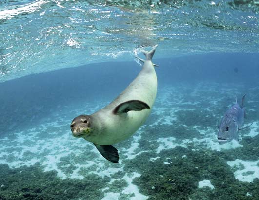
Hawaiian Monk Seal…and friend
The moderately strong trade winds will be increasing a notch or two over the next several days. As a high pressure system to our north moves closer on Wednesday into Thursday, our local trade wind speeds should surge a little, with stronger trade winds occurring into the weekend. These trade winds will likely soften going into the Labor Day holiday, into next week. Small craft wind advisories have been stretched up across all the major channels between the Big island and Oahu…including those windiest coastal waters as well.
The windward sides will find cloudy periods, with showers falling at times…while the leeward sides remain generally dry. There’s an increase in windward showers expected later in the work week, which will occur due to the arrival of an upper level low pressure system. The computer models then show another ridge overhead this coming holiday weekend…which should bring us back around to drier weather then. A tropical disturbance moving by to our south, may bring a few showers to the windward sides Thursday into Friday…especially around the Big Island.
It’s Tuesday evening here in Kihei, Maui, as I begin writing this last section of today’s narrative update. As noted above, the trade winds will be on the rise soon. As a precaution, the NWS office in Honolulu has issued a fire weather watch, which remains in effect from Wednesday morning through Wednesday afternoon. We could see these critical fire weather conditions extend into Thursday. The island of Molokai has had a large fire burning the last couple of days. Speaking of fires, California sure is having some difficult times with forest fires as well.
~~~ Looking out the window here in Kihei before I take the drive back upcountry to Kula, it’s almost completely clear! Blue skies galore is the name of the game for sure. The trade winds are blowing nicely, with the strongest winds as of 5pm, being reported at Maalaea Bay, Maui…with a gust of 38 mph. I would imagine that as the trade winds pick up over the next few days, we’ll see some of those windier locations easily gusting up over the 40 mph mark at times. I’ll be back with you again early Wednesday morning, I hope you have a great Tuesday night until then! Aloha for now…Glenn.
Extra: The great month of September…celebrated by the music group Earth, Wind & Fire!
Interesting: Earth’s oceans are vast reservoirs of carbon dioxide (CO2) with the potential to control the pace of global warming. It all hinges on the fate of marine "snow" — a constant sprinkle of carbon-rich bits that flutter down from the sea surface to the cold depths below.
And according to a new study, the flurries could suck much more of the greenhouse gas out of the atmosphere than previously thought. Each year, phytoplankton floating in the seas’ big blue expanse drink in 10 billion tons of carbon from the air (humans emit about 8 billion tons).
Their shells and excretions rain down from the surface, providing a feast for creatures that recycle up to 90 percent of the carbon back into the water as CO2. Only a light dusting lands on the ocean floor. But small changes in this carbon system have big implications for climate.
Interesting2: China is taking advantage of the green technology revolution that the challenge of climate change provides, according to a new report launched recently by former British Prime Minister Tony Blair in Beijing. The report from The Climate Group shows that China is leading the development and commercialization of a range of low carbon technologies.
With a new breed of entrepreneurs and ambitious government policies, Chinese businesses are amongst the top producers of electric vehicles, wind turbines, solar panels and energy efficient appliances.
Tony Blair, speaking at the launch event in Beijing, said: "China is already playing an important role in producing and consuming those technologies needed to solve the climate change challenge."
"A new global climate agreement will set a route map for this to happen and for our journey to a prosperous low carbon 21st century. As one of the world’s major economic powers, China will have to be at the forefront of this journey. This report shows that it can be."
Interesting3: A wolf hunt is set to begin in Idaho on Tuesday if a federal judge does not stop it. It would be the first time in decades that hunters have been allowed to pursue the gray wolf, an animal that has come to symbolize tensions over how people interact with wilderness in the West.
On Monday, the judge, Donald W. Molloy of Federal District Court, will hold a hearing to determine whether to issue an injunction sought by wildlife advocates against the hunt and reopen the question of returning the wolf to the endangered list.
Gray wolves were taken off the list five months ago, after being protected under federal law for more than 30 years. More than 6,000 hunters in Idaho have bought licenses for the chance to participate in the hunt, in which wildlife officials will allow 220 wolves to be killed. In 2008, the population stood at about 850. Montana will allow 75 animals to be killed, starting Sept. 15.
Interesting4: Carbon dioxide will soon be declared a dangerous pollutant – a move that could help propel slow-moving climate-change legislation on Capitol Hill, the head of the Environmental Protection Agency said Monday. EPA Administrator Lisa Jackson told reporters that a formal "endangerment finding," which would trigger federal regulations on greenhouse gas emissions, probably would "happen in the next months."
Jackson announced her timeline even as top senators said they were delaying plans to introduce legislation that would set new limits on carbon dioxide emissions. Senators had been scheduled to unveil legislation next Tuesday, but the date has now been pushed back to later in September.
The EPA kick-started the regulatory process in April when it proposed declaring carbon dioxide and five other greenhouse gases as pollutants that jeopardize the public health and welfare. EPA scientists believe the greenhouse gases contribute to global warming by trapping heat in the Earth’s atmosphere.
Interesting5: Official rainfall figures have confirmed that south west Scotland has just had its wettest August on record. Statistics recorded at the Met Office’s Eskdalemuir observatory in Dumfries and Galloway also show it was the third wettest month ever. Assistant manager Billy Jagger said one day alone – 20 August – saw 3.25” of rainfall.
He said the total for the month had been 15in – about three times the average for August in the region. "It has been quite bad," said Mr Jagger. "It is the wettest August ever recorded." He added that it was close to beating the Dumfries and Galloway record for monthly rainfall.
"The wettest month ever recorded is February 1997 with 16 inches," said Mr Jagger. "And in January 1928 we had 15.5” so it’s not that far behind the all-time record." The rain has had an impact on many people – none more so than the region’s farmers.
Robin Spence at Roberthill, near Lockerbie, has had to save animals from drowning twice in the past month. "We had a situation 10 days ago where we were swimming cattle out from next to the River Annan because of flooding," he said. "We have never seen that degree of flooding in August before.”
Two or three days later we were doing the same again." He said that as well as the risk to animals, the rain had also flattened crops. "We are just in harvest season just now and the crops that are still to cut are getting very much damaged by the wind and rain."
And, of course, the bad weather has meant that the harvest is way behind." Early prospects for September do not appear much better. The Met Office is advising of a risk of more heavy rain in the region on Wednesday into Thursday with up to 2” possible in places.
Interesting6: The future of the Earth could rest on potentially dangerous and unproven geo-engineering technologies unless emissions of carbon dioxide can be greatly reduced, the latest Royal Society report has found. The report (published September 1, 2009 by the Royal Society, the UK’s national academy of science) found that unless future efforts to reduce greenhouse gas emissions are much more successful than they have been so far, additional action in the form of geo-engineering will be necessary if we are to cool the planet.
Geo-engineering technologies were found to be very likely to be technically possible and some were considered to be potentially useful to augment the continuing efforts to mitigate climate change by reducing emissions. However, the report identified major uncertainties regarding their effectiveness, costs and environmental impacts.
Professor John Shepherd, who chaired the Royal Society’s geo-engineering study, said, “It is an unpalatable truth that unless we can succeed in greatly reducing CO2 emissions we are headed for a very uncomfortable and challenging climate future, and geo-engineering will be the only option left to limit further temperature increases.
Our research found that some geo-engineering techniques could have serious unintended and detrimental effects on many people and ecosystems – yet we are still failing to take the only action that will prevent us from having to rely on them. Geo-engineering and its consequences are the price we may have to pay for failure to act on climate change.”
« Previous Page


