September 2009
Monthly Archive
Posted by Glenn
1 Comment
September 20-21, 2009
Air Temperatures – The following maximum temperatures were recorded across the state of Hawaii Sunday afternoon:
Lihue, Kauai – 83
Honolulu, Oahu 89
Kaneohe, Oahu – 86
Kahului, Maui – 86
Hilo, Hawaii – 81
Kailua-kona – 86
Air Temperatures ranged between these warmest and coolest spots near sea level around the state – and on the highest mountains…at 5 p.m. Sunday evening:
Honolulu, Oahu – 85F
Molokai airport – 80
Haleakala Crater – 52 (near 10,000 feet on Maui)
Mauna Kea summit – 61 (near 14,000 feet on the Big Island)
Precipitation Totals – The following numbers represent the largest precipitation totals (inches) during the last 24 hours on each of the major islands, as of Sunday afternoon:
0.29 Wainiha, Kauai
0.07 Kii, Oahu
0.00 Molokai
0.00 Lanai
0.00 Kahoolawe
0.41 West Wailuaiki, Maui
1.27 Mountain View, Big Island
Marine Winds – Here’s the latest (automatically updated) weather map showing high pressure systems to the north and northeast, with a ridge being pushed southward by an approaching cold front. Weakening trade winds will occur Monday into Tuesday.
Satellite and Radar Images: To view the cloud conditions we have here in Hawaii, please use the following satellite links, starting off with this Infrared Satellite Image of the islands to see all the clouds around the state during the day and night. This next image is one that gives close images of the islands only during the daytime hours, and is referred to as a Close-up visible image. This next image shows a larger view of the Pacific…giving perspective to the wider ranging cloud patterns in the Pacific Ocean. Finally, here’s a Looping IR satellite image, making viewable the clouds around the islands 24 hours a day. To help you keep track of where any showers may be around the islands, here’s the latest animated radar image.
Hawaii’s Mountains – Here’s a link to the live webcam on the summit of near 14,000 foot Mauna Kea on the Big Island of Hawaii. The tallest peak on the island of Maui is the Haleakala Crater, which is near 10,000 feet in elevation. These two webcams are available during the daylight hours here in the islands…and when there’s a big moon rising just after sunset for an hour or two! Plus, during the nights and early mornings you will be able to see stars, and the sunrise too…depending upon weather conditions.
Tropical Cyclone activity in the eastern and central Pacific – Here’s the latest weather information coming out of the National Hurricane Center, covering the eastern north Pacific. You can find the latest tropical cyclone information for the central north Pacific (where Hawaii is located) by clicking on this link to the Central Pacific Hurricane Center. Here’s a tracking map covering both the eastern and central Pacific Ocean. A satellite image, which shows the entire ocean area between Hawaii and the Mexican coast…can be found here.
Aloha Paragraphs

Wild Dolphins…offshore from Maui
Sunday has been a transition day, as we leave the recent light to moderately strong winds behind…grading into a lighter wind episode during the first half of the new week ahead. These trade winds will persist Sunday night, although relax in strength Monday. Our local winds will be noticeably lighter later in the day Monday through the Wednesday time frame. The computer models point out that by Thursday, the trade winds will return, and become fairly strong and gusty again Friday into next weekend.
Our trade wind producing ridge of high pressure is in the process of being pushed south towards the islands over the next couple of days…by an advancing early season cold front. This in turn will cause our trade winds to perhaps give way completely…into light and variable winds. If the ridge moves over the islands, we may begin to see some volcanic haze spreading up the island chain. The daytime sea breezes will keep us feeling warm and muggy during the days, while the offshore flowing land breezes at night…will bring slightly cooler early morning temperatures our way.
The mostly modest increase in showers we’ve seen lately haven’t been all that big a deal, although if you live along the windward sides…you may have noticed them…especially on the Big Island. This satellite image shows that a few more showers will ride up the windward sides of the other islands Sunday night into early Monday morning…especially from about Maui up through the island chain to Kauai.
As we move into the upcoming new week, we’ll find at least one early season cold front trying to push southward towards our islands. It may come close enough to drop a few showers on Kauai, but that’s becoming less likely now. The lighter winds though will set up those daytime sea breezes, and cause cloudy afternoons in the upcountry areas…with a few showers. As the trade winds return later during the new week, the focus for showers will shift back over to the windward sides.
I drove down to Hookipa Beach Park Saturday morning, to help out on a beach clean up. There were several organizations that put together this International Coastal Cleanup Day event, Get the Drift and Bag It, at both Honolua Bay, and Hookipa Beach Park. It was good to join in with other interested people to pick up the junk that floats into these beautiful beach areas here on Maui, and in other areas around the nation. I found that it wasn’t so much the stuff that floats in, but more the trash that gets deposited along our beaches that I found. In particular, there were lots of rusty beer bottle tops, and old cigarette butts. The butts were what I saw most of, and made me realize that some people don’t think, when they flick their burned down cigarettes away. Come on folks, the beach is not a place to leave those butts, as they can easily get into the ocean. ~~~ I found Hookipa to be very clean actually, and with a sack that was mostly empty, I drove down to the Buddhist Temple in Paia, across from the Paia Community Center, and walked out on that ‘little used’ sandy beach. I found all kinds of stuff there, and felt better about throwing my nearly full sack in a dumpster after that collection effort. What can I say? Please, when you go to the beach, or out into nature somewhere, please flick the spent tobacco out of your cigarettes, if you smoke, and take those used filters to a proper trash container. Thanks for doing the right thing!
It’s Sunday evening here in Kula, Maui, as I begin writing this last paragraph of today’s narrative. Sunday was another generally nice day, just the way almost all of our days have been so far this month. September has turned out to be one of the better months this year. Perhaps the main thing has been that we’ve not seen any tropical cyclones, despite the fact that we are still involved in the hurricane season here in the central north Pacific. I’ll be back early Monday morning with your next new weather narrative, I hope you have a great Sunday night until then! Aloha for now…Glenn.
Interesting: Earthquakes, volcanic eruptions, giant landslides and tsunamis may become more frequent as global warming changes the earth’s crust, scientists said recently. Climate-linked geological changes may also trigger "methane burps", the release of a potent greenhouse gas, currently stored in solid form under melting permafrost and the seabed, in quantities greater than all the carbon dioxide (CO2) in our air today.
"Climate change doesn’t just affect the atmosphere and the oceans but the earth’s crust as well. The whole earth is an interactive system," Professor Bill McGuire of University College London told Reuters, at the first major conference of scientists researching the changing climate’s effects on geological hazards.
"In the political community people are almost completely unaware of any geological aspects to climate change." The vulcanologists, seismologists, glaciologists, climatologists and landslide experts at the meeting have looked to the past to try to predict future changes, particularly to climate upheaval at the end of the last ice age, some 12,000 years ago.
"When the ice is lost, the earth’s crust bounces back up again and that triggers earthquakes, which trigger submarine landslides, which cause tsunamis," said McGuire, who organised the three-day conference. David Pyle of Oxford University said small changes in the mass of the earth’s surface seems to affect volcanic activity in general, not just in places where ice receded after a cold spell.
Weather patterns also seem to affect volcanic activity – not just the other way round, he told the conference. Behind him was a slide of a dazzlingly bright orange painting, "London sunset after Krakatau, 1883" – referring to a huge Asian volcanic eruption whose effects were seen and felt around the world.
Volcanoes can spew vast amounts of ash, sulphur, carbon dioxide and water into the upper atmosphere, reflecting sunlight and sometimes cooling the earth for a couple of years. But too many eruptions, too close together, may have the opposite effect and quicken global warming, said U.S. vulcanologist Peter Ward.
"Prior to man, the most abrupt climate change was initiated by volcanoes, but now man has taken over. Understanding why and how volcanoes did it will help man figure out what to do," he said. Speakers were careful to point out that many findings still amounted only to hypotheses, but said evidence appeared to be mounting that the world could be in for shocks on a vast scale.
Tony Song of NASA’s Jet Propulsion Laboratory in California warned of the vast power of recently discovered "glacial earthquakes" — in which glacial ice mass crashes downwards like an enormous landslide. In the West Antarctic, ice piled more than one mile (1.5 km) above sea level is being undermined in places by water seeping in underneath.
"Our experiments show that glacial earthquakes can generate far more powerful tsunamis than undersea earthquakes with similar magnitude," said Song. "Several high-latitude regions, such as Chile, New Zealand and Canadian Newfoundland are particularly at risk." He said ice sheets appeared to be disintegrating much more rapidly than thought and said glacial earthquake tsunamis were "low-probability but high-risk".
McGuire said the possible geological hazards were alarming enough, but just one small part of a scary picture if man-made CO2 emissions were not stabilised within around the next five years."Added to all the rest of the mayhem and chaos, these things would just be the icing on the cake," he said. "Things would be so bad that the odd tsunami or eruption won’t make much difference."
Interesting2: In the Fall of 2007, tens of thousands of small arctic geese called Pacific brant (Branta bernicla nigricans) decided not to go south for the winter. For these long-haul migratory birds, it was a dramatic choice — they usually spend the cold months munching their favorite eel grass in the waters off Mexico’s Baja peninsula.
But changes in Earth’s climate have so affected them that the barren windswept lagoons of western Alaska are looking more and more appealing. The trend is likely to continue, according to a new study, affecting not only brant but a host of migratory birds around the globe.
David Ward of the United States Geological Survey in Anchorage has been studying brant behavior for nearly three decades. When he began back in the 1970s, only around 4000 birds toughed out the winter in Izembek Lagoon, a 25-mile long stretch of protected water on the Alaska Peninsula.
Two autumns ago, the number had climbed to 40,000 — nearly 30 percent of the total population. "The birds normally wait for a storm system to come down through the Aleutians," Ward said. "They catch the tail winds down south. But the track of storm systems is a little different now."
Changing winds have been accompanied by warmer weather, which means less ice covering Izembek’s eel grass-rich waters. It’s a buffet for the brant, which can feast through the winter without having to make the arduous journey several thousand miles south and back.
Come spring they are the first birds back to the breeding grounds, and often the most successful at raising their young. In fact, conditions are so good that the geese run the risk of overpopulating, according to Robert Trost of the U.S. Fish and Wildlife Service in Portland, Ore.
The Pacific brant population hasn’t grown much in size over the years, but an increasing food supply could lead to an explosion of birds in the next few years. "Throughout North America and parts of Asia, geese are most influenced by springtime conditions," he said. As spring thaws creep earlier in the calendar, geese will be able to raise larger clutches of young.
The honeymoon isn’t likely to last. Brant and many other species that live on coastlines could soon see their habitats flooded by sea level rise and swallowed by rampant erosion, two consequences of human-induced global warming. "Right now it’s conjecture to say what the long-term impact will be, but the prognosis is not so good," Trost said.
Interesting3: In the late 1920s, people intentionally introduced birds known as Japanese white-eyes into Hawaiian agricultural lands and gardens for purposes of bug control. Now, that decision has come back to bite us. A recent increase in the numbers of white-eyes that live in old-growth forests is leaving native bird species with too little to eat, according to a report published online on September 17th in Current Biology, a Cell Press publication.
The findings show that introduced species can alter whole communities in significant ways and cause visible harm to the birds that manage to survive. "Native Hawaiian songbirds cannot rear normal-size offspring in the presence of large numbers of introduced Japanese white-eyes," said Leonard Freed of the University of Hawaii at Manoa.
"Their growth is stunted." "Just as there are permanent effects of stunted growth in human children, there are permanent effects in adult birds," added Rebecca Cann, also of the University of Hawaii at Manoa. "Birds cannot use their shorter bills to feed efficiently for themselves or when feeding their young.
Stunted birds have higher death rates than normal size birds. The Japanese white-eye is causing this problem for native Hawaiian birds by depleting the food available for growth, survival, and breeding." Undernourished birds are left more susceptible to other threats, including infectious diseases.
"Birds can only tolerate malaria if they have adequate nutrition to mount an immune response," Freed said. "They can only tolerate chewing lice if they have adequate nutrition to replace heat lost through plumage degraded by the lice." The threat posed by the white-eyes came as a surprise to the researchers.
That’s because over more than a decade of study, it had seemed as though the white-eyes were living in peaceful coexistence with other birds, including the endangered Hawaii akepa. But sometime after the year 2000, the researchers began to notice that young akepa were disappearing.
The akepa fledglings that were seen were noticeably underweight. Other native birds had many broken wing and tail feathers—a sign of malnutrition—and suffered from a major increase in chewing lice. The researchers sounded an alarm, alerting the US Fish and Wildlife Service of the problem, but nothing was done, and two-thirds of the akepa in their long-term study site had disappeared by 2006.
Although Hawaiian birds face many threats, such as malaria, yellow-jacket wasps, and parasitoid wasps escaped from biological control of insects, the researchers were able to show that the white-eyes are most likely responsible for the decline of 7 of 8 native forest birds in a major portion of a national wildlife refuge.
Young birds in a site with fewer white-eyes continued to grow normally, they found, despite potentially greater challenges from malaria and parasitoids. In other parts of Hawaii where white-eyes are flourishing, native species are suffering a similar fate. The white-eyes are yet another example of the threats that introduced species can pose.
When white-eyes were introduced, "no one at that time could have imagined that they would invade native forests," Cann said. "This is a problem with all introduced species. It is impossible to predict how they will respond to the new environment.
The white-eye is a member of a bird family famous for expanding its range and consuming new types of prey, even to the point that individuals that colonize a new habitat may vary among themselves in the prey items they consume. But that was not known in 1929." Even today, Freed said, foreign species continue to be put to work in risky ways.
"Right now, realtors are using alien catfish to clean up the algae-ridden swimming pools of abandoned foreclosed houses in Florida. What if some escape during a flood into streams and lakes?" The researchers include Leonard A. Freed, and Rebecca L. Cann, of the University of Hawaii at Manoa, Honolulu, Hawaii.
Interesting5: Poor Pluto. First it gets kicked out of the planet club, now it’s not even the coldest place in the solar system. Dark craters near the moon’s south pole have snatched that title – which is good news for the prospects of finding water ice on Earth’s companion. The craters’ towering rims block the sun from reaching their centers, like the long shadows cast by tall buildings at dusk.
In this permanent darkness, they stay at a constant -240 °Celsius – more than 30 °C above absolute zero and 10 °C cooler than Pluto, which was measured at -230 °C in 2006. "The lunar south pole is among the coldest parts of the solar system and may be in fact colder than what we expect from places like Pluto," NASA scientist Richard Vondrak said at a press conference on Thursday.
The cold temperature bodes well for the prospect of finding water ice deposits in the moon’s shadowy pockets. Previous calculations had shown that water and other volatile gases would dissipate into space at temperatures above about -220 °C. The measurements come from NASA’s Lunar Reconnaissance Orbiter (LRO), which launched in June.
The satellite’s temperature sensor, DIVINER, measures the amount of emitted and reflected radiation given off by the surface. LRO has a number of other instruments designed to map properties such as topography and neutron levels – another possible indicator of water.
In July, the satellite sent back pictures of the Apollo landing sites to commemorate the 40th anniversary of humans on the moon. On Thursday, LRO’s primary mission began to collect data that could be used to plan a possible return to the moon.
The temperature finding raises hopes that NASA’s other current lunar satellite mission, LCROSS, the Lunar Crater Observation and Sensing Satellite, will find evidence of water when it crashes into a crater near the moon’s south pole on 9 October.
Posted by Glenn
[2] Comments
September 19-20, 2009
Air Temperatures – The following maximum temperatures were recorded across the state of Hawaii Saturday afternoon:
Lihue, Kauai – 85
Honolulu, Oahu 89
Kaneohe, Oahu – 85
Kahului, Maui – 87
Hilo, Hawaii – 83
Kailua-kona – 88
Air Temperatures ranged between these warmest and coolest spots near sea level around the state – and on the highest mountains…at 5 p.m. Saturday evening:
Honolulu, Oahu – 86F
Lihue, Kauai – 79
Haleakala Crater – 52 (near 10,000 feet on Maui)
Mauna Kea summit – 52 (near 14,000 feet on the Big Island)
Precipitation Totals – The following numbers represent the largest precipitation totals (inches) during the last 24 hours on each of the major islands, as of Saturday afternoon:
0.83 Mount Waialeale, Kauai
0.05 Poamoho 2, Oahu
0.00 Molokai
0.00 Lanai
0.00 Kahoolawe
0.01 Oheo Gulch, Maui
0.15 Laupahoehoe, Big Island
Marine Winds – Here’s the latest (automatically updated) weather map showing high pressure systems to the northeast, and far northwest. Ridges that are connecting these high pressure cells, to our north, will keep breezy trade winds blowing through Sunday…becoming lighter Monday.
Satellite and Radar Images: To view the cloud conditions we have here in Hawaii, please use the following satellite links, starting off with this Infrared Satellite Image of the islands to see all the clouds around the state during the day and night. This next image is one that gives close images of the islands only during the daytime hours, and is referred to as a Close-up visible image. This next image shows a larger view of the Pacific…giving perspective to the wider ranging cloud patterns in the Pacific Ocean. Finally, here’s a Looping IR satellite image, making viewable the clouds around the islands 24 hours a day. To help you keep track of where any showers may be around the islands, here’s the latest animated radar image.
Hawaii’s Mountains – Here’s a link to the live webcam on the summit of near 14,000 foot Mauna Kea on the Big Island of Hawaii. The tallest peak on the island of Maui is the Haleakala Crater, which is near 10,000 feet in elevation. These two webcams are available during the daylight hours here in the islands…and when there’s a big moon rising just after sunset for an hour or two! Plus, during the nights and early mornings you will be able to see stars, and the sunrise too…depending upon weather conditions.
Tropical Cyclone activity in the eastern and central Pacific – Here’s the latest weather information coming out of the National Hurricane Center, covering the eastern north Pacific. You can find the latest tropical cyclone information for the central north Pacific (where Hawaii is located) by clicking on this link to the Central Pacific Hurricane Center. Here’s a tracking map covering both the eastern and central Pacific Ocean. A satellite image, which shows the entire ocean area between Hawaii and the Mexican coast…can be found here.
Aloha Paragraphs

The beautiful Island of Oahu
We remain in a well established trade wind weather pattern Saturday night, with light to moderately strong winds prevailing into Sunday…becoming lighter during the new week ahead. The trade winds have eased up enough Saturday, that small craft wind advisories have been dropped from those typically windier areas around Maui and the Big Island. These trade winds will persist Sunday, although relax in strength once we get into the new work week ahead.
The computer models continue to show our trade wind producing ridge of high pressure sliding down near the island of Kauai Tuesday through Thursday. This in turn will cause our trade winds to give way completely, or close to that…into light and variable winds. If the ridge gets close enough, we may begin to see some possible volcanic haze spreading up the island chain for several days. The trade winds are expected to increase in strength again towards Friday into next weekend.
The light to moderately strong trade winds will carry a few showers our way, although nothing heavy is expected in terms of precipitation through Sunday. The chance for a minor increase in showers later tonight into Sunday won’t be noticed by many, although if you live along the windward sides…there may be a few more showers falling than we’ve seen lately. This satellite image shows that those few showers will arrive first on the Big Island, and ride up the windward sides of the other islands into Sunday.
As we move into the upcoming new week, we’ll find at least one early season cold front trying to push southward towards our islands. It may come close enough to drop a few showers on Kauai, but that’s still uncertain. The lighter winds though will set up daytime sea breezes, and cause cloudy afternoons in the upcountry areas…with a few showers. As the trade winds return later during the new week, the focus for showers will ride back over to the windward sides.
Friday evening I went to see a new film at the Maui Arts and Cultural Center, called The Girl from Monaco (2009). This is what’s being written about it: set in the photogenic principality of Monaco, this uncommonly shrewd and funny farce about a famous defense lawyer, whose life is turned upside-down as a result of his infatuation with a stunning blonde beauty played by newcomer Louise Bourgoin-who is undeniably the most mouthwatering cinematic eye-candy from France since Catherine Deneuve first graced the silver screen-is a "pitch perfect treat for movie-goers who appreciate story, character and crisp dialogue" according to The Hollywood Reporter. I thought it was a good film, rather engaging generally, and of course the leading lady was very fun to look at! I could give this film a solid B grade. Here’s a trailer in case you’re interested.
I drove down to Hookipa Beach Park Saturday morning, to help out on a beach clean up. There were several organizations that put together this International Coastal Cleanup Day event, Get the Drift and Bag It, at both Honolua Bay, and Hookipa Beach Park. It was good to join in with other interested people to pick up the junk that floats into these beautiful beach areas here on Maui, and in other areas around the nation. I found that it wasn’t so much the stuff that floats in, but more the trash that gets deposited along our beaches that I found. In particular, there were lots of rusty beer bottle tops, and old cigarette butts. The butts were what I saw most of, and made me realize that some people don’t think, when they flick their burned down cigarettes away. Come on folks, the beach is not a place to leave those butts, as they can easily get into the ocean. ~~~ I found Hookipa to be very clean actually, and with a sack that was mostly empty, I drove down to the Buddhist Temple in Paia, across from the Paia Community Center, and walked out on that ‘little used’ sandy beach. I found all kinds of stuff there, and felt better about throwing my nearly full sack in a dumpster after that collection effort. What can I say? Please, when you go to the beach, or out into nature somewhere, please flick the spent tobacco out of your cigarettes, if you smoke, and take those used filters to a proper trash container. Thanks for doing the right thing!
It’s early Saturday evening here in Kula, Maui, as I begin writing this last paragraph of today’s narrative. What a great day, the weather was near perfect! It’s almost sunset and I want to get out there and be with it. Before I head out on the deck for that though, I want to share with you a wonderful book that I’m reading, called The School of Essential Ingredients, written by Erica Bauermeister. The truth is that I love this book, it’s so sweet, a book that gives evocative lessons that food can teach us about life. ~~~ I’ll be back with you Sunday morning, with your next new weather narrative from paradise. I hope you have a great Saturday night until then! Aloha for now…Glenn.
Interesting: Earthquakes, volcanic eruptions, giant landslides and tsunamis may become more frequent as global warming changes the earth’s crust, scientists said recently. Climate-linked geological changes may also trigger "methane burps", the release of a potent greenhouse gas, currently stored in solid form under melting permafrost and the seabed, in quantities greater than all the carbon dioxide (CO2) in our air today.
"Climate change doesn’t just affect the atmosphere and the oceans but the earth’s crust as well. The whole earth is an interactive system," Professor Bill McGuire of University College London told Reuters, at the first major conference of scientists researching the changing climate’s effects on geological hazards.
"In the political community people are almost completely unaware of any geological aspects to climate change." The vulcanologists, seismologists, glaciologists, climatologists and landslide experts at the meeting have looked to the past to try to predict future changes, particularly to climate upheaval at the end of the last ice age, some 12,000 years ago.
"When the ice is lost, the earth’s crust bounces back up again and that triggers earthquakes, which trigger submarine landslides, which cause tsunamis," said McGuire, who organised the three-day conference. David Pyle of Oxford University said small changes in the mass of the earth’s surface seems to affect volcanic activity in general, not just in places where ice receded after a cold spell.
Weather patterns also seem to affect volcanic activity – not just the other way round, he told the conference. Behind him was a slide of a dazzlingly bright orange painting, "London sunset after Krakatau, 1883" – referring to a huge Asian volcanic eruption whose effects were seen and felt around the world.
Volcanoes can spew vast amounts of ash, sulphur, carbon dioxide and water into the upper atmosphere, reflecting sunlight and sometimes cooling the earth for a couple of years. But too many eruptions, too close together, may have the opposite effect and quicken global warming, said U.S. vulcanologist Peter Ward.
"Prior to man, the most abrupt climate change was initiated by volcanoes, but now man has taken over. Understanding why and how volcanoes did it will help man figure out what to do," he said. Speakers were careful to point out that many findings still amounted only to hypotheses, but said evidence appeared to be mounting that the world could be in for shocks on a vast scale.
Tony Song of NASA’s Jet Propulsion Laboratory in California warned of the vast power of recently discovered "glacial earthquakes" — in which glacial ice mass crashes downwards like an enormous landslide. In the West Antarctic, ice piled more than one mile (1.5 km) above sea level is being undermined in places by water seeping in underneath.
"Our experiments show that glacial earthquakes can generate far more powerful tsunamis than undersea earthquakes with similar magnitude," said Song. "Several high-latitude regions, such as Chile, New Zealand and Canadian Newfoundland are particularly at risk." He said ice sheets appeared to be disintegrating much more rapidly than thought and said glacial earthquake tsunamis were "low-probability but high-risk".
McGuire said the possible geological hazards were alarming enough, but just one small part of a scary picture if man-made CO2 emissions were not stabilised within around the next five years."Added to all the rest of the mayhem and chaos, these things would just be the icing on the cake," he said. "Things would be so bad that the odd tsunami or eruption won’t make much difference."
Interesting2: In the Fall of 2007, tens of thousands of small arctic geese called Pacific brant (Branta bernicla nigricans) decided not to go south for the winter. For these long-haul migratory birds, it was a dramatic choice — they usually spend the cold months munching their favorite eel grass in the waters off Mexico’s Baja peninsula.
But changes in Earth’s climate have so affected them that the barren windswept lagoons of western Alaska are looking more and more appealing. The trend is likely to continue, according to a new study, affecting not only brant but a host of migratory birds around the globe.
David Ward of the United States Geological Survey in Anchorage has been studying brant behavior for nearly three decades. When he began back in the 1970s, only around 4000 birds toughed out the winter in Izembek Lagoon, a 25-mile long stretch of protected water on the Alaska Peninsula.
Two autumns ago, the number had climbed to 40,000 — nearly 30 percent of the total population. "The birds normally wait for a storm system to come down through the Aleutians," Ward said. "They catch the tail winds down south. But the track of storm systems is a little different now."
Changing winds have been accompanied by warmer weather, which means less ice covering Izembek’s eel grass-rich waters. It’s a buffet for the brant, which can feast through the winter without having to make the arduous journey several thousand miles south and back.
Come spring they are the first birds back to the breeding grounds, and often the most successful at raising their young. In fact, conditions are so good that the geese run the risk of overpopulating, according to Robert Trost of the U.S. Fish and Wildlife Service in Portland, Ore.
The Pacific brant population hasn’t grown much in size over the years, but an increasing food supply could lead to an explosion of birds in the next few years. "Throughout North America and parts of Asia, geese are most influenced by springtime conditions," he said. As spring thaws creep earlier in the calendar, geese will be able to raise larger clutches of young.
The honeymoon isn’t likely to last. Brant and many other species that live on coastlines could soon see their habitats flooded by sea level rise and swallowed by rampant erosion, two consequences of human-induced global warming. "Right now it’s conjecture to say what the long-term impact will be, but the prognosis is not so good," Trost said.
Interesting3: In the late 1920s, people intentionally introduced birds known as Japanese white-eyes into Hawaiian agricultural lands and gardens for purposes of bug control. Now, that decision has come back to bite us. A recent increase in the numbers of white-eyes that live in old-growth forests is leaving native bird species with too little to eat, according to a report published online on September 17th in Current Biology, a Cell Press publication.
The findings show that introduced species can alter whole communities in significant ways and cause visible harm to the birds that manage to survive. "Native Hawaiian songbirds cannot rear normal-size offspring in the presence of large numbers of introduced Japanese white-eyes," said Leonard Freed of the University of Hawaii at Manoa.
"Their growth is stunted." "Just as there are permanent effects of stunted growth in human children, there are permanent effects in adult birds," added Rebecca Cann, also of the University of Hawaii at Manoa. "Birds cannot use their shorter bills to feed efficiently for themselves or when feeding their young.
Stunted birds have higher death rates than normal size birds. The Japanese white-eye is causing this problem for native Hawaiian birds by depleting the food available for growth, survival, and breeding." Undernourished birds are left more susceptible to other threats, including infectious diseases.
"Birds can only tolerate malaria if they have adequate nutrition to mount an immune response," Freed said. "They can only tolerate chewing lice if they have adequate nutrition to replace heat lost through plumage degraded by the lice." The threat posed by the white-eyes came as a surprise to the researchers.
That’s because over more than a decade of study, it had seemed as though the white-eyes were living in peaceful coexistence with other birds, including the endangered Hawaii akepa. But sometime after the year 2000, the researchers began to notice that young akepa were disappearing.
The akepa fledglings that were seen were noticeably underweight. Other native birds had many broken wing and tail feathers—a sign of malnutrition—and suffered from a major increase in chewing lice. The researchers sounded an alarm, alerting the US Fish and Wildlife Service of the problem, but nothing was done, and two-thirds of the akepa in their long-term study site had disappeared by 2006.
Although Hawaiian birds face many threats, such as malaria, yellow-jacket wasps, and parasitoid wasps escaped from biological control of insects, the researchers were able to show that the white-eyes are most likely responsible for the decline of 7 of 8 native forest birds in a major portion of a national wildlife refuge.
Young birds in a site with fewer white-eyes continued to grow normally, they found, despite potentially greater challenges from malaria and parasitoids. In other parts of Hawaii where white-eyes are flourishing, native species are suffering a similar fate. The white-eyes are yet another example of the threats that introduced species can pose.
When white-eyes were introduced, "no one at that time could have imagined that they would invade native forests," Cann said. "This is a problem with all introduced species. It is impossible to predict how they will respond to the new environment.
The white-eye is a member of a bird family famous for expanding its range and consuming new types of prey, even to the point that individuals that colonize a new habitat may vary among themselves in the prey items they consume. But that was not known in 1929." Even today, Freed said, foreign species continue to be put to work in risky ways.
"Right now, realtors are using alien catfish to clean up the algae-ridden swimming pools of abandoned foreclosed houses in Florida. What if some escape during a flood into streams and lakes?" The researchers include Leonard A. Freed, and Rebecca L. Cann, of the University of Hawaii at Manoa, Honolulu, Hawaii.
Interesting5: Poor Pluto. First it gets kicked out of the planet club, now it’s not even the coldest place in the solar system. Dark craters near the moon’s south pole have snatched that title – which is good news for the prospects of finding water ice on Earth’s companion. The craters’ towering rims block the sun from reaching their centers, like the long shadows cast by tall buildings at dusk.
In this permanent darkness, they stay at a constant -240 °Celsius – more than 30 °C above absolute zero and 10 °C cooler than Pluto, which was measured at -230 °C in 2006. "The lunar south pole is among the coldest parts of the solar system and may be in fact colder than what we expect from places like Pluto," NASA scientist Richard Vondrak said at a press conference on Thursday.
The cold temperature bodes well for the prospect of finding water ice deposits in the moon’s shadowy pockets. Previous calculations had shown that water and other volatile gases would dissipate into space at temperatures above about -220 °C. The measurements come from NASA’s Lunar Reconnaissance Orbiter (LRO), which launched in June.
The satellite’s temperature sensor, DIVINER, measures the amount of emitted and reflected radiation given off by the surface. LRO has a number of other instruments designed to map properties such as topography and neutron levels – another possible indicator of water.
In July, the satellite sent back pictures of the Apollo landing sites to commemorate the 40th anniversary of humans on the moon. On Thursday, LRO’s primary mission began to collect data that could be used to plan a possible return to the moon.
The temperature finding raises hopes that NASA’s other current lunar satellite mission, LCROSS, the Lunar Crater Observation and Sensing Satellite, will find evidence of water when it crashes into a crater near the moon’s south pole on 9 October.
Posted by Glenn
No Comments
September 18-19, 2009
Air Temperatures – The following maximum temperatures were recorded across the state of Hawaii Friday afternoon:
Lihue, Kauai – 85
Honolulu, Oahu 90
Kaneohe, Oahu – 85
Kahului, Maui – 89
Hilo, Hawaii – 84
Kailua-kona – 87
Air Temperatures ranged between these warmest and coolest spots near sea level around the state – and on the highest mountains…at 5 p.m. Friday evening:
Barking Sands – 86F
Hilo, Hawaii – 80
Haleakala Crater – 59 (near 10,000 feet on Maui)
Mauna Kea summit – 59 (near 14,000 feet on the Big Island)
Precipitation Totals – The following numbers represent the largest precipitation totals (inches) during the last 24 hours on each of the major islands, as of Friday afternoon:
1.75 Mount Waialeale, Kauai
0.88 Oahu Forest NWR, Oahu
0.45 Molokai
0.08 Lanai
0.08 Kahoolawe
1.72 Puu Kukui, Maui
0.74 Glenwood, Big Island
Marine Winds – Here’s the latest (automatically updated) weather map showing high pressure systems to the northeast, and far northwest. Ridges that are connecting these high pressure cells, to our north…will keep breezy trade winds blowing through Sunday.
Satellite and Radar Images: To view the cloud conditions we have here in Hawaii, please use the following satellite links, starting off with this Infrared Satellite Image of the islands to see all the clouds around the state during the day and night. This next image is one that gives close images of the islands only during the daytime hours, and is referred to as a Close-up visible image. This next image shows a larger view of the Pacific…giving perspective to the wider ranging cloud patterns in the Pacific Ocean. Finally, here’s a Looping IR satellite image, making viewable the clouds around the islands 24 hours a day. To help you keep track of where any showers may be around the islands, here’s the latest animated radar image.
Hawaii’s Mountains – Here’s a link to the live webcam on the summit of near 14,000 foot Mauna Kea on the Big Island of Hawaii. The tallest peak on the island of Maui is the Haleakala Crater, which is near 10,000 feet in elevation. These two webcams are available during the daylight hours here in the islands…and when there’s a big moon rising just after sunset for an hour or two! Plus, during the nights and early mornings you will be able to see stars, and the sunrise too…depending upon weather conditions.
Tropical Cyclone activity in the eastern and central Pacific – Here’s the latest weather information coming out of the National Hurricane Center, covering the eastern north Pacific. You can find the latest tropical cyclone information for the central north Pacific (where Hawaii is located) by clicking on this link to the Central Pacific Hurricane Center. Here’s a tracking map covering both the eastern and central Pacific Ocean. A satellite image, which shows the entire ocean area between Hawaii and the Mexican coast…can be found here.
Aloha Paragraphs

Red lava and sunset…on the Big Island
We remain in a well established trade wind weather pattern, with moderately strong winds prevailing…becoming lighter next week. The trade winds are still strong enough to keep small craft wind advisories active across the southern channels, and the Maalaea Bay on Maui too. These trade winds will persist for the time being, although relax in strength once we get into the new work week ahead. The trade winds are expected to increase in strength again towards the end of next week.
The locally gusty trade winds will carry a few showers our way, although nothing serious is expected in terms of precipitation through the weekend. The trade winds will pick up showers at times from over the ocean to our east, carrying them towards the windward sides of the islands. The leeward sections will remain dry for the most part.
As we move into the upcoming new week, we’ll find one or two early season cold fronts trying to push southward, although they won’t reach our islands. They will come close enough though, that our trade wind producing ridge of high pressure will move south towards Hawaii. This in turn will soften our trade winds, and probably give us a few afternoon upcountry showers. Otherwise, there will be just those usual windward biased showers in the lighter trade wind flow at times.
I’m going to see a film this evening at the Maui Arts and Cultural Center, called The Girl from Monaco (2009). It looks like a good one, and this is what’s being written about it: set in the photogenic principality of Monaco, this uncommonly shrewd and funny farce about a famous defense lawyer, whose life is turned upside-down as a result of his infatuation with a stunning blonde beauty played by newcomer Louise Bourgoin-who is undeniably the most mouthwatering cinematic eye-candy from France since Catherine Deneuve first graced the silver screen-is a "pitch perfect treat for movie-goers who appreciate story, character and crisp dialogue" according to The Hollywood Reporter. I’ll let you know what I think about this film Saturday morning, when I return online. Here’s a trailer in case you are interested.
It’s early Friday evening here in Kihei, Maui, as I begin writing this last paragraph of today’s narrative. Looking out the window before I leave Kihei for the drive over to Kahului, to the Maui Arts and Cultural Center, I see generally clear skies outside. The trade winds are blowing briskly, but I know the air temperature is in the 80F’s. I have a plan to drive over to Hookipa Beach Park Saturday morning, to help out on a beach clean up…conducted by the Surfrider Foundation. Surfrider Maui has joined the coalition of Maui marine conservation
and community groups in support of the International Coastal Cleanup Day event, Get the Drift and Bag It, scheduled for 8 to 11 a.m. Saturday, September 19, 2009 at both Honolua Bay and Hookipa Beach Park. I’ll be back early Saturday morning with your next new weather narrative. I hope you have a great Friday night wherever you happen to be spending it! Aloha for now…Glenn.
Interesting: Earthquakes, volcanic eruptions, giant landslides and tsunamis may become more frequent as global warming changes the earth’s crust, scientists said recently. Climate-linked geological changes may also trigger "methane burps", the release of a potent greenhouse gas, currently stored in solid form under melting permafrost and the seabed, in quantities greater than all the carbon dioxide (CO2) in our air today.
"Climate change doesn’t just affect the atmosphere and the oceans but the earth’s crust as well. The whole earth is an interactive system," Professor Bill McGuire of University College London told Reuters, at the first major conference of scientists researching the changing climate’s effects on geological hazards.
"In the political community people are almost completely unaware of any geological aspects to climate change." The vulcanologists, seismologists, glaciologists, climatologists and landslide experts at the meeting have looked to the past to try to predict future changes, particularly to climate upheaval at the end of the last ice age, some 12,000 years ago.
"When the ice is lost, the earth’s crust bounces back up again and that triggers earthquakes, which trigger submarine landslides, which cause tsunamis," said McGuire, who organised the three-day conference. David Pyle of Oxford University said small changes in the mass of the earth’s surface seems to affect volcanic activity in general, not just in places where ice receded after a cold spell.
Weather patterns also seem to affect volcanic activity – not just the other way round, he told the conference. Behind him was a slide of a dazzlingly bright orange painting, "London sunset after Krakatau, 1883" – referring to a huge Asian volcanic eruption whose effects were seen and felt around the world.
Volcanoes can spew vast amounts of ash, sulphur, carbon dioxide and water into the upper atmosphere, reflecting sunlight and sometimes cooling the earth for a couple of years. But too many eruptions, too close together, may have the opposite effect and quicken global warming, said U.S. vulcanologist Peter Ward.
"Prior to man, the most abrupt climate change was initiated by volcanoes, but now man has taken over. Understanding why and how volcanoes did it will help man figure out what to do," he said. Speakers were careful to point out that many findings still amounted only to hypotheses, but said evidence appeared to be mounting that the world could be in for shocks on a vast scale.
Tony Song of NASA’s Jet Propulsion Laboratory in California warned of the vast power of recently discovered "glacial earthquakes" — in which glacial ice mass crashes downwards like an enormous landslide. In the West Antarctic, ice piled more than one mile (1.5 km) above sea level is being undermined in places by water seeping in underneath.
"Our experiments show that glacial earthquakes can generate far more powerful tsunamis than undersea earthquakes with similar magnitude," said Song. "Several high-latitude regions, such as Chile, New Zealand and Canadian Newfoundland are particularly at risk." He said ice sheets appeared to be disintegrating much more rapidly than thought and said glacial earthquake tsunamis were "low-probability but high-risk".
McGuire said the possible geological hazards were alarming enough, but just one small part of a scary picture if man-made CO2 emissions were not stabilised within around the next five years."Added to all the rest of the mayhem and chaos, these things would just be the icing on the cake," he said. "Things would be so bad that the odd tsunami or eruption won’t make much difference."
Interesting2: In the Fall of 2007, tens of thousands of small arctic geese called Pacific brant (Branta bernicla nigricans) decided not to go south for the winter. For these long-haul migratory birds, it was a dramatic choice — they usually spend the cold months munching their favorite eel grass in the waters off Mexico’s Baja peninsula.
But changes in Earth’s climate have so affected them that the barren windswept lagoons of western Alaska are looking more and more appealing. The trend is likely to continue, according to a new study, affecting not only brant but a host of migratory birds around the globe.
David Ward of the United States Geological Survey in Anchorage has been studying brant behavior for nearly three decades. When he began back in the 1970s, only around 4000 birds toughed out the winter in Izembek Lagoon, a 25-mile long stretch of protected water on the Alaska Peninsula.
Two autumns ago, the number had climbed to 40,000 — nearly 30 percent of the total population. "The birds normally wait for a storm system to come down through the Aleutians," Ward said. "They catch the tail winds down south. But the track of storm systems is a little different now."
Changing winds have been accompanied by warmer weather, which means less ice covering Izembek’s eel grass-rich waters. It’s a buffet for the brant, which can feast through the winter without having to make the arduous journey several thousand miles south and back.
Come spring they are the first birds back to the breeding grounds, and often the most successful at raising their young. In fact, conditions are so good that the geese run the risk of overpopulating, according to Robert Trost of the U.S. Fish and Wildlife Service in Portland, Ore.
The Pacific brant population hasn’t grown much in size over the years, but an increasing food supply could lead to an explosion of birds in the next few years. "Throughout North America and parts of Asia, geese are most influenced by springtime conditions," he said. As spring thaws creep earlier in the calendar, geese will be able to raise larger clutches of young.
The honeymoon isn’t likely to last. Brant and many other species that live on coastlines could soon see their habitats flooded by sea level rise and swallowed by rampant erosion, two consequences of human-induced global warming. "Right now it’s conjecture to say what the long-term impact will be, but the prognosis is not so good," Trost said.
Interesting3: In the late 1920s, people intentionally introduced birds known as Japanese white-eyes into Hawaiian agricultural lands and gardens for purposes of bug control. Now, that decision has come back to bite us. A recent increase in the numbers of white-eyes that live in old-growth forests is leaving native bird species with too little to eat, according to a report published online on September 17th in Current Biology, a Cell Press publication.
The findings show that introduced species can alter whole communities in significant ways and cause visible harm to the birds that manage to survive. "Native Hawaiian songbirds cannot rear normal-size offspring in the presence of large numbers of introduced Japanese white-eyes," said Leonard Freed of the University of Hawaii at Manoa.
"Their growth is stunted." "Just as there are permanent effects of stunted growth in human children, there are permanent effects in adult birds," added Rebecca Cann, also of the University of Hawaii at Manoa. "Birds cannot use their shorter bills to feed efficiently for themselves or when feeding their young.
Stunted birds have higher death rates than normal size birds. The Japanese white-eye is causing this problem for native Hawaiian birds by depleting the food available for growth, survival, and breeding." Undernourished birds are left more susceptible to other threats, including infectious diseases.
"Birds can only tolerate malaria if they have adequate nutrition to mount an immune response," Freed said. "They can only tolerate chewing lice if they have adequate nutrition to replace heat lost through plumage degraded by the lice." The threat posed by the white-eyes came as a surprise to the researchers.
That’s because over more than a decade of study, it had seemed as though the white-eyes were living in peaceful coexistence with other birds, including the endangered Hawaii akepa. But sometime after the year 2000, the researchers began to notice that young akepa were disappearing.
The akepa fledglings that were seen were noticeably underweight. Other native birds had many broken wing and tail feathers—a sign of malnutrition—and suffered from a major increase in chewing lice. The researchers sounded an alarm, alerting the US Fish and Wildlife Service of the problem, but nothing was done, and two-thirds of the akepa in their long-term study site had disappeared by 2006.
Although Hawaiian birds face many threats, such as malaria, yellow-jacket wasps, and parasitoid wasps escaped from biological control of insects, the researchers were able to show that the white-eyes are most likely responsible for the decline of 7 of 8 native forest birds in a major portion of a national wildlife refuge.
Young birds in a site with fewer white-eyes continued to grow normally, they found, despite potentially greater challenges from malaria and parasitoids. In other parts of Hawaii where white-eyes are flourishing, native species are suffering a similar fate. The white-eyes are yet another example of the threats that introduced species can pose.
When white-eyes were introduced, "no one at that time could have imagined that they would invade native forests," Cann said. "This is a problem with all introduced species. It is impossible to predict how they will respond to the new environment.
The white-eye is a member of a bird family famous for expanding its range and consuming new types of prey, even to the point that individuals that colonize a new habitat may vary among themselves in the prey items they consume. But that was not known in 1929." Even today, Freed said, foreign species continue to be put to work in risky ways.
"Right now, realtors are using alien catfish to clean up the algae-ridden swimming pools of abandoned foreclosed houses in Florida. What if some escape during a flood into streams and lakes?" The researchers include Leonard A. Freed, and Rebecca L. Cann, of the University of Hawaii at Manoa, Honolulu, Hawaii.
Interesting5: Poor Pluto. First it gets kicked out of the planet club, now it’s not even the coldest place in the solar system. Dark craters near the moon’s south pole have snatched that title – which is good news for the prospects of finding water ice on Earth’s companion. The craters’ towering rims block the sun from reaching their centers, like the long shadows cast by tall buildings at dusk.
In this permanent darkness, they stay at a constant -240 °Celsius – more than 30 °C above absolute zero and 10 °C cooler than Pluto, which was measured at -230 °C in 2006. "The lunar south pole is among the coldest parts of the solar system and may be in fact colder than what we expect from places like Pluto," NASA scientist Richard Vondrak said at a press conference on Thursday.
The cold temperature bodes well for the prospect of finding water ice deposits in the moon’s shadowy pockets. Previous calculations had shown that water and other volatile gases would dissipate into space at temperatures above about -220 °C. The measurements come from NASA’s Lunar Reconnaissance Orbiter (LRO), which launched in June.
The satellite’s temperature sensor, DIVINER, measures the amount of emitted and reflected radiation given off by the surface. LRO has a number of other instruments designed to map properties such as topography and neutron levels – another possible indicator of water.
In July, the satellite sent back pictures of the Apollo landing sites to commemorate the 40th anniversary of humans on the moon. On Thursday, LRO’s primary mission began to collect data that could be used to plan a possible return to the moon.
The temperature finding raises hopes that NASA’s other current lunar satellite mission, LCROSS, the Lunar Crater Observation and Sensing Satellite, will find evidence of water when it crashes into a crater near the moon’s south pole on 9 October.
Posted by Glenn
No Comments
September 17-18, 2009
Air Temperatures – The following maximum temperatures were recorded across the state of Hawaii Thursday afternoon:
Lihue, Kauai – 85
Honolulu, Oahu 90
Kaneohe, Oahu – 85
Kahului, Maui – 87
Hilo, Hawaii – 85
Kailua-kona – 86
Air Temperatures ranged between these warmest and coolest spots near sea level around the state – and on the highest mountains…at 5 p.m. Thursday evening:
Port Allen, Kauai – 88F
Kapalua, Maui – 79
Haleakala Crater – 57 (near 10,000 feet on Maui)
Mauna Kea summit – 63 (near 14,000 feet on the Big Island)
Precipitation Totals – The following numbers represent the largest precipitation totals (inches) during the last 24 hours on each of the major islands, as of Thursday afternoon:
0.07 Mount Waialeale, Kauai
0.50 Oahu Forest NWR, Oahu
0.11 Molokai
0.02 Lanai
0.02 Kahoolawe
0.53 Puu Kukui, Maui
0.24 Pahoa, Big Island
Marine Winds – Here’s the latest (automatically updated) weather map showing high pressure systems to the northeast, and far northwest. Ridges that are connecting these high pressure cells, to our north…will keep breezy trade winds blowing through Friday.
Satellite and Radar Images: To view the cloud conditions we have here in Hawaii, please use the following satellite links, starting off with this Infrared Satellite Image of the islands to see all the clouds around the state during the day and night. This next image is one that gives close images of the islands only during the daytime hours, and is referred to as a Close-up visible image. This next image shows a larger view of the Pacific…giving perspective to the wider ranging cloud patterns in the Pacific Ocean. Finally, here’s a Looping IR satellite image, making viewable the clouds around the islands 24 hours a day. To help you keep track of where any showers may be around the islands, here’s the latest animated radar image.
Hawaii’s Mountains – Here’s a link to the live webcam on the summit of near 14,000 foot Mauna Kea on the Big Island of Hawaii. The tallest peak on the island of Maui is the Haleakala Crater, which is near 10,000 feet in elevation. These two webcams are available during the daylight hours here in the islands…and when there’s a big moon rising just after sunset for an hour or two! Plus, during the nights and early mornings you will be able to see stars, and the sunrise too…depending upon weather conditions.
Tropical Cyclone activity in the eastern and central Pacific – Here’s the latest weather information coming out of the National Hurricane Center, covering the eastern north Pacific. You can find the latest tropical cyclone information for the central north Pacific (where Hawaii is located) by clicking on this link to the Central Pacific Hurricane Center. Here’s a tracking map covering both the eastern and central Pacific Ocean. A satellite image, which shows the entire ocean area between Hawaii and the Mexican coast…can be found here.
Aloha Paragraphs

Hawaiian Art…Rebecca Lowell
Moderately strong trade winds will prevail through the rest of the week, becoming locally stronger and gusty in those typically windier places going into Friday and Saturday. As the trade winds accelerate a bit more now, we see that small craft wind advisories are going up in the southern channels, and the Maalaea Bay on Maui too. These trade winds will persist for the time being, although mellow out once we get into the new work week ahead.
The computer forecast models continue to show early season cold fronts approaching the state next week. As these cold fronts approach our islands, they will weaken our local trade wind flow. The models are now suggesting that one of these fronts will actually push down into the islands. This wouldn’t be the most unusual thing to happen this time of year…but would buck climatology at least to some extent. We’ll have to keep an eye on this situation over the next several days.
Now that the trade winds are more active, it goes hand in hand to begin seeing some increase in windward showers…which has begun to happen already. The trade winds will pick up showers from over the ocean to our east, carrying them towards the windward sides of the islands. The leeward sections will remain dry for the most part, although could see a few showers here and there too. Our leeward beaches will be in pretty good shape, especially during the mornings…when the trade winds will be lightest as usual.
It’s early Thursday evening here in Kihei, Maui, as I begin writing this last paragraph of today’s narrative. The exceptionally clear weather that we saw during the first part of this work week, is now long gone. The trade winds have carried lots of moisture in our direction, with showers falling more regularly along the windward coasts and slopes. As this looping radar image shows, this certainly isn’t too exaggerated at this point. Most of the showers heading our way, at around 530pm Thursday evening…were taking aim on the east side of the Big Island.
~~~ Looking out the windows of my office here in Kihei, I see generally cloudy skies, with just little windows of blue here and there. The trade winds are blowing nicely, with many area’s of Maui County gusting up over 30 mph. The top gust was 35 mph at both Maalaea Bay, and also at Kahoolawe. I’m about ready to take the drive back upcountry now, and am looking forward to getting away from this computer screen, and out for my evening walk. I’ll be back here early Friday morning with your next new weather narrative. I hope you have a great Thursday night! Aloha for now…Glenn.
Extra: The Big Picture…Antarctica
Interesting: The chance that a person in cardiac arrest will survive increases when rescuers doing cardiopulmonary resuscitation (CPR) spend more time giving chest compressions, according to a multi-center study reported in Circulation: Journal of the American Heart Association. “Chest compressions move blood with oxygen to the heart and the brain to save the brain and prepare the heart to start up its own rhythm when a shock is delivered with a defibrillator,” said Jim Christenson, M.D., lead author of the study and clinical professor of emergency medicine at the University of British Columbia.
“We found that even short pauses in chest compressions were quite detrimental.” The proportion of time during CPR that rescuers spend giving chest compressions during each minute of CPR, called the chest compression fraction (CCF), is extremely variable.
Prior to 2005, interruptions to chest compressions resulted in less than 50 percent of total CPR time being spent on chest compressions.
However, the 2005 American Heart Association Guidelines for Cardiopulmonary Resuscitation and Emergency Cardiovascular Care emphasized the importance of minimizing interruptions in chest compressions. This resulted in some emergency medical services (EMS) agencies achieving a CCF between 60 percent and 85 percent, Christenson said.
Interesting2: Other vitamins and nutrients may get more headlines, but experts say as many as two billion people around the world have diets deficient in zinc – and studies at Oregon State University and elsewhere are raising concerns about the health implications this holds for infectious disease, immune function, DNA damage and cancer. One new study has found DNA damage in humans caused by only minor zinc deficiency. Zinc deficiency is quite common in the developing world.
Even in the United States, about 12 percent of the population is probably at risk for zinc deficiency, and perhaps as many as 40 percent of the elderly, due to inadequate dietary intake and less absorption of this essential nutrient, experts say. Many or most people have never been tested for zinc status, but existing tests are so poor it might not make much difference if they had been.
"Zinc deficiencies have been somewhat under the radar because we just don’t know that much about mechanisms that control its absorption, role, or even how to test for it in people with any accuracy," said Emily Ho, an associate professor with the Linus Pauling Institute at OSU, and international expert on the role of dietary zinc.
However, studies have shown that zinc is essential to protecting against oxidative stress and helping DNA repair – meaning that in the face of zinc deficiency, the body’s ability to repair genetic damage may be decreasing even as the amount of damage is going up.
Two studies recently published, in the Journal of Nutrition and the American Journal of Clinical Nutrition, found significant levels of DNA damage both with laboratory animals and in apparently healthy men who have low zinc intake.
Zinc depletion caused strands of their DNA to break, and increasing the intake of zinc reversed the damage back to normal levels. "In one clinical study with men, we were able to see increases in DNA damage from zinc deficiency even before existing tests, like decreased plasma zinc levels, could spot the zinc deficiency," Ho said.
"An inadequate level of zinc intake clearly has consequences for cellular health." Many zinc studies, Ho said, have focused on prostate cancer – the second leading cause of cancer deaths in American men – because the prostate gland has one of the highest concentrations of zinc in the body, for reasons that are not clearly known.
When prostate glands become cancerous, their level of zinc drops precipitously, and some studies have suggested that increasing zinc in the prostate may at least help prevent prostate cancer and could potentially be a therapeutic strategy.
There are concerns about the relationship of zinc intake to esophageal, breast, and head and neck cancers. And the reduced zinc status that occurs with aging may also contribute to a higher incidence of infection and autoimmune diseases, researchers said in one study in the Journal of Nutrition.
Interesting3: Countries can develop while curtailing climate change if they are ‘climate-smart’, the World Bank has said in a major new report. The world need not make a decision between growth and prosperity or preservation, it argues in the latest edition of the authoritative World Development Report, so long as it takes action immediately, works together, and transforms its energy systems.
The report, ‘Development and Climate Change’, was launched at the Overseas Development Institute in London, United Kingdom, this week (14 September). The authors say that climate change should not be seen as an insurmountable problem.
"We talk about a climate-smart world as opposed to a climate-resilient world because resilience is a fairly passive concept, it assumes that there’s a big bad threat out there that we need to protect ourselves against and there’s not much we can do to avoid that threat," said Marianne Fay, co-director of the report and incoming chief economist of the World Bank’s Sustainable Development Network, at the launch.
Countries can continue to develop by employing climate-smart policies that reduce vulnerability to climate change while pursuing low-carbon growth, says the report. "Climate change will affect the comparative advantage of a number of nations, particularly if those nations are first-movers.
Therefore there will be opportunities as well as costs," said Fay. "We will need to call on all the ingenuity and innovation that we are capable of," she added. Lord Anthony Giddens, professor emeritus at the London School of Economics said: "This is a huge intellectual task that we face, of thinking what kind of society will have to come into being… if we are to have a chance of containing climate change within reasonable limits".
"It’s not just a matter of on-the-ground facts, it’s also a matter of imagination… [the society] has to look different from the current one. We’re at the beginning of a long intellectual road." Creating new and distributing existing technologies is a major part of achieving a climate-smart world, says the report.
Investment in R&D needs to be drastically increased, from a total of US$53—73 billion per year to several hundreds of billions. Increasing public funding — from US$13 billion a year — will not be enough, they say. Incentives need to be created for both the public and private sectors to pursue innovative solutions.
"The energy sector invests 0.5 per cent of its revenue in R&D. That’s in contrast to innovative industries such as telecommunications which spend eight per cent and pharmaceutical sector which spend 15 per cent. Clearly the energy sector is not an innovative industry today." Developing countries are vital to this innovation process.
"You don’t just go and helicopter-drop a new technology into a country. You need that country to have developed the ability to have identified the technology they need, to adopt it and to implement it," Fay told SciDev.Net.
The report acknowledges that low-carbon technology transfer to developing countries has so far been modest. Technology transfer could be boosted, by including joint production and sharing agreements for technology in any new climate deal — thus ensuring developing countries are part of the innovation process.
Interesting4: Today the Obama Administration released a 1,200 page document of proposed regulation changes that will drastically alter the fuel economy and emissions standards that auto manufacturers are required to meet in the US. Although it could be an incredibly contentious topic, it seems that so far the proposal has gained wide support from all sides of the spectrum including environmental organizations and industry lobby groups.
The changes — which would alter both the Department of Transportation’s and the Environmental Protection Agency’s rules — call for what amounts to about a 5% increase in fuel economy standards per year from 2011 to 2016 starting with 27.3 mpg in 2011 and ending with 35.5 mpg in 2016.
In addition to the new economy standards, the White House has outlined the first ever greenhouse gas emissions limits for new cars sold in the US. Starting with model year 2016, each manufacturer’s new car fleet would have to meet an average limit of 250 grams of carbon emitted per mile driven.
The administration said that altogether the new rules would save the average car buyer $3,000 in fuel costs over the life of a vehicle, reduce emissions of carbon dioxide by about 950 million metric tons, and reduce the US’ dependence on foreign oil by about 1.8 billion barrels.
Environmental organizations quickly got in on dousing praise on the proposal. The Natural Resources Defense Council called the new rules "unprecedented" and the Sierra Club’s Ann Mesnikoff said "Taking fuel economy out of the 1970s and into the 21st century is a big step."
Interesting5: American producers are struggling to meet robust demand for organic foods despite dire predictions for the organic sector during the economic downturn. Some market researchers claim that consumers have increasingly turned to less expensive options that still tap into their ethical concerns, such as local, Fairtrade and free range.
But, in this latest review, the USDA said that the organic market has proved resilient, with "double-digit growth for well over a decade", and that organic consumers have become "increasingly main stream".
The USDA’s Agricultural Marketing Service said: "Organic products have shifted from being a lifestyle choice for a small share of consumers to being consumed at least occasionally by a majority of Americans."
And while concerns have been raised that consumers may not be prepared to pay steep premiums for organic foods, Economic Research Service (ERS) data has shown that consumers are buying organic foods at significantly higher prices than conventional.
The ERS said that the 2006 price for a half-gallon container of milk ranged from 60 percent above non-organic milk for private label organic milk, to 109 percent above non-organic for branded organic milk.
Barcs, Hungary 17 September 2009 — Croatia and Hungary signed today a declaration to establish a Trans-Boundary UNESCO Biosphere Reserve that will protect their shared biodiversity hotspot along the Mura, Drava and Danube Rivers.
This paves the way to create Europe’s largest river protection area. The ceremony in the presence of the Prime Ministers of Croatia and Hungary, Mrs Jadranka Kosor and Mr Gordon Bajnai, took place in the border city of Barcs, Hungary.
Given the global significance of this agreement, WWF has highlighted the leading role of the Governments of Croatia and Hungary with a "Leaders for a Living Planet" award, handed over by Lifeng Li, Director of WWF Global Freshwater Program.
"This cross border agreement to protect an area of great natural importance will foster regional cooperation, international understanding and peace keeping — 20 years after the fall of the ‘Iron Curtain’", said James P. Leape, Director General of WWF International. "It is not only a significant advance for the region but can serve as an example of how nature conservation visions can bring countries together".
Interesting6: Writing in The Lancet and the British Medical Journal, they urge doctors to "take a lead" on the climate issue. In a separate editorial, the journals say that people in poor tropical nations will suffer the worst impacts. They argue that curbing climate change would have other benefits such as more healthy diets and cleaner air.
December’s UN summit, to be held in Copenhagen, is due to agree a new global climate treaty to supplant the Kyoto Protocol. But preparatory talks have been plagued by lack of agreement on how much to cut greenhouse gas emissions and how to finance climate protection for the poorest countries.
Posted by Glenn
[4] Comments
September 16-17, 2009
Air Temperatures – The following maximum temperatures were recorded across the state of Hawaii Wednesday afternoon:
Lihue, Kauai – 84
Honolulu, Oahu – 89
Kaneohe, Oahu – 84
Kahului, Maui – 87
Hilo, Hawaii – 83
Kailua-kona – 87
Air Temperatures ranged between these warmest and coolest spots near sea level around the state – and on the highest mountains…at 5 p.m. Wednesday evening:
Honolulu, Oahu – 85F
Hilo, Hawaii – 79
Haleakala Crater – 57 (near 10,000 feet on Maui)
Mauna Kea summit – 63 (near 14,000 feet on the Big Island)
Precipitation Totals – The following numbers represent the largest precipitation totals (inches) during the last 24 hours on each of the major islands, as of Wednesday afternoon:
0.04 Mount Waialeale, Kauai
0.03 Kahuku training area, Oahu
0.00 Molokai
0.00 Lanai
0.00 Kahoolawe
0.00 Maui
0.14 Pahoa, Big Island
Marine Winds – Here’s the latest (automatically updated) weather map showing high pressure systems to the northeast, and far northwest. Ridges that are connecting these high pressure cells, to our north…will keep breezy trade winds blowing through Thursday.
Satellite and Radar Images: To view the cloud conditions we have here in Hawaii, please use the following satellite links, starting off with this Infrared Satellite Image of the islands to see all the clouds around the state during the day and night. This next image is one that gives close images of the islands only during the daytime hours, and is referred to as a Close-up visible image. This next image shows a larger view of the Pacific…giving perspective to the wider ranging cloud patterns in the Pacific Ocean. Finally, here’s a Looping IR satellite image, making viewable the clouds around the islands 24 hours a day. To help you keep track of where any showers may be around the islands, here’s the latest animated radar image.
Hawaii’s Mountains – Here’s a link to the live webcam on the summit of near 14,000 foot Mauna Kea on the Big Island of Hawaii. The tallest peak on the island of Maui is the Haleakala Crater, which is near 10,000 feet in elevation. These two webcams are available during the daylight hours here in the islands…and when there’s a big moon rising just after sunset for an hour or two! Plus, during the nights and early mornings you will be able to see stars, and the sunrise too…depending upon weather conditions.
Tropical Cyclone activity in the eastern and central Pacific – Here’s the latest weather information coming out of the National Hurricane Center, covering the eastern north Pacific. You can find the latest tropical cyclone information for the central north Pacific (where Hawaii is located) by clicking on this link to the Central Pacific Hurricane Center. Here’s a tracking map covering both the eastern and central Pacific Ocean. A satellite image, which shows the entire ocean area between Hawaii and the Mexican coast…can be found here.
Aloha Paragraphs

Amakihi…native Hawaiian bird
The trade winds have accelerated as expected Wednesday…and will remain on the blustery side into the weekend. The computer forecast models show another early season cold front approaching the state late this weekend. If this front gets as close as some of the models suggest, our trade winds could become very light again as we move into early next week. If the winds take a turn to the east-southeast, or even southeast…we could possibly see a bit of volcanic haze moving up over some of the smaller islands, from the Big Island vents.
Other than a few windward biased showers, we will remain drier than normal for the time being. The trade winds may pick up a few showers from over the ocean to our east, carrying them towards the windward sides of the islands. The leeward sections will remain dry, as they have been all this week. As we get into early next week, there’s a bit more uncertainty in the general forecast. If the trade winds break down, we could see some afternoon showers developing along the leeward slopes then. Some of the computer models are also showing a bit of tropical moisture riding in on the southeast wind flow then too.
It’s early Wednesday evening here in Kihei, Maui, as I begin writing this last paragraph of this morning’s narrative. The trade winds came barreling back into town today, in no uncertain terms. The strongest gust that I say Wednesday afternoon was around 36 mph at Maalaea Bay, although there were several 30+ mph gusts around other places in Maui County. As of 5pm, the winds were still on the gusty side in the southern part of the Aloha state, with 35 mph on the Big Island, 38 at Maalaea Bay, 32 mph at Kahului, and 35 at Kahoolawe. We’ll see more of these types of winds, and it likely won’t be long before the NWS issues small craft advisories in those windier locations around the state.
~~~ Looking out the windows here in Kihei this evening, it’s cloudier than it has been the last 3-4 days…although only partly cloudy at best. The trade winds are starting to carry a bit more moisture our way, although those clouds remain on the dry side, with little in the way of rainfall expected…almost all of which will be deposited along the windward sides. I’m about ready to head upcountry now, up to Kula, which will be nice to get home. I’ll be back early Thursday morning as usual though, ready to prepare your next new weather narrative. I hope you have a great Wednesday night wherever you happen to be spending it! Aloha for now…Glenn.
Interesting: Some killer whale populations favor king salmon so much that the whales will actually die when numbers of this largest member of the salmon family drop, according to new research. The study, published in the latest Royal Society Biology Letters, suggests that although killer whales may consume a variety of fish species and mammals, many are highly specialized hunters dependent on this single salmon species.
Lead author John Ford explained to Discovery News that "nutritional stress" probably leads to killer whale deaths because it can make the whales "susceptible to other factors leading to mortality, such as disease and parasitism," and possibly also more vulnerable to the "immuno-suppressive effects of PCBs" and other ocean pollutants.
Ford, a research scientist at Fisheries and Oceans Canada, and his colleagues used 25 years of demographic data from two populations of fish-eating killer whales in the northeastern Pacific Ocean, along with data on numbers of chum and Chinook salmon, commonly known as king salmon.
The data consisted of annual photo ID censuses for the whales and Pacific Salmon Commission population estimates for the fish. The scientists determined that from 1974 to the mid 1990’s, resident killer whale populations steadily grew in number at an increase of nearly 2.6 percent per year.
That pattern abruptly ended in the mid 1990’s, when both analyzed populations of killer whales entered a period of prolonged decline, dropping by up to 17 percent as of 2001. By 2004, the populations began to recover and show growth again.
Interesting2: Physicists at the University of Toronto have discovered that changes in the Earth’s ozone layer due to climate change will reduce the amount of ultraviolet (UV) radiation in northern high latitude regions such as Siberia, Scandinavia and northern Canada. Other regions of the Earth, such as the tropics and Antarctica, will instead face increasing levels of UV radiation.
“Climate change is an established fact, but scientists are only just beginning to understand its regional manifestations,” says Michaela Hegglin, a postdoctoral fellow in the Department of Physics, and the lead author of the study published in Nature Geoscience on September 6.
Using a sophisticated computer model, Hegglin and U of T physicist Theodore Shepherd determined that 21st-century climate change will alter atmospheric circulation, increasing the flux of ozone from the upper to the lower atmosphere and shifting the distribution of ozone within the upper atmosphere.
The result will be a change in the amount of UV radiation reaching the Earth’s surface which varies dramatically between regions: e.g. up to a 20 per cent increase in UV radiation over southern high latitudes during spring and summer, and a nine per cent decrease in UV radiation over northern high latitudes, by the end of the century.
While the effects of increased UV have been widely studied because of the problem of ozone depletion, decreased UV could have adverse effects too, e.g. on vitamin D production for people in regions with limited sunlight such as the northern high latitudes.
“Both human and ecosystem health are affected by air quality and by UV radiation,” says Shepherd. “While there has been much research on the impact of climate change on air quality, our work shows that this research needs to include the effect of changes in stratospheric ozone.
And while there has been much research on the impact of ozone depletion on UV radiation and its impacts on human and ecosystem health, the notion that climate change could also affect UV radiation has not previously been considered. This adds to the list of potential impacts of climate change, and is especially important for Canada as northern high latitudes are particularly affected.”
Interesting3: Global warming could actually chill down North America within just a few decades, according to a new study that says a sudden cooling event gripped the region about 8,300 years ago. Analysis of ancient moss from Newfoundland, Canada, links an injection of freshwater from a burst glacial lake to a rapid drop in air temperatures by a few degrees Celsius along North America’s East Coast.
This event created a colder year-round climate with a much shorter growing season for about 150 years, from northern Canada to what is now Cape Hatteras, North Carolina. The results suggest that North America’s climate is highly sensitive to melt water flowing into the ocean, said lead study author Tim Daley of Swansea University in the U.K.
The work also means that history could repeat itself: Currently Greenland’s ice sheet is melting at a rapid clip, releasing freshwater into the North Atlantic. In a worst-case scenario, the authors say, a sudden melt could trigger another regional cooling event—although other experts say today’s extreme, human-driven warming might cancel out any strong cooling effect.
Daley and colleagues studied mosses dating back more than 8,700 years that were preserved in a Newfoundland peat bog. The ratios of two different types of oxygen in the mosses allowed the team to trace changes in atmospheric temperature over time. When air temperatures are lower, the mosses contain less oxygen-18, a heavier version of the more common type, oxygen-16.
About 8,350 years ago, the amount of oxygen-18 relative to oxygen-16 suddenly dropped, the team reports in the September issue of the journal Geology. Previous research had found that, around the same time, a northern ice dam burst, releasing the contents of a vast glacial lake into the Labrador Sea, between Canada and Denmark.
Normally a warm ocean current called the Gulf Stream runs up the east coast of North America, helping to keep the region balmier than it should be, considering how far north it is. But the entire glacial lake drained within less than a year, injecting a huge pulse of freshwater into the North Atlantic Ocean.
Daley and colleagues think the lake water diluted the salty ocean current and slowed the Gulf Stream, which in turn led to rapid cooling in North America. "As a result, Canadian summer temperatures would have been similar to those currently experienced in autumn or spring," said team member Neil Loader, also of Swansea University.
Climate records from Greenland and Europe also show a sudden cooling during the same time period, but this is the first clear evidence for a North American chill. The moss data show that current climate models "significantly underestimate the impact and duration of the climate perturbation resulting from the mega-flood," said Swansea team member Alayne Perrott.
This means these same models might not be accurately predicting what might happen in the future if Greenland’s ice sheet continues to melt. However, some scientists say that the data showing a prehistoric North American cool down may only indicate a coastal phenomenon.
"The study site is very close to the North Atlantic Ocean, and it is very likely that the climate change is primarily an oceanic signal," said Hans Renssen, a climate researcher at Vrije University in Amsterdam, who was not involved in the study.
As for whether today’s melt in Greenland could trigger another round of cooling, Renssen thinks it’s possible, but he doesn’t believe the change would be as dramatic as last time. In fact, he said, any future cooling is likely to be overwhelmed by human-caused warming, "resulting in no cooling in North America at all, only less warming than without the event."
Interesting4: A small group of Himalayan glaciers grew in size when the earth became hotter 9,000 years ago, new research shows. Summer Rupper, professor of geology at Brigham Young University in the United States, reports in the September issue of Quaternary Research that a small group of Himalayan glaciers grew by several kilometers 9,000 years ago — during an ‘inter-glacial’ period when central Asia grew hotter by six degrees Celsius.
Her findings are based on a model that predicts both glacier mass and energy balance at its surface under varying regional climatic factors such as temperature, humidity, cloudiness and rainfall, and wind. Rupper reports that shifting weather patterns at the time brought more clouds and winds to the area, making it cooler and helping ice formation.
Her team is now extrapolating the findings to a new project to predict future water changes in the area — now under threat as glaciers melt because of global warming. However, the paradox of glaciers increasing in size — and not melting — during warmer conditions occurred under very different conditions.
During the last four inter-glacial periods, including the period addressed in Rupper’s research, that occurred in the past 350,000 years, carbon dioxide concentrations remained below 300 parts per million (ppm).
Present carbon dioxide levels have exceeded 380 ppm because of global warming, Kulkarni told a South Asian media workshop on climate change last month (27 August). Satellite data from 1962 to 2004 indicates that more than 1,000 Himalayan glaciers have retreated by around 16 per cent, Kulkarni says.
The glaciers are retreating at varying speeds. Some are melting faster, such as the Parbati glacier at a rate of 50 meters per year and Gangotri at 28 meters; while others like the Pindari glacier are retreating more slowly, at five meters per year. The Himalayan glaciers are breaking into pieces and many are not forming new ice, "A large number of glaciers have no [ice] accumulation," Kulkarni says.
Scientists at the International Centre for Integrated Mountain Development (ICIMOD) in Kathmandu, Nepal, also report large-scale melting in Himalayas of 10—60 meters each year, while the Imja glacier south of Mount Everest is retreating by 74 meters each year.
Posted by Glenn
No Comments
September 15-16, 2009
Air Temperatures – The following maximum temperatures were recorded across the state of Hawaii Tuesday afternoon:
Lihue, Kauai – 84
Honolulu, Oahu – 89
Kaneohe, Oahu – 85
Kahului, Maui – 86
Hilo, Hawaii – 82
Kailua-kona – 87
Air Temperatures ranged between these warmest and coolest spots near sea level around the state – and on the highest mountains…at 5 p.m. Tuesday evening:
Port Allen, Kauai – 88F
Hilo, Hawaii – 79
Haleakala Crater – missing (near 10,000 feet on Maui)
Mauna Kea summit – 63 (near 14,000 feet on the Big Island)
Precipitation Totals – The following numbers represent the largest precipitation totals (inches) during the last 24 hours on each of the major islands, as of Tuesday afternoon:
0.03 Kapahi, Kauai
0.03 Kahuku training area, Oahu
0.00 Molokai
0.00 Lanai
0.00 Kahoolawe
0.00 Maui
0.02 Glenwood, Big Island
Marine Winds – Here’s the latest (automatically updated) weather map showing high pressure systems to the northeast, moving eastward. As this happens, our winds will be increasing in strength.
Satellite and Radar Images: To view the cloud conditions we have here in Hawaii, please use the following satellite links, starting off with this Infrared Satellite Image of the islands to see all the clouds around the state during the day and night. This next image is one that gives close images of the islands only during the daytime hours, and is referred to as a Close-up visible image. This next image shows a larger view of the Pacific…giving perspective to the wider ranging cloud patterns in the Pacific Ocean. Finally, here’s a Looping IR satellite image, making viewable the clouds around the islands 24 hours a day. To help you keep track of where any showers may be around the islands, here’s the latest animated radar image.
Hawaii’s Mountains – Here’s a link to the live webcam on the summit of near 14,000 foot Mauna Kea on the Big Island of Hawaii. The tallest peak on the island of Maui is the Haleakala Crater, which is near 10,000 feet in elevation. These two webcams are available during the daylight hours here in the islands…and when there’s a big moon rising just after sunset for an hour or two! Plus, during the nights and early mornings you will be able to see stars, and the sunrise too…depending upon weather conditions.
Tropical Cyclone activity in the eastern and central Pacific – Here’s the latest weather information coming out of the National Hurricane Center, covering the eastern north Pacific. You can find the latest tropical cyclone information for the central north Pacific (where Hawaii is located) by clicking on this link to the Central Pacific Hurricane Center. Here’s a tracking map covering both the eastern and central Pacific Ocean. A satellite image, which shows the entire ocean area between Hawaii and the Mexican coast…can be found here.
Aloha Paragraphs

Sea turtle basking…Big Island’s lava beaches
The trade winds began picking up Tuesday afternoon, returning a bit earlier than expected. These refreshing trade winds will continue blowing right into the weekend. It appears that the trade winds may break down again as we move into early next week…as a deep upper level trough of low pressure, with its associated cold front, dips southward towards the tropics.
Clouds and showers remain at an absolute minimum Tuesday evening, as our overlying atmosphere continues to be dry and stable. As the trade winds pick up going forward, we’ll begin to see a few showers carried towards the windward sides of the islands. The leeward sections will remain dry. This pleasant weather will carry forward right into the upcoming weekend.
It’s early Tuesday evening here in Kihei, Maui, as I begin writing this last paragraph of today’s narrative. As mentioned above, the trade winds came back a bit earlier than forecast, which is just fine. We saw winds gusting to 30 mph at a couple of places this afternoon, like Maalaea Bay here on Maui. At around 5pm, Port Allen on Kauai was having a 30 mph gust too, with 27 mph on Kahoolawe, 23 on Lanai, and 29 mph at Maalaea Bay. We should see the trade winds get an even tighter hold in our Hawaiian Island weather picture on Wednesday into Thursday.
~~~ Looking out the windows of my office here in Kihei at around 530pm, I see 95% clear skies in all directions! Our weather this week has just been fantastic, some of the best of the year perhaps. As the trade winds return, I don’t see any untoward changes on the horizon, although the windward sides may begin to see a few showers eventually. I’m about ready to take the drive back upcountry to Kula, and I can hardly wait to get out there on my evening walk. I’ll be back early Wednesday morning with your next new weather narrative from paradise, I hope you have a great Tuesday night! Aloha for now…Glenn.
Interesting: Italian authorities have found the wreck of a ship sunk by the mafia with 180 barrels of toxic waste on board, one of more than 30 such vessels believed to lie off Italy’s southern coast, officials said on Tuesday. Following a lead from a mafia turncoat, investigators used a remote-controlled submersible to film the 360-feet long vessel on Saturday, around 18 miles from the coast of the southwestern Italian region of Calabria.
The ship, which officials say may even contain radioactive elements, lay in 500 meters (yards) of water in the Tyrrhenian sea. TV images showed at least one barrel had fallen from its damaged hull and lay empty on the seabed. "There could be problems of toxins and heavy metals … this is an issue for the whole international community," said Silvestro Greco, head of Calabria’s environment agency.
The ship’s location was revealed by Francesco Fonti, an ex-member of Calabria’s feared ‘Ndrangheta crime group, who confessed to using explosives to sink this vessel and two others.
Greco said investigators believed there were 32 ships carrying toxic waste sunk by the mafia since the introduction of tighter environmental legislation in the 1980s made illegal waste disposal a lucrative business for crime groups.
"The Mediterranean is 0.7 percent of the world’s seas. If in this tiny portion there are more than 30 (toxic waste) shipwrecks, imagine what there could be elsewhere," he said.
Interesting2: Over 4 billion people in the world have cell phones. They’re handy, portable, inexpensive and we wonder how we even got along with out them before we had one. Cell phones are here to stay, there’s no doubt about that.
But there are mounting concerns about the adverse health affects from radiation emitted from your cell phone. Nothing has been proven, but considering that a cell phone operates by sending out radio waves made up of electromagnetic radiation, it’d be wise to be conscious and make smart choices.
All phones release radiation, but some release more than others, so one way to make smarter choices is to choose a phone that emits less. The Environmental Working Group has just provided a new online Cell Phone Radiation Guide providing the radiation levels for about 1,000 cell phones.
What’s your cell phone’s radiation level? Cell phones all have a Specific Absorption Rate (SAR), which is a way of measuring the amount of radio-frequency energy that is absorbed by the human body.
As of 1996, this exposure limit was set by the FCC, and no phone can have a SAR level greater than 1.6 watts per kilogram (W/kg). As of 2000, the Cellular Telecommunications & Internet Association (CTIA) mandated that all cell phone manufacturers disclose radiation levels to consumers by placing a label on the phone.
We have never seen a SAR rating disclosed for cell phones, so if the rating is listed, the manufacturers are certainly not advertising that information.
Interesting3: The composition of some of our nation’s forests may be quite different 200 to 400 years from today according to a recent study at the University of Illinois. The study found that temperature and photosynthetic active radiation were the two most important variables in predicting what forest landscapes may look like in the future.
The uncertainties became very high after the year 2200. Approximately 100,000 acres of forested area west of Lake Superior which make up the Boundary Waters Canoe Area was used for the study.
Using computer models PnET-II and LANDIS-II, the researchers were able to simulate 209 possible scenarios, including 13 tree species and 27 possible climate profiles to predict how the landscape will look over time.
"The tools that we developed and we’re using for the research project can be applied to any discipline dealing with risk and uncertainty in decision making," said U of I researcher George Gertner.
"We were dealing with the uncertainties in global change predictions using the projections established by the United Nations Intergovernmental Panel of Climate Change.
These projections were based on different CO2 reduction scenarios and global circulation models. "The study found that the most important source of uncertainty in the forest composition prediction is from the uncertainty in temperature predictions.
The second most important source is photosynthetic active radiation, the third is carbon dioxide, and the fourth is precipitation. "The Boundary Waters Area is significant because it’s a transitional area between boreal forests – like those in Canada, Russia, Sweden, and Norway – and temporal forests," Gertner said.
"So, if there are changes in the climate you’ll see the changes – if it gets warmer, the temporal forests will move north. Because of its proximity to Lake Superior, rainfall is not so critical there. It’s very moist.
So, if you were to do a similar sort of study, say, in Illinois, temperature may not cause so much uncertainty; rainfall might." The research was done by a team consisting of George Gertner, a statistician and quantitative ecologist; Chonggang Xu, his Ph.D. student; and Robert Scheller, a landscape ecologist at the Conservation Biology Institute in Corvallis, Oregon.
They drew from the disciplines of statistics and ecology to interpret the data collected to predict the future of the forest landscape. "You have to have an understanding of the biology, physiology, as well as statistics as it relates to uncertainty.
If you don’t, then the results might not mean anything. You have to be able to interpret everything and make sure it all makes sense." Gertner explained that in traditional uncertainty analysis, the variables are considered to be independent of one another.
"But in reality, they are all interrelated. We try to account for the actual correlation of these inputs – these relationships. And that’s where the methodology is new, because of that." The relationships of the variables are more complicated than just raising the temperature and lowering the amount of rainfall.
"One scenario might be if we establish a policy to reduce CO 2 greenhouse gas emissions by a certain level," Gertner said. "If we have agencies around the world who adopt these policies to make these reductions, over time the scenarios predict what will happen, but with uncertainty."
The question is what to do about it? How to adapt? How to manage the forest for global change? "The bottom line is that we have to have very robust systems that can handle this variability. It can’t be rigid. If we have robust systems, whatever happens, it can handle it. Sustainability comes into play in the robustness. You try to manage those areas by having more diversity, not monocultures."
Interesting4: UK scientists have warned that UN negotiations aimed at tackling climate change are based on substantial underestimates of what it will cost to adapt to its impacts. The real costs of adaptation to climate change are likely to be two-to-three times greater than estimates made by the UN Framework Convention on Climate Change (UNFCCC), the researchers say.
In a study published by the International Institute for Environment and Development and the Grantham Institute for Climate Change, they add that costs will be even more when the full range of climate impacts on human activities is considered.
The UNFCCC has estimated annual global costs of adapting to climate change to be $40–170 billion, or the cost of about three Olympic Games per year. But the report’s authors – including Dr Pam Berry from the Environmental Change Institute at Oxford University – say that these estimates were produced too quickly and did not include key sectors such as energy, manufacturing, retailing, mining, tourism and ecosystems.
Dr Berry led the work on estimating the costs of protecting ecosystems and the services they can provide for human society, which were excluded from the UNFCCC estimates. She found that this is an important source of under-estimation, and will cost over $350 billion, including both protected and non-protected areas.
‘The costs of adaptation for ecosystems are potentially huge, the largest of any sector,’ says Dr Berry. ‘This is not only because of the projected future losses of species, but also because of the immense value of ecosystems for human health and well-being through the provision of food, fuel and fiber.
The worrying feature is that our report has identified how little is known about this, the biggest elephant in the room. Even worse, uncertainty is leading to its omission from the overall figures, which will compound the underestimate.’
Interesting5: Research conducted at Texas A&M University casts doubts on the notion that El Niño has been getting stronger because of global warming and raises interesting questions about the relationship between El Niño and a severe flu pandemic 91 years ago. The findings are based on analysis of the 1918 El Niño, which the new research shows to be one of the strongest of the 20th century. El Niño occurs when unusually warm surface waters form over vast stretches of the eastern Pacific Ocean and can affect weather systems worldwide.
Using advanced computer models, Benjamin Giese, a professor of oceanography who specializes in ocean modeling, and his co-authors conducted a simulation of the global oceans for the first half of the 20th century and they find that, in contrast with prior descriptions, the 1918-19 El Niño was one of the strongest of the century.
Giese’s work will be published in the current Bulletin of the American Meteorological Society, and the research project was funded by NOAA (National Oceanic and Atmospheric Administration) and the National Science Foundation.
Giese says there were few measurements of the tropical Pacific Ocean in 1918, the last year of World War I, and the few observations that are available from 1918 are mostly along the coast of South America. "But the model results show that the El Niño of 1918 was stronger in the central Pacific, with a weaker signature near the coast," Giese explains.
"Thus the limited measurements likely missed detecting the 1918 El Niño." Giese adds, "The most commonly used indicator of El Niño is the ocean temperature anomaly in the central Pacific Ocean. By that standard, the 1918-19 El Niño is as strong as the events in 1982-83 and 1997-98, considered to be two of the strongest events on record, causing some researchers to conclude that El Niño has been getting stronger because of global warming.
Since the 1918-19 El Niño occurred before significant warming from greenhouse gasses, it makes it difficult to argue that El Niño s have been getting stronger." The El Niño of 1918 coincided with one of the worst droughts in India, he adds.
"It is well known that there is a connection between El Niño and the failure of the Indian monsoon, just as there is a well-established connection between El Niño and Atlantic hurricane intensity," Giese says.
In addition to drought in India and Australia, 1918 was also a year in which there were few Atlantic hurricanes. The research also raises questions about El Niño and mortality from the influenza pandemic of 1918.
By mid-1918, a flu outbreak – which we now know was the H1N1 strain that is of great concern today – was sweeping the world, and the resulting fatalities were catastrophic: At least 25 million people died worldwide, with some estimates as high as 100 million deaths. India was particularly hard hit by the influenza.
"We know that there is a connection between El Niño and drought in India," Giese notes. "It seems probable that mortality from influenza was high in India because of famine associated with drought, so it is likely that El Niño contributed to the high mortality from influenza in India."
The flu epidemic of 1918, commonly called the "Spanish Flu," is believed to be the greatest medical holocaust in history. It lasted from March of 1918 to June of 1920, and about 500 million people worldwide became infected, with the disease killing between 25 million to 100 million, most of them young adults.
An estimated 17 million died in India, between 500,000 to 675,000 died in the U.S. and another 400,000 died in Japan. Could the events of 1918 be a harbinger of what might occur in 2009? Giese says there are some interesting parallels.
The winter and spring in 1918 were unusually cold throughout North America, just at the time influenza started to spread in the central U.S. That was followed by a strengthening El Niño and subsequent drought in India. As the El Niño matured in the fall of 1918, the influenza became a pandemic.
With a moderate to strong El Niño now forming in the Pacific and the H1N1 flu strain apparently making a vigorous comeback, the concerns today are obvious, Giese adds.
Interesting6: Air quality has improved to "good" and "moderate" levels in Los Angeles County after clouds of smoke from the nearly three-week Station fire prompted health officials to caution residents and warn against strenuous outdoor activities. The South Coast Air Quality Management District has not issued a smoke advisory since Thursday and has since reported that most unhealthy air in the Los Angeles Basin is not attributed to the fire, said spokesman Sam Atwood.
"There is a small possibility where there could be some unhealthy air quality in areas that are directly impacted by smoke, but we just haven’t seen that occurring in the San Gabriel or San Fernando valleys the last couple of days," Atwood said. He said that air quality levels, particularly in some of the foothill areas, had reached hazardous levels at the outset of the blaze.
"I think we’re essentially back to the normal air quality situation for this time of year," he said. An AQMD map forecasting today’s air quality in Los Angeles and surrounding counties shows mostly green and yellow, correlating to "good" and "moderate" levels.
Nonetheless, Los Angeles County’s top public health official warned that air quality in the immediate vicinity of the Station fire could still be dangerous.
"In any area of visible smoke or where there is an odor of smoke, all individuals are urged to be cautious and to avoid unnecessary outdoor activities," said Jonathan E. Fielding of the Department of Public Health.
The Station fire, which began late last month, has burned more than 160,500 acres and is 87% contained, fire officials said. Crews are mostly working on its eastern edge in the San Gabriel Wilderness, and full containment is expected Saturday.
Interesting7: Sea levels rose as much as 2 feet higher than predicted this summer along the U.S. East Coast, surprising scientists who forecast such periodic fluctuations. The immediate cause of the unexpected rise has now been solved, U.S. officials say in a new report (hint: it wasn’t global warming). But the underlying reason remains a mystery.
A new report from NOAA has identified the two major factors behind the high sea levels—a weakened Gulf Stream and steady winds from the northeastern Atlantic. The Gulf Stream is a northward-flowing superhighway of ocean water off the U.S. East Coast.
Running at full steam, the powerful current pulls water into its "orbit" and away from the East Coast. But this summer, for reasons unknown, "the Gulf Stream slowed down," Edwing said, sending water toward the coasts—and sea levels shooting upward. Adding to the sustained surge, autumn winds from the northeastern Atlantic arrived a few months early, pushing even more water coastward.
Posted by Glenn
No Comments
September 14-15, 2009
Air Temperatures – The following maximum temperatures were recorded across the state of Hawaii Monday afternoon:
Lihue, Kauai – 84
Honolulu, Oahu – 89
Kaneohe, Oahu – 85
Kahului, Maui – 85
Hilo, Hawaii – 82
Kailua-kona – 86
Air Temperatures ranged between these warmest and coolest spots near sea level around the state – and on the highest mountains…at 6 p.m. Monday evening:
Barking Sands, Kauai – 86F
Hilo, Hawaii – 75
Haleakala Crater – 52 (near 10,000 feet on Maui)
Mauna Kea summit – 52 (near 14,000 feet on the Big Island)
Precipitation Totals – The following numbers represent the largest precipitation totals (inches) during the last 24 hours on each of the major islands, as of Monday afternoon:
0.06 Mount Waialaele, Kauai
0.01 Dillingham, Oahu
0.00 Molokai
0.00 Lanai
0.00 Kahoolawe
0.01 Ulupalakua, Maui
0.52 Kahuku Ranch, Big Island
Marine Winds – Here’s the latest (automatically updated) weather map showing high pressure systems to the northeast, and far to the northwest. Winds becoming gradually lighter Tuesday, picking up later Wednesday or Thursday.
Satellite and Radar Images: To view the cloud conditions we have here in Hawaii, please use the following satellite links, starting off with this Infrared Satellite Image of the islands to see all the clouds around the state during the day and night. This next image is one that gives close images of the islands only during the daytime hours, and is referred to as a Close-up visible image. This next image shows a larger view of the Pacific…giving perspective to the wider ranging cloud patterns in the Pacific Ocean. Finally, here’s a Looping IR satellite image, making viewable the clouds around the islands 24 hours a day. To help you keep track of where any showers may be around the islands, here’s the latest animated radar image.
Hawaii’s Mountains – Here’s a link to the live webcam on the summit of near 14,000 foot Mauna Kea on the Big Island of Hawaii. The tallest peak on the island of Maui is the Haleakala Crater, which is near 10,000 feet in elevation. These two webcams are available during the daylight hours here in the islands…and when there’s a big moon rising just after sunset for an hour or two! Plus, during the nights and early mornings you will be able to see stars, and the sunrise too…depending upon weather conditions.
Tropical Cyclone activity in the eastern and central Pacific – Here’s the latest weather information coming out of the National Hurricane Center, covering the eastern north Pacific. You can find the latest tropical cyclone information for the central north Pacific (where Hawaii is located) by clicking on this link to the Central Pacific Hurricane Center. Here’s a tracking map covering both the eastern and central Pacific Ocean. A satellite image, which shows the entire ocean area between Hawaii and the Mexican coast…can be found here.
Aloha Paragraphs

Windward Oahu
We find ourselves in a lighter trade wind weather pattern…edging into a modified convective weather regime. These lighter winds will remain in place through the middle of this work week…with the refreshing trade winds returning later Wednesday or Thursday into the weekend. The lighter winds now, will make our local atmosphere feel rather warm and sultry during the days, and slightly cooler at night.
The overlying atmosphere will remain quite dry and stable however, so that whatever shower activity that develops…will be limited. As noted above, we’ll begin feeling rather hot and muggy during the days as we move through these first several days of the week. We’ll have daytime sea breezes from off the ocean…and land breezes heading back to the ocean at night locally. There will be cloud free skies much of the time over the next several days!
Monday was a great day, with a maximum amount of sunshine in most areas. These generally clear blue skies across the state, with all that sunshine, and somewhat lighter trade winds…made for gorgeous beach weather conditions! Skies across the state were absolutely clear Monday afternoon, unusually clear as a matter of fact. I expect similar conditions Tuesday, with classic late summer weather conditions prevailing. ~~~ I had trouble with my website editor today, although after lots of repair work, that things are back in order now…thank goodness! Aloha for now…Glenn.
Interesting: Fish in U.S. waters from Cape Hatteras to the Canadian border have moved away from their traditional, long-time habitats over the past four decades because of fundamental changes in the regional ecosystem, according to a new report by NOAA researchers. The 2009 Ecosystem Status Report also points out the need to manage the waters off the northeastern coast of the United States as a whole rather than as a series of separate and unrelated components.
Known as the Northeast U.S. Continental Shelf Large Marine Ecosystem (NES LME), the ecosystem spans approximately 100,000 square miles and supports some of the highest revenue-generating fisheries in the nation. During the past 40 years, the ecosystem has experienced extensive fishing by domestic and foreign fleets, changes in ocean water temperatures due to climate change, and pressures from increasing human populations along the coast.
Michael Fogarty, who heads the Ecosystem Assessment Program at the Northeast Fisheries Science Center (NEFSC) of NOAA’s Fisheries Service in Woods Hole, Mass., says his team’s report highlights the need to understand natural and human-related changes in this region and to develop effective management and mitigation strategies.
"There are many pressures on the ecosystem including fishing, pollution, habitat loss from coastal development, and impacts on marine life from shipping and other uses of the ocean," Fogarty said. "In addition, changing climate conditions are warming ocean waters, changing ocean chemistry and circulation patterns, and altering atmospheric systems. These changes have, in turn, been linked to changes in the distribution and abundance of fish species in the region and their major sources of food."
Interesting2: Us humans have a very short attention span. This year it might be global warming, next year it might be some other disaster we have to worry about; this is the cycle of politics, media and hysteria that never really addresses the issue. But the inconvenient thing about climate change is that it is happening now, each and every one of us is to blame for it, and unless something is done now (or yesterday), this annoying global warming thing is eventually going to make the hellish surface of Venus look like a water park.
And guess what? To enact any kind of change, there needs to be tight controls on man made carbon production, there needs to be grass roots efforts to alter individual’s consumption of raw materials and science must find ways to help nature to mend the impact we’ve already had on the world. Climate change could very well be mankind’s next World War; rather than killing an enemy with bombs and bullets, we’ll see huge numbers of people indiscriminately dying through rapid changes in weather cycles and unexpected climate-related disasters.
In short, global warming will begin to affect each and every one of us as time goes on, and the effects may seem small at first, but they are going to get bigger and more deadly unless we find ways to curb the quantity of greenhouse gases in our atmosphere.
So, how does the average rise in global temperatures impact me? For those of you who know me, I’m an avid fan of fine wines (of the $5-$10 price bracket) and good beers. I’d be very upset if anything disrupted the supply of either to the market shelves. Unfortunately, it looks like global warming is directly impacting one of the world’s most famous beers, and there’s not a lot we can do about it.
In a paper recently published in the Journal of Agricultural and Forest Meteorology, a team led by climatologist Martin Mozny of the Czech Hydrometeorological Institute has found that the quality of Saaz hops — a delicate variety of hop used to make pilsner lager — has been decreasing in recent years. Why? It would appear the continuing rise of air temperature in the Czech Republic (where the crops are located) is the culprit.
The team used high-resolution weather pattern, crop yield and hop quality data to gauge the impact of climate change on the Saaz crops between 1954 to 2006. Mozny’s team found that the acidity of the hops had dropped 0.06% every year in this time period. Ideally, to get that characteristic delicate bitter pilsner taste, the hops must contain around 5% alpha acid. Unfortunately, this quantity is dropping and showing little sign of stabilizing. In fact, the team predict that it is only going to get worse.
But this isn’t an isolated case, the hop growing regions of eastern Germany and central Slovakia have noticed similar changes in their crops. So what? This doesn’t mean the world is going to run out of beer any time soon does it. But wait, this is just the thin edge of the wedge. Currently we are seeing changes in entire crops that we use to produce consumables. It is naive to think these changes are limited to a small number of beer-making crops. This situation will become more and more common, not just for specialty beers, but for staple foods.
Climate change is creeping into our daily lives, what will it take to make us realize that global warming isn’t going away and that we are causing it? This realization may already be too late for us to do much about it. The phrase "act now!" isn’t an overused environmentalist slogan, it’s a necessity.
Posted by Glenn
No Comments
September 13-14, 2009
Air Temperatures – The following maximum temperatures were recorded across the state of Hawaii Sunday afternoon:
Lihue, Kauai – 84
Honolulu, Oahu – 89
Kaneohe, Oahu – 85
Kahului, Maui – 87
Hilo, Hawaii – 83
Kailua-kona – 86
Air Temperatures ranged between these warmest and coolest spots near sea level around the state – and on the highest mountains…at 4 p.m. Sunday afternoon:
Honolulu, Oahu – 87F
Kapalua, Maui – 80
Haleakala Crater – 52 (near 10,000 feet on Maui)
Mauna Kea summit – 64 (near 14,000 feet on the Big Island)
Precipitation Totals – The following numbers represent the largest precipitation totals (inches) during the last 24 hours on each of the major islands, as of Sunday afternoon:
0.77 Mount Waialaele, Kauai
0.69 Oahu Forest NWR, Oahu
0.10 Molokai
0.00 Lanai
0.01 Kahoolawe
1.00 West Wailuaiki, Maui
0.49 Laupahoehoe, Big Island
Marine Winds – Here’s the latest (automatically updated) weather map showing high pressure systems to the northeast, and far to the northwest. Winds becoming gradually lighter Monday and Tuesday.
Satellite and Radar Images: To view the cloud conditions we have here in Hawaii, please use the following satellite links, starting off with this Infrared Satellite Image of the islands to see all the clouds around the state during the day and night. This next image is one that gives close images of the islands only during the daytime hours, and is referred to as a Close-up visible image. This next image shows a larger view of the Pacific…giving perspective to the wider ranging cloud patterns in the Pacific Ocean. Finally, here’s a Looping IR satellite image, making viewable the clouds around the islands 24 hours a day. To help you keep track of where any showers may be around the islands, here’s the latest animated radar image.
Hawaii’s Mountains – Here’s a link to the live webcam on the summit of near 14,000 foot Mauna Kea on the Big Island of Hawaii. The tallest peak on the island of Maui is the Haleakala Crater, which is near 10,000 feet in elevation. These two webcams are available during the daylight hours here in the islands…and when there’s a big moon rising just after sunset for an hour or two! Plus, during the nights and early mornings you will be able to see stars, and the sunrise too…depending upon weather conditions.
Tropical Cyclone activity in the eastern and central Pacific – Here’s the latest weather information coming out of the National Hurricane Center, covering the eastern north Pacific. You can find the latest tropical cyclone information for the central north Pacific (where Hawaii is located) by clicking on this link to the Central Pacific Hurricane Center. Here’s a tracking map covering both the eastern and central Pacific Ocean. A satellite image, which shows the entire ocean area between Hawaii and the Mexican coast…can be found here.
Aloha Paragraphs

The windward side of Oahu
Sunday will be a transition day, as we leave our trade wind pattern behind…heading into a convective weather regime. These lighter winds will remain in place through the middle of the upcoming work week…with the refreshing trade winds returning by Thursday into the weekend. The lighter winds now, will make our local atmosphere feel warm and sultry during the days, and slightly cooler at night.
The overlying atmosphere will remain quite dry and stable however, so that whatever shower activity that develops…will be limited. As noted above, we’ll begin feeling rather hot and muggy during the days as we move through the first several days of the new week. We’ll have daytime sea breezes from off the ocean…and land breezes heading back to the ocean at night. Some of the afternoon clouds will drop a few showers, generally over and around the leeward upcountry areas.
It’s Sunday evening here in Kula, Maui, as I begin writing this last part of this morning’s narrative. The well advertised lighter wind flow across our islands is just about ready to start. There were still some trade winds around Sunday, but they will become lighter Monday. Looking at this looping satellite image, we find high cirrus clouds coming our way from the southwest. Looking out the windows of my weather tower this afternoon, I can see mostly clear skies, at least there are hardly any lower cumulus or stratocumuls cloudiness around. There are beautiful streaks of the high cirrus though…which should provide a lovely sunset. If that high stuff is still around early Monday morning, we may see some more color again then. I hope you have a great Sunday night! Aloha for now…Glenn.
Interesting: The quality of a person’s social life could have an even greater impact than diet and exercise on their health and well-being. There is growing evidence that being a member of a social group can significantly reduce the risk of conditions like stroke, dementia and even the common cold.
New research by the Universities of Exeter and Queensland, Australia, shows that membership of social groups has a positive impact on health and well-being.
The work highlights the importance of belonging to a range of social groups, of hanging onto social groups, and of building new social groups in dealing with life changes such as having a stroke and being diagnosed with dementia.
Writing in Scientific American Mind, the researchers from the Universities of Exeter, Queensland and Kansas review a number of previous studies, including many of their own, which identify a link between group membership and physical and mental health.
Some more recent studies which support the same conclusion are presented by the Exeter-based researchers at the British Science Festival. Commenting on this work, Professor Alex Haslam of the University of Exeter, said: "We are social animals who live and have evolved to live in social groups.
Membership of groups, from football teams to book clubs and voluntary societies, gives us a sense of social identity. This is an indispensable part of who we are and what we need to be in order to lead rich and fulfilling lives. For this reason groups are central to mental functioning, health and well-being".
Interesting2: After searching for more than 50 years, scientists finally have discovered a number of new mosquito repellents that beat DEET, the gold standard for warding off those pesky, sometimes disease-carrying insects. The stuff seems like a dream come true. It makes mosquitoes buzz off three times longer than DEET, the active ingredient in many of today’s bug repellents.
It does not have the unpleasant odor of DEET. And it does not cause DEET’s sticky-skin sensation. But there’s a fly in the ointment: The odds may be stacked against any of the new repellents finding a place on store shelves this year or next — or ever. Ulrich Bernier, Ph.D., lead researcher for the repellent study, said the costly, time-consuming pre-market testing and approval process is a hurdle that will delay availability of the repellents, which were discovered last year.
The results of his team’s work were presented at the 238th National Meeting of the American Chemical Society (ACS) by Maia Tsikoli, Ph.D., a post-doctoral researcher working with Bernier. "Commercial availability of topical repellents can take years and a significant investment to achieve that end goal," Bernier said.
"The cost will be several hundred thousand dollars. Once you determine that the repellent works through some screening process, we then have to go through a toxicological hazard evaluation involving numerous toxicological tests."
Provided the repellents continue to work well when tested in the laboratory on human skin, and if they pass the battery of toxicological tests, they would still face a series of tests to prove their effectiveness in making mosquitoes bug off, Bernier said.
"Clearly, the odds are stacked against new repellent products making it to market," he noted. Bernier and his team discovered the repellents with what they say is the first successful application of a computer model using the molecular structures of more than 30,000 chemical compounds tested as repellents over the last 60 years.
Using 11 known compounds, they synthesized 23 new ones. Of those, 10 gave about 40 days protection, compared to 17.5 days for DEET, when a soaked cloth was worn by a human volunteer. When applied to the skin, however, DEET lasts about five hours.
Bernier routinely participates in repellency studies, which involve about 500 mosquitoes trying to land on his arm and bite through a repellent-soaked cloth. "If the mosquitoes don’t even land, we know the repellent is surely working," he explained. "If they walk around on the cloth-covered-arm, they are on the verge of being repelled. If they bite… on to the next repellent."
Overall, in addition to lasting longer than current products, including DEET, the new repellents don’t have the stickiness or unpleasant smell common with today’s insect sprays and liquids, said Bernier. He said that extended studies are now evaluating the effectiveness of the repellents against flies and ticks.
"This was quite an ambitious project," Bernier said. "The USDA historical archives and repellents database we used consisted of more than 30,000 chemical structures tested over the past six decades." To search for the best repellents, the team devised software that recognized structural features of a chemical that would make it effective in keeping the bugs away.
They trained it by feeding it the molecular structures of 150 known repellents. Based on this information, the program learned to identify the chemical traits of a good repellent without the chemists even having to know what those traits were. For example, the team checked out 2,000 variants of a compound found in black pepper that repels insects.
Interesting3: It was back-to-school time for much of the U.S. this week, as millions of students bustled into classrooms to start the new year. But compared with school years past, this academic season has been decidedly more fraught, since it marks what could be the full-scale return of the H1N1 influenza virus.
If previous flu pandemics are any measure, we may see spikes in infection once school gets under way. Kids in classrooms are major spreaders of infectious disease; they get sick, infect one another, then bring the disease back home.
That’s why officials are trying to get the new H1N1 vaccine tested and ready for use as soon as possible — the longer America’s schoolchildren go unprotected, the bigger the H1N1 pandemic could become.
A new study in the Sept. 10 edition of Science makes the case for widespread and speedy immunization, suggesting that doing so could stifle the pandemic. A team of researchers led by Ira Longini, a biostatistician at Fred Hutchinson Cancer Research Center, used data from earlier H1N1 outbreaks this year in the U.S. and Mexico to model how the pandemic is likely to unfold this fall. The team found that by first vaccinating children, then adults, until 70% of the U.S. population is covered, officials would be able to all but stop the pandemic.
Interesting4: Tens of millions of people could be infected with swine flu in China in the coming months, a health ministry official warned today, adding that fatalities would be "unavoidable". "According to expert estimates, our nation during the autumn season might have several tens of millions infected with A(H1N1),” Liang Wannian, deputy director of the ministry’s health emergency office, said.
Mr Liang said of that total, "half of them could experience clinical symptoms, several millions will seek medical help, and serious cases and fatalities will be unavoidable.” The spread of A(H1N1) influenza in China has gathered pace as the autumn months approach, Mr Liang said, with over half of the nation’s nearly 7000 cases detected between August 24 and September 10.
Of those cases, nearly 95 per cent were contracted within China, whereas the vast majority of cases reported from June to August originated abroad, he said. "The situation we face is not optimistic,” Mr Liang said, noting that the virus had been found in all of China’s 31 provinces and regions.
"We are facing severe challenges in our prevention and control work.” China has so far reported no swine flu deaths. The State Council, or cabinet, yesterday issued new regulations on handling A(H1N1) outbreaks, ordering the ministries of health and education, and the food and drug administration to coordinate prevention and control.
Since June, China has witnessed over 200 "large-scale” outbreaks of swine flu with over 85 per cent of them occurring in schools or at school-related activities, Mr Liang said. China is soon expected to launch a nationwide vaccination program. The World Health Organization has said it could be the first country in the world to do so.
Interesting5: Upon first entering the White House, President Obama expressed to Barbara Walters his intention to set an example for Americans on how to live more eco-friendly: "Each of us have a role to play in not being wasteful when it comes to energy… Part of what I want to do is to show the American people it’s not that hard." The Obama family put those words into action very quickly from Michelle Obama’s organic herb and vegetable garden on the south lawn to the Obama girls’ green swing-set made of recycled materials, shredded tires and nontoxic dyes.
The current first family isn’t the first in the White House to implement energy-saving practices. In 1979 President Jimmy Carter had a $28,000 solar water heater installed on the roof of the West Wing, and President George W. Bush installed a small photovoltaic system as well as two solar water heating systems.
Obama, however, plans to earn a LEED certification to make the White House the greenest it has ever been. The Leadership in Energy and Environmental Design (LEED) certification was developed by the U.S. Green Building Council (USGBC) to measure and reward buildings and communities that implement green building design, construction, operation, and maintenance.
Greening a home is no easy task, but with the historic status and required security of the White House, the Obama family has their work cut out for them. Rick Fedrizzi, CEO and President of the USGBC, believes that "LEED certification of the White House is absolutely possible and viable."
On top of the availability of recycling in the East and West Wings, White House drinking fountains — which apparently did not accommodate the refilling of water-bottles — are even being modified to make the process much easier.
White House Council on Environmental Quality (CEQ) spokesperson, Christine Glunz, says the effort to get the White House to LEED certification includes energy and water systems as well as waste.
She believes it is vital to consider toxicity and life-cycle when making purchases for facilities. CEQ is looking to reduce the carbon footprint of the White House by implementing computerized energy management systems, automatic light sensors that turn off in unoccupied rooms and low-flow water valves.
Paints and sealers with low or no volatile organic compounds (VOCs), biodegradable cleaners and recycled equipment will all be used by White House groundskeepers and engineers, according to a White House spokesperson. Window films that will lower UV rays and save energy will also be added.
According to an article on the National Geographic website, any leftover materials from White House renovations and demolitions will be donated to local reuse organizations. If President Obama continues to enforce such eco-friendly changes throughout his term, he will be on the right track to making the White House more of a "green house," proving with a LEED certification that he can lead Americans to a greener world.
Posted by Glenn
No Comments
September 12-13, 2009
Air Temperatures – The following maximum temperatures were recorded across the state of Hawaii Saturday afternoon:
Lihue, Kauai – 84
Honolulu, Oahu – 89
Kaneohe, Oahu – 84
Kahului, Maui – 87
Hilo, Hawaii – 83
Kailua-kona – 87
Air Temperatures ranged between these warmest and coolest spots near sea level around the state – and on the highest mountains…at 5 p.m. Saturday evening:
Barking Sands, Kauai – 86F
Kapalua, Maui – 77
Haleakala Crater – 50 (near 10,000 feet on Maui)
Mauna Kea summit – 54 (near 14,000 feet on the Big Island)
Precipitation Totals – The following numbers represent the largest precipitation totals (inches) during the last 24 hours on each of the major islands, as of Saturday afternoon:
0.21 Mount Waialaele, Kauai
0.15 South Fork Kaukonahua, Oahu
0.05 Molokai
0.00 Lanai
0.00 Kahoolawe
0.38 Oheo Gulch, Maui
0.97 Kealakekua, Big Island
Marine Winds – Here’s the latest (automatically updated) weather map showing far away high pressure systems this weekend. Winds becoming gradually lighter Sunday into Monday.
Satellite and Radar Images: To view the cloud conditions we have here in Hawaii, please use the following satellite links, starting off with this Infrared Satellite Image of the islands to see all the clouds around the state during the day and night. This next image is one that gives close images of the islands only during the daytime hours, and is referred to as a Close-up visible image. This next image shows a larger view of the Pacific…giving perspective to the wider ranging cloud patterns in the Pacific Ocean. Finally, here’s a Looping IR satellite image, making viewable the clouds around the islands 24 hours a day. To help you keep track of where any showers may be around the islands, here’s the latest animated radar image.
Hawaii’s Mountains – Here’s a link to the live webcam on the summit of near 14,000 foot Mauna Kea on the Big Island of Hawaii. The tallest peak on the island of Maui is the Haleakala Crater, which is near 10,000 feet in elevation. These two webcams are available during the daylight hours here in the islands…and when there’s a big moon rising just after sunset for an hour or two! Plus, during the nights and early mornings you will be able to see stars, and the sunrise too…depending upon weather conditions.
Tropical Cyclone activity in the eastern and central Pacific – Here’s the latest weather information coming out of the National Hurricane Center, covering the eastern north Pacific. You can find the latest tropical cyclone information for the central north Pacific (where Hawaii is located) by clicking on this link to the Central Pacific Hurricane Center. Here’s a tracking map covering both the eastern and central Pacific Ocean. A satellite image, which shows the entire ocean area between Hawaii and the Mexican coast…can be found here.
Aloha Paragraphs

North shore of Kauai
Light to moderately strong trade winds are getting lighter now, with light winds beginning Sunday…into the new work week ahead. These light winds will remain in place through most of the upcoming week…with the refreshing trade winds returning around next Thursday or Friday into the weekend. The lighter winds soon, will make our local atmosphere feel very warm and sultry during the days, and slightly cooler at night.
We’ll see several retired cold fronts approaching the islands during the next week, helping to keep a high pressure ridge quite near…or even over the Aloha state. As the fronts keep our ridge near by, our local winds will be lighter in turn. This will take us out of a trade wind weather pattern soon, shifting us into a convective weather pattern. This will bring clear mornings, giving way to afternoon cloudy periods…with a few localized upcountry showers on the leeward slopes.
The overlying atmosphere will remain quite dry and stable however, so that whatever shower activity that develops…will be limited. As noted above, we’ll begin feeling rather hot and muggy during the days through much of next week. We’ll have daytime sea breezes coming onto the islands from off the ocean…and land breezes heading back over the ocean from the land at night. This type of later summer weather pattern is quite common this time of year.
The computer models all agree that we’ll see lighter than normal wind speeds, along with lighter than normal rainfall amounts well into the future. This is all good news, at least in terms of nice weather. The one draw back perhaps, will be the somewhat muggy conditions that will prevail during the heat of the days…starting in a day to two. It will take the return of the trade winds around next Friday, to bring back our windward showers, and a more comfortable environment.
I went to see a new film Friday evening after work, called The Hurt Locker (2009). A brief synopsis is: "members of the Army’s elite, battle insurgents and each other, as they seek out and disarm a wave of roadside bombs on the streets of Baghdad." This film is receiving very good ratings by the critics, although the subject matter was intense, to say the least. The critics and users of the film both gave The Hurt Locker an A-, which I would have to agree with. It had me sitting on the edge of the sit in many parts of the film, and I had to remind myself to relax my body many, many times as well. Once again, it is not a film that I could honestly recommend to most of you readers, although there are some of you, those that have the stomach for it, who will be very glad you saw such an engaging piece of work. I found it quite interesting that a woman directed this very macho film! Here’s a trailer, if you happen to be interested.
It’s Saturday evening here in Kula, Maui, as I begin writing this last part of today’s narrative. Saturday’s not over yet, and actually it’s early in the evening as I begin writing this part of this narrative update. I hung around the house the first part of the day, reading, talking on the phone, having breakfast, drinking some coffee, and generally relaxing in a fun way. I then took off for Paia, and ended up at Baldwin Beach. It was a lovely day there, and reminded me deeply what a wonderful place Maui is to live! I took a long walk down to what’s called Baby Beach, in Spreckelsville. I jumped in the warm ocean afterwards, and enjoyed being sloshed around by the larger than normal waves that were breaking. Then I went shopping at the health food store, before heading upcountry to Kula again. It’s such a good day to be alive! It’s interesting how sometimes you can take all this beauty for granted, and at other times it just seems so amazingly special. At any rate, I’m feeling relaxed, and ready to head into the evening hours, with another great day off from work on Sunday. Speaking of which, I’ll meet you back here Sunday morning with your next new weather narrative from paradise. I hope you have a great Saturday night! Aloha for now…Glenn.
Imagining with the Lennons…and again with this song…Woman
Interesting: The quality of a person’s social life could have an even greater impact than diet and exercise on their health and well-being. There is growing evidence that being a member of a social group can significantly reduce the risk of conditions like stroke, dementia and even the common cold.
New research by the Universities of Exeter and Queensland, Australia, shows that membership of social groups has a positive impact on health and well-being.
The work highlights the importance of belonging to a range of social groups, of hanging onto social groups, and of building new social groups in dealing with life changes such as having a stroke and being diagnosed with dementia.
Writing in Scientific American Mind, the researchers from the Universities of Exeter, Queensland and Kansas review a number of previous studies, including many of their own, which identify a link between group membership and physical and mental health.
Some more recent studies which support the same conclusion are presented by the Exeter-based researchers at the British Science Festival. Commenting on this work, Professor Alex Haslam of the University of Exeter, said: "We are social animals who live and have evolved to live in social groups.
Membership of groups, from football teams to book clubs and voluntary societies, gives us a sense of social identity. This is an indispensable part of who we are and what we need to be in order to lead rich and fulfilling lives. For this reason groups are central to mental functioning, health and well-being".
Interesting2: After searching for more than 50 years, scientists finally have discovered a number of new mosquito repellents that beat DEET, the gold standard for warding off those pesky, sometimes disease-carrying insects. The stuff seems like a dream come true. It makes mosquitoes buzz off three times longer than DEET, the active ingredient in many of today’s bug repellents.
It does not have the unpleasant odor of DEET. And it does not cause DEET’s sticky-skin sensation. But there’s a fly in the ointment: The odds may be stacked against any of the new repellents finding a place on store shelves this year or next — or ever. Ulrich Bernier, Ph.D., lead researcher for the repellent study, said the costly, time-consuming pre-market testing and approval process is a hurdle that will delay availability of the repellents, which were discovered last year.
The results of his team’s work were presented at the 238th National Meeting of the American Chemical Society (ACS) by Maia Tsikoli, Ph.D., a post-doctoral researcher working with Bernier. "Commercial availability of topical repellents can take years and a significant investment to achieve that end goal," Bernier said.
"The cost will be several hundred thousand dollars. Once you determine that the repellent works through some screening process, we then have to go through a toxicological hazard evaluation involving numerous toxicological tests."
Provided the repellents continue to work well when tested in the laboratory on human skin, and if they pass the battery of toxicological tests, they would still face a series of tests to prove their effectiveness in making mosquitoes bug off, Bernier said.
"Clearly, the odds are stacked against new repellent products making it to market," he noted. Bernier and his team discovered the repellents with what they say is the first successful application of a computer model using the molecular structures of more than 30,000 chemical compounds tested as repellents over the last 60 years.
Using 11 known compounds, they synthesized 23 new ones. Of those, 10 gave about 40 days protection, compared to 17.5 days for DEET, when a soaked cloth was worn by a human volunteer. When applied to the skin, however, DEET lasts about five hours.
Bernier routinely participates in repellency studies, which involve about 500 mosquitoes trying to land on his arm and bite through a repellent-soaked cloth. "If the mosquitoes don’t even land, we know the repellent is surely working," he explained. "If they walk around on the cloth-covered-arm, they are on the verge of being repelled. If they bite… on to the next repellent."
Overall, in addition to lasting longer than current products, including DEET, the new repellents don’t have the stickiness or unpleasant smell common with today’s insect sprays and liquids, said Bernier. He said that extended studies are now evaluating the effectiveness of the repellents against flies and ticks.
"This was quite an ambitious project," Bernier said. "The USDA historical archives and repellents database we used consisted of more than 30,000 chemical structures tested over the past six decades." To search for the best repellents, the team devised software that recognized structural features of a chemical that would make it effective in keeping the bugs away.
They trained it by feeding it the molecular structures of 150 known repellents. Based on this information, the program learned to identify the chemical traits of a good repellent without the chemists even having to know what those traits were. For example, the team checked out 2,000 variants of a compound found in black pepper that repels insects.
Interesting3: It was back-to-school time for much of the U.S. this week, as millions of students bustled into classrooms to start the new year. But compared with school years past, this academic season has been decidedly more fraught, since it marks what could be the full-scale return of the H1N1 influenza virus.
If previous flu pandemics are any measure, we may see spikes in infection once school gets under way. Kids in classrooms are major spreaders of infectious disease; they get sick, infect one another, then bring the disease back home.
That’s why officials are trying to get the new H1N1 vaccine tested and ready for use as soon as possible — the longer America’s schoolchildren go unprotected, the bigger the H1N1 pandemic could become.
A new study in the Sept. 10 edition of Science makes the case for widespread and speedy immunization, suggesting that doing so could stifle the pandemic. A team of researchers led by Ira Longini, a biostatistician at Fred Hutchinson Cancer Research Center, used data from earlier H1N1 outbreaks this year in the U.S. and Mexico to model how the pandemic is likely to unfold this fall. The team found that by first vaccinating children, then adults, until 70% of the U.S. population is covered, officials would be able to all but stop the pandemic.
Interesting4: Tens of millions of people could be infected with swine flu in China in the coming months, a health ministry official warned today, adding that fatalities would be "unavoidable". "According to expert estimates, our nation during the autumn season might have several tens of millions infected with A(H1N1),” Liang Wannian, deputy director of the ministry’s health emergency office, said.
Mr Liang said of that total, "half of them could experience clinical symptoms, several millions will seek medical help, and serious cases and fatalities will be unavoidable.” The spread of A(H1N1) influenza in China has gathered pace as the autumn months approach, Mr Liang said, with over half of the nation’s nearly 7000 cases detected between August 24 and September 10.
Of those cases, nearly 95 per cent were contracted within China, whereas the vast majority of cases reported from June to August originated abroad, he said. "The situation we face is not optimistic,” Mr Liang said, noting that the virus had been found in all of China’s 31 provinces and regions.
"We are facing severe challenges in our prevention and control work.” China has so far reported no swine flu deaths. The State Council, or cabinet, yesterday issued new regulations on handling A(H1N1) outbreaks, ordering the ministries of health and education, and the food and drug administration to coordinate prevention and control.
Since June, China has witnessed over 200 "large-scale” outbreaks of swine flu with over 85 per cent of them occurring in schools or at school-related activities, Mr Liang said. China is soon expected to launch a nationwide vaccination program. The World Health Organization has said it could be the first country in the world to do so.
Interesting5: Upon first entering the White House, President Obama expressed to Barbara Walters his intention to set an example for Americans on how to live more eco-friendly: "Each of us have a role to play in not being wasteful when it comes to energy… Part of what I want to do is to show the American people it’s not that hard." The Obama family put those words into action very quickly from Michelle Obama’s organic herb and vegetable garden on the south lawn to the Obama girls’ green swing-set made of recycled materials, shredded tires and nontoxic dyes.
The current first family isn’t the first in the White House to implement energy-saving practices. In 1979 President Jimmy Carter had a $28,000 solar water heater installed on the roof of the West Wing, and President George W. Bush installed a small photovoltaic system as well as two solar water heating systems.
Obama, however, plans to earn a LEED certification to make the White House the greenest it has ever been. The Leadership in Energy and Environmental Design (LEED) certification was developed by the U.S. Green Building Council (USGBC) to measure and reward buildings and communities that implement green building design, construction, operation, and maintenance.
Greening a home is no easy task, but with the historic status and required security of the White House, the Obama family has their work cut out for them. Rick Fedrizzi, CEO and President of the USGBC, believes that "LEED certification of the White House is absolutely possible and viable."
On top of the availability of recycling in the East and West Wings, White House drinking fountains — which apparently did not accommodate the refilling of water-bottles — are even being modified to make the process much easier.
White House Council on Environmental Quality (CEQ) spokesperson, Christine Glunz, says the effort to get the White House to LEED certification includes energy and water systems as well as waste.
She believes it is vital to consider toxicity and life-cycle when making purchases for facilities. CEQ is looking to reduce the carbon footprint of the White House by implementing computerized energy management systems, automatic light sensors that turn off in unoccupied rooms and low-flow water valves.
Paints and sealers with low or no volatile organic compounds (VOCs), biodegradable cleaners and recycled equipment will all be used by White House groundskeepers and engineers, according to a White House spokesperson. Window films that will lower UV rays and save energy will also be added.
According to an article on the National Geographic website, any leftover materials from White House renovations and demolitions will be donated to local reuse organizations. If President Obama continues to enforce such eco-friendly changes throughout his term, he will be on the right track to making the White House more of a "green house," proving with a LEED certification that he can lead Americans to a greener world.
Posted by Glenn
1 Comment
September 11-12, 2009
Air Temperatures – The following maximum temperatures were recorded across the state of Hawaii Friday afternoon:
Lihue, Kauai – 84
Honolulu, Oahu – 90
Kaneohe, Oahu – 85
Kahului, Maui – 88
Hilo, Hawaii – 83
Kailua-kona – 88
Air Temperatures ranged between these warmest and coolest spots near sea level around the state – and on the highest mountains…at 5 p.m. Friday evening:
Port Allen, Kauai – 86F
Hilo, Hawaii – 80
Haleakala Crater – 54 (near 10,000 feet on Maui)
Mauna Kea summit – 57 (near 14,000 feet on the Big Island)
Precipitation Totals – The following numbers represent the largest precipitation totals (inches) during the last 24 hours on each of the major islands, as of Friday afternoon:
2.15 Mount Waialaele, Kauai
0.28 Oahu Forest NWR, Oahu
0.00 Molokai
0.00 Lanai
0.00 Kahoolawe
0.06 Oheo Gulch, Maui
0.15 Hilo airport, Big Island
Marine Winds – Here’s the latest (automatically updated) weather map showing a weak 1022 millibar high pressure system to the northeast. Trade winds will be active through Saturday…although becoming gradually lighter Sunday.
Satellite and Radar Images: To view the cloud conditions we have here in Hawaii, please use the following satellite links, starting off with this Infrared Satellite Image of the islands to see all the clouds around the state during the day and night. This next image is one that gives close images of the islands only during the daytime hours, and is referred to as a Close-up visible image. This next image shows a larger view of the Pacific…giving perspective to the wider ranging cloud patterns in the Pacific Ocean. Finally, here’s a Looping IR satellite image, making viewable the clouds around the islands 24 hours a day. To help you keep track of where any showers may be around the islands, here’s the latest animated radar image.
Hawaii’s Mountains – Here’s a link to the live webcam on the summit of near 14,000 foot Mauna Kea on the Big Island of Hawaii. The tallest peak on the island of Maui is the Haleakala Crater, which is near 10,000 feet in elevation. These two webcams are available during the daylight hours here in the islands…and when there’s a big moon rising just after sunset for an hour or two! Plus, during the nights and early mornings you will be able to see stars, and the sunrise too…depending upon weather conditions.
Tropical Cyclone activity in the eastern and central Pacific – Here’s the latest weather information coming out of the National Hurricane Center, covering the eastern north Pacific. You can find the latest tropical cyclone information for the central north Pacific (where Hawaii is located) by clicking on this link to the Central Pacific Hurricane Center. Here’s a tracking map covering both the eastern and central Pacific Ocean. A satellite image, which shows the entire ocean area between Hawaii and the Mexican coast…can be found here.
Aloha Paragraphs

Horses grazing…South Point, Big Island
Light to moderately strong trade winds will continue into the weekend, with lighter winds later Sunday…into the new work week ahead. These light winds will remain in place through most of the upcoming week…with the refreshing trade winds returning around next Friday into the weekend. The light winds will make our local atmosphere feel very warm and sultry during the days, and slightly cooler than normal at night.
A deep storm that has been in the Gulf of Alaska, spawned an early season cold front in our direction, although it won’t reach our islands. It’s approach however will help to weaken our trade wind producing ridge of high pressure, the reason our local trade winds will be lighter in a day or two. Meanwhile, this storm has generated a northwest swell in our direction…keeping our surf up along the north and west facing beaches into the weekend.
As the winds calm down during the next week, our trade wind weather pattern will give way to a convective weather pattern. This suggests that we’ll see relatively clear mornings, giving way to afternoon cloudy periods…with a few localized upcountry showers on the leeward slopes. The overlying atmosphere will remain quite dry and stable however, so that whatever shower activity that develops…will be limited. As noted above, we’ll begin feeling rather hot and muggy during the days this weekend, through much of next week. A different way to think of a convective weather pattern, in terms of light winds, is that we’ll have daytime sea breezes coming onto the islands from off the ocean…and land breezes heading back over the ocean from the land at night.
The computer models all agree that we’ll see lighter than normal wind speeds, along with somewhat lighter than normal rainfall amounts. This is all good news, at least in terms of nice weather. The one draw back perhaps, will be the somewhat muggy conditions that will prevail during the heat of the days starting in a few days. None of the above is particularly unusual for this time of year. It’s too early for cold fronts to be reaching us, but cold fronts will begun to dig a bit further south in latitude, softening our local trade winds at times as we get into the autumn month of October.
It’s Friday evening here in Kihei, Maui, as I begin writing this last section of today’s narrative. Friday was another really nice day, with lots of sunshine, and the locally swift trade wind breezes moving the tropical vegetation this way and that. At 5pm, the strongest wind gust around the state state was being reported at Maalaea Bay, Maui…at 39 mph. I expect more good weather to prevail as we move through the upcoming weekend. Rainfall will be limited, with just a few showers spraying their way along the windward coasts and slopes…generally during the night and early morning hours.
~~~ I’ve decided to go see a new film this evening, called The Hurt Locker (2009)…starring Ralph Fiennes and Anthony Mackie, among others. A brief synopsis is: "members of the Army’s elite, battle insurgents and each other, as they seek out and disarm a wave of roadside bombs on the streets of Baghdad." This will be a much different type of film than I saw last Friday evening, although fortunately I enjoy all different types of films. This film is receiving very good ratings by the critics, although the subject matter will be rather intense, to say the least. I’ll of course let you know what I thought when I come back online Saturday morning, with your next narrative update. By the way, here’s a trailer, if you happen to be interested. I hope you have a great Friday night! Aloha for now…Glenn.
Interesting article from the Environmental News Network: A look at America’s growing "Small Living" movement.
Interesting youtube video: no emission cars
Interesting: The quality of a person’s social life could have an even greater impact than diet and exercise on their health and well-being. There is growing evidence that being a member of a social group can significantly reduce the risk of conditions like stroke, dementia and even the common cold.
New research by the Universities of Exeter and Queensland, Australia, shows that membership of social groups has a positive impact on health and well-being.
The work highlights the importance of belonging to a range of social groups, of hanging onto social groups, and of building new social groups in dealing with life changes such as having a stroke and being diagnosed with dementia.
Writing in Scientific American Mind, the researchers from the Universities of Exeter, Queensland and Kansas review a number of previous studies, including many of their own, which identify a link between group membership and physical and mental health.
Some more recent studies which support the same conclusion are presented by the Exeter-based researchers at the British Science Festival. Commenting on this work, Professor Alex Haslam of the University of Exeter, said: "We are social animals who live and have evolved to live in social groups.
Membership of groups, from football teams to book clubs and voluntary societies, gives us a sense of social identity. This is an indispensable part of who we are and what we need to be in order to lead rich and fulfilling lives. For this reason groups are central to mental functioning, health and well-being".
Interesting2: After searching for more than 50 years, scientists finally have discovered a number of new mosquito repellents that beat DEET, the gold standard for warding off those pesky, sometimes disease-carrying insects. The stuff seems like a dream come true. It makes mosquitoes buzz off three times longer than DEET, the active ingredient in many of today’s bug repellents.
It does not have the unpleasant odor of DEET. And it does not cause DEET’s sticky-skin sensation. But there’s a fly in the ointment: The odds may be stacked against any of the new repellents finding a place on store shelves this year or next — or ever. Ulrich Bernier, Ph.D., lead researcher for the repellent study, said the costly, time-consuming pre-market testing and approval process is a hurdle that will delay availability of the repellents, which were discovered last year.
The results of his team’s work were presented at the 238th National Meeting of the American Chemical Society (ACS) by Maia Tsikoli, Ph.D., a post-doctoral researcher working with Bernier. "Commercial availability of topical repellents can take years and a significant investment to achieve that end goal," Bernier said.
"The cost will be several hundred thousand dollars. Once you determine that the repellent works through some screening process, we then have to go through a toxicological hazard evaluation involving numerous toxicological tests."
Provided the repellents continue to work well when tested in the laboratory on human skin, and if they pass the battery of toxicological tests, they would still face a series of tests to prove their effectiveness in making mosquitoes bug off, Bernier said.
"Clearly, the odds are stacked against new repellent products making it to market," he noted. Bernier and his team discovered the repellents with what they say is the first successful application of a computer model using the molecular structures of more than 30,000 chemical compounds tested as repellents over the last 60 years.
Using 11 known compounds, they synthesized 23 new ones. Of those, 10 gave about 40 days protection, compared to 17.5 days for DEET, when a soaked cloth was worn by a human volunteer. When applied to the skin, however, DEET lasts about five hours.
Bernier routinely participates in repellency studies, which involve about 500 mosquitoes trying to land on his arm and bite through a repellent-soaked cloth. "If the mosquitoes don’t even land, we know the repellent is surely working," he explained. "If they walk around on the cloth-covered-arm, they are on the verge of being repelled. If they bite… on to the next repellent."
Overall, in addition to lasting longer than current products, including DEET, the new repellents don’t have the stickiness or unpleasant smell common with today’s insect sprays and liquids, said Bernier. He said that extended studies are now evaluating the effectiveness of the repellents against flies and ticks.
"This was quite an ambitious project," Bernier said. "The USDA historical archives and repellents database we used consisted of more than 30,000 chemical structures tested over the past six decades." To search for the best repellents, the team devised software that recognized structural features of a chemical that would make it effective in keeping the bugs away.
They trained it by feeding it the molecular structures of 150 known repellents. Based on this information, the program learned to identify the chemical traits of a good repellent without the chemists even having to know what those traits were. For example, the team checked out 2,000 variants of a compound found in black pepper that repels insects.
Interesting3: It was back-to-school time for much of the U.S. this week, as millions of students bustled into classrooms to start the new year. But compared with school years past, this academic season has been decidedly more fraught, since it marks what could be the full-scale return of the H1N1 influenza virus.
If previous flu pandemics are any measure, we may see spikes in infection once school gets under way. Kids in classrooms are major spreaders of infectious disease; they get sick, infect one another, then bring the disease back home.
That’s why officials are trying to get the new H1N1 vaccine tested and ready for use as soon as possible — the longer America’s schoolchildren go unprotected, the bigger the H1N1 pandemic could become.
A new study in the Sept. 10 edition of Science makes the case for widespread and speedy immunization, suggesting that doing so could stifle the pandemic. A team of researchers led by Ira Longini, a biostatistician at Fred Hutchinson Cancer Research Center, used data from earlier H1N1 outbreaks this year in the U.S. and Mexico to model how the pandemic is likely to unfold this fall. The team found that by first vaccinating children, then adults, until 70% of the U.S. population is covered, officials would be able to all but stop the pandemic.
Interesting4: Tens of millions of people could be infected with swine flu in China in the coming months, a health ministry official warned today, adding that fatalities would be "unavoidable". "According to expert estimates, our nation during the autumn season might have several tens of millions infected with A(H1N1),” Liang Wannian, deputy director of the ministry’s health emergency office, said.
Mr Liang said of that total, "half of them could experience clinical symptoms, several millions will seek medical help, and serious cases and fatalities will be unavoidable.” The spread of A(H1N1) influenza in China has gathered pace as the autumn months approach, Mr Liang said, with over half of the nation’s nearly 7000 cases detected between August 24 and September 10.
Of those cases, nearly 95 per cent were contracted within China, whereas the vast majority of cases reported from June to August originated abroad, he said. "The situation we face is not optimistic,” Mr Liang said, noting that the virus had been found in all of China’s 31 provinces and regions.
"We are facing severe challenges in our prevention and control work.” China has so far reported no swine flu deaths. The State Council, or cabinet, yesterday issued new regulations on handling A(H1N1) outbreaks, ordering the ministries of health and education, and the food and drug administration to coordinate prevention and control.
Since June, China has witnessed over 200 "large-scale” outbreaks of swine flu with over 85 per cent of them occurring in schools or at school-related activities, Mr Liang said. China is soon expected to launch a nationwide vaccination program. The World Health Organization has said it could be the first country in the world to do so.
Interesting5: Upon first entering the White House, President Obama expressed to Barbara Walters his intention to set an example for Americans on how to live more eco-friendly: "Each of us have a role to play in not being wasteful when it comes to energy… Part of what I want to do is to show the American people it’s not that hard." The Obama family put those words into action very quickly from Michelle Obama’s organic herb and vegetable garden on the south lawn to the Obama girls’ green swing-set made of recycled materials, shredded tires and nontoxic dyes.
The current first family isn’t the first in the White House to implement energy-saving practices. In 1979 President Jimmy Carter had a $28,000 solar water heater installed on the roof of the West Wing, and President George W. Bush installed a small photovoltaic system as well as two solar water heating systems.
Obama, however, plans to earn a LEED certification to make the White House the greenest it has ever been. The Leadership in Energy and Environmental Design (LEED) certification was developed by the U.S. Green Building Council (USGBC) to measure and reward buildings and communities that implement green building design, construction, operation, and maintenance.
Greening a home is no easy task, but with the historic status and required security of the White House, the Obama family has their work cut out for them. Rick Fedrizzi, CEO and President of the USGBC, believes that "LEED certification of the White House is absolutely possible and viable."
On top of the availability of recycling in the East and West Wings, White House drinking fountains — which apparently did not accommodate the refilling of water-bottles — are even being modified to make the process much easier.
White House Council on Environmental Quality (CEQ) spokesperson, Christine Glunz, says the effort to get the White House to LEED certification includes energy and water systems as well as waste.
She believes it is vital to consider toxicity and life-cycle when making purchases for facilities. CEQ is looking to reduce the carbon footprint of the White House by implementing computerized energy management systems, automatic light sensors that turn off in unoccupied rooms and low-flow water valves.
Paints and sealers with low or no volatile organic compounds (VOCs), biodegradable cleaners and recycled equipment will all be used by White House groundskeepers and engineers, according to a White House spokesperson. Window films that will lower UV rays and save energy will also be added.
According to an article on the National Geographic website, any leftover materials from White House renovations and demolitions will be donated to local reuse organizations. If President Obama continues to enforce such eco-friendly changes throughout his term, he will be on the right track to making the White House more of a "green house," proving with a LEED certification that he can lead Americans to a greener world.
« Previous Page — Next Page »


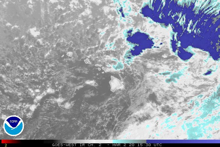