February 2009
Monthly Archive
Posted by Glenn
1 Comment
February 8-9, 2009
Air Temperatures – The following maximum temperatures were recorded across the state of Hawaii Sunday afternoon:
Lihue, Kauai – 76
Honolulu, Oahu – 80
Kaneohe, Oahu – 77
Kahului, Maui – 81
Hilo, Hawaii – 77
Kailua-kona – 81
Air Temperatures ranged between these warmest and coolest spots near sea level, and on the highest mountains…at 5 p.m. Sunday afternoon:
Kailua-kona – 79F
Lihue, Kauai – 73
Haleakala Crater – 46 (near 10,000 feet on Maui)
Mauna Kea summit – 27 (near 14,000 feet on the Big Island)
Precipitation Totals – The following numbers represent the largest precipitation totals (inches) during the last 24 hours on each of the major islands, as of Sunday afternoon:
2.81 Mount Waialaele, Kauai
0.27 Oahu Forest NWR, Oahu
0.00 Molokai
0.00 Lanai
0.00 Kahoolawe
0.59 West Wailuaiki, Maui
0.70 Honokaa, Big Island
Weather Chart – Here’s the latest (automatically updated) weather map showing high pressure systems to the north and northeast of the Hawaiian Islands. Our winds will remain in the light to moderately strong range through Tuesday
Satellite and Radar Images: To view the cloud conditions we have here in Hawaii, please use the following satellite links, starting off with the Infrared Satellite Image of the islands to see all the clouds around the state during the day and night. This next image is one that gives close images of the islands only during the daytime hours, and is referred to as a Close-up visible image. This next image shows a larger view of the Pacific…giving perspective to the wider ranging cloud patterns in the Pacific Ocean. Finally, here’s a looping IR satellite image, making viewable the clouds around the islands 24 hours a day. To help you keep track of where any showers may be around the islands, here’s the latest animated radar image.
Hawaii’s Mountains – Here’s a link to the live webcam on the summit of near 14,000 foot Mauna Kea on the Big Island of Hawaii. The tallest peak on the island of Maui is the Haleakala Crater, which is near 10,000 feet in elevation. These two webcams are available during the daylight hours here in the islands…and when there’s a big moon rising just after sunset for an hour or two! Plus, during the nights and early mornings you will be able to see stars, and the sunrise too…depending upon weather conditions.
Aloha Paragraphs

Full moon time again
Photo Credit: flickr.com
The trade winds will stick around into the new week. The trade winds will get a little lighter Monday and Tuesday, before boosting-up again starting Wednesday. Looking further ahead, the computer forecast models continue to suggest that our winds will remain out of the trade wind direction through the next week…becoming quite strong and gusty during the second half of the week.
Besides the locally cloudy afternoons, and a few showers along the windward sides…our weather will be generally quite nice. As this satellite image points out, the weather remained nice in most places across the island chain Sunday. The one exception was over the slopes on the Big Island, where towering cumulus clouds, and even a thunderstorm popped-up during the afternoon hours, providing a few heavy showers. The upcoming week will start off with a few showers, although again, our weather will be mostly ok.
~~~ It’s around 6pm here in Kula, Maui, with a few clouds around…although most of the afternoon was amazingly clear. The air temperature is running close to 70F degrees at the moment, although now that the sun is getting ready to go down, the temperature will be dropping fairly quickly here in the upcountry area. Speaking of the sun going down, that will mean that the February full moon will be coming up soon!
~~~ This afternoon I bbq’d boneless organic chicken thighs, which I’ll eat for dinners during the coming week nights. I also sauteed fresh vegetables, including onion, potatoes, carrots, mushrooms, celery, and aspargus. This will take care of me for the upcoming dinner meals, which makes it easy to heat up. Since it‘s almost sunset, I’ll be heading out to witness that pleasant treat, sharing it with the two cats lounging around out there at the moment, Kiwi and Redgirl. I hope you have a great Sunday night, and make it outside tonight, to check out the huge moon rising out of of the eastern horizon. I hope too that you can come back again Monday morning, at which point I’ll have your next new weather narrative paradise waiting for you! Aloha for now…Glenn.
Interesting: Federal fisheries managers have voted to bar all commercial fishing in U.S. waters from north of the Bering Strait and east to the Canadian border in light of the rapid climate changes that are transforming the Arctic. In a unanimous vote yesterday, the North Pacific Fishery Management Council ruled that scientists and policymakers need to better assess how global warming is affecting the region before allowing fishing on stocks such as Arctic cod, saffron cod and snow crab. "There’s concern over unregulated fishing, there’s concern about warming, there’s concern about how commercial fishing might affect resources in the region, local residents and subsistence fishing and the ecosystem as a whole," said Bill Wilson, a council aide. Environmentalists and fishing interests praised the move as sensible, given the changes to ice cover and other features of the Arctic environment. The Marine Conservation Alliance — an association representing fishermen and processors who harvest ground fish and crab off Alaska’s coast — endorsed the council’s decision to close an area spanning nearly 200,000 square miles, an area nearly twice as large as the U.S. national park system.
Interesting2: Coral reefs off the southeast coast of Taiwan have turned black with disease possibly due to sewage discharge, threatening fragile undersea ecosystems and tourism, a study released Friday said. The discovery on a problem long suspected but seldom documented shows that coral is suffering widely in waters up to five meters (16.4 feet) deep and 300 meters offshore from two outlying islands, said researcher Chen Chao-lun of Taiwan’s state-funded Academia Sinica. "This is a large distribution and we had no previous information," said Chen, whose began doing research with local environmental groups in 2007. "If you snorkel, you’ll see it’s black. If it’s all black, there won’t be too many tourists." Coral reefs, delicate undersea structures resembling rocky gardens made by tiny animals called coral polyps, are important nurseries and shelters for fish and other sea life.
They also protect coastlines, provide a critical source of food for millions of people and are potential storehouses of medicines. Taiwan’s study did not pinpoint a cause for the diseased coral, but untreated sewage may a factor, Chen said. On Green Island, a tourism hotspot and one the sites surrounded by diseased coral, garbage and excrement are dumped into the surrounding azure waters while reefs are often plundered by coral-robbing tourists, officials and long-time divers say. The Taiwan researchers have sent their report to the government and plan to check for problems in other offshore areas known to support coral, Chen said.
Interesting3: Wind and solar power grew at a blistering pace in recent years, and that growth seemed likely to accelerate, especially in the United States under the green-minded administration of the new president, Barack Obama. But because of the credit crisis and the broader economic downturn, the opposite is happening: Except in isolated markets, like China, installation of wind and solar power is slowing, and in some cases plummeting. Factories building parts for these industries in the United States have announced a wave of layoffs in recent weeks, and trade groups are projecting 30 percent to 50 percent declines this year in the installation of new equipment, a decrease that bars more help from the government. Prices for turbines and solar panels, which soared when the boom began a few years ago, are falling. Communities that were patting themselves on the back just last year for attracting a wind or solar plant are now coping with cutbacks. ”I thought if there was any industry that was bulletproof, it was that industry,” said Rich Mattern, the mayor of West Fargo, North Dakota, where DMI Industries of Fargo operated a plant that makes towers for wind turbines.
Even though the flat Dakotas are among the best places in the world for wind farms, DMI recently announced a cut of about 20 percent of its work force because of falling sales. Much of the problem stems from the credit crisis that has left Wall Street banks reeling. Once, as many as 18 big banks and financial institutions were willing to help finance installation of wind turbines and solar arrays, taking advantage of generous government tax incentives. But with the banks in so much trouble, that number has dropped to four, according to Keith Martin, a tax and project finance specialist with the law firm Chadbourne & Parke. Wind and solar developers have been left hunting for capital. ”It’s absolutely frozen,” said Craig Mataczynski, president of Renewable Energy Systems Americas, a wind developer. He projected his company would build just under half as much this year as it did last year. The effects of the banking crisis were also being felt in Europe, although industry groups said it was too soon to tell what effect the credit freeze would have on the fast-growing sector.
Interesting4: Martha Kermel holds out rail-thin arms covered with a latticework of scratches from her encounter with a plague of caterpillars that has devastated crops and spread fear through this corner of West Africa. "They scratched my arms when they moved," said Kermel, a mother of four, telling how the small creatures poured down onto her from the tree branches overhead as she set out from her village to a rice farm cultivated by her community in Liberia. That was two weeks ago. Now the millions of caterpillars which covered the road and nearby bushes have retreated into cocoons, or hatched already into moths ready to spawn a new generation of grubs here or further afield. The insects can travel up to 60 miles a day, and have already crossed the border to Guinea, an agriculturally rich country and the source of many of Liberia’s food imports.
That has set alarm bells ringing in neighboring Ivory Coast, the world’s top cocoa grower and an important producer of coffee, rubber, palm oil and other cash crops. The creatures were first thought to be army worms, a moth caterpillar, but they were identified this week as the young of another kind of moth, the Achaea catocaloides, which are also known to damage cocoa and other tree crops. For the time being, the moths are headed north, and experts in Ivory Coast said this week they should avoid Ivory Coast’s valuable cocoa belt, which produces about 40 percent of world supply. But they remain a risk to Ivory Coast’s central borderlands, which produce around 100,000 tons of cocoa and 70,000 tons of robusta coffee a year.
Interesting5: A researcher at North Carolina State University is tracking the movement of the Redbay Ambrosia beetle, an invasive insect that, if it spreads to southeast Florida, may severely affect the production of avocados, a $15 million to $30 million industry in the state. First detected in the United States near Savannah, Ga., in 2002, the beetle had spread to Hilton Head Island, S.C., by 2004, causing widespread mortality in Redbay trees. Dr. Frank Koch, a research assistant professor at NC State who works with the United States Forest Service to help monitor and track the geographical movement of invasive species like the Redbay Ambrosia beetle, says it currently is continuing its journey south.The female Ambrosia beetle carries fungal spores on its body, a source of food for adult beetles and their larvae, which then inoculate Redbay trees. The fungus causes laurel wilt, the source of widespread and severe levels of Redbay mortality in the Southeastern coastal plain.
When the beetles bore into the sapwood of a host tree, the fungus germinates in the tree tissue and can cause tree death. "This beetle is very small – roughly two millimeters long – but it kills extremely rapidly," Koch says. "There are thousands of species of Ambrosia beetles, but they usually don’t cause damage to this extent. This particular beetle is very serious because the fungus it carries is remarkably lethal." The worry, Koch says, is that as the beetle continues to spread down the coast, it will begin to affect avocado trees, which belong to the same genus as Redbay trees. "This beetle is moving very fast, and it may be in the avocado-growing region of Florida within a year or two," Koch says. "The avocado industry is very concentrated – about 7,500 acres southwest of Miami – and an invasion by these beetles could cause major damage to the production of avocados."
Interesting6: A new University of British Columbia study reconciles a debate that has long raged among marketers and psychologists: What color most improves brain performance and receptivity to advertising, red or blue? It turns out they both can, it just depends on the nature of the task or message. The study, which could have major implications for advertising and interior design, finds that red is the most effective at enhancing our attention to detail, while blue is best at boosting our ability to think creatively. "Previous research linked blue and red to enhanced cognitive performance, but disagreed on which provides the greatest boost," says Juliet Zhu of UBC’s Sauder School of Business, author of the study which will appear in the Feb. 5 issue of Science. "It really depends on the nature of the task."
Between 2007 and 2008, the researchers tracked more than 600 participants’ performance on six cognitive tasks that required either detail-orientation or creativity. Most experiments were conducted on computers, with a screen that was red, blue or white. Red boosted performance on detail-oriented tasks such as memory retrieval and proofreading by as much as 31 per cent compared to blue. Conversely, for creative tasks such as brainstorming, blue environmental cues prompted participants to produce twice as many creative outputs as when under the red color condition. These variances are caused by different unconscious motivations that red and blue activate, says Zhu, noting that color influences cognition and behavior through learned associations.
Interesting7: Australia is to be the hottest place on the planet this weekend with temperatures set to breach 113F degrees in the south-east corner of the continent, officials warned Friday. The big worry is that arsonists would take advantage of ideal conditions and lay potentially deadly forest fires. "We are going to have unbelievably high temperatures, and we are also going to have unbelievably high winds," Victoria state Premier John Brumby said. "We have got a state which is just tinder-dry." He warned of a possible repeat of the blazes of 1983 that left 75 people dead.
Fire brigades are on high alert with all the state’s fleet of water-bombing aircraft on standby. Residents of Melbourne fear a repeat of the power blackout the heat wave has brought in recent weeks. In neighboring New South Wales, all 70,000 volunteer firefighters were to be on call. National parks where the danger of arson is high would be placed out-of-bounds to the public. People were being asked to watch out for those deliberately lighting fires and to report any suspicious behavior to police. More than half of Australia’s forest fires are believed to be the work of arsonists.
Posted by Glenn
No Comments
February 7-8, 2009
Air Temperatures – The following maximum temperatures were recorded across the state of Hawaii Saturday afternoon:
Lihue, Kauai – 76
Honolulu, Oahu – 82
Kaneohe, Oahu – 77
Kahului, Maui – 82
Hilo, Hawaii – 80
Kailua-kona – 82
Air Temperatures ranged between these warmest and coolest spots near sea level, and on the highest mountains…at 4 p.m. Saturday afternoon:
Honolulu, Oahu – 80F
Lihue, Kauai – 74
Haleakala Crater – 43 (near 10,000 feet on Maui)
Mauna Kea summit – 25 (near 14,000 feet on the Big Island)
Precipitation Totals – The following numbers represent the largest precipitation totals (inches) during the last 24 hours on each of the major islands, as of Saturday afternoon:
0.03 Mount Waialaele, Kauai
0.51 Oahu Forest NWR, Oahu
0.01 Molokai
0.00 Lanai
0.00 Kahoolawe
0.04 Oheo Gulch, Maui
0.30 Piihonua, Big Island
Weather Chart – Here’s the latest (automatically updated) weather map showing high pressure systems to the north and northeast of the Hawaiian Islands Saturday evening. Our winds, which will become steady trade winds Sunday, then become somewhat lighter Monday and Tuesday…only to increase again, quite substantially during the second half of the upcoming week.
Satellite and Radar Images: To view the cloud conditions we have here in Hawaii, please use the following satellite links, starting off with the Infrared Satellite Image of the islands to see all the clouds around the state during the day and night. This next image is one that gives close images of the islands only during the daytime hours, and is referred to as a Close-up visible image. This next image shows a larger view of the Pacific…giving perspective to the wider ranging cloud patterns in the Pacific Ocean. Finally, here’s a looping IR satellite image, making viewable the clouds around the islands 24 hours a day. To help you keep track of where any showers may be around the islands, here’s the latest animated radar image.
Hawaii’s Mountains – Here’s a link to the live webcam on the summit of near 14,000 foot Mauna Kea on the Big Island of Hawaii. The tallest peak on the island of Maui is the Haleakala Crater, which is near 10,000 feet in elevation. These two webcams are available during the daylight hours here in the islands…and when there’s a big moon rising just after sunset for an hour or two! Plus, during the nights and early mornings you will be able to see stars, and the sunrise too…depending upon weather conditions.
Aloha Paragraphs

Nice sunset on Kauai
Photo Credit: flickr.com
The trade winds were somewhat lighter than expected today, with some increase in speed as we move into Sunday. The trade winds will get a little boost Sunday, before slowing down a touch again Monday into mid-week, blowing generally in the light to moderately strong range. Looking ahead, the computer forecast models suggest that our winds will remain out of the trade wind direction through the next week…becoming quite strong and gusty during the second half of the upcoming week.
The cold air aloft, left in the wake of the departing low pressure system, caused more than the expected clouds to build up during the day Saturday. The associated air aloft is unusually cold, making our overlying atmosphere more unstable than expected too. Some of these afternoon clouds built up into thunderstorms, with a few generous showers falling. This pattern may continue for another couple of days. As the trade winds pick up, they will carry a few showers to the windward sides at times too.
Besides the locally cloudy afternoons, with localized showers, again locally quite heavy…our weather will be generally nice otherwise. As this satellite image points out, the clouds associated with the departing upper level trough…are now located to the east of our islands. Our local beaches will generally be in fine shape Sunday and Monday, although with showers popping-up over the interior sections later in the days. Looking ahead, the new week ahead looks fine, although we may see some increasing showers being carried in our direction on the brisk trade winds, towards the second half of the week.
~~~ Friday evening I went to see the new film called Underworld: Rise of the Lycans (2009), starring Michael Sheen, Bill Nighy, Rhona Mitra, among others. This definitely isn’t a film that I would recommend to most of you, as it includes romance, suspense, horror, as well as being a thriller. The general strory revolves around the origins of the centuries-old blood feud between the aristocratic vampires, known as Death Dealers, and their onetime slaves, the Lycans. This is a dark film, with all kinds of violence spread through its entirety. Somehow, I saw some small bit of humor at the depth of its darkness, as it tries, and succeeds so well…at being dark. I have to admit that I enjoyed it for the most part, and found all this violence somehow entertaining. The theater in Kahului was quite full, suggesting that I wasn’t the only person who likes this kind of thing. At any rate, this is the third film of this series, and I have liked them all quite a bit. Here’s a trailer for this film, just in case you might be slightly curious.
~~~ It’s early evening here in Kula, Maui…also called upcountry. The morning started off amazingly well, with mostly clear skies. The daytime heating, coupled with the residual cold air from the departing trough aloft…cooked-up clouds as the later morning graded into the afternoon hours. I went down to Paia for some shopping at the health food store, and ended speaking with quite a few folks, some I knew, and some that I met. At any rate, on the drive back home, I saw evidence of that exceptionally cold air aloft over the islands. This manifested as towering cumulus clouds, and even a few thunderstorms over some of the other islands! This pattern should continue for a few more days, with most of the heavier clouds flaring-up during the afternoons.
~~~ I’m sipping on a nice drink this evening, which started out with a glass full of Reed’s Jamaican style ginger ale, followed by a healthy splash of premium vodka. It’s a Saturday evening indulgence on my part, following a pretty full-on work week. It’s just before sunset outside my weather tower, which is beckoning me to my regular viewing perch. By the way, without the cloudy skies this evening, I spotted what looks to be a very close to full moon rising! I am very fortunate to have a bi-coastal view, punctuated with the beautiful West Maui Mountains inbetween. Since its Sunday morning coming up, I’ll likely lay in bed later than usual, although I’ll be back with your next new weather narrative from paradise in the morning for sure. I hope you have a great Saturday night until then! Aloha for now…Glenn.
Interesting: Federal fisheries managers have voted to bar all commercial fishing in U.S. waters from north of the Bering Strait and east to the Canadian border in light of the rapid climate changes that are transforming the Arctic. In a unanimous vote yesterday, the North Pacific Fishery Management Council ruled that scientists and policymakers need to better assess how global warming is affecting the region before allowing fishing on stocks such as Arctic cod, saffron cod and snow crab. "There’s concern over unregulated fishing, there’s concern about warming, there’s concern about how commercial fishing might affect resources in the region, local residents and subsistence fishing and the ecosystem as a whole," said Bill Wilson, a council aide. Environmentalists and fishing interests praised the move as sensible, given the changes to ice cover and other features of the Arctic environment. The Marine Conservation Alliance — an association representing fishermen and processors who harvest ground fish and crab off Alaska’s coast — endorsed the council’s decision to close an area spanning nearly 200,000 square miles, an area nearly twice as large as the U.S. national park system.
Interesting2: Coral reefs off the southeast coast of Taiwan have turned black with disease possibly due to sewage discharge, threatening fragile undersea ecosystems and tourism, a study released Friday said. The discovery on a problem long suspected but seldom documented shows that coral is suffering widely in waters up to five meters (16.4 feet) deep and 300 meters offshore from two outlying islands, said researcher Chen Chao-lun of Taiwan’s state-funded Academia Sinica. "This is a large distribution and we had no previous information," said Chen, whose began doing research with local environmental groups in 2007. "If you snorkel, you’ll see it’s black. If it’s all black, there won’t be too many tourists." Coral reefs, delicate undersea structures resembling rocky gardens made by tiny animals called coral polyps, are important nurseries and shelters for fish and other sea life.
They also protect coastlines, provide a critical source of food for millions of people and are potential storehouses of medicines. Taiwan’s study did not pinpoint a cause for the diseased coral, but untreated sewage may a factor, Chen said. On Green Island, a tourism hotspot and one the sites surrounded by diseased coral, garbage and excrement are dumped into the surrounding azure waters while reefs are often plundered by coral-robbing tourists, officials and long-time divers say. The Taiwan researchers have sent their report to the government and plan to check for problems in other offshore areas known to support coral, Chen said.
Interesting3: Wind and solar power grew at a blistering pace in recent years, and that growth seemed likely to accelerate, especially in the United States under the green-minded administration of the new president, Barack Obama. But because of the credit crisis and the broader economic downturn, the opposite is happening: Except in isolated markets, like China, installation of wind and solar power is slowing, and in some cases plummeting. Factories building parts for these industries in the United States have announced a wave of layoffs in recent weeks, and trade groups are projecting 30 percent to 50 percent declines this year in the installation of new equipment, a decrease that bars more help from the government. Prices for turbines and solar panels, which soared when the boom began a few years ago, are falling. Communities that were patting themselves on the back just last year for attracting a wind or solar plant are now coping with cutbacks. ”I thought if there was any industry that was bulletproof, it was that industry,” said Rich Mattern, the mayor of West Fargo, North Dakota, where DMI Industries of Fargo operated a plant that makes towers for wind turbines.
Even though the flat Dakotas are among the best places in the world for wind farms, DMI recently announced a cut of about 20 percent of its work force because of falling sales. Much of the problem stems from the credit crisis that has left Wall Street banks reeling. Once, as many as 18 big banks and financial institutions were willing to help finance installation of wind turbines and solar arrays, taking advantage of generous government tax incentives. But with the banks in so much trouble, that number has dropped to four, according to Keith Martin, a tax and project finance specialist with the law firm Chadbourne & Parke. Wind and solar developers have been left hunting for capital. ”It’s absolutely frozen,” said Craig Mataczynski, president of Renewable Energy Systems Americas, a wind developer. He projected his company would build just under half as much this year as it did last year. The effects of the banking crisis were also being felt in Europe, although industry groups said it was too soon to tell what effect the credit freeze would have on the fast-growing sector.
Interesting4: Martha Kermel holds out rail-thin arms covered with a latticework of scratches from her encounter with a plague of caterpillars that has devastated crops and spread fear through this corner of West Africa. "They scratched my arms when they moved," said Kermel, a mother of four, telling how the small creatures poured down onto her from the tree branches overhead as she set out from her village to a rice farm cultivated by her community in Liberia. That was two weeks ago. Now the millions of caterpillars which covered the road and nearby bushes have retreated into cocoons, or hatched already into moths ready to spawn a new generation of grubs here or further afield. The insects can travel up to 60 miles a day, and have already crossed the border to Guinea, an agriculturally rich country and the source of many of Liberia’s food imports.
That has set alarm bells ringing in neighboring Ivory Coast, the world’s top cocoa grower and an important producer of coffee, rubber, palm oil and other cash crops. The creatures were first thought to be army worms, a moth caterpillar, but they were identified this week as the young of another kind of moth, the Achaea catocaloides, which are also known to damage cocoa and other tree crops. For the time being, the moths are headed north, and experts in Ivory Coast said this week they should avoid Ivory Coast’s valuable cocoa belt, which produces about 40 percent of world supply. But they remain a risk to Ivory Coast’s central borderlands, which produce around 100,000 tons of cocoa and 70,000 tons of robusta coffee a year.
Interesting5: A researcher at North Carolina State University is tracking the movement of the Redbay Ambrosia beetle, an invasive insect that, if it spreads to southeast Florida, may severely affect the production of avocados, a $15 million to $30 million industry in the state. First detected in the United States near Savannah, Ga., in 2002, the beetle had spread to Hilton Head Island, S.C., by 2004, causing widespread mortality in Redbay trees. Dr. Frank Koch, a research assistant professor at NC State who works with the United States Forest Service to help monitor and track the geographical movement of invasive species like the Redbay Ambrosia beetle, says it currently is continuing its journey south.The female Ambrosia beetle carries fungal spores on its body, a source of food for adult beetles and their larvae, which then inoculate Redbay trees. The fungus causes laurel wilt, the source of widespread and severe levels of Redbay mortality in the Southeastern coastal plain.
When the beetles bore into the sapwood of a host tree, the fungus germinates in the tree tissue and can cause tree death. "This beetle is very small – roughly two millimeters long – but it kills extremely rapidly," Koch says. "There are thousands of species of Ambrosia beetles, but they usually don’t cause damage to this extent. This particular beetle is very serious because the fungus it carries is remarkably lethal." The worry, Koch says, is that as the beetle continues to spread down the coast, it will begin to affect avocado trees, which belong to the same genus as Redbay trees. "This beetle is moving very fast, and it may be in the avocado-growing region of Florida within a year or two," Koch says. "The avocado industry is very concentrated – about 7,500 acres southwest of Miami – and an invasion by these beetles could cause major damage to the production of avocados."
Interesting6: A new University of British Columbia study reconciles a debate that has long raged among marketers and psychologists: What color most improves brain performance and receptivity to advertising, red or blue? It turns out they both can, it just depends on the nature of the task or message. The study, which could have major implications for advertising and interior design, finds that red is the most effective at enhancing our attention to detail, while blue is best at boosting our ability to think creatively. "Previous research linked blue and red to enhanced cognitive performance, but disagreed on which provides the greatest boost," says Juliet Zhu of UBC’s Sauder School of Business, author of the study which will appear in the Feb. 5 issue of Science. "It really depends on the nature of the task."
Between 2007 and 2008, the researchers tracked more than 600 participants’ performance on six cognitive tasks that required either detail-orientation or creativity. Most experiments were conducted on computers, with a screen that was red, blue or white. Red boosted performance on detail-oriented tasks such as memory retrieval and proofreading by as much as 31 per cent compared to blue. Conversely, for creative tasks such as brainstorming, blue environmental cues prompted participants to produce twice as many creative outputs as when under the red color condition. These variances are caused by different unconscious motivations that red and blue activate, says Zhu, noting that color influences cognition and behavior through learned associations.
Interesting7: Australia is to be the hottest place on the planet this weekend with temperatures set to breach 113F degrees in the south-east corner of the continent, officials warned Friday. The big worry is that arsonists would take advantage of ideal conditions and lay potentially deadly forest fires. "We are going to have unbelievably high temperatures, and we are also going to have unbelievably high winds," Victoria state Premier John Brumby said. "We have got a state which is just tinder-dry." He warned of a possible repeat of the blazes of 1983 that left 75 people dead.
Fire brigades are on high alert with all the state’s fleet of water-bombing aircraft on standby. Residents of Melbourne fear a repeat of the power blackout the heat wave has brought in recent weeks. In neighboring New South Wales, all 70,000 volunteer firefighters were to be on call. National parks where the danger of arson is high would be placed out-of-bounds to the public. People were being asked to watch out for those deliberately lighting fires and to report any suspicious behavior to police. More than half of Australia’s forest fires are believed to be the work of arsonists.
Posted by Glenn
No Comments
February 6-7, 2009
Air Temperatures – The following maximum temperatures were recorded across the state of Hawaii Friday afternoon:
Lihue, Kauai – 76
Honolulu, Oahu – 78
Kaneohe, Oahu – 78
Kahului, Maui – 82
Hilo, Hawaii – 79
Kailua-kona – 82
Air Temperatures ranged between these warmest and coolest spots near sea level, and on the highest mountains…at 5 p.m. Friday evening:
Kapalua, Maui – 79F
Lihue, Maui – 74
Haleakala Crater – 43 (near 10,000 feet on Maui)
Mauna Kea summit – 27 (near 14,000 feet on the Big Island)
Precipitation Totals – The following numbers represent the largest precipitation totals (inches) during the last 24 hours on each of the major islands, as of Friday afternoon:
0.14 Mount Waialaele, Kauai
0.09 Poamoho 2, Oahu
0.01 Molokai
0.00 Lanai
0.00 Kahoolawe
0.11 Oheo Gulch, Maui
0.09 Mountain View, Big Island
Weather Chart – Here’s the latest (automatically updated) weather map showing a high pressure systems to the northeast and northwest of the Hawaiian Islands. Our winds, which may start out from the SE or ESE direction, will turn more towards the usual trade wind direction this weekend.
Satellite and Radar Images: To view the cloud conditions we have here in Hawaii, please use the following satellite links, starting off with the Infrared Satellite Image of the islands to see all the clouds around the state during the day and night. This next image is one that gives close images of the islands only during the daytime hours, and is referred to as a Close-up visible image. This next image shows a larger view of the Pacific…giving perspective to the wider ranging cloud patterns in the Pacific Ocean. Finally, here’s a looping IR satellite image, making viewable the clouds around the islands 24 hours a day. To help you keep track of where any showers may be around the islands, here’s the latest animated radar image.
Hawaii’s Mountains – Here’s a link to the live webcam on the summit of near 14,000 foot Mauna Kea on the Big Island of Hawaii. The tallest peak on the island of Maui is the Haleakala Crater, which is near 10,000 feet in elevation. These two webcams are available during the daylight hours here in the islands…and when there’s a big moon rising just after sunset for an hour or two! Plus, during the nights and early mornings you will be able to see stars, and the sunrise too…depending upon weather conditions.
Aloha Paragraphs

The upper west side on Maui
Photo Credit: flickr.com
The trade winds shifted to the southeast, and got lighter than expected Friday. These lighter than expected winds will only be temporary however, as the trade winds return this weekend. Looking ahead, the computer forecast models strongly suggest that our winds will remain out of the trade wind direction through the next week. Those same models point out strengthening wind speeds, especially during the second half of the upcoming new week.
The skies tried hard to clear themselves of the long lasting clouds, but couldn’t quite break free…especially on Maui and the Big Island Friday. The trough of low pressure aloft, which has persisted through this work week, still had its cloud producing work to do. This trough however is about to depart our area, which should help to clear our skies, and give us back our sunshine. This will happen during the weekend, and will be a welcome relief to both our visitors and local residents both. There will still be a few showers around, especially over the Big Island and Maui slopes during the afternoons…and along the windward sides at times too.
The overall outlook, from a weather perspective, is looking up however. As this satellite image points out, there are still lots clouds associated with the departing upper level trough…especially to the east of our islands. This wide swath of clouds will be easing eastward, with already Kauai and Oahu having cleared. There are chunks of clouds still hanging on over Maui and the Big Island, although those two islands will see clearing soon as well. Our local beaches will generally be in fine shape both Saturday and Sunday!
~~~ I’m about ready to leave Kihei, for the drive over to Kahului, where I’ll be seeing a new film this evening. This time around I’ve decided on seeing Underworld: Rise of the Lycans (2009), starring Michael Sheen, Bill Nighy, Rhona Mitra, among others. This definitely isn’t a film that I would recommend to most of you, as it includes romance, suspense, horror, as well as being a thriller. The general strory revolves around the origins of the centuries-old blood feud between the aristocratic vampires, known as Death Dealers, and their onetime slaves, the Lycans. I haven’t seen any of the ratings of the critics, although the Yahoo users are giving it an A minus. The other film rating website I use, called RottenTomatoes, is less generous with its praise, giving it a 32% out of 100…ouch. At any rate, I’ve seen the others in this series, and have actually liked them quite a bit. So, I’ll take a chance, and go see it. Here’s a trailer for this film, just in case you might be slightly curious.
~~~ I’ll be back online early Saturday morning with your next new weather narrative. I anticipate that I’ll have more good news in terms of improving weather conditions here in the Hawaiian Islands. I hope you have a good Friday night night, wherever you happen to be spending it, leading into a nice Saturday morning! Aloha for now…Glenn.
Interesting: Federal fisheries managers have voted to bar all commercial fishing in U.S. waters from north of the Bering Strait and east to the Canadian border in light of the rapid climate changes that are transforming the Arctic. In a unanimous vote yesterday, the North Pacific Fishery Management Council ruled that scientists and policymakers need to better assess how global warming is affecting the region before allowing fishing on stocks such as Arctic cod, saffron cod and snow crab. "There’s concern over unregulated fishing, there’s concern about warming, there’s concern about how commercial fishing might affect resources in the region, local residents and subsistence fishing and the ecosystem as a whole," said Bill Wilson, a council aide. Environmentalists and fishing interests praised the move as sensible, given the changes to ice cover and other features of the Arctic environment. The Marine Conservation Alliance — an association representing fishermen and processors who harvest ground fish and crab off Alaska’s coast — endorsed the council’s decision to close an area spanning nearly 200,000 square miles, an area nearly twice as large as the U.S. national park system.
Interesting2: Coral reefs off the southeast coast of Taiwan have turned black with disease possibly due to sewage discharge, threatening fragile undersea ecosystems and tourism, a study released Friday said. The discovery on a problem long suspected but seldom documented shows that coral is suffering widely in waters up to five meters (16.4 feet) deep and 300 meters offshore from two outlying islands, said researcher Chen Chao-lun of Taiwan’s state-funded Academia Sinica. "This is a large distribution and we had no previous information," said Chen, whose began doing research with local environmental groups in 2007. "If you snorkel, you’ll see it’s black. If it’s all black, there won’t be too many tourists." Coral reefs, delicate undersea structures resembling rocky gardens made by tiny animals called coral polyps, are important nurseries and shelters for fish and other sea life.
They also protect coastlines, provide a critical source of food for millions of people and are potential storehouses of medicines. Taiwan’s study did not pinpoint a cause for the diseased coral, but untreated sewage may a factor, Chen said. On Green Island, a tourism hotspot and one the sites surrounded by diseased coral, garbage and excrement are dumped into the surrounding azure waters while reefs are often plundered by coral-robbing tourists, officials and long-time divers say. The Taiwan researchers have sent their report to the government and plan to check for problems in other offshore areas known to support coral, Chen said.
Interesting3: Wind and solar power grew at a blistering pace in recent years, and that growth seemed likely to accelerate, especially in the United States under the green-minded administration of the new president, Barack Obama. But because of the credit crisis and the broader economic downturn, the opposite is happening: Except in isolated markets, like China, installation of wind and solar power is slowing, and in some cases plummeting. Factories building parts for these industries in the United States have announced a wave of layoffs in recent weeks, and trade groups are projecting 30 percent to 50 percent declines this year in the installation of new equipment, a decrease that bars more help from the government. Prices for turbines and solar panels, which soared when the boom began a few years ago, are falling. Communities that were patting themselves on the back just last year for attracting a wind or solar plant are now coping with cutbacks. ”I thought if there was any industry that was bulletproof, it was that industry,” said Rich Mattern, the mayor of West Fargo, North Dakota, where DMI Industries of Fargo operated a plant that makes towers for wind turbines.
Even though the flat Dakotas are among the best places in the world for wind farms, DMI recently announced a cut of about 20 percent of its work force because of falling sales. Much of the problem stems from the credit crisis that has left Wall Street banks reeling. Once, as many as 18 big banks and financial institutions were willing to help finance installation of wind turbines and solar arrays, taking advantage of generous government tax incentives. But with the banks in so much trouble, that number has dropped to four, according to Keith Martin, a tax and project finance specialist with the law firm Chadbourne & Parke. Wind and solar developers have been left hunting for capital. ”It’s absolutely frozen,” said Craig Mataczynski, president of Renewable Energy Systems Americas, a wind developer. He projected his company would build just under half as much this year as it did last year. The effects of the banking crisis were also being felt in Europe, although industry groups said it was too soon to tell what effect the credit freeze would have on the fast-growing sector.
Interesting4: Martha Kermel holds out rail-thin arms covered with a latticework of scratches from her encounter with a plague of caterpillars that has devastated crops and spread fear through this corner of West Africa. "They scratched my arms when they moved," said Kermel, a mother of four, telling how the small creatures poured down onto her from the tree branches overhead as she set out from her village to a rice farm cultivated by her community in Liberia. That was two weeks ago. Now the millions of caterpillars which covered the road and nearby bushes have retreated into cocoons, or hatched already into moths ready to spawn a new generation of grubs here or further afield. The insects can travel up to 60 miles a day, and have already crossed the border to Guinea, an agriculturally rich country and the source of many of Liberia’s food imports.
That has set alarm bells ringing in neighboring Ivory Coast, the world’s top cocoa grower and an important producer of coffee, rubber, palm oil and other cash crops. The creatures were first thought to be army worms, a moth caterpillar, but they were identified this week as the young of another kind of moth, the Achaea catocaloides, which are also known to damage cocoa and other tree crops. For the time being, the moths are headed north, and experts in Ivory Coast said this week they should avoid Ivory Coast’s valuable cocoa belt, which produces about 40 percent of world supply. But they remain a risk to Ivory Coast’s central borderlands, which produce around 100,000 tons of cocoa and 70,000 tons of robusta coffee a year.
Interesting5: A researcher at North Carolina State University is tracking the movement of the Redbay Ambrosia beetle, an invasive insect that, if it spreads to southeast Florida, may severely affect the production of avocados, a $15 million to $30 million industry in the state. First detected in the United States near Savannah, Ga., in 2002, the beetle had spread to Hilton Head Island, S.C., by 2004, causing widespread mortality in Redbay trees. Dr. Frank Koch, a research assistant professor at NC State who works with the United States Forest Service to help monitor and track the geographical movement of invasive species like the Redbay Ambrosia beetle, says it currently is continuing its journey south.The female Ambrosia beetle carries fungal spores on its body, a source of food for adult beetles and their larvae, which then inoculate Redbay trees. The fungus causes laurel wilt, the source of widespread and severe levels of Redbay mortality in the Southeastern coastal plain.
When the beetles bore into the sapwood of a host tree, the fungus germinates in the tree tissue and can cause tree death. "This beetle is very small – roughly two millimeters long – but it kills extremely rapidly," Koch says. "There are thousands of species of Ambrosia beetles, but they usually don’t cause damage to this extent. This particular beetle is very serious because the fungus it carries is remarkably lethal." The worry, Koch says, is that as the beetle continues to spread down the coast, it will begin to affect avocado trees, which belong to the same genus as Redbay trees. "This beetle is moving very fast, and it may be in the avocado-growing region of Florida within a year or two," Koch says. "The avocado industry is very concentrated – about 7,500 acres southwest of Miami – and an invasion by these beetles could cause major damage to the production of avocados."
Interesting6: A new University of British Columbia study reconciles a debate that has long raged among marketers and psychologists: What color most improves brain performance and receptivity to advertising, red or blue? It turns out they both can, it just depends on the nature of the task or message. The study, which could have major implications for advertising and interior design, finds that red is the most effective at enhancing our attention to detail, while blue is best at boosting our ability to think creatively. "Previous research linked blue and red to enhanced cognitive performance, but disagreed on which provides the greatest boost," says Juliet Zhu of UBC’s Sauder School of Business, author of the study which will appear in the Feb. 5 issue of Science. "It really depends on the nature of the task."
Between 2007 and 2008, the researchers tracked more than 600 participants’ performance on six cognitive tasks that required either detail-orientation or creativity. Most experiments were conducted on computers, with a screen that was red, blue or white. Red boosted performance on detail-oriented tasks such as memory retrieval and proofreading by as much as 31 per cent compared to blue. Conversely, for creative tasks such as brainstorming, blue environmental cues prompted participants to produce twice as many creative outputs as when under the red color condition. These variances are caused by different unconscious motivations that red and blue activate, says Zhu, noting that color influences cognition and behavior through learned associations.
Interesting7: Australia is to be the hottest place on the planet this weekend with temperatures set to breach 113F degrees in the south-east corner of the continent, officials warned Friday. The big worry is that arsonists would take advantage of ideal conditions and lay potentially deadly forest fires. "We are going to have unbelievably high temperatures, and we are also going to have unbelievably high winds," Victoria state Premier John Brumby said. "We have got a state which is just tinder-dry." He warned of a possible repeat of the blazes of 1983 that left 75 people dead.
Fire brigades are on high alert with all the state’s fleet of water-bombing aircraft on standby. Residents of Melbourne fear a repeat of the power blackout the heat wave has brought in recent weeks. In neighboring New South Wales, all 70,000 volunteer firefighters were to be on call. National parks where the danger of arson is high would be placed out-of-bounds to the public. People were being asked to watch out for those deliberately lighting fires and to report any suspicious behavior to police. More than half of Australia’s forest fires are believed to be the work of arsonists.
Posted by Glenn
No Comments
February 5-6, 2009
Air Temperatures – The following maximum temperatures were recorded across the state of Hawaii Thursday afternoon:
Lihue, Kauai – 75
Honolulu, Oahu – 80
Kaneohe, Oahu – 72
Kahului, Maui – 80
Hilo, Hawaii – 73
Kailua-kona – 80
Air Temperatures ranged between these warmest and coolest spots near sea level, and on the highest mountains…at 4 p.m. Thursday afternoon:
Honolulu, Oahu – 78F
Hilo airport – 72
Haleakala Crater – 54 (near 10,000 feet on Maui)
Mauna Kea summit – 36 (near 14,000 feet on the Big Island)
Precipitation Totals – The following numbers represent the largest precipitation totals (inches) during the last 24 hours on each of the major islands, as of Thursday afternoon:
1.67 Mount Waialaele, Kauai
0.08 Kahuku, Oahu
0.01 Molokai
0.00 Lanai
0.00 Kahoolawe
0.33 West Wailuaiki, Maui
0.97 Glenwood, Big Island
Weather Chart – Here’s the latest (automatically updated) weather map showing a 1036 millibar high pressure system far to the northeast of the Hawaiian Islands Friday. Our winds will remain out of the trade wind direction…locally gusty into Saturday.
Satellite and Radar Images: To view the cloud conditions we have here in Hawaii, please use the following satellite links, starting off with the Infrared Satellite Image of the islands to see all the clouds around the state during the day and night. This next image is one that gives close images of the islands only during the daytime hours, and is referred to as a Close-up visible image. This next image shows a larger view of the Pacific…giving perspective to the wider ranging cloud patterns in the Pacific Ocean. Finally, here’s a looping IR satellite image, making viewable the clouds around the islands 24 hours a day. To help you keep track of where any showers may be around the islands, here’s the latest animated radar image.
Hawaii’s Mountains – Here’s a link to the live webcam on the summit of near 14,000 foot Mauna Kea on the Big Island of Hawaii. The tallest peak on the island of Maui is the Haleakala Crater, which is near 10,000 feet in elevation. These two webcams are available during the daylight hours here in the islands…and when there’s a big moon rising just after sunset for an hour or two! Plus, during the nights and early mornings you will be able to see stars, and the sunrise too…depending upon weather conditions.
Aloha Paragraphs

Gusty trade winds…less cloudy soon
Photo Credit: flickr.com
Trade winds, trade winds…and more trade winds. A trade wind generating high pressure system to our northeast, will be moving away soon, allowing our winds to slack-off a little going into the weekend. The computer models show another high pressure system moving into place to our north however…which will boost our trade wind speeds again shortly thereafter.
The long lasting bout with cloudy weather, will finally be coming to an end…especially on the leeward sides going into the weekend. The trough of low pressure aloft, to the south of the islands, will keep high and middle level clouds around locally Friday. There will be an increasing amount of thin spots in this cloud cover however, so that we we’ll see some sunshine breaking through during the days. This trough will move away during the weekend, allowing sunny weather to return. Meanwhile, the low clouds being carried our way on the trade winds, will bring some fairly typical showers onto our windward sides.
It’s early Thursday evening here in Kihei, Maui, as I begin writing this last section of today’s narrative. The trade winds will be the primary mover and shaker in our Hawaiian Island weather picture going forward. The good thing about the trade winds during the winter month of February, is that they often keep fair weather conditions around, with just those usual passing showers along the windward coasts and slopes.
~~~ I’m about ready to leave Kihei, for the drive back upcountry to Kula. Looking out the window before I leave, I’d like to say that it’s mostly clear…although it isn’t! As a matter of fact, as it has been all this week, it’s actually mostly cloudy. Speaking of which, here’s a satellite image, showing you the nature, and extent of this cloudiness. There is light at the end of the tunnel however, as this stuff will soon be exiting our area, and shifting to the east, away from all the Hawaiian Islands. I can imagine that already by Friday, we will see considerably more of our famous Hawaiian sunshine…which will do nothing but increase more so going into the weekend!
~~~ Let me turn back to the winds for a second before I leave. Looking around the state at 5pm, the strongest gust that I found was 35 mph down at South Point, on the Big Island…along with the 30 mph gust on the small island of Kahoolawe at the same time. Here in Kihei, at least outside this building at the moment, there is hardly a breathe of air. I’m sure that once I get upcountry to Kula, it will be calm as well, as the trades are blocked by the hulk of the Haleakala Crater. At any rate, I hope you have a great Thursday night! I’ll be back very early Friday morning with your next new weather narrative from paradise…very early at least here in the islands. Aloha for now…Glenn.
Interesting: In that strange intersection of economics and politics, there is a new fashion: Trillion is the new billion. A billion is a thousand million, and a trillion is a thousand billion. To provide some perspective on just how big a trillion dollars is, think about it like this: A trillion dollars is the number 1 followed by 12 zeroes. Or you can think of it this way: One trillion $1 bills stacked one on top of the other would reach nearly 68,000 miles (about 109,400 kilometers) into the sky, or about a third of the way from the Earth to the moon. Some Republicans are hardly over the moon about the growing size of the proposed economic stimulus plan. Senate Republican leader Mitch McConnell said this week that Americans have become desensitized to just how much money that is. "To put a trillion dollars in context, if you spend a million dollars every day since Jesus was born, you still wouldn’t have spent a trillion," McConnell said.
"A million dollars a day for 2,000 years is only three-quarters of a trillion dollars. It’s a big number no matter how you slice it," Paulos said. Here’s another way to look at it. "A million seconds is about 11½ days. A billion seconds is about 32 years, and a trillion seconds is 32,000 years," Paulos said. "People tend to lump them together, perhaps because they rhyme, but if you think of it in terms of a jail sentence, do you want to go to jail for 11½ days or 32 years or maybe 32,000 years? So, they’re vastly different, and people generally don’t really have a real visceral grasp of the differences among them." Everyone is tossing around the words million, billion and trillion. With the national debt now topping $10 trillion, following a $700 billion bank rescue and proposed $800 billion-plus stimulus package, have we become numb to the numbers?"
Interesting2: A nationwide craze for screen golf cafes has brought golf out of the open spaces in South Korea, turning it into one of the most popular new indoor entertainments for the masses. Golf has traditionally been perceived as an elitist sport, with the country’s 4 million golfers regarded as people of class, status and money. Only a chosen few are able to splurge on the expensive golf club membership fees that can be as high as 200 million to 300 million won, or 144,000 to 210,000 US dollars. Only those at the top executive level are able to spare the time, as well as the money, needed to play an 18-hole round of real golf. But the image of golf as a pastime only for the rich began to change in 2002, when screen golf cafes began to catch on. In South Korea today there are some 175 major real golf courses, compared to some 5,000 screen golf cafes. At the golf cafes, golfers swing real golf clubs, hitting a real ball into a wall-sized interactive screen displaying some of the fairways of the world’s most popular golf courses.
Screen golf itself had already been around for many years, but it was mostly used as a teaching tool for golf rookies. But it was the advancement in Korean simulation technology that enhanced the real-life feel of golfing, closely replicating the fairways and accurately simulating the golfing action, that has made it appealing not only for practice but also for affordable fun and informal social gatherings. When the virtual reality screen golf was first launched in 2001 by South Korean venture company Golfzon, it initially targeted golf rookies who were too shy to play outdoors before honing their skill. But now screen golf has spread to include a fan base of ordinary people who had wanted to play golf but could not afford it. Compared with the 250 dollars that an 18-hole round real golf would cost, a round of screen golf costs only 10 to 20 dollars for a 9-hole to 18-hole round of virtual golf. Screen golf has become a prime pastime at social gatherings. It usually brings together three to six friends, colleagues or family members to play during a one or two hour break.
Interesting3: A thick cloud of dust from the Sahara desert engulfed the Greek capital Thursday, a phenomenon uncommon for this time of year according to meteorologists. Weather experts said the arrival of the thick dust from Africa, which was brought on southerly winds, normally occurs in the autumn. "There will probably be problems with the landing and take-off of flights due to the lack of visibility above airports," said meteorologist Kostas Lagouvardos, adding that "a few days ago there was a thick cloud of dust on the southern Mediterranean island of Crete." Lagouvardos said the concentration of dust particles in the atmosphere would probably linger for a few more days and would affect those suffering from asthma or lung-related problems.
Interesting4: Sub-freezing temperatures across the South may spell disaster for farmers at the height of the winter harvest. The same cold snap that sprinkled North Carolina with snow and brought tornado-strength winds and frigid air to Georgia has sent Florida into a big chill – threatening the state’s usually abundant citrus crops. "It can be incredibly devastating. If it’s below 28F degrees for four to six hours, you can do damage to citrus, which is one of the heartier crops we have," Terry McElroy, a Florida Agriculture Department spokesman, told CBS News.
Most of the country’s winter fruits and vegetables come from Florida fields and a deep freeze can be costly. Across the state, workers rushed to get truck loads of produce out of the fields and on to market ahead of the cold. "Right now, the valencias are coming in, the honeybells are finishing up. And it … would be devastating to the industry," grower Bob Roth told CBS Radio News. Fortunately, temperatures in citrus country were not expected to stay low long enough to do significant damage to that crop, reports Cobiella. And there’s even better news for growers – the weather’s expected to warm up Thursday.
Interesting5: The European Commission has unveiled measures aimed at protecting sharks, many of which are in sharp decline. The proposals would close loopholes in current shark fining regulations, cut catches of endangered species and set quotas according to scientific advice. About half of ocean-going shark species are threatened with extinction. Conservation groups have given a mixed reaction to the commission’s proposals, which now go to the European Parliament and Council of Ministers for approval. "The plan is a great step forwards for the conservation of sharks in European waters and beyond," said Sonja Fordham, policy director of the Shark Alliance, a coalition of organizations representing conservation, science and recreational interests. "The commitments to science-based fishing limits, endangered species protection, and a stronger fining ban are essential to securing a brighter future for some of Europe’s most vulnerable and neglected animals."
The regulations will also apply to sharks’ close relatives, skates and rays. But the Madrid-based conservation group Oceana said the proposals did not go far enough. "We have got a vague document which does not contain measures to achieve the goal of conservation and sustainable management of sharks," said the group’s director of investigations, Ricardo Aguilar. "Key omissions include a commitment to the precautionary approach, and integration with existing EU and global environmental measures that aim to protect threatened sharks and their habitats." Among other things, Oceana had been lobbying for a much tighter timescale on the introduction of these controls, some of which may not come into force for four years – and then only if the European Parliament and Council of Ministers agree.
Interesting6: Researchers in California are reporting an advance toward the long-sought goal of "invisible electronics" and transparent displays, which can be highly desirable for heads-up displays, wind-shield displays, and electronic paper. The scientists describe development of tiny, transparent electronic circuits — the most powerful of their kind to date — that could pave the way for transparent electronics and other futuristic applications, including flexible electronic newspapers and wearable clothing displays. In the new study, Chongwu Zhou and colleagues point out that although scientists have previously developed nano-sized transparent circuits, previous versions are limited to a handful of materials that are transparent semiconductors. The researchers describe the development of transparent thin-film transistors (TTFTs) composed of highly aligned, single-walled carbon nanotubes — each about 1/50,000th the width of a single human hair. They are transparent, flexible, and perform well. Laboratory experiments showed that TTFTs could be easily applied to glass and plastic surfaces, and showed promise in other ways for a range of possible practical applications.
Interesting7: Emergency officials in British Columbia, Yukon and Alaska are preparing for the possible eruption of the Mount Redoubt volcano near Anchorage. The volcano, 166 kilometers southwest of the Alaskan city, has been showing signs of minor activity since the fall. In November, geologists saw changes in emissions and some minor melting near the summit, and the threat rating was upgraded. Recently, it was upgraded again and there have been conference calls among agencies to review emergency-measures plans. "Right now, it’s sort of in watch mode," Michael Templeton, manager of the Yukon Emergency Measures Organization, said yesterday. Whether an eruption would affect the territory remains unknown, he said. Volcanic ash has been known to travel thousands of kilometers, but distance and direction depend on factors such as the height of the volcano’s smoke plume and the direction of the wind.
Officials are watching the Alaska Volcano Observatory website, which provides updates on activity at Redoubt. "Seismic activity at Redoubt continues at an elevated level and is well above background levels. A major concern is the possibility of ash ending up in the flight path of aircraft. Mr. Templeton said planes in the air at the time of an eruption would be notified by radio. Should the volcano erupt, officials in Alaska would contact B.C. officials, who would then contact those in Yukon. Mr. Templeton said the B.C. Provincial Emergency Program has more employees and is staffed around the clock, while Yukon emergency officials are available only on call outside regular working hours.In 1992, parts of the Alaska Highway in Yukon were closed when the Mount Spurr volcano erupted close to the Canada-U.S. border.
Posted by Glenn
No Comments
February 4-5, 2009
Air Temperatures – The following maximum temperatures were recorded across the state of Hawaii Wednesday afternoon:
Lihue, Kauai – 71
Honolulu, Oahu – 77
Kaneohe, Oahu – 76
Kahului, Maui – 74
Hilo, Hawaii – 74
Kailua-kona – 81
Air Temperatures ranged between these warmest and coolest spots near sea level, and on the highest mountains…at 4 p.m. Wednesday afternoon:
Kailua-kona – 80F
Hilo airport – 70
Haleakala Crater – 48 (near 10,000 feet on Maui)
Mauna Kea summit – 37 (near 14,000 feet on the Big Island)
Precipitation Totals – The following numbers represent the largest precipitation totals (inches) during the last 24 hours on each of the major islands, as of Wednesday afternoon:
2.32 Mount Waialaele, Kauai
1.18 Oahu Forest NWR, Oahu
0.25 Molokai
0.00 Lanai
0.00 Kahoolawe
1.29 West Wailuaiki, Maui
3.13 Laupahoehoe, Big Island
Weather Chart – Here’s the latest (automatically updated) weather map showing a relatively close 1030 millibar high pressure system to the north of the Hawaiian Islands Thursday. Our winds will remain out of the trade wind direction…locally gusty, becoming slightly lighter Friday.
Satellite and Radar Images: To view the cloud conditions we have here in Hawaii, please use the following satellite links, starting off with the Infrared Satellite Image of the islands to see all the clouds around the state during the day and night. This next image is one that gives close images of the islands only during the daytime hours, and is referred to as a Close-up visible image. This next image shows a larger view of the Pacific…giving perspective to the wider ranging cloud patterns in the Pacific Ocean. Finally, here’s a looping IR satellite image, making viewable the clouds around the islands 24 hours a day. To help you keep track of where any showers may be around the islands, here’s the latest animated radar image.
Hawaii’s Mountains – Here’s a link to the live webcam on the summit of near 14,000 foot Mauna Kea on the Big Island of Hawaii. The tallest peak on the island of Maui is the Haleakala Crater, which is near 10,000 feet in elevation. These two webcams are available during the daylight hours here in the islands…and when there’s a big moon rising just after sunset for an hour or two! Plus, during the nights and early mornings you will be able to see stars, and the sunrise too…depending upon weather conditions.
Aloha Paragraphs

Dolphins offshore from the Kona coast
Photo Credit: flickr.com
The breezy trade winds will remain a part of our weather here in the islands…right on into the weekend. The small craft advisories, which were previously all encompassing, have been scaled back Wednesday across Hawaii’s coastal and channel waters now. The computer models have all come into alignment, over continued trade winds…as we move into the weekend time frame. The winds will be strongest through Thursday, with some moderation beginning Friday into the weekend and beyond.
The windward sides will continue to see a few passing showers at times, with continued generally cloudy to partly cloudy conditions elsewhere. The gusty nature of our trade wind flow, will occasionally blow a few stray showers over into the leeward sides…on the smaller islands. Otherwise, in terms of cloud cover, it appears that the trough of low pressure near the islands aloft, will keep a pretty steady stream of high and middle level clouds around into Friday. This will keep our Hawaiian sunshine subdued for the time being…with more sunshine this expected this weekend generally.
It’s Wednesday evening here in Kihei, Maui, as I begin writing this last section of today’s narrative. We can’t seem to shake the cloudy skies, which have prevailed for this entire week so far. The largest part of this overcast consists of high cirrus clouds, and middle level altocumulus clouds, streaming across our area from the deeper tropics to our southwest…like a conveyor belt! A low pressure trough continues to funnel this moisture over us, which in turn greatly reduces our available sunshine. Here’s a satellite image, so you can see the nature of all this cloudiness. Meanwhile, here’s a looping radar image as well, so that you can see where the showers are falling. The majority of these clouds were located to the south of Kauai and the Big Island, over the ocean Wednesday evening.
~~~ The clouds and sunshine were contesting Wednesday, briefly that is, over which would dominate here in the islands. The clouds won, by far, as mostly cloudy skies took over after a few morning breaks in the overcast. Looking out the window here in Kihei, before taking the drive upcountry to Kula, it’s cloudy. It should be noted that the overcast seems thinner, which is actually letting more light through, than has been the case the last two evenings when I’ve left. The last two evenings I’ve been able to take a nice walk when I get home, last evenings was a foggy one. Just thinking about getting out from behind this desk, and away from this computer screen, is exciting! I have a nice red sauce pasta dinner to heat up after my walk, and before I settle in on the couch for some reading, or a telephone conversation. Tomorrow is another day, as the old adage goes, and I’m already looking forward to all the weather work it will entail. I hope you have a great Wednesday night, and that you will join me here again on Thursday, when I’ll have the next new weather narrative from paradise waiting for your arrival! Aloha for now…Glenn.
Interesting: The largest snake the world has ever known — as long as a school bus and as heavy as a small car — ruled tropical ecosystems only 6 million years after the demise of the fearsome Tyrannosaurus Rex, according to a new discovery published in the journal Nature. Partial skeletons of a new giant, boa constrictor-like snake named "Titanoboa" found in Colombia by an international team of scientists and now at the University of Florida are estimated to be 42 to 45 feet long, the length of the T-Rex "Sue" displayed at Chicago’s Field Museum, said Jonathan Bloch, a UF vertebrate paleontologist who co-led the expedition with Carlos Jaramillo, a paleo-botanist from the Smithsonian Tropical Research Institute in Panama. Researchers say the extinct snake was even larger than the wildest dreams of directors of modern horror movies. "Truly enormous snakes really spark people’s imagination, but reality has exceeded the fantasies of Hollywood," said Bloch, who is studying the snake at the Florida Museum of Natural History on the UF campus. "The snake that tried to eat Jennifer Lopez in the movie ‘Anaconda’ is not as big as the one we found." Jason Head, a paleontologist at the University of Toronto in Mississauga and the paper’s senior author, described it this way: "The snake’s body was so wide that if it were moving down the hall and decided to come into my office to eat me, it would literally have to squeeze through the door." Besides tipping the scales at an estimated 1.25 tons, the snake lived during the Paleocene Epoch, a 10-million-year period immediately following the extinction of the dinosaurs 65 million years ago, Bloch said.
The scientists also found many skeletons of giant turtles and extinct primitive crocodile relatives that likely were eaten by the snake, he said. "Prior to our work, there had been no fossil vertebrates found between 65 million and 55 million years ago in tropical South America, leaving us with a very poor understanding of what life was like in the northern Neo-tropics," he said. "Now we have a window into the time just after the dinosaurs went extinct and can actually see what the animals replacing them were like." Size does matter because the snake’s gigantic dimensions are a sign that temperatures along the equator were once much hotter. That is because snakes and other cold-blooded animals are limited in body size by the ambient temperature of where they live, Bloch said. "If you look at cold-blooded animals and their distribution on the planet today, the large ones are in the tropics, where it’s hottest, and they become smaller the farther away they are from the equator," he said. Based on the snake’s size, the team was able to calculate that the mean annual temperature at equatorial South America 60 million years ago would have been about 91 degrees Fahrenheit, about 10 degrees warmer than today, Bloch said. The presence of outsized snakes and turtles shows that even 60 million years ago the foundations of the modern Amazonian tropical ecosystem were in place, he said.
Interesting2: The existing infrastructure for responding to maritime accidents in the Arctic is limited and more needs to be done to enhance emergency response capacity as Arctic sea ice declines and ship traffic in the region increases, according to new report released today by the University of New Hampshire and the National Oceanic and Atmospheric Administration. The report details findings from a panel of experts and decision-makers from Arctic nation governments, industry and indigenous communities convened by the Coastal Response Research Center, a UNH-NOAA partnership housed at the university. The panel, which included representatives from the U.S. Coast Guard and U.S. Arctic Research Commission, assessed the potential threat of maritime accidents in the Arctic and the ability of nations in the region to respond effectively to vessels in distress, oil spills and other situations. “The reduction of polar sea ice and the increasing worldwide demand for energy will likely result in a dramatic increase in the number of vessels that travel Arctic waters,” said Nancy Kinner, UNH co-director of the CRRC and a professor of civil and environmental engineering. “As vessel traffic increases, disaster scenarios are going to become more of a reality.”
Interesting3: One’s happiness might seem like a personal subject, but a Kansas State University researcher says employers should be concerned about the well-being of their employees because it could be the underlying factor to success. Thomas Wright, Jon Wefald Leadership Chair in Business Administration and professor of management at K-State, has found that when employees have high levels of psychological well-being and job satisfaction, they perform better and are less likely to leave their job — making happiness a valuable tool for maximizing organizational outcomes. "The benefits of a psychologically well work force are quite consequential to employers, especially so in our highly troubled economic environment," Wright said. "Simply put, psychologically well employees are better performers. Since higher employee performance is inextricably tied to an organization’s bottom line, employee well-being can play a key role in establishing a competitive advantage."
Happiness is a broad and subjective word, but a person’s well-being includes the presence of positive emotions, like joy and interest, and the absence of negative emotions, like apathy and sadness, Wright said. An excessive negative focus in the workplace could be harmful, such as in performance evaluations where negatives like what an employee failed to do are the focus of concentration, he said. When properly implemented in the workplace environment, positive emotions can enhance employee perceptions of finding meaning in their work. In addition, studies have shown that being psychologically well has many benefits for the individual, Wright said. Employees with high well-being tend to be superior decision makers, demonstrate better interpersonal behaviors and receive higher pay, he said. His recent research also indicates that psychologically well individuals are more likely to demonstrate better cardiovascular health.
Interesting4: There’s an emerging star in the super-food world. Plums are rolling down the food fashion runway sporting newly discovered high levels of healthy nutrients, say scientists at Texas AgriLife Research. Plainly, “blueberries have some stiff competition,” said Dr. Luis Cisneros, AgriLife Research food scientist." Stone fruits are super fruits with plums as emerging stars." Far from fruit snobbery, the plum is being ushered in after Cisneros and Dr. David Byrne, AgriLife Research plant breeder, judged more than 100 varieties of plums, peaches and nectarines and found them to match or exceed the much-touted blueberries in antioxidants and phyto-nutrients associated with disease prevention. The duo acknowledge that blueberries remain a good nutritional choice.
But Byrne said their findings are plum good news, especially in tight economic times, because one relatively inexpensive plum contains about the same amount of antioxidants as a handful of more expensive blueberries. “People tend to eat just a few blueberries at a time – a few on the cereal or as an ingredient mixed with lots of sugar,” Cisneros said. “But people will eat a whole plum at once and get the full benefit.” Discovery of the plum’s benefits – along with that of fellow stone fruits, the peach and the nectarine – came after the researchers measured at least five brands of blueberries on the market. Against those numbers, the team measured the content of more than 100 different types of plums, nectarines and peaches.
Interesting5: In a sharp break with the policy of the previous administration, US Energy Secretary Steven Chu used his first major interview to warn of catastrophe if drastic action is not taken to curb global warming. Speaking to the Los Angeles Times Wednesday, Chu warned that farms and vineyards in California, which is the nation’s leading agricultural producer, could vanish by the end of the century as a rise in temperatures destroys the Sierra snowpack that is the source of most of the state’s water. "I don’t think the American public has gripped in its gut what could happen," he said. "We are looking at a scenario where there’s no more agriculture in California."
With California already struggling with a three-year drought, Chu warned that the water shortage would not just affect agriculture. "I don’t actually see how they can keep their cities going" either, he said. Chu said that he sees public education as a key part of the administration’s strategy to fight global warming – along with billions of dollars for alternative energy research and infrastructure, a national standard for electricity from renewable sources and legislation to limit greenhouse gas emissions. He compared the situation to a family buying an old house and being told by an inspector that it must pay a hefty sum to rewire it or risk an electrical fire that could burn everything down. "I’m hoping that the American people will wake up," Chu said, and pay the cost of rewiring.
Interesting6: The oldest fossilized evidence of animals has been unearthed in Oman and reveals that tiny sea sponges were abundant 635 million years ago, long before most of the planet’s other major animal groups evolved, according to a new analysis. This early life hardly looked like us, but some of the so-called demo-sponges can be sizable today. Demo-sponges still make up 90 percent of all sponges on Earth and 100 percent of Earth’s largest sponges, including barrel sponges, which can be larger than an old-style phone booth.
The ancient demo-sponges — probably measuring across no more than the width of a fork tine — were pinned down via fossilized steroids, called steranes, which are characteristic of the cell membranes of the sponges, rather than via direct fossils of the sponges themselves. "The fact that we can detect sponge steranes at all suggests that by the Cryogenian Period [about 850 to 635 million years ago] demo-sponges were ecologically prominent and there were abundant demo-sponges living on the shallow sea floor," said geochemist Gordon D. Love of the University of California, Riverside, who headed up the analysis detailed in the Feb. 5 issue of the journal Nature.
Posted by Glenn
[5] Comments
February 3-4, 2009
Air Temperatures – The following maximum temperatures were recorded across the state of Hawaii Tuesday afternoon:
Lihue, Kauai – 70
Honolulu, Oahu – 75
Kaneohe, Oahu – 72
Kahului, Maui – 71
Hilo, Hawaii – 71
Kailua-kona – 82
Air Temperatures ranged between these warmest and coolest spots near sea level, and on the highest mountains…at 4 p.m. Tuesday afternoon:
Barking Sands, Kauai – 79F
Molokai airport – 67
Haleakala Crater – 46 (near 10,000 feet on Maui)
Mauna Kea summit – 36 (near 14,000 feet on the Big Island)
Precipitation Totals – The following numbers represent the largest precipitation totals (inches) during the last 24 hours on each of the major islands, as of Tuesday afternoon:
2.01 Mount Waialaele, Kauai
5.76 Oahu Forest NWR, Oahu
1.61 Molokai
0.03 Lanai
0.01 Kahoolawe
7.03 West Wailuaiki, Maui
5.29 Honokaa, Big Island
Weather Chart – Here’s the latest (automatically updated) weather map showing a relatively close 1032 millibar high pressure system to the north of the Hawaiian Islands Wednesday. Our winds will remain out of the trade wind direction…gusty into Wednesday and Thursday.
Satellite and Radar Images: To view the cloud conditions we have here in Hawaii, please use the following satellite links, starting off with the Infrared Satellite Image of the islands to see all the clouds around the state during the day and night. This next image is one that gives close images of the islands only during the daytime hours, and is referred to as a Close-up visible image. This next image shows a larger view of the Pacific…giving perspective to the wider ranging cloud patterns in the Pacific Ocean. Finally, here’s a looping IR satellite image, making viewable the clouds around the islands 24 hours a day. To help you keep track of where any showers may be around the islands, here’s the latest animated radar image.
Hawaii’s Mountains – Here’s a link to the live webcam on the summit of near 14,000 foot Mauna Kea on the Big Island of Hawaii. The tallest peak on the island of Maui is the Haleakala Crater, which is near 10,000 feet in elevation. These two webcams are available during the daylight hours here in the islands…and when there’s a big moon rising just after sunset for an hour or two! Plus, during the nights and early mornings you will be able to see stars, and the sunrise too…depending upon weather conditions.
Aloha Paragraphs
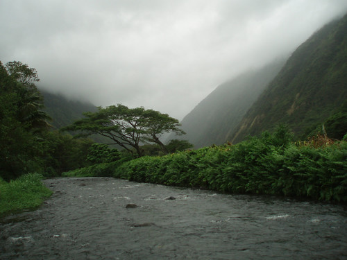
Cool and breezy – showers windward sides
Photo Credit: flickr.com
The trade winds remain blustery as expected, which will remain active through Wednesday…becoming lighter Thursday into the weekend. All of Hawaii’s coastal and channel waters still have small craft wind advisories, which will remain active into mid-week. As we move into the second half of this work week, our winds will become somewhat lighter. The computer models continue to show lighter winds this weekend, coming in from the east-southeast or southeast. Volcanic haze is often carried over the state, from the Big Island vents during SE wind episodes…which may become a part of our Hawaiian Island weather picture then.
Generous rainfall amounts continue to be brought into the state on the blustery northeast trade winds. The windward sides have seen the greatest share of these trade wind showers. Although, with the stronger winds blowing, the leeward sides have seen some showers falling locally too. Weather conditions will improve on Thursday, especially along the south and west facing beaches. Lighter winds from the southeast, as we get to the weekend, will cause afternoon upcountry convective shower activity…some of which may be locally generous.
It’s Tuesday evening here in Kihei, Maui, as I begin writing this last section of today’s narrative. The inclement weather conditions, at least on the north and east facing windward sides remains active now. These inclement weather conditions will prevail into Wednesday, with gradually improving conditions Thursday onward. Here’s a satellite image, so you can keep an eye on the clouds moving through the state. As you can see, we continue to find large amounts of high cirrus clouds streaming overhead. Here’s a looping radar image as well, so that you can see where the showers are being carried in…on the cool northeast wind flow.
~~~ Orographic precipitation continues to gather over the windward coasts and slopes Tuesday evening. Orographic simply means that moisture being carried in on the trade winds, rises as it impacts the slopes of our volcanic islands, with clouds and showers dumping rainfall there. I used the word dumping on purpose, due to the generous rainfall totals being noted along those slopes during the last 24 hours…as of late Tuesday afternoon. Here’s a few examples: 2.01" in the mountains on Kauai; 5.76" over the mountains on Oahu; 1.61" on Molokai; 4.69" over the West Maui Mountains…7.03" over the windward side of east Maui; and finally the 5.29" on the Big Island.
~~~ Tuesday was not a banner day for sunshine here in the islands, far from it as a matter of fact! If you had a chance, or can spare a few seconds now, you can click on the satellite image above, that we have a ton of high clouds streaming overhead. These icy clouds are being pushed in our direction by an upper level trough of low pressure just to our southwest. The counterclockwise rotation around this trough, is carrying this sun dimming and filter, high level moisture over our islands. This cloudiness, in addition to the cool northeast winds, kept our high temperatures on the low side again today…topping out at near record low levels in many areas! The rainfall during the last 24 hours, at a rain gauge along the Hana Highway, here on Maui, measured over 7.00" of the wet stuff! It was a windy, cloudy, and locally wet day here in paradise Tuesday!
~~~ I’m about ready to head out, on my drive back upcountry to Kula. Looking out the window here in Kihei, before I leave at near 530pm, its just about totally cloudy out there. I do see a very small break in the clouds, with the slightest bit of blue sky showing through the otherwise overcast skies. I’d like to say that our weather will improve Wednesday, but I’m afraid that we’ll likely have to wait until Thursday, before we see any substantial changes. Nonetheless, I’d like to wish you well, and at the same time invite you back again Wednesday. I hope you have a great Tuesday night until then! Aloha for now…Glenn.
Interesting: Some bio-fuels cause more health problems than petrol and diesel, according to scientists who have calculated the health costs associated with different types of fuel. The study shows that corn-based bio-ethanol, which is produced extensively in the US, has a higher combined environmental and health burden than conventional fuels. However, there are high hopes for the next generation of bio-fuels, which can be made from organic waste or plants grown on marginal land that is not used to grow foods. They have less than half the combined health and environmental costs of standard gasoline and a third of current bio-fuels. The work adds to an increasing body of research raising concerns about the impact of modern corn-based bio-fuels. Several studies last year showed that growing corn to make ethanol bio-fuels was pushing up the price of food. Environmentalists have highlighted other problems such deforestation to clear land for growing crops to make the fuels. The UK governments renewable fuels advisors recommended slowing down the adoption of bio-fuels until better controls were in place to prevent inadvertent climate impacts.
Using computer models developed by the US Environmental Protection Agency, the researchers found the total environmental and health costs of gasoline are about 71 cents per gallon, while an equivalent amount of corn-ethanol fuel has associated costs of 72 cents to $1.45, depending on how it is produced. The next generation of so-called cellulosic bio-ethanol fuels costs 19 cents to 32 cents, depending on the technology and type of raw materials used. These are experimental fuels made from woody crops that typically do not compete with conventional agriculture. The results are published online today in the Proceedings of the National Academy of Sciences. "The dialogue so far on bio-fuels has been pretty much focused on greenhouse gases alone," said David Tilman, a professor at the department of ecology, evolution and behavior at the University of Minnesota. "And yet we felt there were many other impacts that were positive or negative not being included. We wanted to expand the analysis from greenhouse gases to at least one other item and we chose health impacts."
Interesting2: The specter of an ocean floor littered with dead shellfish, rock fish, sea stars and other marine life off the Oregon coast spurred Mark Snyder, a climate change expert, to investigate whether California’s coast faced a similar calamity. It could, the University of California Santa Cruz earth scientist said, citing climate change, which some scientists believe is responsible for stronger and more persistent winds along the coast. There’s no debate that windier conditions drive more upwelling of nutrient-rich deep ocean waters. At normal levels, this upwelling sustains the abundance of marine life, but too much of these rich waters leads to a boom-and-bust cycle that ultimately creates ocean "dead zones" with little or no oxygen. Marine life that can’t swim or scuttle away from these lethal zones suffocate.
To assess future wind and upwelling scenarios along the California coast, Snyder and his colleagues at UC Santa Cruz ran climate simulations for two time periods. One spanned from 1968 to 2000, verifying the accuracy of the modeling. The second simulated the region’s estimated climate from 2038 to 2070, using the intergovernmental panel on climate change "high-growth" emissions projections. Snyder said he chose the high emissions scenario because todays are exceeding earlier IPCC estimates. The results showed increases in wind speeds of as much as 2 meters per second, a 40% increase from current wind speeds, which now average 5 meters per second, Snyder said. The change in wind speeds is already happening, Snyder said. California winds have been growing in strength in the past 30 years. Snyder said he knows his hypothesis needs more research, so he’ll know whether to continue pursuing it or to discard it. The latter is unlikely, he said, given the new cycle of dead zones on the Oregon and Washington coasts that started in 2002.
Interesting3: Google Earth allows web users to explore world’s oceans in 3D. The Ocean tool combines renderings of underwater terrain with expert content from marine biologists and oceanographers, allowing web surfers to swim around virtual underwater volcanoes, watch videos about exotic marine life, read about nearby shipwrecks, and contribute photos and videos of their favorite diving spots. Google said that humans had only ever explored around five per cent of the world’s oceans, which cover more than 70 per cent of the earth’s surface and contain 80 per cent of all life. Eric Schmidt, Google’s chief executive, said the launch of Ocean in Google Earth provided an opportunity to change people’s perspective about the importance of the oceanic ecosystem in the overall health of the planet. "In discussions about climate change, the world’s oceans are often overlooked, despite being an integral part of the issue," he said. "Biodiversity loss in our oceans in the next 20 to 30 years will be roughly equivalent to losing an entire Amazon rainforest, but this goes unnoticed because we can’t see it."
The Ocean feature is included in the newest version of Google Earth. As users zoom in on the ocean they will see a dynamic water surface, which they can then "dive" beneath to navigate the sea floor. Areas available for exploration include the Mid-Ocean Ridge, the world’s longest underwater mountain range, which stretches 50,000km around the globe.Many of the world’s leading scientists, researchers and ocean explorers have contributed to the fact files, videos and information sheets within the tool. There is even new and unseen footage from the archives of Jacques Cousteau, as well as the ability to track satellite-tagged sea animals, such as whales.
Interesting4: Your mother always told you not to use your teeth as tools to open something hard, and she was right. Human skulls have small faces and teeth and are not well-equipped to bite down forcefully on hard objects. Not so of our earliest ancestors, say scientists. New research published in the February 2009 issue of Proceedings of the National Academy of Sciences reveals nut-cracking abilities in our 250-million-year-old relatives that enabled them to alter their diet to adapt to changes in food sources in their environment. Mark Spencer, an Arizona State University assistant professor, and doctoral student Caitlin Schrein in ASU’s School of Human Evolution and Social Change, are part of the international team of researchers who devised the study featured in the article "The feeding biomechanics and dietary ecology of Australopithecus africanus." Using state-of-the-art computer modeling and simulation technology – the same kind engineers use to simulate how a car reacts to forces in a front-end collision – evolutionary scientists built a virtual model of the A. africanus skull and were able to see just how the jaw operated and what forces it could produce.
"We started with a CT scan of a skull that is one of the most complete specimens of A. africanus that we have," said Spencer, researcher in ASU’s Institute of Human Origins and a lead investigator on the project, which was funded by the National Science Foundation and European Union. This would be a later ancestor of Lucy – STS5 – who is affectionately known as "Mrs. Ples." The skull, discovered in 1947, has struts on the side of the nose, but no teeth. "We meshed those data with another specimen with teeth to make the virtual model of the bone and tooth structure. "Then we looked at chimpanzees, who share common features with Australopithecus, and took measurements of how their muscles work and added that to the model. We were able to validate this model by comparing it to a similar model built for a species of monkey called macaques," Spencer explained. The result – a rainbow colored virtual skull that illustrates forces absorbed by the cranial structure in simulated bite scenarios and how their unusual facial features were ideally suited to support the heavy loads of cracking hard nuts.
Interesting5: More energy from wind power came online in Europe in 2008 than from any other energy source, the European Wind Energy Association (EWEA) reported recently. Of new energy-generating capacity that went online in that year, 43 per cent came from wind power, the group said. That meant an average of 20 wind turbines installed every working day of that year. The growth in production capacity means about 4.2 per cent of Europe’s energy demand will come from wind power. The group says that will mean 108 million tonnes less in carbon dioxide emissions a year, the equivalent of taking more than 50 million cars off European roads. "The figures show that wind energy is the undisputed number one choice in Europe’s efforts to move towards clean, indigenous renewable power," said Christian Kjaer, EWEA’s chief executive. The group said it saw the most growth in Germany and Spain. The group also said it was seeing market growth in eastern Europe.
Interesting6: It is 3 degrees and snowing outside the Alaska Volcano Observatory in Anchorage, but inside the operations center, things are heating up. "This is kind of the nerve center, if you will," says geologist Michelle Coombs, who is at the helm of a bank of video monitors showing readouts from sensors on Mount Redoubt, a volcano about 100 miles southwest of Anchorage. The sensors measure seismic activity on the volcano’s summit. Scientists at the observatory combine that information with data gathered from daily airplane flights to the volcano to measure gases and try to figure out if and when Redoubt is going to blow. "We’re seeing lots of little earthquakes right now," says Coombs. "As that magma rises, it breaks rock as it gets to the surface, and it also it gives off gases, and that leads to the seismic activities were seeing now."
When the magma, or molten rock, makes it to the surface, the volcano will erupt. A siren goes off, and one of the video monitors goes haywire. Is the mountain erupting? "That’s just a little alarm. There was just a little bit of increased seismic activity," Coombs says reassuringly. "It’s a special kind of earthquake particular to volcanoes called a long-period earthquake. It has more to do with fluid and gases than with breaking rock." Since the monitors first showed increased activity on January 23, the observatory has been staffed 24 hours a day. Scientists here are calling in reinforcements; several geologists from the Lower 48 have been making their way north to help.
Coombs thinks Redoubt will erupt within days or weeks. No one lives near the mountain, which sits on the Cook Inlet and is largely surrounded by glacier ice. That means there is no direct danger from lava flows, but huge clouds of ash could spread throughout Alaska. When Redoubt last erupted in 1989, it spread ash across Alaska for five months. "Geologists like to use the past as a key to the future, and previous historical eruptions of Redoubt have produced ash clouds of up to 40,000 feet above sea level," says Coombs. She notes that at current weather conditions, "it would take about three hours for that ash to leave the volcano and arrive in Anchorage." The ash is composed largely of silica, which is similar to tiny fragments of glass.
Down on the ground, the ash can be dangerous to breathe in and can damage cars as their engines draw the ash into their engines. But it is usually a nuisance. However, in the sky, the ash clouds can create very dangerous flying conditions for jets. "For jet aviation, it’s a very severe hazard because jet engines run at a very high temperature. And once that silica-rich ash gets ingested into the engine, it can re-melt and coat the insides of the engines and freeze up those engines," says Coombs. "That’s really the major thing we are trying to avoid here." The day after the 1989 eruption of Redoubt, a 747 flew into an ash cloud near Anchorage and all four engines stalled. The pilot was able to get two of the engines restarted, and the plane landed safely. Coombs says airspace around the volcano and Anchorage may be closed if Redoubt erupts.
Interesting7: Mexico City shut down a main water pipeline under a new conservation program, cutting service to more than 2 million residents Sunday after some reservoirs dropped to their lowest levels in 16 years. The Mexico City government and the National Water Commission will interrupt service for three days every month until May, when the rainy season begins. Mexico City’s government says the plan will affect everyone from those living in million-dollar mansions to cement hovels. Another 13 cities in the metro area of 20 million also will see service reduced, the National Water Commission said. To prepare for the three-day shutdown, which ends Tuesday, residents filled underground cisterns, saved water in buckets to bathe and were flushing toilets and doing the wash only when necessary. Saleswoman Amanda Sanchez, 46, was not happy about having her taps shut off. "It’s hard, especially for working mothers like me, because I use more water on the weekends," she said. Even before this weekend, some residents have had virtually no running water because of the poor condition of their pipes. City water pipes are so leaky, experts estimate 40 percent of drinking water is lost, and nearly all Mexico City’s abundant rainfall simply flows into sewage drains. The shut-off also will allow authorities to make much-needed repairs to the pipelines.
Interesting8: More than 47 million years ago, a whale was about to give birth to her young … on land. That’s according to skeletal remains of a pregnant cetacean whose fetus was positioned head-down as is the case for land mammals but not aquatic whales. The teeth of the fetus were so well-developed that researcher’s who analyzed the fossils think the baby would have been born within days, had its mom not died. The fossil discovery marks the first extinct whale and fetus combination known to date, shedding light on the lifestyle of ancient whales as they made the transition from land to sea during the Eocene Epoch (between 54.8 million and 33.7 million years ago). Philip Gingerich, a paleontologist at the University of Michigan, Ann Arbor, and his team discovered the pregnant whale remains in Pakistan in 2000, and then in 2004, Gingerich’s co-authors and others found the nearly complete skeleton of an adult male from the same species in those fossil beds. The adult whales are each about 8.5 feet long and weighed between 615 and 860 pounds, though the male was slightly longer and heavier than the female.
Interesting9: The Earth’s seasons have shifted back in the calendar year, with the hottest and coldest days of the years now occurring almost two days earlier, a new study finds. This shift could be the work of global warming, the researchers say. To figure this out, scientists at the University of California, Berkeley and Harvard studied temperature data from 1850 to 2007 compiled by the University of East Anglia’s Climate Research Unit in the United Kingdom. They found that temperatures over land in the 100-year period between 1850 and 1950 showed a simple, natural pattern of variability, with the hottest day of the year in the Northern Hemisphere landing around July 21. But from the mid-1950s onward (the period when global average temperatures began to rise), the hottest day came 1.7 days earlier. This shift is happening at the same time that those summer and winter peaks are getting warmer and the gap between them is closing (because winter temperatures are rising faster than summer ones).
And with this shift of peak warming and cooling comes a corresponding shift in the onset of the seasons, which the researchers say explains the month-to-month pattern of temperatures over the past 50 years. "Once we have accounted for the fact that the temperature averaged over any given year is increasing, we find that some months have been warming more than other months," said Alexander Stine, a graduate student at UC Berkeley. "We were surprised to find that over land, most of the difference in the warming of one month relative to another is simply the result of this shift in the timing of the seasons, and a decrease in the difference between summer and winter temperatures." In recent years, scientists have noted other signs that the seasons are shifting: some birds are migrating earlier; plants are blooming earlier; mountain snows are melting earlier. The timing of the shift along with the rise in global temperatures leads Stine and his colleagues to think that human-caused climate change is the ultimate cause behind the shift. But exactly which effects of global warming are driving the shift is less clear.
Posted by Glenn
[2] Comments
February 2-3, 2009
Air Temperatures – The following maximum temperatures were recorded across the state of Hawaii Monday afternoon:
Lihue, Kauai – 74
Honolulu, Oahu – 80
Kaneohe, Oahu – 77
Kahului, Maui – 80
Hilo, Hawaii – 78
Kailua-kona – 87
Air Temperatures ranged between these warmest and coolest spots near sea level, and on the highest mountains…at 4 p.m. Monday afternoon:
Kailua-kona – 79F
Lihue, Kauai – 70
Haleakala Crater – 48 (near 10,000 feet on Maui)
Mauna Kea summit – 36 (near 14,000 feet on the Big Island)
Precipitation Totals – The following numbers represent the largest precipitation totals (inches) during the last 24 hours on each of the major islands, as of Monday afternoon:
0.76 Mount Waialaele, Kauai
0.86 Oahu Forest NWR, Oahu
0.09 Molokai
0.00 Lanai
0.00 Kahoolawe
1.72 West Wailuaiki, Maui
1.45 Hilo airport, Big Island
Weather Chart – Here’s the latest (automatically updated) weather map showing a relatively close 1032 millibar high pressure system to the north-northwest of the Hawaiian Islands Tuesday. Our winds will remain out of the trade wind direction…gusty into Wednesday.
Satellite and Radar Images: To view the cloud conditions we have here in Hawaii, please use the following satellite links, starting off with the Infrared Satellite Image of the islands to see all the clouds around the state during the day and night. This next image is one that gives close images of the islands only during the daytime hours, and is referred to as a Close-up visible image. This next image shows a larger view of the Pacific…giving perspective to the wider ranging cloud patterns in the Pacific Ocean. Finally, here’s a looping IR satellite image, making viewable the clouds around the islands 24 hours a day. To help you keep track of where any showers may be around the islands, here’s the latest animated radar image.
Hawaii’s Mountains – Here’s a link to the live webcam on the summit of near 14,000 foot Mauna Kea on the Big Island of Hawaii. The tallest peak on the island of Maui is the Haleakala Crater, which is near 10,000 feet in elevation. These two webcams are available during the daylight hours here in the islands…and when there’s a big moon rising just after sunset for an hour or two! Plus, during the nights and early mornings you will be able to see stars, and the sunrise too…depending upon weather conditions.
Aloha Paragraphs

Gusty – showery weather windward sides
Photo Credit: flickr.com
Strong and gusty trade winds are blowing across all the islands Monday evening, and will continue through mid-week…after which they will calm down some into the weekend. This boost in wind speeds has triggered a small craft wind advisory in all of the Hawaiian coastal and channel waters going into Tuesday. As we move into the second half of the week, our winds will become somewhat lighter…as a cold front moves by to our north during the Saturday-Sunday time frame. It looks like, at least from this vantage point, that our trade winds will remain active right into next week.
Clouds have spread across all of the islands, both at the surface…and at higher levels of the atmosphere as well. These clouds, at least the lower level ones, will be dropping showers locally. The windward sides will see the largest share of these trade wind showers, although with the stronger winds blowing, the leeward sides will see some on the smaller islands too. Weather conditions will improve by Thursday, especially along the south and west facing shores. The computer models continue to show easterly to southeast winds this weekend, perhaps drawing tropical moisture up into the state then. As the trade winds return after the weekend, most of the showers will shift back over to the windward sides.
It’s Monday evening here in Kihei, Maui, as I begin writing this last section of today’s narrative. As pointed out above, our weather is going through some changes into Tuesday. Actually, looking at satelite imagery, and out the window here in Kihei this afternoon…I should say has gone through changes. Our winds have accelerated, our clouds have increased, along with an uptick in passing showers along the windward sides especially. These inclement weather conditions will prevail into Wednesday, with gradually improving conditions Thursday onward. Here’s a satellite image, so you can keep an eye on the clouds moving through the state. You will notice quite a few high level cirrus clouds still streaming across island skies, which are blocking the lower level clouds quite effectively. Here’s a looping radar image as well, so that we can see the showers being carried in on the cool northeast wind flow.
~~~ It’s cloudy, windy, and locally showery here in the islands now. The satellite image above shows the degree of cloudiness that has moved over all the islands. The radar imagery too shows that there aren’t all that many showers around yet, although windward Maui is getting its fair share. These showers will increase a bit more, and will stretch over to the leeward sides at times locally. As far as the winds, at least early Monday evening, the strongest winds that I saw was the rather robust 36 mph gust at windy Maalaea Bay…here on Maui. Wait a second, hold your horses for a second, now I see a top gust of 42 mph on the small island of Lanai! This air in a hurry will be sticking around for the next couple of days, so that we may find even stronger gusts blowing on Tuesday!
~~~ I’m about ready to jump in the car, for the drive upcountry to Kula. I’ll keep my eyes peeled for anything unusual during that drive, and if something catches my eye, I’ll come back online at home, that is after I take my brisk walk…and let you know what it was. Otherwise, I’ll be back very early Tuesday morning with your next new weather narrative from paradise…even if it is a little bit on the inclement side at the moment. I hope you have a great Monday night until then! Aloha for now…Glenn.
Interesting: There were no reports of injuries or damage from the eruption of Mount Asama, which is about 90 miles northwest of Tokyo. The volcano erupted at 1:51 a.m. (11:51 p.m. EST) Monday, belching out a plume that rose about a mile high, according to Japan’s Meteorological Agency. The plume was still roiling over the volcano’s crater late Monday. Chunks of rock from the explosion were found about 3,300 feet away from the volcano. Ash was detected over a wide area, including central Tokyo. In the town of Karuizawa, southeast of the volcano, the ash was thick enough to obscure road markings in some areas, town official Noboru Yanagishi said. "Some people said they heard a strange noise in the morning when the eruption occurred," he said.
Interesting2: Japan denied on Monday accusations by a U.S.-based hard-line anti-whaling group that Japanese whaling ships had used weapons against activists on inflatable boats near Antarctica. The Sea Shepherd Conservation Society said in a statement that two crew members were injured when Japanese whalers used water cannon, concussion grenades, acoustic weapons and threw brass and lead balls at Sea Shepherd boats. The group said on Sunday that it had spotted the Japanese whaling fleet and was closing in on them. "If our crew can hit them, then they would be better off quitting the research vessel and joining a professional baseball team," said Shigeki Takaya, an assistant director of the Far Seas Fisheries Division at Japan’s fisheries ministry.
Interesting3: With arctic sea ice melting like ice cubes in soda, scientists want to protect a region they say will someday be the sole remaining frozen bastion of a disappearing world. Spanning the northern Canadian archipelago and western Greenland, it would be the first area formally protected in response to climate change, and a last-ditch effort to save polar bears and other animals. "All the indications are of huge change, and a huge response is needed if you want to have polar bears beyond 2050," said Peter Ewins, the World Wildlife Fund’s Director of Species Conservation. National Parks have proven to be one of the most important ways to protect and preserve natural areas and wildlife. First established in the United States in 1916, national parks have since been adopted internationally. But protecting an area outside of a single country’s borders could prove to be difficult. The arctic sea ice is composed of vast plains of three- to nine-foot-thick ice that cover the top of the northern hemisphere. Though, some of the ice melts each summer, much of it remains frozen year-round — or, at least, it used to. Summer melts are accelerating, and winter re-freezing can no longer make up the difference.
Every summer now seems to be accompanied by news of unprecedented ice loss and more waters open for the first time in known history. "When the (Ice Age) glaciers retreated, there was ice left in different spots around the world. Those isolated pockets of biodiversity were called refugia," said Stephanie Pfirman, an environmental science professor at Barnard College. "The same is likely to happen in the Arctic." If current greenhouse gas emission trends continue, the proposed protected region will be the only area with year-round ice, according to the Intergovernmental Panel on Climate Change. "The IPCC reports published over the last few years pretty much agree that even if we switched off our carbon power stations and SUVs tomorrow, we’d have significant shrinkage of ice-dominated ecosystems to the middle of the century — and in reality, it could be faster than that," Ewins said. Protecting the ice won’t be easy: a warming Arctic means new shipping routes and newly-accessible natural resources, from oil to diamonds and uranium. But this isn’t the first time humanity has chosen between material wealth and icy treasure.
Interesting4: The biggest snowstorm in 18 years hit southeastern England, including London, on Monday. By late in the afternoon, local time, as much as 8 inches of snow blanketed parts of London. The heavy snow produced massive travel problems in the sprawling capital city. Bus service was stopped, and some subway lines also had service suspended. Numerous accidents were reported on area roadways; these led to road closures and backed-up traffic. The snow severely affected air travel to and from the city’s several airports. At Heathrow, a jet slid into a grassy area while moving to a terminal after landing; there were no injuries. All flights at Heathrow were cancelled for several hours. The storm also forced widespread school closings.
Interesting5: A century from now, Spain and Italy will be enduring baking, parched summers while residents of central and north-west Europe will be experiencing what we now think of as Mediterranean warmth. Reindert Haarsma and his team from the Royal Netherlands Meteorological Institute in De Bilt used existing computer models to study changes in weather patterns resulting from the expected global warming. These indicated that summer temperatures in southern Europe would rise by 2 to 3 °C compared with today’s, and that lack of rain would dry up the soils. The hot, dry air above these arid soils would then rise and expand, creating a low-pressure zone over the region. Winds circulating anticlockwise around this zone would feed continental air to more northerly areas, raising temperatures there too.
Interesting6: Heightened support from the Obama Administration and the new Congress on environmental issues, strong green elements in the proposed stimulus and anticipated regulatory changes are fueling optimism for green investment, according to Allianz Global Investors. That’s the assessment of results from the latest survey of American investors for the asset management firm, which says Americans see a "golden age" coming for green investing. In addition to expecting broad policy change from Washington, D.C., investors increasingly perceive firms that seek to address environmental issues as strong investment opportunities, the company said. "The need for pollution control, clean water and energy efficiency is not going away," Brian Gaffney, managing director and CEO of Allianz Global Investors Distributors, said in a statement. "Investors perceive there is real opportunity here and they want to capitalize on it." Gaffney said investors’ positive outlook on the environmental technology sector reflects their perception of the area as a long-term opportunity. "Investors understand that robust demand for innovation and solutions will fuel growth, and consequently profits, for years to come," he said.
Interesting7: Rising sea levels are causing salt water to flow into India’s biggest river, threatening its ecosystem and turning vast farmlands barren in the country’s east, a climate change expert warned Monday. A study by an east Indian university in the city of Kolkata revealed surprising growth of mangroves on the Ganges river, said Pranabes Sanyal, the eastern India representative of the National Coastal Zone Management Authority (NCZMA). "This phenomenon is called extension of salt wedge and it will salinate the groundwater of Kolkata and turn agricultural lands barren in adjoining rural belts," said Sanyal, an expert in global warming. Sea levels in some parts of the Bay of Bengal were rising at 3.14 mm annually against a global average of 2 mm, threatening the low-lying areas of eastern India. Climate experts warned last year that as temperatures rise, the Indian subcontinent — home to about one-sixth of humanity — will be badly hit with more frequent and more severe natural disasters such as floods and storms and more disease and hunger.
Posted by Glenn
No Comments
February 1-2, 2009
Air Temperatures – The following maximum temperatures were recorded across the state of Hawaii Sunday afternoon:
Lihue, Kauai – 75
Honolulu, Oahu – 80
Kaneohe, Oahu – 77
Kahului, Maui – 79
Hilo, Hawaii – 78
Kailua-kona – 82
Air Temperatures ranged between these warmest and coolest spots near sea level, and on the highest mountains…at 5 p.m. Sunday evening:
Kailua-kona – 82F
Lihue, Kauai – 73
Haleakala Crater – 48 (near 10,000 feet on Maui)
Mauna Kea summit – 37 (near 14,000 feet on the Big Island)
Precipitation Totals – The following numbers represent the largest precipitation totals (inches) during the last 24 hours on each of the major islands, as of Sunday afternoon:
0.35 Mount Waialaele, Kauai
0.02 Kahuku, Oahu
0.00 Molokai
0.00 Lanai
0.00 Kahoolawe
0.01 West Wailuaiki, Maui
0.20 Laupahoehoe, Big Island
Weather Chart – Here’s the latest (automatically updated) weather map showing high pressure systems far to the northeast, and to the northwest of the Hawaiian Islands Monday. Our winds will remain out of the trade wind direction…strengthening notably today and Tuesday.
Satellite and Radar Images: To view the cloud conditions we have here in Hawaii, please use the following satellite links, starting off with the Infrared Satellite Image of the islands to see all the clouds around the state during the day and night. This next image is one that gives close images of the islands only during the daytime hours, and is referred to as a Close-up visible image. This next image shows a larger view of the Pacific…giving perspective to the wider ranging cloud patterns in the Pacific Ocean. Finally, here’s a looping IR satellite image, making viewable the clouds around the islands 24 hours a day. To help you keep track of where any showers may be around the islands, here’s the latest animated radar image.
Hawaii’s Mountains – Here’s a link to the live webcam on the summit of near 14,000 foot Mauna Kea on the Big Island of Hawaii. The tallest peak on the island of Maui is the Haleakala Crater, which is near 10,000 feet in elevation. These two webcams are available during the daylight hours here in the islands…and when there’s a big moon rising just after sunset for an hour or two! Plus, during the nights and early mornings you will be able to see stars, and the sunrise too…depending upon weather conditions.
Aloha Paragraphs

Gusty winds and showers arriving soon
Photo Credit: flickr.com
Light trade winds prevailed Sunday, which will strengthen during the day Monday…becoming stronger and gusty into Tuesday. A boost in our trade winds will bring blustery conditions, with cooler weather to the state Monday, lasting into the mid-week time frame. The trade winds will calm down some during the second half of the upcoming work week. As we move into next weekend, our winds will become lighter still, and from the south to southeast…to the south of a cold front. These winds, as they pass over the Big Island vents, will carry volcanic haze to the other islands.
The windward sides will see a few passing showers will be moving into a period of passing showers…with some extending to the leeward sides at times. The tail-end of a cold front, and an approaching trough of low pressure to the east…will combine to bring an increase in cool showers into Tuesday. The windward sides will see the bulk of these showers, although with the stronger trade winds blowing, the leeward sides will see a few stretching over there locally on the smaller islands too. Weather conditions will improve starting Wednesday, especially along the south and west facing shores.
It’s Sunday evening here in Kula, Maui, as I begin writing this last section of today’s narrative. As noted above, our trade winds will pick up Monday, as a retired cold front, called a shear line, arrives from the northwest. At the same time, a trough of low pressure to the east, is edging in our direction. These two weather features will bring stronger and gusty trade winds, along with lower air temperatures. The trade winds will carry showery clouds into our area as well…especially along our windward coasts and slopes. This winter weather reality will last into Wednesday, with an improving forecast for Thursday into the upcoming weekend time frame.
~~~ As pointed out above, our weather will be going through some rather drastic changes during the next 24 hours. Our winds will be accelerating, our clouds will be increasing…along with a surge in passing showers along the windward sides especially. These inclement weather conditions will prevail through Tuesday, with gradually improving conditions later Wednesday onward. Here’s a looping satellite image, so we can see the high level cirrus clouds that are sweeping into our area, preceding the arrival of the lower level clouds, and gusty trade winds Monday. I suppose we’d better bring up this looping radar image too, as we’ll have showers arriving soon too.
~~~ I had a wonderful day Sunday, hanging out at home with my neighbors mostly. They came over to my house in the morning, wondering if I needed a cup of coffee…and the day went forward from there. I didn’t need that cup, but somehow I ended up over there, as their place is larger. Then it was outside working a bit, and somehow we ended up on my deck, for a period of ping pong, which we haven’t played for quite a while. Then I got into cooking a batch of red sauce pasta, and they went on a walk. I had planned on going on that walk, but got a telephone call from one of my best friends, telling me about a health issue that is serious…which changed my mood immediately, and changed my life in an instant! At any rate, there’s the most vivid sunset happening here right now, and I feel moved to get out there and ponder the beauty. I hope you have a great Sunday night, and will meet me here again very early Monday morning. Aloha for now…Glenn.
Interesting: Wintry conditions are set to dominate the UK weather in the coming week, bringing heavy snow for many parts. On Friday and Saturday, temperatures across eastern parts of the UK will gradually fall, but it is not until Sunday that the cold weather really takes hold. Temperatures in Birmingham on Sunday are set to peak at just 34F. Wintry showers are set for eastern parts of the UK on Sunday, with anywhere from Aberdeenshire to Kent receiving around half an inch of snow. On Monday and Tuesday, this snow risk extends further west, with significant accumulations possible for much of England, Wales, and southern Scotland. Up to 8 inches of snow is possible over higher ground in the east by the end of Tuesday. The return to colder weather across the UK is due to the influence of an area of high pressure centered over Scandinavia. This high pressure system will remain slow moving into next week, and will draw in very cold air from continental Europe and western Russia. As this cold air moves across the North Sea, it will pick up moisture, which is then deposited as snow showers over the UK. So far, this winter has been the coldest in the UK for over a decade. Forecasters from the Met Office expect temperatures for the whole of winter to be average or below average.
Interesting2: A searing heat wave worsened on Friday in Melbourne, Australia, as the temperature soared to 113 degrees F, or 35 degrees above average. Wednesday and Thursday set respective highs of 110 and 112 degrees F. This was the first time since record-keeping began in 1855 that three consecutive days surpassed 109 degrees F in the city. Friday’s high came close to Melbourne’s all-time highest temperature, 114 degrees F, which was reached on Jan. 13, 1939. The high heat played a role in a massive blackout late on Friday as demand for electricity surged. Furthermore, brushfires instigated by the hot, dry weather burned at least 10 homes.
Interesting3: China needs more rational policies to make the most of its wind power, says an editorial in Nature. Despite doubling their capacity every year for the past three years, China’s wind turbines are less efficient at producing energy and break down more often than those in other countries. China’s bidding system favors developers that promise cheap supplies of electricity — even if such promises make the projects unprofitable, says the editorial. International companies with more efficient turbines don’t even bother to bid. And many appointed projects fail to get off the ground. China could learn from countries with more experience of wind energy, says the editorial. It suggests the first thing to do is focus on producing power, rather than building turbines. The editorial also recommends that China adopts more reasonable targets. Operating at international standards of efficiency, China’s turbines could produce five per cent of the nation’s energy needs by 2020 and could make China the biggest producer of wind energy in the world.
Interesting4: Villagers in the Kamchatka peninsula are reliant on poaching salmon as almost their sole source of income, according to a new report launched today by WWF-Russia and TRAFFIC, the wildlife trade monitoring network. The report assesses the level of poaching in Kamchatka (so-called illegal, unregulated and unreported (IUU) catch) of five species of salmon – pink, chum, sockeye, Coho and Chinook – and analyses the importation of these species by countries in the region. “Salmon is an integral part of Kamchatka’s economy, but stocks are threatened by unsustainable illegal off-take,” says Natalia Dronova, WWF-TRAFFIC co-ordinator and an author of the report. She adds: “The future security of this vital economic resource depends on how we treat it today.” Salmon are mainly poached for their roe (eggs), which are sold as a cheaper alternative to caviar.
According to the report, poaching of salmon on the spawning grounds has increased significantly, driven by a combination of factors including easier access because of better roads, Russia’s economic situation, and an easing of the country’s salmon trade regulations. For example, in 2003-2006 the actual catch of chum salmon was an average 1.5 times more than officially reported. “Combating the poachers is complicated by technical difficulties, corruption, and because the illegal salmon catch is almost the sole source of income for villagers in Kamchatka,” says Dronova. Currently on rivers where legal fisheries exist, poaching provides income to about 30% of households. However, on rivers not used by legal fishing entities, up to 90% or even 100% of families live through poaching. The report says that improving the options for legal processing of fish, plus providing other forms of employment, for example through increased tourism to the region, would reduce the levels of illegally fished salmon. Improved local and federal law enforcement would also help in preserving salmon and salmon-based livelihoods for the people of Kamchatka.
Intersting5: The oceans have long buffered the effects of climate change by absorbing a substantial portion of the greenhouse gas carbon dioxide. But this benefit has a catch: as the gas dissolves, it makes seawater more acidic. Now an international panel of marine scientists says this acidity is accelerating so fast it threatens the survival of coral reefs, shellfish and the marine food web generally. The panel, comprising 155 scientists from 26 countries and organized by the United Nations and other international groups, is not the first to point to growing ocean acidity as an environmental threat, but its blunt language and international credentials give its assessment unusual force. It called for “urgent action” to sharply reduce emissions of carbon dioxide. “Severe damages are imminent,” the group said Friday in a statement summing up its deliberations at a symposium in Monaco last October. The statement, called the Monaco Declaration, said increasing acidity is interfering with the growth and health of shellfish and eating away at coral reefs, processes that would eventually affect marine food webs generally. Already, the group said, there have been detectable decreases in shellfish, shell weights and interference with the growth of coral skeletons.
Interesting6: A new way of making LEDs could see household lighting bills reduced by up to 75% within five years. Gallium Nitride (GaN), a man-made semiconductor used to make LEDs (light emitting diodes), emits brilliant light but uses very little electricity. Until now high production costs have made GaN lighting too expensive for wide spread use in homes and offices. However the Cambridge University based Centre for Gallium Nitride has developed a new way of making GaN which could produce LEDs for a tenth of current prices. GaN, grown in labs on expensive sapphire wafers since the 1990s, can now be grown on silicon wafers. This lower cost method could mean cheap mass produced LEDs become widely available for lighting homes and offices in the next five years. Based on current results, GaN LED lights in every home and office could cut the proportion of UK electricity used for lights from 20% to 5%. That means we could close or not need to replace eight power stations. A GaN LED can burn for 100,000 hours so, on average, it only needs replacing after 60 years. And, unlike currently available energy-saving bulbs GaN LEDs do not contain mercury so disposal is less damaging to the environment.
GaN LEDs also have the advantage of turning on instantly and being dimmable. Professor Colin Humphreys, lead scientist on the project said: “This could well be the holy grail in terms of providing our lighting needs for the future. We are very close to achieving highly efficient, low cost white LEDs that can take the place of both traditional and currently available low energy light bulbs. That won’t just be good news for the environment. It will also benefit consumers by cutting their electricity bills.” GaN LEDs, used to illuminate landmarks like Buckingham Palace and the Severn Bridge, are also appearing in camera flashes, mobile phones, torches, bicycle lights and interior bus, train and plane lighting. Parallel research is also being carried out into how GaN lights could mimic sunlight to help 3m people in the UK with Seasonal Affective Disorder (SAD). Ultraviolet rays made from GaN lighting could also aid water purification and disease control in developing countries, identify the spread of cancer tumors and help fight hospital super bugs’.
Interesting7: A researcher from the University of the West of England was inspired by her own nightmares and a chance encounter at a lecture to examine more closely the stuff that dreams are made of. Her PhD study has focused on an astounding discovery that women suffer more nightmares then men. As a mature student Dr Jennie Parker was interested in looking at some aspect of psychology for her PhD study and it was at a lecture about dreams, given by former UWE researcher Dr Susan Blackmore that she had a moment of epiphany. Dr Parker explains, “My own nightmares had two reoccurring themes, one concerned standing on the beach at Weston Super Mare, my home town, when the tide suddenly goes out very fast and returns as a huge tidal wave that is about to engulf me. The other dream includes a dinosaur roaming the streets at night and looking in at my window.
I wondered if my experience was common amongst women. “Several years on and Dr Parker has completed a study that looks set to turn Dream Research on its head and expand its potential as a subject with multi faceted possibilities hitherto unrealized. In the course of her work she found that research into sleep and dreams had used data collection techniques that discounted entirely the role of emotions in dreams. She believes that this ‘discovery’ opens up a whole new raft of research possibilities into the psychology of dreaming. Dr Parker explains, “My most significant finding is that women in general do experience more nightmares than men. An early study into dreams lead to my discovering that normative research procedures into Dream Research often considered the structure of dreams but that there is a gaping hole in terms of academic study that investigates emotional significance in the analysis of dreams.
Interesting8: Older Americans have experienced huge, negative financial shifts that now make it more difficult to enter retirement with sustainable economic security, a new study finds. Seventy-eight percent of all senior households are financially vulnerable when it comes to their ability to meet essential expenses and cover projected costs over their lifetimes. This is according to the Senior Economic Security Index (SESI), a new research project developed by The Institute on Assets and Social Policy at Brandeis University and Demos, a national public policy and research organization. Single households, African-American households, and Latino households are the most likely groups of seniors to be financially vulnerable. These sobering stats serve as a wakeup call for younger and middle-aged Americans. Though they are financially vulnerable, today’s seniors represent a best-case scenario of having reached retirement under stronger Social Security, better employer-based benefits, and greater opportunities to avoid debt and build assets than future generations will experience.
« Previous Page


