November 2007
Monthly Archive
Posted by Glenn
No Comments
November 6-7 2007
Air Temperatures – The following maximum temperatures were recorded across the state of Hawaii Tuesday:
Lihue, Kauai – 84
Honolulu, Oahu – 81
Kaneohe, Oahu – 82
Kahului, Maui – 85
Hilo, Hawaii – 85
Kailua-Kona, Hawaii – 85
Temperatures ranged between these warmest and coolest spots near sea level at 4 a.m. Wednesday morning:
Kailua-kona – 76F
Kahului, Maui – 69
Precipitation Totals – The following numbers represent the largest precipitation totals (inches) during the last 24 hours on each of the major islands, as of Wednesday morning:
0.06 WAILUA, KAUAI
0.20 WILSON TUNNEL, OAHU
0.00 MOLOKAI
0.00 LANAI
0.00 KAHOOLAWE
1.11 OHEO GULCH, MAUI
3.01 PALI 2, BIG ISLAND
Weather Chart – The low pressure system to our west-southwest is keeping our winds on the light side, with the isobars still showing the wind flow out of the southeast or east-southeast. However, as the low fills and moves away towards the west, a 1025 millibar high pressure system to the NE, with its associated ridge, will bring back the trade winds late Wednesday or by Thursday. Here’s the latest (automatically updated) weather map. Here’s a Weather Map Symbol page for clarification about what all those weather symbols mean on the map.
Hawaii’s Mountains – Here’s a link to the live webcam on the summit of near 14,000 foot Mauna Kea on the Big Island of Hawaii. The tallest peak on the island of Maui is the Haleakala Crater, which is near 10,000 feet in elevation. These two webcams are available during the daylight hours here in the islands…and when there’s a big moon rising just after sunset for an hour or two! Plus, during the nights and early mornings you will be able to see stars, and the sunrise too…depending upon cloud conditions.
Tropical Cyclone activity in the eastern and central Pacific – Here’s the latest information coming out of the National Hurricane Center, covering the eastern north Pacific. You can find the latest tropical cyclone information for the central north Pacific (where Hawaii is located) by clicking on this link to the Central Pacific Hurricane Center. Here’s a tracking map covering both the eastern and central Pacific Ocean.
Satellite and Radar Images: To view the cloud conditions we have here in Hawaii, please use the following satellite links, starting off with the Infrared Satellite Image of the islands to see all the clouds around the state during the day and night. This next image is one that gives close images of the islands only during the daytime hours, and is referred to as a Close-up visible image. This next image shows a larger view of the Pacific…giving perspective to the wider ranging cloud patterns in the Pacific Ocean…out from the islands. To help you keep track of where any showers may be around the islands, here’s the latest animated radar image.
Aloha Paragraphs
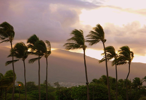
 Tropical Bliss on Maui
photo credit: flickr.com
The rain producing Kona low pressure system, which brought good rains to Hawaii this past weekend, continues to move away towards the southwest. This departing low pressure system is still close enough though, that it wouldn’t be out of the question for a few more related showers to fall in places across the islands Tuesday afternoon. However, the threat of these showers will be diminishing, with improved weather conditions beginning in earnest Wednesday…which will remain the case through the remainder of this week.
The winds, which have been rather light and from the southeast direction, are about to get a little stronger…becoming light to moderately strong trade winds by later Wednesday into Thursday. The return of our easterly trade wind flow will bring us back into a more normal trade wind weather pattern soon. This simply means that we’ll see sunnier weather for the south and west facing leeward beaches. The north and east facing windward sides will see the usual partly cloudy skies, with a few passing showers…most generous during the night and early morning hours.
It’s Tuesday evening here in Kula, Maui, as I start writing this last paragraph of today’s narrative. As you can see from this satellite image, we still have quite a few clouds to the south and south west of Hawaii. The cirrus clouds coming up off the tops of thunderstorms down there, were streaking across island skies Tuesday. We may very well see a wonderfully colorful sunset! As the atmosphere is stabilizing now, meaning it is less shower prone, our weather in general is getting better by the moment. ~~~ The webcam atop the summit of the near 14,000 Mauna Kea on the Big Island, showed great pictures of the snow atop that mountain Monday! Here’s a link to that webcam, so that during the daylight hours you can see that beautiful snow up there again today…and perhaps still a few patches on Wednesday. ~~~ As noted in one of the paragraphs above, we have the trade winds just around the corner to our east, which will usher in favorably inclined weather circumstances starting Wednesday, with sunnier and drier weather on tap through the rest of this week once it starts. I’ll be back early Wednesday morning with your next new weather narrative from paradise. I hope you have a great Tuesday night wherever you happen to be reading from! Aloha for now…Glenn.
Posted by Glenn
No Comments
November 5-6 2007
Air Temperatures – The following maximum temperatures were recorded across the state of Hawaii Monday:
Lihue, Kauai – 81
Honolulu, Oahu – 80
Kaneohe, Oahu – 83
Kahului, Maui – 87
Hilo, Hawaii – 82
Kailua-Kona, Hawaii – 87
Temperatures ranged between these warmest and coolest spots near sea level at 4 a.m. Tuesday:
Lihue, Kauai – 77F
Kahului, Maui – 67
Precipitation Totals – The following numbers represent the largest precipitation totals (inches) during the last 24 hours on each of the major islands, as of Tuesday morning:
0.67 MOUNT WAIALEALE, KAUAI
1.46 OLOMANA FIRE STATION, OAHU
0.07 MOLOKAI
0.16 LANAI
0.00 KAHOOLAWE
0.06 KAUPO GAP, MAUI
0.45 PIIHONUA, BIG ISLAND
Weather Chart – The low pressure system to our SW is keeping our winds on the light side, with the isobars still showing the wind flow out of the SE. However, as the low fills and moves away towards the SW, a high pressure system to the NE, with its associated ridge, will bring back the trade winds Wednesday. Here’s the latest (automatically updated) weather map. Here’s a Weather Map Symbol page for clarification about what all those weather symbols mean on the map.
Hawaii’s Mountains – Here’s a link to the live webcam on the summit of near 14,000 foot Mauna Kea on the Big Island of Hawaii. The tallest peak on the island of Maui is the Haleakala Crater, which is near 10,000 feet in elevation. These two webcams are available during the daylight hours here in the islands…and when there’s a big moon rising just after sunset for an hour or two! Plus, during the nights and early mornings you will be able to see stars, and the sunrise too…depending upon cloud conditions.
Tropical Cyclone activity in the eastern and central Pacific – Here’s the latest information coming out of the National Hurricane Center, covering the eastern north Pacific. You can find the latest tropical cyclone information for the central north Pacific (where Hawaii is located) by clicking on this link to the Central Pacific Hurricane Center. Here’s a tracking map covering both the eastern and central Pacific Ocean.
Satellite and Radar Images: To view the cloud conditions we have here in Hawaii, please use the following satellite links, starting off with the Infrared Satellite Image of the islands to see all the clouds around the state during the day and night. This next image is one that gives close images of the islands only during the daytime hours, and is referred to as a Close-up visible image. This next image shows a larger view of the Pacific…giving perspective to the wider ranging cloud patterns in the Pacific Ocean…out from the islands. To help you keep track of where any showers may be around the islands, here’s the latest animated radar image.
Aloha Paragraphs
 Improving weather conditions in Hawaii
photo credit: flickr.com
There’s still the chance of more showers across the Aloha state Monday evening into the night. A Kona low pressure system is now located in the area southwest of Kauai Monday. The relatively close proximity of this surface low pressure system will keep our atmosphere still a little unstable for the time being. This unstable air mass may cause a couple more heavy showers, with the best chances over or near Kauai and Oahu. The NWS has continued the flash flood watch for only those western Islands Monday evening. The good news is that this low pressure cell is filling and moving away towards the southwest now, which will take the threat of heavy showers away with it.
Flash flooding occurred in some places this past weekend…most notably on the island of Oahu. All of the Hawaiian Islands had periods of heavy showers, ranging between 2-5 inches in general during the last 24-36 hours. The windward side of Oahu received over 14 inches of rain at one point, during a 24 hour period…which is a significant fall of water! Other than in those places where the rains came down in buckets, most of the precipitation fell in the light to moderately heavy category. We got a good soaking for our island vegetation, helping to push the drought conditions, that we saw during the summer months…back quite a bit.
It’s Monday evening here in the islands, as I write this last paragragh of this narrative update. As you can see from this looping satellite image, we have the counterclockwise circulating Kona low pressure center located to the southwest of Kauai. The relatively close proximity of this low pressure system, will keep tropical moisture coming up into the Hawaiian Islands for the time being. This of course will keep the threat of off and on showers in the forecast…although the threat is diminishing for Maui County and the Big Island. In addition, here’s the looping radar image (you need to refresh this image if you’ve already looked at it before), showing more showery clouds moving towards Kauai and Oahu. ~~~ The webcam atop the summit of the near 14,000 Mauna Kea on the Big Island, showed snow showers falling at times Sunday, mixed with rain. Here’s a link to that webcam, so that once the sun comes up, you will be able to see if there’s any of the white stuff sticking to the ground up there. It’s melting quickly, and as the sun goes down, the picture will only show darkness. ~~~ Looking ahead, we see further improvement in our weather circumstances Tuesday, with the trade winds dominating our Hawaiian Island weather picture, starting later Tuesday through the rest of the week. ~~~ I’ll be back early Tuesday morning with your next complete weather narrative, I hope you have a great Monday night wherever you happen to be spending it! Aloha for now…Glenn.
Posted by Glenn
No Comments
November 4-5 2007
Air Temperatures – The following maximum temperatures were recorded across the state of Hawaii Sunday:
Lihue, Kauai – 79
Honolulu, Oahu – 78
Kaneohe, Oahu – 76
Kahului, Maui – 75
Hilo, Hawaii – 82
Kailua-Kona, Hawaii – 82
Temperatures ranged between these warmest and coolest spots near sea level at 4 a.m. Monday:
Kahului, Maui – 73F
Lihue, Kauai – 69
Precipitation Totals – The following numbers represent the largest precipitation totals (inches) during the last 24 hours on each of the major islands, as of Monday morning:
1.08 LIHUE AIRPORT, KAUAI
8.49 KANEOHE MCBH, OAHU
5.75 MOLOKAI
2.79 LANAI
0.57 KAHOOLAWE
1.61 MAHINAHINA, MAUI
2.24 PALI 2, BIG ISLAND
Weather Chart – A low pressure system just to the west of the state of Hawaii will keep our winds on the light side, blowing out of the east to SE, depending upon where you are…more breezy on the Big Island end of the chain. Here’s the latest (automatically updated) weather map. Here’s a Weather Map Symbol page for clarification about what all those weather symbols mean on the map.
Hawaii’s Mountains – Here’s a link to the live webcam on the summit of near 14,000 foot Mauna Kea on the Big Island of Hawaii. The tallest peak on the island of Maui is the Haleakala Crater, which is near 10,000 feet in elevation. These two webcams are available during the daylight hours here in the islands…and when there’s a big moon rising just after sunset for an hour or two! Plus, during the nights and early mornings you will be able to see stars, and the sunrise too…depending upon cloud conditions.
Tropical Cyclone activity in the eastern and central Pacific – Here’s the latest information coming out of the National Hurricane Center, covering the eastern north Pacific. You can find the latest tropical cyclone information for the central north Pacific (where Hawaii is located) by clicking on this link to the Central Pacific Hurricane Center. Here’s a tracking map covering both the eastern and central Pacific Ocean.
Satellite and Radar Images: To view the cloud conditions we have here in Hawaii, please use the following satellite links, starting off with the Infrared Satellite Image of the islands to see all the clouds around the state during the day and night. This next image is one that gives close images of the islands only during the daytime hours, and is referred to as a Close-up visible image. This next image shows a larger view of the Pacific…giving perspective to the wider ranging cloud patterns in the Pacific Ocean…out from the islands. To help you keep track of where any showers may be around the islands, here’s the latest animated radar image.
Aloha Paragraphs
 Rainy weather in Hawaii
photo credit: flickr.com
Inclement weather conditions with periods of heavy rain, along with localized flooding will continue across the Hawaiian Islands. A Kona low continues slipping down into the area WNW of the Hawaiian islands Sunday evening, which is adding instability to our overlying atmosphere as we move through the next couple of days. This unstable air mass will provide possible heavy showers, with localized flooding over into Tuesday. The NWS has continued the flash flood watch for the entire state of Hawaii through Tuesday night, which escalated into a flash flood warning at times during the last 24 hours.
This unsettled weather pattern will include southeast to south winds across the islands. Winds coming in from this direction help to draw up rich moisture from the deeper tropics, which help to feed showers that form over the Aloha state. The combination of the tropical moisture from our southeast and south, and the instability caused by the Kona low’s cold air aloft to our WNW…is what is prompting our locally heavy showers now, with thunderstorms at times as well.
This is the first major rain storm of the autumn season here in Hawaii. We’re looking for a final end to what turned out to be quite a dry summer on some of the islands…where drought conditions prevailed locally. The heaviest showers initially occurred on Kauai and Oahu, although the rest of the state saw precipitation spreading down through the island chaing Sunday afternoon into the evening hours.
Flash flooding occurred in some places…so everyone should remain alert for weather related problems. The air aloft has been cold enough to cause the seasons first snowfall atop the summits on the Big Island. The Haleakala Crater on Maui was too far below the freezing level to see any of that white stuff however. It will likely take until the middle of the new week ahead for these inclement weather conditions to move away completly. We can look for improvement to occur around Wednesday, when the trade winds will return, and drier weather moves back through the remainder of the week.
It’s Sunday evening here in the islands, as I write this last paragragh of this narrative update. As you can see from this looping satellite image, we have a major amount of tropical moisture being drawn up over the islands from the southwest by the counterclockwise rotating Kona low pressure system to the west-northwest of Kauai. That image shows a certain amount of clearing behind the main cloud band wrapping into the Kona low. Although, the unstable air mass should keep at least periodic showers, and even some heavy ones moving up over the state from the west for the time being. In addition, here’s a looping radar image (you need to refresh this image if you’ve already looked at it before) as well. ~~~ As evidence of this wet weather, the windward side of Oahu, received 14.29 inches of heavy rain during the last 24 hours! The area of rain has moved down over the southern part of the state, and will continue its path down over the Big Island into Sunday night. ~~~ I’ll be back early Monday morning with your next new weather narrative, including more cutting edge information about this wet weather pattern. Aloha for now…Glenn.
Posted by Glenn
No Comments
November 3-4 2007
Air Temperatures – The following maximum temperatures were recorded across the state of Hawaii Friday:
Lihue, Kauai – 84
Honolulu, Oahu – 82
Kaneohe, Oahu – 83
Kahului, Maui – 90
Hilo, Hawaii – 83
Kailua-Kona, Hawaii – 84
Temperatures ranged between these warmest and coolest spots near sea level at 5 a.m. Saturday:
Kailua-kona – 75F
Kahului, Maui – 67
Precipitation Totals – The following numbers represent the largest precipitation totals (inches) during the last 24 hours on each of the major islands, as of Saturday morning:
1.20 HANALEI RIVER, KAUAI
0.98 NUUANU UPPER, OAHU
0.00 MOLOKAI
0.01 LANAI
0.00 KAHOOLAWE
0.24 KAUPO GAP, MAUI
1.90 PAHOA, BIG ISLAND
Weather Chart – A strong high pressure system is still evident far to the NE of Hawaii, although its associated ridge to our north is being weakened rapidly by low pressure to our NW. This pressure configuration will keep our winds lighter and from the SE to south over the next several days. Here’s the latest (automatically updated) weather map. Here’s a Weather Map Symbol page for clarification about what all those weather symbols mean on the map.
Hawaii’s Mountains – Here’s a link to the live webcam on the summit of near 14,000 foot Mauna Kea on the Big Island of Hawaii. The tallest peak on the island of Maui is the Haleakala Crater, which is near 10,000 feet in elevation. These two webcams are available during the daylight hours here in the islands…and when there’s a big moon rising just after sunset for an hour or two! Plus, during the nights and early mornings you will be able to see stars, and the sunrise too…depending upon cloud conditions.
Tropical Cyclone activity in the eastern and central Pacific – Here’s the latest information coming out of the National Hurricane Center, covering the eastern north Pacific. You can find the latest tropical cyclone information for the central north Pacific (where Hawaii is located) by clicking on this link to the Central Pacific Hurricane Center. Here’s a tracking map covering both the eastern and central Pacific Ocean.
Satellite and Radar Images: To view the cloud conditions we have here in Hawaii, please use the following satellite links, starting off with the Infrared Satellite Image of the islands to see all the clouds around the state during the day and night. This next image is one that gives close images of the islands only during the daytime hours, and is referred to as a Close-up visible image. This next image shows a larger view of the Pacific…giving perspective to the wider ranging cloud patterns in the Pacific Ocean…out from the islands. To help you keep track of where any showers may be around the islands, here’s the latest animated radar image.
Aloha Paragraphs
 The beautiful colors of Hawaii’s ocean
photo credit: flickr.com
Saturday will start off just fine in most areas, with clouds increasing during the afternoon…leading to locally heavy upcountry showers. A Kona low is forming to the northwest of Kauai now, which will lead to a greater degree of instability in our overlying atmosphere. This unstable air mass will increase the chance for heavy showers, with localized flooding probable over the next several days. The NWS has continued the flash flood watch for the entire state of Hawaii through Tuesday night as a matter of fact. As we move into Saturday night, Sunday and Monday, and perhaps even Tuesday…a more widespread rain event is expected.
This unsettled weather pattern will include southeast to south winds across the islands. Southeast winds can bring volcanic haze up over the Kona coast, reaching as far NW as the islands of Maui County in such a case. Winds coming in from this direction help to draw up rich moisture from the deeper tropics as well, which help to feed showers that form over the Aloha state. The combination of the tropical moisture from our southeast and south, and the instability caused by the upper low’s cold air…is what will prompt locally heavy showers, or even thunderstorms at times.
This will be the first major rain storm of the autumn season here in Hawaii. The computer forecast models had a difficult time getting to a common weather solution, although over the last several days, have finally agreed upon a common weather solution. We’re looking for a final end to what turned out to be quite a dry summer on some of the islands…where drought conditions prevailed. We will see the chance for heavy showers starting Saturday afternoon, focused most intently over and around the mountains. There will certainly be towering cumulus, and the chance of an isolated cumulonimbus clouds.
The weekend will start off in a pleasant enough manner, although conditions will get progressively wetter as the Kona low moves closer to the islands by Saturday night and Sunday. There is a good chance that flash flooding will occur in some places, so everyone should be alert for weather related problems. The air aloft may be cold enough to cause the seasons first snowfall atop the summits on the Big Island. The Haleakala Crater on Maui will be too far below the freezing level to see any of that white stuff however. It will likely take until the middle of next week for these inclement weather conditions to move away. We can look for improvement to occur around next Wednesday, when the trade winds will return, and drier weather moves back through the remainder of the week.
On another note, stepping aside from the weather for a moment, I saw the new film called Michael Clayton Friday evening after work, starring George Clooney among others. The Boston Globe gave this film an A- in terms of a grade, and said the following: "Steadily paced, occasionally lumbering, the movie’s for grown-ups willing to settle in and sift the complex chess moves of legal and personal feint and counterfeint." – The Chicago Sun-Times wrote: "Michael Clayton makes old-style Hollywood craftsmanship look easy. It’s one of the most satisfying films of the year, recalling a classy breed of studio film more common in the 1970s and the early ’80s. Such films often made money, but they weren’t blockbusters and didn’t try to be. Generally they were too low-key to bust any blocks. So is “Michael Clayton,” but I suspect it will wear well, and well past Oscar season." Here’s a trailer for Michael Clayton. I very much enjoyed this film, and would recommend it highly for those that are drawn to such stories such as this.
It’s Saturday here in the islands, as I write this last paragragh of this narrative. Last night when I went to bed up here in Kula, Maui, just before I fell asleep, I kept noticing this white flickering reflected in the window. I finally sat up and looked in the direction it was coming from, which to be to the north, over towrds Paia and Haiku. It turned out to be an incredible display of constantly flashing lightning from thunderstorms offshore from the north shore of east Maui! It’s still dark as write these words, with all of that now having ended. ~~~ As you can see from this looping satellite image, we have a ton of high clouds being drawn up over the islands from the south, and the heavy duty looking rain clouds associated with the approaching counterclockwise rotating Kona low pressure system to the north. While I’m adding links to keep an eye on this approaching storm, here’s a looping radar image as well. ~~~ I’ll be back often during the day, and through each of the next 3-4 days, keeping you closely abreast of all the latest weather news in regards to this seriously wet weather situation that will envelope the islands soon. Aloha for now…Glenn.
Posted by Glenn
[3] Comments
November 1-2 2007
Air Temperatures – The following maximum temperatures were recorded across the state of Hawaii Thursday:
Lihue, Kauai – 84
Honolulu, Oahu – 85
Kaneohe, Oahu – 81
Kahului, Maui – 85
Hilo, Hawaii – 84
Kailua-Kona, Hawaii – 84
Temperatures ranged between these warmest and coolest spots near sea level at 4 a.m. Friday:
Lihue, Kauai – 76F
Kahului, Maui – 66
Precipitation Totals – The following numbers represent the largest precipitation totals (inches) during the last 24 hours on each of the major islands, as of Friday morning:
0.64 WAINIHA, KAUAI
3.00 POAMOHO 2, OAHU
0.17 MOLOKAI
3.26 LANAI
0.00 KAHOOLAWE
2.09 PUU KUKUI, MAUI
2.30 HILO AIRPORT, BIG ISLAND
Weather Chart – A strong high pressure system is still evident far to the NE of Hawaii, although its associated ridge to our north is being weakened rapidly by low pressure to our NW. This pressure configuration will turn our winds lighter and from the SE to south over the next several days. Here’s the latest (automatically updated) weather map. Here’s a Weather Map Symbol page for clarification about what all those weather symbols mean on the map.
Hawaii’s Mountains – Here’s a link to the live webcam on the summit of near 14,000 foot Mauna Kea on the Big Island of Hawaii. The tallest peak on the island of Maui is the Haleakala Crater, which is near 10,000 feet in elevation. These two webcams are available during the daylight hours here in the islands…and when there’s a big moon rising just after sunset for an hour or two! Plus, during the nights and early mornings you will be able to see stars, and the sunrise too…depending upon cloud conditions.
Tropical Cyclone activity in the eastern and central Pacific – Here’s the latest information coming out of the National Hurricane Center, covering the eastern north Pacific. You can find the latest tropical cyclone information for the central north Pacific (where Hawaii is located) by clicking on this link to the Central Pacific Hurricane Center. Here’s a tracking map covering both the eastern and central Pacific Ocean.
Satellite and Radar Images: To view the cloud conditions we have here in Hawaii, please use the following satellite links, starting off with the Infrared Satellite Image of the islands to see all the clouds around the state during the day and night. This next image is one that gives close images of the islands only during the daytime hours, and is referred to as a Close-up visible image. This next image shows a larger view of the Pacific…giving perspective to the wider ranging cloud patterns in the Pacific Ocean…out from the islands. To help you keep track of where any showers may be around the islands, here’s the latest animated radar image.
Aloha Paragraphs
 Another nice sunset here in the islands
photo credit: flickr.com
As the trade winds fade away, our weather will remain pretty good for the time being. Although with the relatively close proximity of an upper level low pressure to the east-northeast of the Big Island, our atmosphere remains unstable enough that there may be a continued threat of heavy showers locally. Looking at the clouds around the Hawaiian Islands Thursday evening, they seem to have a rather pronounced vertical development…indicating the presence of cold air aloft. When we see these towering cumulus clouds, with a weakening wind field, the chance of locally heavy showers, although spotty at the moment…increases.
After nearly a week’s worth of flip flops in the computer forecast models, they seem to be in fair agreement that we will see a wet weekend coming up. The upper level low to our ENE now is expected to fill and move away soon. This doesn’t help us much, as a new long wave trough of low pressure is expected to swing down from the middle latitudes, depositing a cutoff low pressure center to the NW of Kauai by Saturday. These cutoff lows are called Kona lows when they form within range of the Hawaiian Islands. They are infamous for being heavy rain producers, at least sometimes. When these low pressure systems form to the west and NW of Hawaii they can funnel large amounts of tropical moisture up over the islands. It’s not a complete certainty yet, but there’s a good chance that we could see heavy showers, even ones heavy enough to cause localized flooding starting Saturday, and remaining a threat into early next week.
Back to the winds, as they become lighter and from the southeast, there will be several influences in our local Hawaiian Island weather pattern. The first will be for an increase in vog over the Kona side of the Big Island, reaching up over the islands of Maui County. This SE orientation will put most of the state in the wind shadow of the Big Island, with much lighter winds than have been blowing during the recent long term trade wind episode. SE winds too can bring rich tropical moisture up from the deeper tropics, fuel for the showers that are expected due to the instability created by the Kona low’s closeness. Cloud plumes can be carried from one island to the next, which can concentrate their associated showers for long enough to cause localized flooding rainfall. Finally, rather warm and muggy weather can take place with such a SE wind flow.
There seems to still be enough uncertainty, that this may or may not manifest completely as drawn out in the paragraphs above. However, most of the computer forecast models are now suggesting that some form of trough or Kona low will come close to, or over the islands over the next 4-5 days. There are still some wild cards in the mix, but in sum…unsettled weather coming our way, with the best prospect for the heaviest showers between Saturday and Sunday or Monday. Between now and then, there seems to be a distinct lack of clouds over us, and upstream, which will limit the shower outbreaks temporarily. Later Friday things should become more interesting, and hopefully put an end to whatever drought prone pockets that still remain in place across the Hawaiian Islands. Looking further ahead, by about Tuesday we should see improvement in these unsettled weather circumstances, as the trade winds return
It’s Thursday evening here in Hawaii as I begin updating this last paragraph of today’s narrative. As you can see from the information in the paragraphs above, we have a good chance of a wet weekend coming up. There’s still a part of me that wants to hedge my bet on this unfolding as the computer models indicate. All this week I’ve been asking for just one or two more days to fully make up my mind in regards to this rain event. It’s finally the judgement day though, and the models are all just too lined up together in their forecast, in lock step if you will…to overlook their weather solution. So, with just a little leftover reluctance, I’ll finally submit to the good chance of increasing showers Saturday through next Monday or Tuesday! I think folks should be ready for the chance of some good soaking rains during that time frame, with the possibility of flooding rainfall not out of the question. The cold air associated with the upper low may onof both Mauna Kea and Mauna Loa on the Big Island! ~~~ I’ll be back very early Friday morning, well before dawn, with your next new weather narrative, I hope you have a great Thursday night wherever you happen to be spending it! Aloha for now…Glenn.
« Previous Page


