March 2007
Monthly Archive
Posted by Glenn
No Comments
April 29-30 2007
Air Temperatures – The following maximum temperatures were recorded across the state of Hawaii Sunday:
Lihue, Kauai – 82F
Honolulu, Oahu – 85
Kaneohe, Oahu – 81
Kahului, Maui – 83
Hilo, Hawaii – 82
Kailua-Kona, Hawaii – 82
Temperatures early Monday morning ranged between these warmest and coolest spots near sea level at the 4 a.m. hour:
Kaneohe, Oahu – 74F
Hilo, Hawaii – 67
Precipitation Totals – The following numbers represent the largest precipitation totals (inches) during the last 24 hours on each of the major islands, as of Monday morning:
0.92 MOUNT WAIALEALE, KAUAI
0.69 MANOA LYON ARBORETUM, OAHU
0.11 MOLOKAI
0.02 LANAI
0.61 KAHOOLAWE
1.79 PUU KUKUI, MAUI
0.27 LAUPAHOEHOE, BIG ISLAND
Weather Chart – Here’s the latest (automatically updated) weather map…showing high pressure centers located far to the NE and NW of Hawaii Monday. The high to the NW will move into the area north of the state Tuesday, with somewhat stronger trade wind speeds then. Here’s a Weather Map Symbol page for clarification about what all those weather symbols mean on the map.
Hawaii’s Mountains – Here’s a link to the live webcam on the summit of near 14,000 foot Mauna Kea on the Big Island of Hawaii. The tallest peak on the island of Maui is the Haleakala Crater, which is near 10,000 feet in elevation. These two webcams are available during the daylight hours here in the islands…and when there’s a big moon rising just after sunset for an hour or two! Plus, during the nights and early mornings you will be able to see stars, and the sunrise too…depending upon cloud conditions.
Satellite Images – To view the cloud conditions we have here in Hawaii, please use the following satellite links, starting off with the Infrared Satellite Image of the islands to see all the clouds around the state during the day and night. This next image is one that gives close images of the islands only during the daytime hours, and is referred to as a Close-up visible image. This next image shows a larger view of the Pacific…giving perspective to the wider ranging cloud patterns in the Pacific Ocean…out from the islands. To help you keep track of where any showers may be around the islands, here’s the latest animated radar image.
Aloha Paragraphs

A special rainbow on the windward side of Oahu
The trade winds will continue blowing in the moderately strong category…locally gusty during the afternoon hours in those windiest spots around the Aloha state. Weather charts continue to show the trade winds remaining in this breezy condition through the rest of this weekend. The computer models show the trade winds increasing again Monday. This new increase in trade wind speeds will take us out through the first half of the new work week ahead. Thereafter, at some point during the second half of the week, our winds will become lighter again by a notch or two…perhaps veering around to the ESE or even SE then.
As usual, with the trade winds blowing across our latitudes of the north central Pacific, there will be at least a few passing showers along the windward sides of the islands As the trade winds increase some starting Monday, we will likely see some additional showers arriving along those north and east facing windward coasts and slopes. As is often the case, the leeward sides will continue to be flooded with warm to very warm sunshine during the days. All things considered, this weekend will be quite nice, with just that modest increase in showers slated starting on Monday.
It’s early Sunday evening here in Kula, Maui, as I begin writing this well before sunset commentary. It was still very sunny in the lowlands Sunday, especially right down near the beaches. Here in Kula, and across many of the upcountry areas around the state, clouds began stacking-up quite early in the day…although there weren’t any showers, or even a sprinkle in most places. The trade winds continue to blow, and are slated, as the computer forecast models have pointed out for the last week, to increase some soon. The new week ahead looks good, at least from a weather perspective, especially along those sun baked leeward beaches! ~~~ I’ve been jamming around this afternoon, finishing projects and doing the last of my domestic chores, in anticipation of leaving soon for the windward side. I have a birthday party to attend in Haiku, which should be fun. A music group called the Hula Honeys will be doing a live performance, then a catered dinner, followed by a rock and roll dance party. This party is happening at a couple of good friends of mine, who live on an estate, which is lovely. I’m trying to get there a little early, as I won’t be able to stay late…as 4am comes very early Monday morning, at which point I’ll be back online to prepare this narrative page, along with the Windsurf/Kiteboarding, Beach, Surfing, and the Dive and Snorkeling pages…which I update twice each day. So, here’s wishing you a great Sunday evening/night, along with an invitation to join me here again Monday. Aloha for now…Glenn.
TV weather show online now: At long last, my tv weather program is available on the internet! It’s not exactly like watching your TV set, but it’s a fairly close approximation. Each day’s new show will replace the previous days show (Monday through Friday) around mid-morning here in Hawaii, usually by 10am HST or so. That of course would make it around 1pm on the west coast, and around 4pm on the east coast…I can’t say what times it will be in other parts in the world. If you click here, it will take you to the website where it can be viewed. I want to thank the kind folks at the Maui Media Lab, located in Paia, Maui for this opportunity to show what’s happening weatherwise here in Hawaiian Islands! By the way, you will need to have a quicktime viewer on your computer to view the feed…you can get the free download here if it’s not already loaded on your machine.
Posted by Glenn
1 Comment
March 20-21 2007
Air Temperatures – The following maximum temperatures were recorded across the state of Hawaii Tuesday:
Lihue, Kauai – 80F
Honolulu, Oahu – 80
Kaneohe, Oahu – 80
Kahului, Maui – 81
Hilo, Hawaii – 79
Kailua-Kona, Hawaii – 80
Temperatures early Wednesday morning ranged between these warmest and coolest spots near sea level at the 4 a.m. hour:
Kaneohe, Oahu – 74F
Hilo, Hawaii – 64
Precipitation Totals – The following numbers represent the largest precipitation totals (inches) during the last 24 hours on each of the major islands, as of Wednesday morning:
0.97 LIHUE AIRPORT, KAUAI
0.15 MANOA LYON ARBORETUM, OAHU
0.04 MOLOKAI
0.07 LANAI
0.00 KAHOOLAWE
0.91 PUU KUKUI, MAUI
0.64 MOUNTAIN VIEW, BIG ISLAND
Weather Chart – Here’s the latest (automatically updated) weather map…showing a 1035 millibar high pressure center far to the NE of Hawaii Wednesday. Meanwhile, a cold front will move by to the north of the state, pushing the high’s ridge a little closer to the islands. The net result will be for slightly lighter trade winds by Thursday. Here’s a Weather Map Symbol page for clarification about what all those weather symbols mean on the map.
Hawaii’s Mountains – Here’s a link to the live webcam on the summit of near 14,000 foot Mauna Kea on the Big Island of Hawaii. The tallest peak on the island of Maui is the Haleakala Crater, which is near 10,000 feet in elevation. These two webcams are available during the daylight hours here in the islands…and when there’s a big moon rising just after sunset for an hour or two! Plus, during the nights and early mornings you will be able to see stars, and the sunrise too…depending upon cloud conditions.
Satellite Images – To view the cloud conditions we have here in Hawaii, please use the following satellite links, starting off with the Infrared Satellite Image of the islands to see all the clouds around the state during the day and night. This next image is one that gives close images of the islands only during the daytime hours, and is referred to as a Close-up visible image. This next image shows a larger view of the Pacific…giving perspective to the wider ranging cloud patterns in the Pacific Ocean…out from the islands. To help you keep track of where any showers may be around the islands, here’s the latest animated radar image.
Aloha Paragraphs
 Poipu Beach on Kauai…can you dig it?
Photo Credit: Flikr.com
Fresh trade winds will continue to rule the Hawaiian Island weather picture for the time being. Weather maps show a 1034 millibar high pressure system far to the NNE of the Aloha state, which are providing us with gusty trade winds now. These trade winds will remain quite gusty Tuesday, and then slip a little in strength Wednesday…as the high pressure system moves further east. Small craft advisory flags are in force over the windiest places in the southern part of the state Tuesday. These breezy trade winds will last through the week…and then increase in strength some this coming weekend.
The windward sides will continue to see some passing shower activity. These north and east facing windward coasts and slopes will have showers carried into those areas by the fresh trade winds. Some leeward areas on the smaller islands will see a few showers being carried over there in places too, riding over the lower mountains on the gusty trade winds for the time being. There are no organized rain makers, or cold fronts approaching the state at this time, so that we’ll see just the usual showers falling from time to time along the windward coasts and slopes. The leeward sides will exhibit mostly sunny to partly cloudy days.
It’s early Tuesday evening here in Kula, Maui, as I start writing this sunset commentary. Besides enjoying the entire day, doing my various weather jobs, the high point was getting to the beach at lunch. Oh man, that was great, being out in the warm sunshine, taking a nice long walk on the sand, and then jumping into the ocean for a swim, and bodysurfing a few waves too! The healing waters of the Pacific Ocean are such a treat, and to be able to do it almost everyday, it really sinks into my soul. When I first arrived, there was no wind, or just a light breeze. By the time I left, about a half hour later, the wind had come up enough that there were all kinds of white caps chalking-up the nearshore waters. I was glad to have had the pleasure of being there before the afternoon winds hit the Kihei coast. I’m home now obviously, with the late day sunshine adding its golden glow to this area. It’s so peaceful upcountry when there’s no wind blowing, and the air is still warm, and the sunset beckons me out to my weather deck for the final show of the day. I hope you were able to catch the sunset where you are today, or perhaps the sunrise on Wednesday. I’d like to draw your attention down to the next paragraph, as it lays out my pledge drive…I haven’t had one in several years. I hope I get a good response, as I feel I certainly give you readers lots of good energy, and keep folks plugged into the islands, hopefully in a positive way, even when you’re back home on the mainland, or here in the islands too. I’ll be back very early Wednesday morning with your next weather narrative from paradise. I hope you have a great Tuesday night! Aloha for now…Glenn.
I haven’t had a Hawaii Weather Today pledge drive for several years, somehow I kept putting it off, because I don’t like asking for things I guess. However, as many of you know, I put my heart and soul into this website, on a daily basis, actually several times per day, year in and year out. I’m not the NWS or some other government agency, and receive no outside funding…except for a small amount of revenue from advertising links that I offer ~~~ I’d like to ask the readers of this website, if you would please make a donation to my efforts. In the past I have used Paypal, but this time around I’d like to ask those who could offer their support, to send a check. How much would be reasonable you might wonder? I suggest somewhere around $35, up or down from that ball park figure…depending on how much value you receive from visiting my internet weather pages. Please email me (address at the bottom of this page) for where to send your pledge to keep this website going into the future. Thanks so much for your consideration! Aloha…Glenn
Posted by Glenn
1 Comment
March 19-20 2007
Air Temperatures – The following maximum temperatures were recorded across the state of Hawaii Monday:
Lihue, Kauai – 80F
Honolulu, Oahu – 80
Kaneohe, Oahu – 80
Kahului, Maui – 83
Hilo, Hawaii – 81
Kailua-Kona, Hawaii – 84
Temperatures early Tuesday morning ranged between these warmest and coolest spots near sea level at the 4 a.m. hour:
Lihue, Kauai – 72F
Hilo, Hawaii – 65
Precipitation Totals – The following numbers represent the largest precipitation totals (inches) during the last 24 hours on each of the major islands, as of Tuesday morning:
0.81 MOUNT WAIALEALE, KAUAI
0.68 SOUTH FORK KAUKONAHUA, OAHU
0.30 MOLOKAI
0.01 LANAI
0.00 KAHOOLAWE
1.70 PUU KUKUI, MAUI
0.18 HONAUNAU, BIG ISLAND
Weather Chart – Here’s the latest (automatically updated) weather map…showing a 1034 millibar high pressure center far to the NNE of Hawaii Tuesday. This will keep fresh trade winds blowing for the time being, pulling back a little in strength Wednesday. Here’s a Weather Map Symbol page for clarification about what all those weather symbols mean on the map.
Hawaii’s Mountains – Here’s a link to the live webcam on the summit of near 14,000 foot Mauna Kea on the Big Island of Hawaii. The tallest peak on the island of Maui is the Haleakala Crater, which is near 10,000 feet in elevation. These two webcams are available during the daylight hours here in the islands…and when there’s a big moon rising just after sunset for an hour or two! Plus, during the nights and early mornings you will be able to see stars, and the sunrise too…depending upon cloud conditions.
Satellite Images – To view the cloud conditions we have here in Hawaii, please use the following satellite links, starting off with the Infrared Satellite Image of the islands to see all the clouds around the state during the day and night. This next image is one that gives close images of the islands only during the daytime hours, and is referred to as a Close-up visible image. This next image shows a larger view of the Pacific…giving perspective to the wider ranging cloud patterns in the Pacific Ocean…out from the islands. To help you keep track of where any showers may be around the islands, here’s the latest animated radar image.
Aloha Paragraphs
 Playing at the beach in Hawaii
The trade winds will remain active through the rest of the week here in the Islands. Weather maps show a 1034 millibar high pressure system far to the NNW of the Aloha state, which are providing us with gusty trade winds now. These trade winds will remain quite gusty Monday, and then slip a little in strength Tuesday…as the high pressure system moves further east. Small craft advisory flags are in force over the windiest places around the state Monday. These breezy trade winds will last through the week.
The windward sides will continue to see some passing shower activity. These north and east facing windward coasts and slopes will have showers carried into those areas by the fresh trade winds. Some leeward areas on the smaller islands will see a few showers being carried over there in places too, by the gusty trade winds for the time being. These incoming showers will slow down later Tuesday or so, at which point we will be moving into quite a dry period through most of the rest of this week.
It’s early Monday evening here in Kula, Maui, as I start writing this sunset commentary. So, this is the last night of winter, because Tuesday will be the first day of spring! Monday was a great day, which finally dried out along the windward sides of the islands…after quite a wet weekend. Although, looking at the latest satellite image, and in real time glancing over towards the windward sides here on Maui, I see another batch of showery clouds moving in. This will bring a period of showery weather into the night, and perhaps even into the early morning hours on Tuesday. During the day Tuesday however looks to be another good day to have a beach experience. For the maxiumum tanning opportunity, I would highly suggest that one heads out to the south and west facing leeward beaches. The morning hours are almost always less windy, although I’d there will be no shortage of sunshine at any time of the day. Things remain favorably inclined through much of the rest of this week. The trade winds will continue to blow, giving motion to our coconut palms, and scuffing-up the ocean surface with white caps too. I’ll be back very early Tuesday morning with your next weather narrative from paradise, I hope you have a restful and relaxing Monday night! Aloha for now…Glenn.
Note: Due to popular demand (over the years) there’s finally a small picture of myself in the upper right hand corner of this page. Now you can attach a face (or at least the side of a face) to these weather narratives. 
Posted by Glenn
[6] Comments
March 18-19 2007
Air Temperatures – The following maximum temperatures were recorded across the state of Hawaii Sunday:
Lihue, Kauai – 79F
Honolulu, Oahu – 79
Kaneohe, Oahu – 80
Kahului, Maui – 80
Hilo, Hawaii – 81
Kailua-Kona, Hawaii – 82
Temperatures early Monday morning ranged between these warmest and coolest spots near sea level at the 4 a.m. hour:
Kaneohe, Oahu – 73F
Hilo, Hawaii – 65
Precipitation Totals – The following numbers represent the largest precipitation totals (inches) during the last 24 hours on each of the major islands, as of Monday morning:
0.09 MOUNT WAIALEALE, KAUAI
0.82 OAHU FOREST NWR, OAHU
0.51 MOLOKAI
0.00 LANAI
0.12 KAHOOLAWE
2.62 PUU KUKUI, MAUI
0.44 WAIAKEA UKA, BIG ISLAND
Weather Chart – Here’s the latest (automatically updated) weather map…showing a 1034 millibar high pressure center far to the NNW of Hawaii Monday. This will keep fresh trade winds blowing for the time being, pulling back a little in strength Tuesday. Here’s a Weather Map Symbol page for clarification about what all those weather symbols mean on the map.
Hawaii’s Mountains – Here’s a link to the live webcam on the summit of near 14,000 foot Mauna Kea on the Big Island of Hawaii. The tallest peak on the island of Maui is the Haleakala Crater, which is near 10,000 feet in elevation. These two webcams are available during the daylight hours here in the islands…and when there’s a big moon rising just after sunset for an hour or two! Plus, during the nights and early mornings you will be able to see stars, and the sunrise too…depending upon cloud conditions.
Satellite Images – To view the cloud conditions we have here in Hawaii, please use the following satellite links, starting off with the Infrared Satellite Image of the islands to see all the clouds around the state during the day and night. This next image is one that gives close images of the islands only during the daytime hours, and is referred to as a Close-up visible image. This next image shows a larger view of the Pacific…giving perspective to the wider ranging cloud patterns in the Pacific Ocean…out from the islands. To help you keep track of where any showers may be around the islands, here’s the latest animated radar image.
Aloha Paragraphs
 Lots of sunshine on the leeward beaches…especially during the mornings
A late winter trade wind weather pattern is now well established here in the Hawaiian Islands. Weather maps show high pressure systems to the north and NE of the Aloha state, which are sending gusty trade winds into our Hawaiian Island weather picture. These trade winds will remain quite gusty into the new week ahead. Small craft advisory flags are in force over the windiest places around the state Sunday. These breezy trade winds will last through the next week.
The general weather outlook remains good today into the new work week ahead. Daytime air temperatures will be warm, under the influence of sunnier weather conditions now. The north and east windward coasts and slopes will as usual be several degrees cooler. At the same time, there will be cloudy periods, with showers spilling from those clouds at times, being carried in the trade winds on those sides of the islands. Some leeward areas on the smaller islands will see a few showers being carried over there in places, by the gusty trade winds…otherwise mostly dry and quite sunny during the morning hours.
It’s early Sunday evening here in Kula, Maui, as I start writing this pre-sunset commentary. The windward clouds hung in with quite a tenacity Sunday…dropping more showers than expected. The clouds over and around the mountains too, gathered thickly at times, letting loose with showers up there as well. Here in Kula, there were alternating periods of clouds and showers and partly sunny times as well…although not many. The leeward beaches started off ok, but even there at times, the mountain clouds slid downhill to mask our Hawaiian sunshine at times during the afternoon hours ~~~ I went out only once today, and that was a quick trip out to Makawao and Pukalani to get food with my next door neighbor. The sun is shining brightly in Kula at the moment, and feels great on my back. Looking over towards the windward side, there are those same long lasting gray clouds, which have been dropping showers over towards Makawao and Haiku, and it even looks like Kahului and Wailuku may be getting some showers too ~~~ I made some pasta sauce this afternoon, which I’ll be heating up in the evenings during the work days ahead, at least through Thursday for dinners ~~~ I hope you have a good Sunday night, and that you will join me here again on Monday. Aloha for now…Glenn.
Note: Due to popular demand (over the years) there’s finally a small picture of myself in the upper right hand corner of this page. Now you can put a face [or at least the side of a face] to these weather narratives.
Posted by Glenn
1 Comment
March 15-16 2007
Air Temperatures – The following maximum temperatures were recorded across the state of Hawaii Thursday:
Lihue, Kauai – 81F
Honolulu, Oahu – 77
Kaneohe, Oahu – 81
Kahului, Maui – 82
Hilo, Hawaii – 84
Kailua-Kona, Hawaii – 83
Temperatures early Friday morning ranged between these warmest and coolest spots near sea level at the 4 a.m. hour:
Kailua-kona – 73F
Honolulu, Oahu – 66
Precipitation Totals – The following numbers represent the largest precipitation totals (inches) during the last 24 hours on each of the major islands, as of Friday morning:
2.31 WAINIHA, KAUAI
1.61 MAUNAWILI, OAHU
0.98 MOLOKAI
0.78 LANAI
0.71 KAHOOLAWE
0.73 MAHINAHINA, MAUI
0.52 KAPAPALA RANCH, BIG ISLAND
Weather Chart – Here’s the latest (automatically updated) weather map…showing a weak trough of low pressure located near the Big Island Friday. Meanwhile, high pressure centers are noted far to the NW and NE of the islands, with their associated ridges getting ready to bring us trade winds this weekend. Here’s a Weather Map Symbol page for clarification about what all those weather symbols mean on the map.
Hawaii’s Mountains – Here’s a link to the live webcam on the summit of near 14,000 foot Mauna Kea on the Big Island of Hawaii. The tallest peak on the island of Maui is the Haleakala Crater, which is near 10,000 feet in elevation. These two webcams are available during the daylight hours here in the islands…and when there’s a big moon rising just after sunset for an hour or two! Plus, during the nights and early mornings you will be able to see stars, and the sunrise too…depending upon cloud conditions.
Satellite Images – To view the cloud conditions we have here in Hawaii, please use the following satellite links, starting off with the Infrared Satellite Image of the islands to see all the clouds around the state during the day and night. This next image is one that gives close images of the islands only during the daytime hours, and is referred to as a Close-up visible image. This next image shows a larger view of the Pacific…giving perspective to the wider ranging cloud patterns in the Pacific Ocean…out from the islands. To help you keep track of where any showers may be around the islands, here’s the latest animated radar image.
Aloha Paragraphs
 Wild Orchids Hawaii
Photo Credit: flikr.com
The showery cold front has moved over Kauai and Oahu…and is heading towards the islands of Maui County Thursday evening. This weather feature has our local winds blowing in from the south through SW Kona direction out ahead of the front. The threat of heavy rain is still in the forecast where winds are coming up from the south, and until the departing cold front, or what is now simply a shearline, moves away to the NE Friday. We will see partly cloudy conditions in general, with cloudy skies ahead of, and along with the cold front…with the outside chance of a thunderstorm from the island of Maui and perhaps the northern half of the Big Island.
The air flow coming in behind the cold front has become drier and a little cooler as north to NE winds start up Thursday over Kauai and Oahu. Friday will be a transition day between the Kona winds today, and the returning trade winds by this weekend. Whatever showers that may be around Thursday will be gone for the most part Friday, although there’s always the chance we could see a couple of showers riding in on the returning NE breezes. The overall outlook remains favorably inclined as we move into the upcoming weekend.
As we move into the weekend those NE breezes will have become our classic trade winds. These trade winds will become quite gusty into next week. The trade winds will usher in lots of sunshine for the leeward sides, and some passing showers for the windward sides. The long range weather outlook for the islands remains very encouraging! This weekend will begin a good long stretch of good weather, with tons of sunshine available for those interested in sun tanning and outdoor activities. We’ll see just a few showers spilling from the clouds being carried along the windward coasts and slopes by the strengthening trade winds.
It’s early Thursday evening here in Kula, Maui, as I begin writing this cloudy sunset commentary. The air is charged with moisture this evening here on Maui, and as local radar is showing, we have rain coming our way. The cold front described above, is finally moving down through the state. It brought some heavy showers to Oahu during the day, and is about ready to start raining on Molokai, Lanai, and Maui. As I look out the windows of my weather tower here in Kula, all I can see are moisture laden cumulus clouds in the fading light. When I swing around in my chair I can see shafts of rain already falling in the central valley, which means that Kihei and Lahaina are already on the receiving end of incoming showers. Again, the radar makes those showers look like pretty heavy ones, so that there will likely be some fairly intense downpours as we move into the night hours. This old cold front will be well to the east and NE of Maui by morning, but probably the Big Island will have some of these showers arriving later Thursday night into Friday. How exciting, I just love these weather changes! I’ll be back before the crack of dawn Friday, to lay out what’s up then, although I expect improving weather pretty much statewide, although with the Big Island the last to clear later in the day Friday…moving into a great looking weekend. I hope you have a restful Thursday night wherever you happen to be reading from. Aloha for now…Glenn.
Note: Due to popular demand (over the years) there’s finally a small picture of myself in the upper right hand corner of this page. Now you can put a face [or at least the side of a face] to these weather narratives.
Posted by Glenn
[4] Comments
March 14-15 2007
Air Temperatures – The following maximum temperatures were recorded across the state of Hawaii Wednesday:
Lihue, Kauai – 84F
Honolulu, Oahu – 74
Kaneohe, Oahu – 80
Kahului, Maui – 76
Hilo, Hawaii – 84
Kailua-Kona, Hawaii – 83
Temperatures early Thursday morning ranged between these warmest and coolest spots near sea level at the 4 a.m. hour:
Kailua-kona – 71F
Kahului, Maui – 64
Precipitation Totals – The following numbers represent the largest precipitation totals (inches) during the last 24 hours on each of the major islands, as of Thursday morning:
2.68 KALAHEO, KAUAI
0.76 SCHOFIELD BARRACKS, OAHU
1.38 MOLOKAI
0.24 LANAI
0.60 KAHOOLAWE
1.72 OHEO GULCH, MAUI
1.45 LAUPAHOEHOE, BIG ISLAND
Weather Chart – Here’s the latest (automatically updated) weather map…showing a weak cold front still located near Kauai Thursday. Winds will be southerly and SW during the day…turning north then NE Thursday night into Friday. Here’s a Weather Map Symbol page for clarification about what all those weather symbols mean on the map.
Hawaii’s Mountains – Here’s a link to the live webcam on the summit of near 14,000 foot Mauna Kea on the Big Island of Hawaii. The tallest peak on the island of Maui is the Haleakala Crater, which is near 10,000 feet in elevation. These two webcams are available during the daylight hours here in the islands…and when there’s a big moon rising just after sunset for an hour or two! Plus, during the nights and early mornings you will be able to see stars, and the sunrise too…depending upon cloud conditions.
Satellite Images – To view the cloud conditions we have here in Hawaii, please use the following satellite links, starting off with the Infrared Satellite Image of the islands to see all the clouds around the state during the day and night. This next image is one that gives close images of the islands only during the daytime hours, and is referred to as a Close-up visible image. This next image shows a larger view of the Pacific…giving perspective to the wider ranging cloud patterns in the Pacific Ocean…out from the islands. To help you keep track of where any showers may be around the islands, here’s the latest animated radar image.
Aloha Paragraphs
 The beauty of Hawaii
Photo Credit: flikr.com
A cold front has been more or less stalled near the island of Kauai for the last couple of days…but will be moving across Kauai and Oahu tonight into Thursday. This weather feature has our local winds blowing in from the south through SW Kona direction ahead of it. Winds such as this bring warm and moist conditions up from the deeper tropics. The frontal cloud band will pass through parts of the state with little fan-fare soon. The threat of heavy rain is now pretty much over, except over the Big Island temporarily, where a band of prefrontal showers may keep showers falling into Thursday…some could be briefly heavy.
The prefrontal showers spoken of above, got each of the islands from Kauai to Maui wet Wednesday. As a matter of fact, the prefrontal cloudiness was the most wet part of the recent showery weather that we’ve had. Some of the showers associated with just such a cloud band, out ahead of the sluggish cold front, had embedded thunderstorms in it Wednesday, with lightning and thunder a part of our weather today! The air flow coming in behind the cold front will become drier and a little cooler as north to NE winds start up Thursday.
By the time we get into the weekend those breezes will turn clockwise to the trade wind direction. These trade winds will become quite gusty into next week. The trade winds will usher in lots of sunshine for the leeward sides, and still some passing showers for the windward sides. The long range weather outlook for the islands looks very encouraging! This weekend will begin a good long stretch of favorably inclined weather conditions, with sunshine galore, and just a few showers spilling from the clouds being carried along the windward coasts and slopes by the strengthening trade winds.
A deep storm, which spun up this past weekend, and had hurricane force winds swirling around its center…generated a very large NW swell in our direction. This swell began impacting the north and west shores of Kauai and Oahu Tuesday afternoon, and arriving before sunset on Maui. It was one of the largest swells of the winter season…up there in the top two or three. At any rate, it would be wise to be very careful when getting near the ocean in those areas where these large breakers are doing their thing. This will be along the north and west shores for the most part, but there will be some wrapping of the swell around the islands, so that waves could be breaking at other beaches as well. This swell will gradually be lowering in size Thursday into Friday. The next large NW swell arrive this coming Saturday night into Sunday.
It’s early Wednesday evening here in Kula, Maui, as I begin writing this sunset commentary. As this quickly weakening cold front is still around, here’s a looping satellite image for you to keep track of the cold front’s cloud band as it works its way out of the state during the next 12 hours. As rainfall is still expected around the Big Island, I’ll leave this looping radar image up as well. What an interesting day from a weather perspective! Kauai started off early with thunderstorms, which moved on to Oahu later. Those lightning and thundering cumulonimbus clouds then took aim on Lanai, Molokai, and Maui…one after an other late this morning into the early afternoon hours. I spent the day in Kihei as usual, working at the Pacific Disaster Center, and there was a whole group of us standing outside watching the storm approaching, which chased us inside the office with its torrential rains! There were at least 5-6 strokes of lightning, followed by big claps of thunder. Conditions really cleared up nicely during the afternoon hours, with lots of blue skies appearing for a change. Not more than a few minutes ago, here in Kula, it was mostly clear, but I just looked out the window of my weather tower, and I find myself enveloped in a cool fog all the sudden. Weather really is great isn’t it!? I hope you have a wonderful Wednesday night, and might consider meeting me here again early Thursday morning, at which point I’ll have the next weather narrative from paradise waiting for you. Aloha for now…Glenn.
Note: Due to popular demand (over the years) there’s been added a small picture of myself in the upper right hand corner of this page. Now at least you can put a face [or at least the side of a face] to these weather narratives.
Posted by Glenn
[2] Comments
March 13-14 2007
Air Temperatures – The following maximum temperatures were recorded across the state of Hawaii Tuesday:
Lihue, Kauai – 82F
Honolulu, Oahu – 81
Kaneohe, Oahu – 83
Kahului, Maui – 77
Hilo, Hawaii – 86
Kailua-Kona, Hawaii – 79
Temperatures early Wednesday morning ranged between these warmest and coolest spots near sea level at the 4 a.m. hour:
Kaneohe, Oahu – 76F
Hilo, Hawaii – 68
Precipitation Totals – The following numbers represent the largest precipitation totals (inches) during the last 24 hours on each of the major islands, as of Wednesday morning:
0.22 OMAO, KAUAI
0.31 WAIAWA, OAHU
0.14 MOLOKAI
1.02 LANAI
0.21 KAHOOLAWE
0.46 PUU KUKUI, MAUI
0.81 KAHUA RANCH, BIG ISLAND
Weather Chart – Here’s the latest (automatically updated) weather map…showing a cold front slowly moving down through the state from the NW. Winds will be southerly and SW ahead of the cold front…turning NW and north behind the frontal cloud band. Here’s a Weather Map Symbol page for clarification about what all those weather symbols mean on the map.
Hawaii’s Mountains – Here’s a link to the live webcam on the summit of near 14,000 foot Mauna Kea on the Big Island of Hawaii. The tallest peak on the island of Maui is the Haleakala Crater, which is near 10,000 feet in elevation. These two webcams are available during the daylight hours here in the islands…and when there’s a big moon rising just after sunset for an hour or two! Plus, during the nights and early mornings you will be able to see stars, and the sunrise too…depending upon cloud conditions.
Satellite Images – To view the cloud conditions we have here in Hawaii, please use the following satellite links, starting off with the Infrared Satellite Image of the islands to see all the clouds around the state during the day and night. This next image is one that gives close images of the islands only during the daytime hours, and is referred to as a Close-up visible image. This next image shows a larger view of the Pacific…giving perspective to the wider ranging cloud patterns in the Pacific Ocean…out from the islands. To help you keep track of where any showers may be around the islands, here’s the latest animated radar image.
Aloha Paragraphs
 Lava pouring into the ocean on the Big Island
Photo Credit: flikr.com
A cold front is moving slowly down through the Hawaiian Island chain. This weather feature has our local winds blowing in from the south through SW Kona direction statewide, becoming locally strong and gusty ahead of the front. The frontal cloud band is bringing a period of rain with it, and given its "slow motion" progress, there will be locally heavy rains, with flooding not out of the question. As a result, the NWS forecast office in Honolulu is keeping a flash flood watch in effect for both Kauai and Oahu…which would be upgraded to a flash flood warning if heavy rains concentrate their efforts in any one area. The island of Lanai became just such a place during the day Tuesday for a time.
It appears that most of the heaviest rain from the cold front will be deposited over Kauai and Oahu. Despite that fact, there will be periods of prefrontal showers for the islands of Maui County, some could be locally heavy. The Big Island, the most southerly island in the Hawaiian Island chain, will see some showers as well, but it may be a token gesture (compared to the other islands) by the time the front dissipates or stalls there in a couple of days. Things can change of course, so that Maui and the Big island may get more than currently expected…only time will tell.
Towards the end of the work week, and into the weekend, the cold front should be done with us…with improving weather riding in on the trade winds then. In the wake of the frontal passage, our winds will veer around to the north and NE. This will take place on Kauai and Oahu first, then Maui, and finally the Big Island by Friday. The trade winds will usher in drier air, and a fairly nice late winter trade wind weather pattern the result. This pleasant outlook will extend into at least the beginning of the following work week. The trade winds typically present the leeward sides with lots of sunshine, with a few passing showers falling along the windward slopes and coasts.
It’s early Tuesday evening here in Kula, Maui, as I begin writing this sunset commentary. It certainly isn’t a banner example of a sunset however, as there are tons of clouds about this evening. So that you can see just how much cloudiness that I’m talking about, here’s a looping satellite image for you to keep track of the cold front’s cloud band as it works its way down towards Oahu. As rainfall is expected, I think it would be a good idea to include this looping radar image as well, so that you can keep an eye on where the heaviest rainfall is occurring. If you’re here in the islands, it would be good to remember that roads get slippery, and with all the focused showers now taking aim on our islands, there will be some ponding of roadways, and perhaps even flash flooding to deal with at times. Another note of caution as well, a storm which had hurricane force winds this past weekend, has generated a very large NW swell in our direction. Wednesday will dawn with near giant surf breaking along our north and west facing beaches, so be very careful when getting near the ocean in those areas! I hope you have a great Tuesday night wherever you happen to be reading from. Aloha for now…Glenn.
Note: Due to popular demand (over the years) there’s been added a small picture of myself in the upper right hand corner of this page. Now at least you can put a face [or at least the side of a face] to these weather narratives.
Posted by Glenn
[6] Comments
March 12-13 2007
Air Temperatures – The following maximum temperatures were recorded across the state of Hawaii Monday:
Lihue, Kauai – 81F
Honolulu, Oahu – 80
Kaneohe, Oahu – 83
Kahului, Maui – 83
Hilo, Hawaii – 86
Kailua-Kona, Hawaii – 83
Temperatures early Tuesday morning ranged between these warmest and coolest spots near sea level at the 4 a.m. hour:
Kaneohe, Oahu – 77F
Hilo, Hawaii – 64
Precipitation Totals – The following numbers represent the largest precipitation totals (inches) during the last 24 hours on each of the major islands, as of Tuesday morning:
1.03 MOUNT WAIALEALE, KAUAI
0.37 POAMOHO 2, OAHU
0.08 MOLOKAI
0.32 LANAI
0.11 KAHOOLAWE
0.87 KAUPO GAP, MAUI
0.10 WAIKII, BIG ISLAND
Weather Chart – Here’s the latest (automatically updated) weather map…showing a ridge of high pressure over or near the Big Island, with a cold front slowly moving down through the state from the NW. Winds will be southerly, then SW and increasing in strength some ahead of the cold front…turning NW and north behind the frontal cloud band. Here’s a Weather Map Symbol page for clarification about what all those weather symbols mean on the map.
Hawaii’s Mountains – Here’s a link to the live webcam on the summit of near 14,000 foot Mauna Kea on the Big Island of Hawaii. The tallest peak on the island of Maui is the Haleakala Crater, which is near 10,000 feet in elevation. These two webcams are available during the daylight hours here in the islands…and when there’s a big moon rising just after sunset for an hour or two! Plus, during the nights and early mornings you will be able to see stars, and the sunrise too…depending upon cloud conditions.
Satellite Images – To view the cloud conditions we have here in Hawaii, please use the following satellite links, starting off with the Infrared Satellite Image of the islands to see all the clouds around the state during the day and night. This next image is one that gives close images of the islands only during the daytime hours, and is referred to as a Close-up visible image. This next image shows a larger view of the Pacific…giving perspective to the wider ranging cloud patterns in the Pacific Ocean…out from the islands. To help you keep track of where any showers may be around the islands, here’s the latest animated radar image.
Aloha Paragraphs
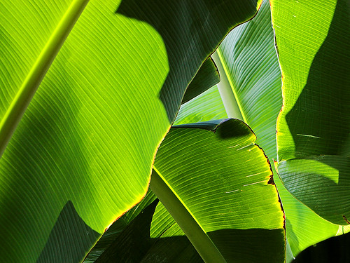 Banana leaves
Photo Credit: Konaboy
A new cold front is approaching the state of Hawaii, which will bring another round of showers this week. The latest computer forecast models continue to show an upper level low pressure trough, and it’s associated surface cold front heading our way. These weather features will turn our winds to the south through SW Monday and Tuesday, increasing some in strength ahead of its arrival. This next cold front will be a slow mover, passing down through the state Tuesday through Thursday…starting off as usual on Kauai, and ending up near the Big Island. This second front will bring another period of showers…some of which will be locally quite heavy. Late Monday afternoon a flood advisory went up for locally heavy rains around Kauai.
The weather Monday will be pretty good, although we’ll already begin to see some prefrontal showers in places. Monday will be a transition day, with southerly Kona winds coming up over us from the deeper tropics. This wind flow will carry some showers, ahead of the actual cold front, and may become a bit gusty too. As the front moves through, along with the upper level support of a trough aloft, we will likely see some locally heavy rainfall amounts accumulating…with some localized. Drier weather will arrive in the wake of the cold front as it moves down through the Aloha state, and statewide by Friday into the upcoming weekend.
It’s early Monday evening here in Kula, Maui, as I begin writing this sunset commentary. The current Kona winds, coming in from the south and SW directions, have really warmed things up here in the state. Any location near sea level Monday, had high temperatures in the lower to middle 80F’s. There is a lot more humidity in the air now as well, with the flow coming up from the deeper tropics. There have been showers around too, especially up near Kauai and Niihau, although just about all the islands had some form of shower activity in places. Here in Kula, at the 3,100 foot elevation on the west facing slopes of the Haleakala Crater, it was 67 degrees at 630pm, which is many degrees warmer than usual for this time. There’s some streaky high clouds around this evening too, which lit up nicely around sunset. I’m about to go down and make dinner, which will be a nice fat Ahi fish taco, with all the fixin’s….which will include fresh salsa, a few slices of farmers cheese, and leafage of fresh lettuce out of the garden. Yum! I hope you have a great Monday night wherever you happen to be writing from, and that you will meet me here again on Tuesday, for more important weather information about the slow moving cold front that will be working its way down through the island chain. Aloha for now…Glenn.
Note: Due to popular demand (certainly not by my own desire) there’s been added a small picture of Glenn in the upper right hand corner of this page. Now at least, after all these years, you can put a face [or at least the side of a face] to these weather narratives…that is if you haven’t already seen the live broadcast TV weather shows for the last 17 years!
Posted by Glenn
[2] Comments
March 10 2007
Air Temperatures – The following maximum temperatures were recorded across the state of Hawaii Friday:
Lihue, Kauai – 81F
Honolulu, Oahu – 80
Kaneohe, Oahu – 83
Kahului, Maui – 83
Hilo, Hawaii – 85
Kailua-Kona, Hawaii – 84
Temperatures early Saturday morning ranged between these warmest and coolest spots near sea level at the 6 a.m. hour:
Kailua-kona – 74F
Hilo, Hawaii – 66
Precipitation Totals – The following numbers represent the largest precipitation totals (inches) during the last 24 hours on each of the major islands, as of Saturday morning:
4.28 KOKEE, KAUAI
1.62 SCHOFIELD BARRACKS, OAHU
1.55 MOLOKAI
1.52 LANAI
0.39 KAHOOLAWE
1.76 OHEO GULCH, MAUI
1.15 PAHALA, BIG ISLAND
Weather Chart – Here’s the latest (automatically updated) weather map…showing a cold front moving down through the state of Hawaii Saturday, with gusty winds ahead of the front, and lighter north to NE winds behind it. Winds will be NE and be lighter Sunday…except gusty where they funnel through valleys and channels. Here’s a Weather Map Symbol page for clarification about what all those weather symbols mean on the map.
Hawaii’s Mountains – Here’s a link to the live webcam on the summit of near 14,000 foot Mauna Kea on the Big Island of Hawaii. The tallest peak on the island of Maui is the Haleakala Crater, which is near 10,000 feet in elevation. These two webcams are available during the daylight hours here in the islands…and when there’s a big moon rising just after sunset for an hour or two! Plus, during the nights and early mornings you will be able to see stars, and the sunrise too…depending upon cloud conditions.
Satellite Images – To view the cloud conditions we have here in Hawaii, please use the following satellite links, starting off with the Infrared Satellite Image of the islands to see all the clouds around the state during the day and night. This next image is one that gives close images of the islands only during the daytime hours, and is referred to as a Close-up visible image. This next image shows a larger view of the Pacific…giving perspective to the wider ranging cloud patterns in the Pacific Ocean…out from the islands. To help you keep track of where any showers may be around the islands, here’s the latest animated radar image.
Aloha Paragraphs
 Whales spouting in Hawaiian waters
Photo Credit: flikr.com
An active cold front is bearing down on the Hawaiian Islands, turning our winds to the Kona direction now. The winds will be getting stronger, with a wind advisory, for locally gusty winds to near 50 mph around Kauai Friday night. We’ll see increasing clouds as we move through Friday night into Saturday, over the islands of Kauai and Oahu as the cold front passes overhead. Those northern most islands will see prefrontal showers arriving out ahead of the actual cold front. The islands of Maui County and the Big Island will see gradually increasing cloudiness during the day Saturday.
The cold front will bring showers to Maui County later in the day Saturday, ending up finally over or near the Big Island Saturday night. This cold front will have some enhancement to it, in terms of showers, as an upper level trough of low pressure will be riding along above the frontal boundary. There will likely be some briefly heavy showers falling right along the leading edge of the frontal cloud band as it passes over each island in turn. Sunday will find the residual clouds and showers hung-up over the windward sides of Maui and the Big Island as the front stalls near those two southern islands.
In the wake of the cold front, we’ll see a brief period of cooler north and NE winds blowing, but this will be short lived at best on Sunday. The latest computer forecast models show another low pressure trough and cold front team heading our way, which will turn our winds to the SE through SW Monday and Tuesday of the new week ahead. This will lead to another cold front passing down through the state around Wednesday. This second front will bring another quick round of showers, although it’s still too early to know the exact details in terms of timing, and generosity of showers that will accompany the front.
It’s early Friday evening as I begin writing this pre-sunset commentary from Kihei, Maui. I’m finding it a little exciting as I track this cold front, which I have been talking about in the paragraphs above. At any, if you have any interest, you could keep an eye on the progress of this cold front as it slides down through the Hawaiian Island chain during the next 24 hours. By the way, when the cold front arrives over the Big Island, the air may be cold enough up there, that we could see some minor amount of snow falling on the summits of Mauna Kea and Mauna Loa by Sunday morning. While I was at the beach at lunch, I happened to spot a couple of Humpback whales swimming by just offshore from Kihei. The picture I put above looked almost exactly like what I saw…really cool! I’m about ready to leave my office and head out to a new film this evening, called Zodiac. I found this little snippet about it: David Fincher’s magnificently obsessive new film, “Zodiac,” tracks the story of the serial killer who left dead bodies up and down California in the 1960s and possibly the ’70s, and that of the men who tried to stop him. Set when the Age of Aquarius disappeared into the black hole of the Manson family murders, the film is at once sprawling and tightly constructed, opaque and meticulously detailed. The San Francisco police department’s frustrating investigation which turned up many clues but never netted a suspect. This sounds pretty heavy duty, but I guess I’m up for the job of sitting there and getting swept away in the dark theatre, while eating popcorn as fast as I can throw it into my mouth. I’ll let you know what I think Saturday morning when I do my next narrative updates ~ that is if I haven’t been scared to death by this thriller of a film! Aloha for now…Glenn.
Posted by Glenn
[2] Comments
March 8-9 2007
Air Temperatures – The following maximum temperatures were recorded across the state of Hawaii Thursday:
Lihue, Kauai – 82F
Honolulu, Oahu – 79
Kaneohe, Oahu – 83
Kahului, Maui – 84
Hilo, Hawaii – 84
Kailua-Kona, Hawaii – 83
Temperatures early Friday morning ranged between these warmest and coolest spots near sea level at the 4 a.m. hour:
Kaneohe, Oahu – 75F
Hilo, Hawaii – 67
Precipitation Totals – The following numbers represent the largest precipitation totals (inches) during the last 24 hours on each of the major islands, as of Friday morning:
0.24 MOUNT WAIALEALE, KAUAI
0.07 SCHOFIELD BARRACKS, OAHU
0.00 MOLOKAI
0.05 LANAI
0.00 KAHOOLAWE
0.06 KAUPO GAP, MAUI
0.03 WAIAHA, BIG ISLAND
Weather Chart – Here’s the latest (automatically updated) weather map…showing a ridge over the very southern part of the state of Hawaii, where it will keep south to SW breezes in place Friday…becoming a little gusty ahead of an active Pacific cold front approaching from the NW into Saturday. Here’s a Weather Map Symbol page for clarification about what all those weather symbols mean on the map.
Hawaii’s Mountains – Here’s a link to the live webcam on the summit of near 14,000 foot Mauna Kea on the Big Island of Hawaii. The tallest peak on the island of Maui is the Haleakala Crater, which is near 10,000 feet in elevation. These two webcams are available during the daylight hours here in the islands…and when there’s a big moon rising just after sunset for an hour or two! Plus, during the nights and early mornings you will be able to see stars, and the sunrise too…depending upon cloud conditions.
Satellite Images – To view the cloud conditions we have here in Hawaii, please use the following satellite links, starting off with the Infrared Satellite Image of the islands to see all the clouds around the state during the day and night. This next image is one that gives close images of the islands only during the daytime hours, and is referred to as a Close-up visible image. This next image shows a larger view of the Pacific…giving perspective to the wider ranging cloud patterns in the Pacific Ocean…out from the islands. To help you keep track of where any showers may be around the islands, here’s the latest animated radar image.
Aloha Paragraphs
 The beauty of the Big Island of Hawaii
Photo Credit: flikr.com
An approaching cold front has forced our high pressure ridge down over the state, and have turned our winds to the SE through SW now…strengthening some in the process. As these winds turned SE now, they have brought thick volcanic haze up over some parts of the state from the Big Island. Mornings will dawn clear just about everywhere, and then as the sun rises higher in the sky during the later mornings, clouds will form locally through the afternoon hours…mostly around the mountains. There will be some mostly light showers falling, but nothing heavy is expected. Kauai and perhaps Oahu may start to see a few showers falling ahead of the cold front on the Kona winds, especially on Friday.
Thursday will still be fine for the most part, although as we move into later Friday and Saturday, the cold front will be changing our weather…with increasing chance of showers. An upper level trough of low pressure is approaching the islands, with it’s associated surface cold front moving along with it. This is what’s causing our winds to become SE to SW, rather than our usual trade winds. The upper level trough will likely prompt some briefly heavy showers with the frontal passage. The models show a short period of cooler north to NE winds behind the cold front Sunday into Monday. Then the winds swing around to the SE to SW again, ahead of another cold front arriving around next Wednesday.
It’s early Thursday evening here in Kula, Maui, as I begin writing this sunset commentary. The sun went down here on Maui rather quickly, and without much flash. As a matter of fact, the volcanic haze is so thick now that just a round ball of red dove into the ocean to our west…without so much as a splash. The atmosphere often gets this way before a cold front pushes through. The next couple of days will be interesting, as we haven’t had a cold front lately. On another note, at work today at the Pacific Disaster Center, we had a group of senior citizens come for a presentation. I coordinated this meeting, and gave a fun little 40 minute "Weather in Hawaii" presentation. I always enjoy these things, but rarely can find the time, outside of work, to give them. If you saw last evening’s sunset commentary, I gave a talk to a bunch of cub scouts in Makawao last night. It’s been a busy couple of days, which I’ve enjoyed. I’ll be back very early Friday morning, with your next weather narrative. Tomorrow night I’m planning on seeing the film, called Zodiac, which I missed last Friday night. It’s a long film, and doesn’t get out until well after 10pm. I had considered going dancing after that in Paia, but I may end up being a little tired, after starting my day at 4am. I hope you have a great Thursday night! Aloha for now…Glenn.
Next Page »


