March 2006
Monthly Archive
Posted by Glenn
[10] Comments
March 31-April 1 2006
Air Temperatures – The following maximum temperatures were recorded across Hawaii Friday:
Lihue, Kauai – 75F
Honolulu, Oahu – 72
Kaneohe, Oahu – 73
Kahului, Maui – 83
Hilo, Hawaii – 83
Kailua-Kona, Hawaii – 83
Temperatures early Saturday morning ranged between these warmest and coolest spots near sea level at the 4 a.m. hour:
Kailua-kona – 74
Molokai airport – 68
Precipitation Totals – The following numbers represent the largest precipitation totals during the last 24 hours (as of Saturday morning) on each of the major islands, including:
0.49 KALAHEO, KAUAI
4.10 WAIMANALO, OAHU
0.20 MOLOKAI
0.22 LANAI
0.01 KAHOOLAWE
1.59 WAILUKU, MAUI
0.14 KEAHOLE AIRPORT, BIG ISLAND
Weather Chart – Here’s the latest (automatically updated) weather map…showing a low pressure system to the west of the islands. We also see a new high pressure system to our NE. This pressure configuration will keep mostly light winds around Saturday into Sunday…with light trade winds filling back into our area Sunday night or early Monday. Here’s a Weather Map Symbol page for clarification about what all those funny weather symbols mean.
Hawaii’s Mountains – Here’s a link to the live webcam on the summit of near 14,000 foot Mauna Kea on the Big Island of Hawaii. The tallest peak on the island of Maui is the Haleakala Crater, which is near 10,000 feet in elevation. These two webcams are only available during the daylight hours here in the islands…that is unless there’s a big moon rising just after sunset for an hour or two!
Satellite Images – To view the cloud conditions we have here in Hawaii, please use the following satellite links, starting off with the Infrared Satellite Image of the islands to see all the clouds around the state during the day and night. This next image is one that gives close images of the islands only during the daytime hours, and is referred to as a Close-up visible image. This next image shows a larger view of the Pacific…giving perspective to the wider ranging cloud patterns in the Pacific Ocean…out from the islands. To help you keep track of where any showers may be around the islands, here’s the latest animated radar image.
Aloha Paragraphs
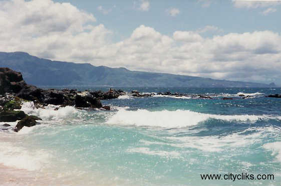
Hookipa Beach Park, Maui…
The Hawaiian Islands remain under a canopy of high and middle level clouds, the same kind that we’ve seen for most of the last month and more. This will continue to give us partly to mostly cloudy skies. What’s more important about this fact is that these clouds, or more specifically, the lower level clouds, are dropping showers in places. Each of the islands have been taking their turn at being on the receiving end of these showers, although Maui and the Big Island have had less lately, although those two islands could get wet any time!
All the ingredients are still in place to keep our overlying atmosphere prone for more showers. Those meteorological elements include: tons of rich tropical moisture; cold air aloft, and favorably inclined winds. These conditions will keep the threat of heavy showers around into the weekend. The NWS forecast office in Honolulu has continued its flash flood watch through Saturday afternoon. The most likely islands for heavy showers will remain Kauai and Oahu…although things could change quickly.
A low pressure system, the one that has been out to our west “foreverâ€, is a big part of why our weather just can’t seem to get better. The prospect for more off and on showery weather remains in place today, and will likely stick around into the weekend. Fortunately it hasn’t been in the form of constant downpours. Actually, it has been a hit and miss situation, with many areas seeing no rainfall during the last 24 hours on Maui and the Big Island. The other islands haven’t been so luck!
The latest computer forecast models show that the trough to our west will keep pumping moisture into our area of the north central Pacific. It’s rather interesting, that a fairly constant stream of showery clouds have been moving over Hawaii. To the east and west, there are not so many clouds! Eventually we will dig ourselves out of this wet weather pattern, or should that be bail ourselves out!? I’d say we will be looking at better weather right after the upcoming weekend, at least that’s the latest thought in the meteorology field.
It’s late Friday afternoon here in Kihei, Maui. I just got off work, and am REALLY looking forward to having the weekend off! Just before I left work, I was interviewed by National Public Radio (NPR) about the extended period of heavy rainfall here in Hawaii during the month of March. I’ve been talking about, and describing this flooding rainfall event for the better part of six weeks now…and so am starting to sound like a broken record…at least to myself! I got to the beach today at lunch again, and besides the dirty water, from all the silt that has run off the island into the ocean, it was fun. There was actually some nice bodysurfing waves breaking, which always helps to make my day. As usual, the big question on everyones lips is: “when will this rainy weather stop!?” I believe we’re heading out of this mess now, although it may take another couple of days to break totally free. I’d say next week should be a much different story than this past week. I hope you have a great Friday night, I guess I’ll go see the new Sharon Stone film, called Basic Instinct 2, and then either go surfing or kayaking Saturday. I’ll be back first thing in the morning to update this page with the latest weather news. Aloha for now…Glenn.
p.s. As a way of thanking my link sponsors, and drawing your attention to the great sites on the left hand margin of all my webpages, I’m highlighting each of them individually. Today’s business is A Happy Maui Wedding…providing Maui Wedding Planning and Packages. “We are a small family operation. A fun-loving husband and wife team. We have more than 20 years of wedding and hospitality industry experience between the two of us. Happy Maui Weddings are simply, a way of life for us. We have no desire to be the biggest wedding company on Maui, we don’t even have a toll-free number or credit card acceptance ability. What we do have is a lot of heart, a desire to be innovative and a wealth of knowledge acquired here on Maui. We also have a low overhead, which translates into Happy Wedding Prices for you!”
This website receives between 6,000 and 19,000+ page impressions per day, depending upon the weather and the season. As of early Friday night, March’s total count has been 411,773. That’s a lot of folks looking at all the pages on this site, including the new and useful links on the left hand margin on all the pages of this website. This will be all the links that I’ll be taking until June…thanks to all the businesses who are sponsoring Hawaii/Maui Weather Today!
Posted by Glenn
[4] Comments
March 30-31 2006
Air Temperatures – The following maximum temperatures were recorded across Hawaii Thursday:
Lihue, Kauai – 70F
Honolulu, Oahu – 75
Kaneohe, Oahu – 77
Kahului, Maui – 82
Hilo, Hawaii – 82
Kailua-Kona, Hawaii – 83
Temperatures early Friday morning ranged between these warmest and coolest spots near sea level at the 4 a.m. hour:
Kailua-kona – 742
Lihue, Kauai – 66
Precipitation Totals – The following numbers represent the largest precipitation totals during the last 24 hours (as of Friday morning) on each of the major islands, including:
1.33 OMAO, KAUAI
3.14 KALAELOA AIRPORT, OAHU
2.364 MOLOKAI
1.91 LANAI
0.00 KAHOOLAWE
2.89 KULA, MAUI
0.07 KAHUA RANCH, BIG ISLAND
Weather Chart – Here’s the latest (automatically updated) weather map…showing a low pressure system just to the west of the islands. This pressure configuration will keep mostly light winds around Friday…with light easterly winds filling back into our area this weekend or by early next week. Here’s a Weather Map Symbol page for clarification about what all those funny weather symbols mean.
Hawaii’s Mountains – Here’s a link to the live webcam on the summit of near 14,000 foot Mauna Kea on the Big Island of Hawaii. The tallest peak on the island of Maui is the Haleakala Crater, which is near 10,000 feet in elevation. These two webcams are only available during the daylight hours here in the islands…that is unless there’s a big moon rising just after sunset for an hour or two!
Satellite Images – To view the cloud conditions we have here in Hawaii, please use the following satellite links, starting off with the Infrared Satellite Image of the islands to see all the clouds around the state during the day and night. This next image is one that gives close images of the islands only during the daytime hours, and is referred to as a Close-up visible image. This next image shows a larger view of the Pacific…giving perspective to the wider ranging cloud patterns in the Pacific Ocean…out from the islands. To help you keep track of where any showers may be around the islands, here’s the latest animated radar image.
Aloha Paragraphs
 The beauty and spirit of our islands
The Hawaiian Islands remain threatened by locally heavy rains today into Friday. Weather elements to the west of the state, in the form of a deep trough of low pressure, are the culprit for this unsettled weather pattern. This is certainly nothing new, as we have been under this spell of much wetter than normal weather for over a month now. This forecast for locally heavy showers and possible thunderstorms will linger over the islands through the weekend. Thus, we’ll see variably cloudy skies, with showers moving overhead off and on for the time being.
This satellite image will show the extent of whatever clouds will be over us, while this radar image will point out where the rains are falling.
The same swath of cloudiness is over the state today, that has been on and off over us the last 5-6 weeks. These clouds are being driven towards us by the counterclockwise circulation around the trough to our west. This stuff is coming in at all levels of the atmosphere, taking a free ride up from the deeper tropics to our south and SW. These clouds are nothing new to Hawaii’s residents and visitors alike! There is good news in the offing however, as next week we should see a breakthrough into better weather.
It’s always good to have something to look forward to!
This “light at the end of the tunnel” will come in the form of our returning trade winds. They may reappear, after a long absence, later this weekend. However, it will likely take until early next week to see the coconut palm trees swaying under their welcome influence. When they first get here, they will probably be full of moisture and keep the windward sides wet. Although as the trough to our west loses its long lasting reign, we should finally begin to see the return of more sunshine, and the kind of weather that we all love so much here in the Aloha state.
Before we get too giddy about the outlook for better weather next week, don’t forget we have to make it through the rest of this workweek!
This prospect isn’t a dry one, and as a matter of fact, we still have some rather impressive “rainage” to move through. As stated above, there will be a considerable amount of water still falling out of the sky. The NWS forecast office in Honolulu has a flash flood watch in effect through Friday evening. It wouldn’t surprise me all that much if it got extended into the weekend time frame. It would be wise to drive very carefully if you are here in the islands, that, and watch out for problems that relate to excessive water runoff.
It’s early Thursday evening here in Kula, Maui, as I start today’s sunset commentary.
It was another cloudy day here in the islands, although with some breaks in the otherwise overcast skies. There was some bona fide sunshine beaming down today, and at least in Kihei, no rain to speak of. The sky looked very threatening towards sunset, but again I didn’t go through any showers getting home. There are some patches of fog hanging in tree tops, which was a great sight just before dark. I made it to the beach at lunch, took my walk along the waters edge, then dove into the ocean. I’ve definitely seen cleaner conditions, there was lots of silt in the ocean from the recent heavy rains. I’m so delighted to let you know that I’m doing this update on my new computer! It is such a pleasure to be hunkered into my weather tower again, on my own machine. It was quite a hassle for the last few days, having to go other places to get my updates done. It is so warm and muggy right now, I’m actually bare chested, and don’t feel the slightest bit of chill…thanks to all the tropical moisture that is enveloping the Hawaiian Islands now. It’s time to go down and have a bite to eat, although before I go down the stairs, let me say thanks for stopping by this evening. I hope you have a pleasant night, and that you will meet me here on Friday. By the way, things are looking up in terms of our local weather starting this weekend! Aloha for now…Glenn.
p.s. As a way of thanking my link sponsors, and drawing your attention to the great sites on the left hand margin of all my webpages, I’m highlighting each of them individually. Today’s business is Ululoa Productions…the company that brings the world Hawaiian Music from Maui…celebrating the spirit of Aloha. Laurie and Jake Rohrer run this production company from the heart, and the music they produce reflects that oh so well! They were kind enough to send me three CD’s, my favorite of which is one called HoloHolo Mai Maui…which I can recommend highly. I play this CD and their others often, and will soon be sharing it with my TV weather show audience as well.
This website receives between 6,000 and 18,000+ page impressions per day, depending upon the weather and the season. As of early Friday morning, March’s total count has been 396,598. That’s a lot of folks looking at all the pages on this site, including the new and useful links on the left hand margin on all the pages of this website. This will be all the links that I’ll be taking until June…thanks to all the businesses who are sponsoring Hawaii/Maui Weather Today! I’m putting together a waiting list now if you’re interested.
Posted by Glenn
[14] Comments
March 29-30 2006
Air Temperatures – The following maximum temperatures were recorded across Hawaii Wednesday:
Lihue, Kauai – 80F
Honolulu, Oahu – 77
Kaneohe, Oahu – 79
Kahului, Maui – 77
Hilo, Hawaii – 85
Kailua-Kona, Hawaii – 81
Temperatures early Thursday morning ranged between these warmest and coolest spots near sea level at the 4 a.m. hour:
Kailua-kona – 74
Kahului – 66
Precipitation Totals – The following numbers represent the largest precipitation totals during the last 24 hours (as of Thursday morning) on each of the major islands, including:
0.31 MT WAIALAELAE, KAUAI
0.71 ST STEPHENS, OAHU
0.35 MOLOKAI
0.84 LANAI
0.94 KAHOOLAWE
2.85 KAUPO GAG, MAUI
0.85 LAUPAHOEHOE, BIG ISLAND
Weather Chart – Here’s the latest (automatically updated) weather map…showing a low pressure system to the west of the islands, with its associated trough to our NW and north. At the same time, we find a high pressure system to the east of the state, with its ridge extending westward to near the islands. This pressure configuration will keep mostly light winds around through Friday. Here’s a Weather Map Symbol page for clarification about what all those funny weather symbols mean.
Hawaii’s Mountains – Here’s a link to the live webcam on the summit of near 14,000 foot Mauna Kea on the Big Island of Hawaii. The tallest peak on the island of Maui is the Haleakala Crater, which is near 10,000 feet in elevation. These two webcams are only available during the daylight hours here in the islands…that is unless there’s a big moon rising just after sunset for an hour or two!
Satellite Images – To view the cloud conditions we have here in Hawaii, please use the following satellite links, starting off with the Infrared Satellite Image of the islands to see all the clouds around the state during the day and night. This next image is one that gives close images of the islands only during the daytime hours, and is referred to as a Close-up visible image. This next image shows a larger view of the Pacific…giving perspective to the wider ranging cloud patterns in the Pacific Ocean…out from the islands. To help you keep track of where any showers may be around the islands, here’s the latest animated radar image.
Aloha Paragraphs
 Hula Princess
Printsellers.com
The Hawaiian Islands remain to the east of a trough of low pressure Wednesday. This keeps our overlying atmosphere unsettled and shower prone. The long lasting flash flood watch over the entire state remains in effect through Friday evening. Temperatures will be warm during the days and at night, and rather muggy at times near the coasts.
Wednesday will remain variable cloudy, with showers around in places…some of which will be locally heavy. Yet another round of potentially heavy showers are set to arrive Wednesday night, and stick around into Thursday and Friday. As a matter of fact, the prospect of more off and on showers remains a part of the forecast through the rest of this week.
The latest computer forecast models agree in bringing in heavy showers Wednesday night into Thursday. There may very well be more thunderstorms around too. This of course poses the threat of more localized flooding. The models pretty much agree on keeping this inclement weather pattern over the islands through much of this week, and even into the first part of next week.
However, it should be pointed out, that the current SW to south Kona winds, will be giving way to trade winds in over this coming weekend. This should have some bearing on where the most showers will be falling. As the trade winds kick in, we may see some relief for the leeward sides of the islands, where most of the visitors stay. This however suggests that the windward sides may see a period of wet trade winds.
Here is the latest satellite image, showing what clouds are hovering over the islands. This looping radar image shows where those clouds are dropping rain.
It’s been yet another day of cloudy weather, with off and on showers here on Maui, which continues to be remarkable, although not in the positive sense of the word! Several times it came down very hard in Kihei, while many of us stood at the windows watching. When I left work a new rain squall was starting, and it rained all the way home. It was sketchy driving up the Haleakala Highway, as there was so much water on the road. I had my windshield wipers on full blast at times. It actually has calmed down as I write these words, while composing this so called sunset commentary. I’m at my next door neighbors house doing this work, as my own laptop computer is having trouble. I have a new computer lined up, and should be back in business in a couple of days, thank goodness! The latest computer forecast models are indicating more rain for the next couple of days, some of which is going to be locally heavy, with possible flooding here and there. I had the Maui News call this afternoon, asking for another interview, the third this week. It’s starting to feel pretty strange, putting out the word that we have many more days of potentially wet weather to come! At this point it looks like this unsettled weather pattern will be with us through the weekend into early next week. Things can change on a dime though, and I promise to give you the first glimmer of hope as it becomes available. I hope you have a pleasant Wednesday night, and trust that I’ll be back first thing Thursday morning with more news on this very unusual weather event. Aloha for now…Glenn.
p.s. As a way of thanking my link sponsors, and drawing your attention to the great sites on the left hand margin of all my webpages, I’m highlighting each of them individually. Today’s business is Printsellers.com… A New Traditon. As the largest purveyor of original antique maps, prints and engravings in the state of Hawaii, their holdings of original 17th, 18th, and 19th century imagery is substantial. Due to an increased interest in antique maps and prints, prices have risen substantially for items which were once quite accessible. As a result, many of their clients have expressed a desire for very high quality, yet affordable reproductions…which they have been able to accomplish. You can find a link to their website on the left hand margin of this page.
This website receives between 6,000 and 18,000+ page impressions per day, depending upon the weather and the season. As of late Wednesday afternoon, March’s total count has been 372,110. That’s a lot of folks looking at all the pages on this site, including the new and useful links on the left hand margin on all the pages of this website. This will be all the links that I’ll be taking until June…thanks to all the businesses who are sponsoring Hawaii/Maui Weather Today! I’m putting together a waiting list now if you’re interested.
Posted by Glenn
[20] Comments
March 28-29 2006
Air Temperatures
– The following maximum temperatures were recorded across Hawaii Tuesday:
Lihue, Kauai – 75F
Honolulu, Oahu – 75
Kaneohe, Oahu – 78
Kahului, Maui – 78
Hilo, Hawaii – 85
Kailua-Kona, Hawaii – 83
Temperatures early Wednesday morning ranged between these warmest and coolest spots near sea level at the 4 a.m. hour:
Lihue, Kauai – 73
Hilo – 70
Precipitation Totals – The following numbers represent the largest precipitation totals during the last 24 hours (as of Wednesday morning) on each of the major islands, including:
1.93 WAILUA, KAUAI
1.28 WAIANAE VALLEY, OAHU
0.85 MOLOKAI
1.42 LANAI
2.20 KAHOOLAWE
1.61 ULUPALAKUA, MAUI
0.62 UPOLU POINT, BIG ISLAND
Weather Chart – Here’s the latest (automatically updated)
weather map…showing a low pressure system to the west of the islands, with its associated trough to our NW and north. This will keep mostly light winds around through Thursday. Here’s a Weather Map Symbol page for clarification about what all those funny weather symbols mean.
Hawaii’s Mountains – Here’s a link to the live webcam on the summit of near 14,000 foot
Mauna Kea on the Big Island of Hawaii. The tallest peak on the island of Maui is the Haleakala Crater, which is near 10,000 feet in elevation. These two webcams are only available during the daylight hours here in the islands…that is unless there’s a big moon rising just after sunset for an hour or two!
Satellite Images – To view the cloud conditions we have here in Hawaii, please use the following satellite links, starting off with the
Infrared Satellite Image of the islands to see all the clouds around the state during the day and night. This next image is one that gives close images of the islands only during the daytime hours, and is referred to as a Close-up visible image. This next image shows a larger view of the Pacific…giving perspective to the wider ranging cloud patterns in the Pacific Ocean…out from the islands. To help you keep track of where any showers may be around the islands, here’s the latest animated radar image.
Aloha Paragraphs

Waimanalo Beach, Oahu
Photo: Douglas Peebles
The Hawaiian Islands are starting the sixth straight week of unsettled weather! We’ve seen flash flooding, heavy rains, hail, thunderstorms, strong gusty winds, waterspouts and even a tornado during this long lasting period of inclement weather! The culprit for all of this, which continues to be active today…is a persistent trough of low pressure to our NW through west. Looking back in the record books, we had a very similar weather episode way back in March 1951, but not since then.
Before anyone starts to think this spell of wet weather will last forever, let me give you some encouraging words. The latest computer forecast models continue to show that by next week, we will have the trade winds blowing again, which have been mostly absent during the last month or more. These returning trade winds will set the stage for improving weather conditions, especially along the sunny leeward beaches…although the windward sides may see some passing showers continuing.
We need to back track a bit, as we still need to get through the rest of this week! One look at the following pictures, will give you a good idea that we’re not out of the woods just yet. The following satellite and radar images, show lots clouds and showers around early Tuesday. This satellite image will give you an idea of what’s out there in our local skies. This looping radar image will show you where those showers are falling. These images will automatically be updated, so you can come back at different times and see the newest version…although you may need to refresh the page.
The way it looks from here, that trough of low pressure will remain planted out to our west. This will keep the “flood gates” open for more showers, some of which will continue to be locally heavy. As I have mentioned several times lately, these showers will be of the hit and miss variety. These rains haven’t been all that widespread generally. They have a tendency to soak one area, and not touch another area that might not be all that far away. That’s what’s making this prolonged rainy period bearable, as it is generally a fairly spotty kind of rain. Look for more on and off showers through the weekend. The current flash flood watch over the state remains in effect through early Thurdsay morning.
It’s Tuesday evening here in Kula, Maui, as I start this sunset commentary. Today was actually quite a nice day, at least during the first half of the day. High clouds kept the sunshine muted, and then rainy weather set in later in the day though. I got to the beach at lunch, and found it to be warm, and the ocean felt really nice too. I watched the radar and satellite images this afternoon, as storm clouds built up to the south and SW. The rains came in like gang busters, and streets and roads were very wet during my drive home to Kula. I heard thunder right as day turned to night, somewhere off in the distance. Then a pea soup fog moved in, which has muted the sounds and sights totally. As I have been exclaiming lately, actually for a long time now, this is all very impressively unusual! I’ll be back first thing Wednesday morning, and by the way, there’s a thunderstorm happening outside as I sign off tonight! Aloha for now…Glenn.
p.s. As a way of thanking my link sponsors, and drawing your attention to the great sites on the left hand margin of all my webpages, I’m highlighting each of them individually. Today’s business is Jim Sanders Realty, which is representing Maui Real Estate.com…Billy Jalbert’s website. Billy says: “Whether your ideal lifestyle is surfing, kiteboarding or windsurfing on the North Shore near Paia and Haiku, enjoying calm beaches, exclusive golf courses and resorts in Wailea and Kihei, resort style living near Kapalua and Lahaina, or casual Upcountry living in Makawao or Kula, we specialize in finding the ideal real estate that best fits your dreams of a new lifestyle.”
This website receives between 6,000 and 18,000+ page impressions per day, depending upon the weather and the season. As of early Wednesday morning, March’s total count has been 358,113. That’s a lot of folks looking at all the pages on this site, including the new and useful links on the left hand margin on all the pages of this website. This will be all the links that I’ll be taking until June…thanks to all the businesses who are sponsoring Hawaii/Maui Weather Today! I’m putting together a waiting list now if you’re interested.
Posted by Glenn
No Comments
March 27-28 2006
Air Temperatures – The following maximum temperatures were recorded across Hawaii Monday:
Lihue, Kauai – 78F
Honolulu, Oahu – 76
Kaneohe, Oahu – 77
Kahului, Maui -Â 76
Hilo, Hawaii – 74
Kailua-Kona, Hawaii – 73
Temperatures early Tuesday morning ranged between these warmest and coolest spots near sea level at the 4 a.m. hour:
Kaneohe, Oahu – 72
Kailua-kona – 68
Precipitation Totals – The following numbers represent the largest precipitation totals during the last 24 hours (as of Tuesday morning) on each of the major islands, including:
5.24 MOUNT WAIALEALE, KAUAI
0.93 WAIANAE VALLEY, OAHU
0.64 MOLOKAI
0.79 LANAI
0.49 KAHOOLAWE
1.62 KAUPO GAP, MAUI
2.90 KEALAKEKUA, BIG ISLAND
Weather Chart – Here’s the latest (automatically updated) weather map…showing a low pressure system to the west of the islands, with its associated trough to our NW and north. This will keep mostly light winds around, tending SW to SE through Wednesday. Here’s a Weather Map Symbol page for clarification about what all those funny weather symbols mean.
Hawaii’s Mountains – Here’s a link to the live webcam on the summit of near 14,000 foot Mauna Kea on the Big Island of Hawaii. The tallest peak on the island of Maui is the Haleakala Crater, which is near 10,000 feet in elevation. These two webcams are only available during the daylight hours here in the islands…that is unless there’s a big moon rising just after sunset for an hour or two!
Satellite Images – To view the cloud conditions we have here in Hawaii, please use the following satellite links, starting off with the Infrared Satellite Image of the islands to see all the clouds around the state during the day and night. This next image is one that gives close images of the islands only during the daytime hours, and is referred to as a Close-up visible image. This next image shows a larger view of the Pacific…giving perspective to the wider ranging cloud patterns in the Pacific Ocean…out from the islands. To help you keep track of where any showers may be around the islands, here’s the latest animated radar image.
Aloha Paragraphs

 Sunset in Kapalua, Maui
Photo: Douglas PeeblesÂ
Not too much has changed in terms of our weather outlook, with the same trough of low pressure still sitting out to the west of the state. This means that the Hawaiian Islands will continue to see cloudier than normal skies, with more than the usual amount of showers around too through the first half of Monday. The following satellite and radar images, show lots clouds and showers around early Monday. This satellite image will give you an idea of what’s out there in our local skies. This looping radar image will show you where those showers are falling.
It appears that Monday will see lots of showers…while later Monday should have a temporary break in all the incoming moisture. The latest computer forecast models show that another round of rainy weather will approach the Aloha state starting Wednesday…lasting off and on into Thursday and Friday, and probably into the weekend. There is some good news to be had here though, as the models point out that by next week, our weather will return to its usual outstanding qualities!
I have a very good feeling that just about everyone is ready for the long lasting wet spell to end. I’m sure that the sun worshippers are at their wits end, at the end of their rope, so to speak. Even those folks who don’t mind a little rain once in a while, are getting fed up with all the cloudy weather too. It’s been going on for so long now, well over a month in fact, that I’m starting to enjoy the novelty of it all! At the same time, I could stand to see some sunshine during my lunch time beach walks and swims.
The local breezes continue to come up from the deep tropics, which is keeping the air temperatures mild. The cloud cover is keeping the days cooler than they otherwise would be, and the nights rather balmy. There is so much moisture in the air, that whenever the sun does appear for a while, it begins to feel rather muggy right away. One glance at that satellite image in the first paragraph, will probably show you that we don’t have to worry about it getting too sunny just yet…although, as it turned out, the sun is actually out full-on late Monday afternoon in some places!
It’s early Monday evening as I start today’s sunset commentary. It’s hard to believe, but there is the most beautiful sunshine that has broken through the parting clouds! After a very hard driving rain this morning, in most places across Maui, the clouds have cleared from the west. It is such an incredible treat to see blue skies again. I believe this will set the stage for more sunshine on Tuesday, which I’m sure no one will have a problem with. Looking out my weather tower window, I can see that the entire hulk of the Haleakala Crater is clear too. Looking west, there is not one cloud over the West Maui Mountains either! After such a long time, with cloudy weather prevailing, it feels nothing less than luscious to be seeing all the island looking green and crisp. I have a feeling that there are a lot of folks down at the beach right now, rejoicing in the pleasure of our first good sunset in, well, too long! I hope you have a great Monday night wherever you are. Here’s a personal invitation to each of you, to join me here again Tuesday morning for the next new completely updated weather narrative from the islands. Aloha for now…Glenn.
Â
p.s. As a way of thanking my link sponsors, and drawing your attention to the great sites on the left hand margin of all my webpages, I’m highlighting each of them individually. Today’s business is called Shot From Above, which presents for sale wonderful aerial photography. Chris Dahl-Bredine, the owner of the site lives in Taos, New Mexico…and also spends whatever time he can here on Maui. His website is a great one, with incredible pictures, and music too.
This website receives between 6,000 and 18,000+ page impressions per day, depending upon the weather and the season. As of early Tuesday morning, March’s total count has been 340,239. That’s a lot of folks looking at all the pages on this site, including the new and useful links on the left hand margin on all the pages of this website. This will be all the links that I’ll be taking until June…thanks to all the businesses who are sponsoring Hawaii/Maui Weather Today!Â
Posted by Glenn
[8] Comments
March 26-27 2006
Air Temperatures – The following maximum temperatures were recorded across Hawaii Sunday:
Lihue, Kauai – 73F
Honolulu, Oahu – 74
Kaneohe, Oahu – 72
Kahului, Maui – 82
Hilo, Hawaii – 80
Kailua-Kona, Hawaii – 81
Temperatures early Monday morning ranged between these warmest and coolest spots near sea level at the 5 a.m. hour:
Kailua-kona – 74
Molokai airport – 68
Precipitation Totals – The following numbers represent the largest precipitation totals during the last 24 hours (as of early Monday morning) on each of the major islands, including:
4.53 LIHUE AIRPORT, KAUAI
5.72 MAKUA RIDGE, OAHU
1.90 MOLOKAI
2.01 LANAI
1.31 KAHOOLAWE
0.92 KULA BRANCH STATION, MAUI
0.20 MOUNTAIN VIEW, BIG ISLAND
Weather Chart – Here’s the latest (automatically updated) weather map…showing a low pressure system to the NW of the islands, with its associated trough to our west. This will keep mostly light winds around, tending SW to SE through Tuesday. Here’s a Weather Map Symbol page for clarification about what all those funny weather symbols mean.
Hawaii’s Mountains – Here’s a link to the live webcam on the summit of near 14,000 foot Mauna Kea on the Big Island of Hawaii. The tallest peak on the island of Maui is the Haleakala Crater, which is near 10,000 feet in elevation. These two webcams are only available during the daylight hours here in the islands…that is unless there’s a big moon rising just after sunset for an hour or two!
Satellite Images – To view the cloud conditions we have here in Hawaii, please use the following satellite links, starting off with the Infrared Satellite Image of the islands to see all the clouds around the state during the day and night. This next image is one that gives close images of the islands only during the daytime hours, and is referred to as a Close-up visible image. This next image shows a larger view of the Pacific…giving perspective to the wider ranging cloud patterns in the Pacific Ocean…out from the islands. To help you keep track of where any showers may be around the islands, here’s the latest animated radar image.
Aloha Paragraphs

Holding hands on the island of Lanai
The long lasting low pressure system to the NW of Hawaii, along with its associated trough of low pressure to our west…is keeping the islands shower prone Sunday. This low and trough continues to carry tropical moisture over the Aloha state from the deeper tropics to our south and SW. This threat of locally heavy rainfall is serious enough…that the NWS forecast in Honolulu is keeping the flash flood watch active for the entire state through late Monday.
The heaviest rains are shifting around from one area of the state to another. It’s certainly not a continuous rainstorm, but more periodic, and striking in a hit and miss fashion. There are times of muted sunshine, mixed with mostly cloudy skies. It’s not quiteas bad as one might expect reading the general forecast across the state. The problem is all the high clouds that continue to stream across the state, which is keeping sunshine at a minimum for the time being.
The latest weather maps and computer forecast models are showing that this unsettled weather will remain in place for a while longer. This is not the greatest news, as while it is there, the threat of rain, some locally heavy, will continue. As a matter of fact, the models show this trough remaining out to our west through Sunday, well into the new week ahead. The next round of generally wet weather will arrive today into Monday…and then again around mid-week for a day to two.
The counterclockwise winds, in relation to the trough, will keep kona winds blowing across our area. These winds are warm, and moisture laden. They have generally been quite light, although there have been stronger breezes in places too. There are no marine warnings or advisories in place currently. The atmosphere remains unstable enough, that we may see more thunderstorm cells forming at times through Monday.Â
It’s early Sunday evening here in Kula, Maui, as I begin today’s sunset commentary. If you take a second to glance at the following satellite and radar images, go ahead… it’s easy. They show lots clouds around later Sunday, this satellite image will give you an idea of what’s out there in our local skies. There are showers around too, coming up from the SW, right over the islands in places. This radar image will show you where those showers are, looping along like a conveyor belt from latitudes south of the main Hawaiian Islands. I got out into some of that water vapor being moved up over us today, breathing it in through the ethers off the ocean….while kayaking out into whale territory. Not to leave out sharks, there was a sign, warning of shark sightings at that beach, which had me looking for fins. As it turned out, we only saw whale fins, tails, spouts, and of course the impressive breaches. We paddled out at least two miles, as there were slack winds, making for an easy go and come back in. We saw some friends on the beach when we arrived, and there was good natured kidding of the weatherman, as is often the case. Here comes the next wave of moisture, this time in the form of fog being blown up the slopes of the Haleakala Crater just before the sunset hour. I’m listening to Hawaiian Slack key guitar, Gaby Pahinui…music that melts your heart, as sweet as the nature of the islands themselves. I look forward to joining you here Monday morning, Prince Kuhio Day, which is a state holiday in Hawaii. I’ll have no TV weather show, but be back early Monday morning with your completely updated weather+ narrative . Aloha for now, see you then…Glenn.
This website receives between 6,000 and 18,000+ page impressions per day, depending upon the weather and the season. As of early Monday morning, March’s total count has been 320,689. That’s a lot of folks looking at all the pages on this site, including the new and useful links on the left hand margin on all the pages of this website. This will be all the links that I’ll be taking until June…thanks to all the businesses who are sponsoring Hawaii/Maui Weather Today!Â
Posted by Glenn
[2] Comments
March 25-26 2006
Air Temperatures – The following maximum temperatures were recorded across Hawaii Saturday:
Lihue, Kauai – 80F
Honolulu, Oahu – 78
Kaneohe, Oahu – 81
Kahului, Maui – 83
Hilo, Hawaii – 84
Kailua-Kona, Hawaii – 82
Temperatures early Sunday morning ranged between these warmest and coolest spots near sea level at the 5 a.m. hour:
Kailua-kona – 73
Kahului airport – 69
Precipitation Totals – The following numbers represent the largest precipitation totals during the last 24 hours (as of Sunday morning) on each of the major islands, including:
0.83 OMAO, KAUAI
3.49 WAIAWA, OAHU
0.24 MOLOKAI
0.45 LANAI
0.29 KAHOOLAWE
0.44 HAIKU, MAUI
0.86 PUU WAAWAA, BIG ISLAND
Weather Chart – Here’s the latest (automatically updated) weather map…showing a low pressure system to the NW of the islands, with its associated trough to our west. This will keep mostly light winds around, tending SW to south, locally quite breezy in some places through Monday. Here’s a Weather Map Symbol page for clarification about what all those funny weather symbols mean.
Hawaii’s Mountains – Here’s a link to the live webcam on the summit of near 14,000 foot Mauna Kea on the Big Island of Hawaii. The tallest peak on the island of Maui is the Haleakala Crater, which is near 10,000 feet in elevation. These two webcams are only available during the daylight hours here in the islands…that is unless there’s a big moon rising just after sunset for an hour or two!
Satellite Images – To view the cloud conditions we have here in Hawaii, please use the following satellite links, starting off with the Infrared Satellite Image of the islands to see all the clouds around the state during the day and night. This next image is one that gives close images of the islands only during the daytime hours, and is referred to as a Close-up visible image. This next image shows a larger view of the Pacific…giving perspective to the wider ranging cloud patterns in the Pacific Ocean…out from the islands. To help you keep track of where any showers may be around the islands, here’s the latest animated radar image.
Aloha Paragraphs

Kayaking in Hawaii…near Lanikai, Oahu
Photo: Douglas Peebles
The long lasting low pressure system to the NW of Hawaii, along with its associated trough of low pressure to our west…is keeping the islands shower prone. This low and trough continues to carry tropical moisture over the Aloha state from the deeper tropics to our south and SW. This threat of locally heavy rainfall is serious enough…that the NWS forecast in Honolulu has extended the flash flood watch for the entire state through late Monday.
The heaviest rains are shifting around from one area of the state to another. It’s certainly not a continuous rainstorm, but more periodic, and striking in a hit and miss fashion. There are times of sunshine, mixed with cloudy skies. It’s not as bad as one might expect reading the general forecast across the state. Friday was actually quite a nice day, while Saturday turned mostly cloudy again.
The latest weather maps and computer forecast models are showing that this unsettled weather will remain in place for a while longer. This is not the greatest news, as while it is there, the threat of rain, some locally heavy, will continue. As a matter of fact, the models show this trough remaining out to our west through the weekend well into the new week ahead. The next round of generally wet weather will arrive later Sunday into Monday…and then again around mid-week.
The counterclockwise winds, in relation to the trough, will keep kona winds blowing across our area. These winds are warm, and moisture laden. They have generally been quite light, although there have been stronger breezes in places too. There are no marine warnings or advisories in place currently. The atmosphere remains unstable enough, that we may see more thunderstorm cells forming at times.Â
It’s early Saturday evening here in Kula, Maui, as I begin today’s sunset commentry. There’s lot clouds around right now, this satellite image will give you an idea what I’m talking about. There are showers around too, coming up from the SW, right over the islands in places. This radar image will show you where those showers are, in a looping motion. I got down to Kahului to get two new tires late this morning, which always feels good when you have good tires on the car. I met my kayaking friend then, and we drove over to Makena, and went out into the ocean. We didn’t see any sign of whales, although it was nice to be out in the marine environment. It was cloudy, with a stiff little Kona breeze coming up from the SW. Then it was Pinata’s for lunch in Kahului, and on to Mana Foods in Paia for my weekly grocery shopping. I came home to a foggy reality here in Kula, which I enjoy. We’re going out kayaking again Sunday morning, this time over in the Olowalu area of west Maui. I hope you have a great Saturday night! I’ll be back Sunday morning with more narrative updates. Aloha for now…Glenn.
This website receives between 6,000 and 18,000+ page impressions per day, depending upon the weather and the season. As of early Sunday morning, March’s total count has been 308,102. That’s a lot of folks looking at all the pages on this site, including the new and useful links on the left hand margin on all the pages of this website. This will be all the links that I’ll be taking until June…thanks to all the businesses who are sponsoring Hawaii/Maui Weather Today!Â
Posted by Glenn
[3] Comments
March 24-25 2006
Air Temperatures – The following maximum temperatures were recorded across Hawaii Friday:
Lihue, Kauai – 81F
Honolulu, Oahu – 78
Kaneohe, Oahu – 82
Kahului, Maui – 83
Hilo, Hawaii – 81
Kailua-Kona, Hawaii – 78
Temperatures early Saturday morning ranged between these warmest and coolest spots near sea level at the 4 a.m. hour:
Kailua-kona – 74
Hilo airport – 69
Precipitation Totals – The following numbers represent the largest precipitation totals during the last 24 hours (as of Saturday morning) on each of the major islands, including:
0.83 LIHUE AIRPORT, KAUAI
1.44 WAIMANALO, OAHU
0.21 MOLOKAI
0.34 LANAI
0.50 KAHOOLAWE
1.22 WAIKAPU COUNTRY CLUB, MAUI
1.03 MOUNTAIN VIEW, BIG ISLAND
Weather Chart – Here’s the latest (automatically updated) weather map…showing a low pressure system to the NW of the islands, with its associated trough to our west. This will keep mostly light winds around, tending SW to south, locally quite breezy. Here’s a Weather Map Symbol page for clarification about what all those funny weather symbols mean.
Hawaii’s Mountains – Here’s a link to the live webcam on the summit of near 14,000 foot Mauna Kea on the Big Island of Hawaii. The tallest peak on the island of Maui is the Haleakala Crater, which is near 10,000 feet in elevation. These two webcams are only available during the daylight hours here in the islands…that is unless there’s a big moon rising just after sunset for an hour or two!
Satellite Images – To view the cloud conditions we have here in Hawaii, please use the following satellite links, starting off with the Infrared Satellite Image of the islands to see all the clouds around the state during the day and night. This next image is one that gives close images of the islands only during the daytime hours, and is referred to as a Close-up visible image. This next image shows a larger view of the Pacific…giving perspective to the wider ranging cloud patterns in the Pacific Ocean…out from the islands. To help you keep track of where any showers may be around the islands, here’s the latest animated radar image.
Aloha Paragraphs

What fun exploring the beach!
Photo: Douglas Peebles
The pesky low pressure system to the NW of Hawaii, along with its associated trough of low pressure to our west…is keeping the islands shower prone. This low and trough continues to pump deep tropical moisture over the Aloha state from the deeper tropics to our south and SW. This threat of locally heavy rainfall is serious enough…that the NWS forecast in Honolulu has extended the flash flood watch for the entire state through late Saturday.
The heaviest rains of late have shifted from Kauai and Oahu, down over the south central islands in the chain recently. This put Lanai, Molokai and Maui under the wettest portion of the inclement weather conditions Thursday night. The largest rainfall total, as of early Friday morning, was the overly generous 8.36″ at Mahinahina, a small community on the upper west side of Maui. Speaking of Maui, there were very heavy duty thunderstorms that fired off during the night, with spectacular lightning displays!
The latest weather maps and computer forecast models are indicating, that this unsettled weather producing trough to our west, will remain stuck in place for a while longer. This is not good news, as while it is there, the threat of rain, some locally heavy, will continue. We thought we might see some easing of the precipitation threat this weekend, although now, that hopeful sign is fading. As a matter of fact, the models show this trough parked out to our west through the weekend into Monday.
The counterclockwise winds, in relation to the trough, will keep kona winds blowing across our area. These winds are warm, and moisture laden. They have generally been quite light, although there have been stronger breezes in places too. There are no marine warnings or advisories in place currently. The atmosphere remains unstable enough, that we may very well see more thunderstorm cells forming. In addition, there have been numerous reports of waterspouts over the nearby ocean…which are simply tornadoes that form over water. It’s been windy atop the Big Island summits, with a wind advisory active up there Friday.
It’s early Friday evening here in Kula, Maui, as I start this sunset commentary. I had a plan to see a new film this evening after work, but then glanced at the latest satellite image. What I saw changed the course of the plan, and I immediately high-tailed it back home. I’ll add this radar image too, so you can see the nature of what is heading my way. Of course by the time you read this, it may have come and gone already. At any rate the NWS just put out a severe thunderstorm warning for Maui, Oahu and the Big Island. This means that there could be strong and gusty winds, hail, and heavy flooding rainfall. I figured that I didn’t want to miss all this, sitting inside a movie theater. So here I am, whipping out this commentary, so I can get out on my weather deck, and observe this thing coming in. I have a whale watching kayak trip planned for Saturday morning, which I’m very much looking forward to as well. I went to the beach at lunch today, and it was totally sunny for a change! The water was SO INCREDIBLY NICE, and I enjoyed bodysurfing a few small breaking waves. Ok, that’s it for now, unless it hails or something, and I can’t resist getting back online to tell you all about it later. Otherwise, I’ll be back Saturday morning with the next updated narrative. Aloha for now…Glenn.
p.s. I’m delighted with the response to all the businesses who have added their links to the left hand margin on all my webpages! I’d like to suggest that you check them out, as they offer valuable services and products. I want to highlight them individually over the next couple of weeks, with today’s business being Lani Kai…a brand new, fully remodeled, luxury vacation condo ideally located in sunny South Maui adjacent to some of Hawaii’s most beautiful beaches. Lani Kai, or “Heavenly Ocean†in Hawaiian, is your luxurious home base for exploring the best that Maui has to offer.
Added Feature: Fact: this website receives between 6,000 and 18,000+ page impressions per day, depending upon the weather and the season. As of early Saturday morning, March’s total count has been 296,867. That’s a lot of folks looking at all the pages on this site, including the new and useful links on the left hand margin. You can have a link from this popular website, directly to yours. It may be a good way to increase traffic to your own website. This placement on the Links List is available for $50 per month, with a three month minimum. That brings with it three months of possible higher than normal visitors to your business for just $150. My hope is that it will provide an important way that you can increase the presence of your site to lots of internet viewers. It may be a good way to highlight your internet business to folks who have an interest in most things Hawaiian. Please email me, or leave a message in the reply box below, if you have some interest in this proposal. A link to your site will be displayed along the left hand margin of all the pages on this website, in alphabetical order. There is one spot left in this three month quarter. Then in June, I’ll start accepting new businesses again…that is if any of the current businesses decide to drop out. There will be a waiting list started after one more link signs up.
Posted by Glenn
No Comments
March 23-24 2006
Air Temperatures – The following maximum temperatures were recorded across Hawaii Thursday:
Lihue, Kauai – 82F
Honolulu, Oahu – 82
Kaneohe, Oahu – 79
Kahului, Maui -Â 86
Hilo, Hawaii – 84
Kailua-Kona, Hawaii – 86
Temperatures early Friday morning ranged between these warmest and coolest spots near sea level at the 4 a.m. hour:
Kailua-kona – 73
Hilo airport – 66
Precipitation Totals – The following numbers represent the largest precipitation totals during the last 24 hours (as of Friday morning) on each of the major islands, including:
0.61 PORT ALLEN, KAUAI
2.44 NIU VALLEY, OAHU
2.16 MOLOKAI
3.98 LANAI
0.02 KAHOOLAWE
7.49 MAHINAHINA, MAUI
2.54 KAPAPALA RANCH, BIG ISLAND
Weather Chart – Here’s the latest (automatically updated) weather map…showing a low pressure system to the NW of the islands, with its associated trough to our west. This will keep light-moderate winds around, tending south…today into Saturday, locally quite breezy. Here’s a Weather Map Symbol page for clarification about what all those funny weather symbols mean.
Hawaii’s Mountains – Here’s a link to the live webcam on the summit of near 14,000 foot Mauna Kea on the Big Island of Hawaii. The tallest peak on the island of Maui is the Haleakala Crater, which is near 10,000 feet in elevation. These two webcams are only available during the daylight hours here in the islands…that is unless there’s a big moon rising just after sunset for an hour or two!
Satellite Images – To view the cloud conditions we have here in Hawaii, please use the following satellite links, starting off with the Infrared Satellite Image of the islands to see all the clouds around the state during the day and night. This next image is one that gives close images of the islands only during the daytime hours, and is referred to as a Close-up visible image. This next image shows a larger view of the Pacific…giving perspective to the wider ranging cloud patterns in the Pacific Ocean…out from the islands. To help you keep track of where any showers may be around the islands, here’s the latest animated radar image.
Aloha Paragraphs

Black sand beach on the Big Island
Photo: Ann Cecil
  Â
The persistent Kona low pressure system remains active to the NW of the Hawaiian Islands. The counterclockwise flow of air around this weather feature is drawing up lots of moisture over the Aloha state…from the deeper tropics to our SW and south. The heaviest rains yesterday brought localized flooding to the Garden Island of Kauai. Last night that band of heavy showers moved over the Gathering Place Island of Oahu, where localized flooding was noted as well.
Thursday finds an eastward movement of these heavy showers, where heavy rains were reported over Molokai and parts of Maui Thursday. This radar image will show you where the location of those downpours are currently. The threat of heavy showers remains across the entire state at the moment, with the flash flood watch now extended to Friday night. This satellite image will show you where the clouds are, and perhaps even some clearing that may take place from the west, starting on the Kauai end of the chain at times.
This long lasting period of inclement weather conditions is a difficult one to forecast. Some of the computer forecast models are showing that this Kona low will remain parked to our NW into early next week. Although, others are showing an improvement in our weather starting as early as this weekend. I may be wrong, or it may just be wishful thinking, but I’m starting to feel a little optimism here. However, we still need to deal with the possible heavy showers that will be passing over the state today into Friday.
The longer term computer forecast models were pointing towards better weather next week. The operative word in that sentence is were…as in they aren’t anymore. This is simply unbelievable, as in beyond belief! I’m having a difficult time comprehending how we could go on into yet another week of wet weather. I mean, for crying out loud, it’s been over a month now that we’ve been putting up with these inclement weather conditions! I have to say that we should hang loose about next week’s prospect of more showers, at least for another couple of days, while the models get their water soaked “ducks in a row!” The models show the most rainfall gearing up for the Kauai end of the chain early next week.
It’s early Thursday evening here in Kula, Maui, as I start today’s sunset commentary. This was one of those days, as the saying goes. Here are a few of the items that qualified it as one of those days: I couldn’t update my surf page this morning, one of the most important on this website, besides this narrative page of course; I rushed down to Kahului, to the Maui Community College to update it, before getting ready for my live broadcast TV weather show…which stressed me out some; at lunch, as I started to head down towards the beach to mellow out, I saw I had a flat tire…which fortunately I have a road repair service, and they came and fixed it right away; so I didn’t get in the ocean, which didn’t help matters; I took my laptop downtown to try and find out why I couldn’t update the surf page, and didn’t find out why; so I will have to do extra work again Friday to accommodate this situation. None of this is a life or death matter, although when you work a tight schedule like I do, this takes a certain toll on my well being. At any rate, I hope you had a better day than I, and actually, as it turns out, I had quite a good day despite the speed bumps along the way. One of highpoints today, was the heavy rain we had briefly in Kihei late in the afternoon! I’ll be back even earlier than usual Friday morning, so hey, let’s meet here again then. Aloha for now…Glenn.
p.s. I’m delighted with the response to all the businesses who have added their links to the left hand margin on all my webpages! I’d like to suggest that you check them out, as they offer valuable services and products. I want to highlight them individually over the next couple of weeks, with today’s company being E Paepae Ka Pukoa…16 single family Homesites in Spreckelsville, Maui. This website says: “Owning one of these Homesites will provide the rare opportunity to have a private access to one of the great ocean beaches in the world.” Serious buyers may call Henry Spencer to discuss any issues related to the sale of lots.
Added Feature: Fact: this website receives between 6,000 and 18,000+ page impressions per day, depending upon the weather and the season. As of early Friday morning, March’s total count has been 281,868. That’s a lot of folks looking at all the pages on this site, including the new and useful links on the left hand margin. You can have a link from this popular website, directly to yours. It may be a good way to increase traffic to your own website. This placement on the Links List is available for $50 per month, with a three month minimum. That brings with it three months of possible higher than normal visitors to your business for just $150. My hope is that it will provide an important way that you can increase the presence of your site to lots of internet viewers. It may be a good way to highlight your internet business to folks who have an interest in most things Hawaiian. Please email me, or leave a message in the reply box below, if you have some interest in this proposal. A link to your site will be displayed along the left hand margin of all the pages on this website, in alphabetical order. There is one spot left in this three month quarter. Then in June, I’ll start accepting new businesses again…that is if any of the current businesses decide to drop out. There will be a waiting list started after one more link signs up.
Posted by Glenn
[5] Comments
March 22-23 2006
Air Temperatures – The following maximum temperatures were recorded across Hawaii Wednesday:
Lihue, Kauai – 76F
Honolulu, Oahu – 77
Kaneohe, Oahu – 79
Kahului, Maui -Â 80
Hilo, Hawaii – 81
Kailua-Kona, Hawaii – 79
Temperatures early Thursday morning ranged between these warmest and coolest spots near sea level at the 4 a.m. hour:
Kailua-kona – 74
Lihue airport – 68
Precipitation Totals – The following numbers represent the largest precipitation totals during the last 24 hours (as of Thursday morning) on each of the major islands, including:
1.76 LIHUE, KAUAI
2.90 KAWAILOA, OAHU
0.45 MOLOKAI
0.32 LANAI
0.05 KAHOOLAWE
0.43 HAIKU, MAUI
0.45 KAHUKU RANCH, BIG ISLAND
Weather Chart – Here’s the latest (automatically updated) weather map…showing a low pressure system to the NW of the islands, with its associated trough to our west. At the same time we find a high pressure system far east, with its associated ridge extending west, but still quite a ways away from the Big Island. This will keep light winds around, tending south…today into Friday, locally breezy. Here’s a Weather Map Symbol page for clarification about what all those funny weather symbols mean.
Hawaii’s Mountains – Here’s a link to the live webcam on the summit of near 14,000 foot Mauna Kea on the Big Island of Hawaii. The tallest peak on the island of Maui is the Haleakala Crater, which is near 10,000 feet in elevation. These two webcams are only available during the daylight hours here in the islands…that is unless there’s a big moon rising just after sunset for an hour or two!
Satellite Images – To view the cloud conditions we have here in Hawaii, please use the following satellite links, starting off with the Infrared Satellite Image of the islands to see all the clouds around the state during the day and night. This next image is one that gives close images of the islands only during the daytime hours, and is referred to as a Close-up visible image. This next image shows a larger view of the Pacific…giving perspective to the wider ranging cloud patterns in the Pacific Ocean…out from the islands. To help you keep track of where any showers may be around the islands, here’s the latest animated radar image.
Aloha Paragraphs

Waikiku, the famous beach of Honolulu…
 Â
A low pressure system remains anchored in place to the NW of the main Hawaiian Islands now. We can call this long lasting low pressure system a Kona low. The placement of this low pressure system is causing our local winds to come in from the south and SW. This direction not only brings warm air from the deeper tropics, but also lots of rich moisture from over the oceans to our south. The location of this low will also help to keep our overlying atmosphere shower prone.
What else is new!? The air mass surrounding the islands has been that way for over a month now, at least off and on. I might add, that it seems like more “on than off” at this point! At any rate, the local clouds are charged with rain potential. Thus far, the Kauai and Oahu end of the island chain have been getting the most heavy precipitation. The meteorological dynamics are in place to keep whatever clouds that are around showery ones just about anywhere.
A quick glance at this satellite image, shows there to be absolutely no shortage of clouds over us! These clouds consist of the high and middle level variety, which are famous for muting our sunshine during the days, and giving whatever moon that’s around, a fuzzy look. At the same time, we find considerable amounts of lower level clouds, the ones that can dump locally heavy rain. A look at this radar image, confirms that there is no lack of showers falling in our area either!
There could easily be some thunderstorms mixed into this cloudy reality. Thunderstorms are one of the principle flooding agents, and may very well help to augment whatever localized flooding that we have going on. Thus, the NWS forecast office in Honolulu has the flash flood watch active across the entire state through late Thursday night. At this point, the biggest question becomes: when will all this threat of heavy rains end? Everyone’s been asking that question, and it’s a good one too, but not so easy to answer.
The way it looks from here, we will continue to see the possibility of locally heavy rains into Friday. Some of the forecast models are showing some possible improvement then into the weekend. Although the one fly in the ointment, remains the placement of a low pressure trough out to the west of the islands. This could keep the chance of showers around into early next week. I would hazard an educated guess that by next Tuesday we might finally begin to see improved weather conditions.
It’s early Wednesday evening here in Kula, Maui, as I start this sunset commentary. I must confess that there wasn’t any sunset this evening, it basically went from dark cloudiness to darkness! Actually, up here in Kula, as I look out the window of my weather tower, in what little light there is left…all I see is pea soup fog! It’s warm though, which is at least some consolation I suppose. I prefer coolness at this time of night, so I’m feeling slightly too warm. If you have a moment, you could go up three paragraphs on this page, and check out all those clouds that are totally enveloping the islands, and see whatever showers that happen to be around…and I’m sure there will be some on that radar image! It certainly wasn’t an altogether bad day, as there were mostly just high clouds around, which dimmed our sunshine significantly, but didn’t drop rain. I should add that Kauai got heavy rains this afternoon, some of which was of the flooding variety. Tonight and Thursday we should see rain, here and there, and often quite heavy. There’s at least a glimmer of hope that Friday and Saturday will improve. I’ll be back early Thursday morning with more news about this rainy reality we are “putting up with” here in the islands. Aloha for now…Glenn.
p.s. I’m delighted with the response to all the businesses who have added their links to the left hand margin on all my webpages! I’d like to suggest that you check them out, as they offer valuable services and products. I want to highlight them individually over the next couple of weeks, with today’s company being First Horizon Home Loans. The agent  who has sponsored this link is Chris Lum, who lives here on Maui. His intention is to help you finance your home, and more . . . to build a relationship based on unparalleled service and personal attention. He works right here in the Central Valley on Maui, and is ready to help you get the best terms. I can recommend him to folks who live here on Maui.Â
Added Feature: Fact: this website receives between 6,000 and 18,000+ page impressions per day, depending upon the weather and the season. As of early Thursday morning, March’s total count has been 265,201. That’s a lot of folks looking at all the pages on this site, including the new and useful links on the left hand margin. You can have a link from this popular website, directly to yours. It may be a good way to increase traffic to your own website. This placement on the Links List is available for $50 per month, with a three month minimum. That brings with it three months of possible higher than normal visitors to your business for just $150. My hope is that it will provide an important way that you can increase the presence of your site to lots of internet viewers. It may be a good way to highlight your internet business to folks who have an interest in most things Hawaiian. Please email me, or leave a message in the reply box below, if you have some interest in this proposal. A link to your site will be displayed along the left hand margin of all the pages on this website, in alphabetical order. There is one spot left in this three month quarter. Then in June, I’ll start accepting new businesses again…that is if any of the current businesses decide to drop out. There will be a waiting list started after one more link signs up.
Next Page »


