Air Temperatures ranged between these warmest and coolest spots near sea level around the state – and on the highest mountains…at 4pm Sunday afternoon:
Kailua-kona – 78F
Kahului, Maui – 67
Haleakala Crater – missing (near 10,000 feet on Maui)
Mauna Kea summit – 41 (near 14,000 feet on the Big Island)
Precipitation Totals–The following numbers represent the largest precipitation totals (inches) during the last 24 hours on each of the major islands, as of Sunday afternoon: 1.99 Kokee, Kauai 1.26 Makaha Stream, Oahu
1.30 Molokai
0.09 Lanai
0.00 Kahoolawe 2.69 West Wailuaiki, Maui 0.80 Honokaa, Big Island
Marine Winds – Here’s the latest (automatically updated)weather mapshowing a 1033 millibar high pressure system far to the northwest of Hawaii…moving eastward. A cold front is moving down across the Big Island, with cooler and stronger north to northeast winds blowing across the island chain into Monday. Satellite and Radar Images:To view the cloud conditions we have here in Hawaii, please use the following satellite links, starting off with thisInfrared Satellite Imageof the islands to see all the clouds around the state during the day and night. This next image is one that gives close images of the islands only during the daytime hours, and is referred to as aClose-up visible image. This next image showsa larger view of the Pacific…giving perspective to the wider ranging cloud patterns in the Pacific Ocean. Finally, here’s aLooping IR satellite image, making viewable the clouds around the islands 24 hours a day. To help you keep track of where any showers may be around the islands, here’s the latest animatedradar image.
Hawaii’s Mountains – Here’s a link to the live webcam on the summit of near 14,000 foot Mauna Kea on the Big Island of Hawaii. The tallest peak on the island of Maui is the Haleakala Crater, which is near 10,000 feet in elevation. These two webcams are available during the daylight hours here in the islands…and when there’s a big moon rising just after sunset for an hour or two! Plus, during the nights and early mornings you will be able to see stars, and the sunrise too…depending upon weather conditions. Tropical Cyclone activity in the eastern and central Pacific– Here’s the latest weather information coming out of theNational Hurricane Center, covering the eastern north Pacific. You can find the latest tropical cyclone information for the central north Pacific (where Hawaii is located) by clicking on this link to the Central Pacific Hurricane Center. Here’s atracking mapcovering both the eastern and central Pacific Ocean. A satellite image, which shows the entire ocean area between Hawaii and the Mexican coast…can be found here.
Note: the text below the picture is missing if you are using IE or Safari browsers, you will have to switch to Mozilla Firefox to see it…temporarily.
Aloha Paragraphs
Cool windy weather here in the islands…with showers
A cold front has spread cool windy weather conditions down the island chain from the northwest.In response to this situation, we have small craft wind advisories active across all coastal waters. At the same time, the windiest channels between the islands have unusual gale warnings posted. Speaking of unusual, we also have active wind advisories across many areas over the islands themselves Sunday evening. This IRsatellite imageshows the cold front...which has passed over Kauai, Oahu and Maui, and is traveling over the Big Island at the time of this writing. Here's a looping radar image, so we can keep track of the showers that will be passing through the state.
The heaviest rainfall thus far, has ended up over the upcountry area along the windward side of Maui...with most islands now finding 1.00"+ rainfall amounts.There continue to be low flying drizzle and misty showers along many of the leeward sides of the smaller islands. The windward coasts and slopes have seen showers passing overhead all day Sunday...which will continue into Sunday night, and likely into Monday morning. By the way, the largest rainfall total, as I was referring to above, was the 2.69" at the West Wailuaiki rain gauge above the Keane Peninsula...along the Hana coast of east Maui.Let’s take a peek at this cold front, using the same satellite image as above, only with a broader perspective. We can see the leading edge of the front having pushed into the area southeast of the Big Island...with the trailing edge still between the islands of Kauai and Oahu. While we’re checking out this active Pacific frontal boundary, here’s an even larger look, using this University of Washington picture. It helps us to see that most of the incoming moisture is being pushed up against the windward sides, with just those few light misty showers along the leeward sides in places.The windiest part of this event will be now through Tuesday, with some gradually reduction in wind speeds into mid-week.The winds were coming in first from the north, due to the following high pressure system, behind the cold front…being located to our northwest. As time moves on, this cool air will turn clockwise to the northeast, and eventually all the way around to the ENE and east by mid-week onwards. The models point out that these trade winds will continue over us through most of the upcoming week. As is often the case, we will see incoming showery clouds depositing moisture along our windward coasts and slopes…which will be very welcome due to the severely dry conditions that prevail now. The models suggest that these showers may even become more frequent from Wednesday through Friday.It’s Sunday evening, as I begin writing the last section of today's narrative.If you had a chance to read down through the paragraphs above, you know that we've seen a fairly big change in our local weather conditions Sunday, as this cold front has pushed down through the island chain. This front has been able to move over all the islands, which is a good thing. Likely though, this frontal passage will be remembered more for the strong and gusty winds following it, rather than the rainfall that falls from it. Speaking of winds, they have been blustery, at least in those areas that are exposed to the northerly direction of this air in a hurry. There are some locations that have seen generally light breezes in contrast, even along the windward sides today. The strongest gust that I happened to see today, was at an unlikely spot, which usually has quite light winds. This was over the small island of Lanai, where there was a 44 mph gust during the afternoon hours. At 5pm Sunday evening, the wind was still gusting all the way up to 48.4 mph...the strongest in the state of Hawaii! There were several reports of 38 and 42 mph gusts locally at the same time...windy weather to say the least! Here in Kula, Maui, it's been blowing strongly all day, with light mist and drizzle falling. The air temperature was 61.7F degrees at just before 6pm, with the low 60's being the case all day. ~~~ I'll be back with you again early Monday morning, I hope you have a good Sunday night, and enjoy the still "close to full moon" shining down from above! Aloha for now...Glenn.
Air Temperatures ranged between these warmest and coolest spots near sea level around the state – and on the highest mountains…at 7pm Saturday evening:
Kokole Point, Kauai – 79F
Molokai airport – 72
Haleakala Crater – 62 (near 10,000 feet on Maui)
Mauna Kea summit – 37 (near 14,000 feet on the Big Island)
Precipitation Totals–The following numbers represent the largest precipitation totals (inches) during the last 24 hours on each of the major islands, as of Saturday afternoon: 0.01 Poipu, Kauai 0.08 Oahu Forest NWR, Oahu
0.00 Molokai
0.00 Lanai
0.00 Kahoolawe
0.02 Puu Kukui, Maui
0.13 Waiakea Uka, Big Island
Marine Winds – Here’s the latest (automatically updated)weather mapshowing a 1021 millibar high pressure system to the northeast of Hawaii…moving eastward. A cold front is moving in our direction, with cooler, stronger north to northeast winds into Monday, as a strong high pressure system moves into the area northwest of Hawaii. Satellite and Radar Images:To view the cloud conditions we have here in Hawaii, please use the following satellite links, starting off with thisInfrared Satellite Imageof the islands to see all the clouds around the state during the day and night. This next image is one that gives close images of the islands only during the daytime hours, and is referred to as aClose-up visible image. This next image showsa larger view of the Pacific…giving perspective to the wider ranging cloud patterns in the Pacific Ocean. Finally, here’s aLooping IR satellite image, making viewable the clouds around the islands 24 hours a day. To help you keep track of where any showers may be around the islands, here’s the latest animatedradar image.
Hawaii’s Mountains – Here’s a link to the live webcam on the summit of near 14,000 foot Mauna Kea on the Big Island of Hawaii. The tallest peak on the island of Maui is the Haleakala Crater, which is near 10,000 feet in elevation. These two webcams are available during the daylight hours here in the islands…and when there’s a big moon rising just after sunset for an hour or two! Plus, during the nights and early mornings you will be able to see stars, and the sunrise too…depending upon weather conditions. Tropical Cyclone activity in the eastern and central Pacific– Here’s the latest weather information coming out of theNational Hurricane Center, covering the eastern north Pacific. You can find the latest tropical cyclone information for the central north Pacific (where Hawaii is located) by clicking on this link to the Central Pacific Hurricane Center. Here’s atracking mapcovering both the eastern and central Pacific Ocean. A satellite image, which shows the entire ocean area between Hawaii and the Mexican coast…can be found here.
Aloha Paragraphs
Cool windy weather…right around the corner
A weakening cold front is approaching the island chain from the northwest, which will move down through the state tonight through Sunday.This IRsatellite imageshows relatively clear skies over most of the state, just out ahead of the cold front...which was closing in on Kauai. The cold front will reach Kauai during the night, and then slide down through the island chain during the day Sunday. We'd better ad this looping radar image, so we can keep track of the showers that will be brought into the state, on the quickly moving Pacific cold front.
As we move into Sunday, we’ll see some definite weather changes, as the front’s precipitation shield pushes down through the islands…hopefully as far as the Big Island.The computer models had, as has been their habit this winter, shown a good rainfall event earlier this week. More recently though, it now looks like the rainfall can be de-emphasized a bit, although there will be some showers falling during the nextr 24 hours. We’re hoping that these showery clouds will make it down to the Big Island, where the most severe drought conditions in the state prevail at the moment. The wind aspect of this cold front, and especially in the wake of its passage, will be the bigger event overall though.Let’s take a peek at this cold front, using the samesatellite imageas above, only with a broader perspective. We can see the front pushing into the clear atmosphere over the islands. While we’re checking out this active Pacific frontal boundary, here’s an even larger look, using a University of Washington picture. This lastimagemakes the cold front look more impressive than it actually is.Looking into the first day of the new work week ahead, it has windy written all over it…which may very well necessitate several different NWS issued wind products in response.It looks very likely that small craft wind advisories will be needed across the entire marine area, in terms of the coastal waters. There have been hints that the winds may become strong enough that we could actually see a fairly unusual gale warning flag being hoisted over a couple of the major channels between the islands. It wouldn’t be out of the question to see a wind advisory go up over one or three of the windiest land locations over the islands themselves. These too are fairly unusual, and definitely suggest that this windy episode will catch most folk’s attention. Perhaps the windiest part of this event will be through Monday, with some gradually reduction in wind speeds Tuesday.The winds will come in first from the north, due to the following high pressure system, behind the cold front…being located to our northwest. As time moves on, this cool blast of air will turn clockwise to the northeast, and eventually all the way around to the ENE and east by mid-week. The models point out that this will be a longer lasting period of trade winds than we’ve been seeing so far this winter, which isn’t too unexpected climatologically… given that we’re pushing towards the start of the spring season a little ways ahead. As is often the case, we will see incoming showery clouds depositing moisture along our windward coasts and slopes…which will be very welcome due to the severely dry conditions that prevail now. The models suggest that these showers may be more frequent from Wednesday through Friday.It’s Saturday evening, as I begin writing the last section of today's narrative.If you had a chance to read down through the paragraphs above, you know that we'll see a fairly big change in our local weather, as we move into Sunday, as this cold front pushes down through the island chain. I'm hoping for some decent rains riding in with the frontal cloud band, although if things go as they have most of this winter...it may be somewhat disappointing. This front however does have a decent chance of moving over all the islands, which is a good thing. Likely though, this frontal passage will be remembered more for the strong and gusty winds following it, rather than the rainfall that falls from it.
~~~ It's around 730pm Saturday evening as I write these last few words. Wow, what a day, with the tsunami moving through the island chain! It was a big deal here in the islands, a very big deal actually! We dodged a bullet, so to speak, compared at least to what we've seen in other parts of the world lately. I'm pretty sure that quite a few folks are having a drink or two this evening, and I'd say they sure deserve to let off a little steam. Our next focus becomes the cold front described in the paragraphs above. The frontal cloud band was just about 100 miles or less, to the northwest of Kauai this evening, and will have moved over Oahu towards Maui by the time I get back with you on Sunday morning. The big thing will be the chilly winds in the wake of the front. What I'm noticing however, is that here in Kula, Maui, we already have some cool north to northwest winds blowing...even ahead of the cold front. I hope you have a great Saturday night, and that you will join me again on Sunday. I had trouble keeping my website going Saturday, with all the heavy internet traffic, although things should smooth out from here on out. I just checked to see how many hits I had on this website during the day, and there had been 30,238...with 404 google clicks! Oh yeah, check out that full moon tonight. Aloha for now...Glenn.Tsunami Information:A Tsunami cancellation notice was issued at 138pm Saturday.
SUBJECT - TSUNAMI WARNING CANCELLATION
THE TSUNAMI WARNING IS CANCELLED FOR THE STATE OF HAWAII EFFECTIVE AT 0138 PM HST.
AN EARTHQUAKE HAS OCCURRED WITH THESE PRELIMINARY PARAMETERS
ORIGIN TIME - 0834 PM HST 26 FEB 2010
COORDINATES - 36.1 SOUTH 72.6 WEST
LOCATION - NEAR COAST OF CENTRAL CHILE
MAGNITUDE - 8.8 MOMENT
MEASUREMENTS OR REPORTS OF TSUNAMI WAVE ACTIVITY
GAUGE LOCATION LAT LON TIME AMPL PER
------------------- ----- ------ ----- --------------- -----
KAWAIHAE HAWAII 20.0N 155.8W 2211Z 0.52M / 1.7FT 24MIN
BARBERS PT HI 21.3N 158.1W 2140Z 0.19M / 0.6FT 76MIN
KAUMALAPAU HAWAII 20.8N 156.9W 2136Z 0.18M / 0.6FT 56MIN
KAHULUI MAUI 20.9N 156.5W 2147Z 0.98M / 3.2FT 22MIN
NAWILIWILI KAUAI 22.0N 159.4W 2151Z 0.28M / 0.9FT 44MIN
PAGO PAGO AS 14.3S 170.7W 2132Z 0.66M / 2.2FT 12MIN
LAT - LATITUDE (N-NORTH, S-SOUTH)
LON - LONGITUDE (E-EAST, W-WEST)
TIME - TIME OF THE MEASUREMENT (Z IS UTC IS GREENWICH TIME) AMPL - TSUNAMI AMPLITUDE MEASURED RELATIVE TO NORMAL SEA LEVEL.
IT IS ...NOT... CREST-TO-TROUGH WAVE HEIGHT.
VALUES ARE GIVEN IN BOTH METERS(M) AND FEET(FT).
PER - PERIOD OF TIME IN MINUTES(MIN) FROM ONE WAVE TO THE NEXT.
EVALUATION:
BASED ON ALL AVAILABLE DATA THERE IS NO LONGER A DESTRUCTIVE TSUNAMI THREAT TO THE STATE OF HAWAII. THEREFORE THE TSUNAMI WARNING FOR HAWAII IS CANCELLED.
HOWEVER SOME COASTAL AREAS IN HAWAII MAY CONTINUE TO EXPERIENCE SMALL SEA LEVEL CHANGES AND STRONG OR UNUSUAL CURRENTS LASTING FOR SEVERAL MORE HOURS.
THIS TSUNAMI WARNING CANCELLATION DOES NOT MEAN IT IS NOW SAFE TO RESUME NORMAL ACTIVITIES OR REENTER EVACUATED SHORELINE AREAS. YOUR COUNTY CIVIL DEFENSE AGENCY AND POLICE DEPARTMENT WILL MAKE THIS DETERMINATION. STAY TUNED TO YOUR LOCAL BROADCAST STATION FOR THE CIVIL DEFENSE -ALL CLEAR- ANNOUNCEMENT FOR YOUR AREA.
REPEAT - DO NOT REENTER EVACUATED SHORELINE AREAS UNTIL ANNOUNCED BY YOUR COUNTY CIVIL DEFENSE AGENCY. STAY TUNED TO YOUR LOCAL BROADCAST STATION FOR THE -ALL CLEAR- ANNOUNCEMENT FOR YOUR AREA. PLEASE YIELD TO ROADBLOCKS AND UNIFORMED OFFICERS WHO ARE CONTROLLING REENTRY INTO EVACUATED SHORELINE AREAS.
THIS WILL BE THE FINAL MESSAGE ISSUED FOR THIS EVENT UNLESS ADDITIONAL DATA ARE RECEIVED. Interesting:An iceberg the size of Luxembourg has broken off from a glacier in Antarctica after being rammed by another giant iceberg, scientists said on Friday, in an event that could affect ocean circulation patterns. The 965 square mile iceberg broke off earlier this month from the Mertz Glacier's 100 miles floating tongue of ice that sticks out into the Southern Ocean. The collision has since halved the size of the tongue that drains ice from the vast East Antarctic ice sheet.
"The calving itself hasn't been directly linked to climate change but it is related to the natural processes occurring on the ice sheet," said Rob Massom, a senior scientist at the Australian Antarctic Division and the Antarctic Climate and Ecosystems Cooperative Research Center in Hobart, Tasmania. Both organizations, along with French scientists, have been studying existing giant cracks in the ice tongue and monitored the bumper-car-like collision by the second iceberg, B-9B.
Interesting2:China has no intention of capping its greenhouse gas emissions even as authorities are committed to realizing the nation's target to reduce carbon intensity through new policies and measures, the country's top climate change negotiators said yesterday. The negotiators also warned that rich and developing countries have little hope of overcoming key disagreements over how to fight global warming.
China "could not and should not" set an upper limit on greenhouse gas emissions at the current phase, said Su Wei, the chief negotiator of China for climate change talks in Copenhagen, at a meeting in Beijing on China's climate change policies in the post-Copenhagen era.
Su, who is also director of the department of combating climate change under the National Development and Reform Commission, said that China's greenhouse gas emissions have to grow correspondingly as the country still has a long way to go in improving people's livelihoods and eradicating poverty.
The country's carbon dioxide emissions per capita is also relatively low compared to developed countries and China has not contributed much to climate change because of its short history as an industrial nation, he said. However, China will spare no effort to adopt proactive measures to fight the negative effects caused by global warming and achieve the country's ambitious goal of cutting carbon intensity per GDP unit by 40 to 45 percent by 2020, a voluntary target China pledged last November, he said.
"The targets for carbon intensity reduction will be included in the 12th and 13th five-year plans (2011-15; 2016-20) as a binding index," he said. The targets remain a very challenging task for China, as its secondary industry comprises a large part of the country's industrial structure, said Ma Zhong, a professor at the Renmin University of China.
Interesting3:The U.S. Fish and Wildlife Service is acting to remove Endangered Species Act protection from Arizona's desert nesting bald eagles. Almost two years after U.S. District Court Judge Mary Murguia’s March 5, 2008 rejection of the agency's last attempt in 2007, a similar decision by Fish and Wildlife has been released for publication in tomorrow's Federal Register. Today the agency also filed a request with the U.S. District Court to remove an injunction currently in place to protect the eagle.
"We conclude that the best information available does not indicate that persistence in the ecosystem of the Sonoran Desert Area is important to the species as a whole," the new Fish and Wildlife decision states. But no recognized bald eagle expert agrees with that assertion, as no expert agreed with the Service’s earlier 2007 decision to remove protection. "The science and the law have not changed, but sadly, neither have the politics," says Dr. Robin Silver with the Center for Biological Diversity.
"If the decision stands, it will be a death sentence for our desert nesting bald eagles. We're anxious to get back into court to save these magnificent birds." The desert nesting bald eagle is an icon of the Southwest's desert rivers, and only about 50 breeding pairs survive.
The population is reproductively, geographically, biologically, and behaviorally distinct from all other bald eagle populations, since no other bald eagle population occupies habitat so hot and dry — an adaptation that’s critically important as global warming becomes increasingly problematic for species survival. No other population of bald eagles will move in if this population disappears, and that will result in a significant gap in the overall bald-eagle range.
Interesting4:The personal care industry has long demanded stricter standards for products labeled "natural," and in February, the Natural Products Association (NPA), the group representing retailers and manufacturers including Whole Foods and Clorox Co., has released new standards for home-care products. These include household cleaners for bathrooms and kitchen countertops and laundry detergents. Up until now, there has been no definition of the term "natural" within the home-care products industry.
Daniel Fabricant, NPA vice president of scientific and regulatory affairs, has been quoted as saying that many so-called natural cleaning products contain largely synthetic ingredients. And consumers are already confused about what makes products natural as well as organic. The Natural Certification Program and Seal of Approval was developed for products that meet the NPA’s new guidelines.
In May 2008, the NPA created standards and a seal for natural personal care products such as shampoos, moisturizers, and lotions. More than 340 products have been reviewed and have been certified by the NPA.
In order to display the Natural Home Care Seal, home-care product manufacturers must meet specific criteria, including making certain their products contain at least 95 percent truly natural ingredients derived from natural sources, with the exception of water. The products must not contain any ingredients that have any suspected health risks, such as residues of heavy metals or other ingredients not approved by the FDA or the EPA; or have any ingredients that adversely affect the natural ingredients.
Interesting5:Bees communicate their floral findings in order to recruit other worker bees of the hive to forage in the same area. There are two main hypotheses to explain how foragers recruit other workers; the "waggle dance" theory and the "odor plume" theory. The dance language theory is far more widely accepted, and has far more empirical support.
Honeybees do not only waggle dance to tell hive mates the whereabouts of good eats, they also bump and beep to warn others when big trouble awaits at some of those floral diners according to a recent study. In 1947, Karl von Frisch correlated the runs and turns of the dance to the distance and direction of the food source from the hive.
The orientation of the dance correlates to the relative position of the sun to the food source, and the length of the waggle portion of the run is correlated to the distance from the hive. Also, the more vigorous the display is, the better the food. There seem to be two types of dances: the circle for food less than 100 meters distant and the figure 8 for longer distances.
Now there is the discovery of the "stop" or warning signal as the first negative or "inhibitory" message ever found in bees. Previously the only recognized messages were all about how good and where the nectar was at various locations relative to hive. "Originally people called it a begging signal," said bee researcher James Nieh of the University of California at San Diego, regarding what was for 20 years considered a mysterious behavior.
"It's usually produced by butting the head and giving a short beep" to another bee that is in the middle of providing information to the hive about a specific feeding site. Another researcher thought perhaps this had something to do with overcrowded feeding areas, said Nieh. But others saw the same behavior in un-crowded hives as well. "That got me thinking about what there could be in common.
What if they were being attacked?" So Nieh and his assistants devised a series of experiments to simulate attacks by predatory crab spiders or by bees from competing colonies. "In all causes we found yes, they all significantly increased 'stop' signals," Nieh confirmed. His results are reported in the February 23 issue of the journal Current Biology.
What's more, the bees delivering the stop signals are not wasting time: They target the message directly at those bees that are trying to recruit for the specific locations where the attacks are happening, said Nieh. They do this, as their experiments confirmed, by identifying odors that the bees got from those specific locations, he explained.
Ants also have a similar "stop" signal. Pharaoh ant colonies can re-designate pheromone trails with a scent that says "Don't follow this trail!" when the way is no longer safe or worthwhile. The negative signals the bees and ants brings them that much closer to operating exactly like a multi-cellular organisms which use positive and negative feedback signals all the time between cells.
Interesting6:The creation of marine protected areas can lead to the rapid recovery of depleted fish populations, according to several new studies presented at the annual meeting of the American Association for the Advancement of Science. One study, conducted in a network of 12 marine reserves covering 188 square miles near Los Angeles, showed that since the area was closed to fishing in 2003, heavily-fished species such as blue rockfish have increased by 50 percent.
A study of the Great Barrier Reef in Australia showed that when the Australian government increased the portion of the park closed to commercial fishing from 5 percent to 32 percent in 2003, the biomass of numerous fish species, including coral trout, doubled within two years. In Mexico’s heavily-fished Gulf of California, the creation of the Cabo Pulmo protected area at the southern tip of the Baja peninsula has created a flourishing area of marine life, according to one study.
Another study said that well-designed marine reserves can benefit fisheries outside of protected areas, since halting fishing in key spawning areas means that fertilized fish eggs can drift with sea currents and replenish populations far from reserves. The studies are published in a special issue of the Proceedings of the National Academy of Sciences.
Air Temperatures ranged between these warmest and coolest spots near sea level around the state – and on the highest mountains…at 5pm Friday evening:
Kailua-kona – 81F
Lihue, Kauai – 77
Haleakala Crater – missing (near 10,000 feet on Maui)
Mauna Kea summit – 45 (near 14,000 feet on the Big Island)
Precipitation Totals–The following numbers represent the largest precipitation totals (inches) during the last 24 hours on each of the major islands, as of Friday afternoon: 0.79 Mount Waialaele, Kauai 0.06 Oahu Forest NWR, Oahu
0.00 Molokai
0.00 Lanai
0.00 Kahoolawe
0.05 West Wailuaiki, Maui 0.17 Kawainui Stream, Big Island
Marine Winds – Here’s the latest (automatically updated)weather mapshowing a 1026 millibar high pressure system to the northeast of Hawaii. A cold front is moving in our direction, which will push the ridge over the islands…slowing down our winds. Cooler, stronger north to northeast winds will arrive Sunday. Satellite and Radar Images:To view the cloud conditions we have here in Hawaii, please use the following satellite links, starting off with thisInfrared Satellite Imageof the islands to see all the clouds around the state during the day and night. This next image is one that gives close images of the islands only during the daytime hours, and is referred to as aClose-up visible image. This next image showsa larger view of the Pacific…giving perspective to the wider ranging cloud patterns in the Pacific Ocean. Finally, here’s aLooping IR satellite image, making viewable the clouds around the islands 24 hours a day. To help you keep track of where any showers may be around the islands, here’s the latest animatedradar image.
Hawaii’s Mountains – Here’s a link to the live webcam on the summit of near 14,000 foot Mauna Kea on the Big Island of Hawaii. The tallest peak on the island of Maui is the Haleakala Crater, which is near 10,000 feet in elevation. These two webcams are available during the daylight hours here in the islands…and when there’s a big moon rising just after sunset for an hour or two! Plus, during the nights and early mornings you will be able to see stars, and the sunrise too…depending upon weather conditions. Tropical Cyclone activity in the eastern and central Pacific– Here’s the latest weather information coming out of theNational Hurricane Center, covering the eastern north Pacific. You can find the latest tropical cyclone information for the central north Pacific (where Hawaii is located) by clicking on this link to the Central Pacific Hurricane Center. Here’s atracking mapcovering both the eastern and central Pacific Ocean. A satellite image, which shows the entire ocean area between Hawaii and the Mexican coast…can be found here.
Aloha Paragraphs
Inside the Haleakala Crater…on Maui
A weak cold stalled out before reaching Oahu Thursday, although allowed strengthening trade winds to envelop the island chain Friday…with a few windward biased showers.These trade winds however won’t last long, as the next cold front in line is already approaching from the northwest. This IRsatellite imageshows what’s left of the retired frontal cloud band having retreated to the north of the islands…actually pushed there by the trade winds. This satellite picture also shows the relatively clear skies present over the Aloha state Friday afternoon. The atmosphere remains on the dry and stable side today, so that whatever showers that might be coaxed out of our stratocumulus and cumulus clouds…will be generally on the light side.
As we shift into the first part of the upcoming weekend, this next cold front will force our trade wind producing high pressure ridge southward over some parts of the island chain.This in turn will prompt lighter air, which will likely veer our local winds around to the southeast and south…perhaps even to the southwest around Kauai later in the day Saturday into the night. We may see some vog being carried up from the BigIsland vents in places Saturday. The Kona winds ahead of the cold front my pick up some strength on the Kauai end of the chain too.
As we move into Sunday, we’ll see some fairly dramatic weather changes, as the front’s precipitation shield pushes down through the islands…hopefully as far as the Big Island.The computer models had, as has been their habit this winter, shown a good rainfall event earlier this week. More recently though, it now looks like the rainfall can be de-emphasized to some degree, although there will be some showers quite assuredly during the day Sunday. We’re hoping that these showery clouds will make it down to Maui and the Big Island, where the most severe drought conditions in the state prevail at the moment.
The wind aspect of this cold front, and especially in the wake of its passage (fropa), will likely be the bigger event overall though.Let’s take a peek at this cold front, using the samesatellite imageas above, only with a broader perspective. We can see, at least at the time of this writing, a well pronounced leading edge…called in the weather business a rope cloud. While we’re checking out this active Pacific frontal boundary, here’s an even larger look, using a University of Washington image. This lastimagemakes the cold front look quite impressive, along with a large area of high cirrus clouds to our far southeast.
Looking into the first day of the new work week ahead, it has windy written all over it…which may very well necessitate several different NWS issued wind products in response.It looks very likely that small craft wind advisories will be needed across the entire marine area, in terms of the coastal waters. There have been hints that the winds may become strong enough that we could actually see a fairly unusual gale warning flag being hoisted over a couple of the major channels between the islands. It wouldn’t be out of the question to see a wind advisory go up over one or three of the windiest land locations over the islands themselves. These too are fairly unusual, and definitely suggest that this windy episode will catch most folk’s attention.
Perhaps the windiest part of this event will be through Monday, with some gradually reduction in wind speeds Tuesday.The winds will come in first from the north, due to the following high pressure system, behind the cold front…being located to our northwest. As time moves on, this cool blast of air will turn clockwise to the northeast, and eventually all the way around to the ENE and east by mid-week. The models point out that this will be a longer lasting period of trade winds than we’ve been seeing so far this winter, which isn’t too unexpected climatologically… given that we’re pushing towards the start of the spring season a little ways ahead. As is often the case, we will see incoming showery clouds depositing moisture along our windward coasts and slopes…which will be very welcome due to the severely dry conditions that prevail now.
It’s Friday, as I begin writing the last section of today’s narrative.If you had a chance to read down through the paragraphs above, you know that we have one more nice day coming up. There will be clouds around at times, which isn’t unusual. The main thing however is that our overlying atmosphere is dry and stable, which simply means that whatever clouds that around won’t be able to drop many showers. We’ll see a fairly big change as we push into Sunday, as this next cold front pushes down into the island chain. I’m hoping for some decent rains riding in with the frontal cloud band, although if things go as they have most of this winter…it may be somewhat disappointing. This front however does have a decent chance of moving over all the islands, which is a good thing. Likely though, this frontal passage will be remembered more for the strong and gusty winds following it, rather than the rainfall that falls from it. As always, time will tell, and I’ll be keeping close track of its behavior as it approaches, and then moves over us from the northwest Saturday night into Sunday.
~~~ I find it interesting, that as much as I was looking forward to getting back home here on Maui, after being on Oahu most of the work week…I miss Honolulu a bit! There’s something so engaging about being on that very active island, with its over 1 million people. I’m actually a little surprised that I have this feeling, although as I’m here on Maui for another day or two, I’m pretty sure it will fade.
~~~ I’m planning on going to see a new film this evening, one in which I told myself was too scary, and that I was going to give a pass. I had a close friend from California who I trust, tell me that it wasn’t all that confronting, so I’ll go give it a try. It’s called Shutter Island (2010), directed by Martin Scorsese…starring Leonardo DiCaprio
, Ben Kingsley, Mark Ruffalo, among others. A short synopsis: Two U.S. marshals, Teddy Daniels and Chuck Aule, are summoned to a remote and barren island off the coast of Massachusetts, to investigate the mysterious disappearance of a murderess from the island’s fortress-like hospital for the criminally insane. Again, as I’ve viewed the trailer, it looks pretty intense to me. Just in case you have any interest in taking a look, you can see what you think by clicking on this trailer.
I just took another look at the trailer, in anticipation of seeing it tonight, and I must admit…this looks like it will be pushing me right to the edge of my bravery threshold!
~~~ I’ll be back Saturday morning with your next new weather narrative, and of course, if I make it through this film, my personal review. I hope you have a good Friday night until then! Aloha for now…Glenn.
Extra:A massive 8+ magnitude earthquake has occurred in Chile.
THE PACIFIC TSUNAMI WARNING CENTER HAS ISSUED AN EXPANDING REGIONAL TSUNAMI WARNING AND WATCH FOR PARTS OF THE PACIFIC LOCATED CLOSER TO THE EARTHQUAKE. AN EVALUATION OF THE PACIFIC WIDE TSUNAMI THREAT IS UNDERWAY AND THERE IS A POSSIBILITY THAT HAWAII COULD BE ELEVATED TO A WATCH OR WARNING STATUS.
IF TSUNAMI WAVES IMPACT HAWAII THEIR ESTIMATED EARLIEST ARRIVAL TIME IS
1119 AM HST SAT 27 FEB 2010
Interesting:An iceberg the size of Luxembourg has broken off from a glacier in Antarctica after being rammed by another giant iceberg, scientists said on Friday, in an event that could affect ocean circulation patterns. The 965 square mile iceberg broke off earlier this month from the Mertz Glacier’s 100 miles floating tongue of ice that sticks out into the Southern Ocean. The collision has since halved the size of the tongue that drains ice from the vast East Antarctic ice sheet.
"The calving itself hasn’t been directly linked to climate change but it is related to the natural processes occurring on the ice sheet," said Rob Massom, a senior scientist at the Australian Antarctic Division and the Antarctic Climate and Ecosystems Cooperative Research Center in Hobart, Tasmania. Both organizations, along with French scientists, have been studying existing giant cracks in the ice tongue and monitored the bumper-car-like collision by the second iceberg, B-9B.
Interesting2:China has no intention of capping its greenhouse gas emissions even as authorities are committed to realizing the nation’s target to reduce carbon intensity through new policies and measures, the country’s top climate change negotiators said yesterday. The negotiators also warned that rich and developing countries have little hope of overcoming key disagreements over how to fight global warming.
China "could not and should not" set an upper limit on greenhouse gas emissions at the current phase, said Su Wei, the chief negotiator of China for climate change talks in Copenhagen, at a meeting in Beijing on China’s climate change policies in the post-Copenhagen era.
Su, who is also director of the department of combating climate change under the National Development and Reform Commission, said that China’s greenhouse gas emissions have to grow correspondingly as the country still has a long way to go in improving people’s livelihoods and eradicating poverty.
The country’s carbon dioxide emissions per capita is also relatively low compared to developed countries and China has not contributed much to climate change because of its short history as an industrial nation, he said. However, China will spare no effort to adopt proactive measures to fight the negative effects caused by global warming and achieve the country’s ambitious goal of cutting carbon intensity per GDP unit by 40 to 45 percent by 2020, a voluntary target China pledged last November, he said.
"The targets for carbon intensity reduction will be included in the 12th and 13th five-year plans (2011-15; 2016-20) as a binding index," he said. The targets remain a very challenging task for China, as its secondary industry comprises a large part of the country’s industrial structure, said Ma Zhong, a professor at the Renmin University of China.
Interesting3:The U.S. Fish and Wildlife Service is acting to remove Endangered Species Act protection from Arizona’s desert nesting bald eagles. Almost two years after U.S. District Court Judge Mary Murguia’s March 5, 2008 rejection of the agency’s last attempt in 2007, a similar decision by Fish and Wildlife has been released for publication in tomorrow’s Federal Register. Today the agency also filed a request with the U.S. District Court to remove an injunction currently in place to protect the eagle.
"We conclude that the best information available does not indicate that persistence in the ecosystem of the Sonoran Desert Area is important to the species as a whole," the new Fish and Wildlife decision states. But no recognized bald eagle expert agrees with that assertion, as no expert agreed with the Service’s earlier 2007 decision to remove protection. "The science and the law have not changed, but sadly, neither have the politics," says Dr. Robin Silver with the Center for Biological Diversity.
"If the decision stands, it will be a death sentence for our desert nesting bald eagles. We’re anxious to get back into court to save these magnificent birds." The desert nesting bald eagle is an icon of the Southwest’s desert rivers, and only about 50 breeding pairs survive.
The population is reproductively, geographically, biologically, and behaviorally distinct from all other bald eagle populations, since no other bald eagle population occupies habitat so hot and dry — an adaptation that’s critically important as global warming becomes increasingly problematic for species survival. No other population of bald eagles will move in if this population disappears, and that will result in a significant gap in the overall bald-eagle range.
Interesting4:The personal care industry has long demanded stricter standards for products labeled "natural," and in February, the Natural Products Association (NPA), the group representing retailers and manufacturers including Whole Foods and Clorox Co., has released new standards for home-care products. These include household cleaners for bathrooms and kitchen countertops and laundry detergents. Up until now, there has been no definition of the term "natural" within the home-care products industry.
Daniel Fabricant, NPA vice president of scientific and regulatory affairs, has been quoted as saying that many so-called natural cleaning products contain largely synthetic ingredients. And consumers are already confused about what makes products natural as well as organic. The Natural Certification Program and Seal of Approval was developed for products that meet the NPA’s new guidelines.
In May 2008, the NPA created standards and a seal for natural personal care products such as shampoos, moisturizers, and lotions. More than 340 products have been reviewed and have been certified by the NPA.
In order to display the Natural Home Care Seal, home-care product manufacturers must meet specific criteria, including making certain their products contain at least 95 percent truly natural ingredients derived from natural sources, with the exception of water. The products must not contain any ingredients that have any suspected health risks, such as residues of heavy metals or other ingredients not approved by the FDA or the EPA; or have any ingredients that adversely affect the natural ingredients.
Interesting5:Bees communicate their floral findings in order to recruit other worker bees of the hive to forage in the same area. There are two main hypotheses to explain how foragers recruit other workers; the "waggle dance" theory and the "odor plume" theory. The dance language theory is far more widely accepted, and has far more empirical support.
Honeybees do not only waggle dance to tell hive mates the whereabouts of good eats, they also bump and beep to warn others when big trouble awaits at some of those floral diners according to a recent study. In 1947, Karl von Frisch correlated the runs and turns of the dance to the distance and direction of the food source from the hive.
The orientation of the dance correlates to the relative position of the sun to the food source, and the length of the waggle portion of the run is correlated to the distance from the hive. Also, the more vigorous the display is, the better the food. There seem to be two types of dances: the circle for food less than 100 meters distant and the figure 8 for longer distances.
Now there is the discovery of the "stop" or warning signal as the first negative or "inhibitory" message ever found in bees. Previously the only recognized messages were all about how good and where the nectar was at various locations relative to hive. "Originally people called it a begging signal," said bee researcher James Nieh of the University of California at San Diego, regarding what was for 20 years considered a mysterious behavior.
"It’s usually produced by butting the head and giving a short beep" to another bee that is in the middle of providing information to the hive about a specific feeding site. Another researcher thought perhaps this had something to do with overcrowded feeding areas, said Nieh. But others saw the same behavior in un-crowded hives as well. "That got me thinking about what there could be in common.
What if they were being attacked?" So Nieh and his assistants devised a series of experiments to simulate attacks by predatory crab spiders or by bees from competing colonies. "In all causes we found yes, they all significantly increased ‘stop’ signals," Nieh confirmed. His results are reported in the February 23 issue of the journal Current Biology.
What’s more, the bees delivering the stop signals are not wasting time: They target the message directly at those bees that are trying to recruit for the specific locations where the attacks are happening, said Nieh. They do this, as their experiments confirmed, by identifying odors that the bees got from those specific locations, he explained.
Ants also have a similar "stop" signal. Pharaoh ant colonies can re-designate pheromone trails with a scent that says "Don’t follow this trail!" when the way is no longer safe or worthwhile. The negative signals the bees and ants brings them that much closer to operating exactly like a multi-cellular organisms which use positive and negative feedback signals all the time between cells.
Interesting6:The creation of marine protected areas can lead to the rapid recovery of depleted fish populations, according to several new studies presented at the annual meeting of the American Association for the Advancement of Science. One study, conducted in a network of 12 marine reserves covering 188 square miles near Los Angeles, showed that since the area was closed to fishing in 2003, heavily-fished species such as blue rockfish have increased by 50 percent.
A study of the Great Barrier Reef in Australia showed that when the Australian government increased the portion of the park closed to commercial fishing from 5 percent to 32 percent in 2003, the biomass of numerous fish species, including coral trout, doubled within two years. In Mexico’s heavily-fished Gulf of California, the creation of the Cabo Pulmo protected area at the southern tip of the Baja peninsula has created a flourishing area of marine life, according to one study.
Another study said that well-designed marine reserves can benefit fisheries outside of protected areas, since halting fishing in key spawning areas means that fertilized fish eggs can drift with sea currents and replenish populations far from reserves. The studies are published in a special issue of the Proceedings of the National Academy of Sciences.
Air Temperatures ranged between these warmest and coolest spots near sea level around the state – and on the highest mountains…at 8pm Thursday evening:
Kailua-kona – 76F
Hilo, Hawaii – 70
Haleakala Crater – missing (near 10,000 feet on Maui)
Mauna Kea summit – missing (near 14,000 feet on the Big Island)
Precipitation Totals–The following numbers represent the largest precipitation totals (inches) during the last 24 hours on each of the major islands, as of Thursday evening: 0.61 Hanalei River, Kauai 0.29 Nuuanu upper, Oahu
0.00 Molokai
0.00 Lanai
0.00 Kahoolawe
0.18 West Wailuaiki, Maui 0.08 Kapapala Ranch, Big Island
Marine Winds – Here’s the latest (automatically updated)weather mapshowing a 1025 millibar high pressure system to the north of Hawaii. A cold front has stalled over or near Kauai. This pressure configuration will trade winds blowing…gradually veering around to the southeast.
Satellite and Radar Images:To view the cloud conditions we have here in Hawaii, please use the following satellite links, starting off with thisInfrared Satellite Imageof the islands to see all the clouds around the state during the day and night. This next image is one that gives close images of the islands only during the daytime hours, and is referred to as aClose-up visible image. This next image showsa larger view of the Pacific…giving perspective to the wider ranging cloud patterns in the Pacific Ocean. Finally, here’s aLooping IR satellite image, making viewable the clouds around the islands 24 hours a day. To help you keep track of where any showers may be around the islands, here’s the latest animatedradar image.
Hawaii’s Mountains – Here’s a link to the live webcam on the summit of near 14,000 foot Mauna Kea on the Big Island of Hawaii. The tallest peak on the island of Maui is the Haleakala Crater, which is near 10,000 feet in elevation. These two webcams are available during the daylight hours here in the islands…and when there’s a big moon rising just after sunset for an hour or two! Plus, during the nights and early mornings you will be able to see stars, and the sunrise too…depending upon weather conditions. Tropical Cyclone activity in the eastern and central Pacific– Here’s the latest weather information coming out of theNational Hurricane Center, covering the eastern north Pacific. You can find the latest tropical cyclone information for the central north Pacific (where Hawaii is located) by clicking on this link to the Central Pacific Hurricane Center. Here’s atracking mapcovering both the eastern and central Pacific Ocean. A satellite image, which shows the entire ocean area between Hawaii and the Mexican coast…can be found here.
Aloha Paragraphs
Trade winds for the time being…becoming lighter Saturday
Our weather will remain quite nice most of the day Friday, with a frontal cloud band arriving later this weekend…followed by gusty winds.The leeward sides will find generally fine weather, with little if any rainfall through Friday into Saturday. The windward sides will have a few showers, although not many. This IRsatellite imageshows the recent frontal boundary, or what we could call a cloud band…having backed off to the north of Kauai. Some stray clouds are coming into the state over or near Oahu, and down near Maui and the Big Island, offshore from the leeward sides. If we look at an even larger view of the central Pacific, using this IRsatellite picture, we can see lots of high cirrus clouds traveling along in the jet stream…to the north and south of the islands.
The trade winds are blowing now, behind the recent front…which will become much stronger later this weekend into early next week.The recent front brought a few showers to Kauai, but basically stalled before arriving on Oahu. The models now show light southeast to south winds developing this weekend…ahead of the next cold front. There will be more generous precipitation with this next cold front, although not as many as we would like…considering how dry all the islands are at this time. In the wake of this next cold fornt, we’ll find cool north breezes…followed by rather blustery trade winds, and windward biased showers into early next week. The computer models go on to show that the trade winds will persist through much of next week, with windward showers at times.
It’s Thursday, as I begin writing the last section of today’s narrative.I just got back from Oahu, where I attended a great hurricane workshop, put on by both FEMA, and the Central Pacific Hurricane Center. While I was there, my laptop pooped out on me, so I was unable to do any updating on this website. I’m sorry about that, and things will improve from this point forward. I just flew in, and am super tired at the moment. I’ll be back Friday morning, but have at least gotten my website pages going again. I will have more time to write in the morning, once I get some much needed sleep. I hope you are doing well, and as noted above, our weather will be generally pretty good through Saturday. Once this next active cold front moves through later this weekend, our weather will definitely be changing. The way it looks from here, this next weather occurrence will be much more of a wind event, than a rainfall event. We would rather have, or at least need, more rain than wind at this point. At any point, I’ll be back soon with a more thorough narrative come Friday morning. I hope you have a great Thursday night until then! Aloha for now…Glenn.
Air Temperatures ranged between these warmest and coolest spots near sea level around the state – and on the highest mountains…at 6am Wednesday morning:
Kailua-kona – 68F
Lihue, Kauai – 61
Haleakala Crater – 48 (near 10,000 feet on Maui)
Mauna Kea summit – 39 (near 14,000 feet on the Big Island)
Precipitation Totals–The following numbers represent the largest precipitation totals (inches) during the last 24 hours on each of the major islands, as of Wednesday morning: 0.01 Poipu, Kauai
0.05 Hawaii Kai, Oahu
0.00 Molokai
0.00 Lanai
0.00 Kahoolawe
0.01 Kula, Maui 0.02 Kapapala Ranch, Big Island
Marine Winds – Here’s the latest (automatically updated)weather mapshowing a 1024 millibar high pressure system far to the east-northeast of Hawaii. This high has an elongated ridge of high pressure extending westward, located near Kauai. This pressure configuration will keep our wind speeds light Wednesday.…becoming trade winds Thursday.
Satellite and Radar Images:To view the cloud conditions we have here in Hawaii, please use the following satellite links, starting off with thisInfrared Satellite Imageof the islands to see all the clouds around the state during the day and night. This next image is one that gives close images of the islands only during the daytime hours, and is referred to as aClose-up visible image. This next image showsa larger view of the Pacific…giving perspective to the wider ranging cloud patterns in the Pacific Ocean. Finally, here’s aLooping IR satellite image, making viewable the clouds around the islands 24 hours a day. To help you keep track of where any showers may be around the islands, here’s the latest animatedradar image.
Hawaii’s Mountains – Here’s a link to the live webcam on the summit of near 14,000 foot Mauna Kea on the Big Island of Hawaii. The tallest peak on the island of Maui is the Haleakala Crater, which is near 10,000 feet in elevation. These two webcams are available during the daylight hours here in the islands…and when there’s a big moon rising just after sunset for an hour or two! Plus, during the nights and early mornings you will be able to see stars, and the sunrise too…depending upon weather conditions. Tropical Cyclone activity in the eastern and central Pacific– Here’s the latest weather information coming out of theNational Hurricane Center, covering the eastern north Pacific. You can find the latest tropical cyclone information for the central north Pacific (where Hawaii is located) by clicking on this link to the Central Pacific Hurricane Center. Here’s atracking mapcovering both the eastern and central Pacific Ocean. A satellite image, which shows the entire ocean area between Hawaii and the Mexican coast…can be found here.
Aloha Paragraphs
Generally good weather Wednesday
Our weather will remain quite nice most of the day Wednesday…with a frontal cloud band arriving late into Thursday morning.The leeward sides will find generally fine weather, with little if any rainfall through the occurrence of this weak frontal event. The windward sides will have generally dry weather, although the cloud band will carry some showers perhaps to Kauai…and maybe even Oahu. This IRsatellite imageshows partly cloudy skies over the state Wednesday, with high cirrus clouds stretching down over Kauai…although pulling up to the north at the time of this writing. If we look at an even larger view of the central Pacific, using this IRsatellite picture, we can see the cloud band…extending out of the high clouds to our north.
A high pressure ridge remains nearly stationary near Kauai Wednesday morning, which will keep light winds in our area. These gentle winds will keep pleasant weather conditions over our islands. The light winds will cause some afternoon clouds, although hardly any showers. The front will arrive with just a few showers, mostly around Kauai…followed by a brief period of light northeast winds Thursday into early Friday. The models then show potentially gusty southeast to south winds developing later Friday into the weekend…ahead of the next cold front. There will be more generous precipitation with the weekend cold front, accompanied by cool north breezes…followed by rather blustery trade winds, and windward biased showers into early next week.
It’s Wednesday, as I begin writing the last section of this morning’s narrative.Our weather will remain generally quite nice for the next couple of days. As mentioned above, we’ll find a weak frontal boundary edging up close to Kauai this evening or by early Thursday morning, ushering in some clouds and a few showers. Looking a bit further ahead, we’ll find this weekend’s cold front bringing a good amount of showers to the state. We could sure use the moisture, as the state of Hawaii is much drier than normal. We may find rather gusty winds ahead of the cold front, coming up from the south and southeast, which could easily carry some volcanic haze up over the smaller islands…from the vents on the Big Island. In the wake of the cold front, we’ll find a windy period arriving too. The computer models are now showing winds strong enough that we’ll certainly see small craft wind advisories in all coastal areas. The latest thought is that perhaps we’ll even see gale warnings going up in the southern channels, and perhaps even wind advisories over those windiest parts of the state, as we move into early next week! ~~~ I’m in Honolulu, where I’m participating in a hurricane workshop, sponsored by both FEMA, and the Central Pacific Hurricane Center. The meeting is taking place at the NWS forecast office, which is located on the Manoa campus of the University of Hawaii. ~~~ I’ve had some problems with this laptop computer this morning, like getting this new narrative just about sent out, and then the computer did a weird thing, and I had to completely start over! I’m sure most of us know that feeling, and then having to begin again…its frustrating to say the least. So, I’m nervous that that will happen again now, so I want to push this out to you right now! I’ll be back later in the day hopefully. I hope you have a great Wednesday until then. Aloha for now…Glenn.
Interesting:Although global warming could cause the number of tropical cyclones to decrease around the world by the end of the century, the storms that do form probably will be more intense, a study in the journal Nature Geoscience finds. "Tropical cyclones" is an umbrella term that encompasses all tropical storms, hurricanes, typhoons and cyclones. The study’s authors, led by Thomas Knutson of the Geophysical Fluid Dynamics Laboratory in Princeton, N.J., base their findings on an analysis of past storm data as well as computer models that project future storm activity out to the year 2100.
Based on the analysis, Knutson says, the number of tropical cyclones around the world can be expected to decrease 6% to 34% by the end of the century. On average, about 87 tropical cyclones form each year globally. So by 2100, there could be as few as 57 storms each year. But just as the overall numbers decrease, the study finds that the intensity of the strongest storms is forecast to increase, from 2% to 11%, by the end of the century. Why the decrease in overall storms yet an increase in stronger storms?
Although the study does not address that, Knutson cites one of his studies in the journal Science in January that found that increased wind shear in a warmer world could tear apart developing Atlantic hurricanes, which would decrease the overall number that form. But the study theorized that those storms that do survive the wind-shear weeding-out process would gain in strength because of warmer sea-surface temperatures.
Nature Geoscience study co-author Christopher Landsea of the National Hurricane Center in Miami, who has been skeptical of a link between global warming and hurricane activity, calls the research "very useful. It brings together different folks with different beliefs." Landsea says the potential increase in strong hurricanes is "pretty tiny. We’re not looking at any drastic increase by 2100."
For example, he says, a 150-mph hurricane might increase only to a 157-mph hurricane. "In my perspective, that’s a little change, a long ways in the future." He says the focus should be more on societal effects of hurricanes. He notes that damage costs for each hurricane are doubling in the USA every 10 to 15 years: "Societal changes are much more important than the changes due to global warming.
Interesting2:As Mongolia cowers under the brutal thrall of its worst winter in decades, questions are being asked as to whether the country should end its reliance on nomadic herders and dig deeper into its mineral reserves instead. Some 800 years ago, Mongolia’s nomadic herdsmen were surging across the steppe under the leadership of Genghis Khan and conquering China, Tibet and much of central Asia.
Today, most of their descendents are at the mercy of the hostile Mongolian weather or crammed in the capital, Ulan Bator, where they struggle to make a living even though the country sits on some of the world’s richest mineral reserves. Mongolia has been extremely cautious about developing its huge but untapped reserves of coal, copper, gold and uranium, and it recently announced it would cancel an auction for the world’s biggest coking coal reserve at Tavan Tolgoi.
However, the government’s hand might be forced by massive fiscal debt, coupled with a crippling humanitarian problem as nomadic herders, fleeing a freezing winter that is killing their herds, overwhelm the capital. The ruling Mongolian People’s Revolutionary Party needs cash quickly to relieve the strain on Ulan Bator and provide jobs and an education for a million struggling nomads. The cash can only come from opening up its mining sector to foreign firms.
Interesting3:Fallout from a loss of public confidence in climate science is affecting other fields of research, a top US academic claimed. American opinion polls point to a general deterioration in people’s faith in science, according to Dr Ralph Cicerone, president of the National Academy of Sciences. It came after two major public relations setbacks for the global warming gurus. One was the "climategate" scandal involving leaked emails from the Climatic Research Unit at the University of East Anglia, which led to accusations that scientists manipulated and suppressed data.
The other was an admission by the United Nations’ influential climate change body that it issued flawed data about the rate at which Himalayan glaciers were melting. Two years ago the Intergovernmental Panel on Climate Change (IPCC) reported that the mountain range could lose all its glaciers by 2035.
In fact the claim had no valid scientific backing. Speaking about "transparency and integrity in science" today at the world’s biggest science conference in San Diego, California, Dr Cicerone said there had been a loss of public trust in climatology that appeared to be spreading.
Air Temperatures ranged between these warmest and coolest spots near sea level around the state – and on the highest mountains…at 8pm Tuesday evening:
Kailua-kona – 75F
Molokai airport – 66
Haleakala Crater – 46 (near 10,000 feet on Maui)
Mauna Kea summit – 39 (near 14,000 feet on the Big Island)
Precipitation Totals–The following numbers represent the largest precipitation totals (inches) during the last 24 hours on each of the major islands, as of Tuesday evening: 0.01 Poipu, Kauai 0.05 Hawaii Kai, Oahu
0.00 Molokai
0.00 Lanai
0.00 Kahoolawe
0.00 Maui
0.20 Pali 2, Big Island
Marine Winds – Here’s the latest (automatically updated)weather mapshowing a 1024 millibar high pressure system far to the east-northeast of Hawaii. This high has an elongated ridge of high pressure extending westward, located near Kauai. This pressure configuration will keep our wind speeds light into Wednesday.…becoming north late in the day into Thursday.
Satellite and Radar Images:To view the cloud conditions we have here in Hawaii, please use the following satellite links, starting off with thisInfrared Satellite Imageof the islands to see all the clouds around the state during the day and night. This next image is one that gives close images of the islands only during the daytime hours, and is referred to as aClose-up visible image. This next image showsa larger view of the Pacific…giving perspective to the wider ranging cloud patterns in the Pacific Ocean. Finally, here’s aLooping IR satellite image, making viewable the clouds around the islands 24 hours a day. To help you keep track of where any showers may be around the islands, here’s the latest animatedradar image.
Hawaii’s Mountains – Here’s a link to the live webcam on the summit of near 14,000 foot Mauna Kea on the Big Island of Hawaii. The tallest peak on the island of Maui is the Haleakala Crater, which is near 10,000 feet in elevation. These two webcams are available during the daylight hours here in the islands…and when there’s a big moon rising just after sunset for an hour or two! Plus, during the nights and early mornings you will be able to see stars, and the sunrise too…depending upon weather conditions. Tropical Cyclone activity in the eastern and central Pacific– Here’s the latest weather information coming out of theNational Hurricane Center, covering the eastern north Pacific. You can find the latest tropical cyclone information for the central north Pacific (where Hawaii is located) by clicking on this link to the Central Pacific Hurricane Center. Here’s atracking mapcovering both the eastern and central Pacific Ocean. A satellite image, which shows the entire ocean area between Hawaii and the Mexican coast…can be found here.
Aloha Paragraphs
Cirrus clouds streaming overhead now
Our weather will remain quite nice most of the day Wednesday…with a frontal cloud band arriving late into Thursday morning.The leeward sides will find generally fine weather, with little if any rainfall through the occurrence of this weak frontal event. The windward sides will have generally dry weather, although the cloud band will carry some showers perhaps to Kauai…and maybe even Oahu. This IRsatellite imageshows partly cloudy skies over the state Tuesday evening, with high cirrus clouds stretching down over Kauai and Oahu to near Maui County. If we look at an even larger view of the central Pacific, using this IRsatellite picture, we can now see the embedded cloud band…expected to arrive Wednesday evening.
This even largersatellite imageshows this large area of cirrus cloudiness to our north and northwest.
A high pressure ridge remains nearly stationary near Kauai Tuesday evening, which will keep light winds in our area. These gentle winds will keep pleasant weather conditions over our islands. The light winds will cause some afternoon clouds, and a few light showers in the upcountry areas. The front will arrive with some showers, mostly around Kauai later in the day Wednesday…followed by a brief period of light northeast winds Thursday. The models then show gusty southeast to south winds developing later Friday into the weekend…ahead of the next cold front. There will be some fairly generous showers, and more cool north breezes with the cold front…followed by rather blustery trade winds, and windward biased showers into early next week.
It’s Tuesday evening, as I begin writing the last section of today’s narrative.Our weather will remain generally quite nice into mid-week. Tuesday night into early Wednesday morning will be on the cool side again, that is…except for those areas that remain under the high cirrus clouds. These high clouds act like a blanket, which will keep Tuesday’s daytime heat from escaping out into space…limiting the cooling overnight. As mentioned above, we’ll find a weak frontal boundary arriving later Wednesday, ushering in clouds and a few showers. Looking a bit further ahead, after this weekend’s cold front, which will bring a good amount of showers to the state, we’ll see a windy period arriving in the wake of the frontal passage (fropa). The computer models are now showing winds strong enough that we’ll certainly see small craft wind advisories in all coastal areas. The latest thought is that perhaps we’ll even see gale warnings going up in the southern channels, and perhaps even some wind advisories over those windiest parts of the state, as we move into early next week! ~~~ I’m in Honolulu, where I’m participating in a hurricane workshop, sponsored by both FEMA, and the Central Pacific Hurricane Center. The meeting is taking place at the NWS forecast office, which is located on the Manoa campus of the University of Hawaii. ~~~ I thoroughly enjoyed all the presentations today, focused on tropical cyclones. It was great to not only meet some old friends, and some new folks too…and to be with a group of people who follow the weather as closely as I do. I look forward to being back at the workshop again on Wednesday. Looking out the window of my hotel room here in Waikiki just before sunset, it’s generally clear, with just some of those streaks of cirrus high up in the atmosphere. ~~~ I’ll be back early Wednesday morning, well before dawn, to begin writing the next weather narrative from paradise. I hope you have a great Tuesday night until then! Aloha for now…Glenn.
Interesting:Although global warming could cause the number of tropical cyclones to decrease around the world by the end of the century, the storms that do form probably will be more intense, a study in the journal Nature Geoscience finds. "Tropical cyclones" is an umbrella term that encompasses all tropical storms, hurricanes, typhoons and cyclones. The study’s authors, led by Thomas Knutson of the Geophysical Fluid Dynamics Laboratory in Princeton, N.J., base their findings on an analysis of past storm data as well as computer models that project future storm activity out to the year 2100.
Based on the analysis, Knutson says, the number of tropical cyclones around the world can be expected to decrease 6% to 34% by the end of the century. On average, about 87 tropical cyclones form each year globally. So by 2100, there could be as few as 57 storms each year. But just as the overall numbers decrease, the study finds that the intensity of the strongest storms is forecast to increase, from 2% to 11%, by the end of the century. Why the decrease in overall storms yet an increase in stronger storms?
Although the study does not address that, Knutson cites one of his studies in the journal Science in January that found that increased wind shear in a warmer world could tear apart developing Atlantic hurricanes, which would decrease the overall number that form. But the study theorized that those storms that do survive the wind-shear weeding-out process would gain in strength because of warmer sea-surface temperatures.
Nature Geoscience study co-author Christopher Landsea of the National Hurricane Center in Miami, who has been skeptical of a link between global warming and hurricane activity, calls the research "very useful. It brings together different folks with different beliefs." Landsea says the potential increase in strong hurricanes is "pretty tiny. We’re not looking at any drastic increase by 2100."
For example, he says, a 150-mph hurricane might increase only to a 157-mph hurricane. "In my perspective, that’s a little change, a long ways in the future." He says the focus should be more on societal effects of hurricanes. He notes that damage costs for each hurricane are doubling in the USA every 10 to 15 years: "Societal changes are much more important than the changes due to global warming.
Interesting2:As Mongolia cowers under the brutal thrall of its worst winter in decades, questions are being asked as to whether the country should end its reliance on nomadic herders and dig deeper into its mineral reserves instead. Some 800 years ago, Mongolia’s nomadic herdsmen were surging across the steppe under the leadership of Genghis Khan and conquering China, Tibet and much of central Asia.
Today, most of their descendents are at the mercy of the hostile Mongolian weather or crammed in the capital, Ulan Bator, where they struggle to make a living even though the country sits on some of the world’s richest mineral reserves. Mongolia has been extremely cautious about developing its huge but untapped reserves of coal, copper, gold and uranium, and it recently announced it would cancel an auction for the world’s biggest coking coal reserve at Tavan Tolgoi.
However, the government’s hand might be forced by massive fiscal debt, coupled with a crippling humanitarian problem as nomadic herders, fleeing a freezing winter that is killing their herds, overwhelm the capital. The ruling Mongolian People’s Revolutionary Party needs cash quickly to relieve the strain on Ulan Bator and provide jobs and an education for a million struggling nomads. The cash can only come from opening up its mining sector to foreign firms.
Interesting3:Fallout from a loss of public confidence in climate science is affecting other fields of research, a top US academic claimed. American opinion polls point to a general deterioration in people’s faith in science, according to Dr Ralph Cicerone, president of the National Academy of Sciences. It came after two major public relations setbacks for the global warming gurus. One was the "climategate" scandal involving leaked emails from the Climatic Research Unit at the University of East Anglia, which led to accusations that scientists manipulated and suppressed data.
The other was an admission by the United Nations’ influential climate change body that it issued flawed data about the rate at which Himalayan glaciers were melting. Two years ago the Intergovernmental Panel on Climate Change (IPCC) reported that the mountain range could lose all its glaciers by 2035.
In fact the claim had no valid scientific backing. Speaking about "transparency and integrity in science" today at the world’s biggest science conference in San Diego, California, Dr Cicerone said there had been a loss of public trust in climatology that appeared to be spreading.
Air Temperatures ranged between these warmest and coolest spots near sea level around the state – and on the highest mountains…at 4pm Monday afternoon:
Kahului, Maui – 80F
Princeville, Kauai – 573
Haleakala Crater – 59 (near 10,000 feet on Maui)
Mauna Kea summit – 50 (near 14,000 feet on the Big Island)
Precipitation Totals–The following numbers represent the largest precipitation totals (inches) during the last 24 hours on each of the major islands, as of Monday afternoon: 0.11 Mana, Kauai
0.56 Oahu Forest NWR, Oahu
0.00 Molokai
0.00 Lanai
0.00 Kahoolawe
0.00 Maui 0.06 Saddle Quarry, Big Island
Marine Winds – Here’s the latest (automatically updated)weather mapshowing a 1025 millibar high pressure system far to the east-northeast of Hawaii. This high has an elongated ridge of high pressure extending westward, located near Kauai. This pressure configuration will keep our wind speeds light Monday and Tuesday.
Satellite and Radar Images:To view the cloud conditions we have here in Hawaii, please use the following satellite links, starting off with thisInfrared Satellite Imageof the islands to see all the clouds around the state during the day and night. This next image is one that gives close images of the islands only during the daytime hours, and is referred to as aClose-up visible image. This next image showsa larger view of the Pacific…giving perspective to the wider ranging cloud patterns in the Pacific Ocean. Finally, here’s aLooping IR satellite image, making viewable the clouds around the islands 24 hours a day. To help you keep track of where any showers may be around the islands, here’s the latest animatedradar image.
Hawaii’s Mountains – Here’s a link to the live webcam on the summit of near 14,000 foot Mauna Kea on the Big Island of Hawaii. The tallest peak on the island of Maui is the Haleakala Crater, which is near 10,000 feet in elevation. These two webcams are available during the daylight hours here in the islands…and when there’s a big moon rising just after sunset for an hour or two! Plus, during the nights and early mornings you will be able to see stars, and the sunrise too…depending upon weather conditions. Tropical Cyclone activity in the eastern and central Pacific– Here’s the latest weather information coming out of theNational Hurricane Center, covering the eastern north Pacific. You can find the latest tropical cyclone information for the central north Pacific (where Hawaii is located) by clicking on this link to the Central Pacific Hurricane Center. Here’s atracking mapcovering both the eastern and central Pacific Ocean. A satellite image, which shows the entire ocean area between Hawaii and the Mexican coast…can be found here.
Aloha Paragraphs
On my way from Maui to Honolulu…Monday evening
Our weather will remain quite nice into Tuesday…with a cold front arriving at mid-week.The leeward sides will find generally fine weather, with little if any rainfall through Tuesday…although there could be a few afternoon upcountry showers. The windward sides will generally dry weather too. This IRsatellite imageshows clear to partly cloudy skies over the state early Monday evening, with just a few high cirrus clouds stretching down over Kauai and Oahu…to near Maui County. If we look at an even larger view of the central Pacific, using this IRsatellite picture, we can see a considerable area of high cirrus clouds to our north…which is hiding a cold front that will arrive later Wednesday.
This even largersatellite imageshows this massive area of cirrus to our north and northwest.
A high pressure ridge is located near Kauai Monday evening, which will keep light winds in our area through Tuesday. These winds will keep pleasant weather conditions over our islands….especially during the morning hours. The light winds will cause some afternoon clouds, and a few light showers in the upcountry areas. A cold front will arrive with some showers, mostly around Kauai and perhaps Oahu at mid-week…followed by a brief period of light north to northeast winds Thursday. The models then show southeast to south winds developing later Friday into the weekend…ahead of the next cold front. There will be some showers, and more cool north breezes with the cold front…followed by blustery northeast winds, and windward biased showers into early next week.
It’s Monday evening, as I begin writing the last section of today’s narrative.We still have another day or so before the next cold front arrives on Wednesday. The light winds will provide favorably inclined weather conditions for the most part. The front arriving at some point Wednesday won’t bring all that much rainfall, although will bring some showers with it locally…especially on the Kauai end of the state. ~~~ I worked as usual in Kihei today, and am about to fly over to Honolulu this evening for three days. I’ll be participating in a hurricane workshop sponsored by both FEMA, and the Central Pacific Hurricane Center. The meeting will be at the NWS forecast office, which happens to be located on the Manoa campus of the University of Hawaii. ~~~ Tuesday morning will be chilly, as the radiation cooling of the atmosphere will be happening all night, and especially when today’s clouds evaporate. The light winds too will promote cooler than normal temperatures as well. Tuesday will be a lot like today, which was a decent day, with those afternoon clouds brought on by the daytime heating of the islands. By the way, look for nice sunset colors this evening, as least from Kauai down through some parts of Maui. Oh yeah, one more thing, the surf will be rising along the north and west facing shores tonight, and the NWS forecast office has issued a high surf warning in response. ~~~ I’m on my way to the Kahului airport now, and will be back early Tuesday morning, writing from my hotel room in Waikiki. I hope you have a great Monday night until then! Aloha for now…
Glenn.
Interesting:Although global warming could cause the number of tropical cyclones to decrease around the world by the end of the century, the storms that do form probably will be more intense, a study in the journal Nature Geoscience finds. "Tropical cyclones" is an umbrella term that encompasses all tropical storms, hurricanes, typhoons and cyclones. The study’s authors, led by Thomas Knutson of the Geophysical Fluid Dynamics Laboratory in Princeton, N.J., base their findings on an analysis of past storm data as well as computer models that project future storm activity out to the year 2100.
Based on the analysis, Knutson says, the number of tropical cyclones around the world can be expected to decrease 6% to 34% by the end of the century. On average, about 87 tropical cyclones form each year globally. So by 2100, there could be as few as 57 storms each year. But just as the overall numbers decrease, the study finds that the intensity of the strongest storms is forecast to increase, from 2% to 11%, by the end of the century. Why the decrease in overall storms yet an increase in stronger storms?
Although the study does not address that, Knutson cites one of his studies in the journal Science in January that found that increased wind shear in a warmer world could tear apart developing Atlantic hurricanes, which would decrease the overall number that form. But the study theorized that those storms that do survive the wind-shear weeding-out process would gain in strength because of warmer sea-surface temperatures.
Nature Geoscience study co-author Christopher Landsea of the National Hurricane Center in Miami, who has been skeptical of a link between global warming and hurricane activity, calls the research "very useful. It brings together different folks with different beliefs." Landsea says the potential increase in strong hurricanes is "pretty tiny. We’re not looking at any drastic increase by 2100."
For example, he says, a 150-mph hurricane might increase only to a 157-mph hurricane. "In my perspective, that’s a little change, a long ways in the future." He says the focus should be more on societal effects of hurricanes. He notes that damage costs for each hurricane are doubling in the USA every 10 to 15 years: "Societal changes are much more important than the changes due to global warming.
Interesting2:As Mongolia cowers under the brutal thrall of its worst winter in decades, questions are being asked as to whether the country should end its reliance on nomadic herders and dig deeper into its mineral reserves instead. Some 800 years ago, Mongolia’s nomadic herdsmen were surging across the steppe under the leadership of Genghis Khan and conquering China, Tibet and much of central Asia.
Today, most of their descendents are at the mercy of the hostile Mongolian weather or crammed in the capital, Ulan Bator, where they struggle to make a living even though the country sits on some of the world’s richest mineral reserves. Mongolia has been extremely cautious about developing its huge but untapped reserves of coal, copper, gold and uranium, and it recently announced it would cancel an auction for the world’s biggest coking coal reserve at Tavan Tolgoi.
However, the government’s hand might be forced by massive fiscal debt, coupled with a crippling humanitarian problem as nomadic herders, fleeing a freezing winter that is killing their herds, overwhelm the capital. The ruling Mongolian People’s Revolutionary Party needs cash quickly to relieve the strain on Ulan Bator and provide jobs and an education for a million struggling nomads. The cash can only come from opening up its mining sector to foreign firms.
Interesting3:Fallout from a loss of public confidence in climate science is affecting other fields of research, a top US academic claimed. American opinion polls point to a general deterioration in people’s faith in science, according to Dr Ralph Cicerone, president of the National Academy of Sciences. It came after two major public relations setbacks for the global warming gurus. One was the "climategate" scandal involving leaked emails from the Climatic Research Unit at the University of East Anglia, which led to accusations that scientists manipulated and suppressed data.
The other was an admission by the United Nations’ influential climate change body that it issued flawed data about the rate at which Himalayan glaciers were melting. Two years ago the Intergovernmental Panel on Climate Change (IPCC) reported that the mountain range could lose all its glaciers by 2035.
In fact the claim had no valid scientific backing. Speaking about "transparency and integrity in science" today at the world’s biggest science conference in San Diego, California, Dr Cicerone said there had been a loss of public trust in climatology that appeared to be spreading.
Air Temperatures ranged between these warmest and coolest spots near sea level around the state – and on the highest mountains…at 4pm Sunday afternoon:
Kahului, Maui – 81F
Kaneohe, Oahu – 73
Haleakala Crater – 57 (near 10,000 feet on Maui)
Mauna Kea summit – 45 (near 14,000 feet on the Big Island)
Precipitation Totals–The following numbers represent the largest precipitation totals (inches) during the last 24 hours on each of the major islands, as of Sunday afternoon: 0.01 Kokee, Kauai 0.53 Maunawili, Oahu
0.00 Molokai
0.00 Lanai
0.04 Kahoolawe 1.01 Oheo Gulch, Maui 0.73 Glenwood, Big Island
Marine Winds – Here’s the latest (automatically updated)weather mapshowing a 1025 millibar high pressure system far to the east-northeast of Hawaii. This high has an elongated ridge of high pressure extending westward, located to the north of Kauai. This pressure configuration will keep our wind speeds light Monday and Tuesday.
Satellite and Radar Images:To view the cloud conditions we have here in Hawaii, please use the following satellite links, starting off with thisInfrared Satellite Imageof the islands to see all the clouds around the state during the day and night. This next image is one that gives close images of the islands only during the daytime hours, and is referred to as aClose-up visible image. This next image showsa larger view of the Pacific…giving perspective to the wider ranging cloud patterns in the Pacific Ocean. Finally, here’s aLooping IR satellite image, making viewable the clouds around the islands 24 hours a day. To help you keep track of where any showers may be around the islands, here’s the latest animatedradar image.
Hawaii’s Mountains – Here’s a link to the live webcam on the summit of near 14,000 foot Mauna Kea on the Big Island of Hawaii. The tallest peak on the island of Maui is the Haleakala Crater, which is near 10,000 feet in elevation. These two webcams are available during the daylight hours here in the islands…and when there’s a big moon rising just after sunset for an hour or two! Plus, during the nights and early mornings you will be able to see stars, and the sunrise too…depending upon weather conditions. Tropical Cyclone activity in the eastern and central Pacific– Here’s the latest weather information coming out of theNational Hurricane Center, covering the eastern north Pacific. You can find the latest tropical cyclone information for the central north Pacific (where Hawaii is located) by clicking on this link to the Central Pacific Hurricane Center. Here’s atracking mapcovering both the eastern and central Pacific Ocean. A satellite image, which shows the entire ocean area between Hawaii and the Mexican coast…can be found here.
Aloha Paragraphs
Upper West…Maui
A relatively dry and stable air mass over the islands will limit rainfall through the next several days…although there will be those occasional showers.The leeward sides will find generally fine weather, with little if any rainfall. The windward sides will find a few showers falling at times, generally during the night and early morning hours. This IRsatellite imageshows generally clear skies over the coasts, with clouds over and around the mountains…which will clear out over night. If we look at an even larger view of the central Pacific, using this IRsatellite picture, we can see areas of high cirrus clouds to our southeast…and to the north.
The winds were lighter Sunday, coming all the way down into light and variable conditions Monday and Tuesday. These winds will keep pleasant weather conditions over our islands….especially during the morning hours. Our winds will remain light into early in the new week…ahead of the next cold front Wednesday. The lighter winds will cause some afternoon clouds, and a few light showers in the upcountry areas. A cold front will arrive with some showers at mid-week…followed by chilly north to northeast winds again for a few days. The models now show southerly winds developing Friday into the weekend…ahead of the next showery cold front then.
It’s Sunday evening, as I begin writing the last section of today’s narrative.Sunday was quite a bit like the weather we saw on Saturday, and more or less like what we’ll see as we move through the first couple of days of the new work week ahead. Mornings will be clear and cool, with clouds forming over and around the mountains during the afternoons…with a few showers locally. The cold front arriving around mid-week, should provide some showers, but isn’t expected to be all that big a deal. We’ll see those cool north to northeast breezes briefly after it moves through. Then, and we’ll see warmer Kona breezes, which will start blowing towards the end of the upcoming work week. This will occur due to the approach of another cold front next weekend, which will bring cloudy and showery conditions to our state. ~~~ I work as usual in Kihei Monday, and then fly over to Honolulu for three days. I’ll be participating in a hurricane workshop sponsored by both FEMA, and the Central Pacific Hurricane Center. The meeting will be at the NWS forecast office, which happens to be located on the campus of the University of Hawaii, Manoa. ~~~ The showers that we saw here upcountry in Kula Saturday afternoon didn’t materialize Sunday afternoon. It’s 445pm as I write these last few words, with the temperature up here on the mountain, reading a slightly cool 65.8F degrees. Just 20 something minutes down the mountain, in Kahului at the same time, it was a much warmer 81 degrees. There are some high cirrus clouds starting to show themselves to the north of Maui, which if they spread further into the state, may bring some color to our local skies around sunset. ~~~ I’ll be back very early Monday morning with your next new weather narrative. I hope you have a great Sunday night until then! Aloha for now…Glenn.
Air Temperatures ranged between these warmest and coolest spots near sea level around the state – and on the highest mountains…at 4pm Saturday afternoon:
Port Allen, Kauai – 81F
Lihue, Kauai – 73
Haleakala Crater – 54 (near 10,000 feet on Maui)
Mauna Kea summit – 41 (near 14,000 feet on the Big Island)
Precipitation Totals–The following numbers represent the largest precipitation totals (inches) during the last 24 hours on each of the major islands, as of Saturday afternoon: 0.11 Mount Waialaele, Kauai 0.41 Oahu Forest NWR, Oahu
0.10 Molokai
0.00 Lanai
0.00 Kahoolawe 0.69 West Wailuaiki, Maui 0.30 Kawainui Stream, Big Island
Marine Winds – Here’s the latest (automatically updated)weather mapshowing weak high pressure systems…along with their associated ridges to the north-northwest, and to the east-northeast of Hawaii. This pressure configuration will bring our wind speeds down, and turn them to the east and and then light and variable Sunday and Monday.
Satellite and Radar Images:To view the cloud conditions we have here in Hawaii, please use the following satellite links, starting off with thisInfrared Satellite Imageof the islands to see all the clouds around the state during the day and night. This next image is one that gives close images of the islands only during the daytime hours, and is referred to as aClose-up visible image. This next image showsa larger view of the Pacific…giving perspective to the wider ranging cloud patterns in the Pacific Ocean. Finally, here’s aLooping IR satellite image, making viewable the clouds around the islands 24 hours a day. To help you keep track of where any showers may be around the islands, here’s the latest animatedradar image.
Hawaii’s Mountains – Here’s a link to the live webcam on the summit of near 14,000 foot Mauna Kea on the Big Island of Hawaii. The tallest peak on the island of Maui is the Haleakala Crater, which is near 10,000 feet in elevation. These two webcams are available during the daylight hours here in the islands…and when there’s a big moon rising just after sunset for an hour or two! Plus, during the nights and early mornings you will be able to see stars, and the sunrise too…depending upon weather conditions. Tropical Cyclone activity in the eastern and central Pacific– Here’s the latest weather information coming out of theNational Hurricane Center, covering the eastern north Pacific. You can find the latest tropical cyclone information for the central north Pacific (where Hawaii is located) by clicking on this link to the Central Pacific Hurricane Center. Here’s atracking mapcovering both the eastern and central Pacific Ocean. A satellite image, which shows the entire ocean area between Hawaii and the Mexican coast…can be found here.
Aloha Paragraphs
Upcountry Maui…Curtis Wilson Cost
A relatively dry and stable air mass over the islands will limit rainfall through the next several days…although there will be those occasional showers.The leeward sides will find generally fine weather, with little if any rainfall. The windward sides will find a few showers falling at times, generally during the night and early morning hours. This IRsatellite imageshows a further reduction in the low stratocumulus clouds upstream of the islands…to our northeast and east. If we look at an even larger view of the central Pacific, using this IRsatellite picture, we can see large areas of high cirrus clouds to our south and southeast…and to the north.
The winds will gradually become light and variable in direction Sunday…into Monday and Tuesday. These winds will keep pleasant weather conditions over our islands….especially during the morning hours. Our winds will become light this weekend into early in the new week…ahead of the next cold front Wednesday. We may begin to see some light haze collecting over some parts of the island chain Sunday through Tuesday. The lighter winds will also cause some afternoon clouds, and a few light showers in the upcountry areas. The cold front will arrive with some showers at mid-week…followed by chilly north to northeast winds again for a few days.
It’s Saturday evening, as I begin writing the last section of today’s narrative.Saturday was a good day in terms of weather, although it remained slightly cooler than normal. The windward sides had a few showers, and even the leeward sides, in a couple of places, had the clouds that formed over and around the mountains…rolling down towards the coasts. I expect a nice day Sunday, with more of the afternoon clouds in the upcountry areas, dropping a few light showers here and there. ~~~Friday evening I went to see the new film called The Wolfman (2010), starring Benicio De Toro, Emily Blunt, and Anthony Hopkins…among others. This is being rated an R film, due to bloody horror, violence and gore! The critics are giving this film a C+ grade, while viewers aren’t much more generous, giving it a B-. I was a bit anxious about this film, after reading several reviews, but charged ahead anyway. I must admit that it was scary in parts, although I didn’t have to advert my eyes even once. At one particularly unnerving point, something shocked me a bit, and my foot shot out a little, hitting the sit in front of me…the guy sitting in that seat sort of chuckled in understanding. I was glad I saw the film, although would have a tough time recommending it. It really was quite an interesting film, and I would give it a B grade. Here’s atrailerfor this film, that is if you have the guts to view it.~~~Here in Kula, Maui this evening, the clouds got thick enough, that at around 5pm, we had some light drizzle falling. I expect these clouds to evaporate after dark, with another cool night on tap in the highlands. I’ll be back Sunday morning at some point, although as is my new habit, I’m trying to sleep in like a normal person on Sunday’s now. This will have me putting out the next narrative later than during the rest of the week. I hope you have a great Saturday night wherever you happen to be reading from! Aloha for now…Glenn.
Air Temperatures ranged between these warmest and coolest spots near sea level around the state – and on the highest mountains…at 5pm Friday evening:
Port Allen, Kauai – 79F
Kapalua, Maui – 68
Haleakala Crater – 46 (near 10,000 feet on Maui)
Mauna Kea summit – 37 (near 14,000 feet on the Big Island)
Precipitation Totals–The following numbers represent the largest precipitation totals (inches) during the last 24 hours on each of the major islands, as of Friday afternoon: 0.03 Mount Waialaele, Kauai
1.81 Oahu Forest NWR, Oahu
0.10 Molokai
0.00 Lanai
0.00 Kahoolawe
0.28 West Wailuaiki, Maui 0.15 Kawainui Stream, Big Island
Marine Winds – Here’s the latest (automatically updated)weather mapshowing high pressure systems…along with their associated ridges moving eastward into the area northeast of the islands. This pressure configuration will bring out wind speeds down, and turn them to the east and southeast into Sunday.
Satellite and Radar Images:To view the cloud conditions we have here in Hawaii, please use the following satellite links, starting off with thisInfrared Satellite Imageof the islands to see all the clouds around the state during the day and night. This next image is one that gives close images of the islands only during the daytime hours, and is referred to as aClose-up visible image. This next image showsa larger view of the Pacific…giving perspective to the wider ranging cloud patterns in the Pacific Ocean. Finally, here’s aLooping IR satellite image, making viewable the clouds around the islands 24 hours a day. To help you keep track of where any showers may be around the islands, here’s the latest animatedradar image.
Hawaii’s Mountains – Here’s a link to the live webcam on the summit of near 14,000 foot Mauna Kea on the Big Island of Hawaii. The tallest peak on the island of Maui is the Haleakala Crater, which is near 10,000 feet in elevation. These two webcams are available during the daylight hours here in the islands…and when there’s a big moon rising just after sunset for an hour or two! Plus, during the nights and early mornings you will be able to see stars, and the sunrise too…depending upon weather conditions. Tropical Cyclone activity in the eastern and central Pacific– Here’s the latest weather information coming out of theNational Hurricane Center, covering the eastern north Pacific. You can find the latest tropical cyclone information for the central north Pacific (where Hawaii is located) by clicking on this link to the Central Pacific Hurricane Center. Here’s atracking mapcovering both the eastern and central Pacific Ocean. A satellite image, which shows the entire ocean area between Hawaii and the Mexican coast…can be found here.
Aloha Paragraphs
Another of those wonderful Hawaiian sunsets
A relatively dry and stable air mass over the islands will limit rainfall through the weekend…although there will be those occasional showers.The leeward sides will find generally fine weather, with little if any rainfall. The windward sides will find a few showers falling at times, generally during the night and early morning hours. This IRsatellite imageshows somewhat of a reduction in the low stratocumulus clouds, which have prevailed along most of windward areas the last few days. If we look at an even larger view of the central Pacific, using this IRsatellite picture, we can see a vast area of high cirrus clouds to our south and southeast.
The trade winds will gradually become lighter Saturday, becoming light and variable in direction Sunday…into Monday and Tuesday. These winds will keep pleasant weather conditions over our islands. If we check out thisweather map, we see a couple of high pressure systems moving by to the north of Hawaii…moving into the area northest of the islands. Our winds will become lighter from the southeast later this weekend into early in the new week…ahead of the next cold front around Wednesday. We may begin to see some haze collecting over some parts of the island chain Sunday through Tuesday. The lighter winds will also cause some afternoon clouds, and a few light showers in the upcountry areas. The cold front will arrive with some showers…followed by chilly north to northeast winds again for a few days.
It’s Friday evening, as I begin writing the last section of today’s narrative.As noted in the paragraphs above, our weather will remain generally favorable, with just a few showers falling here and there at times. The cool northeast winds, which have been blowing across the state since the last cold front, this past Wednesday…will be giving way to warmer and lighter winds this weekend. We don’t really have anything to worry about until around the middle of the new week ahead. This will present itself as the next cold front brings around round of chilly north to northeast winds into play for a few days. ~~~This evening I’ve decided to go see the new film called The Wolfman (2010), starring Benicio De Toro, Emily Blunt, and Anthony Hopkins…among others. This is being rated an R film, due to bloody horror, violence and gore! Oh my gosh, and I’m going to see this! The critics are giving this film a C+ grade, while viewers aren’t much more generous, giving it a B-. Now that I’ve been reading a few of the reviews, I’m getting scared, I might end up averting my eyes a few times!? Here’s atrailerfor this film, that is if you have the guts to view it. I hope I don’t have nightmares tonight!~~~I’ll be back Saturday morning with your next new weather narrative, and my review of this film too. I hope you have a great Friday night until then! Aloha for now…Glenn.


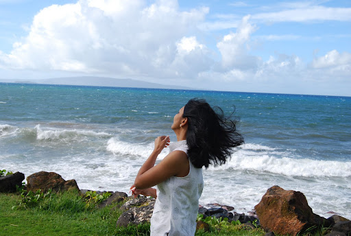
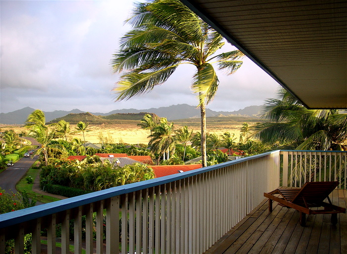


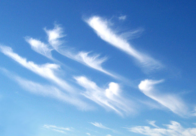
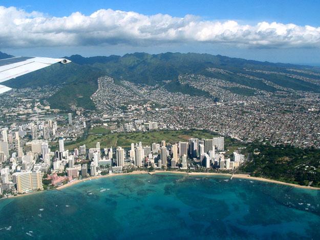


