October 2009
Monthly Archive
Posted by Glenn
[29] Comments
November 10-11, 2009
Air Temperatures – The following maximum temperatures were recorded across the state of Hawaii Tuesday afternoon:
Lihue, Kauai – 81
Honolulu, Oahu – 87
Kaneohe, Oahu – 82
Kaunakakai, Molokai – 84
Kahului, Maui – 86
Hilo, Hawaii – 83
Kailua-kona – 86
Air Temperatures ranged between these warmest and coolest spots near sea level around the state – and on the highest mountains…at 5pm Tuesday evening:
Barking Sands, Kauai – 85F
Hilo, Hawaii – 74
Haleakala Crater – missing (near 10,000 feet on Maui)
Mauna Kea summit – missing (near 14,000 feet on the Big Island)
Precipitation Totals – The following numbers represent the largest precipitation totals (inches) during the last 24 hours on each of the major islands, as of Tuesday afternoon:
0.23 Mount Waialeale, Kauai
0.25 Oahu Forest NWR, Oahu
0.00 Molokai
0.00 Lanai
0.00 Kahoolawe
0.39 West Wailuaiki, Maui
0.65 Pahoa, Big Island
Marine Winds – Here’s the latest (automatically updated) weather map showing a very strong 1038 millibar high pressure system far to the north of the islands. Trade winds will continue through Thursday…although become lighter at times.
Satellite and Radar Images: To view the cloud conditions we have here in Hawaii, please use the following satellite links, starting off with this Infrared Satellite Image of the islands to see all the clouds around the state during the day and night. This next image is one that gives close images of the islands only during the daytime hours, and is referred to as a Close-up visible image. This next image shows a larger view of the Pacific…giving perspective to the wider ranging cloud patterns in the Pacific Ocean. Finally, here’s a Looping IR satellite image, making viewable the clouds around the islands 24 hours a day. To help you keep track of where any showers may be around the islands, here’s the latest animated radar image.
Hawaii’s Mountains – Here’s a link to the live webcam on the summit of near 14,000 foot Mauna Kea on the Big Island of Hawaii. The tallest peak on the island of Maui is the Haleakala Crater, which is near 10,000 feet in elevation. These two webcams are available during the daylight hours here in the islands…and when there’s a big moon rising just after sunset for an hour or two! Plus, during the nights and early mornings you will be able to see stars, and the sunrise too…depending upon weather conditions.
Tropical Cyclone activity in the eastern and central Pacific – Here’s the latest weather information coming out of the National Hurricane Center, covering the eastern north Pacific. You can find the latest tropical cyclone information for the central north Pacific (where Hawaii is located) by clicking on this link to the Central Pacific Hurricane Center. Here’s a tracking map covering both the eastern and central Pacific Ocean. A satellite image, which shows the entire ocean area between Hawaii and the Mexican coast…can be found here.
Aloha Paragraphs

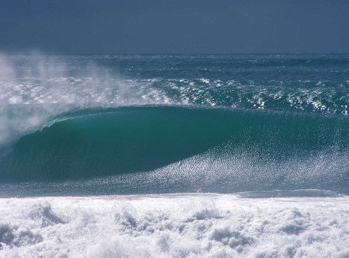
Sunset paddling…offshore from the Big Island
It appears likely that our weather will be going through some fairly major changes over the next several days, as an area of low pressure makes our overlying atmosphere shower prone. It looks like shower prone may be too light an expression however, as a flash flood watch already covers the entire state. The main concern is for locally heavy precipitation, as cold air aloft destabilizes the air mass surrounding the Hawaiian Islands. Cold air above, with warm moist air below, is a definite recipe for potential flooding rainfall. All the ingredients are forecast to be in place, to wring out lots of rainfall from the clouds that develop. Some of these clouds may attain very high tops, which brings in the possibility of thunderstorms too. Speaking of high level, here’s a webcam view of Mauna Kea on the Big Island, which may see its first significant snowfall of the autumn season over the next several days.
The latest satellite imagery shows some heavy showers already falling around the islands…although over the ocean at the time of this writing. The most active areas early Tuesday evening were to the southwest and east of the Big Island…and to the north of all the islands. This IR satellite picture shows all the clouds, with the extensive high clouds, that we’ve seen recently, now having pushed far to the east of the islands. We can see lower level clouds being carried our way on the light to locally moderate trade winds. The strongest gusts were occurring at Maalaea Bay on Maui…where a gust of 30 mph was being reported. Typically, this would indicate that our easterly trade winds are turning more northeast, rather than the normal east to east-northeast breezes. The winds will be shifting around quite a bit perhaps, as the trough moves over us from east to west.
The latest computer models definitely show a somewhat prolonged period of off and on, potentially heavy showers. Many areas around the Aloha state will get wet, perhaps everywhere will get an occasional deluge. The following GFS precipitation model shows lots of moisture in our area through the next 180 hours…or potentially through the rest of this week. At this point it’s difficult to know exactly when we might become drier, although as we all know, these conditions don’t last forever. Sometimes it seems that the more hype we have going in, the less likely that it will pan out to be all that bad. This can hold true, but not always! The fact that the NWS forecast office in Honolulu began issuing hydrologic outlook statements going in, often signifies that they feel a strong confidence in what the models are showing. It would be wise to expect heavy rains, and all the associated flooding that may accompany it. Speaking of flooding, here’s a looping radar image, which will show us where the heavy rains are falling.
Wow, what a day, lots of details to work through upon returning to work…after being away for over three weeks! We see that there is some active weather coming our way, as detailed in the paragraphs above. Since Wednesday is a holiday, Veteran’s Day, I’ll be off work. I’m a veteran of the Vietnam war (drafted into that war by the way), so in a certain sense…it’s my day to celebrate being alive. I had planned on going to see a new film this evening, but couldn’t find anything that really excited me all that much. Therefore, I think I’ll just go get something to go from someplace in Kahului, and then head home. I have my computer fixed, so I’ll be able to update this website Wednesday morning. I hope you have a great Tuesday night until then! Aloha for now…Glenn.
My recent Vacation:
October 20-21 – Hi everyone, I made it, flew into the San Francisco airport, with its wet runways Monday night. The lady at the Kahului airport, Karen, moved my seat up from 46A to 16A, with endless leg room and a window…which was a great start to my trip. I took the Marin Airporter to my friend’s house, where I found homemade soup, toast and cheese waiting. She had a Pumpkin ale to wash that down with, before I went to bed. Yesterday we started off our day with a nice walk, breakfast, coffee, and watched Democracy Now with Amy Goodman on the television. Later in the day we took a nice long walk into Baltimore Canyon, filled with Redwood trees…and a nice running creek. Finished off the day with wine on the deck to sunset. I slept wonderfully last night, and woke early, ready to start off my second day of vacation. ~~~ Today, Wednesday, we started off with a nice walk, then back home for breakfast. Today’s longer hike was into Tennessee Valley, a great walk down to the ocean. We had a wonderful Mexican food late lunch, before going to Whole Foods for shopping. I love that market, which has everything that I enjoy eating. One of our old friends will join us for dinner this evening, with good conversations guaranteed! Having a fabulous trip so far, and then on Friday will fly down to Long Beach for almost a week with my parents and family. I’ll catch up with you again soon, hope you are doing well. Aloha, Glenn.
October 22-23 Hi again, I had a fabulous day yesterday, starting off with the traditional early walk, this time down to a marsh, under low clouds and fog. Had a couple of eggs that we had bought at a local farmers market, along with potatoes, and toast for breakfast…and of course espresso too. We watched Democracy Now on TV, which is something my friend Linda enjoys most mornings. I like the program, but sometimes feel a little bogged down with all the stuff going on in the world, of which…I’d prefer not to know so much about. We ended up at Tennessee Valley again, walking all the way down to the ocean, where there was an active high surf advisory along the coast. The waves were large and powerful. We took off our shoes, and ran around some on the sand. Being more experienced in such conditions, I was the one responsible for telling Linda when to run back, so we didn’t get wet. We drove back to her house, for another wine and sunset, end to the day. ~~~ Today is Friday, and I took the Marin Airporter down to the San Francisco airport, for a short one hour flight down to Long Beach. My Mom picked me up, and I ended up visiting with her and my Dad during the afternoon. My brother Steve flies in from Texas just after 6pm, and I’ll go pick him up. I’m sure this will be a great family reunion, I’ll come back and let you know what’s going on in a couple of days. Aloha, Glenn
October 24-28 Good morning, it’s been a while since I’ve had a chance to sit down and write a few words. The reason…work! Oh yeah, my brother and I have been working our way through a long list of things to do at my parents house. He and I start off our days around 630am, jumping in my Mom’s car, and cruizing over to the coffee place my brother likes to get a cup of coffee to go. Then, it’s over to the donut shop that he picks up pasteries for my parents, and yes…I’ve been indulging some too. We then check the list, go to the store and buy building materials and stuff, and come back for a day of work. He and I are both used to working, so it’s good that we have something to do. At night we all sit around the living room, eating our dinners on TV trays, watching Monday night football, or whatever’s on that particular evening. ~~~ Since I last wrote we had a big family reunion at my sisters daughters house, which was fun. Since my brother and I leave tomorrow, we’re having everyone over again today. This morning Steve and I drove up to the top of Signal Hill and watched the sun rise over the mountains surrounding the LA basin. We’ll be finishing up our work this morning, before everyone comes over for lunch. ~~~ Steve flies back to Texas Thursday, and I fly up to San Francisco…where my good friend Bob will pick me up, then driving up to Linda’s house in Marin County. Bob and I take off up the coast from there, where we’ve rented a place right on a bluff over looking the ocean…located between Gualala and Point Arena. This rental has an outdoor hot tub overlooking the ocean, along with a big stone fireplace, which will be a treat. I’ll catch up with you at some point over the next week or so. Be well until then, Aloha, Glenn.
October 29-November 3 I had a great time being with my Mom, Dad, two sisters, and brother in southern California. I love each of them, and enjoyed our time together. Wow, the best of the best, that’s how I could describe the time between when I last wrote…and now! I flew back up to Marin from Long Beach, and my best friend Bob picked me up, and from there the word fun kicked in big time. The first evening we went out to eat at a place in Larkspur called Left Bank, which served up good eats. The next morning we started off the day early by hiking through the Tennessee Valley, a nice valley down to the ocean. Later that morning Bob and I jumped in his Toyota Prius and headed north on Highway 101. We headed towards the coast by getting off in Cotati, and driving to Sebastopol. Bob and I both went to Sonoma State University in that general area, where we were deeply involved in Geography and Meteorology. We sat around in the warm sun outside the Whole Foods store there, and enjoyed seeing the people walking by. Someone saw the T-shirt I was wearing, which said Hana, Maui on it, which often triggered conversations about the islands. We took the drive out through Guerneville to Jenner, following alongside the Russian River. We finally made it to our vacation rental called Moonstar, which was absolutely perfect!
~~~ Bob had one entire side of this great house, while I took up residence in the other. I was always the first one up in the morning, getting out to the hot tub well before sunrise. It happened to be full moon while we were visiting Moonstar, which was so cool. At any rate, we headed north for breakfast in Point Arena that first morning, after which we drove north to the Russian Gulch for a long hike. This area winds through old growth Redwood stands, ending up at a waterfall. While we were stopped there, admiring the beauty, two women walked up, one of which worked and lived in the nearby town of Mendocino, while the other lived in Novato. What could have been a brief hello in passing, turned out to be nearly an hour long in depth conversation about such things as what does Being Here Now mean? This day happened to be Halloween, and we had found out about a dance in Point Arena that night. Bob and I both love to dance, and to drink a couple of shots of vodka to loosen ourselves up properly before hand…which we did. The music was great, with lots of folks to dance with on the nice size floor. Upon returning to Moonstar at night, we almost always took a hot tub, and went over the fine details of the day.
~~~ The next day, well, it was yet another stunningly beautiful day, as they all were, with glorious sunshine, and not much wind on the ocean. The day started off, at least for me, as the last stars gave way to the gradually lightening of the morning sky. When Bob got up, one thing lead to another, like coffee to an early morning cocktail before the sun even rose! Under general circumstances, having a drink before sunrise would never happen, no way, never. But, we were deep into nature, and somehow things just turned that way, and by the way, was so much fun to watch the ocean, which was right below the bluff this house sat on, surrounded by nine full acres of coastal environment. We watched all the sea birds flying by, the full moon slipping into the ocean, sometimes listening to the Moody Blues, or Neil Young on the stereo, with the speakers out the windows towards the hot tub, sometimes loud! We headed up highway 1 again, all the way up to the small town of Mendocino. We took a right off the highway into the Big River State Park, where we were amazed at how pristine it was. We hiked up through the forest on a nice trail, and then took a sharp right down a cliff to the flood plain below. There were stands of Redwood, Douglas Fir, and a few others lining the river. We spent several hours out in the sun just talking about life in all directions. We then went into Mendocino and had lunch, before driving back south to our place. We ended up at a great restaurant called St. Orres, near our Moonstar for dinner. We sat by the fireplace out front enjoying a glass of wine, and somehow we eventually began talking to these two women who were hanging out too. We ended up talking for several hours with them, inviting them to have dinner with us at our table. We talked about everything under the sun, I mean the full November moon!
~~~ This brought us up to our last full day on the coast, and by then we were a bit tired, after all the long hikes, early and late hours, and to some extent partying. After all the same activities as the day before before sunrise and after, and having a nice breakfast, we headed out for what we thought would be a short walk. As things sometimes turn out, this short jaunt, turned out to be a long hike down the coast, along the entire nine acres of our ocean front property. It was totally fun to just have the time to explore, to sit and ponder the beauty, and of course have another long talk about nature, weather, spirituality, and likely women…knowing Bob and I. This last morning started off in the hot tub, admiring the huge ocean, and lots of waves breaking on the rocks right there in front. We drove north, stopping off in Point Arena at the co-op, saying goodbye to a old friend of mine who owns the store, Peter. We drove north and then east to the small town of Boonville, in the lovely wine grape growing Anderson Valley…known best for its Pinot Noir. We stopped at our favorite vineyard, called Goldeneye, and sat out in the courtyard soaking in the beauty of the grape vines, in their splendid green, yellow, and red leaves…on an exceptionally sunny and abnormally warm day. We tasted some of the wine, and got talking to one of the lady wine servers there, named Jeana, not exactly sure of the spelling. The three of us hit it off so well we ended spending almost three hours there speaking about everything wine, and our own lives too. Bob works for the County of Sacramento, in the area of Geographical Information Systems (GIF), and teaches at San Francisco State College, and two other colleges in the central Valley. He has been accepted to teach classes at UC Davis too, and has applied to Berkeley as well. Jeana lived with her husband and three kids on 40 acres on a ridge above Boonville. Their place is powered by the sun exclusively, and is country living at its finest. Me, well, you know what I do already. We then drove south to Linda’s house in Marin, and sat out on her deck and shared a bottle of red wine, before taking a good walk, and then back for dinner.
~~~ We all got up early Wednesday morning, wanting to fit in one more hike, this time back to Tennessee Valley. We had to get back early so Bob could get cleaned up, fed, coffee’d, and ready for the drive back to Sacramento to begin work at noon. He taught that evening, so it was going to be a long day for h. Linda and I will be doing some stuff, but to tell you the truth, I feel like I need to recouperate a little. This time with Bob, which we do every year, was as I mentioned before, the best of the best, and is probably what I look forward to doing the most of anything that I do in a typical year. I really couldn’t write about everything, as I would have needed twice the space, although now that I think of it, spotting that coyote out in a field along highway 1 was great too…once we got the binoculars on him. So, I’m going to go out on the deck now, and wait for Linda to get back home. I need to go get a new cell phone battery charger, which I accidently left up north. I’ll get back online at least once or twice more before flying back to Maui, and trust that all of you are enjoying yourselves! Be well my friends, Aloha, Glenn.
November 4-6 Picking up the story again, Wednesday afternoon the weather began to look like rain…which finally began later in the day. I stayed home and relaxed, although finally got out to rake all the leaves off the grass before the light rains began. We, Linda and I also mowed the lawns, I grabbed a bottle of wine from the cellar, and we made dinner together. Dinner consisted of Miso soup, with tofu, bock choy, and noodles. We were tired after that, and sat watching a little television, before I went to bed early, to catch up on some much needed sleep. Thursday morning, we headed out on a new walk, taking in the sights along the way. Breakfast consisted of fruit salad, oatmeal, and coffee…along with a previously purchased fancy pastry from the shopping center. Linda took off for yoga, and I retired to reading on the deck, in the nice warm sunshine. We took a drive to San Rafael, to one of the best farmers markets in the area. When we got home, we had a quick java boost, before driving over to Tennessee Valley, with leftover drizzle in the air…but we were determined. Linda suggest a route in the valley that she hadn’t hiked in over 10 years. Along the way we saw four big wild turkeys, which mesmerized me. Further up the trail, we saw a Western Blue Bird, a Mule deer with a large rack of antlers…then we began looking for a Bobcat in the late afternoon sunshine, punctuated by a lovely a rainbow. We didn’t see a cat, but ended up spotting a coyote…which was a major treat! Just after enjoying the coyote company, a Great Horned Owl began hooting in the nearby forest as we were leaving. The day seemed to warrant the opening of a 375ML bottle of 2006 Anderson Valley Goldeneye Pinot Noir, which was delicious. We then cooked a grass fed ribeye steak, plated with small yukon gold potatoes, a salad, and tiny steamed brussel sprouts, sprinkled with grated cheese. Later in the evening, we turned on her computer and watched youtube video’s.
~~~ Friday morning we started off early by walking along a marsh creek, where we saw about 25 Great Egrets and Snowy Egrets, and a Coopers Hawk…don’t forget that Linda is a birder! We came back for an oatmeal breakfast, watched Democracy Now with Amy Goodman on the television. I called a friend who used to work at the Pacific Disaster Center on Maui, who now works in downtown San Francisco. Linda dropped me off at the Ferry building, and I ferried to San Francisco, with a heavy drizzle falling. I got a window seat and immediately started talking with a gentleman who pulled in across from me. We chatted through the entire voyage across the bay about this and that. We docked, and I was astonished by the crowds of people, and the level of loud talking surrounding me. I found a reasonably quite nook, and called my friend Jeff Logan on the cell phone, who walked from his office, and met me. We hadn’t seen each other in many years, so it was great to catch up some while having a Thai lunch together. We then went to his office, called CustomWeather, where I met many of his fellow workers. We spent about two hours there, which was great, looking out of his office windows at all the people walking by below, and the surrounding tall buildings. Then we took the bus from SF across the Golden Gate Bridge, to Larkspur, near Corte Madre and San Rafael. We met his wife Mele at a restaurant called Benissimo, where we had a nice Italian dinner and a glass of red wine. Later, after dinner and great conversation, we headed over to a place where meditation was taking place, along with a talk by a man named David. Afterwards we went to Jeff and Mele’s place for Chamomile tea. They both have Harley Davidson motorcycles, and showed me a great slide show of their travels to the Sierra Nevada mountains, and the canyonlands of Utah. It was a very long day, and I was pooped when I got back to Linda’s at around 1130pm. I heard Linda get in past midnight, after her Tango dance evening in San Francisco.
November 7-8 Saturday was rather a low key day, at least through most of the morning into the early afternoon hours. Linda and I got invited over to some friend’s house for dinner and a glass of wine. We drove part way, and then walked the rest of the way. There were five lovely ladies at this dinner party, which was especially enjoyable for me! We all knew each other, although I did meet one new friend. This person was driving one of the ladies to the SF airport, for a long flight to Sri Lanka, where she will be teaching yoga for the next five months. My friends Jeff and Mele, who live nearby had called me earlier in the day and invited me to go to see a new film with them. They picked me up, and we went to see the new Michael Jackson film called This Is It. This film was excellent, especially because I have admired MJ’s music and dancing skills from way back. A couple of their lady friends had saved us a seat, which was fortunate, as the theatre was totally packed. I loved the film, and hope to see it again when I get back to Maui. The five of us then went to a restaurant/bar nearby, and sat around raving about the film over a glass of wine. All of the above would have generally made for a good day, but no, we weren’t quite through yet. We all went over to one of the ladies house for more fun, which turned out to be dancing in her front room to MJ video’s. I’m not sure where she got these long playing video’s, but they were excellent. Jeff and Mele drove me back to Linda’s after all this, and I slipped under the warm down comforter on my big bed, which felt so good!
~~~ Today is my last full day of vacation, so that I’m right at the tail-end of my time away from the islands. Linda and I just hung around through the morning, having another wonderful breakfast together. I love sitting out on her deck watching all the birds while I sip on my coffee each morning. We had a mutual friend stop over during the afternoon, who had just flown in from Australia. His girlfriend had just picked him up from the airport in SF, and they were on their way home to Santa Rosa. Shortly thereafter Linda and I took off for a long walk out in nature. I wish I could tell you where we went, but unfortunately I didn’t catch the name of this place. I would ask Linda, but she’s out Tango dancing again this evening. I do know however that it was along the slopes of Mount Tamalpais, which are exceptionally beautiful. We ended up stopping by one of Linda’s friends on the way home, who lives in a small canyon. His name is Nick, and he served Linda a small glass of red wine, while we went out in his back yard and observed all the birds that frequent that area. Nick has all kinds of bird feeders placed in the trees surrounding his house, so there is a marvelous number of bird species that were flitting around like crazy. They were busy talking about birds, and using their binoculars to take closer looks. We made it back to Linda’s, where I retired to the back deck with a glass of red wine myself. This particular bottle, which I got out of the cellar, was a very nice Atascadero Creek 2002 Sonoma County Green Valley, Pinot Noir from Railroad Vineyard. I’m sitting here now, after watching the sunset, and snipping the most incredibly fragrant red rose in Linda’s yard!
~~~ I’m waiting for Linda to get home, so had some time to write these last two paragraphs. We’ll have dinner together, probably watch some television, and then it will be time to gear up on Monday, for the flight back to Kahului, Maui. One of my neighbors is picking me up from the airport at around 5pm, leading into Tuesday…my first day back to work. This will be the last sharing that I will be doing before slipping back into my regular routine Tuesday. I hope you have enjoyed reading about my vacation as much as I have enjoyed using these writings as sort of a journal. By the way, we have some potentially heavy rains coming to the Hawaiian Islands around Wednesday and Thursday, with possible flooding and maybe even a thunderstorm or two! I’ll catch up with you either Monday evening, or certainly by early Tuesday morning. Be well until then, Aloha for now…Glenn.
November 9 Hi everyone, I’m home here in Kula, Maui, and it’s so warm in Hawaii…at least compared to northern California. I have more to say, but my neighbors have invited me for dinner, as I have no food, and need to shop soon. When I turned my computer on I found it to be not working properly. This of course leaves me high and dry in terms of updating this website, at least at home. I’m using my neighbors right now, and hopefully I’ll have mine fixed soon. I should be able to get on another computer again Tuesday, so will be back online then. Be well, Aloha, Glenn.
Posted by Glenn
[6] Comments
October 18-19, 2009
Air Temperatures – The following maximum temperatures were recorded across the state of Hawaii Sunday afternoon:
Lihue, Kauai – 83
Honolulu, Oahu – 89
Kaneohe, Oahu – 84
Kaunakakai, Molokai – 88
Kahului, Maui – 89
Hilo, Hawaii – 87
Kailua-kona – 88
Air Temperatures ranged between these warmest and coolest spots near sea level around the state – and on the highest mountains…at 4 p.m. Sunday afternoon:
Port Allen, Kauai – 88F
Kaneohe, Oahu – 81
Haleakala Crater – 59 (near 10,000 feet on Maui)
Mauna Kea summit – 41 (near 14,000 feet on the Big Island)
Precipitation Totals – The following numbers represent the largest precipitation totals (inches) during the last 24 hours on each of the major islands, as of Sunday afternoon:
0.31 Mount Waialeale, Kauai
0.30 Oahu Forest NWR, Oahu
0.12 Molokai
0.02 Lanai
0.00 Kahoolawe
1.04 West Wailuaiki, Maui
0.17 Pahoa, Big Island
Marine Winds – Here’s the latest (automatically updated) weather map showing a high pressure systems located generally to the northeast of the islands. These highs and ridges will keep the trade winds active Sunday and Monday…locally strong and gusty.
Satellite and Radar Images: To view the cloud conditions we have here in Hawaii, please use the following satellite links, starting off with this Infrared Satellite Image of the islands to see all the clouds around the state during the day and night. This next image is one that gives close images of the islands only during the daytime hours, and is referred to as a Close-up visible image. This next image shows a larger view of the Pacific…giving perspective to the wider ranging cloud patterns in the Pacific Ocean. Finally, here’s a Looping IR satellite image, making viewable the clouds around the islands 24 hours a day. To help you keep track of where any showers may be around the islands, here’s the latest animated radar image.
Hawaii’s Mountains – Here’s a link to the live webcam on the summit of near 14,000 foot Mauna Kea on the Big Island of Hawaii. The tallest peak on the island of Maui is the Haleakala Crater, which is near 10,000 feet in elevation. These two webcams are available during the daylight hours here in the islands…and when there’s a big moon rising just after sunset for an hour or two! Plus, during the nights and early mornings you will be able to see stars, and the sunrise too…depending upon weather conditions.
Tropical Cyclone activity in the eastern and central Pacific – Here’s the latest weather information coming out of the National Hurricane Center, covering the eastern north Pacific. You can find the latest tropical cyclone information for the central north Pacific (where Hawaii is located) by clicking on this link to the Central Pacific Hurricane Center. Here’s a tracking map covering both the eastern and central Pacific Ocean. A satellite image, which shows the entire ocean area between Hawaii and the Mexican coast…can be found here.
Aloha Paragraphs
South shore waves…high surf advisory
The trade winds will continue into the first couple of days of the new work week ahead…locally on the blustery side for the time being. The NWS office in Honolulu has extended the small craft wind advisory to all the major channels across the island chain now…in addition to a few of those locally windier coastal areas around Maui and the Big Island. The winds may gradually take on a more southeast orientation as we get towards Tuesday, last for several days. A new tropical depression, called 3C has developed to the south of the state of Hawaii, strengthening over the next couple of days. This feature, along with an approaching cold front to our northwest, will cause our winds to weaken, and turn more southeast. This may carry some volcanic haze up from the Big Island over the other islands for a couple of days by mid-week. The trade winds are expected to return towards the end of the new work week ahead.
The overlying atmosphere remains quite dry and stable for the time being…with likely just a few windward biased showers at times. The trade wind flow will continue into Monday, bringing fairly normal weather conditions to the Aloha state. Satellite imagery shows that there are just scattered moisture pockets upstream, with nothing unusual in that regard now. The leeward sides should remain generally nice, with lots of sunshine beaming down during the days. The northern fringe of the new tropical depression 3C, moving by to our southwest, may bring an increase in clouds and showers later Tuesday into Wednesday or Thursday.
It’s that time of the year again, when I’ll be taking my annual vacation to the mainland…once again to California. I’ll be leaving tomorrow afternoon, and be gone for about three weeks. I’ll be visiting my good friends, and also spending some quality time with my family in Long Beach as well. This will be a time when I renew my batteries, and spend time away from my weather schedule here in the islands. I’ll have more to say about this going forward, but just wanted to give you a heads up ahead of time. I’ll leave this paragraph here, so that those who drop by every few days, will know of my plans, and won’t be surprised. By the way, you will be able to continue getting the latest weather forecasts for each of the islands, by going to the left hand margin of any of the pages on this website, and clicking on the island you want to know about.
It’s early Sunday evening here in Kula, Maui, as I begin writing the last section of today’s narrative update. As noted above, we’ve seen a lovely day Sunday, with gorgeous trade wind weather prevailing. This satellite image shows the tropical depression about 600 miles south of our islands. As noted above, this area will likely strengthen into a tropical storm…and even into a hurricane well to the west of Hawaii with time. I’ll keep this looping satellite image here, so we can keep track of this tropical vortex to our south. Here’s the latest track map for this new tropical depression 3C…the islands are hidden under the box in the right hand corner by the way. ~~~ As Sunday winds down, after being quite sunny in most areas, the big news continues in the marine environment, where a significant south swell is bringing breaking waves to the south and west shores. The other feature of note, is the gusty trade winds that are whipping up the surface of our surrounding ocean as well. Then, of course, we have that tropical vortex down to our south at the moment too. Speaking of storms, we also find a super typhoon in the western Pacific, taking aim on the northern part of Luzon Island, in the Philippines. Last but not least, we have a major hurricane in the eastern Pacific, likely to impact the southern part of the Baja peninsula soon. So, we have active tropical cyclone activity here in the Pacific, while the Atlantic remains calm. ~~~ This will be my last narrative update until my vacation begins tomorrow. I’ll come back in the morning and prepare this website for my departure. You will be able to get all the current weather forecasts for all the islands however, by going to the left hand margin of any page, and click on the area that you would like to find out about. I’ll have more information about my vacation plans here in the morning, and then when possible, I’ll sent notes about where I am, and what I’m up to along the way. I hope you have a good Sunday night! Aloha for now…Glenn.
Interesting: Another potential "super typhoon" is threatening to make landfall in areas in Luzon. Luzon was among the worst areas to be hit by two devastating storms in the last three weeks. It was storm 22W, but now it has been given the international name of Lupit.
The storm will be named Ramil once it enters Philippine territory. It would be the 18th storm to enter the country this year.
PAGASA’s weather satellite spotted the storm at 1,350 kilometers east of Visayas, packing center winds of 65 kilometers per hour and gusts of up to 80 kph. As of 2 a.m. Friday morning, it located approximately 945 nautical miles of Luzon in the Philippines. It has tracked west-northwestward at 15 knots over the past six hours.
The government have forewarned residents already devastated by storms Ondoy (international code name Ketsana) and Pepeng (Parma) to be prepared "for an intense storm – typhoon." The new storm, which was first spotted over the Marianas Islands, threatens to hit Luzon areas as its residents scrambles to recover from the twin storms that devastated thousands of hectares of residential and agricultural areas for the last three weeks.
As of 2 a.m. Friday, the National Disaster Coordinating Council said a total of 392 people have been confirmed killed by landslides and floods caused by Pepeng’s or Parma’s heavy rains. Ondoy’s death toll was pegged at 341, bringing the total of deaths from the two storms to 733. This information is according to ABS/CBM news team in Asia. The number of missing people from after the two storms is estimated at 89. The twin storms also damaged at least $20 billion worth of crops and infrastructure.
Interesting2: Philanthropist and businessman George Soros announced this week that he would be the next in a line of wealthy front-runners to fund initiatives in clean technology. Soros is the founder of hedge fund Soros Fund Management LLC, and has been known for making monetary contributions to other charitable efforts that effect the well-being of society, such as health care and education; now he’s shifting his focus to play a part in reducing the impact of climate change.
Soros will establish the Climate Policy Initiative, an organization that will work with the US, China, India, Brazil and Europe and ensure that public interests are represented as new issues that affect climate change are established.
According to Thomas Holler, who will lead the initiative, "It will be part advisory service, part policy developer and part watchdog," Soros’ major role in the Climate Policy Initiative will be through his contribution of $10 million for year for the next 10 years.
Soros has also pledged to invest $1 billion in clean energy technology, contributing to the estimated $1 trillion needed to keep the globe’s temperatures in check; ensuring that they don’t rise beyond 2 degrees Celsius per year as a result of global warming.
Interesting3: Contrary to what was previously assumed, being overweight is not increasing the overall death rate in the German population. Matthias Lenz of the Faculty of Mathematics, Computer Science, and Natural Sciences of the University of Hamburg and his co-authors present these and other results in the current issue of Deutsches Ärtzeblatt International.
Most Germans are overweight, with a body mass index (BMI) between 25 and 29.9 kg/m2. About 20% are obese (BMI of 30 or over), with age- and gender-related differences. The authors systematically evaluated 42 studies of the relationships between weight, life expectancy, and disease.
The Süddeutsche Zeitung published an advance notice of the report, which shows that overweight does not increase death rates, although obesity does increase them by 20%. As people grow older, obesity makes less and less difference. For coronary heart disease, overweight increases risk by about 20% and obesity increases it by about 50%.
On the other hand, a larger BMI is associated with a lower risk of bone and hip fracture. In relation to cancer, the overall death rate among extremely obese men (BMI above 40) is no higher than among those of normal weight.
Men who are overweight even have a 7% lower death rate. No significant association was found in women. According to the authors’ analysis, overall mortality is unchanged by overweight, but increased by 20% by obesity, while extreme obesity raises it by up to 200%.
Interesting4: According to climate change experts, our planet has a fever — melting glaciers are just one stark sign of the radical changes we can expect. But global warming’s effects on farming and water resources is still a mystery. A new Tel Aviv University invention, a real-time "Optical Soil Dipstick" (OSD), may help solve the mystery and provide a new diagnostic tool for assessing the health of our planet.
According to Prof. Eyal Ben-Dor of TAU’s Department of Geography, his soil dipstick will help scientists, urban planners and farmers understand the changing health of the soil, as well as its agricultural potential and other associated concerns. "I was always attracted to drug development and diagnostics, which spurred the development of this OSD device," he says.
"It’s like a diagnostic device that measures soil health. Through a small hole in the surface of the earth, we can assess what lies beneath it." As climate change alters our planet radically, Prof. Ben-Dor explains, this dipstick could instantly tell geographers what parts of the U.S. are best — or worst — for farming.
For authorities in California, it is already providing proof that organic farms are chemical-free, and it could be used as a whistle-blower to catch environmental industrial polluters. The efficacy of the OSD was recently reported in the Soil Science Society of America Journal.
Interesting5: People are more likely to wash their hands when they have been shamed into it, according to a study by the London School of Hygiene & Tropical Medicine. The study, published in the American Journal of Public Health, looked at responses to electronic hygiene messages displayed in UK service station toilets.
A million people die every year from diarrheal disease and respiratory infection. Hand washing with soap is the cheapest and best way of controlling these diseases. It also prevents the spread of flu, and hospital-acquired infections such as Clostridium difficile.
However, "it’s difficult to know what kind of message is most effective at changing this everyday behavior, so it’s important to experimentally test what works best in a real setting. That way you can save money and make sure your program will be effective prior to rolling out any public health campaign at great expense," says Robert Aunger, leader of the study.
A quarter of a million people were counted using the toilets and their use of soap was monitored by on-line sensors. Only 32% of men washed their hands with soap whilst women were twice as good, with 64% washing their hands.
A variety of messages, ranging from ‘Water doesn’t kill germs, soap does’ to ‘Don’t be a dirty soap dodger’, were flashed onto LED screens at the entrance of the toilets and the effects of the messages on behavior were measured.
‘Is the person next to you washing with soap?’ was best overall, showing how people respond to whether they thought others were watching. There were intriguing differences in behavior by gender, with women responding to reminders, while men tended to react best to messages that invoked disgust, for example ‘soap it off or eat it later’.
Interesting6: Drinking water from plastic bottles made with the toxic chemical bisphenol A (BPA) increases urinary levels of the chemical by nearly 70 percent, according to a study conducted by researchers from Harvard University and the Centers for Disease Control and Prevention. BPA, an industrial chemical that makes plastics hard and transparent, is widely used in plastic drinking bottles, infant bottles and other consumer products, and also in resins that line cans of food and infant formula.
The chemical has been shown to disrupt the hormonal system, potentially leading to reproductive defects as well as brain damage, cardiovascular disease, cancer, obesity and diabetes. The study, conducted on 77 student volunteers, was published in the journal Environmental Health Perspectives.
Interesting7: NOAA’s Fisheries Service announced yesterday that two of three populations totaling more than 200,000 spotted seals in and near Alaska are not currently in danger of extinction or likely to become endangered in the foreseeable future. The announcement follows an 18-month status review. However, NOAA is proposing to list a third smaller population of 3,300 seals off China and Russia as threatened.
"The northern two spotted seal populations exceed 200,000 individuals. We do not predict the expected fluctuations in sea ice will affect them enough to warrant listing at this time," said Doug Mecum, acting administrator for NOAA’s Fisheries Service Alaska region. Spotted seals have three distinct populations.
The 100,000-strong Bering Sea population segment lives near Kamchatka and in the Gulf of Anadyr in Russia and in the eastern Bering Sea in United States waters. Another distinct population segment of roughly 100,000 seals has breeding populations in both the Sea of Japan and the Sea of Okhotsk.
The southern-most population of about 3,300 seals is centered in Liaodong Bay, China and Peter the Great Bay, Russia.The Center for Biological Diversity, an environmental organization, petitioned to have spotted seals listed under the Endangered Species Act in 2007, expressing concern for the species’ habitat from climate warming and loss of sea ice.
Interesting8: Coffee accounts for 80% of all Fair Trade certified products sold in the US, and with 40 million pounds of Fair Trade coffee purchases in 2009, Starbucks is by far the largest buyer of Fair Trade coffee on the planet. Starbucks’ commitment to Fair Trade is commendable, and in fact seems exceptional, in a world where the vast majority of companies engage in less-than-ethical business practices.
TransFair USA, the only third-party Fair Trade certifier in the US, calls the relationship between the non-profit and Starbucks "deeply transformational" to thousands of farmers and their communities. Fair Trade ensures that farmers around the world receive a reasonable price for their products, which in turn helps producers to invest in their communities, pay for their children’s education, and become better stewards of the land.
Not only are coffee growers getting a better price, coffee drinkers are getting a better cup of coffee. Today some of the highest quality coffees available are Fair Trade certified. In honor of Fair Trade Month, TransFair USA CEO, Paul Rice, and Starbucks Senior Vice President of Coffee & Tea, Dub Hay, met on Monday to discuss the virtues of Fair Trade and how the relationship between the non-profit and the world’s most well known coffee slinger has grown in recent years. The discussion was broadcast live over the Internet, fielding questions submitted via Twitter, Facebook, and live chat.
Posted by Glenn
No Comments
October 17-18, 2009
Air Temperatures – The following maximum temperatures were recorded across the state of Hawaii Saturday afternoon:
Lihue, Kauai – 83
Honolulu, Oahu – 88
Kaneohe, Oahu – 82
Kaunakakai, Molokai – 86
Kahului, Maui – 88
Hilo, Hawaii – 84
Kailua-kona – 87
Air Temperatures ranged between these warmest and coolest spots near sea level around the state – and on the highest mountains…at 5 p.m. Saturday evening:
Port Allen, Kauai – 86F
Princeville, Kauai – 79
Haleakala Crater – 54 (near 10,000 feet on Maui)
Mauna Kea summit – 41 (near 14,000 feet on the Big Island)
Precipitation Totals – The following numbers represent the largest precipitation totals (inches) during the last 24 hours on each of the major islands, as of Saturday afternoon:
0.32 Mount Waialeale, Kauai
0.03 Manoa Valley, Oahu
0.00 Molokai
0.00 Lanai
0.09 Kahoolawe
0.06 West Wailuaiki, Maui
1.02 Waiakea Uka, Big Island
Marine Winds – Here’s the latest (automatically updated) weather map showing a high pressure system located to the northeast of the islands. This high and its ridge will keep the trade winds active Sunday and Monday…locally strong and gusty.
Satellite and Radar Images: To view the cloud conditions we have here in Hawaii, please use the following satellite links, starting off with this Infrared Satellite Image of the islands to see all the clouds around the state during the day and night. This next image is one that gives close images of the islands only during the daytime hours, and is referred to as a Close-up visible image. This next image shows a larger view of the Pacific…giving perspective to the wider ranging cloud patterns in the Pacific Ocean. Finally, here’s a Looping IR satellite image, making viewable the clouds around the islands 24 hours a day. To help you keep track of where any showers may be around the islands, here’s the latest animated radar image.
Hawaii’s Mountains – Here’s a link to the live webcam on the summit of near 14,000 foot Mauna Kea on the Big Island of Hawaii. The tallest peak on the island of Maui is the Haleakala Crater, which is near 10,000 feet in elevation. These two webcams are available during the daylight hours here in the islands…and when there’s a big moon rising just after sunset for an hour or two! Plus, during the nights and early mornings you will be able to see stars, and the sunrise too…depending upon weather conditions.
Tropical Cyclone activity in the eastern and central Pacific – Here’s the latest weather information coming out of the National Hurricane Center, covering the eastern north Pacific. You can find the latest tropical cyclone information for the central north Pacific (where Hawaii is located) by clicking on this link to the Central Pacific Hurricane Center. Here’s a tracking map covering both the eastern and central Pacific Ocean. A satellite image, which shows the entire ocean area between Hawaii and the Mexican coast…can be found here.
Aloha Paragraphs

South shore waves…high surf advisory
The trade winds will continue through the weekend…becoming locally strong and gusty. This weather map shows a 1022 millibar high pressure system to the northeast of the state Saturday night. This will increase our local wind speeds, bringing them up into the moderately strong category…locally stronger and gusty into Monday. The NWS office in Honolulu has issued a small craft wind advisory for the gusty trade winds, active over those windiest areas in Maui County and the Big Island. The winds may gradually take on a more southeast to east-southeast orientation as we get towards the middle of the new work week ahead.
As the trade winds have returned, and will continue through this weekend…we’re now into a well established trade wind weather pattern. These trade winds will begin carrying moisture off the ocean in our direction, with a normal increase in clouds and a few showers along our windward coasts and slopes at times. This autumn trade wind flow will continue through the weekend, bringing fairly normal weather conditions to the Aloha state. Satellite imagery shows that there are cloud bands to our east, which will bring showers to the windward sides Saturday night into Sunday morning…a few of which may be locally heavy. The Big Island will see the arrival of these showers first, as the showers ride westward on the gusty trade winds. The leeward sides should remain generally nice, although may see a few showers arriving at times.
It’s that time of the year again, when I’ll be taking my annual vacation to the mainland…once again to California. I’ll be leaving on Monday, and be gone for about three weeks. I’ll be visiting my good friends, and also spending some quality time with my family in Long Beach as well. This will be a time when I renew my batteries, and spend time away from my weather schedule here in the islands. I’ll have more to say about this going forward, but just wanted to give you a heads up ahead of time. I’ll leave this paragraph here, so that those who drop by every few days, will know of my plans, and won’t be surprised. By the way, you will be able to continue getting the latest weather forecasts for each of the islands, by going to the left hand margin of any of the pages on this website, and clicking on the island you want to know about.
It’s early Saturday evening here in Kula, Maui, as I begin writing the last section of today’s narrative update. As noted above, we are involved in a lovely weekend, with gorgeous trade wind weather prevailing. This satellite image shows that there is still a large area of thunderstorms, located down to the southeast of the islands. The computer models have certainly backed off on their suggestions of a tropical system moving up into our area…at least for the moment. These models can fluctuate at times, so there may be more to say over the next couple of days. There’s always the chance that some of that moisture from the deep tropics may shift northward, and bring some showers our way around the middle of the new week. I think it would be wise to keep this looping satellite image close at hand, just to see if we spot any signs of spin to the clouds to our southeast. ~~~ I had a haircut in Paia this morning, and then went straight to the beach at Baldwin. I found very few people there, much less than a normal Saturday lately. At any rate, I took a long walk down to what’s called Baby Beach, and thoroughly enjoyed the great weather. I got into the surf for a while, and it felt so wonderful to be in that warm ocean, and to ride a couple of breaking waves! I went shopping, and then drove back up here to Kula, and have been enjoying the afternoon. It’s just before sunset now, and I’m about ready to head out for my early evening walk. I’ll be back Sunday morning with your next new weather narrative from paradise, I hope you have a great Saturday night! Aloha for now…Glenn.
Interesting: Another potential "super typhoon" is threatening to make landfall in areas in Luzon. Luzon was among the worst areas to be hit by two devastating storms in the last three weeks. It was storm 22W, but now it has been given the international name of Lupit.
The storm will be named Ramil once it enters Philippine territory. It would be the 18th storm to enter the country this year.
PAGASA’s weather satellite spotted the storm at 1,350 kilometers east of Visayas, packing center winds of 65 kilometers per hour and gusts of up to 80 kph. As of 2 a.m. Friday morning, it located approximately 945 nautical miles of Luzon in the Philippines. It has tracked west-northwestward at 15 knots over the past six hours.
The government have forewarned residents already devastated by storms Ondoy (international code name Ketsana) and Pepeng (Parma) to be prepared "for an intense storm – typhoon." The new storm, which was first spotted over the Marianas Islands, threatens to hit Luzon areas as its residents scrambles to recover from the twin storms that devastated thousands of hectares of residential and agricultural areas for the last three weeks.
As of 2 a.m. Friday, the National Disaster Coordinating Council said a total of 392 people have been confirmed killed by landslides and floods caused by Pepeng’s or Parma’s heavy rains. Ondoy’s death toll was pegged at 341, bringing the total of deaths from the two storms to 733. This information is according to ABS/CBM news team in Asia. The number of missing people from after the two storms is estimated at 89. The twin storms also damaged at least $20 billion worth of crops and infrastructure.
Interesting2: Philanthropist and businessman George Soros announced this week that he would be the next in a line of wealthy front-runners to fund initiatives in clean technology. Soros is the founder of hedge fund Soros Fund Management LLC, and has been known for making monetary contributions to other charitable efforts that effect the well-being of society, such as health care and education; now he’s shifting his focus to play a part in reducing the impact of climate change.
Soros will establish the Climate Policy Initiative, an organization that will work with the US, China, India, Brazil and Europe and ensure that public interests are represented as new issues that affect climate change are established.
According to Thomas Holler, who will lead the initiative, "It will be part advisory service, part policy developer and part watchdog," Soros’ major role in the Climate Policy Initiative will be through his contribution of $10 million for year for the next 10 years.
Soros has also pledged to invest $1 billion in clean energy technology, contributing to the estimated $1 trillion needed to keep the globe’s temperatures in check; ensuring that they don’t rise beyond 2 degrees Celsius per year as a result of global warming.
Interesting3: Contrary to what was previously assumed, being overweight is not increasing the overall death rate in the German population. Matthias Lenz of the Faculty of Mathematics, Computer Science, and Natural Sciences of the University of Hamburg and his co-authors present these and other results in the current issue of Deutsches Ärtzeblatt International.
Most Germans are overweight, with a body mass index (BMI) between 25 and 29.9 kg/m2. About 20% are obese (BMI of 30 or over), with age- and gender-related differences. The authors systematically evaluated 42 studies of the relationships between weight, life expectancy, and disease.
The Süddeutsche Zeitung published an advance notice of the report, which shows that overweight does not increase death rates, although obesity does increase them by 20%. As people grow older, obesity makes less and less difference. For coronary heart disease, overweight increases risk by about 20% and obesity increases it by about 50%.
On the other hand, a larger BMI is associated with a lower risk of bone and hip fracture. In relation to cancer, the overall death rate among extremely obese men (BMI above 40) is no higher than among those of normal weight.
Men who are overweight even have a 7% lower death rate. No significant association was found in women. According to the authors’ analysis, overall mortality is unchanged by overweight, but increased by 20% by obesity, while extreme obesity raises it by up to 200%.
Interesting4: According to climate change experts, our planet has a fever — melting glaciers are just one stark sign of the radical changes we can expect. But global warming’s effects on farming and water resources is still a mystery. A new Tel Aviv University invention, a real-time "Optical Soil Dipstick" (OSD), may help solve the mystery and provide a new diagnostic tool for assessing the health of our planet.
According to Prof. Eyal Ben-Dor of TAU’s Department of Geography, his soil dipstick will help scientists, urban planners and farmers understand the changing health of the soil, as well as its agricultural potential and other associated concerns. "I was always attracted to drug development and diagnostics, which spurred the development of this OSD device," he says.
"It’s like a diagnostic device that measures soil health. Through a small hole in the surface of the earth, we can assess what lies beneath it." As climate change alters our planet radically, Prof. Ben-Dor explains, this dipstick could instantly tell geographers what parts of the U.S. are best — or worst — for farming.
For authorities in California, it is already providing proof that organic farms are chemical-free, and it could be used as a whistle-blower to catch environmental industrial polluters. The efficacy of the OSD was recently reported in the Soil Science Society of America Journal.
Interesting5: People are more likely to wash their hands when they have been shamed into it, according to a study by the London School of Hygiene & Tropical Medicine. The study, published in the American Journal of Public Health, looked at responses to electronic hygiene messages displayed in UK service station toilets.
A million people die every year from diarrheal disease and respiratory infection. Hand washing with soap is the cheapest and best way of controlling these diseases. It also prevents the spread of flu, and hospital-acquired infections such as Clostridium difficile.
However, "it’s difficult to know what kind of message is most effective at changing this everyday behavior, so it’s important to experimentally test what works best in a real setting. That way you can save money and make sure your program will be effective prior to rolling out any public health campaign at great expense," says Robert Aunger, leader of the study.
A quarter of a million people were counted using the toilets and their use of soap was monitored by on-line sensors. Only 32% of men washed their hands with soap whilst women were twice as good, with 64% washing their hands.
A variety of messages, ranging from ‘Water doesn’t kill germs, soap does’ to ‘Don’t be a dirty soap dodger’, were flashed onto LED screens at the entrance of the toilets and the effects of the messages on behavior were measured.
‘Is the person next to you washing with soap?’ was best overall, showing how people respond to whether they thought others were watching. There were intriguing differences in behavior by gender, with women responding to reminders, while men tended to react best to messages that invoked disgust, for example ‘soap it off or eat it later’.
Interesting6: Drinking water from plastic bottles made with the toxic chemical bisphenol A (BPA) increases urinary levels of the chemical by nearly 70 percent, according to a study conducted by researchers from Harvard University and the Centers for Disease Control and Prevention. BPA, an industrial chemical that makes plastics hard and transparent, is widely used in plastic drinking bottles, infant bottles and other consumer products, and also in resins that line cans of food and infant formula.
The chemical has been shown to disrupt the hormonal system, potentially leading to reproductive defects as well as brain damage, cardiovascular disease, cancer, obesity and diabetes. The study, conducted on 77 student volunteers, was published in the journal Environmental Health Perspectives.
Interesting7: NOAA’s Fisheries Service announced yesterday that two of three populations totaling more than 200,000 spotted seals in and near Alaska are not currently in danger of extinction or likely to become endangered in the foreseeable future. The announcement follows an 18-month status review. However, NOAA is proposing to list a third smaller population of 3,300 seals off China and Russia as threatened.
"The northern two spotted seal populations exceed 200,000 individuals. We do not predict the expected fluctuations in sea ice will affect them enough to warrant listing at this time," said Doug Mecum, acting administrator for NOAA’s Fisheries Service Alaska region. Spotted seals have three distinct populations.
The 100,000-strong Bering Sea population segment lives near Kamchatka and in the Gulf of Anadyr in Russia and in the eastern Bering Sea in United States waters. Another distinct population segment of roughly 100,000 seals has breeding populations in both the Sea of Japan and the Sea of Okhotsk.
The southern-most population of about 3,300 seals is centered in Liaodong Bay, China and Peter the Great Bay, Russia.The Center for Biological Diversity, an environmental organization, petitioned to have spotted seals listed under the Endangered Species Act in 2007, expressing concern for the species’ habitat from climate warming and loss of sea ice.
Interesting8: Coffee accounts for 80% of all Fair Trade certified products sold in the US, and with 40 million pounds of Fair Trade coffee purchases in 2009, Starbucks is by far the largest buyer of Fair Trade coffee on the planet. Starbucks’ commitment to Fair Trade is commendable, and in fact seems exceptional, in a world where the vast majority of companies engage in less-than-ethical business practices.
TransFair USA, the only third-party Fair Trade certifier in the US, calls the relationship between the non-profit and Starbucks "deeply transformational" to thousands of farmers and their communities. Fair Trade ensures that farmers around the world receive a reasonable price for their products, which in turn helps producers to invest in their communities, pay for their children’s education, and become better stewards of the land.
Not only are coffee growers getting a better price, coffee drinkers are getting a better cup of coffee. Today some of the highest quality coffees available are Fair Trade certified. In honor of Fair Trade Month, TransFair USA CEO, Paul Rice, and Starbucks Senior Vice President of Coffee & Tea, Dub Hay, met on Monday to discuss the virtues of Fair Trade and how the relationship between the non-profit and the world’s most well known coffee slinger has grown in recent years. The discussion was broadcast live over the Internet, fielding questions submitted via Twitter, Facebook, and live chat.
Posted by Glenn
No Comments
October 16-17, 2009
Air Temperatures – The following maximum temperatures were recorded across the state of Hawaii Friday afternoon:
Lihue, Kauai – 82
Honolulu, Oahu – 89
Kaneohe, Oahu – 82
Kaunakakai, Molokai – 85
Kahului, Maui – 86
Hilo, Hawaii – 84
Kailua-kona – 87
Air Temperatures ranged between these warmest and coolest spots near sea level around the state – and on the highest mountains…at 5 p.m. Friday evening:
Kailua-kona – 84F
Lihue, Kauai – 76
Haleakala Crater – 50 (near 10,000 feet on Maui)
Mauna Kea summit – 43 (near 14,000 feet on the Big Island)
Precipitation Totals – The following numbers represent the largest precipitation totals (inches) during the last 24 hours on each of the major islands, as of Friday afternoon:
0.17 Mount Waialeale, Kauai
0.01 Waimanalo, Oahu
0.00 Molokai
0.00 Lanai
0.00 Kahoolawe
0.04 Puu Kukui, Maui
0.20 Kealakekua, Big Island
Marine Winds – Here’s the latest (automatically updated) weather map showing a high pressure system located to the north of the islands, moving eastward. This high and its ridge will keep the trade winds active Saturday and Sunday…becoming locally strong and gusty.
Satellite and Radar Images: To view the cloud conditions we have here in Hawaii, please use the following satellite links, starting off with this Infrared Satellite Image of the islands to see all the clouds around the state during the day and night. This next image is one that gives close images of the islands only during the daytime hours, and is referred to as a Close-up visible image. This next image shows a larger view of the Pacific…giving perspective to the wider ranging cloud patterns in the Pacific Ocean. Finally, here’s a Looping IR satellite image, making viewable the clouds around the islands 24 hours a day. To help you keep track of where any showers may be around the islands, here’s the latest animated radar image.
Hawaii’s Mountains – Here’s a link to the live webcam on the summit of near 14,000 foot Mauna Kea on the Big Island of Hawaii. The tallest peak on the island of Maui is the Haleakala Crater, which is near 10,000 feet in elevation. These two webcams are available during the daylight hours here in the islands…and when there’s a big moon rising just after sunset for an hour or two! Plus, during the nights and early mornings you will be able to see stars, and the sunrise too…depending upon weather conditions.
Tropical Cyclone activity in the eastern and central Pacific – Here’s the latest weather information coming out of the National Hurricane Center, covering the eastern north Pacific. You can find the latest tropical cyclone information for the central north Pacific (where Hawaii is located) by clicking on this link to the Central Pacific Hurricane Center. Here’s a tracking map covering both the eastern and central Pacific Ocean. A satellite image, which shows the entire ocean area between Hawaii and the Mexican coast…can be found here.
Aloha Paragraphs

Rising surf along our leeward beaches…high surf advisory
The trade winds have filled back into the Hawaiian Island weather picture now, and will continue through the weekend…becoming locally strong and gusty. This weather map shows a high pressure system to the north of the state Friday night…moving eastward. As this high pressure cell gets to the northeast of the Aloha state this weekend, it will be stronger, reaching near 1023 millibars. This will increase our local wind speeds, bringing them up into the moderately strong category…locally a bit stronger and gusty. >> Meanwhile, the computer models, at least some of them, show a tropical system forming to the southeast of the Hawaiian Islands in a couple of days. They go on to show this, what could become, tropical depression called 2C coming up towards our islands early next week. If this occurs, we could see gusty winds moving into the state then, plus an increase in showers.
Those computer models suggest that there may be a slim chance of this system strengthening into a tropical storm…whose name would be Neki. There is still quite a bit of uncertainty about what exactly will happen however, and there will be a couple of days before we need to get all spun-up over this possibility…or not. This will be something a bit unusual, as often we see tropical systems form over in the eastern Pacific, and then take well over a week or more to get closer to our islands…in other words, lots of lead time. This time around though, things could be more accelerated, and we may see inclement weather conditions already by Tuesday or Wednesday of new week ahead. I’ll be following this closely, and will continue to bring you the latest updates as they become available.
At any rate, as the trade winds have returned, and will continue into the weekend…as we’re now back into a trade wind weather pattern. These trade winds will begin carrying moisture off the ocean in our direction, with a normal increase in clouds and a few showers along our windward coasts and slopes. This autumn trade wind flow will continue through the weekend, bringing fairly normal weather conditions to the Aloha state. Satellite imagery shows that there are a few cloud bands to our east, which will bring showers periodically to the windward sides. The leeward sides should remain generally dry, and quite sunny during the days. As a matter of fact, our weather will be really nice, with the next possible interruption, could occur around next Tuesday or Wednesdays…for a couple of days.
It’s that time of the year again, when I’ll be taking my annual vacation to the mainland…once again to California. I’ll be leaving right after the upcoming weekend, on Monday, and be gone for about three weeks. I’ll be visiting my good friends, and also spending some quality time with my family in Long Beach as well. This will be a time when I renew my batteries, and spend time away from my weather schedule here in the islands. I’ll have more to say about this going forward, but just wanted to give you a heads up ahead of time. I’ll leave this paragraph here, so that those who drop by every few days, will know of my plans, and won’t be surprised. By the way, you will be able to continue getting the latest weather forecasts for each of the islands, by going to the left hand margin of any of the pages on this website, and clicking on the island you want to know about.
It’s early Friday evening here in Kihei, Maui, as I begin writing the last section of today’s narrative update. As noted in the paragraphs above, we have the trade winds back now, picking up into the weekend. There will be a few showers arriving along the windward sides, which is normal in such a weather pattern as we have going on now. This weekend looks like it will be very nice, with pleasant beach weather available in most places, especially the south and west facing leeward beaches. The one thing there will be the waves, which will be larger than normal for this time of year. A storm in the southern hemisphere, about a week ago, generated a swell train of waves, which will be breaking along these beaches…so be careful when you go in the ocean! The NWS forecast office in Honolulu has issued a high surf advisory for these shores starting Saturday morning at 6am. ~~~ Rather than going to see a film this evening, as is my habit, I’m meeting a friend or two for dinner in Kahului. This should be lots of fun, as these folks are very good conversationalists. ~~~ I’ll be back as usual early Saturday morning with your next new weather narrative from paradise. I hope you have a great Friday night until then! Aloha for now…Glenn.
Notice: If you happened to miss reading the first two paragraphs of this narrative, just up the page from here…you may want to go there and take a look where you see >>.
Interesting: Another potential "super typhoon" is threatening to make landfall in areas in Luzon. Luzon was among the worst areas to be hit by two devastating storms in the last three weeks. It was storm 22W, but now it has been given the international name of Lupit.
The storm will be named Ramil once it enters Philippine territory. It would be the 18th storm to enter the country this year.
PAGASA’s weather satellite spotted the storm at 1,350 kilometers east of Visayas, packing center winds of 65 kilometers per hour and gusts of up to 80 kph. As of 2 a.m. Friday morning, it located approximately 945 nautical miles of Luzon in the Philippines. It has tracked west-northwestward at 15 knots over the past six hours.
The government have forewarned residents already devastated by storms Ondoy (international code name Ketsana) and Pepeng (Parma) to be prepared "for an intense storm – typhoon." The new storm, which was first spotted over the Marianas Islands, threatens to hit Luzon areas as its residents scrambles to recover from the twin storms that devastated thousands of hectares of residential and agricultural areas for the last three weeks.
As of 2 a.m. Friday, the National Disaster Coordinating Council said a total of 392 people have been confirmed killed by landslides and floods caused by Pepeng’s or Parma’s heavy rains. Ondoy’s death toll was pegged at 341, bringing the total of deaths from the two storms to 733. This information is according to ABS/CBM news team in Asia. The number of missing people from after the two storms is estimated at 89. The twin storms also damaged at least $20 billion worth of crops and infrastructure.
Interesting2: Philanthropist and businessman George Soros announced this week that he would be the next in a line of wealthy front-runners to fund initiatives in clean technology. Soros is the founder of hedge fund Soros Fund Management LLC, and has been known for making monetary contributions to other charitable efforts that effect the well-being of society, such as health care and education; now he’s shifting his focus to play a part in reducing the impact of climate change.
Soros will establish the Climate Policy Initiative, an organization that will work with the US, China, India, Brazil and Europe and ensure that public interests are represented as new issues that affect climate change are established.
According to Thomas Holler, who will lead the initiative, "It will be part advisory service, part policy developer and part watchdog," Soros’ major role in the Climate Policy Initiative will be through his contribution of $10 million for year for the next 10 years.
Soros has also pledged to invest $1 billion in clean energy technology, contributing to the estimated $1 trillion needed to keep the globe’s temperatures in check; ensuring that they don’t rise beyond 2 degrees Celsius per year as a result of global warming.
Interesting3: Contrary to what was previously assumed, being overweight is not increasing the overall death rate in the German population. Matthias Lenz of the Faculty of Mathematics, Computer Science, and Natural Sciences of the University of Hamburg and his co-authors present these and other results in the current issue of Deutsches Ärtzeblatt International.
Most Germans are overweight, with a body mass index (BMI) between 25 and 29.9 kg/m2. About 20% are obese (BMI of 30 or over), with age- and gender-related differences. The authors systematically evaluated 42 studies of the relationships between weight, life expectancy, and disease.
The Süddeutsche Zeitung published an advance notice of the report, which shows that overweight does not increase death rates, although obesity does increase them by 20%. As people grow older, obesity makes less and less difference. For coronary heart disease, overweight increases risk by about 20% and obesity increases it by about 50%.
On the other hand, a larger BMI is associated with a lower risk of bone and hip fracture. In relation to cancer, the overall death rate among extremely obese men (BMI above 40) is no higher than among those of normal weight.
Men who are overweight even have a 7% lower death rate. No significant association was found in women. According to the authors’ analysis, overall mortality is unchanged by overweight, but increased by 20% by obesity, while extreme obesity raises it by up to 200%.
Interesting4: According to climate change experts, our planet has a fever — melting glaciers are just one stark sign of the radical changes we can expect. But global warming’s effects on farming and water resources is still a mystery. A new Tel Aviv University invention, a real-time "Optical Soil Dipstick" (OSD), may help solve the mystery and provide a new diagnostic tool for assessing the health of our planet.
According to Prof. Eyal Ben-Dor of TAU’s Department of Geography, his soil dipstick will help scientists, urban planners and farmers understand the changing health of the soil, as well as its agricultural potential and other associated concerns. "I was always attracted to drug development and diagnostics, which spurred the development of this OSD device," he says.
"It’s like a diagnostic device that measures soil health. Through a small hole in the surface of the earth, we can assess what lies beneath it." As climate change alters our planet radically, Prof. Ben-Dor explains, this dipstick could instantly tell geographers what parts of the U.S. are best — or worst — for farming.
For authorities in California, it is already providing proof that organic farms are chemical-free, and it could be used as a whistle-blower to catch environmental industrial polluters. The efficacy of the OSD was recently reported in the Soil Science Society of America Journal.
Interesting5: People are more likely to wash their hands when they have been shamed into it, according to a study by the London School of Hygiene & Tropical Medicine. The study, published in the American Journal of Public Health, looked at responses to electronic hygiene messages displayed in UK service station toilets.
A million people die every year from diarrheal disease and respiratory infection. Hand washing with soap is the cheapest and best way of controlling these diseases. It also prevents the spread of flu, and hospital-acquired infections such as Clostridium difficile.
However, "it’s difficult to know what kind of message is most effective at changing this everyday behavior, so it’s important to experimentally test what works best in a real setting. That way you can save money and make sure your program will be effective prior to rolling out any public health campaign at great expense," says Robert Aunger, leader of the study.
A quarter of a million people were counted using the toilets and their use of soap was monitored by on-line sensors. Only 32% of men washed their hands with soap whilst women were twice as good, with 64% washing their hands.
A variety of messages, ranging from ‘Water doesn’t kill germs, soap does’ to ‘Don’t be a dirty soap dodger’, were flashed onto LED screens at the entrance of the toilets and the effects of the messages on behavior were measured.
‘Is the person next to you washing with soap?’ was best overall, showing how people respond to whether they thought others were watching. There were intriguing differences in behavior by gender, with women responding to reminders, while men tended to react best to messages that invoked disgust, for example ‘soap it off or eat it later’.
Interesting6: Drinking water from plastic bottles made with the toxic chemical bisphenol A (BPA) increases urinary levels of the chemical by nearly 70 percent, according to a study conducted by researchers from Harvard University and the Centers for Disease Control and Prevention. BPA, an industrial chemical that makes plastics hard and transparent, is widely used in plastic drinking bottles, infant bottles and other consumer products, and also in resins that line cans of food and infant formula.
The chemical has been shown to disrupt the hormonal system, potentially leading to reproductive defects as well as brain damage, cardiovascular disease, cancer, obesity and diabetes. The study, conducted on 77 student volunteers, was published in the journal Environmental Health Perspectives.
Interesting7: NOAA’s Fisheries Service announced yesterday that two of three populations totaling more than 200,000 spotted seals in and near Alaska are not currently in danger of extinction or likely to become endangered in the foreseeable future. The announcement follows an 18-month status review. However, NOAA is proposing to list a third smaller population of 3,300 seals off China and Russia as threatened.
"The northern two spotted seal populations exceed 200,000 individuals. We do not predict the expected fluctuations in sea ice will affect them enough to warrant listing at this time," said Doug Mecum, acting administrator for NOAA’s Fisheries Service Alaska region. Spotted seals have three distinct populations.
The 100,000-strong Bering Sea population segment lives near Kamchatka and in the Gulf of Anadyr in Russia and in the eastern Bering Sea in United States waters. Another distinct population segment of roughly 100,000 seals has breeding populations in both the Sea of Japan and the Sea of Okhotsk.
The southern-most population of about 3,300 seals is centered in Liaodong Bay, China and Peter the Great Bay, Russia.The Center for Biological Diversity, an environmental organization, petitioned to have spotted seals listed under the Endangered Species Act in 2007, expressing concern for the species’ habitat from climate warming and loss of sea ice.
Interesting8: Coffee accounts for 80% of all Fair Trade certified products sold in the US, and with 40 million pounds of Fair Trade coffee purchases in 2009, Starbucks is by far the largest buyer of Fair Trade coffee on the planet. Starbucks’ commitment to Fair Trade is commendable, and in fact seems exceptional, in a world where the vast majority of companies engage in less-than-ethical business practices.
TransFair USA, the only third-party Fair Trade certifier in the US, calls the relationship between the non-profit and Starbucks "deeply transformational" to thousands of farmers and their communities. Fair Trade ensures that farmers around the world receive a reasonable price for their products, which in turn helps producers to invest in their communities, pay for their children’s education, and become better stewards of the land.
Not only are coffee growers getting a better price, coffee drinkers are getting a better cup of coffee. Today some of the highest quality coffees available are Fair Trade certified. In honor of Fair Trade Month, TransFair USA CEO, Paul Rice, and Starbucks Senior Vice President of Coffee & Tea, Dub Hay, met on Monday to discuss the virtues of Fair Trade and how the relationship between the non-profit and the world’s most well known coffee slinger has grown in recent years. The discussion was broadcast live over the Internet, fielding questions submitted via Twitter, Facebook, and live chat.
Posted by Glenn
[3] Comments
October 15-16, 2009
Air Temperatures – The following maximum temperatures were recorded across the state of Hawaii Thursday afternoon:
Lihue, Kauai – 82
Honolulu, Oahu – 85
Kaneohe, Oahu – 82
Kaunakakai, Molokai – 86
Kahului, Maui – 85
Hilo, Hawaii – 83
Kailua-kona – 86
Air Temperatures ranged between these warmest and coolest spots near sea level around the state – and on the highest mountains…at 5 p.m. Thursday evening:
Port Allen, Kauai – 86F
Lihue, Kauai – 79
Haleakala Crater – 54 (near 10,000 feet on Maui)
Mauna Kea summit – 45 (near 14,000 feet on the Big Island)
Precipitation Totals – The following numbers represent the largest precipitation totals (inches) during the last 24 hours on each of the major islands, as of Thursday afternoon:
0.12 Omao, Kauai
0.18 Kaneohe MCB, Oahu
0.00 Molokai
0.00 Lanai
0.02 Kahoolawe
2.00 Hana airport, Maui
0.33 Kapapala Ranch, Big Island
Marine Winds – Here’s the latest (automatically updated) weather map showing a high pressure ridge located over the northern islands…moving northward. This ridge, as it gets north of Kauai, will bring back the trade winds Friday into Saturday.
Satellite and Radar Images: To view the cloud conditions we have here in Hawaii, please use the following satellite links, starting off with this Infrared Satellite Image of the islands to see all the clouds around the state during the day and night. This next image is one that gives close images of the islands only during the daytime hours, and is referred to as a Close-up visible image. This next image shows a larger view of the Pacific…giving perspective to the wider ranging cloud patterns in the Pacific Ocean. Finally, here’s a Looping IR satellite image, making viewable the clouds around the islands 24 hours a day. To help you keep track of where any showers may be around the islands, here’s the latest animated radar image.
Hawaii’s Mountains – Here’s a link to the live webcam on the summit of near 14,000 foot Mauna Kea on the Big Island of Hawaii. The tallest peak on the island of Maui is the Haleakala Crater, which is near 10,000 feet in elevation. These two webcams are available during the daylight hours here in the islands…and when there’s a big moon rising just after sunset for an hour or two! Plus, during the nights and early mornings you will be able to see stars, and the sunrise too…depending upon weather conditions.
Tropical Cyclone activity in the eastern and central Pacific – Here’s the latest weather information coming out of the National Hurricane Center, covering the eastern north Pacific. You can find the latest tropical cyclone information for the central north Pacific (where Hawaii is located) by clicking on this link to the Central Pacific Hurricane Center. Here’s a tracking map covering both the eastern and central Pacific Ocean. A satellite image, which shows the entire ocean area between Hawaii and the Mexican coast…can be found here.
Aloha Paragraphs

Palms on the water
The main players, which are dictating today’s weather, are the ridge of high pressure over the central Islands, and the cold front which pushed it there…just to the north of the state Friday evening. This weather map shows those two weather features, plus a few others. The cold front is expected to lose its influence over our tropical latitudes, and thereby allowing the high pressure ridge to migrate back northward. As we know, when the ridge is over us, we have slack winds, thus the light wind episode we’ve seen the last couple of days. The migrating of the ridge north, will coincide with the arrival of a new high pressure system to our north. The map shows this weak 1018 millibar high pressure system to the northwest Friday afternoon…moving closer.
While the ridge is still over the central part of the state, and before it slides back north, we’ll remain in this convective weather pattern. The winds never veered around to the southeast, at least not in any general way, so that hazy weather never really took hold. Winds were generally light and variable in direction, with just the typical onshore sea breezes. These breezes carried moisture up slope into the interiors on all the islands. This moisture condenses as it rises in elevation and cools, with cumulus clouds stacking-up from about 3500 to 4000+ feet on up. The overlying atmosphere remains dry and stable however, so that showers have a difficult time being more than light to locally moderate in intensity. As the sun goes down, the sea breezes stop, the clouds have no driver…collapsing again after dark.
As the trade winds return tonight and tomorrow, the sea breezes will stop, or lose their influence to some degree…as we grade back into a trade wind weather pattern. These trade winds will begin carrying moisture off the ocean in our direction, with a normal increase in clouds and a few showers along our windward coasts and slopes. This autumn trade wind flow will continue through the weekend, bringing fairly normal weather conditions to the Aloha state. As we move into the new work week ahead, the trade winds will accompany us. The models continue to show low pressure systems originating to the southeast of the islands, moving by to our north. It’s still a little too early to know exactly what will happen by next Tuesday into mid-week.
It’s that time of the year again, when I’ll be taking my annual vacation to the mainland…once again to California. I’ll be leaving next Monday, and be gone for about three weeks. I’ll be visiting my good friends, and also spending some quality time with my family in Long Beach as well. This will be a time when I renew my batteries, and spend time away from my weather schedule here in the islands. I’ll have more to say about this going forward, but just wanted to give you a heads up ahead of time. I’ll probably leave this paragraph here, so that those who drop by every few days, will know of my plans, and won’t be surprised. As usual, I will likely add a few notes when I can, to keep you abreast of what I’m up to while in California.
It’s early Thursday evening here in Kihei, Maui, as I begin writing the last section of today’s narrative update. As noted above, the trade winds are right around the corner, and will begin to blow already tonight on the Big Island and Maui. These refreshing breezes will work their way up the island chain during the day Friday. The air mass remains very dry and stable, which has greatly limited rainfall the last couple of days. As the trade winds pick up, we will begin to see a few passing showers along the windward sides. This returning trade wind weather pattern will last into the new week ahead. ~~~ Looking out the window here in Kihei, before I take the drive back upcountry to Kula, it is very clear out there, with good visibilities. There are many areas around Maui County that are totally clear, especially the windward sides at around 530pm. ~~~ I’ll be back very early Friday morning with your next new weather narrative from paradise. I hope you have a great Thursday night until then! Aloha for now…Glenn.
Interesting: The Arctic Ocean could be largely ice-free and open to shipping during the summer in as little as ten years’ time, a top polar specialist has said. "It’s like man is taking the lid off the northern part of the planet," said Professor Peter Wadhams, from the University of Cambridge. Professor Wadhams has been studying the Arctic ice since the 1960s.
He was speaking in central London at the launch of the findings of the Catlin Arctic Survey. The expedition trekked across 435km of ice earlier this year. Led by explorer Pen Hadow, the team’s measurements found that the ice-floes were on average 1.8m thick – typical of so-called "first year" ice formed during the past winter and most vulnerable to melting.
The survey route – to the north of Canada – had been expected to cross areas of older "multi-year" ice which is thicker and more resilient. When the ridges of ice between floes are included, the expedition found an average thickness of 4.8m.
Professor Wadhams said: "The Catlin Arctic Survey data supports the new consensus view – based on seasonal variation of ice extent and thickness, changes in temperatures, winds and especially ice composition – that the Arctic will be ice-free in summer within about 20 years, and that much of the decrease will be happening within 10 years.
"That means you’ll be able to treat the Arctic as if it were essentially an open sea in the summer and have transport across the Arctic Ocean." According to Professor Wadhams, faster shipping and easier access to oil and gas reserves were among short-term benefits of the melting.
But in the longer-term, losing a permanent feature of the planet risked accelerated warming, changing patterns of circulation in the oceans and atmosphere, and having unknown effects on ecosystems through the acidification of waters.
Pen Hadow and his companions Ann Daniels and Martin Hartley endured ferocious weather – including a wind chill of minus 70 – delayed resupply flights and starvation rations during the expedition from 1 March to 7 May.
Interesting2: The US Geological Survey, in partnership with the Ecological Society of America, University of Alaska Fairbanks published the results of a study on the changing climate and the important role that the Arctic plays in sequestering carbon. The study shows that the arctic could potentially alter the Earth’s climate by becoming a possible source of global atmospheric carbon dioxide.
The arctic now traps or absorbs up to 25 percent of this gas but climate change could alter that amount, according to a study published in the November issue of Ecological Monographs. In their review paper, David McGuire of the U.S. Geological Survey and the University of Alaska at Fairbanks and his colleagues show that the Arctic has been a carbon sink since the end of the last Ice Age, which has recently accounted for between zero and 25 percent, or up to about 800 million metric tons, of the global carbon sink.
On average, says McGuire, the Arctic accounts for 10-15 percent of the Earth’s carbon sink. But the rapid rate of climate change in the Arctic — about twice that of lower latitudes — could eliminate the sink and instead, possibly make the Arctic a source of carbon dioxide.
Carbon generally enters the oceans and land masses of the Arctic from the atmosphere and largely accumulates in permafrost, the frozen layer of soil underneath the land’s surface. Unlike active soils, permafrost does not decompose its carbon; thus, the carbon becomes trapped in the frozen soil.
Cold conditions at the surface have also slowed the rate of organic matter decomposition, McGuire says, allowing Arctic carbon accumulation to exceed its release. But recent warming trends could change this balance. Warmer temperatures can accelerate the rate of surface organic matter decomposition, releasing more carbon dioxide into the atmosphere.
Of greater concern, says McGuire, is that the permafrost has begun to thaw, exposing previously frozen soil to decomposition and erosion. These changes could reverse the historical role of the Arctic as a sink for carbon dioxide.
Interesting3: The global economic crisis has caused a spike in world hunger that has left more than a billion undernourished, United Nations agencies said in a new report. "It is unacceptable in the 21st century that almost one in six of the world’s population is now going hungry," said Josette Sheeran, executive director of the World Food Programme. "At a time when there are more hungry people in the world than ever before, there is less food aid than we have seen in living memory."
The report by the WFP and the Food and Agriculture Organization was released Wednesday, ahead of World Food Day on Friday. Nearly all the world’s undernourished live in developing countries, according to the report. An estimated 642 million people are suffering from chronic hunger in Asia and the Pacific. An additional 265 million live in sub-Saharan Africa while 95 million come from Latin America, the Caribbean, the Near East and North Africa.
The final 15 million live in developed nations. Should developed economies be doing more to eradicate hunger, poverty? The number of hungry spiked as the global economic crisis took hold and governments pumped resources into stabilizing financial markets. The move meant smaller investments in agriculture and food distribution.
"World leaders have reacted forcefully to the financial and economic crisis, and succeeded in mobilizing billions of dollars in a short time period. The same strong action is needed now to combat hunger and poverty," said Jacques Diouf, director-general of the FAO. "The rising number of hungry people is intolerable."
The report calls for greater investment in agriculture to tackle long and short-term hunger by making farmers productive and more resilient to crises. "We know what is needed to meet urgent hunger needs — we just need the resources and the international commitment to do the job," Sheeran said.
Interesting4: Five giant invasive snake species — Burmese pythons, northern and southern African pythons, boa constrictors and anacondas — could endanger some of America’s most important parks and wilderness areas if they are allowed to multiply, according to a report released by the U.S. Geological Survey (USGS). The reptiles, some of which grow to over 20 feet long and weigh over 200 pounds, threaten the health of native ecosystems in Florida and parts of the southern U.S. by decimating indigenous species of birds and animals.
The snakes have escaped or been released into the wild by people who purchased them as pets when they were small and manageable. The environment of south Florida has proven to be a favorable environment for the snakes to thrive and breed. It is estimated that tens of thousands or Burmese pythons now live throughout the Everglades, a wildlife refuge home to the Florida panther and other endangered species.
The snakes are competing with native alligators, crocodiles and other predators. The report cited as a cautionary tale the Pacific island of Guam, where the invasive brown treesnake has wiped out 10 of Guam’s 12 native bird species, one of its two bat species, and about half of its native lizards.
Large invasive snakes can become dangerous to more than just wildlife — the USGS report said that the snakes thrive in rural and suburban areas and could pose a threat to humans. Four other snakes — the reticulated python, green anaconda, Beni anaconda and Deschauensee’s anaconda, are considered "medium-risk" but are still potentially serious threats, the USGS report said.
Interesting5: Cutting greenhouse gases along the lines of a climate bill pending in Congress would modestly impact the US economy over the next few decades, the bipartisan Congressional Budget Office (CBO) said Wednesday in a report. "Reducing the risk of climate change would come at some cost to the economy," CBO director Douglas Elmendorf told a hearing of the Senate Energy and Natural Resources Committee, two weeks before the Senate takes up the climate change bill.
"Over the next few decades the economic losses from policies to avert climate change would exceed the economic gains in terms of climate change," he added. The House of Representatives passed its own version of the climate bill in June. Elmendorf said the Cap and Trade initiative it includes would reduce US gross domestic product (GDP) by 0.25 percent to 0.75 percent in 2020 and by 3.5 percent in 2050. However, he added, CBO projects that inflation-adjusted GDP growth will be two-and-a-half times larger than today’s, "so those changes will be comparatively modest."
Posted by Glenn
[3] Comments
October 14-15, 2009
Air Temperatures – The following maximum temperatures were recorded across the state of Hawaii Wednesday afternoon:
Lihue, Kauai – 81
Honolulu, Oahu – 84
Kaneohe, Oahu – 82
Kaunakakai, Molokai – 84
Kahului, Maui – 87
Hilo, Hawaii – 83
Kailua-kona – 86
Air Temperatures ranged between these warmest and coolest spots near sea level around the state – and on the highest mountains…at 5 p.m. Wednesday evening:
Barking Sands, Kauai – 84F
Hilo, Hawaii – 78
Haleakala Crater – 54 (near 10,000 feet on Maui)
Mauna Kea summit – 43 (near 14,000 feet on the Big Island)
Precipitation Totals – The following numbers represent the largest precipitation totals (inches) during the last 24 hours on each of the major islands, as of Wednesday afternoon:
0.16 Mount Waialeale, Kauai
0.38 Oahu Forest NWR, Oahu
0.00 Molokai
0.00 Lanai
0.00 Kahoolawe
0.24 West Wailuaiki, Maui
0.48 Kealakekua, Big Island
Marine Winds – Here’s the latest (automatically updated) weather map showing a high pressure ridge located just to the north of the islands. This ridge will be pushed down over Kauai or Oahu by a low and cold front moving by to our north. The trade winds will remain light Thursday into Friday.
Satellite and Radar Images: To view the cloud conditions we have here in Hawaii, please use the following satellite links, starting off with this Infrared Satellite Image of the islands to see all the clouds around the state during the day and night. This next image is one that gives close images of the islands only during the daytime hours, and is referred to as a Close-up visible image. This next image shows a larger view of the Pacific…giving perspective to the wider ranging cloud patterns in the Pacific Ocean. Finally, here’s a Looping IR satellite image, making viewable the clouds around the islands 24 hours a day. To help you keep track of where any showers may be around the islands, here’s the latest animated radar image.
Hawaii’s Mountains – Here’s a link to the live webcam on the summit of near 14,000 foot Mauna Kea on the Big Island of Hawaii. The tallest peak on the island of Maui is the Haleakala Crater, which is near 10,000 feet in elevation. These two webcams are available during the daylight hours here in the islands…and when there’s a big moon rising just after sunset for an hour or two! Plus, during the nights and early mornings you will be able to see stars, and the sunrise too…depending upon weather conditions.
Tropical Cyclone activity in the eastern and central Pacific – Here’s the latest weather information coming out of the National Hurricane Center, covering the eastern north Pacific. You can find the latest tropical cyclone information for the central north Pacific (where Hawaii is located) by clicking on this link to the Central Pacific Hurricane Center. Here’s a tracking map covering both the eastern and central Pacific Ocean. A satellite image, which shows the entire ocean area between Hawaii and the Mexican coast…can be found here.
Aloha Paragraphs

Beautiful ocean…Hawaii
Our trade winds are shifting south of the islands for a couple of days…although they’ll return later Friday, at least on the Big Island end of the island chain…into the weekend statewide. A low pressure system, with its associated cold front moving by to our north…is the reason for the faltering trades. Using this weather map, we can see this low pressure system, with its cold front, to our north. Meanwhile, we have a ridge of high pressure located just to the north of our islands, which will be pushed down over the Aloha state through early Friday. This ridge will bring a period of slack winds, along with muggy conditions for a few days. There may be some localized hazy conditions, along with a buildup of volcanic haze in some places as well.
It will take until later Friday for the cold front to move by, which will allow the ridge of high pressure to migrate northward…bringing back our trade winds into the weekend. These light to moderately strong trade winds will ventilate our stagnant air mass beginning Saturday. The trade winds will usher in pleasant autumn weather conditions. For the time being, the emphasis for showers, while we have the light winds around, will be over and around the mountains during the afternoon hours. The air mass will remain quite dry and stable however, so that we shouldn’t see much rain falling. As the trade winds return, the bias for showers will shift back to the windward sides again. The trade winds will remain active into the beginning of next week, although the latest models show a tropical system, moving by to the south of the state after Monday…which may shift our winds to the southeast. Southeast winds of course are infamous for carrying volcanic emissions up from the BigIsland vents, into other parts of the state, as well as bring some form of tropical moisture our way.
It’s that time of the year again, when I’ll be taking my annual vacation to the mainland…once again to California. I’ll be leaving next Monday, and be gone for about three weeks. I’ll be visiting my good friends, and also spending some quality time with my family in Long Beach as well. This will be a time when I renew my batteries, and spend time away from my weather schedule here in the islands. I’ll have more to say about this going forward, but just wanted to give you a heads up ahead of time. I’ll probably leave this paragraph here, so that those who drop by every few days, will know of my plans, and won’t be surprised. As usual, I will likely add a few notes when I can, to keep you abreast of what I’m up to while in California.
It’s early Wednesday evening here in Kihei, Maui, as I begin writing the last section of today’s narrative update. Wednesday turned out to be quite a cloudy day, although due to the relatively dry and stable atmosphere, we didn’t see all that many showers. I spend the entire day in a closed room here at the Pacific Disaster Center, involved in a Climate Change and Variability Risk Reduction workshop. The subject was: Climate Variability and Water: Shifting risks for Agriculture and Energy. There were participants from around the world who attended, with many of the top climate change experts in attendance. I enjoyed the presentations very much, and I got exposed to lots and lots of information pertaining to this very interesting topic. ~~~ It kept me from going outside once today, so that at times I totally lost track of what was happening in the overhead skies! It was an unusual day in that regard, and Thursday will be the same. ~~~ At any rate, I’m heading out to my car now, to take the drive back upcountry to Kula. I hope you had a good day, and that you have a good Wednesday night. I’ll be back again early Thursday morning with your next new weather narrative from paradise. Aloha for now…Glenn.
Interesting: It’s one of the most active volcanoes in the world, but now Kilauea — on the big island of Hawaii — is making headlines for something else. It’s called vog, it’s a mix of sulfur dioxide and other chemicals, which when combined with sunlight and dust, forms a thick soupy haze similar to smog. Although the volcano has been spitting out vog for more than two decades now, a new vent that opened near the summit in March of 2008 has made things, well — more "voggy."
And it’s giving some people a headache — literally and financially. In addition to causing health problems like itchy and watery eyes and noses, vog is harmful for the exotic plant industry. When the sulfur dioxide hits the moisture inside the beloved protea flower, it turns to sulfuric acid, and burns the plant to a crisp. It has become a major problem for residents who make their living growing these exotic Hawaiian flowers. Toni and Sam Bayaoa lost 90 percent of their crop last year.
Fortunately they were able to come up what seems like a solution. A friend of theirs in South Africa told them to burn the spoiled flowers with a flame and use the ash to protect the new buds. Oddly enough it worked, but the Bayaoas are still working hard at making up their losses from last year, and always trying to stay one step ahead of the vog.
Health concerns surrounding the vog have public schools creating a separate air conditioned "safe" room for kids who experience breathing problems on days when the air is particularly thick with the sulfur dioxide. The state hasn’t been able to do much about the problem, but Sens. Daniel Akaka and Daniel Inouye have been able to secure some federal grants for protea growers like the Bayoas’ crops.
Those affected note the trade winds are blowing the vog towards Oahau, where the state legislature presides. Their hope is that lawmakers will be able to see and smell the problem a little bit more clearly. Residents remember that, afterall, there wouldn’t be a Hawaiian Islands Chain without volcanic activity — it’s what formed and shaped the tropical islands.
Posted by Glenn
No Comments
October 13-14, 2009
Air Temperatures – The following maximum temperatures were recorded across the state of Hawaii Tuesday afternoon:
Lihue, Kauai – 82
Honolulu, Oahu – 85
Kaneohe, Oahu – 81
Kaunakakai, Molokai – 84
Kahului, Maui – 85
Hilo, Hawaii – 81
Kailua-kona – 87
Air Temperatures ranged between these warmest and coolest spots near sea level around the state – and on the highest mountains…at 4 p.m. Tuesday afternoon:
Kailua-kona – 85F
Hilo, Hawaii – 78
Haleakala Crater – 55 (near 10,000 feet on Maui)
Mauna Kea summit – 46 (near 14,000 feet on the Big Island)
Precipitation Totals – The following numbers represent the largest precipitation totals (inches) during the last 24 hours on each of the major islands, as of Tuesday afternoon:
0.46 Mount Waialeale, Kauai
0.89 Oahu Forest NWR, Oahu
0.03 Molokai
0.00 Lanai
0.00 Kahoolawe
0.37 West Wailuaiki, Maui
0.68 Mountain View, Big Island
Marine Winds – Here’s the latest (automatically updated) weather map showing a 1019 millibar high pressure system to the west-northwest of the islands…moving away towards the west. At the same time, we find an approaching cold front pushing this departing high pressure cell’s ridge down towards the islands. Our local trade winds giving way to lighter winds Wednesday into Thursday.
Satellite and Radar Images: To view the cloud conditions we have here in Hawaii, please use the following satellite links, starting off with this Infrared Satellite Image of the islands to see all the clouds around the state during the day and night. This next image is one that gives close images of the islands only during the daytime hours, and is referred to as a Close-up visible image. This next image shows a larger view of the Pacific…giving perspective to the wider ranging cloud patterns in the Pacific Ocean. Finally, here’s a Looping IR satellite image, making viewable the clouds around the islands 24 hours a day. To help you keep track of where any showers may be around the islands, here’s the latest animated radar image.
Hawaii’s Mountains – Here’s a link to the live webcam on the summit of near 14,000 foot Mauna Kea on the Big Island of Hawaii. The tallest peak on the island of Maui is the Haleakala Crater, which is near 10,000 feet in elevation. These two webcams are available during the daylight hours here in the islands…and when there’s a big moon rising just after sunset for an hour or two! Plus, during the nights and early mornings you will be able to see stars, and the sunrise too…depending upon weather conditions.
Tropical Cyclone activity in the eastern and central Pacific – Here’s the latest weather information coming out of the National Hurricane Center, covering the eastern north Pacific. You can find the latest tropical cyclone information for the central north Pacific (where Hawaii is located) by clicking on this link to the Central Pacific Hurricane Center. Here’s a tracking map covering both the eastern and central Pacific Ocean. A satellite image, which shows the entire ocean area between Hawaii and the Mexican coast…can be found here.
Aloha Paragraphs
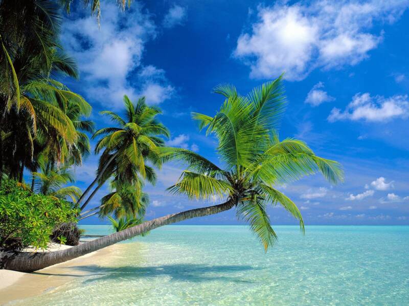
The utmost in tropical visions!
The trade winds blew during the day Tuesday, although will be mostly gone…for several days. What is causing this faltering of the trade winds, is an approaching cold front from the north. Using this weather map, we can see the parent low pressure system, for this cold front, just offshore from the west coast. This storm is bringing wet and windy weather all along the California coast. Tuesday evening we have a 1019 millibar high pressure system positioned west-northwest of Kauai…moving away towards the west. As this high moves away, and the cold front presses down towards us, our trade winds will fade away through the next several days.
As the trade winds falter, we’ll find muggy conditions, associated with what we call a convective weather pattern…settling into our area Wednesday through Friday. As the islands heat up during the days, this causes onshore flowing sea breezes to begin blowing lightly. This in turn carries moisture inland over the islands, which cools and condenses into clouds along the upcountry slopes during the afternoon hours. This time around, it appears that there won’t be all that many showers, and likely nothing overly heavy is anticipated either. These clouds will however look rather threatening, and may spread down towards the coasts during the afternoon hours locally.
Looking a bit further ahead, after the sultry light wind episode that we have coming up…the trade winds will return for the weekend. This will ventilate our stagnant air mass, which by the way, might be rather hazy (some of which may be volcanic in origin) after several days without our typical trade wind flow. Meanwhile, that next cold front mentioned above, will continue pushing our way. It appears that the frontal cloud band may reach Kauai by Friday. It might bring some showers to that northern island, before dissipating going into the weekend. As the front loses its influence, we’ll find returning trade winds bringing relief from the sultry weather conditions beginning Saturday. We may see a few windward biased showers beginning to fall then too.
It’s that time of the year again, when I’ll be taking my annual vacation to the mainland…once again to California. I’ll be leaving next Monday, and be gone for about three weeks. I’ll be visiting my good friends, and also spending some quality time with my family in Long Beach as well. This will be a time when I renew my batteries, and spend time away from my weather schedule here in the islands. I’ll have more to say about this going forward, but just wanted to give you a heads up ahead of time. I’ll probably leave this paragraph here, so that those who drop by every few days, will know of my plans, and won’t be surprised.
It’s early Tuesday evening here in Kihei, Maui, as I begin writing this last section of today’s narrative update. Tuesday saw the combination of trade wind weather, and the start of a convective weather pattern. So, we saw some showers spilling along the windward sides in places, and over the leeward slopes during the afternoons too. The emphasis will more fully shift over to the leeward clouds starting Wednesday, with most of whatever showers that fall, dropping over the upcountry sections during the afternoons then. This convective weather pattern will last through the end of the work week…at which point the trade winds will return this weekend. ~~~ I’m heading back upcountry now, up into the clouds that are still hugging the slopes of Haleakala. I’ll be back early Wednesday morning with your next new weather narrative, at which point the day should start off quite clearly. I hope you have a great Tuesday night until then! Aloha for now…Glenn.
Interesting: Known to science only by two specimens described in 1900, a critically endangered crow has re-emerged on a remote, mountainous Indonesian island thanks in part to a Michigan State University scientist. The Banggai Crow was believed by many to be extinct until Indonesian biologists finally secured two new specimens on Peleng Island in 2007. Pamela Rasmussen, an MSU assistant professor of zoology and renowned species sleuth, provided conclusive verification.
An ornithologist who specializes on the birds of southern Asia, Rasmussen studied the two century-old specimens known as Corvus unicolor in New York’s American Museum of Natural History. She compared them to the new crow specimens in Indonesia’s national museum, to lay to rest speculation that they were merely a subspecies of a different crow. The more common Slender-billed Crow, or Corvus enca, also is found in the Banggai Islands, and likewise is all black.
"The morphometric analysis I did shows that all four unicolor specimens are very similar to each other, and distinctly different from enca specimens. We also showed that the two taxa differ in eye color — an important feature in Corvus," Rasmussen said. "Not only did this confirm the identity of the new specimens but also the specific distinctness of Corvus unicolor, which has long been in doubt."
The rediscovery was spearheaded by professor Mochamad Indrawan of the University of Indonesia, chairperson of the Indonesian Ornithologists’ Union, who conducted ecological field studies. He was assisted by collaborator Yunus Masala and by the Celebes Bird Club, members of which secured the new specimens that are now catalogued at the Museum Zoologicum Bogoriense in Java.
Interesting2: Five giant non-native snake species would pose high risks to the health of ecosystems in the United States should they become established here, according to a U.S. Geological Survey (USGS) report. The USGS report details the risks of nine non-native boa, anaconda and python species that are invasive or potentially invasive in the United States.
Because all nine species share characteristics associated with greater risks, none was found to be a low ecological risk. Two of these species are documented as reproducing in the wild in South Florida, with population estimates for Burmese pythons in the tens of thousands.
Based on the biology and known natural history of the giant constrictors, individuals of some species may also pose a small risk to people, although most snakes would not be large enough to consider a person as suitable prey.
Mature individuals of the largest species—Burmese, reticulated, and northern and southern African pythons—have been documented as attacking and killing people in the wild in their native range, though such unprovoked attacks appear to be quite rare, the report authors wrote.
The snake most associated with unprovoked human fatalities in the wild is the reticulated python. The situation with human risk is similar to that experienced with alligators: attacks in the wild are improbable but possible.
“This report clearly reveals that these giant snakes threaten to destabilize some of our most precious ecosystems and parks, primarily through predation on vulnerable native species,” said Dr. Robert Reed, a coauthor of the report and a USGS invasive species scientist and herpetologist.
High-risk species—Burmese pythons, northern and southern African pythons, boa constrictors and yellow anacondas—put larger portions of the U.S. mainland at risk, constitute a greater ecological threat, or are more common in trade and commerce. Medium-risk species—reticulated python, Deschauensee’s anaconda, green anaconda and Beni anaconda—constitute lesser threats in these areas, but still are potentially serious threats.
Interesting3: Retirees who transition from full-time work into a temporary or part-time job experience fewer major diseases and are able to function better day-to-day than people who stop working altogether, according to a national study. And the findings were significant even after controlling for people’s physical and mental health before retirement.
The study’s authors refer to this transition between career and complete retirement as "bridge employment," which can be a part-time job, self-employment or a temporary job. The findings are reported in the October issue of the Journal of Occupational Health Psychology, published by the American Psychological Association.
"Given the economic recession, we will probably see more people considering post-retirement employment," said co-author Mo Wang, PhD, of the University of Maryland. "These findings highlight bridge employment’s potential benefits." For this study, Wang and his fellow researchers looked at the national Health and Retirement Study, which is sponsored by the National Institute on Aging.
They used data from 12,189 participants who were between the ages of 51 and 61 at the beginning of the study. The participants were interviewed every two years over a six-year period beginning in 1992 about their health, finances, employment history and work or retirement life.
In order to measure the respondents’ health over the course of the study, the researchers considered only physician-diagnosed health problems, such as high blood pressure, diabetes, cancer, lung disease, heart disease, stroke and psychiatric problems.
They controlled not only for baseline physical and mental health but also for age, sex, education level, and total financial wealth. The results showed the retirees who continued to work in a bridge job experienced fewer major diseases and fewer functional limitations than those who fully retired.
Interesting4: "What happened to global warming?" read the headline – on BBC News on Oct. 9, no less. Consider it a cataclysmic event: Mainstream news organizations have begun reporting on scientific research that suggests that global warming may not be caused by man and may not be as dire and imminent as alarmists suggest.
Indeed, as the BBC’s climate correspondent Paul Hudson reported, the warmest year recorded globally "was not in 2008 or 2007, but 1998." It’s true, he continued, "For the last 11 years, we have not observed any increase in global temperatures."
At a London conference later this month, Hudson reported, solar scientist Piers Corbyn will present evidence that solar-charged particles have a big impact on global temperatures. Western Washington University geologist Don J. Easterbrook presented research last year that suggests that the Pacific decadal oscillation (PDO) caused warmer temperatures in the 1980s and 1990s.
With Pacific sea surface temperatures cooling, Easterbrook expects 30 years of global cooling. EPA analyst Alan Carlin – an MIT-trained economist with a degree in physics – referred to "solar variability" and Easterbrook’s work in a document that warned that politics had prompted the Environmental Protection Agency and countries to pay "too little attention to the science of global warming" as partisans ignored the lack of global warming over the past 10 years.
At first the EPA buried the paper, then it permitted Carlin to post it on his personal Web site. In May, Fortune reported on the testimony of John Christy, University of Alabama-Huntsville Earth System Science Center director, before the House Ways and Means Committee. Christy is a 2001 Intergovernmental Panel on Climate Change report signatory who believes human effects have a warming influence, but rejects the disaster scenarios.
As Christy told the committee, climate models rely on land temperature data that are distorted and exaggerated by surface development – that is, asphalt and buildings. In a nice bit of research, Christy, who is also the Alabama state climatologist, debunked the temperature increase predictions made by NASA scientist James Hansen in 1988.
"The real atmosphere," Christy testified, "has many ways to respond to the changes that the extra CO2 is forcing upon it." Add Christy, Easterbrook and Corbyn to the long list of scientists who see climate as a complex issue rather than an opportunity to sermonize and lecture the general public.
Over the years, global warming alarmists have sought to stifle debate by arguing that there was no debate. They bullied dissenters and ex-communicated nonbelievers from their panels. In the name of science, disciples made it a virtue to not recognize the existence of scientists such as MIT’s Richard Lindzen and Colorado State University’s William Gray.
For a long time, that approach worked. But after 11 years without record temperatures that had the seas spilling over the Statue of Liberty’s toes, they are going to have to change tactics. They’re going to have to rely on real data, not failed models and scare stories, and the Big Lie that everyone who counts agrees with them.
Interesting5: Australian voters no longer see the environment as the top policy issue, but the government remained committed Tuesday to an emissions trading scheme which, if defeated in November, could see a snap election. Prime Minister Kevin Rudd was swept to power on his promise to tackle climate change in 2007, but a new opinion poll on Tuesday found that saving jobs was now the top priority for Australians and fighting climate change had fallen to seventh.
"Climate change continues to drop as a priority for Australians," said the fifth annual "Australia and the World" poll by the Sydney-based Lowy Institute for International Policy. "In 2007, Australians ranked tackling climate change as the equal most important foreign policy goal.
This year it ranked seventh out of 10 possible goals, down 10 points since last year and 19 points since 2007." Climate Change Minister Penny Wong dismissed the poll and said the government would press ahead with its emissions trading scheme (ETS).
"Our policy is not determined by polls," she told radio, adding the government would act in the national interest. The legislation has already been rejected once by the Senate and if defeated again would give Rudd, who has a commanding lead in opinion polls, a trigger for a snap election.
Posted by Glenn
1 Comment
October 12-13, 2009
Air Temperatures – The following maximum temperatures were recorded across the state of Hawaii Monday afternoon:
Lihue, Kauai – 82
Honolulu, Oahu – 86
Kaneohe, Oahu – 80
Kaunakakai, Molokai – 83
Kahului, Maui – 85
Hilo, Hawaii – 79
Kailua-kona – 87
Air Temperatures ranged between these warmest and coolest spots near sea level around the state – and on the highest mountains…at 5 p.m. Monday evening:
Kailua-kona – 83F
Hilo, Hawaii – 74
Haleakala Crater – 57 (near 10,000 feet on Maui)
Mauna Kea summit – 45 (near 14,000 feet on the Big Island)
Precipitation Totals – The following numbers represent the largest precipitation totals (inches) during the last 24 hours on each of the major islands, as of Monday afternoon:
1.28 Mount Waialeale, Kauai
3.65 Oahu Forest NWR, Oahu
0.06 Molokai
0.00 Lanai
0.00 Kahoolawe
1.84 West Wailuaiki, Maui
2.40 Hilo airport, Big Island
Marine Winds – Here’s the latest (automatically updated) weather map showing a 1023 millibar high pressure system to the northwest of the islands. Light to moderately strong trade winds giving way to lighter winds Tuesday and Wednesday.
Satellite and Radar Images: To view the cloud conditions we have here in Hawaii, please use the following satellite links, starting off with this Infrared Satellite Image of the islands to see all the clouds around the state during the day and night. This next image is one that gives close images of the islands only during the daytime hours, and is referred to as a Close-up visible image. This next image shows a larger view of the Pacific…giving perspective to the wider ranging cloud patterns in the Pacific Ocean. Finally, here’s a Looping IR satellite image, making viewable the clouds around the islands 24 hours a day. To help you keep track of where any showers may be around the islands, here’s the latest animated radar image.
Hawaii’s Mountains – Here’s a link to the live webcam on the summit of near 14,000 foot Mauna Kea on the Big Island of Hawaii. The tallest peak on the island of Maui is the Haleakala Crater, which is near 10,000 feet in elevation. These two webcams are available during the daylight hours here in the islands…and when there’s a big moon rising just after sunset for an hour or two! Plus, during the nights and early mornings you will be able to see stars, and the sunrise too…depending upon weather conditions.
Tropical Cyclone activity in the eastern and central Pacific – Here’s the latest weather information coming out of the National Hurricane Center, covering the eastern north Pacific. You can find the latest tropical cyclone information for the central north Pacific (where Hawaii is located) by clicking on this link to the Central Pacific Hurricane Center. Here’s a tracking map covering both the eastern and central Pacific Ocean. A satellite image, which shows the entire ocean area between Hawaii and the Mexican coast…can be found here.
Aloha Paragraphs
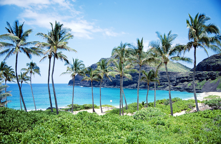
Lovely beach…Kauai
It looks very likely that we’re heading into a weather pattern…which looks remarkably similar to the one we saw last week. The trade winds are blowing at the moment, which will begin a weakening process Tuesday…for several days. What is causing this faltering of the trade winds, will be an approaching cold front…just like last week. Using this weather map, we can see the parent low pressure system, for this cold front, moving towards the west coast of the mainland. By the way, this storm is going to be a wet and windy storm all along the WA, OR, and CA seaboard over the next couple of days! Monday we still have that 1023 millibar high pressure system positioned northwest of Kauai. This quick little trade wind episode will be skidding to a stop later Tuesday into Wednesday, as this high pressure cell moves westward towards the International Dateline.
Here in the tropics, when the trade winds stop blowing, or are reduced significantly in strength…we lose our cooling and refreshing atmospherics. They are replaced by often hot and muggy conditions, associated with what we call a convective weather pattern. The sun is never all that far from being pretty much straight overhead, so that the daytime heating of the islands, causes onshore flowing sea breezes. This carries moisture inland over the islands, which cools and condenses on the upcountry slopes during the afternoon hours. Depending upon what kind of air temperatures reside in the middle and upper air mass over the state…determines if we see any enhancement to whatever showers that happen to fall from these interior cumulus clouds. This time around, it appears that there won’t be all that many showers, and likely nothing overly heavy is anticipated either.
Meanwhile, the first major storm to hit the west coast, generated a swell train of waves in our direction, which are expected to arrive during the day tomorrow. This swell, coming in from the west-northwest direction, will put larger than normal waves on some of our west facing beaches. The north shores will see large surf too. It looks like another new swell will arrive this weekend along those same north and west facing beaches. All of this points strongly to the fact that summer is over, even though it often feels like the summer heat is still around now. The south shores too will see a good rise in surf this weekend, another sign that a spring storm has sent us a new swell from the southern hemisphere…perhaps one of the last largish south swells until next spring here in Hawaii?
Looking a bit further ahead, after the sultry light wind episode that we have coming up soon, again last week…the trade winds will return for the weekend. This will ventilate our stagnant air mass, which by the way, might be rather hazy (some of which may be volcanic in origin) after several days lacking the trade winds. The showers during the light winds will fall over and around the slopes, as stated above. The showers will migrate back over towards the windward coasts and slopes, concentrating their efforts there while the trade winds hang on. I wonder if we should just go ahead and say…before the next cold front bears down on us? Considering climatology, it’s still a bit early for an overly wet and windy cold front to push down over us just yet. I guess we could say that it’s just a matter of time before we see strong and gusty Kona winds preceding a cold front, which brings to bear heavy rainfall.
It’s that time of the year again, when I’ll be taking my annual vacation to the mainland…once again to California. I’ll be leaving in a week from today, and be gone for about three weeks. I’ll be visiting my good friends, and also spending some quality time with my family in Long Beach as well. This will be a time when I renew my batteries, and spend time away from my weather schedule here in the islands. I’ll have more to say about this going forward, but just wanted to give you a heads up ahead of time. I’ll probably leave this paragraph here, so that those who drop by every few days, will know of my plans, and won’t be surprised.
It’s early Monday evening here in Kihei, Maui, as I begin writing this last section of today’s narrative update. Monday saw the trade winds blowing, which remained somewhat gusty in places. At 5pm Monday, the two windiest spots around the state included a 28 mph gust at Port Allen on Kauai, and 30 mph at Maalaea Bay, on Maui. There were still some clouds that hung on along the windward sides, but less than the last couple of days…with the showers tapering off. Glancing out the window here in Kihei, before I take the drive back upcountry, I see generally clear skies, with some clouds around the edges. ~~~ I’ll be back early Tuesday morning again, with your next new weather narrative from paradise. I hope you have a great Monday night wherever you’re spending it! Aloha for now…Glenn.
Interesting: Food production will have to increase by 70% over the next 40 years to feed the world’s growing population, the United Nations food agency predicts. The Food and Agricultural Organization says if more land is not used for food production now, 370 million people could be facing famine by 2050. The world population is expected to increase from the current 6.7 billion to 9.1 billion by mid-century.
Climate change, involving floods and droughts, will affect food production. The FAO said net investments of $83bn a year – an increase of 50% – had to be made in agriculture in developing countries if there was to be enough food by 2050.
"The combined effect of population growth, strong income growth and urbanization… is expected to result in almost the doubling of demand for food, feed and fiber," FAO Director-General Jacques Diouf told delegates at a forum entitled How to Feed the World 2050.
The FAO said that even if governments increased agricultural investments, there could still be 370 million people suffering from famine in 2050. Difficulties ahead included a scarcity of natural resources such as land, water and biodiversity.
Food production would also have to deal with "the effects of climate change, notably higher temperatures, greater rainfall variability and more frequent extreme weather events such as floods and droughts," Mr Diouf warned.
Climate change would reduce water availability and lead to an increase in plant and animal pests and diseases, he said. Mr Diouf said it was important to increase food production in areas where it was most needed, as climate change could reduce potential output by up to 30% in Africa and up to 21% in Asia.
"There should be a special focus on smallholder farmers, women and rural households and their access to land, water and high quality seeds… and other modern inputs," he said. He added that the biofuel market also presented competition to food production. Biofuel production is set to increase by nearly 90% over the next 10 years to reach 192 billion liters by 2018, the FAO said.
Interesting2: The red dust storm that dumped thousands of tons of soil across eastern Australia two weeks ago has caused an explosion in microscopic life in Sydney Harbor and beyond. Researchers analyzing the impact say the finding validates plans to increase fish stocks to feed some of the world’s poorest people using ocean fertilization.
Ian Jones, director of the Ocean Technology Group at University of Sydney, said enriching oceans with nitrogen will also aid the fight against climate change. Jones’ comments follow an analysis of the impact on the sea of the 23 September dust storm that swept across New South Wales and southeast Queensland.
At its peak the storm carried about 140,000 tons of soil an hour from central Australia. An estimated 4000 tons of dust settled on Sydney, while Jones and his colleagues calculate about three million tons landed in the Tasman Sea between Australia and New Zealand.
Measurements taken at the Sydney Institute of Marine Science on the harbor’s north shore show a tripling of microscopic plant life, or phytoplankton, at the Chowder Bay site and in samples taken 10 kilometers off shore.
Interesting3: Indian Kashmir’s biggest glacier, which feeds the region’s main river, is melting faster than other Himalayas glaciers, threatening the water supply of tens of thousands of people, a new report warned on Monday. Experts say rising temperatures are rapidly shrinking Himalayan glaciers, underscoring the effects of climate change that has caused temperatures in the mountainous region to rise by about 1.1 degrees Celsius in the past 100 years.
The biggest glacier in Indian Kashmir, the Kolahoi glacier spread over just a little above 4.25 sq mile, has shrunk 2.63 sq km in the past three decades, a new study said. "Kolahoi glacier is shrinking 0.08 square kilometers a year, which is an alarming speed," said the study, presented at a workshop on "Climate Change, Glacial Retreat and Livelihoods," in Srinagar, Indian Kashmir’s summer capital.
Interesting4: After several strong storms in the Philippines, the recovery continues; however, the solution maybe the removal of more than 400,000 people. According to government officials in Manila, at least 400,000 squatters are blocking major drainage channels of a giant lake which lies on the edge of the Philippine capital.
There are more than one million people living around the Laguna de Bay, which will stay flooded unless dramatic action is taken. It may stay flooded for five months or more under its current conditions. The people who live there have been strongly advised to move on and find a new location to avoid the danger of the wetlands.
In this area shantytowns and illegal settlements far outweigh farms and housing developments. But the decision to move these people will have to be decided by the politicians. This solution comes after days of heavy rain from several storms, the first being Typhoon Ketsana, bringing devastation, taking hundreds of lives and causing millions of dollars worth of damage.
Around 300,000 are living around an illegal garbage dump on the wetlands which connects two rivers. It’s these rivers that are meant to drain away the excess water from the lake into Manila Bay. But the buildup of garbage and make-shift homes is stopping this from happening. Clearing the garbage and the squatters who are responsible for the garbage would clear the channels for the water to flow.
Many squatters have built their homes on stilts to the south side of the lake, but garbage is still a major issue. Other districts also remain under water, so the affects of this area affects over a million people.
Aside from trying to solve these problems over 300,000 people remain homeless due to the recent storms, so it seems the government have their hands full. Infrastructure seems to be a good starting point for this problem, but as with many governments around the world, the prevention never arrives before the cure.
Posted by Glenn
No Comments
October 11-12, 2009
Air Temperatures – The following maximum temperatures were recorded across the state of Hawaii Sunday afternoon:
Lihue, Kauai – 82
Honolulu, Oahu – 85
Kaneohe, Oahu – 82
Kaunakakai, Molokai – 85
Kahului, Maui – 86
Hilo, Hawaii – 85
Kailua-kona – 86
Air Temperatures ranged between these warmest and coolest spots near sea level around the state – and on the highest mountains…at 5 p.m. Sunday evening:
Port Allen, Kauai – 86F
Kaneohe, Oahu – 76
Haleakala Crater – 55 (near 10,000 feet on Maui)
Mauna Kea summit – 43 (near 14,000 feet on the Big Island)
Precipitation Totals – The following numbers represent the largest precipitation totals (inches) during the last 24 hours on each of the major islands, as of Sunday afternoon:
2.65 Kapahi, Kauai
6.12 Oahu Forest NWR, Oahu
0.34 Molokai
0.00 Lanai
0.01 Kahoolawe
1.16 West Wailuaiki, Maui
0.29 Pahoa, Big Island
Marine Winds – Here’s the latest (automatically updated) weather map showing a 1023 millibar high pressure system to the northwest of the islands. Light to moderately strong trade winds arriving in the wake of the shearline Monday into Tuesday.
Satellite and Radar Images: To view the cloud conditions we have here in Hawaii, please use the following satellite links, starting off with this Infrared Satellite Image of the islands to see all the clouds around the state during the day and night. This next image is one that gives close images of the islands only during the daytime hours, and is referred to as a Close-up visible image. This next image shows a larger view of the Pacific…giving perspective to the wider ranging cloud patterns in the Pacific Ocean. Finally, here’s a Looping IR satellite image, making viewable the clouds around the islands 24 hours a day. To help you keep track of where any showers may be around the islands, here’s the latest animated radar image.
Hawaii’s Mountains – Here’s a link to the live webcam on the summit of near 14,000 foot Mauna Kea on the Big Island of Hawaii. The tallest peak on the island of Maui is the Haleakala Crater, which is near 10,000 feet in elevation. These two webcams are available during the daylight hours here in the islands…and when there’s a big moon rising just after sunset for an hour or two! Plus, during the nights and early mornings you will be able to see stars, and the sunrise too…depending upon weather conditions.
Tropical Cyclone activity in the eastern and central Pacific – Here’s the latest weather information coming out of the National Hurricane Center, covering the eastern north Pacific. You can find the latest tropical cyclone information for the central north Pacific (where Hawaii is located) by clicking on this link to the Central Pacific Hurricane Center. Here’s a tracking map covering both the eastern and central Pacific Ocean. A satellite image, which shows the entire ocean area between Hawaii and the Mexican coast…can be found here.
Aloha Paragraphs

Returning trade winds
Trade winds are filling in behind a weak shearline cloud band, which moved down the island chain later Saturday into Sunday morning. We have two high pressure systems, one far to the northwest, and another far to the northeast. At the same time, as we see on this latest weather map, a weakening cold front, or what we call a shearline cloud band, has passed over the islands. In the wake of the shearline, we’ll see these trade winds filling in, blowing in the light to moderately strong category through Monday.
The next in a series of weak cloud bands will approaching the state Monday, pushing a ridge of high pressure down over us again later Tuesday…with another light wind episode starting Wednesday. This next convective weather pattern will exhibit all the usual characteristics, with sultry conditions, some afternoon clouds and showers over the interiors sections…and likely haze too. These weather features will be short lived however, as we move on into the next phase of our upcoming weather circumstances.
A third shearline cloud band will push in our direction by Friday, which should usher in light trade winds…by next weekend. That’s the general lay of the land through the next week, but let’s do a quite rewind here, and come back to the present. Here’s a satellite image showing the ragged leading edge of this band of showery clouds having moved over the Big Island Sunday evening. Here’s a second satellite picture, showing a closer view. There will be quite a few clouds around, in the wake of this front, although not a lot of showers…and most of them sticking to the windward sides.
This weak band of clouds dropped more than the expected amount of rainfall, at least on Kauai and Oahu. The largest precipitation totals included the following: 2.65" at Kapahi, Kauai, and 6.12" in the Koolau Mountains on Oahu. There were additional showers today, mostly of the small drop drizzly variety. The computer models suggest that drier air should arrive on Monday. Monday should be a nice day, with the trade winds blowing, which should stretch into Tuesday. At noted above, our trade winds will take a tumble again around mid-week for a few days, before the trade winds return next weekend.
It’s early Sunday evening here in Kula, Maui, as I begin writing this last section of today’s narrative update. The clouds riding in behind the season’s first cold front, or more accurately called a shearline, were quite abundant Sunday. There have been showers around, even some in the leeward sides of the islands. Here in Kula, there were a couple of showers, separated by partly cloudy conditions. The air temperatures were a little cooler than they have been lately, with the winds coming in from a more northerly direction than we’ve seen for quite some time. I’ll be back early Monday morning with your next new weather narrative, I hope you have a great Sunday night! Aloha for now…Glenn.
Interesting: When lobsters swarm up the beach and octopuses try to clamber up fishing lines to get out of the water, you know that something has gone badly wrong in the ocean. Oxygen-starved dead zones have been appearing with increasing frequency around the world, with some 400 identified so far. While most are caused by sewage or fertilizer leaching into the ocean, a possible new driver has appeared in the northwest Pacific: climate change.
Just as land animals need oxygen in the air to breathe, those in the sea need the oxygen dissolved in seawater. Dead zones cover up to 20,000 sq miles each and their borders shift according to wind, current and tide, killing all animal life that cannot escape in time. “Oregon is a little different,” said Jack Barth, of Oregon State University.
“We have an open coastline, so the ability to flush the coast is high and there are no rivers carrying fertilizer. All nutrients appear to come from natural sources.” But for the past four years Professor Barth has been using autonomous underwater robots to monitor worrying developments on a naturally occurring area of low oxygen off the northwest Pacific, on the border of Washington state and Oregon.
“We’ve seen various degrees of oxygen deficiency,” he said. “We’ve seen zero oxygen, known as anoxia.” Camera footage from remotely operated vehicles “showed us just piles of Dungeness crab, dead tube worms. None could flee”. Off South Africa and Namibia, lobsters swarm to the beach when anoxic waters close in. Professor Barth cites reports that octopuses have tried to climb fishing lines to escape.
Low-oxygen areas occur naturally on the west coast of all continents, where nutrient-rich waters well up to the sunlit surface, causing heavy productivity. The upper waters are well mixed by wind and waves but deeper down there is less opportunity to replenish oxygen. When dead plankton drift into this zone in a marine snowfall, they cause a secondary bloom in microscopic animal life that strips away the oxygen. If the oxygen-starved water does not reach the seabed, the effects are usually less severe.
If it does, the animals there are usually unable to escape. Usually winds push the de-oxygenated areas off Oregon out to sea but in recent years they have been coming ever closer to land and shallower water. Professor Barth said that climate-change models show coastal winds changing.
“The forecast is for stronger and less persistent winds and for deeper waters becoming less oxygenated as surface layers warm, isolating the deeper layers more. So it’s a double-whammy we’re seeing off Oregon.” Although Professor Barth does not yet have enough records to prove that climate change is affecting the winds, he is confident that they are not altering as a result of any natural cycles, such as the warm current El Niño.
Interesting2: In the past, the Chinese were insultingly referred to as the yellow peril, an alien breed whose weird ways might corrupt Western civilization and even bring it to its knees. Today the Chinese are looked on as a green peril, an over-productive people whose use of coal and other filthy fossil fuels might pollute Western society and put the whole world on the fast track to irreversible disaster.
The language has changed dramatically in the past 100 years, but there are striking similarities between how some people viewed the Chinese in the early 20th century and how some people view them in the early 21stcentury. The idea of the Chinese as people who – or their ideas or products – might cause harm to the Western world seems to have remained constant over the decades.
In the climate change debate, China is always depicted as being peculiarly dirty. Its monumental economic growth over the past 30 years is rarely discussed in terms of its vast benefits to humanity but is instead denounced for its destructive impact on nature. So we rarely hear the good news about China’s industrial leap forward.
For example, the fact that, where China had 193 cities in 1978, it now has a remarkable 655; or that where life expectancy in China was a paltry 36.5 years when the People’s Republic was established in 1949, it is now 73.4 years. In 1949, China had a population of 542million and only 117,000 students in higher education; today it has a population of 1.3billion and 20.2 million students in higher education – a figure close to the entire population of Australia.
Yet what are we most frequently told about China’s industrialization? That it is dangerous, both for the people of China and for everyone else across the world. An environmentalist writer in Britain says the upshot of China’s "economic miracle" has been "dust, waste and dirty water". Other Western greens tell us that China’s use of coal is turning the country into a "rapidly advancing dystopia where rivers run black". Even worse, China’s growth might end up killing us all.
We are frequently told that China is the world’s biggest emitter of carbon dioxide and, in the words of one green observer, is putting the world on "the fast track to irreversible disaster". Many environmentalists claim that the UN climate summit at Copenhagen in December is our "last chance to save the planet" and therefore we must get China to agree to sign up. This view of China as a peculiarly threatening nation has eerie echoes of the past.
In the late 19th and early 20th centuries, the movement of Chinese workers and goods to the US and other Western nations gave rise to fears of a polluting effect. In his book Orientals: Asian Americans in Popular Culture, Robert L.Gee says Chinese immigrants were seen as "racial, social and physical pollutants" who might provoke the "demise of Western civilization".
This view of the Chinese was revealling, says Lee: "Pollutants are anomalies in the symbolic structure of society, things that are out of place and create a sense of disorder." Today, in the lingo of environmentalism, the Chinese are seen as the harbingers of climatic disorder. According to the academic Monica Chui, the China-bashing dime-store novels of the late 19th century yellow peril era were also packed with images of the Chinese as "filth, pollutants and toxins".
In her book Fit to be Citizens: Public Health and Race in Los Angeles 1879-1939, Natalia Molina describes how some American public health officials depicted the Chinese as "carriers of diseases and pollutants", giving rise to a perception of Chinese people as "a literal as well as metaphorical threat to the health of the body politic".
One concern of the Yellow Peril era was that if Chinese people bred with white people, or even intoxicated them with their strange habits, then the intelligence levels of Western society would be lowered as a result. This idea was rehabilitated during the great Chinese toy scare of 2007.
When it was revealed that some Chinese toys had high levels of lead in them (though not high enough to cause serious harm to children), there were fears in the US that if American kids chewed on the toys for too long, it might harm their IQ levels (some experts believe that exposure to lead can damage children’s intellectual development).
Here, the old idea about strange items from the East damaging the intellectual resources of the West is given a new lease of life through the environmentalist outlook. This is not to argue that contemporary environmentalists are racists. There are vast differences between labeling a people as pollutants and discussing their behavior as polluting.
However, the persistence of the pollutant label in relation to China reveals much about the fin-de-siecle outlook that underpins contemporary climate fears. If we were to take a more humane view, then we would realize that Chinese growth has been vastly and historically beneficial both to the hundreds of millions of people who have been lifted out of absolute poverty, and to those Western societies that were bankrolled in recent years by Chinese credit.
Posted by Glenn
1 Comment
October 10-11, 2009
Air Temperatures – The following maximum temperatures were recorded across the state of Hawaii Saturday afternoon:
Lihue, Kauai – 81
Honolulu, Oahu – 90
Kaneohe, Oahu – 84
Kahului, Maui – 88
Hilo, Hawaii – 85
Kailua-kona – 88
Air Temperatures ranged between these warmest and coolest spots near sea level around the state – and on the highest mountains…at 9 p.m. Saturday night:
Kailua-kona – 83F
Princeville, Kauai – 75
Haleakala Crater – 50 (near 10,000 feet on Maui)
Mauna Kea summit – 43 (near 14,000 feet on the Big Island)
Precipitation Totals – The following numbers represent the largest precipitation totals (inches) during the last 24 hours on each of the major islands, as of Saturday evening:
3.66 Wainiha, Kauai
0.50 Ahuimanu Loop, Oahu
0.02 Molokai
0.00 Lanai
0.01 Kahoolawe
0.33 Wailuku, Maui
0.16 Kahuku Ranch, Big Island
Marine Winds – Here’s the latest (automatically updated) weather map showing two high pressure systems far to the northeast and northwest of the islands. At the same time, a retired cold front, what we call a shearline cloud band, is being pushed southward into the islands. Light northeasterly breezes will fill in ahead of the cloud band, with light to moderately strong trade winds arriving in the wake of the shearline Sunday into Monday.
Satellite and Radar Images: To view the cloud conditions we have here in Hawaii, please use the following satellite links, starting off with this Infrared Satellite Image of the islands to see all the clouds around the state during the day and night. This next image is one that gives close images of the islands only during the daytime hours, and is referred to as a Close-up visible image. This next image shows a larger view of the Pacific…giving perspective to the wider ranging cloud patterns in the Pacific Ocean. Finally, here’s a Looping IR satellite image, making viewable the clouds around the islands 24 hours a day. To help you keep track of where any showers may be around the islands, here’s the latest animated radar image.
Hawaii’s Mountains – Here’s a link to the live webcam on the summit of near 14,000 foot Mauna Kea on the Big Island of Hawaii. The tallest peak on the island of Maui is the Haleakala Crater, which is near 10,000 feet in elevation. These two webcams are available during the daylight hours here in the islands…and when there’s a big moon rising just after sunset for an hour or two! Plus, during the nights and early mornings you will be able to see stars, and the sunrise too…depending upon weather conditions.
Tropical Cyclone activity in the eastern and central Pacific – Here’s the latest weather information coming out of the National Hurricane Center, covering the eastern north Pacific. You can find the latest tropical cyclone information for the central north Pacific (where Hawaii is located) by clicking on this link to the Central Pacific Hurricane Center. Here’s a tracking map covering both the eastern and central Pacific Ocean. A satellite image, which shows the entire ocean area between Hawaii and the Mexican coast…can be found here.
Aloha Paragraphs
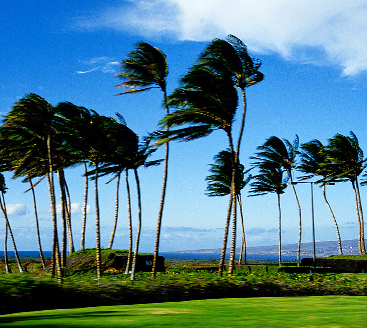
Returning trade winds this weekend
The light wind episode that we’ve had in place this week, will be replaced with returning trade winds this weekend. We have two high pressure systems, one far to the northwest, and another far to the northeast. At the same time, as we see on this latest weather map, a weakening cold front, or what we call a shearline cloud band, being pushed southward towards the islands. We’re definitely at the end of our near week long period of light winds…with the trade winds right around the corner. During the day Saturday, before the shearline arrives, we’ll find light northeast breezes blowing. In the wake of the shearline, we’ll see these trade winds filling in, blowing in the light to moderately strong category.
Whatever haze has been around during the last several days, will be quickly ventilated down stream…blown there by the trade wind flow. This ventilating trade wind flow won’t last long though, hopefully for three or four days. This hazy weather will likely return to our Hawaiian Island weather picture, as yet another light wind event will arrive, as we move towards the middle of the new week ahead. Depending upon just which way the blows are blowing then, we could begin to see volcanic emissions spreading up the island chain again then. This next hazy episode will be carried away, as the trade winds return later next week…whisking it away again.
As the trade winds arrive, whatever showers that are around, will gravitate towards the windward sides. The aforementioned shearline, which can be seen on that weather map above, will be pushed down into the state during the day Saturday into the night…into Sunday on the Big Island. This will add some increase in showers to the windward sides as it moves through…here’s a satellite image showing this band of showery clouds just to the north of Kauai Saturday morning. Here’s a second satellite picture, showing a closer view. Looking further ahead, the models are showing another weak cold front approaching during the new week ahead. Whether it will make it to Hawaii is still a question, but its approach will help to diminish our winds again by mid-week.
Last evening I went to see a new film called Surrogates (2009)…starring Bruce Willis and Radha Mitchell, among others. The short synopsis is: "a cop must investigate a murder in a futuristic society where human interaction has been replaced by idealized robotic surrogates." The critics are giving this film a C+, while film goers are giving it a B. I had a couple of friends who told me that they really liked it. I enjoyed the film well enough, but it didn’t really excite me all that much. I wasn’t on the edge of my seat, nor was I feeling deep emotions of delight, or anything else for that matter. It was just one of those films that was ok. Here’s a trailer if you’re interested in taking a sneak peek.
It’s early Saturday morning here in Kihei, Maui, as I begin writing this last section of this morning’s narrative update. I’m getting a little excited with the prospect of watching this season’s first frontal cloud band moving down the islanc chain. The band was a cold front, and still is further to the north, although down here in the tropics, it’s lost most of its steam. One way that we can tell that, is that we don’t have south or southwest Kona winds blowing ahead of it. Instead, we’re seeing light northeast breezes blowing through it, and arriving even ahead of the shearline itself. ~~~ Changing the tone of this narrative a bit, I’ll be attending a memorial service, or what the organizers are calling a celebration later today. A very good friend of mine, Dr. Julie Claire Holmes, a long time resident of Maui, died this past summer. You may remember that I flew to California to see her for a week near the time of her death. I’ve been feeling her loss ever since, so it will likely be an emotional day, as I go to say another good bye to her, along with lots of her other friends. I’m not sure how the day will go after the memorial, so that I’ll either be back here later, or perhaps as late as Sunday morning, I’m sure you can understand. ~~~ I hope you have a nice Saturday until I talk to you again! Aloha for now…Glenn.
Interesting: When lobsters swarm up the beach and octopuses try to clamber up fishing lines to get out of the water, you know that something has gone badly wrong in the ocean. Oxygen-starved dead zones have been appearing with increasing frequency around the world, with some 400 identified so far. While most are caused by sewage or fertilizer leaching into the ocean, a possible new driver has appeared in the northwest Pacific: climate change.
Just as land animals need oxygen in the air to breathe, those in the sea need the oxygen dissolved in seawater. Dead zones cover up to 20,000 sq miles each and their borders shift according to wind, current and tide, killing all animal life that cannot escape in time. “Oregon is a little different,” said Jack Barth, of Oregon State University.
“We have an open coastline, so the ability to flush the coast is high and there are no rivers carrying fertilizer. All nutrients appear to come from natural sources.” But for the past four years Professor Barth has been using autonomous underwater robots to monitor worrying developments on a naturally occurring area of low oxygen off the northwest Pacific, on the border of Washington state and Oregon.
“We’ve seen various degrees of oxygen deficiency,” he said. “We’ve seen zero oxygen, known as anoxia.” Camera footage from remotely operated vehicles “showed us just piles of Dungeness crab, dead tube worms. None could flee”. Off South Africa and Namibia, lobsters swarm to the beach when anoxic waters close in. Professor Barth cites reports that octopuses have tried to climb fishing lines to escape.
Low-oxygen areas occur naturally on the west coast of all continents, where nutrient-rich waters well up to the sunlit surface, causing heavy productivity. The upper waters are well mixed by wind and waves but deeper down there is less opportunity to replenish oxygen. When dead plankton drift into this zone in a marine snowfall, they cause a secondary bloom in microscopic animal life that strips away the oxygen. If the oxygen-starved water does not reach the seabed, the effects are usually less severe.
If it does, the animals there are usually unable to escape. Usually winds push the de-oxygenated areas off Oregon out to sea but in recent years they have been coming ever closer to land and shallower water. Professor Barth said that climate-change models show coastal winds changing.
“The forecast is for stronger and less persistent winds and for deeper waters becoming less oxygenated as surface layers warm, isolating the deeper layers more. So it’s a double-whammy we’re seeing off Oregon.” Although Professor Barth does not yet have enough records to prove that climate change is affecting the winds, he is confident that they are not altering as a result of any natural cycles, such as the warm current El Niño.
Interesting2: In the past, the Chinese were insultingly referred to as the yellow peril, an alien breed whose weird ways might corrupt Western civilization and even bring it to its knees. Today the Chinese are looked on as a green peril, an over-productive people whose use of coal and other filthy fossil fuels might pollute Western society and put the whole world on the fast track to irreversible disaster.
The language has changed dramatically in the past 100 years, but there are striking similarities between how some people viewed the Chinese in the early 20th century and how some people view them in the early 21stcentury. The idea of the Chinese as people who – or their ideas or products – might cause harm to the Western world seems to have remained constant over the decades.
In the climate change debate, China is always depicted as being peculiarly dirty. Its monumental economic growth over the past 30 years is rarely discussed in terms of its vast benefits to humanity but is instead denounced for its destructive impact on nature. So we rarely hear the good news about China’s industrial leap forward.
For example, the fact that, where China had 193 cities in 1978, it now has a remarkable 655; or that where life expectancy in China was a paltry 36.5 years when the People’s Republic was established in 1949, it is now 73.4 years. In 1949, China had a population of 542million and only 117,000 students in higher education; today it has a population of 1.3billion and 20.2 million students in higher education – a figure close to the entire population of Australia.
Yet what are we most frequently told about China’s industrialization? That it is dangerous, both for the people of China and for everyone else across the world. An environmentalist writer in Britain says the upshot of China’s "economic miracle" has been "dust, waste and dirty water". Other Western greens tell us that China’s use of coal is turning the country into a "rapidly advancing dystopia where rivers run black". Even worse, China’s growth might end up killing us all.
We are frequently told that China is the world’s biggest emitter of carbon dioxide and, in the words of one green observer, is putting the world on "the fast track to irreversible disaster". Many environmentalists claim that the UN climate summit at Copenhagen in December is our "last chance to save the planet" and therefore we must get China to agree to sign up. This view of China as a peculiarly threatening nation has eerie echoes of the past.
In the late 19th and early 20th centuries, the movement of Chinese workers and goods to the US and other Western nations gave rise to fears of a polluting effect. In his book Orientals: Asian Americans in Popular Culture, Robert L.Gee says Chinese immigrants were seen as "racial, social and physical pollutants" who might provoke the "demise of Western civilization".
This view of the Chinese was revealling, says Lee: "Pollutants are anomalies in the symbolic structure of society, things that are out of place and create a sense of disorder." Today, in the lingo of environmentalism, the Chinese are seen as the harbingers of climatic disorder. According to the academic Monica Chui, the China-bashing dime-store novels of the late 19th century yellow peril era were also packed with images of the Chinese as "filth, pollutants and toxins".
In her book Fit to be Citizens: Public Health and Race in Los Angeles 1879-1939, Natalia Molina describes how some American public health officials depicted the Chinese as "carriers of diseases and pollutants", giving rise to a perception of Chinese people as "a literal as well as metaphorical threat to the health of the body politic".
One concern of the Yellow Peril era was that if Chinese people bred with white people, or even intoxicated them with their strange habits, then the intelligence levels of Western society would be lowered as a result. This idea was rehabilitated during the great Chinese toy scare of 2007.
When it was revealed that some Chinese toys had high levels of lead in them (though not high enough to cause serious harm to children), there were fears in the US that if American kids chewed on the toys for too long, it might harm their IQ levels (some experts believe that exposure to lead can damage children’s intellectual development).
Here, the old idea about strange items from the East damaging the intellectual resources of the West is given a new lease of life through the environmentalist outlook. This is not to argue that contemporary environmentalists are racists. There are vast differences between labeling a people as pollutants and discussing their behavior as polluting.
However, the persistence of the pollutant label in relation to China reveals much about the fin-de-siecle outlook that underpins contemporary climate fears. If we were to take a more humane view, then we would realize that Chinese growth has been vastly and historically beneficial both to the hundreds of millions of people who have been lifted out of absolute poverty, and to those Western societies that were bankrolled in recent years by Chinese credit.
Next Page »


