August 2009
Monthly Archive
Posted by Glenn
No Comments
August 31-September 1, 2009
Air Temperatures – The following maximum temperatures were recorded across the state of Hawaii Monday afternoon:
Lihue, Kauai – 84
Honolulu, Oahu – 89
Kaneohe, Oahu – 85
Kahului, Maui – 88
Hilo, Hawaii – 84
Kailua-kona – 90
Air Temperatures ranged between these warmest and coolest spots near sea level – and on the highest mountains…at 5 p.m. Monday evening:
Barking Sands, Kauai – 87F
Lihue, Kauaii – 80
Haleakala Crater – 55 (near 10,000 feet on Maui)
Mauna Kea summit – 55 (near 14,000 feet on the Big Island)
Precipitation Totals – The following numbers represent the largest precipitation totals (inches) during the last 24 hours on each of the major islands, as of Monday afternoon:
0.14 Mount Waialaele, Kauai
0.11 Manoa Valley, Oahu
0.04 Molokai
0.00 Lanai
0.00 Kahoolawe
1.18 Puu Kukui, Maui
0.16 Honaunau, Big Island
Marine Winds – Here’s the latest (automatically updated) weather map showing high pressure systems far to the north of the islands. Trade winds will be active through Monday and Tuesday.
Satellite and Radar Images: To view the cloud conditions we have here in Hawaii, please use the following satellite links, starting off with this Infrared Satellite Image of the islands to see all the clouds around the state during the day and night. This next image is one that gives close images of the islands only during the daytime hours, and is referred to as a Close-up visible image. This next image shows a larger view of the Pacific…giving perspective to the wider ranging cloud patterns in the Pacific Ocean. Finally, here’s a Looping IR satellite image, making viewable the clouds around the islands 24 hours a day. To help you keep track of where any showers may be around the islands, here’s the latest animated radar image.
Hawaii’s Mountains – Here’s a link to the live webcam on the summit of near 14,000 foot Mauna Kea on the Big Island of Hawaii. The tallest peak on the island of Maui is the Haleakala Crater, which is near 10,000 feet in elevation. These two webcams are available during the daylight hours here in the islands…and when there’s a big moon rising just after sunset for an hour or two! Plus, during the nights and early mornings you will be able to see stars, and the sunrise too…depending upon weather conditions.
Tropical Cyclone activity in the eastern and central Pacific – Here’s the latest weather information coming out of the National Hurricane Center, covering the eastern north Pacific. You can find the latest tropical cyclone information for the central north Pacific (where Hawaii is located) by clicking on this link to the Central Pacific Hurricane Center. Here’s a tracking map covering both the eastern and central Pacific Ocean. A satellite image, which shows the entire ocean area between Hawaii and the Mexican coast…can be found here.
Aloha Paragraphs
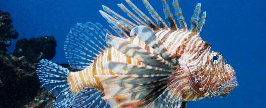
Interesting Hawaiian fish
There appears to be little change in the favorably inclined trade wind weather pattern, through the middle of the week. The trade winds are strong enough Monday evening, to keep small craft wind advisories active in the channel between Maui and Molokai, in the windy Maalaea Bay on Maui, across the Alenuihaha Channel between Maui and the Big Island…and around those windiest areas on the Big Island. Trade wind speeds will range generally between 15 and 25 mph, with stronger gusts locally through Wednesday, and then become a little stronger.
The first half of this new work week will have rather limited shower activity, focused most intently along the windward sides…increasing some Thursday and Friday. The leeward sides will remain mostly dry, with lots of sunshine during the days. The increase in windward showers later in the work week, will occur due to the arrival of an upper level low pressure system. The computer models then show another ridge overhead this coming holiday weekend…which will bring us back around to drier weather then.
Major category 4 hurricane Jimena, will bring very heavy weather conditions to the Baja, California peninsula on Tuesday! Jimena, at the last advisory from the National Hurricane Center, had 155 mph sustained winds…with top gusts to 190 mph! Tropical depression Kevin, also in the eastern Pacific, is weakening further out to sea from Mexico. The Atlantic, and the Gulf of Mexico are quiet at the moment…although there is a new storm trying to take form now…which could move into the Caribbean area over the next couple of days. Here in the central Pacific, there are no active tropical cyclones.
It’s Monday evening here in Kihei, Maui, as I begin writing this last section of this morning’s narrative update. Sunny, sunny, sunny weather here in the islands Monday. The trade winds are the main thing, which were pretty strong and gusty in some areas. At 5pm Monday evening, the strongest gust was being reported at Maalaea Bay, Maui…with 37 mph. These trade winds, along with the great weather, will continue through mid-week. I’m about ready to head back upcountry now, where it looks like nice weather prevailing up there too. I’ll be back early Tuesday morning with your next new weather narrative from paradise, literally! Aloha for now…Glenn.
Extra: The Ross Sisters, very flexible to say the least…back in 1944!
Interesting: A breakthrough discovery from Sandia National Laboratories could help keep a lid on the rising cost of chemical water treatment and make clean drinking water more affordable in "water challenged" areas of the world. Working with researchers at the University of California, the Sandia team substituted one atom in aluminum oxide, a common chemical used to coagulate impurities in water.
The new compound promises a more sustainable way to decontaminate wastewater as well as purify drinking water. Next step: Sandia has partnered with the award-winning water technology company Kemira to bring the new compound into commercial production.
The Sandia development could help provide some much-needed breathing room for water suppliers, which have been struggling for resources to purchase water treatment chemicals during a period of price and supply instability.
Alongside improvements in the efficiency of chemical processes, the water treatment industry is also rapidly developing non-chemical water treatments including UV disinfection, new high-tech membranes, and ultrasound.
Interesting2: The future of wind farms and hybrid cars may well hinge on what happens to a 55-acre hole in the ground at the edge of California’s high desert. The open-pit mine at Mountain Pass, California, holds the world’s richest proven reserve of "rare earth" metals, a family of minerals vital to producing the powerful, lightweight magnets used in the engines of Toyota Motor Corp’s Prius and other hybrid vehicles as well as generators in wind turbines.
Seeking to replace China as the leading supplier of these scarce materials, Colorado-based Molycorp Minerals LLC plans to reopen its long-idled quarry to resume extracting and refining thousands of tons of rare earth ore in the next few years.
Last month, Molycorp reached a joint venture deal with Arnold Magnetic Technologies Corp. of Rochester, New York, to make "permanent" magnets from rare metals at Mountain Pass.
Interesting3: Bluegrass hybrids ideal for pasture and for lawns could be developed faster using genetic markers developed by an Agricultural Research Service (ARS) scientist. ARS geneticist Jason Goldman at the agency’s Southern Plains Range Research Station in Woodward, Okla., identified nine DNA primers that produce markers that can verify successful bluegrass hybrids from DNA samples.
This saves time because breeders currently have to wait for the plant to mature before they can verify a hybrid by physical characteristics. The markers can be used on seedlings. Goldman’s goal is a Kentucky bluegrass-like lawn or pasture grass that is highly tolerant to drought.
The research is part of the laboratory’s program for breeding perennial cool-season forage grasses for the southern Great Plains as alternatives to wheat and other annual crops. Texas bluegrass is native to southern Kansas, Oklahoma, western Arkansas and most of Texas.
It tolerates heat and drought, but produces seed that is difficult to harvest and re-plant. It also lacks the turf quality of Kentucky bluegrass. Kentucky bluegrass is not tolerant to heat and drought, but has excellent turf characteristics and produces seed that is easy to harvest and clean.
Goldman’s goal is to combine them into one variety with a broader geographic range than Kentucky bluegrass, while retaining Kentucky bluegrass’ good qualities. The hybrid must also retain Kentucky bluegrass’ ability to produce seed that breeds true, ensuring identical progeny.
Goldman plans further tests to cross Texas bluegrass with other bluegrass species in addition to Kentucky bluegrass, and to see if the markers can be used for other purposes, such as identifying markers linked to desirable or undesirable plant
Interesting4: Persistent winds and a weakened current in the Mid-Atlantic contributed to higher than normal sea levels along the Eastern Seaboard in June and July, according to a new NOAA technical report. After observing water levels six inches to two feet higher than originally predicted, NOAA scientists began analyzing data from select tide stations and buoys from Maine to Florida and found that a weakening of the Florida Current Transport—an oceanic current that feeds into the Gulf Stream—in addition to steady and persistent Northeast winds, contributed to this anomaly.
“The ocean is dynamic and it’s not uncommon to have anomalies,” said Mike Szabados, director of NOAA’s Center for Operational Oceanographic Products and Services. “What made this event unique was its breadth, intensity and duration.” The highest atypical sea levels occurred closer to where the anomaly formed in the Mid-Atlantic, where cities like Baltimore, Md., at times experienced extreme high tides as much as two feet higher than normal.
Data from NOAA’s National Water Level Observation Network tide stations, Atlantic Oceanographic and Meteorological Laboratory, and National Data Buoy Center, are published in the report. Impacts of the event were amplified by the occurrence of a perigean-spring tide, the natural timing of the season and month when the moon is closest to the Earth and its gravitational pull heightens the elevation of the water.
The combined effects of this tide with the sea level anomaly produced minor flooding on the coast. “The report is a good first assessment,” said NOAA Oceanographer William Sweet, Ph.D. “However, NOAA, with our academic partners, should continue to investigate the broader causes behind the event. Further analysis is needed to fully understand what is driving the patterns we observed."
Interesting5: The search for the best observatory site in the world has lead to the discovery of what is thought to be the coldest, driest, calmest place on Earth — a place where no human is thought to have ever set foot. To search for the perfect site to take pictures of the heavens, a U.S.-Australian research team combined data from satellites, ground stations and climate models in a study to assess the many factors that affect astronomy — cloud cover, temperature, sky-brightness, water vapor, wind speeds and atmospheric turbulence.
The researchers pinpointed a site, known simply as Ridge A, which is 13,297 feet high up on the Antarctic Plateau on the continent at the bottom of the world. The study revealed that Ridge A has an average winter temperature of minus 94 degrees Fahrenheit and an extremely low amount of water in the air. The site is also extremely calm, which means that there is very little of the atmospheric turbulence that elsewhere makes stars appear to twinkle.
"It’s so calm that there’s almost no wind or weather there at all," said study leader Will Saunders, of the Anglo-Australian Observatory in Australia. All these elements combine to make the perfect recipe for an astronomical observation post: "The astronomical images taken at Ridge A should be at least three times sharper than at the best sites currently used by astronomers," Saunders said.
"Because the sky there is so much darker and drier, it means that a modestly sized telescope there would be as powerful as the largest telescopes anywhere else on earth." The site would even be superior to the best existing observatories on high mountain tops in Hawaii and Chile, Saunders said. Researchers assert that a telescope at the site could take images nearly as good as those from the space-based Hubble telescope. Located within the Australian Antarctic Territory, the site is 89 miles from an international robotic observatory and the proposed new Chinese ‘Kunlun’ base at Dome A, a higher point on the Antarctic Plateau.
Posted by Glenn
[2] Comments
August 30-31, 2009
Air Temperatures – The following maximum temperatures were recorded across the state of Hawaii Sunday afternoon:
Lihue, Kauai – 83
Honolulu, Oahu – 89
Kaneohe, Oahu – 83
Kahului, Maui – 87
Hilo, Hawaii – 82
Kailua-kona – 89
Air Temperatures ranged between these warmest and coolest spots near sea level – and on the highest mountains…at 5 p.m. Sunday evening:
Barking Sands, Kauai – 86F
Hilo, Hawaii – 80
Haleakala Crater – 55 (near 10,000 feet on Maui)
Mauna Kea summit – 63 (near 14,000 feet on the Big Island)
Precipitation Totals – The following numbers represent the largest precipitation totals (inches) during the last 24 hours on each of the major islands, as of Sunday afternoon:
0.06 Mount Waialaele, Kauai
0.04 Dillingham, Oahu
0.00 Molokai
0.00 Lanai
0.00 Kahoolawe
0.00 Maui
0.65 Honaunau, Big Island
Marine Winds – Here’s the latest (automatically updated) weather map showing high pressure systems far to the north of the islands. Trade winds will be active through Monday and Tuesday.
Satellite and Radar Images: To view the cloud conditions we have here in Hawaii, please use the following satellite links, starting off with this Infrared Satellite Image of the islands to see all the clouds around the state during the day and night. This next image is one that gives close images of the islands only during the daytime hours, and is referred to as a Close-up visible image. This next image shows a larger view of the Pacific…giving perspective to the wider ranging cloud patterns in the Pacific Ocean. Finally, here’s a Looping IR satellite image, making viewable the clouds around the islands 24 hours a day. To help you keep track of where any showers may be around the islands, here’s the latest animated radar image.
Hawaii’s Mountains – Here’s a link to the live webcam on the summit of near 14,000 foot Mauna Kea on the Big Island of Hawaii. The tallest peak on the island of Maui is the Haleakala Crater, which is near 10,000 feet in elevation. These two webcams are available during the daylight hours here in the islands…and when there’s a big moon rising just after sunset for an hour or two! Plus, during the nights and early mornings you will be able to see stars, and the sunrise too…depending upon weather conditions.
Tropical Cyclone activity in the eastern and central Pacific – Here’s the latest weather information coming out of the National Hurricane Center, covering the eastern north Pacific. You can find the latest tropical cyclone information for the central north Pacific (where Hawaii is located) by clicking on this link to the Central Pacific Hurricane Center. Here’s a tracking map covering both the eastern and central Pacific Ocean. A satellite image, which shows the entire ocean area between Hawaii and the Mexican coast…can be found here.
Aloha Paragraphs

Nice sunset…Hawaii
Trade wind weather will continue, with our winds blowing generally in the light to moderately strong realms…continuing well into the new week ahead. There continues to be no end in sight for these warm winds, continuing right on into the first week of September. The trade winds are strong enough only in the Alenuihaha Channel between Maui and the Big Island, and in certain coastal areas around the Big Island…to warrant small craft wind advisories Sunday evening.
Showers will be at a minimum for the most part, with just a few falling along the windward sides…with dry conditions expected along most of our leeward beaches. The local shower activity will be less than normal for this time of year. Looking a bit further ahead, the models point out a slight increase in showers towards the middle of the new week…focused most intently around the Big Island.
The warm tropical waters of the world remain active Sunday evening. We have tropical storm Krovanh in the western Pacific, along with major hurricane Jimena, and tropical storm Kevin in the eastern Pacific. Just for the record, none of these threaten our Hawaiian Islands whatsoever.
It’s Sunday evening here in Kula, Maui, as I begin writing this last paragraph of today’s narrative update. Sunday was very nice, like Saturday and Friday were…and like Monday and Tuesday will be! I’ve been on the phone with a friend who is visiting Baja, California now…near the southern tip. I called him several days ago and told him to get the heck out of there! Major hurricane Jimena is bearing down on the Baja peninsula. Winds are expected to be 150 mph sustained, with gusts to near 185 mph! He has been visiting a place called Todo Santos, where he and I went on a surfing trip last October. He was fortunate to get a flight back to northern California two days before his expected departure date.
~~~ It’s a bit before sunset as I write these last few words. Again, this weekend was about as good as it gets, with very few showers, lots of sunshine during the days, and balmy trade winds blowing. I’ll be back early Monday morning with your next new weather narrative, I hope you have a great Sunday night until then! Aloha for now…Glenn.
Interesting: A comprehensive new study of irrigation in Asia warns that, without major reforms and innovations in the way water is used for agriculture, many developing nations face the politically risky prospect of having to import more than a quarter of the rice, wheat and maize they will need by 2050. This warning, along with related forecasts and possible solutions, appear in a report entitled, "Revitalizing Asia’s Irrigation: To Sustainably Meet Tomorrow’s Food Needs", which was presented August 17 at 2009 World Water Week in Stockholm by the International Water Management Institute (IWMI).
IWMI, FAO and partner researchers obtained the findings using a computer model called WATERSIM, which helps examine difficult tradeoffs between food security and the environment, specifically in relation to water supplies. The study was carried out by IWMI and the United Nations Food and Agriculture Organization (FAO) along with researchers from partner organizations with funding from the Asian Development Bank (ADB).
It outlines three options for meeting the food needs of Asia’s population, which will expand by one and a half billion people over the next 40 years. The first is to import large quantities of cereals from other regions; the second to improve and expand rainfed agriculture; and the third to focus on irrigated farmlands.
"In the wake of a major global food crisis in 2007 and 2008, cereal prices are expected to be higher and more volatile in the coming years," said Colin Chartres, director general of IWMI, whose research is supported by the Consultative Group on International Agricultural Research (CGIAR).
"Asia’s food and feed demand is expected to double by 2050. Relying on trade to meet a large part of this demand will impose a huge and politically untenable burden on the economies of many developing countries. The best bet for Asia lies in revitalizing its vast irrigation systems, which account for 70 percent of the world’s total irrigated land."
Interesting2: Scientists have just completed an unprecedented journey into the vast and little-explored "Great Pacific Ocean Garbage Patch." On the Scripps Environmental Accumulation of Plastic Expedition (SEAPLEX), researchers got the first detailed view of plastic debris floating in a remote ocean region. It wasn’t a pretty sight.
The Scripps research vessel (R/V) New Horizon left its San Diego homeport on August 2, 2009, for the North Pacific Ocean Gyre, located some 1,000 miles off California’s coast, and returned on August 21, 2009. Scientists surveyed plastic distribution and abundance, taking samples for analysis in the lab and assessing the impacts of debris on marine life.
Before this research, little was known about the size of the "garbage patch" and the threats it poses to marine life and the gyre’s biological environment. The expedition was led by a team of Scripps Institution of Oceanography (SIO) graduate students, with support from University of California Ship Funds, the National Science Foundation (NSF) and Project Kaisei.
"SEAPLEX was an important education experience for the graduate students, and contributed to a better understanding of an important problem in the oceans," said Linda Goad, program director in NSF’s Division of Ocean Sciences. "We hope that SEAPLEX will result in increased awareness of a growing issue." After transiting for six days aboard the research vessel, the researchers reached their first intensive sampling site on August 9th.
Team members began 24-hour sampling periods using a variety of tow nets to collect debris at several ocean depths. "We targeted the highest plastic-containing areas so we could begin to understand the scope of the problem," said Miriam Goldstein of SIO, chief scientist of the expedition.
"We also studied everything from phytoplankton to zooplankton to small mid-water fish." The scientists found that at numerous areas in the gyre, flecks of plastic were abundant and easily spotted against the deep blue seawater. Among the assortment of items retrieved were plastic bottles with a variety of biological inhabitants.
The scientists also collected jellyfish called by-the-wind sailors (Velella velella). On August 11th, the researchers encountered a large net entwined with plastic and various marine organisms; they also recovered several plastic bottles covered with ocean animals, including large barnacles.
Interesting3: An international team of scientists has found that the polyphenol content of fruits has been underestimated. Polyphenol content in fruits usually refers to extractable polyphenols, but a Spanish scientist working at the Institute of Food Research in Norwich analyzed apple, peach and nectarine. She found that non-extractable polyphenol content is up to five times higher than extractable compounds. This work has been published in the Journal of Agricultural and Food Chemistry.
“These polyphenols need to be treated with acid to extract them from the cell walls of fruit in the lab,” said Sara Arranz from the Spanish Council for Scientific Research (CSIC) in Madrid. “If non-extractable polyphenols are not considered, the levels of beneficial polyphenols such as proanthocyanidins, ellagic acid and catechin are substantially underestimated.”
Dr Paul Kroon from IFR explains: “In the human body these compounds will be fermented by bacteria in the colon, creating metabolites that may be beneficial, for example with antioxidant activity.” The Spanish research group, led by Professor Fulgencio Saura-Calixto, has been working to show that non-extractable polyphenols, which mostly escape analysis and are not usually considered in nutritional studies, are a major part of bioactive compounds in the diet.
“These polyphenols are major constituents of the human diet with important health properties. To consider them in nutritional and epidemiological research may be useful for a better understanding of the effects of plant foods in health,” says Professor Saura-Calixto.
Interesting4: Yields of three of the most important crops produced in the United States – corn, soybeans and cotton – are predicted to fall off a cliff if temperatures rise due to climate change. In a paper recently published online in Proceedings of the National Academy of Sciences, North Carolina State University agricultural and resource economist Dr. Michael Roberts and Dr. Wolfram Schlenker, an assistant professor of economics at Columbia University, predict that U.S. crop yields could decrease by 30 to 46 percent over the next century under slow global warming scenarios, and by a devastating 63 to 82 percent under the most rapid global warming scenarios.
The warming scenarios used in the study – called Hadley III models – were devised by the United Kingdom’s weather service. The study shows that crop yields tick up gradually between roughly 50 to 86 degrees Farenheit. But when temperature levels go over 84.2 degrees Farenheit for corn, 86 degrees Farenheit for soybeans and 89.6 degrees Farenheit for cotton, yields fall steeply. “While crop yields depend on a variety of factors, extreme heat is the best predictor of yields,” Roberts says.
“There hasn’t been much research on what happens to crop yields over certain temperature thresholds, but this study shows that temperature extremes are not good.” Roberts adds that while the study examined only U.S. crop yields under warming scenarios, the crop commodity market’s global reach makes the implications important for the entire world, as the United States produces 41 percent of the world’s corn and 38 percent of the world’s soybeans. “Effects of climate change on U.S. crop production will surely be felt around the globe, especially in developing countries,” he says.
Interesting5: Small changes in the energy output of the sun can have a major impact on global weather patterns, such as the intensity of the Indian monsoon, which could be predicted years in advance, a team of scientists said. The sun swings through an 11-year cycle measured in the number of sun spots on the surface that emit bursts of energy.
The difference in energy is only about 0.1 percent between a solar maximum and minimum and determining just how that small variation affects the world’s climate has been one of the great challenges facing meteorologists. Using a century of weather observations and complex computer models, the international team of scientists led by the National Center for Atmospheric Research (NCAR) in the United States showed that even a small increase in the sun’s energy can intensify wind and rainfall patterns.
"Small changes in the sun’s output over the 11-year solar cycle have long been known to have impacts on the global climate system," said Julie Arblaster, from the Center for Australian Weather and Climate Research, a co-author of the study published in the latest issue of the journal Science.
"Here we reconcile for the first time the mechanisms by which these small variations get amplified, resulting in cooler sea surface temperatures in the tropical Pacific and enhancing off-equatorial rainfall."
The researchers found that during periods of strong solar activity the air in the upper atmosphere, in a layer called the stratosphere, heats up. This occurs over the tropics, where sunlight is typically most intense. The extra warming alters wind patterns in the upper atmosphere, which in turn increases tropical rainfall.
Posted by Glenn
No Comments
August 29-30, 2009
Air Temperatures – The following maximum temperatures were recorded across the state of Hawaii Saturday afternoon:
Lihue, Kauai – 83
Honolulu, Oahu – 90
Kaneohe, Oahu – 84
Kahului, Maui – 87
Hilo, Hawaii – 79
Kailua-kona – 89
Air Temperatures ranged between these warmest and coolest spots near sea level – and on the highest mountains…at 5 p.m. Saturday evening:
Kailua-kona – 86F
Hilo, Hawaii – 76
Haleakala Crater – 55 (near 10,000 feet on Maui)
Mauna Kea summit – 52 (near 14,000 feet on the Big Island)
Precipitation Totals – The following numbers represent the largest precipitation totals (inches) during the last 24 hours on each of the major islands, as of Saturday afternoon:
0.21 Lihue, Kauai
0.75 Oahu Forest NWR, Oahu
0.00 Molokai
0.00 Lanai
0.00 Kahoolawe
0.25 West Wailuaiki, Maui
0.86 Mountain View, Big Island
Marine Winds – Here’s the latest (automatically updated) weather map showing high pressure systems far to the northeast through northwest of the islands. Trade winds will be active through Monday.
Satellite and Radar Images: To view the cloud conditions we have here in Hawaii, please use the following satellite links, starting off with this Infrared Satellite Image of the islands to see all the clouds around the state during the day and night. This next image is one that gives close images of the islands only during the daytime hours, and is referred to as a Close-up visible image. This next image shows a larger view of the Pacific…giving perspective to the wider ranging cloud patterns in the Pacific Ocean. Finally, here’s a Looping IR satellite image, making viewable the clouds around the islands 24 hours a day. To help you keep track of where any showers may be around the islands, here’s the latest animated radar image.
Hawaii’s Mountains – Here’s a link to the live webcam on the summit of near 14,000 foot Mauna Kea on the Big Island of Hawaii. The tallest peak on the island of Maui is the Haleakala Crater, which is near 10,000 feet in elevation. These two webcams are available during the daylight hours here in the islands…and when there’s a big moon rising just after sunset for an hour or two! Plus, during the nights and early mornings you will be able to see stars, and the sunrise too…depending upon weather conditions.
Tropical Cyclone activity in the eastern and central Pacific – Here’s the latest weather information coming out of the National Hurricane Center, covering the eastern north Pacific. You can find the latest tropical cyclone information for the central north Pacific (where Hawaii is located) by clicking on this link to the Central Pacific Hurricane Center. Here’s a tracking map covering both the eastern and central Pacific Ocean. A satellite image, which shows the entire ocean area between Hawaii and the Mexican coast…can be found here.
Aloha Paragraphs

Under the Hawaiian Moon
Trade wind weather will continue, with our winds blowing generally in the light to moderately strong realms…continuing well into the new week ahead. There continues to be no end in sight for these warm winds, continuing right on into the first part of September. The trade winds are strong enough only in the Alenuihaha Channel between Maui and the Big Island, and in certain coastal areas around the Big Island…to warrant small craft wind advisories.
Showers will be at a minimum for the most part, with just a few falling along the windward sides…with dry conditions expected along most of our leeward beaches. The local shower activity will be at a minimum for the most part. Looking a bit further ahead, the models point out an increase in showers towards the middle of the new week…focused most intently around the Big Island.
The warm tropical waters of the world remain active this weekend. We have tropical storm Krovanh in the western Pacific; tropical depression 2C here in the central Pacific; hurricane Jimena in the eastern Pacific, along with newly formed tropical storm Kevin. Just for the record, none of these threaten our Hawaiian Islands whatsoever. As mentioned, and coming back to our local weather…it will remain near perfect right through the weekend!
Friday evening after work I went to see the new film called Inglourious Basterds (2009)…starring Brad Pitt among others. This is Quentin Tarantino’s new violent WWII tale of soldiers, peasants and resistance fighters who collide in Nazi-occupied France. The critics are raving about this film, giving it anywhere from a B+ to an A-, although it is violent to say the least. Therefore, I’m not going to be providing a link to the trailer, as I’m sure it would offend many of you. I must admit, I was a bit anxious about seeing the film, but as it turned out, I enjoyed it very much. There’s no doubt about it, this film is gruesome, but I found it didn’t end up offending my sensibilities as much as I feared. I can’t say that I would recommend it, at least to probably 80% of you readers, although there are those 20% of you that would likely find it entertaining.
It’s Saturday evening here in Kula, Maui, as I begin writing this last paragraph of this morning’s narrative update. Saturday was another fabulous day! The local beaches basked in abundant sunshine in most areas. The trade winds blew enough, so that it kept us feeling relatively cool and comfortable. At 6pm Sunday evening here in Kula, at the 3,100 foot elevation, it was a warm 71.6F degrees. The breeze is light, but just active enough to keep my wind chimes singing sweetly. I anticipate that Sunday will be just as nice, as will Monday and Tuesday. This is the time of year when our Hawaiian weather is often very near perfect. I’ll be back Sunday morning with your next new weather narrative. I hope you have a great Saturday night until then! Aloha for now…Glenn.
Extra: Hula dancing and chant
Interesting: A comprehensive new study of irrigation in Asia warns that, without major reforms and innovations in the way water is used for agriculture, many developing nations face the politically risky prospect of having to import more than a quarter of the rice, wheat and maize they will need by 2050. This warning, along with related forecasts and possible solutions, appear in a report entitled, "Revitalizing Asia’s Irrigation: To Sustainably Meet Tomorrow’s Food Needs", which was presented August 17 at 2009 World Water Week in Stockholm by the International Water Management Institute (IWMI).
IWMI, FAO and partner researchers obtained the findings using a computer model called WATERSIM, which helps examine difficult tradeoffs between food security and the environment, specifically in relation to water supplies. The study was carried out by IWMI and the United Nations Food and Agriculture Organization (FAO) along with researchers from partner organizations with funding from the Asian Development Bank (ADB).
It outlines three options for meeting the food needs of Asia’s population, which will expand by one and a half billion people over the next 40 years. The first is to import large quantities of cereals from other regions; the second to improve and expand rainfed agriculture; and the third to focus on irrigated farmlands.
"In the wake of a major global food crisis in 2007 and 2008, cereal prices are expected to be higher and more volatile in the coming years," said Colin Chartres, director general of IWMI, whose research is supported by the Consultative Group on International Agricultural Research (CGIAR).
"Asia’s food and feed demand is expected to double by 2050. Relying on trade to meet a large part of this demand will impose a huge and politically untenable burden on the economies of many developing countries. The best bet for Asia lies in revitalizing its vast irrigation systems, which account for 70 percent of the world’s total irrigated land."
Interesting2: Scientists have just completed an unprecedented journey into the vast and little-explored "Great Pacific Ocean Garbage Patch." On the Scripps Environmental Accumulation of Plastic Expedition (SEAPLEX), researchers got the first detailed view of plastic debris floating in a remote ocean region. It wasn’t a pretty sight.
The Scripps research vessel (R/V) New Horizon left its San Diego homeport on August 2, 2009, for the North Pacific Ocean Gyre, located some 1,000 miles off California’s coast, and returned on August 21, 2009. Scientists surveyed plastic distribution and abundance, taking samples for analysis in the lab and assessing the impacts of debris on marine life.
Before this research, little was known about the size of the "garbage patch" and the threats it poses to marine life and the gyre’s biological environment. The expedition was led by a team of Scripps Institution of Oceanography (SIO) graduate students, with support from University of California Ship Funds, the National Science Foundation (NSF) and Project Kaisei.
"SEAPLEX was an important education experience for the graduate students, and contributed to a better understanding of an important problem in the oceans," said Linda Goad, program director in NSF’s Division of Ocean Sciences. "We hope that SEAPLEX will result in increased awareness of a growing issue." After transiting for six days aboard the research vessel, the researchers reached their first intensive sampling site on August 9th.
Team members began 24-hour sampling periods using a variety of tow nets to collect debris at several ocean depths. "We targeted the highest plastic-containing areas so we could begin to understand the scope of the problem," said Miriam Goldstein of SIO, chief scientist of the expedition.
"We also studied everything from phytoplankton to zooplankton to small mid-water fish." The scientists found that at numerous areas in the gyre, flecks of plastic were abundant and easily spotted against the deep blue seawater. Among the assortment of items retrieved were plastic bottles with a variety of biological inhabitants.
The scientists also collected jellyfish called by-the-wind sailors (Velella velella). On August 11th, the researchers encountered a large net entwined with plastic and various marine organisms; they also recovered several plastic bottles covered with ocean animals, including large barnacles.
Interesting3: An international team of scientists has found that the polyphenol content of fruits has been underestimated. Polyphenol content in fruits usually refers to extractable polyphenols, but a Spanish scientist working at the Institute of Food Research in Norwich analyzed apple, peach and nectarine. She found that non-extractable polyphenol content is up to five times higher than extractable compounds. This work has been published in the Journal of Agricultural and Food Chemistry.
“These polyphenols need to be treated with acid to extract them from the cell walls of fruit in the lab,” said Sara Arranz from the Spanish Council for Scientific Research (CSIC) in Madrid. “If non-extractable polyphenols are not considered, the levels of beneficial polyphenols such as proanthocyanidins, ellagic acid and catechin are substantially underestimated.”
Dr Paul Kroon from IFR explains: “In the human body these compounds will be fermented by bacteria in the colon, creating metabolites that may be beneficial, for example with antioxidant activity.” The Spanish research group, led by Professor Fulgencio Saura-Calixto, has been working to show that non-extractable polyphenols, which mostly escape analysis and are not usually considered in nutritional studies, are a major part of bioactive compounds in the diet.
“These polyphenols are major constituents of the human diet with important health properties. To consider them in nutritional and epidemiological research may be useful for a better understanding of the effects of plant foods in health,” says Professor Saura-Calixto.
Interesting4: Yields of three of the most important crops produced in the United States – corn, soybeans and cotton – are predicted to fall off a cliff if temperatures rise due to climate change. In a paper recently published online in Proceedings of the National Academy of Sciences, North Carolina State University agricultural and resource economist Dr. Michael Roberts and Dr. Wolfram Schlenker, an assistant professor of economics at Columbia University, predict that U.S. crop yields could decrease by 30 to 46 percent over the next century under slow global warming scenarios, and by a devastating 63 to 82 percent under the most rapid global warming scenarios.
The warming scenarios used in the study – called Hadley III models – were devised by the United Kingdom’s weather service. The study shows that crop yields tick up gradually between roughly 50 to 86 degrees Farenheit. But when temperature levels go over 84.2 degrees Farenheit for corn, 86 degrees Farenheit for soybeans and 89.6 degrees Farenheit for cotton, yields fall steeply. “While crop yields depend on a variety of factors, extreme heat is the best predictor of yields,” Roberts says.
“There hasn’t been much research on what happens to crop yields over certain temperature thresholds, but this study shows that temperature extremes are not good.” Roberts adds that while the study examined only U.S. crop yields under warming scenarios, the crop commodity market’s global reach makes the implications important for the entire world, as the United States produces 41 percent of the world’s corn and 38 percent of the world’s soybeans. “Effects of climate change on U.S. crop production will surely be felt around the globe, especially in developing countries,” he says.
Interesting5: Small changes in the energy output of the sun can have a major impact on global weather patterns, such as the intensity of the Indian monsoon, which could be predicted years in advance, a team of scientists said. The sun swings through an 11-year cycle measured in the number of sun spots on the surface that emit bursts of energy.
The difference in energy is only about 0.1 percent between a solar maximum and minimum and determining just how that small variation affects the world’s climate has been one of the great challenges facing meteorologists. Using a century of weather observations and complex computer models, the international team of scientists led by the National Center for Atmospheric Research (NCAR) in the United States showed that even a small increase in the sun’s energy can intensify wind and rainfall patterns.
"Small changes in the sun’s output over the 11-year solar cycle have long been known to have impacts on the global climate system," said Julie Arblaster, from the Center for Australian Weather and Climate Research, a co-author of the study published in the latest issue of the journal Science.
"Here we reconcile for the first time the mechanisms by which these small variations get amplified, resulting in cooler sea surface temperatures in the tropical Pacific and enhancing off-equatorial rainfall."
The researchers found that during periods of strong solar activity the air in the upper atmosphere, in a layer called the stratosphere, heats up. This occurs over the tropics, where sunlight is typically most intense. The extra warming alters wind patterns in the upper atmosphere, which in turn increases tropical rainfall.
Posted by Glenn
No Comments
August 28-29, 2009
Air Temperatures – The following maximum temperatures were recorded across the state of Hawaii Friday afternoon:
Lihue, Kauai – 83
Honolulu, Oahu – 90
Kaneohe, Oahu – 84
Kahului, Maui – 89
Hilo, Hawaii – 80
Kailua-kona – 89
Air Temperatures ranged between these warmest and coolest spots near sea level – and on the highest mountains…at 5 p.m. Friday evening:
Honolulu, Oahu – 86F
Hilo, Hawaii – 75
Haleakala Crater – 59 (near 10,000 feet on Maui)
Mauna Kea summit – 50 (near 14,000 feet on the Big Island)
Precipitation Totals – The following numbers represent the largest precipitation totals (inches) during the last 24 hours on each of the major islands, as of Friday afternoon:
0.07 Mount Waialaele, Kauai
0.03 Oahu Forest NWR, Oahu
0.00 Molokai
0.00 Lanai
0.00 Kahoolawe
0.07 Hana airport, Maui
0.25 Pahoa, Big Island
Marine Winds – Here’s the latest (automatically updated) weather map showing high pressure systems far to the northeast through northwest of the islands. Trade winds will be active through Sunday and beyond.
Satellite and Radar Images: To view the cloud conditions we have here in Hawaii, please use the following satellite links, starting off with this Infrared Satellite Image of the islands to see all the clouds around the state during the day and night. This next image is one that gives close images of the islands only during the daytime hours, and is referred to as a Close-up visible image. This next image shows a larger view of the Pacific…giving perspective to the wider ranging cloud patterns in the Pacific Ocean. Finally, here’s a Looping IR satellite image, making viewable the clouds around the islands 24 hours a day. To help you keep track of where any showers may be around the islands, here’s the latest animated radar image.
Hawaii’s Mountains – Here’s a link to the live webcam on the summit of near 14,000 foot Mauna Kea on the Big Island of Hawaii. The tallest peak on the island of Maui is the Haleakala Crater, which is near 10,000 feet in elevation. These two webcams are available during the daylight hours here in the islands…and when there’s a big moon rising just after sunset for an hour or two! Plus, during the nights and early mornings you will be able to see stars, and the sunrise too…depending upon weather conditions.
Tropical Cyclone activity in the eastern and central Pacific – Here’s the latest weather information coming out of the National Hurricane Center, covering the eastern north Pacific. You can find the latest tropical cyclone information for the central north Pacific (where Hawaii is located) by clicking on this link to the Central Pacific Hurricane Center. Here’s a tracking map covering both the eastern and central Pacific Ocean. A satellite image, which shows the entire ocean area between Hawaii and the Mexican coast…can be found here.
Aloha Paragraphs

Makena Beach…Maui
Trade wind weather will continue, with our winds blowing generally in the moderately strong realms…continuing well into next week. This type of trade wind weather pattern is very common during the summer months. There isn’t an end in sight for these warm winds, continuing right on into the month of September. At this time, there are no small craft wind advisories in our marine environment.
Showers will be few and far between, with just a few falling along the windward sides…with dry conditions expected along our leeward beaches. Favorably inclined weather will prevail everywhere, especially along our beaches…both on the windward and leeward sides of the islands into the weekend. The Big Island will get a few showers, from the northwest fringe of now retired Hilda into Saturday morning.
It’s Friday evening here in Kihei, Maui, as I begin writing this last section of today’s narrative update. More great late summer weather is on tap for the Hawaiian Islands through the next several days. The warm tropical waters of the world are active again now! We have tropical storm Krovanh in the western Pacific; we have tropical depression 2C here in the central Pacific; tropical depression 13E in the eastern Pacific; and tropical storm Danny in the Atlantic. Just for the record, none of these threaten our Hawaiian Islands whatsoever. As mentioned, our weather will be near perfect right through the weekend!
~~~ I’m about ready to drive over to the theatre in Kihei, as I’m done with my work day. I’m going to see a new film this evening called Inglourious Basterds (2009)…starring Brad Pitt among others. Brad Pitt stars in Quentin Tarantino’s violent WWII tale of soldiers, peasants and resistance fighters who collide in Nazi-occupied France. The critics are raving about this film, although it is violent to say the least. As a matter of fact, even watching the trailer is quite challenging for me. Therefore, I’m not going to be providing a link to the trailer, as I’m sure it would offend many of you. I must admit, I’m a bit anxious about seeing this film, but I’m going to give it a go anyway. I’ll give you my impression Saturday morning, when I return with your next new weather narrative from paradise. I hope you have a great Friday night! Aloha for now…Glenn.
Interesting: A comprehensive new study of irrigation in Asia warns that, without major reforms and innovations in the way water is used for agriculture, many developing nations face the politically risky prospect of having to import more than a quarter of the rice, wheat and maize they will need by 2050. This warning, along with related forecasts and possible solutions, appear in a report entitled, "Revitalizing Asia’s Irrigation: To Sustainably Meet Tomorrow’s Food Needs", which was presented August 17 at 2009 World Water Week in Stockholm by the International Water Management Institute (IWMI).
IWMI, FAO and partner researchers obtained the findings using a computer model called WATERSIM, which helps examine difficult tradeoffs between food security and the environment, specifically in relation to water supplies. The study was carried out by IWMI and the United Nations Food and Agriculture Organization (FAO) along with researchers from partner organizations with funding from the Asian Development Bank (ADB).
It outlines three options for meeting the food needs of Asia’s population, which will expand by one and a half billion people over the next 40 years. The first is to import large quantities of cereals from other regions; the second to improve and expand rainfed agriculture; and the third to focus on irrigated farmlands.
"In the wake of a major global food crisis in 2007 and 2008, cereal prices are expected to be higher and more volatile in the coming years," said Colin Chartres, director general of IWMI, whose research is supported by the Consultative Group on International Agricultural Research (CGIAR).
"Asia’s food and feed demand is expected to double by 2050. Relying on trade to meet a large part of this demand will impose a huge and politically untenable burden on the economies of many developing countries. The best bet for Asia lies in revitalizing its vast irrigation systems, which account for 70 percent of the world’s total irrigated land."
Interesting2: Scientists have just completed an unprecedented journey into the vast and little-explored "Great Pacific Ocean Garbage Patch." On the Scripps Environmental Accumulation of Plastic Expedition (SEAPLEX), researchers got the first detailed view of plastic debris floating in a remote ocean region. It wasn’t a pretty sight.
The Scripps research vessel (R/V) New Horizon left its San Diego homeport on August 2, 2009, for the North Pacific Ocean Gyre, located some 1,000 miles off California’s coast, and returned on August 21, 2009. Scientists surveyed plastic distribution and abundance, taking samples for analysis in the lab and assessing the impacts of debris on marine life.
Before this research, little was known about the size of the "garbage patch" and the threats it poses to marine life and the gyre’s biological environment. The expedition was led by a team of Scripps Institution of Oceanography (SIO) graduate students, with support from University of California Ship Funds, the National Science Foundation (NSF) and Project Kaisei.
"SEAPLEX was an important education experience for the graduate students, and contributed to a better understanding of an important problem in the oceans," said Linda Goad, program director in NSF’s Division of Ocean Sciences. "We hope that SEAPLEX will result in increased awareness of a growing issue." After transiting for six days aboard the research vessel, the researchers reached their first intensive sampling site on August 9th.
Team members began 24-hour sampling periods using a variety of tow nets to collect debris at several ocean depths. "We targeted the highest plastic-containing areas so we could begin to understand the scope of the problem," said Miriam Goldstein of SIO, chief scientist of the expedition.
"We also studied everything from phytoplankton to zooplankton to small mid-water fish." The scientists found that at numerous areas in the gyre, flecks of plastic were abundant and easily spotted against the deep blue seawater. Among the assortment of items retrieved were plastic bottles with a variety of biological inhabitants.
The scientists also collected jellyfish called by-the-wind sailors (Velella velella). On August 11th, the researchers encountered a large net entwined with plastic and various marine organisms; they also recovered several plastic bottles covered with ocean animals, including large barnacles.
Interesting3: An international team of scientists has found that the polyphenol content of fruits has been underestimated. Polyphenol content in fruits usually refers to extractable polyphenols, but a Spanish scientist working at the Institute of Food Research in Norwich analyzed apple, peach and nectarine. She found that non-extractable polyphenol content is up to five times higher than extractable compounds. This work has been published in the Journal of Agricultural and Food Chemistry.
“These polyphenols need to be treated with acid to extract them from the cell walls of fruit in the lab,” said Sara Arranz from the Spanish Council for Scientific Research (CSIC) in Madrid. “If non-extractable polyphenols are not considered, the levels of beneficial polyphenols such as proanthocyanidins, ellagic acid and catechin are substantially underestimated.”
Dr Paul Kroon from IFR explains: “In the human body these compounds will be fermented by bacteria in the colon, creating metabolites that may be beneficial, for example with antioxidant activity.” The Spanish research group, led by Professor Fulgencio Saura-Calixto, has been working to show that non-extractable polyphenols, which mostly escape analysis and are not usually considered in nutritional studies, are a major part of bioactive compounds in the diet.
“These polyphenols are major constituents of the human diet with important health properties. To consider them in nutritional and epidemiological research may be useful for a better understanding of the effects of plant foods in health,” says Professor Saura-Calixto.
Interesting4: Yields of three of the most important crops produced in the United States – corn, soybeans and cotton – are predicted to fall off a cliff if temperatures rise due to climate change. In a paper recently published online in Proceedings of the National Academy of Sciences, North Carolina State University agricultural and resource economist Dr. Michael Roberts and Dr. Wolfram Schlenker, an assistant professor of economics at Columbia University, predict that U.S. crop yields could decrease by 30 to 46 percent over the next century under slow global warming scenarios, and by a devastating 63 to 82 percent under the most rapid global warming scenarios.
The warming scenarios used in the study – called Hadley III models – were devised by the United Kingdom’s weather service. The study shows that crop yields tick up gradually between roughly 50 to 86 degrees Farenheit. But when temperature levels go over 84.2 degrees Farenheit for corn, 86 degrees Farenheit for soybeans and 89.6 degrees Farenheit for cotton, yields fall steeply. “While crop yields depend on a variety of factors, extreme heat is the best predictor of yields,” Roberts says.
“There hasn’t been much research on what happens to crop yields over certain temperature thresholds, but this study shows that temperature extremes are not good.” Roberts adds that while the study examined only U.S. crop yields under warming scenarios, the crop commodity market’s global reach makes the implications important for the entire world, as the United States produces 41 percent of the world’s corn and 38 percent of the world’s soybeans. “Effects of climate change on U.S. crop production will surely be felt around the globe, especially in developing countries,” he says.
Interesting5: Small changes in the energy output of the sun can have a major impact on global weather patterns, such as the intensity of the Indian monsoon, which could be predicted years in advance, a team of scientists said. The sun swings through an 11-year cycle measured in the number of sun spots on the surface that emit bursts of energy.
The difference in energy is only about 0.1 percent between a solar maximum and minimum and determining just how that small variation affects the world’s climate has been one of the great challenges facing meteorologists. Using a century of weather observations and complex computer models, the international team of scientists led by the National Center for Atmospheric Research (NCAR) in the United States showed that even a small increase in the sun’s energy can intensify wind and rainfall patterns.
"Small changes in the sun’s output over the 11-year solar cycle have long been known to have impacts on the global climate system," said Julie Arblaster, from the Center for Australian Weather and Climate Research, a co-author of the study published in the latest issue of the journal Science.
"Here we reconcile for the first time the mechanisms by which these small variations get amplified, resulting in cooler sea surface temperatures in the tropical Pacific and enhancing off-equatorial rainfall."
The researchers found that during periods of strong solar activity the air in the upper atmosphere, in a layer called the stratosphere, heats up. This occurs over the tropics, where sunlight is typically most intense. The extra warming alters wind patterns in the upper atmosphere, which in turn increases tropical rainfall.
Posted by Glenn
No Comments
August 27-28, 2009
Air Temperatures – The following maximum temperatures were recorded across the state of Hawaii Thursday afternoon:
Lihue, Kauai – 82
Honolulu, Oahu – 89
Kaneohe, Oahu – 84
Kahului, Maui – 86
Hilo, Hawaii – 83
Kailua-kona – 89
Air Temperatures ranged between these warmest and coolest spots near sea level – and on the highest mountains…at 5 p.m. Thursday evening:
Port Allen, Kauai – 86F
Hilo, Hawaii – 78
Haleakala Crater – 57 (near 10,000 feet on Maui)
Mauna Kea summit – 66 (near 14,000 feet on the Big Island)
Precipitation Totals – The following numbers represent the largest precipitation totals (inches) during the last 24 hours on each of the major islands, as of Thursday afternoon:
0.12 Mount Waialaele, Kauai
0.15 Manoa Valley, Oahu
0.00 Molokai
0.00 Lanai
0.00 Kahoolawe
0.08 Oheo Gulch, Maui
0.20 Laupahoehoe, Big Island
Marine Winds – Here’s the latest (automatically updated) weather map showing high pressure systems far to the northeast through northwest of the islands. Trade winds will blow in the light to moderately strong range through into the weekend…and beyond.
Satellite and Radar Images: To view the cloud conditions we have here in Hawaii, please use the following satellite links, starting off with this Infrared Satellite Image of the islands to see all the clouds around the state during the day and night. This next image is one that gives close images of the islands only during the daytime hours, and is referred to as a Close-up visible image. This next image shows a larger view of the Pacific…giving perspective to the wider ranging cloud patterns in the Pacific Ocean. Finally, here’s a Looping IR satellite image, making viewable the clouds around the islands 24 hours a day. To help you keep track of where any showers may be around the islands, here’s the latest animated radar image.
Hawaii’s Mountains – Here’s a link to the live webcam on the summit of near 14,000 foot Mauna Kea on the Big Island of Hawaii. The tallest peak on the island of Maui is the Haleakala Crater, which is near 10,000 feet in elevation. These two webcams are available during the daylight hours here in the islands…and when there’s a big moon rising just after sunset for an hour or two! Plus, during the nights and early mornings you will be able to see stars, and the sunrise too…depending upon weather conditions.
Tropical Cyclone activity in the eastern and central Pacific – Here’s the latest weather information coming out of the National Hurricane Center, covering the eastern north Pacific. You can find the latest tropical cyclone information for the central north Pacific (where Hawaii is located) by clicking on this link to the Central Pacific Hurricane Center. Here’s a tracking map covering both the eastern and central Pacific Ocean. A satellite image, which shows the entire ocean area between Hawaii and the Mexican coast…can be found here.
Aloha Paragraphs

Disipating tropical depression south of Hawaii
Winter-like storms in the north Pacific, in the Gulf of Alaska, have weakened the trade wind producing high pressure ridge to our north, so that the trade winds will be slightly lighter through the rest of this week…into next week. We can expect light to moderately strong winds to blow well into the future…a little stronger in those typically windiest areas during the days. There are no small craft wind advisories active at this time.
Our overlying atmosphere is dry and stable, with a minimum of shower activity along the windward sides…and near completely dry along the leeward sides. There are no signs of rain in any direction, except for those few showers being carried our way on the trade winds. Generally fine weather will prevail everywhere, especially along our beaches…both on the windward and leeward sides of the islands into the weekend. The Big Island might get a few showers, from the northern fringe of Hilda, as she moves by to our south.
Quickly dissipating tropical depression Hilda remains barely active to the south of the Hawaiian Islands Thursday evening. Hilda is now expected to dissipate into a remnant low pressure system shortly. Here’s an IR satellite image of Hilda…in relation to the Hawaiian Islands. There will be no direct influence on our weather here in the islands…from Hilda. There are no other tropical cyclones that I am concerned about whatsoever.
Everything is lining up nicely to qualify as near perfect…at least in terms of weather here in the Hawaiian Islands. The winds are slightly lighter now, blowing just enough to keep us from feeling too much of the afternoon heat near sea level. Whatever clouds that are around will remain generally dry. This very pleasant, I guess we could stretch it to say late summer weather, will continue into the weekend…and likely beyond. We will likely see some cirrus clouds spreading up over the islands as what’s left of Hilda glides by to our south and southwest.
It’s Thursday evening here in Kihei, Maui, as I begin writing this last section of today’s narrative update. Looking out the window before I take the drive back upcountry to Kula, it’s sunny, sunny and more sunny out there! There are a few clouds around the edges, but as expected…Thursday was a very nice day. I anticipate little change Friday, and then from there, right on into the weekend. You’ve heard just about the last news about quickly dissipating tropical depression Hilda. She is on her last leg, and will be slipping off the track by Friday…at least more than likely. I’ll catch up with you early Friday morning, at which point I’ll have your next new weather narrative ready for da reading. Aloha for now…Glenn.
Interesting: A new study shows just what it takes to convince a person that he isn’t qualified to achieve the career of his dreams. Researchers found that it’s not enough to tell people they don’t have the skills or the grades to make their goal a reality. People will cling to their dreams until they’re clearly shown not only why they’re not qualified, but also what bad things can happen if they pursue their goals and fail.
“Most people don’t give up easily on the dreams. They have to be given a graphic picture of what failure will look like if they don’t make it,” said Patrick Carroll, co-author of the study and assistant professor of psychology at Ohio State University at Lima.
The findings are especially relevant now as students prepare for an uncertain job market and they, along with their teachers and guidance counselors, try to find the best career choices for them. “Educators are trying to lead students to the most realistic career options,” Carroll said.
“You want to encourage students to pursue their dreams, but you don’t want to give them false hope about their abilities and talents. It’s a fine line. “This research is important to understanding how students make revisions in their career goals and decide which career possibilities should be abandoned as unrealistic given their current qualifications. They can then zero in on more realistic possible selves that they actually are qualified to achieve,” he said.
Interesting2: London Mayor Boris Johnson has announced plans to create Britain’s first "hydrogen highway" by building a network of hydrogen filling stations throughout the capital. As part of the scheme, a pilot fleet of around 150 hydrogen cars, five buses and 20 black taxis will be assembled in the run-up to the 2012 London Olympics.
The flamboyant mayor has gone on record as saying that he wants Britain to become a world leader in fuel cell technology and his team have made the ambitious claim that, within twenty years, up to one in three of the 31 million cars in Britain could be fueled by hydrogen.
Interesting3: Two banana diseases spreading in Africa could hurt food supply for 30 million people on the continent who largely rely on the crop, an international agricultural research body said on Wednesday. The Consultative Group on International Agricultural Research (CGIAR) said the banana bunchy top viral disease has infected 45,000 hectares of bananas in Malawi alone and a survey done last year found it in 11 other countries.
"We found the disease to be well-established in Gabon, DRC (Democratic Republic of Congo), Northern Angola and central Malawi," CGIAR quoted Lava Kumar, a researcher at the International Institute of Tropical Agriculture and the survey’s leader, saying in a statement.
Interesting4: After a big earthquake, it’s key to keep the water system afloat. Water is necessary for life, and it fights the fires that often accompany such disasters. UC Irvine engineers plan to outfit the local water system with sensors that will alert officials when and where pipes crack or break, hastening repair – thanks to nearly $5.7 million over three years from the National Institute of Standards and Technology and several local water groups.
"When an earthquake occurs and infrastructure systems fail, continued service of the water network is most critical," said Masanobu Shinozuka, lead project investigator and civil & environmental engineering chair. "Before anything happens, I’d like to have a pipe monitoring system in place to let us know when and where damage occurs. It could minimize misery and save lives."
About 240,000 water-main breaks occur per year in the U.S., according to the Environmental Protection Agency. For example, in December a burst sent about 150,000 gallons of water per minute onto a busy Maryland road, stranding motorists in the icy deluge. Water system failures are estimated to waste up to 6 billion gallons of drinking water every day.
Shinozuka and Pai Chou, electrical engineering & computer science associate professor, have created CD-sized sensing devices that attach to the surface of pressurized (drinking water) and nonpressurized (wastewater) pipes. They will detect vibration and sound changes that could indicate pipe problems. Through antennae, the sensors will relay information wirelessly over long distances to a central location for recording, processing and diagnostic analysis.
Initially, the sensor network will cover about one square mile of the local water system; eventually, it could encompass more than 10 square miles – the largest of its kind to date. A small-scale pressurized water pipe network designed and built by UCI researchers has confirmed that this type of damage identification works well.
Interesting5: A widely used pesticide known to impact wildlife development and, potentially, human health has contaminated watersheds and drinking water throughout much of the United States, according to a new report released today by the Natural Resources Defense Council (NRDC). Banned by the European Union, atrazine is the most commonly detected pesticide in U.S. waters and is a known endocrine disruptor, which means that it affects human and animal hormones.
It has been tied to poor sperm quality in humans and hermaphroditic amphibians. "Evidence shows Atrazine contamination to be a widespread and dangerous problem that has not been communicated to the people most at risk," said Jennifer Sass, PhD, NRDC Senior Scientist and an author of the report.
"U.S. EPA is ignoring some very high concentrations of this pesticide in water that people are drinking and using every day. This exposure could have a considerable impact on reproductive health. Scientific research has tied this chemical to some ghastly impacts on wildlife and raises red flags for possible human impacts."
The report reveals that all of the watersheds monitored by EPA and 90% of the drinking water sampled tested positive for atrazine. Contamination was most severe in Illinois, Iowa, Indiana, Missouri, and Nebraska.
An extensive U.S. Geological Survey study found that approximately 75 percent of stream water and about 40 percent of all groundwater samples from agricultural areas contained atrazine, and according to the New York Times, an estimated 33 million Americans have been exposed to atrazine through their drinking water systems.
"The extent of contamination we found in the data was breathtaking and alarming," said Andrew Wetzler, Director of NRDC’s Wildlife Conservation Program and Deputy Director of NRDC’s Midwest Program, as well as one of the report’s authors. "The EPA found atrazine almost everywhere they looked. I think that the public will find this hard to swallow and I hope it will help force the EPA to address the situation more aggressively."
Interesting6: From mid July to early August 2006, a heat wave swept through the southwestern United States. Temperature records were broken at many locations and unusually high humidity levels for this typically arid region led to the deaths of more than 600 people, 25,000 cattle and 70,000 poultry in California alone.
An analysis of this extreme episode carried out by researchers at Scripps Institution of Oceanography, UC San Diego, put this heat wave in the context of six decades of observed heat waves. Their results suggest that such regional extremes are becoming more and more likely as climate change trends continue.
The team, led by climate scientist Alexander Gershunov, examined meteorological conditions that lead to this and other recorded heat waves, when temperatures rose into the hottest one percent of historical summertime daily and nightly temperatures recorded in California and Nevada since 1948.
The scientists found that heat waves in the region often fall into either of two types: the typical "daytime" events characterized by dry daytime heat and rejuvenating nighttime cooling, or the less typical "nighttime" heat waves characterized additionally by high humidity and hot muggy days and nights.
Since the early 1990s, nighttime heat wave events in California, which historically had been less common, have become more prevalent, increasing in both frequency and intensity. The pinnacle of nighttime heat waves occurred in a 17-day episode during July 2006 when a persistent warm pattern was aggravated by unusually humid conditions, associated with warm ocean waters off Baja California, Mexico.
"Water vapor is the main greenhouse gas. During the night in humid environments, air doesn’t cool nearly as much as it does in dry conditions," said Gershunov. "Elevated humidity also causes heat waves to last longer. Hotter nights pre-condition hotter days and the cycle feeds on itself until the winds change.
The weather pattern that traditionally causes heat waves in California is tending to bring with it more humidity, changing the character of heat waves from the dry daytime heat and cool nights typical for this region, to the muggy heat around the clock that locals are simply not accustomed to."
Posted by Glenn
No Comments
August 26-27, 2009
Air Temperatures – The following maximum temperatures were recorded across the state of Hawaii Wednesday afternoon:
Lihue, Kauai – 82
Honolulu, Oahu – 88
Kaneohe, Oahu – 84
Kahului, Maui – 87
Hilo, Hawaii – 82
Kailua-kona – 87
Air Temperatures ranged between these warmest and coolest spots near sea level – and on the highest mountains…at 5 p.m. Wednesday evening:
Barking Sands, Kauai – 85F
Molokai airport – 78
Haleakala Crater – 63 (near 10,000 feet on Maui)
Mauna Kea summit – 63 (near 14,000 feet on the Big Island)
Precipitation Totals – The following numbers represent the largest precipitation totals (inches) during the last 24 hours on each of the major islands, as of Wednesday afternoon:
0.40 Mount Waialaele, Kauai
0.03 Poamoho, Oahu
0.01 Molokai
0.00 Lanai
0.00 Kahoolawe
0.16 West Wailuaiki, Maui
0.20 Kamuela upper, Big Island
Marine Winds – Here’s the latest (automatically updated) weather map showing high pressure systems far to the northeast through northwest of the islands. Trade winds will be active through Friday into the weekend and beyond.
Satellite and Radar Images: To view the cloud conditions we have here in Hawaii, please use the following satellite links, starting off with this Infrared Satellite Image of the islands to see all the clouds around the state during the day and night. This next image is one that gives close images of the islands only during the daytime hours, and is referred to as a Close-up visible image. This next image shows a larger view of the Pacific…giving perspective to the wider ranging cloud patterns in the Pacific Ocean. Finally, here’s a Looping IR satellite image, making viewable the clouds around the islands 24 hours a day. To help you keep track of where any showers may be around the islands, here’s the latest animated radar image.
Hawaii’s Mountains – Here’s a link to the live webcam on the summit of near 14,000 foot Mauna Kea on the Big Island of Hawaii. The tallest peak on the island of Maui is the Haleakala Crater, which is near 10,000 feet in elevation. These two webcams are available during the daylight hours here in the islands…and when there’s a big moon rising just after sunset for an hour or two! Plus, during the nights and early mornings you will be able to see stars, and the sunrise too…depending upon weather conditions.
Tropical Cyclone activity in the eastern and central Pacific – Here’s the latest weather information coming out of the National Hurricane Center, covering the eastern north Pacific. You can find the latest tropical cyclone information for the central north Pacific (where Hawaii is located) by clicking on this link to the Central Pacific Hurricane Center. Here’s a tracking map covering both the eastern and central Pacific Ocean. A satellite image, which shows the entire ocean area between Hawaii and the Mexican coast…can be found here.
Aloha Paragraphs
Tropical depression Hilda south-southeast of Hilo
The local trade winds in the Hawaiian Islands will remain more or less moderately strong through the rest of the week…into next week. The winds have dropped just enough Wednesday evening, so that the small craft wind advisory has been dropped around Maui and the Big Island.
Showers brought in by the trade winds, will be limited through the rest of the week…confined to the windward sides exclusively. The leeward sides will be dry through this period, with perhaps a random afternoon shower along the leeward slopes of the Big Island. The chance for a few showers in the wake of quickly dissipating tropical depression Hilda…is fading fast.
Tropical depression Hilda remains active to the south-southeast of the Hawaiian Islands Wednesday evening. Hilda will be retiring soon, as it becomes a remnant low on Thursday. Here’s an IR satellite image of Hilda…in relation to the Hawaiian Islands. There will essentially be no direct influence whatsoever on our weather here in the islands…from Hilda.
It’s Wednesday evening here in Kihei, Maui, as I begin writing this last section of today’s narrative update. Our great summertime weather conditions will stretch out through the rest of this week…into next week. August is often a really nice month, unless a tropical cyclone moves into close proximity…which isn’t happening now. The trade winds will continue to blow, and other than just a few scattered windward biased showers…our weather will be near perfect! The one rather interesting thing will be an out of season north and northwest swell, which will arrive Friday and then on Sunday. This will cause larger than normal surf conditions on our north through northwest beaches for several days.
~~~ As I look out the window of my office here in Kihei, just before leaving for the drive back upcountry to Kula, I see clear to partly cloudy skies for the most part. The trade winds are still blowing, with the strongest gust at 5pm noted at Maalaea Bay here on Maui…where there was a 35 mph gust. I’ll back back early Thursday morning with your next new weather narrative. I hope you have a great Wednesday night until then! Aloha for now…Glenn.
Interesting: A new study shows just what it takes to convince a person that he isn’t qualified to achieve the career of his dreams. Researchers found that it’s not enough to tell people they don’t have the skills or the grades to make their goal a reality. People will cling to their dreams until they’re clearly shown not only why they’re not qualified, but also what bad things can happen if they pursue their goals and fail.
“Most people don’t give up easily on the dreams. They have to be given a graphic picture of what failure will look like if they don’t make it,” said Patrick Carroll, co-author of the study and assistant professor of psychology at Ohio State University at Lima.
The findings are especially relevant now as students prepare for an uncertain job market and they, along with their teachers and guidance counselors, try to find the best career choices for them. “Educators are trying to lead students to the most realistic career options,” Carroll said.
“You want to encourage students to pursue their dreams, but you don’t want to give them false hope about their abilities and talents. It’s a fine line. “This research is important to understanding how students make revisions in their career goals and decide which career possibilities should be abandoned as unrealistic given their current qualifications. They can then zero in on more realistic possible selves that they actually are qualified to achieve,” he said.
Interesting2: London Mayor Boris Johnson has announced plans to create Britain’s first "hydrogen highway" by building a network of hydrogen filling stations throughout the capital. As part of the scheme, a pilot fleet of around 150 hydrogen cars, five buses and 20 black taxis will be assembled in the run-up to the 2012 London Olympics.
The flamboyant mayor has gone on record as saying that he wants Britain to become a world leader in fuel cell technology and his team have made the ambitious claim that, within twenty years, up to one in three of the 31 million cars in Britain could be fueled by hydrogen.
Interesting3: Two banana diseases spreading in Africa could hurt food supply for 30 million people on the continent who largely rely on the crop, an international agricultural research body said on Wednesday. The Consultative Group on International Agricultural Research (CGIAR) said the banana bunchy top viral disease has infected 45,000 hectares of bananas in Malawi alone and a survey done last year found it in 11 other countries.
"We found the disease to be well-established in Gabon, DRC (Democratic Republic of Congo), Northern Angola and central Malawi," CGIAR quoted Lava Kumar, a researcher at the International Institute of Tropical Agriculture and the survey’s leader, saying in a statement.
Interesting4: After a big earthquake, it’s key to keep the water system afloat. Water is necessary for life, and it fights the fires that often accompany such disasters. UC Irvine engineers plan to outfit the local water system with sensors that will alert officials when and where pipes crack or break, hastening repair – thanks to nearly $5.7 million over three years from the National Institute of Standards and Technology and several local water groups.
"When an earthquake occurs and infrastructure systems fail, continued service of the water network is most critical," said Masanobu Shinozuka, lead project investigator and civil & environmental engineering chair. "Before anything happens, I’d like to have a pipe monitoring system in place to let us know when and where damage occurs. It could minimize misery and save lives."
About 240,000 water-main breaks occur per year in the U.S., according to the Environmental Protection Agency. For example, in December a burst sent about 150,000 gallons of water per minute onto a busy Maryland road, stranding motorists in the icy deluge. Water system failures are estimated to waste up to 6 billion gallons of drinking water every day.
Shinozuka and Pai Chou, electrical engineering & computer science associate professor, have created CD-sized sensing devices that attach to the surface of pressurized (drinking water) and nonpressurized (wastewater) pipes. They will detect vibration and sound changes that could indicate pipe problems. Through antennae, the sensors will relay information wirelessly over long distances to a central location for recording, processing and diagnostic analysis.
Initially, the sensor network will cover about one square mile of the local water system; eventually, it could encompass more than 10 square miles – the largest of its kind to date. A small-scale pressurized water pipe network designed and built by UCI researchers has confirmed that this type of damage identification works well.
Interesting5: A widely used pesticide known to impact wildlife development and, potentially, human health has contaminated watersheds and drinking water throughout much of the United States, according to a new report released today by the Natural Resources Defense Council (NRDC). Banned by the European Union, atrazine is the most commonly detected pesticide in U.S. waters and is a known endocrine disruptor, which means that it affects human and animal hormones.
It has been tied to poor sperm quality in humans and hermaphroditic amphibians. "Evidence shows Atrazine contamination to be a widespread and dangerous problem that has not been communicated to the people most at risk," said Jennifer Sass, PhD, NRDC Senior Scientist and an author of the report.
"U.S. EPA is ignoring some very high concentrations of this pesticide in water that people are drinking and using every day. This exposure could have a considerable impact on reproductive health. Scientific research has tied this chemical to some ghastly impacts on wildlife and raises red flags for possible human impacts."
The report reveals that all of the watersheds monitored by EPA and 90% of the drinking water sampled tested positive for atrazine. Contamination was most severe in Illinois, Iowa, Indiana, Missouri, and Nebraska.
An extensive U.S. Geological Survey study found that approximately 75 percent of stream water and about 40 percent of all groundwater samples from agricultural areas contained atrazine, and according to the New York Times, an estimated 33 million Americans have been exposed to atrazine through their drinking water systems.
"The extent of contamination we found in the data was breathtaking and alarming," said Andrew Wetzler, Director of NRDC’s Wildlife Conservation Program and Deputy Director of NRDC’s Midwest Program, as well as one of the report’s authors. "The EPA found atrazine almost everywhere they looked. I think that the public will find this hard to swallow and I hope it will help force the EPA to address the situation more aggressively."
Interesting6: From mid July to early August 2006, a heat wave swept through the southwestern United States. Temperature records were broken at many locations and unusually high humidity levels for this typically arid region led to the deaths of more than 600 people, 25,000 cattle and 70,000 poultry in California alone.
An analysis of this extreme episode carried out by researchers at Scripps Institution of Oceanography, UC San Diego, put this heat wave in the context of six decades of observed heat waves. Their results suggest that such regional extremes are becoming more and more likely as climate change trends continue.
The team, led by climate scientist Alexander Gershunov, examined meteorological conditions that lead to this and other recorded heat waves, when temperatures rose into the hottest one percent of historical summertime daily and nightly temperatures recorded in California and Nevada since 1948.
The scientists found that heat waves in the region often fall into either of two types: the typical "daytime" events characterized by dry daytime heat and rejuvenating nighttime cooling, or the less typical "nighttime" heat waves characterized additionally by high humidity and hot muggy days and nights.
Since the early 1990s, nighttime heat wave events in California, which historically had been less common, have become more prevalent, increasing in both frequency and intensity. The pinnacle of nighttime heat waves occurred in a 17-day episode during July 2006 when a persistent warm pattern was aggravated by unusually humid conditions, associated with warm ocean waters off Baja California, Mexico.
"Water vapor is the main greenhouse gas. During the night in humid environments, air doesn’t cool nearly as much as it does in dry conditions," said Gershunov. "Elevated humidity also causes heat waves to last longer. Hotter nights pre-condition hotter days and the cycle feeds on itself until the winds change.
The weather pattern that traditionally causes heat waves in California is tending to bring with it more humidity, changing the character of heat waves from the dry daytime heat and cool nights typical for this region, to the muggy heat around the clock that locals are simply not accustomed to."
Posted by Glenn
No Comments
August 25-26, 2009
Air Temperatures – The following maximum temperatures were recorded across the state of Hawaii Tuesday afternoon:
Lihue, Kauai – 82
Honolulu, Oahu – 87
Kaneohe, Oahu – 84
Kahului, Maui – 87
Hilo, Hawaii – 82
Kailua-kona – 86
Air Temperatures ranged between these warmest and coolest spots near sea level – and on the highest mountains…at 5 p.m. Tuesday evening:
Barking Sands, Kauai – 86F
Kapalua, Maui – 77
Haleakala Crater – 55 (near 10,000 feet on Maui)
Mauna Kea summit – 66 (near 14,000 feet on the Big Island)
Precipitation Totals – The following numbers represent the largest precipitation totals (inches) during the last 24 hours on each of the major islands, as of Tuesday afternoon:
0.39 Mount Waialaele, Kauai
0.14 Manoa Lyon Arboretum, Oahu
0.03 Molokai
0.00 Lanai
0.00 Kahoolawe
0.10 West Wailuaiki, Maui
0.64 Piihonua, Big Island
Marine Winds – Here’s the latest (automatically updated) weather map showing high pressure systems to the northwest through northeast of the islands. Trade winds will be active through Wednesday.
Satellite and Radar Images: To view the cloud conditions we have here in Hawaii, please use the following satellite links, starting off with this Infrared Satellite Image of the islands to see all the clouds around the state during the day and night. This next image is one that gives close images of the islands only during the daytime hours, and is referred to as a Close-up visible image. This next image shows a larger view of the Pacific…giving perspective to the wider ranging cloud patterns in the Pacific Ocean. Finally, here’s a Looping IR satellite image, making viewable the clouds around the islands 24 hours a day. To help you keep track of where any showers may be around the islands, here’s the latest animated radar image.
Hawaii’s Mountains – Here’s a link to the live webcam on the summit of near 14,000 foot Mauna Kea on the Big Island of Hawaii. The tallest peak on the island of Maui is the Haleakala Crater, which is near 10,000 feet in elevation. These two webcams are available during the daylight hours here in the islands…and when there’s a big moon rising just after sunset for an hour or two! Plus, during the nights and early mornings you will be able to see stars, and the sunrise too…depending upon weather conditions.
Tropical Cyclone activity in the eastern and central Pacific – Here’s the latest weather information coming out of the National Hurricane Center, covering the eastern north Pacific. You can find the latest tropical cyclone information for the central north Pacific (where Hawaii is located) by clicking on this link to the Central Pacific Hurricane Center. Here’s a tracking map covering both the eastern and central Pacific Ocean. A satellite image, which shows the entire ocean area between Hawaii and the Mexican coast…can be found here.
Aloha Paragraphs

Tropical storm Hilda southeast of the Big Island
The trade winds are expected to remain moderately strong through the week. The winds are strong enough Tuesday evening, so that the small craft wind advisory is active in most of the waters around Maui County and the Big Island. There’s no big change expected in our trade wind strengths through the next week…at least.
A normal trade wind weather pattern will continue for the time being, keeping whatever few showers that are around…falling along the windward sides. The leeward sides will generally be dry through this period, with fine beach weather expected. Later in the week, as tropical storm Hilda moves by well to the south of the state Thursday through Saturday, we’ll likely see tropical moisture arriving over the islands...generally along the windward sides.
Tropical storm Hilda remains active to the southeast of the Hawaiian Islands Tuesday evening. The hurricane models show Hilda staying well south of the Hawaiian Islands…as it passes by later this week. Here’s the latest Central Pacific Hurricane Center (CPHC) tracking map. Here’s an IR satellite image of Hilda…in relation to the Hawaiian Islands. You can see on that satellite picture huge tropical storm Ignacio over in the eastern Pacific, towards Mexico.
It’s Tuesday evening here in Kihei, Maui, as I begin writing this last section of today’s narrative update. It’s becoming more and more clear that tropical storm Hilda will have little influence on our local weather. We could see a decent increase in showers along our windward sides starting Friday…carried over us in the wake of Hilda. We may also see a modest increase in surf size along the Big Island’s south to southeast shores, although that’s a slight maybe at this point. I don’t think we’ll see much of a change in our local wind speeds.
~~~ The Hawaiian Islands seem to be dodging yet another bullet, remaining north of the inclement weather associated with tropical storm Hilda. The tropical storm in the eastern Pacific, name Ignacio, won’t be any problem for the Hawaiian Islands. He will remain a tropical storm for another couple of days, and then move northward over cooler waters…dissipating into a remnant low pressure system well before getting anywhere near our central Pacific. We could see some of the leftover showers carried in our direction on the trade winds in about a week.
~~~ I’m just getting ready to leave Kihei, and looking out the window, I see fair weather…although its definitely breezy. Looking at the strongest wind gusts around the state at 5pm, the peak was 36 mph at Maalaea Bay…where else! At any rate, I’ll meet you back here early Wednesday morning, when your next weather narrative from paradise will be here waiting for you. I hope you have a great Tuesday night until then! Aloha for now…Glenn.
Extra: Here’s a very wet helicopter ride into the Mount Wai’ale’ale Crater on Kauai…reputed to be the wettest…or one of the wettest places on the planet!
Interesting: Despite several weeks of tropical storms bringing heavy rain to China, northern China is facing a severe drought. Currently around 5,000,000 people are struggling to find drinking water as high temperatures and a lack of rainfall has prolonged drought conditions in northern China. Since late July, insufficient rainfall in an area spanning from Inner Mongolia to Jilin Province in the northeast has led to a worsening drought.
A total of 4.61 million people have been affected and more than 4,000,000 head of livestock are facing difficulty finding drinking water. According to reports from the State Flood Control and Drought Relief Headquarters, 8.67 million hectares of crops are also under threat.
There are renewed fears that the drought could spread south, as affected regions continue to experience high temperatures and less rainfall. It is being deemed the worst drought that Inner Mongolia has seen in five decades. Despite efforts to creating artificial rain to fight off the worst impacts, there is no relief in sight.
The drought agency also warned of possible water shortages in Hunan and Hubei provinces in the south because of low rainfall and high temperatures. Some good news, the country’s main soy producing region has seen very little rain, but a late harvest and rainfall in the next month could eliminate any risk of crop failure according to Vice-Minister for Agriculture Niu Duns in a press conference yesterday.
Interesting2: The Potter phenomenon has been blamed for a surge in the number of people buying owls, emulating the young magician who keeps a snowy owl called Hedwig as a pet. Now an animal sanctuary has opened on the Isle of Wight to help cope with the problem of owls dumped by owners who can no-longer care for them properly.
Animal expert Don Walser, who has opened Newport Owl and Monkey Sanctuary, said: "The problem is that no license is required, anyone can buy an owl." They might look great in the Harry Potter films, but it takes years to train them. Children read the books and see the films and say to their mums and dads they want one and parents don’t realize how much care it takes to look after them.
Interesting3: The land speed record for steam-powered cars has been broken for the first time in more than 100 years, after a British-built car achieved an average speed of 140 miles per hour on Tuesday. Many of the earliest road vehicles were powered by steam, which were easier and safer to start than early gas-powered cars, which had to be cranked by hand. But by the 1920s, the convenience of the internal combustion engine had essentially made steam cars obsolete.
Now, Charles Burnett III has driven them back into the spotlight. He reached speeds of 136 mph and 151 mph during two drives at California’s Edwards Air Force Base on Tuesday. That smashes the previous official record of 127 mph set in 1906 by Fred Marriott of the US in a modified version of the then-popular steam car known as the Stanley Steamer.
Officials from motor sport’s governing body, the Fédération Internationale de l’Automobile (FIA), are expected to ratify the new record shortly. Burnett drove a 7.6-metre-long, 3-ton car called "Inspiration" that grew out of a 1997 student project at Southampton University. The car’s engine burns liquid petroleum gas to heat water in 12 suitcase-sized boilers, creating steam heated to 400°C.
The steam then drives a two-stage turbine that spins at 13,000 revolutions per minute to power its wheels. The FIA requires two 1.6-km-long runs to be performed in opposite directions – to cancel out any effect from wind – within 60 minutes.
Inspiration made the first run at 0727 PDT (1427 GMT) and turned around for the return run with just eight minutes to spare. Before and after each timed run, it took 4 km to accelerate and another 4 km to slow down. The record-setting drives came after several earlier attempts had been thwarted by electrical faults, valve problems, a storm and a tire puncture the previous week.
But the team is planning another run on Wednesday, to try to get even closer to the car’s theoretical top speed of 170 mph. Various groups are trying to develop new steam cars, but none have yet found an efficient way to convert the fuel’s energy into forward motion.
Interesting4: Natural catastrophes such as asteroid impacts, massive volcanic eruptions or large-scale wildfires would have periodically plunged our planet into abnormal darkness. How did life survive without the sun’s life-giving rays during such episodes? With a little help from organisms that can switch to another source of energy while they wait for sunlight to pierce the darkness once more.
To figure out how organisms might have endured periods of so-called "catastrophic darkness", Charles Cockell of the Open University’s Centre for Earth, Planetary, Space and Astronomical Research in Milton Keynes, UK, and his team placed samples of both freshwater and marine microorganisms in darkness for six months – a period similar to what might be expected following a catastrophic event.
The samples included phototrophs, which convert sunlight into usable energy, and mixotrophs, which can use sunlight or consume dead organic matter. The team found that the phototrophic species struggled to survive, with the majority of individuals dying off. The few that survived in a dormant state managed to repopulate when light returned. Mixotrophs, however, seemed to thrive in the darkness.
They even offered a helping hand to their light-dependent cousins: when the lights went out, the mixotrophs were able to switch to getting their energy from dead creatures and plants, and in doing so they kept the nutrients turning over. This improved the conditions for phototrophic recovery when the samples were returned to light.
When the lights went out, the mixotrophs switched to getting their energy from dead creatures and plants. The results show that, contrary to common belief, catastrophic darkness does not completely destroy phototrophic organisms, says Cockell.
"The photosynthetic biosphere is much more robust than generally assumed." Warwick Vincent, director of aquatic ecosystem studies at Laval University in Quebec, Canada, says that "whilst mixotrophy has been known about for a long time, what is novel about this research is the context – that of catastrophic darkness".
Posted by Glenn
1 Comment
August 24-25, 2009
Air Temperatures – The following maximum temperatures were recorded across the state of Hawaii Monday afternoon:
Lihue, Kauai – 83
Honolulu, Oahu – mm
Kaneohe, Oahu – 83
Kahului, Maui – 88
Hilo, Hawaii – 81
Kailua-kona – 88
Air Temperatures ranged between these warmest and coolest spots near sea level – and on the highest mountains…at 5 p.m. Monday evening:
Kailua-Kona – 86F
Hilo, Hawaii – 78
Haleakala Crater – 59 (near 10,000 feet on Maui)
Mauna Kea summit – 59 (near 14,000 feet on the Big Island)
Precipitation Totals – The following numbers represent the largest precipitation totals (inches) during the last 24 hours on each of the major islands, as of Monday afternoon:
0.86 Mount Waialaele, Kauai
0.12 Oahu Forest NWR, Oahu
0.00 Molokai
0.00 Lanai
0.00 Kahoolawe
0.08 West Wailuaiki, Maui
0.48 Piihonua, Big Island
Marine Winds – Here’s the latest (automatically updated) weather map showing high pressure systems to the northwest through northeast of the islands. Trade winds will be active through Wednesday.
Satellite and Radar Images: To view the cloud conditions we have here in Hawaii, please use the following satellite links, starting off with this Infrared Satellite Image of the islands to see all the clouds around the state during the day and night. This next image is one that gives close images of the islands only during the daytime hours, and is referred to as a Close-up visible image. This next image shows a larger view of the Pacific…giving perspective to the wider ranging cloud patterns in the Pacific Ocean. Finally, here’s a Looping IR satellite image, making viewable the clouds around the islands 24 hours a day. To help you keep track of where any showers may be around the islands, here’s the latest animated radar image.
Hawaii’s Mountains – Here’s a link to the live webcam on the summit of near 14,000 foot Mauna Kea on the Big Island of Hawaii. The tallest peak on the island of Maui is the Haleakala Crater, which is near 10,000 feet in elevation. These two webcams are available during the daylight hours here in the islands…and when there’s a big moon rising just after sunset for an hour or two! Plus, during the nights and early mornings you will be able to see stars, and the sunrise too…depending upon weather conditions.
Tropical Cyclone activity in the eastern and central Pacific – Here’s the latest weather information coming out of the National Hurricane Center, covering the eastern north Pacific. You can find the latest tropical cyclone information for the central north Pacific (where Hawaii is located) by clicking on this link to the Central Pacific Hurricane Center. Here’s a tracking map covering both the eastern and central Pacific Ocean. A satellite image, which shows the entire ocean area between Hawaii and the Mexican coast…can be found here.
Aloha Paragraphs
Tropical storm Hilda east-southeast of Hawaii
The trade winds are expected to remain moderately strong through the upcoming week. The winds have calmed down enough Monday, so that the small craft wind advisories across the island chain have been completely dropped. There is little change expected in our local trade wind speeds…despite the passing of what will be hurricane Hilda south of the state later this week.
The windward sides will see off and on showers, although nothing heavy is expected. The leeward sides will be generally dry through this period, with fine weather expected. Later in the week, as what will then be hurricane Hilda moves by to the south of the state around Thursday and Friday into Saturday…we may see some tropical moisture arriving over the islands of Maui and the Big Island for a day or two then.
Tropical storm Hilda remains active to the east-southeast of the Hawaiian Islands Monday evening…likely reaching hurricane strength Wednesday night or early Thursday. The hurricane models show Hilda staying two to three hundred miles south of the Hawaiian Islands…as it passes by to our south later this week. Here’s the latest Central Pacific Hurricane Center (CPHC) tracking map. Here’s an IR satellite image of Hilda…in relation to the Hawaiian Islands. You can see on that satellite picture tropical storm Ignacio over in the eastern Pacific towards Mexico. The first direct influence from this strengthening tropical cyclone could perhaps be modestly larger surf arriving in the islands from the southeast direction about mid-week for a few days.
It’s Monday evening here in Kihei, Maui, as I begin writing this last section of today’s narrative update. As noted above, we have a tropical storm named Hilda to the east-southeast of the islands now. It’s being held at tropical storm force temporarily, but will likely be able to strengthen into a lower level hurricane by Thursday morning. Besides the chance of a rising southeast swell, generated by Hilda on Wednesday, there will be little influence here in the islands…hopefully! The two wild cards at this point, are…1.) the chance of increasing showers later Thursday into Friday…as the northern fringe of Hilda’s rain shield pushes northward to near the Big Island and Maui 2.) the chance that we could see our local trade winds enhanced, becoming stronger and gusty as Hilda moves by to our south. We will need to keep a fairly close eye on this strengthening storm…which is just what I plan on doing through the rest of this week.
~~~ Monday was a nice day, that is if you didn’t mind having a bit of air in a hurry mussing up your hairdo! At 5pm Monday evening the winds were still rather uppity around the state of Hawaii. The strongest gusts early in the evening included 33 mph at Port Allen, Kauai; 35 mph at Honolulu airport, and 40 mph at Maalaea Bay on Maui. The main thing though is all the tropical cyclone activity in the tropics of the world now, including tropical systems Vamco in the western Pacific; Hilda here in the central Pacific, and newly formed tropical storm Ignacio in the eastern Pacific…and finally slowly dissipating Bill in the Atlantic.
~~~ I’m leaving Kihei for the drive upcountry to Kula now. Looking out the window, I see almost totally blue skies, with just a few clouds in the normal places, like over the West Maui Mountains of course. Just at sunset, we saw thicker high cirrus clouds coming up over the islands from the southwest…as shown on this looping satellite image – which provided beautiful sunset colors! Tropical storm Hilda is down to the lower right on the picture. I’ll be back early Tuesday morning with more news on tropical storm Hilda, and the rest of our local weather information too. I hope you have a great Monday night until then! Aloha for now…Glenn.
Interesting: Almost half of the world’s farmland has at least 10 percent tree cover, according to a study on Monday indicating that farmers are far less destructive to carbon-storing forests than previously believed. "The area revealed in this study is twice the size of the Amazon, and shows that farmers are protecting and planting trees spontaneously," Dennis Garrity, Director General of the World Agro-forestry Center in Nairobi, said in a statement.
The Centre’s report, based on satellite images and the first to estimate tree cover on the world’s farms, showed tree canopies exceeded 10 percent on farmland of 3.9 million sq miles — 46 percent of all agricultural land and an area the size of Canada or China.
By one yardstick used by the U.N.’s Food and Agricultural Organization, a "forest" is an area in which tree canopies cover at least 10 percent of an area. The definition excludes, however, farmland or urban areas. The report said that farmers keep or plant trees for uses such as production of fruit, nuts, medicines, fuel, building materials, gums or resins.
Trees also provide shade for crops, work as windbreaks, boundary markers or to help avert erosion. Farms are often portrayed as enemies of forests — homes to a wide diversity of animals and plants. Forests are also giant stores of heat-trapping carbon dioxide, the main greenhouse gas. The report found that trees were integral to agricultural landscapes in all parts of the world, with the exceptions of arid North Africa and West Asia.
Interesting2: Heavy investment in high-speed train networks is not a viable strategy for fighting climate change and could place an excessively heavy burden on taxpayers, a report by a Swedish expert group has found. The report, published by the Expert Group for Environmental Studies, an independent state body under the auspices of the Swedish Department of Finance, argues that a "political consensus has emerged that investing in high-speed railways can contribute to economic growth and reduced carbon emissions".
However, following a lengthy quantitative investigation, the authors have concluded that in reality, the carbon-reducing impact of these networks is minimal, and should not be sold to EU citizens as a realistic ‘green’ policy.
Interesting3: California residents not living in permanent housing may no longer have to deal with the frustration of searching for recycling options. The state’s Integrated Waste Management Board (IWMB) is formulating a program meant to encourage businesses, apartment complexes and mobile home parks to institute recycling. The mandatory recycling directive would most likely set goals for cities and counties, allowing them to implement individual programs as long as they comply.
The San Diego Union-Tribune reports that if half of the 5.5 million tons of recyclable material dumped by large businesses, apartment complexes and mobile home parks were reused, the state could save space in landfills and reduce greenhouse-gas emissions by the equivalent of taking almost 1 million cars off the road.
Interesting4: California took the first step Thursday toward setting a drinking water standard for chromium 6 that could force cities and water districts to undertake costly treatment. Also known as hexavalent chromium, the heavy metal is one of a number of industrial contaminants in the San Fernando Valley aquifer, a source of drinking water for Los Angeles, Burbank and Glendale. The communities now cut chromium levels by blending local groundwater with imported supplies.
But the target concentrations proposed by the state are so low that sophisticated treatment would be necessary to meet them. "We’d have to treat for it or we can’t use the groundwater," said Bill Mace, an assistant general manager at Burbank Water and Power, which gets 40% to 50% of its supplies from the valley aquifer.
Interesting5: Removing oily smudges from mirrors, countertops or fabrics usually requires some elbow grease… and a strong soap or solvent. A new coating developed by researchers at Purdue University promises that grease stains can be wiped away with plain old water.
Incorporating this material into cleaning products, paints or sealants could reduce the need for environmentally damaging solvents and phosphate-containing detergents, the researchers say. Phosphate detergents can kill aquatic life by allowing algae and microbes to overgrow bodies of water, suffocating other animals by consuming the dissolved oxygen.
Interesting6: The news was mixed this week as the U.S. Fish and Wildlife Service announced that it would move forward on a review of 29 plant and animal species and assess their inclusion on the federal endangered species list. The fact that the agency is considering listing any species represents a change from the last eight years.
But the service also rejected petitions for nine species, including the ashy storm-petrel, a California seabird. For those who submitted petitions that were denied, the situation appeared dire.
"Secretary of the Interior Ken Salazar is continuing a Bush-era approach of denying protections to species based on an incomplete and selective interpretation of the science," said Shaye Wolf, a seabird biologist with the Center for Biological Diversity. "The decision reads like a laundry list of excuses to avoid acting to protect the ashy storm-petrel rather than a solid evaluation of the science."
Posted by Glenn
No Comments
August 23-24, 2009
Air Temperatures – The following maximum temperatures were recorded across the state of Hawaii Sunday afternoon:
Lihue, Kauai – 82
Honolulu, Oahu – mm
Kaneohe, Oahu – 83
Kahului, Maui – 87
Hilo, Hawaii – 81
Kailua-kona – 87
Air Temperatures ranged between these warmest and coolest spots near sea level – and on the highest mountains…at 7 p.m. Sunday evening:
Barking Sands, Kauai – 84F
Princeville, Kauai – 75
Haleakala Crater – 52 (near 10,000 feet on Maui)
Mauna Kea summit – 37 (near 14,000 feet on the Big Island)
Precipitation Totals – The following numbers represent the largest precipitation totals (inches) during the last 24 hours on each of the major islands, as of Sunday evening:
0.75 Mount Waialaele, Kauai
0.19 Manoa Valley, Oahu
0.03 Molokai
0.00 Lanai
0.00 Kahoolawe
0.36 West Wailuaiki, Maui
0.48 Piihonua, Big Island
Marine Winds – Here’s the latest (automatically updated) weather map showing high pressure systems to the northwest through northeast of the islands. Trade winds will be active through Tuesday.
Satellite and Radar Images: To view the cloud conditions we have here in Hawaii, please use the following satellite links, starting off with this Infrared Satellite Image of the islands to see all the clouds around the state during the day and night. This next image is one that gives close images of the islands only during the daytime hours, and is referred to as a Close-up visible image. This next image shows a larger view of the Pacific…giving perspective to the wider ranging cloud patterns in the Pacific Ocean. Finally, here’s a Looping IR satellite image, making viewable the clouds around the islands 24 hours a day. To help you keep track of where any showers may be around the islands, here’s the latest animated radar image.
Hawaii’s Mountains – Here’s a link to the live webcam on the summit of near 14,000 foot Mauna Kea on the Big Island of Hawaii. The tallest peak on the island of Maui is the Haleakala Crater, which is near 10,000 feet in elevation. These two webcams are available during the daylight hours here in the islands…and when there’s a big moon rising just after sunset for an hour or two! Plus, during the nights and early mornings you will be able to see stars, and the sunrise too…depending upon weather conditions.
Tropical Cyclone activity in the eastern and central Pacific – Here’s the latest weather information coming out of the National Hurricane Center, covering the eastern north Pacific. You can find the latest tropical cyclone information for the central north Pacific (where Hawaii is located) by clicking on this link to the Central Pacific Hurricane Center. Here’s a tracking map covering both the eastern and central Pacific Ocean. A satellite image, which shows the entire ocean area between Hawaii and the Mexican coast…can be found here.
Aloha Paragraphs
Tropical storm Hilda east-southeast of Hawaii
The trade winds are expected to remain moderately strong through most of the upcoming week. The winds are strong enough to warrant small craft wind advisories across the island chain from Maui County down through the Big Island waters.
The windward sides will see off and on showers, although nothing heavy is expected. The leeward sides will be generally dry through this period, with fine weather expected. Later in the new week, as tropical storm Hilda moves by to the south of the state around Thursday…we may see some tropical moisture arriving for a few days then.
Tropical storm Hilda remains active to the east-southeast of the Hawaiian Islands Sunday night. The hurricane models show this tropical storm staying several hundred miles south of the Hawaiian Islands. Here’s the latest National Hurricane Center tracking map. Here’s an IR satellite image, of Hilda…in relation to the Hawaiian Islands. There’s currently one other area that is also trying to spawn in the eastern Pacific between Hilda and the Mexican coast.
It’s Sunday evening here in Kula, Maui, as I begin writing this last part of today’s narrative update. I had a very nice visit with my friend from Maui/Marin, joined by my two neighbors. The four of us had rousing conversation, with good food too. My friend left for her home in Haiku, while my neighbors and I decided to go up into the Haleakala Crater this afternoon. Wow, what a great hike, part of which was into the Crater using the switchback trail. The weather couldn’t have been more perfect, and we ended up getting home just at dark. I just can’t understand why I’m not hiking around that Crater every weekend! I bought a pass that lasts the rest of my life, and is good for entrance into any national park across the country…free. ~~~ I’m tired, and need to take a load off, jumping into bed, doing some reading, and falling fast asleep. I hope you have a great Sunday night! I’ll be back early Monday morning with your next new narrative. Aloha for now…Glenn.
Interesting: The U.S. Geological Survey released a study that showed mercury contamination in every fish sampled in 291 streams across the country. The work was part of the National Water-Quality Assessment Program (NAWQA) which provides an understanding of water-quality conditions such as whether conditions are getting better or worse over time and how natural features and human activities affect those conditions.
Regional and national assessments are possible because of a consistent study design and uniform methods of data collection and analysis. About a quarter of the fish were found to contain mercury at levels exceeding the criterion for the protection of people who consume average amounts of fish, established by the U.S. Environmental Protection Agency.
More than two-thirds of the fish exceeded the U.S. EPA level of concern for fish-eating mammals. "This study shows just how widespread mercury pollution has become in our air, watersheds, and many of our fish in freshwater streams," said Secretary of the Interior Ken Salazar. "This science sends a clear message that our country must continue to confront pollution, restore our nation’s waterways, and protect the public from potential health dangers."
Some of the highest levels of mercury in fish were found in the tea-colored or "blackwater" streams in North and South Carolina, Georgia, Florida and Louisiana — areas associated with relatively undeveloped forested watersheds containing abundant wetlands compared to the rest of the country. High levels of mercury in fish also were found in relatively undeveloped watersheds in the Northeast and the Upper Midwest.
Elevated levels are noted in areas of the Western United States affected by mining. Mercury, a neurotoxin, is one of the most serious contaminants threatening our nation’s waters. The main source of mercury to natural waters is mercury that is emitted to the atmosphere and deposited onto watersheds by precipitation.
However, atmospheric mercury alone does not explain contamination in fish in our nation’s streams. Naturally occurring watershed features, like wetlands and forests, can enhance the conversion of mercury to the toxic form, methylmercury. Methylmercury is readily taken up by aquatic organisms, resulting in contamination in fish.
An unexpected finding was that the production of methylmercury in channel sediment within the streams themselves appears to be relatively unimportant for controlling methylmercury in stream water. Stream water provides methylmercury to the base of the food chain, and it is the amount of methylmercury in the water that is the primary driver of how much mercury that accumulates in top predator fish.
In general, concentrations in fish increased with increasing concentrations of methylmercury in water. Once in the food web, methylmercury biomagnifies at a fairly consistent rate from algae to invertebrates to fish—even among diverse stream ecosystems. In the ecosystems studied, foodweb characteristics have less impact on the amount of mercury in fish than do methylmercury levels in water.
Interesting2: Kenya has been losing 100 lions a year for the past seven years, leaving the country with just 2000 of its famous big cats, says the Kenya Wildlife Service (KWS) — which concludes the country could have no wild lions at all in 20 years. Conservationists have blamed habitat destruction, disease and conflict with humans for the population collapse.
But Laurence Frank, a wildlife biologist at the University of California, Berkeley, thinks the KWS estimate is optimistic. "Lions are disappearing so fast from Kenya, as well as the rest of Africa, that I think they will disappear [from Kenya] in less than 10 years if action is not taken very quickly," says Frank, who runs several lion conservation projects in the country.
The IUCN suggests that large lion populations of 50 to 100 prides are necessary to conserve genetic diversity and avoid inbreeding. Frank says that the decline of the big cats is due to the inexorable growth in human population and consequent conflict with people over livestock, rather than disease.
Interesting3: Amidst waves and wildlife in the world’s oceans, billions of pounds of polystyrene, water bottles, fishing wire and other plastic products float in endless circles. This bobbing pollution is more than just an eyesore or a choking hazard for birds. According to a new study, plastic in the oceans can decompose in as little as a year, leaching chemical compounds into the water that may harm the health of animals and possibly even people.
"Most people in the world believe that this plastic is indestructible for a very long time," said Katsuhiko Saido, a chemist at Nihon University in Chiba, Japan. He spoke this week at a meeting of the American Chemical Society in Washington, D.C. "We are now concerned that plastic pollution is caused by invisible materials," Saido said through an interpreter. "This will have a great effect on marine life."
Interesting4: Mexico is suffering from its driest year in 68 years, killing crops and cattle in the countryside and forcing the government to slow the flow of water to the crowded capital. Below-average rainfall since last year has left about 80 of Mexico’s 175 largest reservoirs less than half full, said Felipe Arreguin, a senior official at the Conagua commission, which manages the country’s water supply.
"We have zones where the reservoirs are totally full but others that don’t have even a drop of water," he said in an interview late on Tuesday. More than 1,000 cattle have been lost due to lack of rainfall, and up to 20 million tons of crops managed by 3.5 million small farmers are at risk of being lost, agriculture groups say.
Posted by Glenn
No Comments
August 22-23, 2009
Air Temperatures – The following maximum temperatures were recorded across the state of Hawaii Saturday afternoon:
Lihue, Kauai – 82
Honolulu, Oahu – 85
Kaneohe, Oahu – 84
Kahului, Maui – 87
Hilo, Hawaii – 82
Kailua-kona – 90
Air Temperatures ranged between these warmest and coolest spots near sea level – and on the highest mountains…at 4 p.m. Saturday afternoon:
Honolulu, Oahu – 87F
Molokai airport – 79
Haleakala Crater – 59 (near 10,000 feet on Maui)
Mauna Kea summit – 57 (near 14,000 feet on the Big Island)
Precipitation Totals – The following numbers represent the largest precipitation totals (inches) during the last 24 hours on each of the major islands, as of Saturday afternoon:
0.25 Mount Waialaele, Kauai
0.38 Oahu Forest NWR, Oahu
0.01 Molokai
0.00 Lanai
0.00 Kahoolawe
0.43 West Wailuaiki, Maui
0.45 Kamuela upper, Big Island
Marine Winds – Here’s the latest (automatically updated) weather map showing high pressure systems to the north of the islands. Trade winds will be active through Monday.
Satellite and Radar Images: To view the cloud conditions we have here in Hawaii, please use the following satellite links, starting off with this Infrared Satellite Image of the islands to see all the clouds around the state during the day and night. This next image is one that gives close images of the islands only during the daytime hours, and is referred to as a Close-up visible image. This next image shows a larger view of the Pacific…giving perspective to the wider ranging cloud patterns in the Pacific Ocean. Finally, here’s a Looping IR satellite image, making viewable the clouds around the islands 24 hours a day. To help you keep track of where any showers may be around the islands, here’s the latest animated radar image.
Hawaii’s Mountains – Here’s a link to the live webcam on the summit of near 14,000 foot Mauna Kea on the Big Island of Hawaii. The tallest peak on the island of Maui is the Haleakala Crater, which is near 10,000 feet in elevation. These two webcams are available during the daylight hours here in the islands…and when there’s a big moon rising just after sunset for an hour or two! Plus, during the nights and early mornings you will be able to see stars, and the sunrise too…depending upon weather conditions.
Tropical Cyclone activity in the eastern and central Pacific – Here’s the latest weather information coming out of the National Hurricane Center, covering the eastern north Pacific. You can find the latest tropical cyclone information for the central north Pacific (where Hawaii is located) by clicking on this link to the Central Pacific Hurricane Center. Here’s a tracking map covering both the eastern and central Pacific Ocean. A satellite image, which shows the entire ocean area between Hawaii and the Mexican coast…can be found here.
Aloha Paragraphs

It’s good to find shade during the summer
The locally strong and gusty trade winds were active Saturday, which are expected to ease up a little Sunday into the new week…remaining moderately strong well into the future. The winds lost a tad bit of strength recently, so that the small craft wind advisory across the island chain has been pared back some. It now covers only those windiest areas around Maui County to the Big Island.
The overlying atmosphere remains very dry and stable, which will provide nice weather through the weekend…into the new work week ahead. The atmosphere is expected to return to a more normal degree of stability soon, with a modest increase in windward showers starting Sunday into the new week. The leeward coasts will find lots of daytime sunshine beaming down.
A new tropical cyclone has spun up in the eastern Pacific, called 11E, which had already strengthened into tropical storm Hilda Saturday afternoon. It is expected to cross over into our central Pacific Sunday night. The hurricane models show this tropical storm staying well south of the Hawaiian Islands. Here’s the latest National Hurricane Center tracking map. Here’s an IR satellite image, of recently upgraded Hilda…in relation to the Hawaiian Islands. There are currently two areas that are also trying to spawn in the eastern Pacific between Hilda and the Mexican coast.
Friday evening I went down to Kahului to see the new film 500 days of Summer (2009)…starring Joseph Gordon-Levitt, and Zooey Deschanel, among others. The plot was a common one: "Boy-meets-girl story of an unpredictable no-holds-barred love affair." I often don’t go to see comedies, as they usually leave me disappointed somehow. This film was so sweet, and often funny enough too. I honestly could recommend this one, as it left me with a really nice feeling at the end…and all the way through for the most part. I liked the trailer, which is what pulled me in, and I must readily admit that I found the leading lady very attractive. I got quite a crush on this young woman, she was so fun to look at!
It’s Saturday evening here in Kula, Maui, as I begin writing this last part of today’s narrative update. Saturday turned out to be yet another really nice day here in the islands. As you might have noticed in one of the paragraphs above, we have a new tropical storm named Hilda, which will be passing by to the south of our islands towards next weekend. I’m not too worried about this storm, although we will need to keep our eye on this system as it moves into our central Pacific tomorrow night. ~~~ I’m having an old friend over for dinner tonight, a friend who lives both here on Maui, and also in Marin County…north of the San Francisco Bay. I did some extensive shopping for this special meal, and have bought good stuff for breakfast Sunday morning as well. I’ll be back Sunday morning with your next new weather narrative. I hope you have a great Saturday night wherever you happen to be spending it! Aloha for now…Glenn.
Extra: Amazing youtube video…Space Station being build quick time.
Interesting: The U.S. Geological Survey released a study that showed mercury contamination in every fish sampled in 291 streams across the country. The work was part of the National Water-Quality Assessment Program (NAWQA) which provides an understanding of water-quality conditions such as whether conditions are getting better or worse over time and how natural features and human activities affect those conditions.
Regional and national assessments are possible because of a consistent study design and uniform methods of data collection and analysis. About a quarter of the fish were found to contain mercury at levels exceeding the criterion for the protection of people who consume average amounts of fish, established by the U.S. Environmental Protection Agency.
More than two-thirds of the fish exceeded the U.S. EPA level of concern for fish-eating mammals. "This study shows just how widespread mercury pollution has become in our air, watersheds, and many of our fish in freshwater streams," said Secretary of the Interior Ken Salazar. "This science sends a clear message that our country must continue to confront pollution, restore our nation’s waterways, and protect the public from potential health dangers."
Some of the highest levels of mercury in fish were found in the tea-colored or "blackwater" streams in North and South Carolina, Georgia, Florida and Louisiana — areas associated with relatively undeveloped forested watersheds containing abundant wetlands compared to the rest of the country. High levels of mercury in fish also were found in relatively undeveloped watersheds in the Northeast and the Upper Midwest.
Elevated levels are noted in areas of the Western United States affected by mining. Mercury, a neurotoxin, is one of the most serious contaminants threatening our nation’s waters. The main source of mercury to natural waters is mercury that is emitted to the atmosphere and deposited onto watersheds by precipitation.
However, atmospheric mercury alone does not explain contamination in fish in our nation’s streams. Naturally occurring watershed features, like wetlands and forests, can enhance the conversion of mercury to the toxic form, methylmercury. Methylmercury is readily taken up by aquatic organisms, resulting in contamination in fish.
An unexpected finding was that the production of methylmercury in channel sediment within the streams themselves appears to be relatively unimportant for controlling methylmercury in stream water. Stream water provides methylmercury to the base of the food chain, and it is the amount of methylmercury in the water that is the primary driver of how much mercury that accumulates in top predator fish.
In general, concentrations in fish increased with increasing concentrations of methylmercury in water. Once in the food web, methylmercury biomagnifies at a fairly consistent rate from algae to invertebrates to fish—even among diverse stream ecosystems. In the ecosystems studied, foodweb characteristics have less impact on the amount of mercury in fish than do methylmercury levels in water.
Interesting2: Kenya has been losing 100 lions a year for the past seven years, leaving the country with just 2000 of its famous big cats, says the Kenya Wildlife Service (KWS) — which concludes the country could have no wild lions at all in 20 years. Conservationists have blamed habitat destruction, disease and conflict with humans for the population collapse.
But Laurence Frank, a wildlife biologist at the University of California, Berkeley, thinks the KWS estimate is optimistic. "Lions are disappearing so fast from Kenya, as well as the rest of Africa, that I think they will disappear [from Kenya] in less than 10 years if action is not taken very quickly," says Frank, who runs several lion conservation projects in the country.
The IUCN suggests that large lion populations of 50 to 100 prides are necessary to conserve genetic diversity and avoid inbreeding. Frank says that the decline of the big cats is due to the inexorable growth in human population and consequent conflict with people over livestock, rather than disease.
Interesting3: Amidst waves and wildlife in the world’s oceans, billions of pounds of polystyrene, water bottles, fishing wire and other plastic products float in endless circles. This bobbing pollution is more than just an eyesore or a choking hazard for birds. According to a new study, plastic in the oceans can decompose in as little as a year, leaching chemical compounds into the water that may harm the health of animals and possibly even people.
"Most people in the world believe that this plastic is indestructible for a very long time," said Katsuhiko Saido, a chemist at Nihon University in Chiba, Japan. He spoke this week at a meeting of the American Chemical Society in Washington, D.C. "We are now concerned that plastic pollution is caused by invisible materials," Saido said through an interpreter. "This will have a great effect on marine life."
Interesting4: Mexico is suffering from its driest year in 68 years, killing crops and cattle in the countryside and forcing the government to slow the flow of water to the crowded capital. Below-average rainfall since last year has left about 80 of Mexico’s 175 largest reservoirs less than half full, said Felipe Arreguin, a senior official at the Conagua commission, which manages the country’s water supply.
"We have zones where the reservoirs are totally full but others that don’t have even a drop of water," he said in an interview late on Tuesday. More than 1,000 cattle have been lost due to lack of rainfall, and up to 20 million tons of crops managed by 3.5 million small farmers are at risk of being lost, agriculture groups say.
Next Page »


