April 30-May 1, 2009 Air Temperatures – The following maximum temperatures were recorded across the state of Hawaii Thursday afternoon: Lihue, Kauai – 75
Honolulu, Oahu – 83 Kaneohe, Oahu – 78 Kahului, Maui – 79 Hilo, Hawaii – 77
Kailua-kona – 84 Air Temperaturesranged between these warmest and coolest spots near sea level – and on the highest mountains…at 5 p.m. Thursday evening:
Honolulu, Oahu – 82F
Lihue, Kauai – 70
Haleakala Crater – 55 (near 10,000 feet on Maui)
Mauna Kea summit – 41 (near 14,000 feet on the Big Island) Precipitation Totals – The following numbers represent the largest precipitation totals (inches) during the last 24 hours on each of the major islands, as ofThursday afternoon:
0.01 Omao, Kauai
0.06 Oahu Forest NWR, Oahu
0.04 Molokai
0.00 Lanai
0.00 Kahoolawe 0.43 West Wailuaiki, Maui
0.16 Waiakea Uka, Big Island Weather Chart – Here’s the latest (automatically updated) weather mapshows high pressure systems located far to the WNW and ENE of the islands now. Both of these high’s are weak, and with a connecting ridge between the two, to the north of Hawaii…our winds will be generally light trade winds through Saturday. Satellite and Radar Images: To view the cloud conditions we have here in Hawaii, please use the following satellite links, starting off with theInfrared Satellite Image of the islands to see all the clouds around the state during the day and night. This next image is one that gives close images of the islands only during the daytime hours, and is referred to as a Close-up visible image. This next image shows a larger view of the Pacific…giving perspective to the wider ranging cloud patterns in the Pacific Ocean. Finally, here’s a looping IR satellite image, making viewable the clouds around the islands 24 hours a day. To help you keep track of where any showers may be around the islands, here’s the latest animatedradar image.
Hawaii’s Mountains – Here’s a link to the live webcam on the summit of near 14,000 footMauna Kea on the Big Island of Hawaii. The tallest peak on the island of Maui is theHaleakala Crater, which is near 10,000 feet in elevation. These two webcams are available during the daylight hours here in the islands…and when there’s a big moon rising just after sunset for an hour or two! Plus, during the nights and early mornings you will be able to see stars, and the sunrise too…depending upon weather conditions.
Aloha Paragraphs
Baldwin Beach…near Paia, Maui
There will be clouds around at times, but with the atmosphere being so dry and stable…few showers will fall here in the islands. The present, and the upcoming weather pattern will suit almost everyone, as our local clouds won’t be inclined to drop much in the way of precipitation. This will be a solid dry spell, which will last into the weekend, and perhaps through the first several days of next week. As the trade winds return during the second half of next week, we will begin to see more passing showers along our windward sides.
Our winds are still coming in from the northeast Thursday evening, but will shift around to the east…then the southeast later this weekend. Winds coming out of the northeast will still have a slight coolness to them. As they veer around to the true easterly trade wind direction on Friday, they will warm up. Then, speaking of warm winds, they will swing around the compass to the southeast later this coming weekend, which will bring sultry conditions. These southeast winds may bring up some hazy conditions too, with a volcanic origin. Moving into next week, an approaching cold front will stall before arriving, but could turn our local winds around to the south…before the trade winds return by mid-week.
It’s early Thursday evening as I begin writing this last section of today’s weather narrative. Thursday was a dry day, as will be Friday, and Saturday…with not much change into Sunday. I’m sure this is what a lot of folks have been waiting for, especially those that have seen showers falling at times through the last month and more…along the windward sides. Not only will it be drier, it will finally be warmer too. We should see normal air temperatures, with many of the coastal areas being able to rise up to 80F+ degrees, or several degrees above that by the weekend. This is good news, as many people have been exclaiming what a cool winter/spring it has been. The one down side of this is that we may see some volcanic haze being drawn up over the state, coming up from the vents on the Big Island. The daytime heating, coupled with the warm temperatures this weekend too, should promote fairly cloudy skies around the mountains during the afternoons…which could slide down towards the coasts during the afternoon hours.
~~~ I’m about ready to head upcountry, after another good work day down here in Kihei, Maui. Looking out the window before I go get in my car, I see quite a few clouds out there, but they aren’t the rain producing kind. Just to make sure, lets take a quick look at this looping radar image, just to make double sure. There are a few very light, and very widely spaced showers falling, but our very dry weather pattern is already kicking in now. I’ll be back early Friday morning with your next new weather narrative from paradise. I hope you have an exceptional Thursday night, and that you might be inclined to check back in again in soon. By the way, the last two evenings when I got home to Kula, I found foggy, and drizzly weather for my evening walk, which is fine with me. Aloha for now…Glenn.
Interesting: Drinking up to half a glass of wine a day may boost life expectancy by five years—at least in men, suggests research published ahead of print in the Journal of Epidemiology and Community Health. The Dutch authors base their findings on a total of 1,373 randomly selected men whose cardiovascular health and life expectancy at age 50 were repeatedly monitored between 1960 and 2000.
The researchers looked into how much alcohol the men drank, what type it was, and over what period, in a bid to assess whether this had any impact on the risks of their dying from cardiovascular disease, cerebrovascular disease, and from all causes.
They also tracked weight and diet, whether the men smoked, and for how long, and checked for the presence of serious illness. During the 40 years of monitoring, 1,130 of the men died. Over half the deaths were caused by cardiovascular disease.
The proportion of men who drank alcohol almost doubled from 45% in 1960 to 86% in 2000, with the proportion of those drinking wine soaring from 2% to 44% during that period.
The researchers found that light long term alcohol consumption of all types—up to 20 g a day— extended life by around two extra years compared with no alcohol at all. Extended life expectancy was slightly less for those who drank more than 20 g.
And men who drank only wine, and less than half a glass of it a day, lived around 2.5 years longer than those who drank beer and spirits, and almost five years longer than those who drank no alcohol at all.
Drinking wine was strongly associated with a lower risk of dying from coronary heart disease, cerebrovascular disease, and death from all causes. These results held true, irrespective of socioeconomic status, dietary and other lifestyle habits, factors long thought to influence the association between wine drinking and better health.
Interesting2: Researchers have detected common plant toxins that affect human health and ecosystems in smoke from forest fires. The results from the new study also suggest that smoldering fires may produce more toxins than wildfires – a reason to keep human exposures to a minimum during controlled burns. Finding these toxins — known as alkaloids — helps researchers understand how they cycle through earth and air.
Smoke-related alkaloids in the environment can change aquatic and terrestrial ecosystems, as well as where and when clouds form. The study, which was of Ponderosa pines, by scientists at the Department of Energy’s Pacific Northwest National Laboratory will appear June 1 in Environmental Science and Technology.
"Ponderosa pines are widespread in areas that are prone to forest fires," said PNNL physical chemist Julia Laskin, one of the coauthors. "This study shows us which molecules are in smoke so we can better understand smoke’s environmental impact."
As trees and underbrush burn, billowing smoke made up of tiny particles drifts away. The tiny particles contain a variety of natural compounds released from the plant matter.
Researchers have long suspected the presence of alkaloids in smoke or detected them in air during fire season, but no one had directly measured them coming off a fire.
The PNNL researchers had recently developed the technology to pick out alkaloids from the background of similar molecules. To investigate chemicals given off by fires, the team captured some smoke from test fires organized by Colorado State University researchers.
These researchers were doing controlled burns of ponderosa pines, underbrush and other fuels at the Forest Service Fire Science Laboratory in Missoula, Mont. The scientists collected smoke samples in a device that corrals small particles.
Using high-resolution spectrometry instruments in EMSL, DOE’s Environmental Molecular Sciences Laboratory on the PNNL campus, they then determined which molecules the smoke contained. At EMSL, the researchers used the new methods to glean highly detailed information about the smoke’s composition. The team found a wide variety of molecules.
When they compared their results to other studies, they found that 70 percent of these molecules had not been previously reported in smoke. "The research significantly expanded the previous observations," said aerosol chemist and coauthor Alexander Laskin.
Interesting3: The National Marine Fisheries Service has ordered a six-month emergency closure of the bottom longline fishery in the Gulf of Mexico to protect imperiled sea turtles from capture and death. During the closure, which will go into effect May 16, the agency will determine whether and how the fishery can operate while ensuring the survival of the turtles over the long term.
The Service is closing the fishery because its data indicate the fishery had captured more than eight times the number of sea turtles it authorized in its 2005 biological opinion. A Federal Register notice that will be published May 1 explains that further bottom long line fishing could jeopardize the existence of loggerhead sea turtles "unless action is taken to reduce the fishery’s impact on this threatened species."
Earthjustice, the Center for Biological Diversity, Defenders of Wildlife, and a coalition of other conservation groups — Caribbean Conservation Corporation, Florida Wildlife Federation, Gulf Restoration Network and Sea Turtle Restoration Project — had sued the agency in mid-April to seek protection for these imperiled animals and requested the emergency closure implemented today.
"Today is a great day for all who believe in protecting vulnerable sea turtles from unnecessary and illegal harm and ensuring their continued survival in the wild," said Steve Roady, an attorney with Earthjustice. "We commend NOAA Administrator Jane Lubchenco for setting a new course for NMFS that relies on sound science to manage our oceans for the great benefit of our nation and local communities."
"This temporary closure gives sea turtles a much-needed reprieve and gives the agency time to make scientifically sound decisions regarding the long-term operation of the fishery," said Andrea Treece, an attorney with the Center for Biological Diversity. "More sea turtles will now have a chance to make it back to their nesting beaches — and even just look for food — without getting caught up in long lines."
Interesting4: Over the next 20 years, the number of new cancer cases diagnosed annually in the United States will increase by 45 percent, from 1.6 million in 2010 to 2.3 million in 2030, with a dramatic spike in incidence predicted in the elderly and minority populations, according to research from The University of Texas M. D. Anderson Cancer Center. The study, published online April 29 in Journal of Clinical Oncology, is the first to determine such specific long-term cancer incidence projections.
It predicts a 67 percent increase in the number of adults age-65-or-older diagnosed with cancer, from 1 million in 2010 to 1.6 million in 2030. In non-white individuals over the same 20-year span, the incidence is expected to increase by 100 percent, from 330,000 to 660,000. According to Ben Smith, M.D., adjunct assistant professor in M. D. Anderson’s Department of Radiation Oncology, the study underscores cancer’s growing stress on the U.S. health care system.
"In 2030, 70 percent of all cancers will be diagnosed in the elderly and 28 percent in minorities, and the number of older adults diagnosed with cancer will be the same as the total number of Americans diagnosed with cancer in 2010," said Smith, the study’s senior author.
"Also alarming is that a number of the types of cancers that are expected to increase, such as liver, stomach and pancreas, still have tremendously high mortality rates."
Unless specific prevention and/or treatment strategies are discovered, cancer death rates also will increase dramatically, said Smith, who is currently on active military duty and is stationed at Lackland Air Force Base.
Interesting5: Repeatedly going to work when ill significantly boosts the chances of having to take long term sick leave later on, reveals research published ahead of print in the Journal of Epidemiology and Community Health. Going to work when ill is an increasingly recognized phenomenon known as "sickness presence," but relatively little is known about the long term impact of this behavior.
The researchers randomly selected almost 12,000 Danes of working age, who had been in continuous employment for at least a year, to answer questions on their attitudes to work, preparedness to take time off when ill, and general health. They were asked how many times in the preceding year they had gone to work ill when it would have been reasonable to have stayed at home.
Their responses were married up with official records detailing periods of sick leave taken, and lasting at least a fortnight, over the next 18 months. Poor general health, a heavy workload, work-family life conflicts, a good level of social support, holding a senior post, and obesity featured most often among those who repeatedly came to work, despite being ill.
Workers who had done this at least half a dozen times were 53% more likely to end up going off sick for two weeks, and 74% more likely to take more than two months of sick leave, compared with those who did not come to work when ill. These findings held true even after taking account of known risk factors for long term sick leave, previous bouts of lengthy sickness absence, and prevailing health.
Short periods off sick may allow workers to cope better with the stresses of a demanding job, and, overall, the evidence is that employment is good for health, say the authors. But long term sick leave is associated with difficulties finding work, they warn.
Interesting6: A dinosaur bone buried for 80 million years has yielded a mix of proteins and microstructures resembling cells. The finding is important because it should resolve doubts about a previous report that also claimed to have extracted dino tissue from fossils. Proteins such as collagen are far more durable than DNA, but they had not been expected to last the 65 million years since the dinosaurs died out.
So palaeontologist Mary Schweitzer of North Carolina State University attracted wide attention when she reported finding first soft tissue and later collagen from a Tyrannosaurus rex leg bone that was intact until it was broken during excavation. Yet critics said the extraordinary claim required extraordinary evidence, and asked for protein sequences, better handling of samples to prevent contamination, and confirmation analyses from other laboratories.
So Schweitzer took a look at the pristine leg bone of a plant-eating hadrosaur that had been encased in sandstone for 80 million years. She and colleagues exhaustively tested the sample, sequencing the proteins they found with a new and better mass spectrometer and sending samples to two other labs for verification.
Now they report recovering not just collagen – which conveys little evolutionary information because it is the same in almost all animals – but also haemoglobin, elastin and laminin, as well as cell-like structures resembling blood and bone cells. The proteins should reveal more about dinosaur evolution because they vary much more between species.
April 29-30, 2009 Air Temperatures – The following maximum temperatures were recorded across the state of Hawaii Wednesday afternoon: Port Allen, Kauai – 79
Honolulu, Oahu – 78 Kaneohe, Oahu – 76 Kahului, Maui – 78 Hilo, Hawaii – 73
Kailua-kona – 80 Air Temperaturesranged between these warmest and coolest spots near sea level – and on the highest mountains…at 4 p.m. Wednesday afternoon:
Port Allen, Kauai – 81F
Hilo, Hawaii – 72
Haleakala Crater – 57 (near 10,000 feet on Maui)
Mauna Kea summit – 41 (near 14,000 feet on the Big Island) Precipitation Totals – The following numbers represent the largest precipitation totals (inches) during the last 24 hours on each of the major islands, as ofWednesday afternoon:
0.03 Moloaa Dairy, Kauai
0.06 Poamoho, Oahu
0.00 Molokai
0.00 Lanai
0.00 Kahoolawe 0.02 Kahakuloa, Maui 0.31 Kapapala Ranch, Big Island Weather Chart – Here’s the latest (automatically updated) weather mapshows continued northeast breezes, gradually turning more easterly by Friday. Satellite and Radar Images: To view the cloud conditions we have here in Hawaii, please use the following satellite links, starting off with theInfrared Satellite Image of the islands to see all the clouds around the state during the day and night. This next image is one that gives close images of the islands only during the daytime hours, and is referred to as a Close-up visible image. This next image shows a larger view of the Pacific…giving perspective to the wider ranging cloud patterns in the Pacific Ocean. Finally, here’s a looping IR satellite image, making viewable the clouds around the islands 24 hours a day. To help you keep track of where any showers may be around the islands, here’s the latest animatedradar image.
Hawaii’s Mountains – Here’s a link to the live webcam on the summit of near 14,000 footMauna Kea on the Big Island of Hawaii. The tallest peak on the island of Maui is theHaleakala Crater, which is near 10,000 feet in elevation. These two webcams are available during the daylight hours here in the islands…and when there’s a big moon rising just after sunset for an hour or two! Plus, during the nights and early mornings you will be able to see stars, and the sunrise too…depending upon weather conditions.
Aloha Paragraphs
Hawaiian Honeycreeper, Apapane…Polipoli, Maui
Photo Credit: Ron Lutz II
A very stable atmosphere now overlies the Hawaiian Islands, providing exceptionally limited showers. These sort of weather dynamics are a bit unusual for the Aloha state, and as a result, most areas will remain completely dry through the next couple of days, and perhaps right into the weekend. There will be clouds that form over and around the islands, as it’s difficult not have them…being surrounded by the warm tropical ocean. There are no rain producering agents anywhere on the horizon however, so that this generally dry weather pattern may accompany us right into next week.
The slightly cool north to northeast breezes, at least for this late in the spring season…will stick around through the beginning of this dry period, along with warming air temperatures over the next couple of days. Winds from the northerly direction can get a bit gusty in places. It doesn’t look like the winds will be much of an issue this week however, remaining on the light side in general. The NE breezes will give way to very light southeast breezes as we move into the weekend. This will bring us sultry conditions, and a good chance of hazy skies returning. It wouldn’t be totally out of the question for a light shower to pop up, but that shouldn’t be anything to worry about.
It’s early Wednesday evening as I begin writing this last section of today’s weather narrative. As noted above
, the computer models have done some shifting around since this morning’s narrative. They have done away withe the trade winds this weekend, now suggesting that we’ll see southeast winds instead. If this happens, we would see muggy conditions, along with dry weather prevailing…along with some volcanic haze too. We could see another change before the weekend arrives, but it looks very likely that we’ll see very few showers no matter which way they may turn now. ~~~ I’ll be back early Thursday morning with the latest word on just what those models are saying then. Looking out the window here in Kihei, before I take the drive back upcountry, it looks partly cloudy out there, as it often does this time of day. I hope you have a great Wednesday night, and that you can meet me back here again on Thursday. Aloha for now…Glenn. Interesting:Sixty percent of Americans live in areas with unhealthy air pollution levels, despite a growing green movement and more stringent laws aimed at improving air quality, the American Lung Association said in a report released Wednesday, that also listed the healthiest and unhealthiest cities across the U.S. in terms of air quality. The public-health group ranked the pollution levels of U.S. cities and counties based on air quality measurements that state and local agencies reported to the U.S. Environmental Protection Agency between 2005 and 2007.
Overall, the report found that air pollution at times reaches unhealthy levels in almost every major city and that 186.1 million people live in those areas. The number is much higher than last year’s figure of about 125 million people because recent changes to the federal ozone standard mean more counties recognize unhealthy levels of pollution.
Interesting2: A wide range of challenges are facing people in the Arctic regions as the climate warms up twice as fast as the global average. People in some communities in Northern Norway see wind patterns changing and fish moving towards the North. People in Tuktoyaktuk in Northern Canada, who have seen their coastlines eroding for a long time, may see erosion happen faster due to warming temperatures and stronger storms.
The International Polar Year research project «Community Adaptation and Vulnerability in the Arctic Regions» (CAVIAR) aims to compare case studies across all eight Arctic countries and expand knowledge about adaptation and vulnerability to climatic and other changes. “What makes this project unique is that it involves local stakeholders from the start and throughout the research project.
They are defining the research”, says project leader Grete K. Hovelsrud, a senior research fellow at CICERO Center for Climate and Environmental Research – Oslo. As an anthropologist, she and her colleagues present the project for communities, and if they are interested in joining, a dialogue between the researchers and the stakeholders begins.
“They tell us what the most important questions are in their communities, whether they are societal, political or environmental”, Hovelsrud explains. When the research questions are defined, other relevant scientific experts are contacted for the most recent results. In addition, downscaled climate scenarios are prepared for the localities.
“For example, if local stakeholders define precipitation patterns and temperature as important for their livelihoods, we bring them downscaled scenarios. Together we discuss which challenges these scenarios may bring and how these may be met”. Recently Norwegian and Candadian researchers traveled in the north of Norway to exchange knowledge and to meet some of the local stakeholders taking part in the project.
Mark Andrachuk, a resarcher from University of Guelph, says: “There is a tendency for researchers in the Canadian Arctic just to take information and not bring the research back to the community. One of the most important parts of this project is to bring the research results back to the community. Once communities have this information it makes them more able to make decisions in light of future risks”.
Interesting3: Protecting the earth’s nearly four billion hectares of remaining forests and replanting those already lost are both essential for restoring the earth’s health, an important foundation for the new economy. Reducing rainfall runoff and the associated flooding and soil erosion, recycling rainfall inland, and restoring aquifer recharge depend on simultaneously reducing pressure on forests and on reforestation There is a vast unrealized potential in all countries to lessen the demands that are shrinking the earth’s forest cover.
In industrial nations the greatest opportunity lies in reducing the quantity of wood used to make paper, and in developing countries it depends on reducing fuel wood use. The rates of paper recycling in the top 10 paper-producing countries range widely, from China and Finland on the low end, recycling 33 and 38 per cent of the paper they use, to South Korea and Germany on the high end, at 77 and 66 per cent. The United States, the world’s largest paper consumer, is far behind South Korea, but it has raised the share of paper recycled from roughly one fourth in the early 1980s to 50 per cent in 2005.
Interesting4: In 2008, a recycler in Tulsa, Okla. paid 85 cents per pound for aluminum cans, but the going rate for 2009 has dropped to less than half of that amount. According to Michael Patton, executive director of the Metropolitan Environmental Trust in Tulsa, the decrease is directly related to the economic recession. Patton says the "bottom has fallen out of the scrap metal industry."
The demand for metal has disappeared due to the decrease in construction, a drastic change from the metal scarcity in Tulsa just two years ago. "This is related to the economy and demand issues in the home construction industry.
An amazing amount of aluminum, steel and copper is used in home and commercial building construction," Patton tells Tulsa World. "But this construction isn’t happening in America." Over the past five months, the prices for aluminum have fluctuated.
In December, January and February, the price dropped to 15 cents per pound and is now steadying itself at approximately 25 cent per pound. But Patton says this price "rollercoaster" is not necessarily a bad thing.
It helps expand the use of material because entrepreneurs will have to think of news ways to use aluminum cans. On average, a recycled aluminum can is converted back into a usable beverage can in 60 days.
Interesting5: Fossilized corals from tropical Tahiti show that the behavior of ice sheets is much more volatile and dynamic than previously thought, a team led by Oxford University scientists has found. Analysis of the corals suggests that ice sheets can change rapidly over just hundreds of years – events associated with sea level rises of several meters over the same period.
It also shows that a natural warming mechanism thought to be responsible for ending ice ages does not fit the timing of the end of the penultimate ice age, around 137,000 years ago. A report of the research appears online in the journal Science on April 23.
"It’s amazing just how rapidly these ‘melting’ – or ‘deglaciation’ – events occurred and how enormous the volumes of ice involved were," said Dr Alex Thomas, from the Department of Earth Sciences at Oxford University, lead author of the paper.
"In the case of deglaciation after the penultimate ice age, before 137,000 years ago, we’re talking about ice sheets – that covered most of the USA and Canada and were up to five kilometers thick – simply vanishing." The tropical paradise of Tahiti is an ideal place to study the sea level rises associated with deglaciation.
This is because not only is it home to different species of corals that like to live at different depths but it is sinking at a constant rate which can be adjusted for when dating these corals, and it is far enough away from the ice sheets not to be affected by displacement or gravitational effects.
"Getting to these ancient fossilized corals without damaging the reef and local ocean life is far from easy," said Dr Thomas. "A robot submersible was sent to survey the ocean floor and placed a target which was used to guide down a drill from a shallow-draft drilling vessel with great precision and extract our cores.
We only left a tiny hole behind that soon disappeared – something that was only possible because of the expertise of the Integrated Ocean Drilling Program." The fossilized coral within the cores showing sea level changes was then dated using a uranium dating technique.
The timing of these changes showed that a natural warming mechanism known as northern hemisphere summer insolation could not have caused the deglaciation that brought the penultimate ice age to an end.
April 28-29, 2009 Air Temperatures – The following maximum temperatures were recorded across the state of Hawaii Tuesday afternoon: Lihue, Kauai – 76 Honolulu, Oahu – 82 Kaneohe, Oahu – 79 Kahului, Maui – 81 Hilo, Hawaii – 75 Kailua-kona – 81 Air Temperaturesranged between these warmest and coolest spots near sea level – and on the highest mountains…at 4 p.m. Tuesday afternoon:
Poipu, Kauai – 81F
Kaneohe, Oahu – 70
Haleakala Crater – 46 (near 10,000 feet on Maui)
Mauna Kea summit – 36 (near 14,000 feet on the Big Island) Precipitation Totals – The following numbers represent the largest precipitation totals (inches) during the last 24 hours on each of the major islands, as ofTuesday afternoon:
0.34 Kokee, Kauai
0.04 Makua Range, Oahu
0.03 Molokai
0.00 Lanai
0.00 Kahoolawe 0.06 Kaupo, Gap, Maui
0.20 Pali 2, Big Island Weather Chart – Here’s the latest (automatically updated) weather mapshowing a weak 1017 millibar high pressure system just to our NE. The placement of this anticyclone will keep north to northeast breezes around through Thursday. Satellite and Radar Images: To view the cloud conditions we have here in Hawaii, please use the following satellite links, starting off with theInfrared Satellite Image of the islands to see all the clouds around the state during the day and night. This next image is one that gives close images of the islands only during the daytime hours, and is referred to as a Close-up visible image. This next image shows a larger view of the Pacific…giving perspective to the wider ranging cloud patterns in the Pacific Ocean. Finally, here’s a looping IR satellite image, making viewable the clouds around the islands 24 hours a day. To help you keep track of where any showers may be around the islands, here’s the latest animatedradar image.
Hawaii’s Mountains – Here’s a link to the live webcam on the summit of near 14,000 footMauna Kea on the Big Island of Hawaii. The tallest peak on the island of Maui is theHaleakala Crater, which is near 10,000 feet in elevation. These two webcams are available during the daylight hours here in the islands…and when there’s a big moon rising just after sunset for an hour or two! Plus, during the nights and early mornings you will be able to see stars, and the sunrise too…depending upon weather conditions.
Aloha Paragraphs
Hawaiian Stilts…Hanapepe, Kauai
A dissipating cold front brought a few showers to Kauai and Oahu, and is thugging along…trying to make it down to the islands of Maui County. This frontal boundary is on its last legs Tuesday evening, and will likely skid to a stop somewhere near Maui by Wednesday morning. This satellite image shows that it’s quickly losing its cloud band form, as it interacts with the islands. If we switch to this looping radar image, it will give us an even better feel for what kind of precipitation it’s bringing into the state…which is a bare minimal. This front will wash out someplace around Maui on Wednesday, with generally dry weather taking over through the rest of the week.
The winds around the state were pretty light Tuesday, with light south Kona winds ahead of the front…with light north to NE breezes in its wake. Winds from the northerly direction usually bring slightly cool air into the state, and can get a bit gusty in places. It doesn’t look like the winds will be much of an issue this week however, remaining on the light side in general…except those few places that find somewhat moderately strong breezes blowing. As we get into the later part of the week, fairly normal trade winds will replace the north to NE breezes, with favorably inclined conditions continuing on into next week.
It’s early Tuesday evening as I begin writing this last section of today’s weather narrative. The cloud band, although not bringing many showers with it, definitely brought cloudier skies to our islands Tuesday. Here on Maui, the first half of the day was pristine, with hardly a cloud in the sky! Then, during the afternoon hours, we saw lots of clouds moving overhead. If you had a chance to glance at that looping satellite image above, you saw that there’s actually lots of clouds to the west, north, and east of the Aloha state. The brighter, and whiter ones, are high cirrus clouds, which don’t drop rainfall, so we aren’t worrying about them. We may see a few showers around now through Wednesday, but as mentioned above, the rest of the week, and even into early next week, should be quite dry. ~~~ I’m about ready to hit the road, for the drive upcountry towards Kula. Looking out the window here in Kihei, before I leave, I see partly cloudy conditions, although see no signs of showers at the moment. It will be so nice to get back up into that cooler air in Kula, where I’ll get outside for my evening walk. I’ll be back early Wednesday morning with your next new weather narrative, I hope you have a great Tuesday night until then! Aloha for now…Glenn. Interesting: Levees and floodwalls surrounding New Orleans — no matter how large or sturdy — cannot provide absolute protection against overtopping or failure in extreme events, says a new report by the National Academy of Engineering and the National Research Council. The voluntary relocation of people and neighborhoods from areas that are vulnerable to flooding should be considered as a viable public policy option, the report says. If relocation is not feasible, an alternative would be to elevate the first floor of buildings to at least the 100-year flood level.
The report is the fifth and final one to provide recommendations to the Interagency Performance Evaluation Task Force (IPET), formed by the U.S. Army Corps of Engineers to examine why New Orleans’ hurricane-protection system failed during Hurricane Katrina and how it can be strengthened. The previous four reports by the NAE and Research Council examined various draft volumes of the IPET.
This report reviews the 7,500-page IPET draft final report, reflects upon the lessons learned from Katrina, and offers advice for how to improve the hurricane-protection system in the New Orleans area. Although some of the report’s recommendations to enhance hurricane preparedness have been widely acknowledged for years, many have not been adequately implemented, said the committee that wrote the report.
For instance, levees and floodwalls should be viewed as a way to reduce risks from hurricanes and storm surges, not as measures that completely eliminate risk. As with any structure built to protect against flooding, the New Orleans hurricane-protection system promoted a false sense of security that areas behind the structures were absolutely safe for habitation and development, the report says. Unfortunately, there are substantial risks that never were adequately communicated to the public and undue optimism that the 350-mile structure network could provide reliable flood protection, the committee noted.
Interesting2: When most people think about the Olympic Games, they envision blazing torches, gold medals, and triumphant athletes. But a handful of scientists saw the 2008 Beijing Olympics as a once-in-a-lifetime opportunity to find out what happens when a major industrial city suddenly cuts back on air pollution. The first analysis of this "experiment" concludes that China’s efforts produced only a slight improvement in Beijing’s air quality.
Beijing sits in a soupy haze of pollution from nearby factories, coal-fired power plants, and traffic that increases dramatically by the day, making the city one of the most air polluted in the world. China spent billions of dollars trying to control emissions that could hinder athlete’s performances on game day.
From 20 July to 20 September 2008, the Chinese government temporarily closed factories and regulated the number of cars on the road in Beijing and in nearby areas, all with the hopes of curbing aerosols–fine particles suspended in the atmosphere.
China tried a similar traffic strategy in 2006 during a 3-day political summit and achieved 40% to 60% reductions in aerosol concentrations, according to one study. But this study covered only a short period and concentrated on aerosols at ground level, not throughout the larger atmosphere. For the 2008 Olympics, Chinese officials called for reductions of 60% to 70% in automobile emissions and up to 30% in industrial emissions.
To find out how successful they were, atmospheric scientist Jan Cermak of the Swiss Federal Institute of Technology Zurich and a colleague used satellite data to measure the overall amount of particulates hanging over Beijing from 1 August through 19 September for each year from 2002 through 2008.
This technique allowed them to analyze aerosol concentrations in the atmosphere from top to bottom but didn’t allow them to decipher exactly where they were in that space. But just monitoring aerosols isn’t enough, because weather also affects air pollution’s severity–a rainy day can flush pollutants from the air, whereas a windy day can bring in pollutants from far-off industrial areas or carry them out of the city.
So the researchers also collected data on wind speed and direction, rainfall, and relative humidity. They then applied these relationships to predict what air pollution would have been in 2008 without any emission controls.
Interesting3: The Galapagos Islands, renowned for rare animals that inspired Charles Darwin’s theory of evolution, may have to create special shelters to save species from global warming and rising sea levels. Scientists who met there last week decided the indigenous penguin needs "condos" built in cooler, higher areas to nest more safely, Giuseppe Di Carlo, marine climate-change manager at Conservation International, said in an interview.
Shadier bushes would protect plants and animals such as birds and tortoises that produce too many of the same sex in hotter weather. "The challenge that we’re facing is a high rate of extinction," Di Carlo said from the conference. "This will have consequences for the islands’ human population as the economy here is based almost entirely on tourism and fishing."
Interesting4: It has the ability to reach speeds of 102mph, race around a 38 mile mountainous course and is powered by batteries which can be charged from a standard household socket. It’s Kingston University’s new, green motorbike. Designed by six final-year engineering students, the bike is set to make history by competing in the world’s first zero-emissions Grand Prix this summer.
The Kingston team will join 24 eco-bikes from America, India, Italy, Germany and Austria on the start line at the 2009 Isle of Man TTXGP. Work on the bike began last October, under the guidance of course director for motorsport and motorcycle engineering Paul Brandon. The motorbike, which has gone through many designs, will run on non-fossil fuel but will still be able to clock-up an average 70 mph around the course.
“Being green doesn’t have to mean slow,” Mr Brandon said. “There are too many skeptics, when it comes to electric vehicles but we all need to reduce our CO2 output and this initiative is taking a huge leap in that direction. The ideas we and others put to the test on the racing circuit are the ones most likely to become commonplace on the road.” The bike is run from a custom-built, 72-volt battery and the team estimates it will reach speeds of 102 at the fastest downhill section of the 38 mile course.
“The energy density of batteries is far less than that of petrol or diesel so how we manage the energy we carry is critical to our success in the race,” Mr Brandon added. “The bike we have designed has a whole vehicle efficiency of 90 per cent, so we are only wasting 10 per cent of what we carry. By comparison a petrol-based vehicle wastes 70 per cent of the energy it carries.”
Interesting5: An area of an Antarctic ice shelf almost the size of New York City has broken into icebergs this month after the collapse of an ice bridge widely blamed on global warming, a scientist said Tuesday. "The northern ice front of the Wilkins Ice Shelf has become unstable and the first icebergs have been released," Angelika Humbert, glaciologist at the University of Muenster in Germany, said of European Space Agency satellite images of the shelf.
Humbert told Reuters about 270.3 square mile of ice — bigger than Singapore or Bahrain and almost the size of New York City — has broken off the Wilkins this month and shattered into a mass of icebergs. She said ice had cracked up in recent days from the Shelf, the latest of about 10 shelves on the Antarctic Peninsula to retreat in a trend linked by the U.N. Climate Panel to global warming.
The new icebergs added to ice that broke up earlier this month with the shattering of an ice bridge apparently pinning the Wilkins in place between Charcot island and the Antarctic Peninsula. Nine other shelves — ice floating on the sea and linked to the coast — have receded or collapsed around the Antarctic peninsula in the past 50 years, often abruptly like the Larsen A in 1995 or the Larsen B in 2002.
The trend is widely blamed on climate change caused by heat-trapping gases from burning fossil fuels, according to David Vaughan, a British Antarctic Survey scientist who landed by plane on the Wilkins ice bridge with two Reuters reporters in January. Humbert said by telephone her estimates were that the Wilkins could lose a total of 800 to 3,000 sq kms of area after the ice bridge shattered.
The Wilkins shelf has already shrunk by about a third from its original 16,000 sq kms when first spotted decades ago, its ice so thick would take at least hundreds of years to form. Temperatures on the Antarctic Peninsula have warmed by up to 5.4 Fahrenheit this century, Vaughan said, a trend climate scientists blame on global warming from burning fossil fuels in cars, factories and power plants.
April 27-28, 2009 Air Temperatures – The following maximum temperatures were recorded across the state of Hawaii Monday afternoon: Lihue, Kauai – 75
Honolulu, Oahu – 79 Kaneohe, Oahu – 76 Kahului, Maui – 78 Hilo, Hawaii – 75
Kailua-kona – 82 Air Temperaturesranged between these warmest and coolest spots near sea level – and on the highest mountains…at 5 p.m. Monday evening:
Kailua-kona – 79F
Hilo, Hawaii – 69
Haleakala Crater – 48 (near 10,000 feet on Maui)
Mauna Kea summit – 36 (near 14,000 feet on the Big Island) Precipitation Totals – The following numbers represent the largest precipitation totals (inches) during the last 24 hours on each of the major islands, as ofMonday afternoon:
0.01 Hanapepe, Kauai
0.04 Makua Range, Oahu
0.00 Molokai
0.00 Lanai
0.00 Kahoolawe 0.00 Maui 0.05 Glenwood, Big Island Weather Chart – Here’s the latest (automatically updated) weather mapshowing several low pressure systems to the north through east of the Big island…with a weakening cold front pushing down into the state very slowly. Winds will be light and variable Tuesday, although gradually picking up modestly from the north to NE in the wake of the dissipating frontal boundary. Satellite and Radar Images: To view the cloud conditions we have here in Hawaii, please use the following satellite links, starting off with theInfrared Satellite Image of the islands to see all the clouds around the state during the day and night. This next image is one that gives close images of the islands only during the daytime hours, and is referred to as a Close-up visible image. This next image shows a larger view of the Pacific…giving perspective to the wider ranging cloud patterns in the Pacific Ocean. Finally, here’s a looping IR satellite image, making viewable the clouds around the islands 24 hours a day. To help you keep track of where any showers may be around the islands, here’s the latest animatedradar image.
Hawaii’s Mountains – Here’s a link to the live webcam on the summit of near 14,000 footMauna Kea on the Big Island of Hawaii. The tallest peak on the island of Maui is theHaleakala Crater, which is near 10,000 feet in elevation. These two webcams are available during the daylight hours here in the islands…and when there’s a big moon rising just after sunset for an hour or two! Plus, during the nights and early mornings you will be able to see stars, and the sunrise too…depending upon weather conditions.
Aloha Paragraphs
Should be a nice sunset Monday evening!
Artist Credit: Steven Welch
Monday was another nice day, with morning sunshine, which gave way to afternoon clouds locally…although with very few showers fell anywhere. Winds qualifited as light and variable for the most part, with onshore flowing sea breezes. This light wind regime will last through Tuesday, ahead of an approaching weak cold front. As the frontal boundary moves into the state Tuesday through Wednesday, winds will remain light. In the wake of the cold front, our winds should become light to moderately strong northeast winds again, gradually becoming trade winds Friday into the weekend. While the winds are out of the northeast direction, they will keep our area cooler than would normally be expected this time of year.
The cold front mentioned in the first paragraph won’t be a big deal, although may be the most interesting weather feature this week. This late season frontal cloud band will push into this light wind reality, bringing its clouds and showers…generally to the windward sides of the islands. As the light to moderately strong NE winds pick up in the wake of the dissipated cold front, we’ll see a few windward biased showers falling through the rest of the week…although with the air mass remaining dry and stable, they won’t amount to much.
It’s early Monday evening as I begin writing this last section of today’s weather narrative.
We have a few changes up ahead, on our weather horizon. A weakening cold front will make an appearance first on Tuesday, and then linger into Wednesday…as it pushes down towards Maui County. Here’s a satellite image so you can see the leading edge of the approaching cold front. Opening up our view a bit more, using this larger satellite view, we can see a rather large line of cirrus clouds to our south, and another batch to our north, associated with the approaching cold front. ~~~ I’m about ready to leave Kihei, for the drive upcountry to Kula, Maui. Looking out the window, before I get out into my car, I see what looks like partly cloudy conditions. High clouds will likely give a nice sunset Monday evening, at least in most areas around the state. I’ll be back early Tuesday morning with your next new weather narrative, I hope you have a great Monday night! Aloha for now…Glenn.
Interesting: Sixteen nations are responsible for 80 percent of the world’s greenhouse gas emissions. Now those nations, dubbed the "major emitters," are sending representatives to a conference beginning Monday in Washington, D.C., to see if they can work together to slow the pace of climate change. The Obama administration has moved quickly to deal with climate change in the international arena.
It has joined the United Nations talks that will take place in Copenhagen later this year and are aimed at developing a climate-change treaty. It is working one-on-one with China — which recently surpassed the U.S. as the world’s largestcarbon emitter. And in the meetings that start Monday, the Obama administration is convening the 16 nations that contribute most to climate change.
"It was originally started by the Bush administration so they would appear to be doing something when they weren’t really doing anything," says Timothy Wirth, who served in the Clinton administration as a climate envoy. He now runs a nonprofit group called the United Nations Foundation. Plastic bag manufacturers working with the American Chemistry Council have set a goal to increase the recycled content of plastic bags to 40 percent by 2015.
The Full Circle Recycling Initiative, developed by the Progressive Bag Affiliates of the American Chemistry Council, would require a $50 million investment from industry members to increase the collection of bags and update manufacturing processes. The Initiative also aims to have 25 percent of that 40 percent content come from postconsumer recycled plastic.
To achieve the two goals, plastic bag makers would need to use 470 million pounds of recycled plastic (300 million pounds of which is postconsumer) annually, the equivalent of 36 billion bags. In 2007, the latest year there are figures available for plastic bag recycling, 830 million pounds of plastic bags and plastic wrap were recycled.
Interesting2: In car-crazy California, a new fuel standard ordered by state officials to curb greenhouse gases could dramatically change how vehicles run. It also could have a huge effect on cost. The petroleum industry and some economists say the new standard adopted by the state Air Resources Board on Thursday will cost motorists billions, because blending gasoline will become considerably more complicated.
But state officials and environmentalists say the "low-carbon fuel standard" will actually save Californians money by reducing oil consumption and ushering in a competitive new era of biofuels and electric vehicles. The stakes are enormous. The price of fuel can have a significant impact on the state’s economic health. When gas hit $4.50 last summer, it severely hurt tourism and caused delivery companies to impose fuel surcharges.
Interesting3: The Colorado River system supplies water to tens of millions of people and millions of acres of farmland, and has never experienced a delivery shortage. But if human-caused climate change continues to make the region drier, scheduled deliveries will be missed 60-90 percent of the time by the middle of this century, according to a pair of climate researchers at Scripps Institution of Oceanography, UC San Diego.
"All water-use planning is based on the idea that the next 100 years will be like the last 100," said Scripps research marine physicist Tim Barnett, a co-author of the resort. "We considered the question: Can the river deliver water at the levels currently scheduled if the climate changes as we expect it to. The answer is no."
Even under conservative climate change scenarios, Barnett and Scripps climate researcher David Pierce found that reductions in the runoff that feeds the Colorado River mean that it could short the Southwest of a half-billion cubic meters (400,000 acre feet) of water per year 40 percent of the time by 2025. (An acre foot of water is typically considered adequate to meet the annual water needs of two households.)
By the later part of this century, those numbers double. The paper, "Sustainable water deliveries from the Colorado River in a changing climate," appears in the April 20 edition of the journal Proceedings of the National Academy of Sciences.
The analysis follows a 2008 study in which Barnett and Pierce found that Lake Mead, the reservoir on the Colorado River created by Hoover Dam, stood a 50-percent chance of going dry in the next 20 years if the climate changed and no effort was made to preserve a minimum amount of water in the reservoir.
The new study assumes instead that enough water would be retained in the reservoir to supply the city of Las Vegas, and examines what delivery cuts would be required to maintain that level.
Interesting4: Astronomers have found the most distant signs of water in the Universe to date. The water vapor is thought to be contained in a jet ejected from a super massive black hole at the centre of a galaxy, named MG J0414+0534. Dr John McKean of the Netherlands Institute for Radio Astronomy (ASTRON) will be presenting the discovery at the European Week of Astronomy and Space Science in Hatfield on Wednesday 22nd April.
The water emission is seen as a maser, where molecules in the gas amplify and emit beams of microwave radiation in much the same way as a laser emits beams of light. The faint signal is only detectable by using a technique called gravitational lensing, where the gravity of a massive galaxy in the foreground acts as a cosmic telescope, bending and magnifying light from the distant galaxy to make a clover-leaf pattern of four images of MG J0414+0534.
The water maser was only detectable in the brightest two of these images. Dr McKean said, "We have been observing the water maser every month since the detection and seen a steady signal with no apparent change in the velocity of the water vapor in the data we’ve obtained so far.
This backs up our prediction that the water is found in the jet from the super massive black hole, rather than the rotating disc of gas that surrounds it." The radiation from the water maser was emitted when the Universe was only about 2.5 billion years old, a fifth of its current age.
Interesting5: The Wildlife Conservation Society announced today a study showing that some coral reefs off East Africa are unusually resilient to climate change due to improved fisheries management and a combination of geophysical factors. WCS announced the results of the study at the International Coral Reef Initiative (ICRI), which is meeting this week in Phuket, Thailand.
The study, published in the online journal Aquatic Conservation: Marine and Freshwater Ecosystems, provides additional evidence that globally important "super reefs" exist in the triangle from Northern Madagascar across to northern Mozambique to southern Kenya and, thus, should be a high priority for future conservation action.
Authors of the study include Tim McClanahan and Nyawira Muthiga of the Wildlife Conservation Society, Joseph Maina of the Coral Reef Conservation Project, Albogast Kamukuru of the University of Dar es Salaam’s Department of Fisheries Science and Aquaculture, and Saleh A.S. Yahna of the University of Dar es Salaam’s Institute of Marine Sciences and Stockholm University’s Department of Zoology.
The study found that Tanzania’s corals recovered rapidly from the 1998 bleaching event that had wiped out up to 45 percent of the region’s corals. Along with monitoring Tanzania’s reefs, WCS helps coral conservation in this region through training of park staff in protected areas. The authors attribute the recovery of Tanzania’s coral reefs due in part to direct management measures, including closures to commercial fishing.
Areas with fishery closures contained an abundance of fish that feed on algae that can otherwise smother corals, while the few sites without any specific management measures remain degraded; one site had experienced a population explosion of sea urchins—pests that feeds on corals.
Interesting6: The potential for an outbreak of the phenomenon commonly called "red tide" is expected to be "moderately large" this spring and summer, according to researchers with the Woods Hole Oceanographic Institution (WHOI) and North Carolina State University (NCSU). This advisory is based in part on a regional seafloor survey of quantities of Alexandrium fundyense — the algae notorious for producing a toxin that accumulates in clams, mussels, and other shellfish and can cause paralytic shellfish poisoning (PSP) in humans who consume them.
The survey maps are used with computer models that simulate different scenarios of weather and oceanographic conditions to indicate where and in what abundance the toxic cells might be expected in 2009.
The researchers found concentrations of Alexandrium cysts — the dormant seed-like stage of the algae’s life cycle — in the Gulf of Maine to be 40 percent lower than the historically high levels observed prior to last year’s bloom, but still higher than the level preceding a major regional bloom in spring 2006 that closed shellfish beds from Canada to Massachusetts Bay.
The Alexandrium survey has been conducted each fall since 2004 as part of several research and event response projects funded by the National Oceanic and Atmospheric Administration (NOAA) Center for Sponsored Coastal Ocean Research (CSCOR). Fall concentrations of Alexandrium cysts are one of the indicators of the magnitude of a potential bloom in spring.
Interesting7: You know the scenario: 65 million years ago, a big meteor crash sets off volcanoes galore, dust and smoke fill the air, dinosaurs go belly up. One theory holds that cold, brought on by the Sun’s concealment, is what did them in, but a team of paleontologists led by Pascal Godefroit, of the Royal Belgian Institute of Natural Sciences in Brussels, argues otherwise.
Some dinosaurs (warm-blooded, perhaps) were surprisingly good at withstanding near-freezing temperatures, they say. Witness the team’s latest find, a diverse stash of dinosaur fossils laid down just a few million years before the big impact, along what’s now the Kakanaut River of northeastern Russia.
Even accounting for continental drift, the dinos lived at more than 70 degrees of latitude north, well above the Arctic Circle. And they weren’t lost wanderers, either. The fossils include dinosaur eggshells — a first at high latitudes, and evidence of a settled, breeding population. It’s true the Arctic was much warmer back then, but it wasn’t any picnic.
The size and shape of fossilized leaves found with the bones enabled Godefroit’s team to estimate a mean annual temperature of 50 degrees Fahrenheit, with wintertime lows at freezing. Yet there is more than one way to skin a dino. All that dust in the atmosphere must have curtailed photosynthesis everywhere, weakening the base of the food chain and inflicting starvation, and finally extinction, upon the dinosaurs.
Interesting8: In developed nations, the Internet is now a staple, like TV and running water. Well, okay, so sometimes the connection goes down, or you have to load another plug-in to watch that video. But here’s a stat that suggests changes ahead: Only 5 percent of Africans use the Web. Globally, only 23 percent of people are online.
Some say mobile access will change all that. "The Web as I envisaged it, we have not seen it yet. The future is still so much bigger than the past," said Tim Berners-Lee who, despite what Al Gore said, was the main creative force behind the whole thing. Final thought: In 1994, there were about 500 web sites. Now there are more than 80 million.
April 26-27, 2009 Air Temperatures – The following maximum temperatures were recorded across the state of Hawaii Sunday afternoon: Lihue, Kauai – 76
Honolulu, Oahu – 79 Kaneohe, Oahu – 76 Kahului, Maui – 78 Hilo, Hawaii – 74
Kailua-kona – 83 Air Temperaturesranged between these warmest and coolest spots near sea level – and on the highest mountains…at 5 p.m. Sunday evening:
Kailua-kona – 79F
Hilo, Hawaii – 69
Haleakala Crater – 48 (near 10,000 feet on Maui)
Mauna Kea summit – missing (near 14,000 feet on the Big Island) Precipitation Totals – The following numbers represent the largest precipitation totals (inches) during the last 24 hours on each of the major islands, as ofSunday afternoon:
0.05 Hanapepe, Kauai
0.02 Waimanalo, Oahu
0.00 Molokai
0.00 Lanai
0.00 Kahoolawe 0.11 West Wailuaiki, Maui 0.27 Laupahoehoe, Big Island Weather Chart – Here’s the latest (automatically updated) weather mapshowing a very far away 1039 millibar high pressure system far to the northeast of the islands. At the same time we have several low pressure systems to the north through east of the Big island. Winds will be light and variable through Tuesday. Satellite and Radar Images: To view the cloud conditions we have here in Hawaii, please use the following satellite links, starting off with theInfrared Satellite Image of the islands to see all the clouds around the state during the day and night. This next image is one that gives close images of the islands only during the daytime hours, and is referred to as a Close-up visible image. This next image shows a larger view of the Pacific…giving perspective to the wider ranging cloud patterns in the Pacific Ocean. Finally, here’s a looping IR satellite image, making viewable the clouds around the islands 24 hours a day. To help you keep track of where any showers may be around the islands, here’s the latest animatedradar image.
Hawaii’s Mountains – Here’s a link to the live webcam on the summit of near 14,000 footMauna Kea on the Big Island of Hawaii. The tallest peak on the island of Maui is theHaleakala Crater, which is near 10,000 feet in elevation. These two webcams are available during the daylight hours here in the islands…and when there’s a big moon rising just after sunset for an hour or two! Plus, during the nights and early mornings you will be able to see stars, and the sunrise too…depending upon weather conditions.
Aloha Paragraphs
Road from Pukalani to Kula…upcountry Maui
Artist Credit: Don Jusko
Sunday was a great day here in the islands…with the good weather extending into Monday. Our local weather was quite sunny, although locally cloudy, with little change expected through Monday. There’s a good chance that a late season cold front will push down into the state later Tuesday and Wednesday. This won’t be a big deal though, with most showers falling along the windward sides. This front will stall over Maui or the Big Island Wednesday evening, with slightly cooler northeast breezes, along with dry air…moving in during the second half of the new week.
It’s early Sunday evening as I begin writing this last section of today’s weather narrative. As noted above, we had a perfectly fine day, with sunshine generally beaming down along the coasts, and clouds hovering over and around the mountains during the afternoons. There were practically no showers anywhere, which is a nice change. As the winds become lighter over the next couple of days, ahead of the fairly minor cold front arriving later Tuesday-Wednesday…we will continue to see afternoon upcountry clouds forming. All things considered though, the next couple of days will be just fine. ~~~ It’s around 6pm Sunday evening here in Kula, Maui, with most of the afternoon clouds quickly evaporating. As the lower level clouds collapse, I can see that there are some high clouds streaking across our skies at higher altitudes. We can use this satellite image, to spot those cirrus clouds dropping down from the north. ~~~ I’m going to have an early dinner soon, and then sit out and watch the sunset, with those icy cirrus clouds perhaps lighting up to some degree. I’ll be back early Monday morning with your next new weather narrative from paradise. I hope you have a great Sunday night until then! Aloha for now…Glenn.
April 25-26, 2009 Air Temperatures – The following maximum temperatures were recorded across the state of Hawaii Saturday afternoon: Lihue, Kauai – 75
Honolulu, Oahu – 80 Kaneohe, Oahu – 76 Kahului, Maui – 77 Hilo, Hawaii – 72
Kailua-kona – 83 Air Temperaturesranged between these warmest and coolest spots near sea level – and on the highest mountains…at 5 p.m. Saturday evening:
Kailua-kona – 81F
Hilo, Hawaii – 66
Haleakala Crater – 46 (near 10,000 feet on Maui)
Mauna Kea summit – missing (near 14,000 feet on the Big Island) Precipitation Totals – The following numbers represent the largest precipitation totals (inches) during the last 24 hours on each of the major islands, as ofSaturday afternoon:
0.05 Mount Waialeale, Kauai
0.10 Maunawili, Oahu
0.00 Molokai
0.00 Lanai
0.00 Kahoolawe 0.44 West Wailuaiki, Maui 2.04 Laupahoehoe, Big Island Weather Chart – Here’s the latest (automatically updated) weather mapshowing a big 1039 millibar high pressure system far to the northeast of the islands. This high pressure system, due to the trough of low pressure to the east of the Big island…will keep northeast winds blowing through Sunday. The local winds will ease back Monday. Satellite and Radar Images: To view the cloud conditions we have here in Hawaii, please use the following satellite links, starting off with theInfrared Satellite Image of the islands to see all the clouds around the state during the day and night. This next image is one that gives close images of the islands only during the daytime hours, and is referred to as a Close-up visible image. This next image shows a larger view of the Pacific…giving perspective to the wider ranging cloud patterns in the Pacific Ocean. Finally, here’s a looping IR satellite image, making viewable the clouds around the islands 24 hours a day. To help you keep track of where any showers may be around the islands, here’s the latest animatedradar image.
Hawaii’s Mountains – Here’s a link to the live webcam on the summit of near 14,000 footMauna Kea on the Big Island of Hawaii. The tallest peak on the island of Maui is theHaleakala Crater, which is near 10,000 feet in elevation. These two webcams are available during the daylight hours here in the islands…and when there’s a big moon rising just after sunset for an hour or two! Plus, during the nights and early mornings you will be able to see stars, and the sunrise too…depending upon weather conditions.
Aloha Paragraphs
Dolphins in Hawaiian waters
We’re moving through what has turned out to be a really nice weekend, with northeast breezes blowing. The inclement weather conditions, with all the clouds, continues moving away towards the east. Here’s a looping radar image, which shows that what showers that remain in our area, which are very limited. The few showers that will be in falling in the Aloha state through Sunday, will generally be brought in our direction on the northeast breezes along the windward sides.
There are still some localized windward clouds hanging on around Maui and the Big Island…although sunshine will prevail nicely over most other places.
There will be more sunshine than we’ve seen over the last several days, which I’m sure everyone here in the islands will appreciate!
Looking a bit further ahead, there’s a chance that we’ll see a cold front approaching the islands after the weekend, which may bring some showers into the state around next Tuesday or Wednesday. There’s a satellite image showing the nature of our clouds Saturday evening.
Saturday was a marvelous day, that is if you found yourself under the abundant…and warm Hawaiian sunshine!The heavy showers that fell over the state recently are now well east of the Big Island. There will be a few showers, but those will be generally of little importance, falling over the windward sides. This will leave the south and west facing leeward beaches in good shape, with warmer air temperatures making things delightful again.
There were several films that I wanted to see after work Friday Evening, but finally decided to see Dragonball Evolution (2009), starring no one that you would have heard of. This was another one of those action adventures, including science fiction and fantasy. I can see my Mom rolling her eyes, as she can’t understand why I enjoy seeing these types of films! I always ask her, did you check out the trailer…she says of course not…smile. At any rate, the brief synopsis reads: Goku and a handful of friends battle for the Earth against the deadly forces of the Saiyans, who are sweeping across the universe, leaving a path of destruction. Goku and his friends’ best chance for survival rests with the Namekian DragonBalls, which provide them the power to summon a mighty dragon. It seems like I say the same thing each week, and that is that I enjoyed the film I saw. This one wasn’t one of the best, by any means, but somehow it served its purpose. By the way, here’s atrailerjust in case you have the slightest interest in taking a quick peek.
It’s early Saturday evening as I begin writing this last section of today’s weather narrative. Saturday was one of those great really sunny days, after several days of cloudier than normal weather. The one place that the recent clouds are hanging on, is over on the windward sides of both Maui and the Big Island. In contrast, the leeward sides were gloriously sunny all day! I took a quick trip over to the windward side in Paia, walked around town a little, enjoying the cloud cover, with practically no wind…and no showers within sight. I came back to Kula, spent the afternoon hours doing some gardening, along with other domestic duties. ~~~ At around 6pm the sun is still streaming in my weather tower, with that warm sunshine feeling so delightful on my skin. I’ll be taking easy tonight, likely do some telephone talking, reading, all revolving around taking in the sunset out on my weather deck. I hope you have a great Saturday night wherever you’re reading from at the moment! I’ll be back early Sunday morning with the next issuance of this weather narrative from paradise. Aloha for now…Glenn.
April 24-25, 2009 Air Temperatures – The following maximum temperatures were recorded across the state of Hawaii Friday afternoon: Lihue, Kauai – 76 Honolulu, Oahu – 80 Kaneohe, Oahu – 75 Kahului, Maui – 76 Hilo, Hawaii – 73
Kailua-kona – 80 Air Temperaturesranged between these warmest and coolest spots near sea level – and on the highest mountains…at 6 a.m. Saturday morning:
Kailua-kona – 69F
Port Allen, Kauai – 59
Haleakala Crater – 34 (near 10,000 feet on Maui)
Mauna Kea summit – missing (near 14,000 feet on the Big Island) Precipitation Totals – The following numbers represent the largest precipitation totals (inches) during the last 24 hours on each of the major islands, as ofSaturday morning:
0.05 Mount Waialeale, Kauai
0.18 Maunawili, Oahu
0.15 Molokai
0.01 Lanai
0.09 Kahoolawe 1.16 West Wailuaiki, Maui
2.30 Pohakuloa West, Big Island Weather Chart – Here’s the latest (automatically updated) weather mapshowing a big 1038 millibar high pressure system far to the northeast of the islands. This high pressure system, due to the trough of low pressure to the southeast of the Big island…will keep northeast to ENE trade winds blowing through Sunday. Satellite and Radar Images: To view the cloud conditions we have here in Hawaii, please use the following satellite links, starting off with theInfrared Satellite Image of the islands to see all the clouds around the state during the day and night. This next image is one that gives close images of the islands only during the daytime hours, and is referred to as a Close-up visible image. This next image shows a larger view of the Pacific…giving perspective to the wider ranging cloud patterns in the Pacific Ocean. Finally, here’s a looping IR satellite image, making viewable the clouds around the islands 24 hours a day. To help you keep track of where any showers may be around the islands, here’s the latest animatedradar image.
Hawaii’s Mountains – Here’s a link to the live webcam on the summit of near 14,000 footMauna Kea on the Big Island of Hawaii. The tallest peak on the island of Maui is theHaleakala Crater, which is near 10,000 feet in elevation. These two webcams are available during the daylight hours here in the islands…and when there’s a big moon rising just after sunset for an hour or two! Plus, during the nights and early mornings you will be able to see stars, and the sunrise too…depending upon weather conditions.
Aloha Paragraphs
The Keanae Peninsula…along the Hana coast, Maui
A trough of low pressure, which kept our atmosphere shower prone the last 24 hours, has for the most part…lost its influence as we move into the weekend. The locally generous showers, and rain in places, has quickly backed off during the day. Here’s a looping radar image, which shows that what few showers that remain in our area, continue to congregate to the northeast of the Big Island. The few showers that will be in falling in the Aloha state soon, will generally be brought in our direction on the northeast to ENE trade winds.
The cold air associated with a low pressure system in the upper atmosphere over the islands…is through making our air mass unstable now. The instability, working with the considerable low level moisture…kept localized heavy showers around Thursday into Friday. The weather definitely took a turn for the better during the day
Friday, which is expected to continue Saturday and Sunday. There should be more sunshine than we’ve seen over the last several days, which I’m sure everyone here in the islands will appreciate!
Looking a bit further ahead, there’s a good chance that we’ll see a cold front approaching the islands after the weekend, more about that on Saturday. Just in time for the weekend, we’re moving into a much improved weather pattern.The heavy showers that fell over the state are now quickly departing our area, heading eastward. If we look at this looping satellite image, it shows all those clouds now generally to the east of the Big Island. There will be a few showers, but those will be generally of little importance, falling over the windward sides. This will leave the south and west facing leeward beaches in good shape, with warmer air temperatures making things delightful again.
Since it’s Friday evening, I’m just about ready to take a drive over to Kahului, to take in a few film. There are actually several that I find appealing, but have decided to see Dragonball Evolution (2009), starring no one that you would have heard of. This is another one of those action adventure, including science fiction and fantasy. I can see my Mom rolling her eyes, as she can’t understand why I enjoy seeing these types of films! I always ask her, did you check out the trailer…she says of course not…smile. At any rate, the brief synopsis reads:
"Goku and a handful of friends battle for the Earth against the deadly forces of the Saiyans, who are sweeping across the universe, leaving a path of destruction. Goku and his friends’ best chance for survival rests with the Namekian DragonBalls, which provide them the power to summon a mighty dragon.
The truth is that I’m just going to make a flying leap into the theatre, plop down in the seat, and just take what I get…I’m just in that kind of mood!By the way, here’s atrailerjust in case you have the slightest interest in taking a quick peek.
It’s early Friday evening as I begin writing this last section of today’s weather narrative. Looking out the window here in Kihei, Maui, before I take the drive over to Kahului, for my film, it’s at least partly cloudy out there. The trade winds are blowing, hich are actually quite breezy at a little after 6pm. It’s been a good week of work, really interesting, which kept my attention focused really well. I’m happy that I have the next two days off from work, although as you know, I’ll keep this
website updated both Saturday and Sunday. I’ll be back fairly early Saturday morning with your next new narrative, yes from paradise. I hope you have a great Friday night, wherever you happen to be spending it! Aloha for now…Glenn.
Interesting: Fire must be accounted for as an integral part of climate change, according to 22 authors of an article published in the April 24 issue of the journal Science. The authors determined that intentional deforestation fires alone contribute up to one-fifth of the human-caused increase in emissions of carbon dioxide, a heat-trapping gas that increases global temperature.
The work is the culmination of a meeting supported by the Kavli Institute for Theoretical Physics (KITP) and the National Center for Ecological Analysis and Synthesis (NCEAS), both based at the University of California, Santa Barbara and funded by the National Science Foundation (NSF).
The authors call on the Intergovernmental Panel on Climate Change (IPCC) to fully integrate fire into their assessments of global climate change, and consider fire-climate feedbacks, which have been largely absent in global models. The article ties together various threads of knowledge about fire, which have, until now, remained isolated in disparate fields including ecology, global modeling, physics, anthropology and climatology.
Increasing numbers of wildfires are influencing climate as well, the authors report. "The tragic fires in Victoria, Australia, emphasize the ubiquity of recent large wildfires and potentially changing fire regimes that are concomitant with anthropogenic climate change," said David Bowman of the University of Tasmania. "Our review is both timely and of great relevance globally."
Carbon dioxide is the most important and well-studied greenhouse gas that is emitted by burning plants. However, methane, aerosol particulates in smoke, and the changing reflectance of a charred landscape each contribute to changes in the atmosphere caused by fire. Consequences of large fires have huge economic, environmental, and health costs, report the authors.
The authors state, "Earth is intrinsically a flammable planet due to its cover of carbon-rich vegetation, seasonally dry climates, atmospheric oxygen, wide spread lightning and volcano ignitions. Yet, despite the human species’ long-held appreciation of this flammability, the global scope of fire has been revealed only recently by satellite observations available beginning in the 1980s."
Interesting2: An expansion of wetlands and not a large-scale melting of frozen methane deposits is the likely cause of a spike in atmospheric methane gas that took place some 11,600 years ago, according to an international research team led by Scripps Institution of Oceanography at UC San Diego. The finding is expected to come as a relief to scientists and climate watchers concerned that huge accelerations of global warming might have been touched off by methane melts in the past and could happen again now as the planet warms.
By measuring the amount of carbon-14 isotopes in methane from air bubbles trapped in glacial ice, the researchers determined that the surge that took place nearly 12,000 years ago was more chemically consistent with an expansion of wetlands. Wetland regions, which produce large amounts of methane from bacterial breakdown of organic matter, are known to have spread during warming trends throughout history.
"This is good news for global warming because it suggests that methane clathrates do not respond to warming by releasing large amounts of methane into the atmosphere," said Vasilii Petrenko, a postdoctoral fellow at University of Colorado, Boulder, who led the analysis while a graduate student at Scripps.
Interesting3: The oil company Royal Dutch Shell said Thursday that it had reached a $5.8 million settlement over claims of air pollution at its Deer Park refinery near Houston. The proposed settlement would require Shell to reduce emissions from air pollutants from its plant by 80 percent within three years, upgrade chemical units and reduce gas flaring.
The agreement is subject to review by the Environmental Protection Agency and the Justice Department. It must also be approved by the United States District Court for the Southern District of Texas, where the complaint was filed.
Shell was sued last year by Environment Texas Citizen Lobby and the Sierra Club, claiming violations of the Clean Air Act. The suit contended there had been more than a thousand instances of illegal pollution at the plant since 2003, releasing a total of five million pounds of air pollutants into the atmosphere, including toxic chemicals like benzene and 1,3-butadiene, as well as sulfur dioxide and oxides of nitrogen.
Interesting4: The U.S. Fish and Wildlife Service today announced that the Tehachapi slender salamander could warrant federal Endangered Species Act protection due to the destruction of its very limited habitat in the Tehachapi mountains and southern Sierras of California. The salamander now lives primarily on Tejon Ranch, the massive, privately owned biodiversity gem north of Los Angeles.
"The Tehachapi slender salamander has taken a beating in the northern part of its range, while its southern range is now threatened by proposed developments on Tejon Ranch," said Ileene Anderson, a Center for Biological Diversity biologist. "This very rare animal needs immediate protection."
The Tehachapi slender salamander is known from only two populations. One in Caliente Canyon in the southern Sierras and one in the Tehachapi Mountains entirely on Tejon Ranch. Development plans on Tejon Ranch threaten five of the known locations of the secretive salamander. The salamander is also threatened by road construction, mining, livestock grazing, and flood-control projects. It has, for example, been eliminated from the Tehachapi Pass area due to highway construction.
Interesting5: The California Air Resources Board overwhelmingly approved the nation’s first Low Carbon Fuel Standard that will reduce carbon pollution and provide cleaner air for Californians. The new standard will cover emissions from "well to wheels," representing the most comprehensive and ambitious program to account for the pollution created by extracting, growing or refining fuels. It will also give Californians new choices for low carbon fuels, such as advanced biofuels and electricity for plug-in hybrids. Following is a statement by Roland Hwang, Transportation Program Director for the Natural Resources Defense Council:
"California’s adoption of the Low Carbon Fuel Standard marks the beginning of the end for dirty fuels and the dawning of cleaner fuels for America. The handwriting is on the wall: Big Oil needs to stop investing in dirty, high carbon fuels and move to produce more advanced biofuels and other low carbon fuels. Already 14 states are poised to follow California’s lead, representing roughly 40 percent of the United States. Business as usual is not going to work for the ethanol industry, and we hope that they will meet this challenge with the same spirit of innovation that makes California the center of clean technology.
The ethanol industry needs to become a bridge, not a roadblock to America’s clean energy future. But our work is not done. The Air Resources Board unfortunately postponed the adoption of critical safeguards for our native forests, fish and wildlife habitat, and scenic wild lands. We’ll continue to work with the Air Resources Board to encourage the implementation of important safeguards to ensure that biofuel production does not sacrifice the unique natural heritage of California."
Interesting6: It’s not just what you eat and how much you exercise that can pack on the pounds. What your mother consumed during her pregnancy may also add to your own waistline later in life. A new study found that pregnant women who ate the most DDT-contaminated fish while pregnant in the 1970s had daughters that carried as much as 20 extra pounds three decades later.
The study adds to growing evidence that chemicals in the environment can affect body weight and that conditions in the womb can have health effects in adulthood. "The things that mothers are exposed to and that circulate in their blood while babies are in utero really do make a difference a long time later," said Janet Osuch, an epidemiologist at Michigan State University in East Lansing. "Obesity researchers have not looked at this at all."
Interesting7: The Earth’s ailing ozone layer will probably recover, but it will never look exactly like it used to. That is the conclusion of a new study, which found that greenhouse gasses are interfering with ozone’s rebound in complicated ways. The study predicts a patchy future for the ozone layer, with some sections becoming even thicker than they were before bans on ozone-damaging chemicals kicked in. Other sections, meanwhile, may remain sparse. "This shows that greenhouse gas increases could have some surprising effects on ozone," said Feng Li, an atmospheric scientist at NASA’s Goddard Earth Sciences and Technology Center in Greenbelt, Md.
April 23-24, 2009 Air Temperatures – The following maximum temperatures were recorded across the state of Hawaii Thursday afternoon: Lihue, Kauai – 73
Honolulu, Oahu – 77 Kaneohe, Oahu – 72 Kahului, Maui – 79 Hilo, Hawaii – 72
Kailua-kona – 83 Air Temperaturesranged between these warmest and coolest spots near sea level – and on the highest mountains…at 4 p.m. Thursday afternoon:
Kailua-kona – 80F
Kaneohe, Oahu – 68
Haleakala Crater – 45 (near 10,000 feet on Maui)
Mauna Kea summit – missing (near 14,000 feet on the Big Island) Precipitation Totals – The following numbers represent the largest precipitation totals (inches) during the last 24 hours on each of the major islands, as ofThursday afternooon:
0.03 Mount Waialeale, Kauai
1.15 Ahuimanu Loop, Oahu
0.01 Molokai
0.00 Lanai
0.00 Kahoolawe 1.90 West Wailuaiki, Maui 2.24 Laupahoehoe, Big Island Weather Chart – Here’s the latest (automatically updated) weather mapshowing low pressure systems stretched out to the northwest through northeast of Hawaii. At the same time, we find a trough of low pressure located just south of the Big Island. There’s a high pressure system far to the ENE of the islands too, all of which will keep light to almost moderately strong NE winds over us for the time being…lighter winds over the Big Island. Satellite and Radar Images: To view the cloud conditions we have here in Hawaii, please use the following satellite links, starting off with theInfrared Satellite Image of the islands to see all the clouds around the state during the day and night. This next image is one that gives close images of the islands only during the daytime hours, and is referred to as a Close-up visible image. This next image shows a larger view of the Pacific…giving perspective to the wider ranging cloud patterns in the Pacific Ocean. Finally, here’s a looping IR satellite image, making viewable the clouds around the islands 24 hours a day. To help you keep track of where any showers may be around the islands, here’s the latest animatedradar image.
Hawaii’s Mountains – Here’s a link to the live webcam on the summit of near 14,000 footMauna Kea on the Big Island of Hawaii. The tallest peak on the island of Maui is theHaleakala Crater, which is near 10,000 feet in elevation. These two webcams are available during the daylight hours here in the islands…and when there’s a big moon rising just after sunset for an hour or two! Plus, during the nights and early mornings you will be able to see stars, and the sunrise too…depending upon weather conditions.
Aloha Paragraphs
Swimming with Dolphins…Hawaiian waters
The threat of localized heavy showers remains in place Thursday night into Friday…
which is being said
more confidently now.
An area of cold air aloft is edging in over the islands, which will likely trigger localized heavy showers over the Aloha state overnight. Here’s a looping radar image, which shows that most of the heavy showers Thursday evening, were offshore to the southwest of Maui, and to the northeast of Oahu. Gauging the way the clouds are moving, this would put the first area of especially wet weather over the islands of Maui County, and then the Big Island.
The NWS forecast office in Honolulu is keeping the flash flood watch for the entire state active…continuing into the day Friday. The cold air associated with a low pressure system in the upper atmosphere over the islands, is making our overlying air mass unstable. This instability, working with the considerable low level moisture that exists around the islands…should work together in such a way to bring localized heavy showers, or even flooding rainfall. There’s even the chance that a heavy rainfall producing thunderstorm may pop up!
It’s early Thursday evening as I begin writing this last section of today’s weather narrative. If you have a chance to look at this looping radar image, it pretty much tells the story about the chances for locally heavy rainfall are…pretty good I’d say! It’s been a long wait, seeing what would actually happen here, but now through most of Friday will remain shower prone. Before we go any further, we should take a quick glance at all the gathering clouds coming our way from the west, by using this looping satellite image. This is very interesting, confirming what the computer models have been intimating for about a week now. They really are very impressive in their accuracy! ~~~ I’m about ready to slide out of here, from Kihei, Maui, as I take the drive back home upcountry to Kula. Looking out the window before I leave, I see lots of clouds, and the trade winds are breezy too. I expect to see some good soaking rains developing, the first batch of which will likely impact Maui and Kauai, and then likely the Big Island. I would imagine that all of the islands will get quite a good amount, and I’ll be back early Friday morning with more news about all this and more. I hope you have a great Thursday night until then. By the way, if I get woke up with super heavy rains, or the sounds of a thunderstorm, I may have to pry myself out of bed and write a few more words about that during the night, how’s that for going above and beyond the call of duty…smiling! Aloha for now…Glenn.
Interesting: One of the most common complaints about "going solar" is that the upfront cost is just too high. The primary reason a solar power system can be a high ticket purchase for many solar power shoppers is because of the customers’ bad energy usage habits. The majority of solar power shoppers don’t realize they are energy hogs until they start shopping for solar power, when they are forced to understand and analyze their electric consumption.
So how can solar power shoppers instantly get a deep discount on their solar power system? The answer is simple, "reduce then produce." Focusing on energy efficiency, and implementing lifestyle and product changes can greatly reduce the upfront cost of a solar power system. It is always more cost-effective to reduce your consumption through efficiency than it is to produce your own power.
Think of it this way, the more you can save through energy efficiency, the fewer solar panels you need to cover your electric usage. It’s that simple. But most solar power consumers get frustrated seeing high upfront costs of going solar and think there are no alternatives to bring the cost down.
Interesting2:Rare plant and animal species are like rare stamps or coins: they are perceived to be inherently more valuable to people, whatever they look like. Researchers Elena Angulo and Franck Courchamp, from Université de Paris-Sud, have found that people are more attracted to species labeled "rare" than those labeled "common" even when they do not know which species are involved.
The study shows that this irrational value conferred to unknown items only for the sake of rarity is both an asset and a threat for conservation. It has been recently suggested that the value people place on rarity could lead to the extinction of rare species as we are willing to pay the high costs of exploiting the last individuals.
Many hobbies, such as ecotourism or the keeping of exotic pets, may cause this effect, known as the anthropogenic Allee effect. However, this theory relies on the untested assumption that people do indeed value rarity.
Interesting3: WWF has welcomed today’s decision by the European Parliament to support strict rules to eliminate illegally harvested wood from the European market. Based on today’s vote all companies in the wood supply chain will have to provide information about the source of the products they trade in the EU, one of the main markets for wood products. This will contribute to stop trade of illegally harvested wood and related products.
"Illegal logging is a major culprit for the increasing destruction of precious tropical forests and takes away a valuable source of income from local communities," says Anke Schulmeister, Forests Policy Officer at WWF. "As a major producer and importer of timber, the EU has a key role to play for preservation of forests worldwide.
It is only fair that companies are requested to install systems proving that the timber they sell is legal, respect the environment and the rights of local people. This must go together with adequate sanctions."
Interesting4:The Obama administration is using Earth Day for launching another all-out effort to sell the American public and key lawmakers on "green jobs" as the solution for the United States’ environmental and economic woes. The jobs push starts at a critical time for the administration’s energy agenda. The House Energy and Commerce Committee is starting hearings on a comprehensive climate and energy bill that President Obama has long portrayed as key to in his efforts toward economic recovery.
The administration must also try in the next few weeks to push through Congress a budget resolution that raises spending in several energy-related areas, again with the promise of creating millions of new jobs in the renewable-energy arena.
Interesting5:Ontario will enact the toughest rules in Canada when its pesticide ban takes effect today, a move that could land the province in the legal crosshairs of an international trade dispute. Ontario is joining Quebec in restricting the use of pesticides, but its rules go further by prohibiting the sale and cosmetic use of more than 80 ingredients and 250 products, with few exceptions, experts say.
Other provinces are considering similar restrictions to protect the environment and public health, including British Columbia, Prince Edward Island and New Brunswick, said Lisa Gue of the David Suzuki Foundation. Science hasn’t yet proven what effect, if any, pesticides have on our health, but given the risks, governments must err on the side of caution, Gue said from Ottawa. "The lack of scientific certainty cannot be an excuse to delay action to protect health and the environment," she said.
Interesting6:Marine scientists say they are astonished at the spectacular recovery of certain coral reefs in Australia’s Great Barrier Reef Marine Park from a devastating coral bleaching event in 2006. That year high sea temperatures caused massive and severe coral bleaching in the Keppel Islands, in the southern part of the GBR. The damaged reefs were quickly smothered by a single species of seaweed — an event that can spell the total loss of the corals.
However, a lucky combination of rare circumstances meant the reefs were able to achieve a spectacular recovery, with abundant corals re-established in a single year, says Dr Guillermo Diaz-Pulido, from the ARC Centre of Excellence for Coral Reef Studies (CoECRS) and the Centre for Marine Studies at The University of Queensland. Dr Diaz-Pulido explains that the rapid recovery is due to an exceptional combination of previously-underestimated ecological mechanisms.
"Three factors were critical. The first was exceptionally high re-growth of fragments of surviving coral tissue. The second was an unusual seasonal dieback in the seaweeds, and the third was the presence of a highly competitive coral species, which was able to outgrow the seaweed. "But this also all happened in the context of a well-protected marine area and moderately good water quality", said Dr Diaz-Pulido. "It is rare to see reports of reefs that bounce back from mass coral bleaching or other human impacts in less than a decade or two," he adds.
April 22-23, 2009 Air Temperatures – The following maximum temperatures were recorded across the state of Hawaii Wednesday afternoon: Lihue, Kauai – 75
Honolulu, Oahu – 82 Kaneohe, Oahu – 74 Kahului, Maui – 76 Hilo, Hawaii – 69
Kailua-kona – 84 Air Temperaturesranged between these warmest and coolest spots near sea level – and on the highest mountains…at 4 p.m. Wednesday afternoon:
Kailua-kona – 81F
Hilo, Hawaii – 68
Haleakala Crater – 48 (near 10,000 feet on Maui)
Mauna Kea summit – missing (near 14,000 feet on the Big Island) Precipitation Totals – The following numbers represent the largest precipitation totals (inches) during the last 24 hours on each of the major islands, as ofWednesday afternoon:
0.03 Moloaa Dairy, Kauai
0.20 Oahu Forest NWR, Oahu
0.00 Molokai
0.00 Lanai
0.00 Kahoolawe 1.11 Kahakuloa, Maui 3.03 Laupahoehoe, Big Island Weather Chart – Here’s the latest (automatically updated) weather mapshowing a low pressure system to the north-northeast of Hawaii. At the same time, find a trough of low pressure located over the Big Island. There’s a ridge of high pressure several hundred miles to the north of the islands too, all of which will keep light to almost moderately strong NE winds over us for the time being…lightest winds over the Big Island. Satellite and Radar Images: To view the cloud conditions we have here in Hawaii, please use the following satellite links, starting off with theInfrared Satellite Image of the islands to see all the clouds around the state during the day and night. This next image is one that gives close images of the islands only during the daytime hours, and is referred to as a Close-up visible image. This next image shows a larger view of the Pacific…giving perspective to the wider ranging cloud patterns in the Pacific Ocean. Finally, here’s a looping IR satellite image, making viewable the clouds around the islands 24 hours a day. To help you keep track of where any showers may be around the islands, here’s the latest animatedradar image.
Hawaii’s Mountains – Here’s a link to the live webcam on the summit of near 14,000 footMauna Kea on the Big Island of Hawaii. The tallest peak on the island of Maui is theHaleakala Crater, which is near 10,000 feet in elevation. These two webcams are available during the daylight hours here in the islands…and when there’s a big moon rising just after sunset for an hour or two! Plus, during the nights and early mornings you will be able to see stars, and the sunrise too…depending upon weather conditions.
Aloha Paragraphs
Happy Earth Day!
Skies cleared remarkably well during the day Wednesday, at least in many areas…although there are more on their way.
An area of cold air aloft over the next few days may trigger localized heavy showers over the islands through Friday. Here’s a looping radar image so we can keep track of where those showers may be falling…although there was a definite lack of rainfall Wednesday evening! The models are showing the potential rains, that may show up Thursday and Friday, backing off during the upcoming weekend…although more unsettled weather may arrive early next week.
The NWS forecast office in Honolulu is keeping the flash flood watch for the entire state active, starting at noon Thursday…ending at 6pm Friday. This rather strongly suggests that the atmosphere will remain ripe for more showers through the next several days. The cold air associated with a low pressure system in the higher atmosphere over the islands, may enhance whatever showers that happen to be falling. This is still being thought of as a hit or miss situation, which may need until Thursday morning before we know for certain where and when this heavy stuff may take place.
The big question, and its associated uncertainty…continues to be where an anticipated upper level low pressure system will end up. The placement of this destabilizing weather feature will help to determine just where any rainfall, and especially the heavy stuff…will fall. If this low forms to the west of, or over the islands, then we could get very wet. If on the other hand, it locates itself to the northeast or east of the state, then we would remain on the dry side. Here’s a looping satellite image to keep track of where the clouds are headed.
It’s early Wednesday evening as I begin writing this last section of today’s weather narrative. There remains a fair amount of uncertainty around the upcoming weather picture! The one thing that we need to keep our eye on here, is the fact that the NWS has a flash flood watch in force across all the islands, which begins at noon Thursday. The main threat remains that cold air aloft, will cause whatever clouds that around to become very rainy at times later Thursday through
Friday. Again though, where this rain will fall, either over the ocean, or over our islands, remains a question. ~~~ Looking back at that looping radar image in one of the paragraphs above, we’re starting to see some showers forming to the southwest of Kauai, which are heading towards Kauai and perhaps Oahu. Could this be the beginning of the showery weather that the models have been suggesting would arrive…coming in a bit earlier than expected? ~~~Meanwhile, it’s Earth Day on this big round globe of ours! As such, we celebrate what a wonderful home we have in this large universe of ours. I personally love planet Earth, and do everything I can to keep it clean and vital. I know we all love it, in our various ways, but today is the one day of the year when we can remember to feel fond affection for it! ~~~ Here in Kihei, Maui, before I begin the drive back upcountry, it’s nearly cloud free out there, althougth it seems to be getting cloudier by the moment…and hazy too. I’m actually really looking forward to seeing what all happens as we move through the next couple of days, regarding the wet weather. The good news is that it appears that our weekend may turn out to be favorably inclined, although that isn’t a 100% sure thing just yet. I’ll be back early Thursday morning with your next new weather narrative, which should include a more definitive answer to: will the big rains come or not? I hope you have a great Wednesday night until then! Aloha for now…Glenn.
Interesting: The increase in warmer and drier climates predicted to occur under climate change scenarios has led many scientists to also predict a global increase in the number of wildfires. But a new study in the May issue of Ecological Monographs shows that in some cases, changes in the types of plants growing in an area could override the effects of climate change on wildfire frequency.
Philip Higuera of Montana State University and his colleagues show that although changing temperatures and moisture levels set the stage for changes in wildfire frequency, they can often be trumped by changes in the distribution and abundance of plants. Vegetation plays a major role in determining the flammability of an ecosystem, he says, potentially dampening or amplifying the impacts that climate change has on fire frequencies.
"Climate is only one control of fire regimes, and if you only considered climate when predicting fire under climate-change scenarios, you would have a good chance of being wrong," he says. "You wouldn’t be wrong if vegetation didn’t change, but the greater the probability that vegetation will change, the more important it becomes when predicting future fire regimes." Higuera and his colleagues examined historical fire frequency in northern Alaska by analyzing sediments at the bottom of lakes.
Using meter-long samples, called sediment cores, Higuera and his colleagues measured changes in the abundance of preserved plant parts, such as pollen, to determine the types of vegetation that dominated the landscape during different time periods in the past. Like rings in a tree, different layers of sediment represent different times in the past.
Interesting2: From Arctic Inuit to Pacific Islanders, indigenous peoples from 80 countries are meeting at a summit in Anchorage, Alaska, this week to forge a common position on climate change. They want an official voice alongside national governments in upcoming negotiations to agree a successor to the Kyoto protocol. The meeting is emphasizing indigenous peoples’ histories of adapting to change. But beneath it is the fear that they will be trampled by rich countries trying to cut greenhouse emissions by managing indigenous lands.
"Indigenous peoples have contributed least to the global problems of climate change, but will almost certainly bear the greatest brunt of its impact," says Patricia Cochran, chair of the summit and head of the Inuit Circumpolar Conference. Arctic peoples are hurting as sea ice changes and permafrost melts. The Yup’ik village of Newtok, Alaska, is now moving to higher ground to escape storm surges unleashed by disappearing sea ice and another 26 villages in Alaska are similarly threatened.
Interesting3: Rivers in some of the world’s most populous regions are losing water, according to a comprehensive study of global stream flows. The research, led by scientists at the National Center for Atmospheric Research (NCAR) in Boulder, Colo., suggests that the reduced flows in many cases are associated with climate change, and could potentially threaten future supplies of food and water.
The results will be published May 15 in the American Meteorological Society’s Journal of Climate. The research was supported by the National Science Foundation (NSF), NCAR’s sponsor. The results will be published May 15 in the American Meteorological Society’s Journal of Climate. The research was supported by the National Science Foundation (NSF), NCAR’s sponsor.
"The distribution of the world’s fresh water, already an important topic," says Cliff Jacobs of NSF’s Division of Atmospheric Sciences, "will occupy front and center stage for years to come in developing adaptation strategies to a changing climate."
The scientists, who examined stream flows from 1948 to 2004, found significant changes in about one-third of the world’s largest rivers. Of those, rivers with decreased flow outnumbered those with increased flow by a ratio of about 2.5 to 1. Several of the rivers channeling less water serve large populations, including the Yellow River in northern China, the Ganges in India, the Niger in West Africa and the Colorado in the southwestern United States.
In contrast, the scientists reported greater stream flows over sparsely populated areas near the Arctic Ocean, where snow and ice are rapidly melting. "Reduced runoff is increasing the pressure on freshwater resources in much of the world, especially with more demand for water as population increases," says NCAR scientist Aiguo Dai, the lead author of the journal paper.
"Freshwater being a vital resource, the downward trends are a great concern." Many factors may affect river discharge, including dams and the diversion of water for agriculture and industry. The researchers found, however, that the reduced flows in many cases appear to be related to global climate change, which is altering precipitation patterns and increasing the rate of evaporation.
Interesting4: Populations of major wild grazing animals that are the heart and soul of Kenya’s cherished and heavily visited Masai Mara National Reserve—including giraffes, hartebeest, impala, and warthogs—have "decreased substantially" in only 15 years as they compete for survival with a growing concentration of human settlements in the region, according to a new study published today in the May 2009 issue of the British Journal of Zoology.
The study, analyzed by researchers at the Nairobi-based International Livestock Research Institute (ILRI) and led and funded by World Wide Fund for Nature (WWF), is based on rigorous, monthly monitoring between 1989 and 2003 of seven "ungulate," or hoofed, species in the Maasai Mara National Reserve, which covers some 1500 square kilometers in southwestern Kenya.
Scientists found that a total of six species—giraffes, hartebeest, impala, warthogs, topis and waterbuck—declined markedly and persistently throughout the reserve. The study provides the most detailed evidence to date on declines in the ungulate populations in the Mara and how this phenomenon is linked to the rapid expansion of human populations near the boundaries of the reserve.
For example, an analysis of the monthly sample counts indicates that the losses were as high as 95 percent for giraffes, 80 percent for warthogs, 76 percent for hartebeest, and 67 percent for impala. Researchers say the declines they documented are supported by previous studies that have found dramatic drops in the reserve of once abundant wildebeest, gazelles and zebras.
"The situation we documented paints a bleak picture and requires urgent and decisive action if we want to save this treasure from disaster," said Joseph Ogutu, the lead author of the study and a statistical ecologist at ILRI. "Our study offers the best evidence to date that wildlife losses in the reserve are widespread and substantial, and that these trends are likely linked to the steady increase in human settlements on lands adjacent to the reserve."
Interesting5: A group of astronomers today announced the discovery of the least massive planet yet detected outside of our solar system. It is lightweight enough–between two and three times the mass of Earth–to almost certainly be rocky like Earth rather than a huge ball of gas. Although the planet orbits too close to its star to be habitable, a new analysis of one of its neighbors suggests a world with deep oceans.
All this raises the prospect of discovering an Earth-size planet orbiting at just the right distance from its star to give life a chance. "It’s just a matter of time now," says exoplanet specialist Sara Seager of the Massachusetts Institute of Technology in Cambridge. Planet hunters are an ambitious lot. They’re after an Earth-sized, rocky planet orbiting at a comfortable, livable distance from its star.
For ease of observation, the exoplanet should periodically pass between the star and astronomers on Earth. They’ve already bagged huge planets orbiting in a star’s habitable zone–where any water would be liquid–and huge planets transiting in front of their stars. They’ve found small planets too: CoRoT-Exo-7b, whose discovery was announced in February, is twice the diameter of Earth but likely eight times it’s mass–and far from habitable.
What makes the new world so noteworthy is its small mass. At the Joint European and National Astronomy Meeting being held this week in Hatfield, U.K., a 13-member group led by planet hunter Michel Mayor of the Observatory of Geneva in Switzerland announced that Gliese 581 e, located only 20.5 light-years away in the constellation Libra, is so small that it isn’t smothered with gas the way Jupiter or Neptune is.
Interesting6: There are good signs that that corporate sustainability is moving beyond mere PR and blue-sky vibes. It might even be true, descending at last from somewhere past Mars to an Earth-based reality. Speaking of Mars, the candy company of the same name claims it is the "first global chocolate company to commit to fundamentally changing the way sustainable cocoa farming practices are advanced by aiming to certify" that its entire cocoa supply is produced in a sustainable manner by 2020.
It wants to achieve this through collaboration with the Rainforest Alliance, an international non-profit that works on land-use practices, business practices, and consumer behavior. They unveiled new goals in their continuing campaign to help cocoa farmers get on the path toward sustainability. They agreed to redouble efforts to help thousands of farmers meet holistic social and environmental standards so that their farms could earn Rainforest Alliance certification.
Near-term, Mars aims to buy enough certified cocoa so that the Galaxy chocolate bar, for example, which is highly popular in the United Kingdom, can bear the Rainforest Alliance Certified green seal of approval by early 2010. The Rainforest Alliance accepted the company’s challenge to bring enough farms up to code so that 100,000 tons of Rainforest Alliance Certified cocoa would be available each year by 2020. Let’s hope its aim is true.
Mars says this is the "latest milestone in a long-running sustainability effort," and demonstrates a "real commitment" to sustainable farming. "Mars’ commitment to buying sustainable cocoa is unprecedented in size and scope, and the benefits to farmers, farm workers, tropical environments and wildlife will be tangible," says Tensie Whelan, president of the Rainforest Alliance. "This initiative is an example of the tremendous impact global companies can have when they commit to sustainability."
Kind of breathless, kind of self-serving maybe, but it’s a worthy effort and someone has to step up. Give ’em a chocolate bar. The Rainforest Alliance accepted the company’s challenge to bring enough farms up to code so that 100,000 tons of Rainforest Alliance Certified cocoa would be available each year by 2020. Let’s hope its aim is true. Mars says this is the "latest milestone in a long-running sustainability effort," and demonstrates a "real commitment" to sustainable farming.
April 21-22, 2009 Air Temperatures – The following maximum temperatures were recorded across the state of Hawaii Tuesday afternoon: Lihue, Kauai – 72
Honolulu, Oahu – 79 Kaneohe, Oahu – 73 Kahului, Maui – 74 Hilo, Hawaii – 73
Kailua-kona – 80 Air Temperaturesranged between these warmest and coolest spots near sea level – and on the highest mountains…at 4 p.m. Tuesday afternoon:
Kailua-kona – 79F
Princeville, Kauai – 70
Haleakala Crater – 41 (near 10,000 feet on Maui)
Mauna Kea summit – missing (near 14,000 feet on the Big Island) Precipitation Totals – The following numbers represent the largest precipitation totals (inches) during the last 24 hours on each of the major islands, as ofTuesday afternoon:
1.41 Hanalei River, Kauai 5.18 Olomana Fire Station, Oahu
1.11 Molokai
0.00 Lanai
0.00 Kahoolawe 3.84 Kahakuloa, Maui
2.51 Honokaa, Big Island Weather Chart – Here’s the latest (automatically updated) weather mapshowing a low pressure system to the north-northeast of Hawaii, with its associated weakening cold front now to the east of the Big Island Wednesday. There’s a ridge of high pressure several hundred miles to the north of the islands, which will keep light trade winds over us for the time being. Satellite and Radar Images: To view the cloud conditions we have here in Hawaii, please use the following satellite links, starting off with theInfrared Satellite Image of the islands to see all the clouds around the state during the day and night. This next image is one that gives close images of the islands only during the daytime hours, and is referred to as a Close-up visible image. This next image shows a larger view of the Pacific…giving perspective to the wider ranging cloud patterns in the Pacific Ocean. Finally, here’s a looping IR satellite image, making viewable the clouds around the islands 24 hours a day. To help you keep track of where any showers may be around the islands, here’s the latest animatedradar image.
Hawaii’s Mountains – Here’s a link to the live webcam on the summit of near 14,000 footMauna Kea on the Big Island of Hawaii. The tallest peak on the island of Maui is theHaleakala Crater, which is near 10,000 feet in elevation. These two webcams are available during the daylight hours here in the islands…and when there’s a big moon rising just after sunset for an hour or two! Plus, during the nights and early mornings you will be able to see stars, and the sunrise too…depending upon weather conditions.
Aloha Paragraphs
Just the way we like it…
A weakening cold front is located over the Big Island Tuesday evening, which will have the bulk of the showers…falling in Hawaii overnight.
Rainfall, at least almost all of the heavy stuff, has tapered off now. Thislooping radar imageshows where the showers are falling as we move into Tuesday night. There are no precipitation related advisories in force anywhere in the Aloha state at the time of this writing. As noted below, the next chance for more widespread showers will hold off until later Thursday or Friday.
Skies are still quite cloudy in the islands later in the day Tuesday, consisting of a mix of high and low level types. There are some showers falling, especially along the windward sides, and those around the Big Island…but will generally be quite light in most cases. As this looping satellite imageshows,
the clouds, at least the high and middle level clouds, are moving eastward. As shown, they have already cleared Kauai, and will be east of Oahu soon. The trade winds will carry a few clouds and showers our way, going into Wednesday.
Looking a bit further ahead into the week, and especially starting later Thursday into Saturday…we may see another round of locally heavy rains arriving. The computer models have been showing a low pressure system forming to the west of the islands by Thursday night. If this happens as expected by the models, we could see a serious precipitation event. The NWS has issued what they call a hydrologic outlook statement, which calls for "HEAVY RAINS AND FLASH FLOODING POSSIBLE FROM LATE THURSDAY THROUGH SATURDAY." There’s still quite a large question as to the specifics at this point, so it might be best to
wait until Wednesday rolls around before we get too overly worried about this wet weather scenario.
It’s early Tuesday evening as I begin writing this last section of today’s weather narrative. The past 24 hours have been cloudy, along with localized heavy showers on most of the islands. There were reports of 3.00 to 5.00+ inch precipitation totals in those wettest areas. Those rains have ended for the most part, as the cold front which brought them, dissipates over the northern part of the Big island. Early Tuesday evening we still have the high wind warning atop the summits on the Big island, and a localized small craft wind advisory around Maui County…including the Alenuihaha Channel between Maui and the Big Island. ~~~ Looking out the window here in Kihei before I leave for the drive back upcountry to Kula, it’s quite cloudy…with slightly cool northerly breezes blowing. There is some filtered sunshine, as we begin to see some thinning of the cirrus deck, which should make for a nice sunset! Wednesday should be a pretty nice day, with much sunnier skies…as the trade winds make an appearance in our Hawaiian Island weather picture again. ~~~ It will be interesting to see what the computer models show on Wednesday, about the possibility of wet weather moving over us again ater Thursday into Saturday. I’m not personally so absolutely sure that we will see all that much rainfall, but it could still happen. Let’s check it out again Wednesday, when I’ll be back early in the morning with more information about all this. I hope you have a great Tuesday night until then! Aloha for now…Glenn.
Interesting: Climate change will make the day longer by the end of the century, according to a new study. Earth’s atmosphere plays a large role in controlling how fast the planet rotates. As the seasons change, variations in high-level jets of wind shift, adding and subtracting about a millisecond to our day each year. Elfrun Lehmann of the Free University of Berlin in Germany and a group of researchers compared wind patterns measured between 1982 and 2000 to a computer model that projected conditions from 2071 to 2100.
They found that Earth’s days will lengthen by an average of millisecond in the future if carbon dioxide doubles compared to preindustrial levels, thanks mostly to increasingly warm "El Nino" conditions in the tropical Pacific Ocean. "After 2050 you get more strong El Ninos," Lehmann said. "El Ninos lead to extensive increase in jets in the upper troposphere." Lehmann presented his research in a meeting this week of the European Geosciences Union.
Interesting2: A severe drought gripping Texas is causing unusually salty conditions along the Gulf Coast, upsetting the region’s ecological balance and threatening coastal wildlife including oysters, crabs and whooping cranes, the most endangered crane species. The drought is one of the driest on record for Texas and is currently the worst in the U.S., which has seen persistent dry weather across several Western states, Florida and even Hawaii, according to academic and government monitors.
The scarcity of rain has reduced fresh-water flow from rivers and streams into coastal marshes, estuaries and bays that normally dilute the salt content of water from the Gulf of Mexico. This spring, the only migrating whooping-crane flock that exists in the wild lost 23 of its 270 members to hunger and disease brought on by the dry weather, said Tom Stehn, U.S. Fish and Wildlife Service whooping-crane coordinator. That is a big blow to conservation programs that have worked over the past 50 years to slowly increase the number of cranes. Interesting3: Scientists at Harvard University have found that tropical cyclones readily inject ice far into the stratosphere, possibly feeding global warming. The finding, published in Geophysical Research Letters, provides more evidence of the intertwining of severe weather and global warming by demonstrating a mechanism by which storms could drive climate change. Many scientists now believe that global warming, in turn, is likely to increase the severity of tropical cyclones.
"Since water vapor is an important greenhouse gas, an increase of water vapor in the stratosphere would warm the Earth’s surface," says David M. Romps, a research associate in Harvard’s Department of Earth and Planetary Science. "Our finding that tropical cyclones are responsible for many of the clouds in the stratosphere opens up the possibility that these storms could affect global climate, in addition to the oft-mentioned possibility of climate change affecting the frequency and intensity of tropical cyclones."
Romps and co-author Zhiming Kuang, assistant professor of climate science in Harvard’s Faculty of Arts and Sciences, were intrigued by earlier data suggesting that the amount of water vapor in the stratosphere has grown by roughly 50 percent over the past 50 years. Scientists are currently unsure why this increase has occurred; the Harvard researchers sought to examine the possibility that tropical cyclones might have contributed by sending a large fraction of their clouds into the stratosphere.
Using infrared satellite data gathered from 1983 to 2006, Romps and Kuang analyzed towering cloud tops associated with thousands of tropical cyclones, many of them near the Philippines, Mexico, and Central America. Their analysis demonstrated that in a cyclone, narrow plumes of miles-tall storm clouds can rise so explosively through the atmosphere that they often push into the stratosphere.
Romps and Kuang found that tropical cyclones are twice as likely as other storms to punch into the normally cloud-free stratosphere, and four times as likely to inject ice deep into the stratosphere. "It is … widely believed that global warming will lead to changes in the frequency and intensity of tropical cyclones," Romps and Kuang write in Geophysical Research Letters. "Therefore, the results presented here establish the possibility for a feedback between tropical cyclones and global climate."
Interesting4: A UK study into children’s happiness and safety co-authored by a psychologist at the University of Hertfordshire just released has revealed that only 11 per cent of children surveyed are carefree and free from worry. Professor Karen Pine, Research Leader at the University of Hertfordshire’s School of Psychology worked with Intuitive Media Research Services to conduct research among 200,000 UK children aged 6-14 years and over 18,000 of their teachers in their social learning networks.
The study, entitled Happy and Safe, which asked children how safe and happy they felt and what the Government could do to make their lives better, revealed that although 82 per cent of children said that they felt happy most of the time, with girls a little happier than boys and younger children happier than older ones, only 11 per cent are completely carefree and free from worry.
Over half of those surveyed (51 per cent) worried about their parents divorcing or arguing, with over half also worrying about violence and street crime. It also emerged that 72 per cent of those surveyed cited boredom as the cause of their unhappiness – more so for girls (68 per cent) than for boys (58 per cent). “Children’s well being should be the top concern of any society, and a good measure of well being is how safe children feel and how happy and fulfilled they feel,” said Professor Pine.
“I find it surprising that over half of the children surveyed worry about their parents arguing or divorcing. This shows how, when marriages are going through difficulties, children are more often aware than many parents might think they are. A rather worrying finding is that such a large proportion of children said that boredom is the biggest cause of unhappiness – given that kids have such a vast range of multimedia entertainment and extra-curricular activities available to them nowadays.”
Robert Hart from Intuitive Media added: “The children have told us that boredom is the biggest downer, along with adults who expect too much of them and having to work too hard. Children want more freedom to play, relax, pursue their hobbies and be creative.
Interesting5: Reports tell of explosions, small ash clouds and even molten lava within the last week on the volcanic island of Anak Krakatau, Indonesia. The specter is thus raised as to whether one of earth’s most renowned volcanoes is entering an active phase. Anak Krakatau, or "Child of Krakatau", is the successor to the former volcano of Krakatau. It was in 1883 that Krakatau burst in a famous, catastrophic eruption that culminated in the collapse of Krakatau Island into a great undersea volcanic crater, or caldera.
The cataclysmic eruption of Krakatau happened in August 1883. A stupendous blast (said to be heard in Perth, Australia, and on Mauritius) sent an ash cloud 50 miles above the Sunda Strait. Pyroclastic flows of burning hot ash reached the nearby tip of mainland Sumatra taking many lives. A tsunami, triggered either by the collapsing pyroclastic flows or the seafloor caving into to form the caldera. Much of the former island of Krakatau disappeared, either falling into the caldera or being blown literally into the sky by the great blast.
The great eruption of 1883 reshaped the map of the Sunda Strait. More than this, it triggered atmospheric effects felt world wide. Stratospheric sulfur dioxide helped to cool the atmosphere by as much as 2.2 degrees F in the year following the blast. And the high-level particulate matter made for spectacular red sunrises and sunsets.
Today, all that is left of Krakatau Island is the smaller island of Rakata. Then there is Anak Krakatau, which is a new land mass built atop the still active vent that had also fed Krakatau itself. Maybe, Anak will soon be bringing further geological change to this unsettled part of the earth.
Interesting6: Up to 30,000 residents and tourists could be under threat from a newly discovered tsunami risk in the Caribbean, according to experts in disaster risk management. The heavily populated coast of Guadeloupe will have little warning if a tsunami is triggered by the collapse of a volcano on the nearby island of Dominica.
A team of geologists, led by Dr Richard Teeuw from the University of Portsmouth, have discovered that a flank of the volcano Morne aux Diables ("Devils’ Peak") shows signs of collapse and if so, a million-ton chunk of rock could crash into the sea, producing tsunami waves up to almost 3 meters (10 feet) high. Such a rock fall could also weaken three million tones of rock upslope, potentially resulting in much larger landslides and waves of up to five meters.
Dr Teeuw said: “It’s not a case of if this landslide and tsunami will happen, but when. The trigger will probably be a major earthquake, occurring after the heavy rain and coastal erosion of the hurricane season. It could happen in a hundred years or it could happen next week.
“Guadeloupe is a densely populated island with popular tourist beaches, many of which are wide with low angle gradients, which leads to ‘tsunami run-up’ and increased wave heights. In places, there is no protection from coral reef which otherwise might absorb some of the tsunami wave energy.
“There would be damage to property and if people were on the beach then there could be loss of life. This part of the world is well-prepared for hurricane hazards, but is relatively unprepared for the rapid impact of a tsunami.” The vulnerable area of rock was left exposed several thousand years ago when the flank of the volcano collapsed into the sea.
Dr Teeuw will study the seabed for evidence of an ancient tsunami next year. Since the original collapse, coastal erosion has undercut cliffs along the over-steepened margin of the volcano, leaving the remaining flank of the volcano unstable.


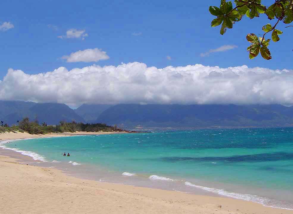


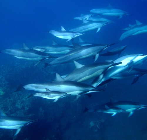


