


Air Temperatures – The following high temperatures (F) were recorded across the state of Hawaii Sunday…along with the low temperatures Sunday:
83 – 68 Lihue, Kauai
83 – 70 Honolulu, Oahu
84 – 65 Molokai
86 – 64 Kahului AP, Maui
85 – 73 Kailua Kona
83 – 67 Hilo AP, Hawaii
Here are the latest 24-hour precipitation totals (inches) for each of the islands as of Sunday evening:
1.35 Lihue, Kauai
0.68 Manoa Lyon Arboretum, Oahu
0.04 Molokai
0.00 Lanai
0.00 Kahoolawe
0.48 Wailuku, Maui
1.49 Waiakea Uka, Big Island
The following numbers represent the strongest wind gusts (mph) as of Sunday evening:
12 Moloaa Dairy, Kauai
15 Wheeler AFB, Oahu
17 Molokai
12 Lanai
25 Kahoolawe
22 Maalaea Bay, Maui
22 South Point, Big Island
Hawaii’s Mountains – Here’s a link to the live webcam on the summit of our tallest mountain Mauna Kea (nearly 13,800 feet high) on the Big Island of Hawaii. This webcam is available during the daylight hours here in the islands, and at night whenever there’s a big moon shining down. Also, at night you will be able to see the stars — and the sunrise and sunset too — depending upon weather conditions.
Aloha Paragraphs

The Pacific storm track remains well north of Hawaii

Thunderstorms offshore to the northeast through south

Clear to partly cloudy…cloudy areas locally

Showers locally…mostly offshore
Looping radar image
Memorializing Life…remembering the Fallen among us
Special Weather Statement: Coastal Flooding
Coastal flooding will occur along all shores of the Hawaiian Islands, due to record level spring (King) tides. Impacts will include beach flooding and standing water on roadways and low-lying areas near the coast through this holiday weekend.
A large late spring south swell will keep surfing breaking along the leeward beaches…before steadily lowering during the new week. Surf generated from this south swell will be augmented by the high tides, resulting in additional beach run up, flooding and erosion.
~~~ Hawaii Weather Narrative ~~~
Broad Brush Overview: Light winds will prevail, prompting a few windward showers during nights and mornings, with clouds and showers shifting to the leeward upcountry areas in the afternoons. The island atmosphere will be a little unstable today, which will allow a few showers to become briefly heavy here and there. Light to moderate trade winds Tuesday and Wednesday are expected to become stronger by the end of the week.
Details: Surface troughs of low pressure northwest and southeast of the islands will help to support light winds into Monday. Meanwhile, low pressure aloft will likely trigger a few heavy showers over interior areas during the afternoons. While thunderstorms aren’t likely, the Big Island slopes may find a bit of thunder and lightning later in the day. The chance for heavy showers will diminish Monday…as the low pressure system aloft moves steadily eastward and away from the island chain.
Looking Further Ahead: By Tuesday the nearby surface troughs will dissipate, and high pressure far northeast of the area will gradually strengthen. This in turn will bring back light to moderately strong trade winds…increasing to stronger levels by the end of the week. A relatively stable atmosphere will allow for a few brief windward showers, and mostly dry conditions leeward…as a more seasonable late spring weather pattern develops.
Here’s a wind profile of the Pacific Ocean – Closer view of the islands / Here’s the vog forecast animation / Here’s the latest weather map
Marine environment details: A High Surf Advisory remains in effect for all south facing shores…this large south swell will gradually diminish through Tuesday.
The south swell is rolling in on top of higher than normal sea levels and king tides.
A northeast swell building today will produce moderate surf through Memorial Day along east facing shores. North swells will be very small though Memorial Day. A moderate north-northwest swell is forecast to arrive Monday night, peak Tuesday night…then lower through Thursday.
Winds will remain below the Small Craft Advisory (SCA) threshold through Memorial Day. Trade winds are forecast to strengthen Monday. Winds are expected to reach SCA speeds around Maui County and the Big Island by Wednesday.
Lowering Surf along the leeward beaches
San Francisco Bay Weather Brief: Dry weather and seasonable temperatures are forecast through Monday. Slight cooling along with a minor chance for showers is expected Tuesday and Wednesday, otherwise little change is forecast through the new week.
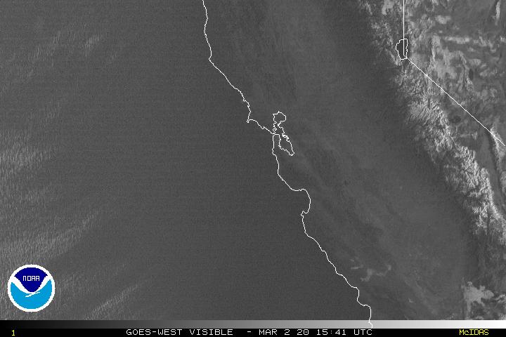
Clouds over the ocean…extending inland locally
World-wide tropical cyclone activity
![]()
>>> Atlantic Ocean: The 2017 hurricane season begins June 1st
>>> Caribbean: The 2017 hurricane season begins June 1st
>>> Gulf of Mexico: The 2017 hurricane season begins June 1st
Here’s a satellite image of the Caribbean Sea…and the Gulf of Mexico
Here’s the link to the National Hurricane Center (NHC)
>>> Eastern Pacific: No active tropical cyclones
A broad area of low pressure located a few hundred miles south of Acapulco, Mexico, is producing a large area of disorganized cloudiness and showers. Some slow development of this disturbance is possible during the next several days while it drifts generally northward.
* Formation chance through 48 hours…low…near 0 percent
* Formation chance through 5 days…medium…50 percent
Here’s a wide satellite image that covers the entire area between Mexico, out through the central Pacific…to the International Dateline.
Here’s the link to the National Hurricane Center (NHC)
>>> Central Pacific: The 2017 hurricane season begins June 1st
Here’s the NOAA 2016 Hurricane Season Summary for the Central Pacific Basin
Here’s a link to the Central Pacific Hurricane Center (CPHC)
>>> Northwest Pacific Ocean: No active tropical cyclones
>>> North and South Indian Oceans / Arabian Sea:
Tropical Cyclone 02B (Mora) remains active in the Bay of Bengal, here’s the Joint Typhoon Warning Center graphical track map, a satellite image…and what the computer models are showing
Here’s a link to the Joint Typhoon Warning Center (JTWC)
Interesting: The annual ‘king tides’ will have extra punch in the islands – It’s not unusual for Hawaii to see the highest tides of the year during the summer, but the ocean conditions that come with them this season could put coastal areas more at risk.
Known as “king tides,” this annual ocean event is expected along Hawaii beaches again today, as well as at the end of June and July. That, combined with above-average sea levels and a south swell forecast, has experts preaching caution.
“We can’t always predict exactly what localized impacts will be, so it’s helpful to spread awareness broadly so property owners and beach goers can anticipate possible impacts,” said Tara Owens, coastal processes and hazards specialist with the University of Hawaii Sea Grant College Program. “Generally speaking, we could have serious flooding, wave run up, and/or erosion at any site in South or West Maui due to the combination of high sea level, high tide and south swell.”
Since April 2016, sea levels around the islands have consistently been higher than expected, said Owens, who’s also a liaison to the Maui County Planning Department. The Kahului Harbor gauge, for instance, has ranged from 3 to 9 inches above predicted levels, and some places in Hawaii have been 11 inches over. University of Hawaii scientists believe it’s related to the big El Nino that passed through in 2015, bringing large waves that washed over highways and further eroded West Maui shores.
“What happens when we have an El Nino is the trade winds die down,” Owens said. “They normally push water across the Pacific Ocean to the western Pacific. But when they die, some of the water from the western Pacific washes over to Hawaii . . . and temporarily raises sea levels. But, for some reason, we’re still experiencing those elevated sea levels as an impact of that event.”
Scientists didn’t fully realize the implications of this “sea level anomaly” until later.
“It was only after documenting them for this whole year that we realized we have this pool of warm water around us that’s sticking around, Owens said.
Then come the king tides. Tides rise and fall by the moon’s gravitational pull. When the sun and moon align, their combined forces create king tides, according to Sea Grant.
Today and Friday, tide levels are predicted between 2 to 3 feet in locations throughout Maui County, according to the National Oceanic and Atmospheric Administration. Over those two days, Hana could experience the highest tides, from 2.87 to 2.92 feet. Meanwhile, Kahului could see tides from 2.73 to 2.78 feet, while Kihei and Maalaea Bay could get 2.57 to 2.62 feet and Lahaina could experience 2.43 to 2.48 feet. Molokai could see 2.65 to 2.69 feet at Kaunakakai Harbor and 2.52 to 2.56 feet at both Kamalo and Pukoo Harbors. Predictions for Kaumalapau on Lanai are 2.62 to 2.66 feet.
Most high tides will hit during late afternoon. NOAA expects them to return June 23 to 24 and July 21 to 22, again from 2 feet to just over 3 feet.
Any beach recently affected by waves or erosion “is especially vulnerable,” Owens said. That includes Kahana Beach and Honokowai/North Kaanapali in West Maui and the beach along Halama Street in Kihei. Wailea and Makena beaches are also “very exposed to south swell.”
Owens recommended moving valuable items in low-lying areas to higher ground. Canoes stored along beaches may need to be relocated. Boats should be secured in anticipation of both the swell and high tides.
“These kind of events represent what we’re going to see more of in the future as sea levels continue to rise,” Owens said.
“Documenting the impacts is a really important thing we can do now to understand what those impacts will be.”
On Maui, there’s been a lot of erosion in recent years, especially during the last two winters, Owens explained. Michele Chouteau McLean, deputy director of the county Planning Department, said “the dynamic shoreline environment — not just king tides but episodic erosion, storm surge, etc.” are an ongoing concern.
“They all threaten public and private property, infrastructure and coastal resources,” McLean said. “While we have generally had effective shoreline management throughout the county, there are still significant areas that are vulnerable to these coastal hazards. We need to get ahead of the curve so that we are not playing defense as often as we do.”
Sue Nighswonger Says:
I am visiting Poi’pu for two weeks. I am desperately trying to find out if VOG is over Kauai currently. I have asthma and need to know when to stay indoors. Everyone I ask has a different answer. Can you help? Thank you!
~~~ Hi Sue, according to this vog animation, it doesn’t appear that vog is over Kauai:
http://weather.hawaii.edu/vmap/hysplit/hawso4.cgi
Aloha, Glenn
woody adamz Says:
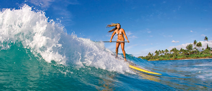
Wow….
WOW….That Tube pic today is 5 stars….
~~~ Hi Woody, that is a great picture…I agree!
Aloha, Glenn