


Air Temperatures – The following high temperatures (F) were recorded across the state of Hawaii Wednesday…along with the low temperatures Wednesday:
83 – 73 Lihue, Kauai
85 – 72 Honolulu, Oahu
83 – 71 Molokai
86 – 70 Kahului AP, Maui
86 – 73 Kailua Kona
82 – 69 Hilo AP, Hawaii
Here are the latest 24-hour precipitation totals (inches) for each of the islands as of Wednesday evening:
3.52 Kilohana, Kauai
2.99 Manoa Lyon Arboretum, Oahu
0.34 Molokai
0.00 Lanai
0.02 Kahoolawe
0.29 Kula Branch Station, Maui
0.76 Kawainui Stream, Big Island
The following numbers represent the strongest wind gusts (mph) as of Wednesday evening:
32 Barking Sands, Kauai
30 Kuaokala, Oahu
30 Molokai
28 Lanai
33 Kahoolawe
32 Maalaea Bay, Maui
30 Kealakomo, Big Island
Hawaii’s Mountains – Here’s a link to the live webcam on the summit of our tallest mountain Mauna Kea (nearly 13,800 feet high) on the Big Island of Hawaii. This webcam is available during the daylight hours here in the islands, and at night whenever there’s a big moon shining down. Also, at night you will be able to see the stars — and the sunrise and sunset too — depending upon weather conditions.
Aloha Paragraphs

The remnants of an old cold front…remain just north of Kauai

There’s no lack of clouds in the central Pacific

Clear to partly cloudy…cloudy areas locally

Showers locally…and offshore
Looping radar image
Special Weather Statement: Coastal Flooding
Coastal flooding is anticipated over the next several days along all shores of the Hawaiian Islands, due to record level spring (king) tides. Impacts will include beach flooding and standing water on roadways and low-lying areas near the coast through the weekend.
A large late spring south swell is expected to build Friday, and continue through the Memorial Day weekend, before steadily lowering next week. Surf generated from this south swell will likely be advisory level heights, although will be augmented by the high tides…resulting in additional beach run up, flooding and erosion.
~~~
The NOAA Central Pacific Hurricane Center (CPHC) has announced that climate conditions point to a near to above normal hurricane season in the Central Pacific this year.
The 2017 outlook calls for a 40% chance of an above normal season, a 40% of a normal season, and a 20% chance of a below normal season…with 5-8 tropical cyclones to affect the Central Pacific. An average season has 4-5 tropical cyclones, which include tropical depressions, tropical storms, and hurricanes.
~~~ Hawaii Weather Narrative ~~~
Broad Brush Overview: Strong trades will persist today, pushing clouds and showers across windward areas. Winds will gradually weaken through the second half of the week, becoming light and variable through the Memorial Day weekend. Daytime sea breezes and nighttime land breezes will take over this weekend, bringing warm and humid weather with possible vog.
Details: Satellites shows showery low clouds moving across the central islands, keeping windward areas locally wet and cloudy. The southern edge of a 60 mile wide frontal cloud band is still within 100 or so miles north of Kauai, and remains nearly stationary at the moment. The area of clouds and showers across Oahu and Maui should spread to Kauai…before moving west of the state.
Looking Further Ahead: Models show the trades will begin to weaken tonight through Friday, then become quite light during the holiday weekend. An easterly flow will continue to bring off and on windward showers through Friday. Leeward areas will see fewer showers, although eventual sea breezes may produce afternoon cloud build ups and showers by Friday. This weekend, flow will likely veer to southeast, bringing voggy conditions to the smaller islands through Memorial Day.
Here’s a wind profile of the Pacific Ocean – Closer view of the islands / Here’s the vog forecast animation / Here’s the latest weather map
Marine environment details: Weather maps showed a large area of strong high pressure encompassing much of the northern Pacific. Remnants of a lingering frontal boundary were oriented east to west…just north of the Kauai and Oahu. The pressure gradient between this boundary and strong high pressure to its north continues to support a large area of strong east-northeast winds.
The latest models show the strong winds, locally and north of the area, holding through today, then trending down through the second half of the week as high pressure shifts northeast over the Gulf of Alaska and weakens. Land and sea breeze conditions will become a possibility over the upcoming weekend, which will allow the seas to trend down locally.
Surf along east facing shores will remain rough due to strong onshore winds locally, then trending down through the second half of the week, as the trades relax.
Surf along north facing shores will steadily lower. For the long range, models are hinting at another moderate north-northwest swell arriving early next week.
Surf along south facing shores is expected to lower now, as the small south swell fades. The largest south swell so far this season is forecast to arrive late Thursday into Friday, peak Friday night through Saturday, then slowly lower into early next week. A high surf advisory for south facing shores will be likely, which will continue into the Memorial Day weekend.
In addition to the expected advisory level surf through the Memorial Day weekend along leeward shores, minor coastal flooding is anticipated, due to a combination of record level spring (king) tides (especially for Maui County and Oahu) and large surf. Impacts will include beach flooding and potentially standing water on roadways and low-lying areas near the coast…around the times of high tides each day through the weekend

Trades…carrying showers our way locally
San Francisco Bay Weather Brief: A cooling trend can be expected through Friday, as high pressure weakens and the marine influence increases. Minor warming is then expected during the upcoming weekend, into early next week…as high pressure returns to the West Coast. No signs of rain over the next 10 days.
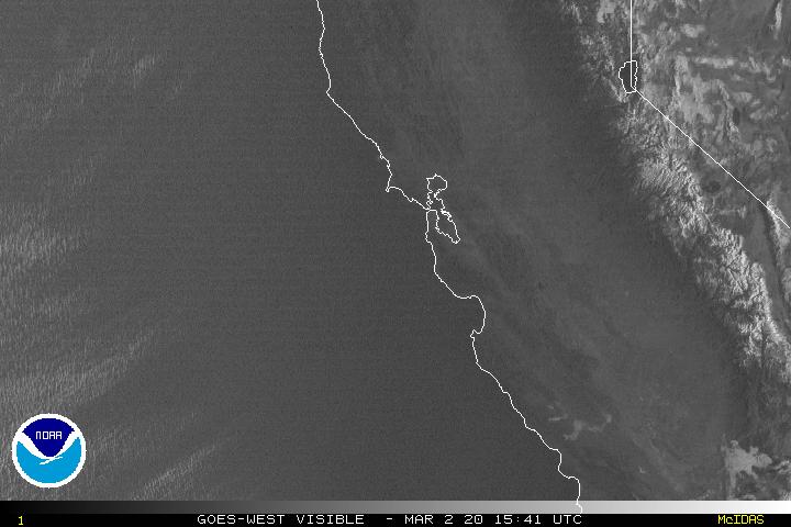
Multi-level clouds in the Bay area and offshore
World-wide tropical cyclone activity
![]()
>>> Atlantic Ocean: The 2017 hurricane season begins June 1st
>>> Caribbean: The 2017 hurricane season begins June 1st
>>> Gulf of Mexico: The 2017 hurricane season begins June 1st
Here’s a satellite image of the Caribbean Sea…and the Gulf of Mexico
Here’s the link to the National Hurricane Center (NHC)
>>> Eastern Pacific: No active tropical cyclones
Here’s the NOAA 2016 Hurricane Season Summary for the Eastern Pacific Basin
Here’s a wide satellite image that covers the entire area between Mexico, out through the central Pacific…to the International Dateline.
Here’s the link to the National Hurricane Center (NHC)
>>> Central Pacific: The 2017 hurricane season begins June 1st
Here’s the NOAA 2016 Hurricane Season Summary for the Central Pacific Basin
Here’s a link to the Central Pacific Hurricane Center (CPHC)
>>> Northwest Pacific Ocean: No active tropical cyclones
>>> North and South Indian Oceans / Arabian Sea: No active tropical cyclones
Here’s a link to the Joint Typhoon Warning Center (JTWC)
Interesting: The annual ‘king tides’ will have extra punch in the islands – It’s not unusual for Hawaii to see the highest tides of the year during the summer, but the ocean conditions that come with them this season could put coastal areas more at risk.
Known as “king tides,” this annual ocean event is expected along Hawaii beaches Thursday and Friday, as well as at the end of June and July. That, combined with above-average sea levels and a south swell forecast, has experts preaching caution.
“We can’t always predict exactly what localized impacts will be, so it’s helpful to spread awareness broadly so property owners and beach goers can anticipate possible impacts,” said Tara Owens, coastal processes and hazards specialist with the University of Hawaii Sea Grant College Program. “Generally speaking, we could have serious flooding, wave run up, and/or erosion at any site in South or West Maui due to the combination of high sea level, high tide and south swell.”
Since April 2016, sea levels around the islands have consistently been higher than expected, said Owens, who’s also a liaison to the Maui County Planning Department. The Kahului Harbor gauge, for instance, has ranged from 3 to 9 inches above predicted levels, and some places in Hawaii have been 11 inches over. University of Hawaii scientists believe it’s related to the big El Nino that passed through in 2015, bringing large waves that washed over highways and further eroded West Maui shores.
“What happens when we have an El Nino is the trade winds die down,” Owens said. “They normally push water across the Pacific Ocean to the western Pacific. But when they die, some of the water from the western Pacific washes over to Hawaii . . . and temporarily raises sea levels. But, for some reason, we’re still experiencing those elevated sea levels as an impact of that event.”
Scientists didn’t fully realize the implications of this “sea level anomaly” until later.
“It was only after documenting them for this whole year that we realized we have this pool of warm water around us that’s sticking around, Owens said.
Then come the king tides. Tides rise and fall by the moon’s gravitational pull. When the sun and moon align, their combined forces create king tides, according to Sea Grant.
On Thursday and Friday, tide levels are predicted between 2 to 3 feet in locations throughout Maui County, according to the National Oceanic and Atmospheric Administration. Over those two days, Hana could experience the highest tides, from 2.87 to 2.92 feet. Meanwhile, Kahului could see tides from 2.73 to 2.78 feet, while Kihei and Maalaea Bay could get 2.57 to 2.62 feet and Lahaina could experience 2.43 to 2.48 feet. Molokai could see 2.65 to 2.69 feet at Kaunakakai Harbor and 2.52 to 2.56 feet at both Kamalo and Pukoo Harbors. Predictions for Kaumalapau on Lanai are 2.62 to 2.66 feet.
Most high tides will hit during late afternoon. NOAA expects them to return June 23 to 24 and July 21 to 22, again from 2 feet to just over 3 feet.
Any beach recently affected by waves or erosion “is especially vulnerable,” Owens said. That includes Kahana Beach and Honokowai/North Kaanapali in West Maui and the beach along Halama Street in Kihei. Wailea and Makena beaches are also “very exposed to south swell.”
Owens recommended moving valuable items in low-lying areas to higher ground. Canoes stored along beaches may need to be relocated. Boats should be secured in anticipation of both the swell and high tides.
“These kind of events represent what we’re going to see more of in the future as sea levels continue to rise,” Owens said.
“Documenting the impacts is a really important thing we can do now to understand what those impacts will be.”
On Maui, there’s been a lot of erosion in recent years, especially during the last two winters, Owens explained. Michele Chouteau McLean, deputy director of the county Planning Department, said “the dynamic shoreline environment — not just king tides but episodic erosion, storm surge, etc.” are an ongoing concern.
“They all threaten public and private property, infrastructure and coastal resources,” McLean said. “While we have generally had effective shoreline management throughout the county, there are still significant areas that are vulnerable to these coastal hazards. We need to get ahead of the curve so that we are not playing defense as often as we do.”
woody adamz Says:
Aloha Mom, Glenn, Linda….Just some good vibes your way….Quite interesting article on our Life Support System re:Third Stone….also…as always…your Island Pic is Da Bomb and, I hope you have all these great pictures listed with a Photo Catalog Co…They pay small time but, it accumulates and…your pics are better than most so you would do fine… Nothin’ like “Spare Change” ..Hope you all are doing well and enjoying this strong spring.. Aloha Nui….
~~~ Hi Woody, good to hear from you again, thanks for your well wishes, and the information about photo’s too.
Aloha, Glenn