


Air Temperatures – The following high temperatures (F) were recorded across the state of Hawaii Sunday…along with the low temperatures Sunday:
77 – 59 Lihue, Kauai
81 – 66 Honolulu, Oahu
85 – 61 Molokai
84 – 62 Kahului AP, Maui
77 – 68 Kona Int’l AP
76 – 65 Hilo AP, Hawaii
Here are the latest 24-hour precipitation totals (inches) for each of the islands as of Sunday evening:
0.18 Mohihi Crossing, Kauai
0.30 Palehua, Oahu
0.00 Molokai
0.00 Lanai
0.00 Kahoolawe
0.08 West Wailuaiki, Maui
0.65 Lower Kahuku, Big Island
The following numbers represent the strongest wind gusts (mph) as of Sunday evening:
17 Port Allen, Kauai
22 Kahuku Trng, Oahu
23 Molokai
15 Lanai
27 Kahoolawe
14 Kaupo Gap, Maui
17 South Point, Big Island
Hawaii’s Mountains – Here’s a link to the live webcam on the summit of our tallest mountain Mauna Kea (nearly 13,800 feet high) on the Big Island of Hawaii. This webcam is available during the daylight hours here in the islands, and at night whenever there’s a big moon shining down. Also, at night you will be able to see the stars — and the sunrise and sunset too — depending upon weather conditions.
Aloha Paragraphs

A dynamic counter-clockwise rotating low pressure system is located north of the state

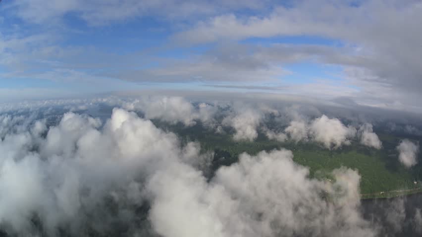
There is no lack of cloud cover over our central Pacific

High clouds are over the Big Island…deep clouds with some generous showers offshore southwest and west

Lots of showers, mostly offshore…some are moderately heavy – Looping radar image
~~~ Hawaii Weather Narrative ~~~
Small Craft Advisory…Pailolo and Alenuihaha Channels, and Big Island windward, leeward water, and southeast waters
Winter Storm Watch…Big Island Summits
Light to moderate trade winds will strengthen slightly Monday…before weakening again by mid-week. Winds, while remaining east to east-southeast, are expected to gradually increase Monday. This locally breezy flow will persist through Tuesday before lighter winds return for Wednesday, through the end of the week. These generally light winds will likely persist through next weekend, and the flow eventually carry volcanic haze (vog) from the Big Island vents, over the smaller islands…bringing hazy conditions Friday through next Sunday.
Model guidance continues to indicate that a trough aloft will deepen northwest of Kauai through Tuesday…before moving over the islands Tuesday night and Wednesday. This development will support thickening high clouds (again) over the whole state, while also bringing increased instability and moisture. Additionally, as the trough aloft passes over the islands, the models suggest the development of a weak surface low pressure system near the islands Wednesday. This may bring a period of unsettled weather…with the chance of heavy rain and localized thunderstorms.
A trend toward drier weather is expected Wednesday night and Thursday, as the trough aloft and associated surface low moves north…and a surface ridge of high pressure develops over the islands. Light winds and mostly dry weather are then expected to persist through the weekend. The models have been off and on showing another cold front approaching the state over the weekend…although it may stall before arriving into our area.
Here’s a wind profile of the Pacific Ocean – Closer view of the islands / Here’s the vog forecast animation / Here’s the latest weather map
Marine environment details: The current west-northwest swell will continue to slowly lower into the early portion of the week. A small reinforcement out of the west-northwest is forecast to fill in Tuesday through mid week. Surf along exposed north and west facing shores will remain below high surf advisory levels through this time. A small to moderate north-northeast swell due to a pair of compact lows to the north of the islands will fill in across the local area through Tuesday night…peaking early Monday. This swell could produce surf near high surf advisory surf for exposed east facing shores around the peak of the swell. For the extended, the latest model guidance depicts a gale to storm force low developing and tracking a few hundred miles north of Midway Wednesday through Thursday…sending a large west-northwest swell toward the local waters for the upcoming weekend.
Light to moderately strong breezes, out of the east-southeast will continue through Tuesday morning, becoming locally strong tonight. The strongest winds will occur across the channels and around the Big Island early Monday morning, through early Tuesday morning…prompting the issuance of a Small Craft Advisory for those areas and time period. Models continue to depict a developing area of low pressure near the state by mid-week, lifting northward across the state through Thursday. Plenty of moisture and instability associated with this feature will lead to increasing shower and thunderstorm chances through this period.
Generally fine weather…although there are lots of showers offshore
World-wide tropical cyclone activity
![]()
>>> Atlantic Ocean: The 2017 hurricane season begins June 1st
Here’s a satellite image of the Atlantic Ocean
>>> Caribbean: The 2017 hurricane season begins June 1st
>>> Gulf of Mexico: The 2017 hurricane season begins June 1st
Here’s a satellite image of the Caribbean Sea…and the Gulf of Mexico
Here’s the link to the National Hurricane Center (NHC)
>>> Eastern Pacific: The 2017 hurricane season begins May 15th
Here’s the NOAA 2016 Hurricane Season Summary for the Eastern Pacific Basin
Here’s a wide satellite image that covers the entire area between Mexico, out through the central Pacific…to the International Dateline.
Here’s the link to the National Hurricane Center (NHC)
>>> Central Pacific: The 2017 hurricane season begins June 1st
Here’s the NOAA 2016 Hurricane Season Summary for the Central Pacific Basin
Here’s a link to the Central Pacific Hurricane Center (CPHC)
>>> Northwest Pacific Ocean: No active tropical cyclones
>>> North and South Indian Oceans / Arabian Sea: No active tropical cyclones
Here’s a link to the Joint Typhoon Warning Center (JTWC)
Interesting: A new study on how ocean currents transport floating marine debris is helping to explain how garbage patches form in the world’s oceans – Researchers from the University of Miami (UM) Rosenstiel School of Marine and Atmospheric Science and colleagues developed a mathematical model that simulates the motion of small spherical objects floating at the ocean surface.
The researchers feed the model data on currents and winds to simulate the movement of marine debris. The model’s results were then compared with data from satellite-tracked surface buoys from the NOAA Global Drifter Program’s database. Data from both anchored buoys and those that become unanchored, or undrogued, over time were used to see how each accumulated in the five ocean gyres over a roughly 20-year timeframe.
“We found that undrogued drifters accumulate in the centers of the gyres precisely where plastic debris accumulate to form the great garbage patches,” said Francisco Beron-Vera, a research associate professor in the UM Rosenstiel School’s Department of Atmospheric Sciences and lead author of the study. “While anchored drifters, which are designed to closely follow water motion, take a much longer time to accumulate in the center of the gyres.”
The study, which takes into account the combined effects of water and wind-induced drag on these objects, found that the accumulation of marine debris in the subtropical gyres is too fast to be due solely to the effect of trade winds that converge in these regions.
“We show that the size and weight of the drifters must be taken into account to fully explain the accumulation,” said Maria Josefina Olascoaga, an associate professor in the UM Rosenstiel School’s Department of Ocean Sciences and a co-author of the study.
The model could be used to track shipwrecks, airplane debris, sea ice and pollution among the many practical applications according to the researchers.
Sandra Says:
Hi Glenn: Just thought you’d like to know that there are lots of us thinking of you and your Mom. We just don’t want to over-burden you. Sending big hugs to you and Mama James. I bet you have thousands of us cheering you both on!!
~~~ Hi Sandra, great to hear from you! I’ll let my Mom know what you’ve written. We both are hanging in there, although it’s a slow healing process as I’m finding out. I’m remaining positive, and trying to keep my Mom as comfortable as possible. She is up and out of her chair more often these days, and even outside walking a bit too.
Again, you are so kind, we appreciate your remembering us here in Southern California!
Aloha, Glenn