


Air Temperatures – The following maximum temperatures (F) were recorded across the state of Hawaii Thursday along with the low temperatures Thursday:
76 – 69 Lihue, Kauai
76 – 68 Honolulu, Oahu
76 – 72 Molokai AP
77 – 69 Kahului AP, Maui
78 – 72 Kailua Kona
80 – 68 Hilo AP, Hawaii
Here are the latest 24-hour precipitation totals (in inches) for each of the islands as of Thursday evening:
0.26 Port Allen, Kauai
0.53 Makua Range, Oahu
0.48 Molokai
0.65 Lanai
0.26 Kahoolawe
0.53 Mahinahina, Maui
3.29 Kahua Ranch, Big Island
The following numbers represent the strongest wind gusts (mph) as of Thursday evening:
13 Port Allen, Kauai
08 Kuaokala, Oahu
04 Molokai
05 Lanai
12 Kahoolawe
08 Kaupo Gap, Maui
17 South Point, Big Island
Here’s a wind profile of the Pacific Ocean – Closer view of the islands
Hawaii’s Mountains – Here’s a link to the live webcam on the summit of our tallest mountain Mauna Kea (nearly 13,800 feet high) on the Big Island of Hawaii. This webcam is available during the daylight hours here in the islands, and at night whenever there’s a big moon shining down. Also, at night you will be able to see the stars — and the sunrise and sunset too — depending upon weather conditions.
Aloha Paragraphs

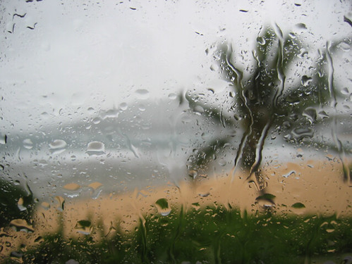
Low pressure to our west…is drawing wet weather up from the southwest

An extensive plume of moisture from the deeper tropics…continues spilling over us

Multi-layered clouds…with embedded showers

It’s a moist late autumn period – Looping radar image
~~~ Hawaii Weather Narrative ~~~
Our winds will remain generally quite light…through the rest of the week. Here’s the latest weather map, showing high pressure systems far east, and north-northwest. At the same time, we have low pressure systems with associated cold fronts just to our north. The winds remain on the light side, prompting daytime onshore sea breezes…followed by offshore flowing land breezes during the nights. Our more widespread breezes are coming up from the southwest to southeast, bringing volcanic haze over the smaller islands locally. By the way, the winds may become locally strong and gusty where thunderstorms pop up here and there.
Low pressure west of the state, will bring wet weather back to us…in an off and on fashion into the weekend. This batch of showers will be hit and miss in nature, although it will remain partly to mostly cloudy throughout. As we get into the later part of the upcoming weekend, we’ll likely see the arrival of a cold front into early next week. This frontal boundary will probably bring us another round of showers then. There’s a chance that we may see a brief period of improving conditions thereafter…before the next cold front approaches the state next Thursday and Friday.
Marine environment details: The current northwest swell will slowly decline today, and no other significant swells are expected through the weekend. A moderate north swell is possible early next week.
Winds will remain on the lighter side, and with no major swell expected, small craft advisory conditions are not expected for the coastal waters through the next few days. Although, thunderstorms may bring hazardous conditions with gusty winds and lightning at times.
More wet weather on tap…off and on through the weekend
World-wide tropical cyclone activity…with storms showing up when active
![]()
>>> Atlantic Ocean: The 2016 hurricane season has ended
Here’s a satellite image of the Atlantic Ocean
>>> Caribbean: The 2016 hurricane season has ended
>>> Gulf of Mexico: The 2016 hurricane season has ended
Here’s a satellite image of the Caribbean Sea…and the Gulf of Mexico
Here’s the link to the National Hurricane Center (NHC)
>>> Eastern Pacific: The 2016 hurricane season has ended
Here’s a wide satellite image that covers the entire area between Mexico, out through the central Pacific…to the International Dateline.
Here’s the link to the National Hurricane Center (NHC)
>>> Central Pacific: The 2016 hurricane season has ended
Here’s a link to the Central Pacific Hurricane Center (CPHC)
>>> South Pacific Ocean: No active tropical cyclones
>>> North and South Indian Oceans / Arabian Sea:
Tropical Cyclone 05B (Vardah) remains active in the Bay of Bengal, here’s the JTWC graphical track map, a satellite image…along with what the computer models are showing
Here’s a link to the Joint Typhoon Warning Center (JTWC)
Interesting: Sea ice hit record lows in November – Unusually high air temperatures and a warm ocean have led to a record low Arctic sea ice extent for November, according to scientists at the National Snow and Ice Data Center (NSIDC) at the University of Colorado Boulder. In the Southern Hemisphere, Antarctic sea ice extent also hit a record low for the month, caused by moderately warm temperatures and a rapid shift in circumpolar winds.
“It looks like a triple whammy—a warm ocean, a warm atmosphere, and a wind pattern all working against the ice in the Arctic,” said NSIDC director Mark Serreze.
Arctic sea ice extent averaged 3.51 million square miles for November, 753,000 square miles below the 1981 to 2010 long-term average for the month. Although the rate of Arctic ice growth was slightly faster than average, total extent actually decreased for a brief period in the middle of the month. The decrease in extent measured 19,300 square miles, and was observed mostly in the Barents Sea, an area of the Arctic Ocean north of Norway, Finland, and Eastern Russia.
NSIDC scientists said the decrease in extent is almost unprecedented for November in the satellite record; a less pronounced and brief retreat of 5,400 square miles happened in 2013. November 2016 is now the seventh month this year to have hit a record low extent in the 38-year satellite monitoring period. The November extent was 3.2 standard deviations below the long-term average, a larger departure than observed in September 2012 when the Arctic summer minimum extent hit a record low.
Arctic sea ice is still in the early stages of winter freeze-up and is expected to continue expanding until it hits its maximum extent around March next year.
NSIDC scientists said unusually high temperatures over the Arctic Ocean, persistent winds from the south, and a warm ocean worked together to drive the record low Arctic extent. Extending from northeast of Greenland towards Svalbard and Severnaya Zemlya, air temperatures at about 2,500 feet above sea level were up to 18 degrees Fahrenheit above the 1981 to 2010 long-term average for the month. Sea surface temperatures in the Barents and Kara Seas remained unusually high, up to 7 degrees Fahrenheit above average around Novaya Zemlya and Svalbard, preventing ice formation. These high temperatures reflected a pattern of winds from the south, which also helped to push the ice northward and reduce the ice extent.
NSIDC scientist Julienne Stroeve was in Svalbard during November and noted the lack of sea ice. “Typically sea ice begins to form in the fjords at the beginning of November, but this year there was no ice to be found,” she said.
In the Southern Hemisphere, sea ice surrounding the continent of Antarctica declined very quickly early in the month and set a record low. The average extent for November was 5.61 million square miles, 699,000 square miles below the 1981 to 2010 average. This was more than twice the previous record departure from average set in November 1986 and was 5.7 standard deviations below the long-term average.
NSIDC scientists said that higher-than-average temperatures and a rapid shift in Antarctic circumpolar winds appear to have caused the rapid decline in Antarctic sea ice.
Air temperatures 4 to 7 degrees Fahrenheit higher than average, and an earlier pattern of strong westerly winds worked to create a more dispersed sea ice pack in the Antarctic. A rapid shift to a more varied wind structure, with three major areas of winds from the north, rapidly compressed low-concentration sea ice around Wilkes Land, Dronning Maud Land, Enderby Land, and the Antarctic Peninsula. Moreover, several very large polynyas (areas of open water within the pack) have opened in the eastern Weddell and along the Amundsen Sea and Ross Sea coast.
“Antarctic sea ice really went down the rabbit hole this time,” said NSIDC lead scientist Ted Scambos. “There are a few things we can say about what happened, but we need to look deeper.”
NASA scientist and NSIDC affiliate scientist Walt Meier said, “The Arctic has typically been where the most interest lies, but this month, the Antarctic has flipped the script and it is southern sea ice that is surprising us.”
'ilima Says:
Hi Glenn – thanks for this. wanted to share that the thunder storms were so severe that about 4:20 this am I was jolted awake by my whole house shaking from the thunder. Quite the show, and kinda scary… we’re right in the rice park area of Kula – any idea if we should expect more of the same?
~~~ Hi Ilima, thanks for your comment. I was already awake at that time, as I was laying there a few minutes before getting out of bed.
I totally agree, the thunderstorm was incredible, super loud and big flashes of lightning. I live several miles away from the Rice Park, although I think all of Kula felt this weather event, including Keokea and Ulupalakua…and probably Pukalani too.
Will there be more? Well, as I write these words, there is another thunderstorm out near Hana. I don’t know for sure if we’ll have anymore thunderstorms, although we may…as we move into the evening and nighttime hours. / Just now an update at 1220pm this afternoon – I just heard a clap of thunder in the distance!
Aloha, Glenn
I'msuzanne albers Says:
Please give update on tumami watch just issued for Maui. Thanks. We need to go
To dr appt and drive from Lahaina to WAILUKU.
~~~ Hi Suzanne, I’ve added information about the possible tsunami here in Hawaii…further up on this page
Aloha, Glenn