


Air Temperatures – The following maximum temperatures (F) were recorded across the state of Hawaii Friday…along with the low temperatures Friday:
82 – 71 Lihue, Kauai
84 – 73 Honolulu, Oahu
84 – 71 Molokai AP
84 – 72 Kahului AP, Maui
87 – 75 Kailua Kona
83 – 71 Hilo AP, Hawaii
Here are the latest 24-hour precipitation totals (inches) for each of the islands…as of Friday evening:
2.17 Kilohana, Kauai
2.08 Palisades, Oahu
0.96 Puu Alii, Molokai
0.02 Lanai
0.00 Kahoolawe
3.10 Puu Kukui, Maui
2.03 Kawainui Stream, Big Island
The following numbers represent the strongest wind gusts (mph)…as of Friday evening:
27 Port Allen, Kauai
33 Kuaokala, Oahu
27 Molokai
40 Lanai
35 Kahoolawe
35 Maalaea Bay, Maui
35 Kohala Ranch, Big Island
Hawaii’s Mountains – Here’s a link to the live web cam on the summit of near 13,800 foot Mauna Kea on the Big Island of Hawaii. This web cam is available during the daylight hours here in the islands…and when there’s a big moon shining down during the night at times. Plus, during the nights you will be able to see stars, and the sunrise and sunset too…depending upon weather conditions.
Aloha Paragraphs

Thunderstorm activity far to the southwest of Hawaii…is sending high cirrus clouds north and northeast over the islands periodically

Thunderstorms far west and southwest…moving away westward

Scattered low clouds…with thick streak of cirrus over Hawaii

Showers over the islands locally…as well as offshore – Looping radar image
Small Craft Advisory…Kaiwi Channel, and the windiest waters around Maui County and the Big Island
~~~ Hawaii Weather Narrative ~~~
Gusty trade winds…becoming slightly lighter this weekend. Here’s the latest weather map, showing a large near 1033 millibar high pressure system, parked well offshore to the north of Hawaii. This dominant area of high pressure over the Pacific will begin to lose some of its influence during the weekend. This will cause our trade wind speeds to lose a little strength, dropping from the current strong and gusty proportions…back down to moderately strong. This high pressure system is forecast to strengthen again during the new week, when the trade winds will zip right back up again, becoming strong and gusty by about Wednesday.
Here’s a wind profile…of the offshore waters around the islands – with a closer view
Here’s the Hawaiian Islands Sulfate Aerosol animated graphic – showing vog forecast
As usual, with the trade winds blowing steadily…they’ll carry an occasional shower our way at times. As the trade winds remain elevated in strength…some showers may spread over into the leeward sides on the smaller islands. As the atmosphere becomes more stable, shower intensity and coverage is expected to taper off through Saturday and probably Sunday too. The models show a trough of low pressure edging in our direction early next week. This low aloft is expected to bring an increase in trade wind showers…as the atmosphere becomes less stable once again. We could be looking at yet another unusually wet windward shower period through much of next week.
Marine environment details: A small craft advisory (SCA) remains in effect for the windy areas around the Big Island and Maui through Sunday evening. The winds will gradually weaken over the next couple of days. Trade winds will likely strengthen again by the middle of the new week and widespread SCA conditions may return.
A High Surf Advisory remains in effect for east facing shores through tomorrow morning due to the strong trade winds. Surf along east facing shores is expected to drop below the advisory level tomorrow as the winds ease slightly.
A series of southeast to southwest swells will produce small to moderate surf along south facing shores. Only small surf is expected along north and west facing shores.

Typical trade wind weather pattern
Here on Maui – Early Friday morning is dawning partly to mostly cloudy, with the usual windward clouds dropping some showers. Looking out the windows of my weather tower before sunrise, these low clouds are stretching from the windward sides over the West Maui Mountains. At the same time, the considerable high cirrus clouds are abundant this morning, which lit up a wonderful pink and orange color at sunrise! The air temperature was 55.5F degrees at 538am. Meanwhile, at about the same time, the Kahului airport was reporting mostly cloudy skies, with a temperature of 73 degrees, while Hana was at 75, and Maalaea Bay was 75 to…with the summit of the Haleakala Crater registering 43 degree. / Now at 845am, it’s totally cloudy and feels like rain up here in Kula…while I can see some muted sunshine down in the central valley.
– Early afternoon, the clouds and have cleared quite a bit from earlier…with clear blue skies and sunshine finally showing their face now.
– Early evening, the sun came out nicely this afternoon, as the high cirrus clouds took a break. However, it looks like they may spread right back over us during the night into Saturday. / 1020pm, mostly clear of lower level clouds, although with a thin veil of high cirrus clouds. These higher clouds are providing a halo around the moon.
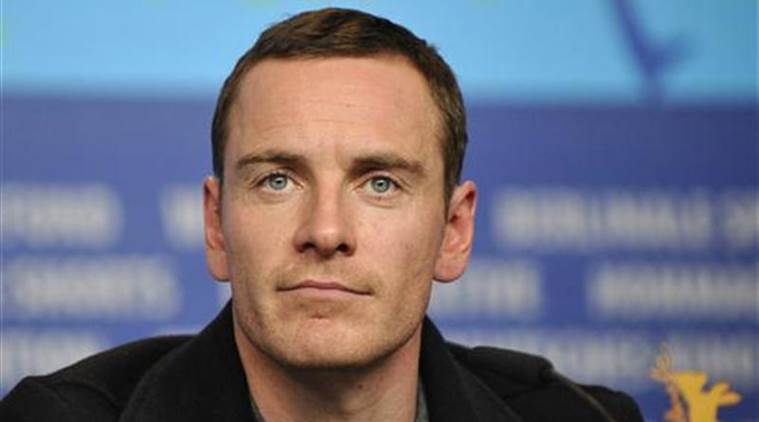
Friday Evening Film, as it turns out I’ve seen most of the films that I’ve been wanting to see at our local theaters. However, there was one that I’ve kind of been wanting to see, although not terribly. It’s called X-man: Apocalypse, starring James McAvoy, Michael Fassbender, Jennifer Lawrence, Oscar Isaac, Nicholas Hoult, Rose Byrne, and Olivia Munn...among many others. The synopsis: following the critically acclaimed global smash hit X-Men: Days of Future Past, director Bryan Singer returns with X-Men: Apocalypse. Apocalypse, the first and most powerful mutant from Marvel’s X-Men universe, amassed the powers of many other mutants, becoming immortal and invincible. Upon awakening after thousands of years, he is disillusioned with the world as he finds it, and recruits a team of powerful mutants to cleanse mankind and create a new world order, over which he will reign. As the fate of the Earth hangs in the balance, they try and save mankind from complete destruction.
This is one of those films that is pure action, no if’s, and’s or but’s about it! My movie viewing friend Jeff was rather reluctant. As it turned out, I now understand how he was a little unenthusiastic about seeing this film. According to him, it was too long, and as a result, he gave it a rather luke warm B- grade. I was a bit more taken by all the action that just kept coming. One critic wrote: “The property is running on bald tires, and, for all its ear-splitting racket and lavish effects, “Apocalypse” is the barest of retreads.” This film was too long, I agree with Jeff, and a bit dull in certain places, although in my book, it deserved a soft B+ grade…just a little better than a straight B. Perhaps you might be wondering, why did they even see this film? Well, that’s a fair question, and for those you who still reading all the way down here, here’s the trailer in case you want to take a quick peek.
World-wide tropical cyclone activity
>>> Atlantic Ocean: No active tropical cyclones
Here’s the 5-day Graphical Tropical Weather Outlook
Here’s a satellite image of the Atlantic Ocean
>>> Caribbean Sea: No active tropical cyclones
>>> Gulf of Mexico: No active tropical cyclones
A tropical wave located near the Yucatan Peninsula is producing cloudiness and disorganized thunderstorm activity from the southern Gulf of Mexico across the Yucatan Peninsula, Belize, and the northwestern Caribbean Sea. A weak surface low pressure system could form over the southern Gulf of Mexico during the next day or so, but only gradual development is expected due to proximity to land and marginally conducive upper-level winds. This system is forecast to move west-northwestward at about 10 mph before it moves inland early next week.
* Formation chance through 48 hours…medium…40 percent
* Formation chance through 5 days…medium…40 percent
Here’s a satellite image of the Caribbean Sea…and the Gulf of Mexico
Here’s the link to the National Hurricane Center (NHC)
>>> Eastern Pacific: No active tropical cyclones
Here’s a wide satellite image that covers the entire area between Mexico, out through the central Pacific…to the International Dateline.
Here’s the link to the National Hurricane Center (NHC)
>>> Central Pacific: No active tropical cyclones
No tropical cyclones expected through the next two days…
Here’s a link to the Central Pacific Hurricane Center (CPHC)
>>> South Pacific Ocean: No active tropical cyclones
>>> North and South Indian Oceans / Arabian Sea: No active tropical cyclones
Here’s a link to the Joint Typhoon Warning Center (JTWC)
Interesting: What Would a Global Warming Increase of 1.5 Degrees Be Like? – How ambitious is the world? The Paris climate conference last December astounded many by pledging not just to keep warming “well below two degrees Celsius,” but also to “pursue efforts” to limit warming to 1.5 degrees C. That raised a hugely important question: What’s the difference between a two-degree world and a 1.5-degree world?
Given we are already at one degree above pre-industrial levels, halting at 1.5 would look to be at least twice as hard as the two-degree option. So would it be worth it? And is it even remotely achievable?
In Paris, delegates called on the U.N.’s Intergovernmental Panel on Climate Change (IPCC) to report on the implications of a 1.5 target. They want the job done by 2018, in time to inform renewed talks on toughening emissions targets beyond those agreed upon in Paris.
But the truth is that scientists are only now getting out of the blocks to address what a 1.5-degree world would look like, because until recently it sounded like a political and technological impossibility. As a commentary published online in Nature Climate Change last week warned, there is “a paucity of scientific analysis” about the consequences of pursuing a 1.5-degree target.
To remedy this, the paper’s researchers, led by Daniel Mitchell and others at Oxford University, called for a dedicated program of research to help inform what they described as “arguably one of the most momentous [decisions] to be made in the coming decade.” And they are on the case, with their own dedicated website and a major conference planned at Oxford in the fall.
So what is at stake? There are two issues to address. First, what would be gained by going the extra mile for 1.5? And second, what would it take to deliver?
First, the gains. According to available research, says the Oxford group, the biggest boost will not be measured in average temperatures. On its own, the difference between 1.5 degrees and 2 degrees is marginal. But it would have a much greater effect on the probability of extreme and destructive weather events like floods, droughts, storms, and heat waves.
We know extreme weather is happening more often. A study last year by Erich Fischer of the Institute for Atmospheric and Climate Science in Zurich found that the risk of what was “once in a thousand days” hot weather has already increased fivefold. His modelling suggests that it will double again at 1.5 degrees and double once more as we go from 1.5 to 2 degrees. The probability of even more extreme events increases even faster.
The same will be true for droughts, says Carl-Friedrich Schleussner of the Potsdam Institute for Climate Impact Research in Germany. Last year, he reported that the extra half-degree would produce dramatic increases in the likely length of dry spells over wide areas of the globe, including the Mediterranean, Central America, the Amazon basin, and southern Africa, with resulting declines in river flows from a third to a half. Schleussner concluded that going from 1.5 to 2 degrees “marks the difference between events at the upper limit of present-day natural variability and a new climate regime, particularly in tropical regions.”
A few studies have tried to drill down to what the difference means for day-to-day lives. And the consequences for many will be stark. At two degrees, parts of southwest Asia, including well-populated regions of the Persian Gulf and Yemen, may become literally uninhabitable without permanent air conditioning.
Some researchers predict a massive decline in the viability of food crops critical for human survival. The extra half-degree could cut corn yields in parts of Africa by half, says Bruce Campbell of the International Center for Tropical Agriculture. Schleussner found that even in the prairies of the U.S., the risk of poor corn yields would double.
Two degrees, says Johan Rockström, director of the Stockholm Resilience Center, “contains significant risks for societies everywhere; 1.5 looks much more scientifically justifiable.”
Ecosystems would feel the difference too. Take tropical coral reefs, which already regularly come under stress because of high ocean temperatures, suffering “bleaching” especially during El Nino events – as happened on the Great Barrier Reef in Australia this year. Most can now recover when the waters cool again, but today’s exceptional temperature may soon become the new normal. “Virtually all tropical coral reefs are projected to be at risk of severe degradation due to temperature-induced bleaching from 2050 onwards,” as warming slips past 1.5 degrees, reports Schleussner.
By some estimates, curbing warming at 1.5 degrees could be sufficient to prevent the formation of an ice-free Arctic in summer, to save the Amazon rainforest, and to prevent the Siberian tundra from melting and releasing planet-warming methane from its frozen depths. It could also save many coastal regions and islands from permanent inundation by rising sea levels, particularly in the longer run.
In 2100, the difference in sea level rise between 1.5 and 2 degrees would be relatively small: 40 centimeters versus 50 centimeters. But centuries later, as the impact of warmer air temperatures on the long-term stability of the great ice sheets of Greenland and Antarctica takes hold, it would be far greater. Michiel Schaeffer of Climate Analytics, a Berlin-based think tank, calculates that by 2300, two degrees would deliver sea level rise of 2.7 meters, while 1.5 degrees would limit the rise to 1.5 meters.
It looks like 1.5 degrees matters a great deal. So how hard would it be to keep warming to that level? After all, last year was one degree above pre-industrial levels. And at various times in the past six months, global average temperatures have sometimes gone above 1.5 degrees.
Most researchers agree that, short of some global economic meltdown, even decade-long averaged temperatures are destined to go above 1.5 degrees of warming by mid-century. So delivering the target by the end of the century will require drawing down temperatures by using technologies and energy systems that can extract carbon dioxide from the atmosphere on a large scale.
For some, this would be nonsensical geoengineering. Kevin Anderson, a climate scientist at the University of Manchester in the U.K., writing in Nature after the Paris conference, declared “the world has just gambled its future on the appearance, in a puff of smoke, of a carbon-sucking fairy godmother.”
But it could be done. The calculations are inexact. Nobody, even now, knows quite how sensitive global temperatures are to rising concentrations of greenhouse gases in the atmosphere. But here is the task, as outlined by Joeri Rogelj, of the Austria-based International Institute for Applied Systems Analysis (IIASA), in an article in Nature Climate Change in March.
The planet’s primary thermostat is the concentration of CO2 in the atmosphere. Pre-industrial levels were 280 parts per million. We just hit 400 ppm with warming at one degree and some more in the pipeline, due to time lags. The IPCC, in its most recent report, estimated that to stop at 1.5 degrees will mean holding concentrations to around 430 ppm.
Because much of our CO2 emissions stay in the atmosphere for centuries, that means bringing annual emissions to zero. Impossible? Maybe, but the good news is that greenhouse gas emissions actually fell in 2015 despite rising global economic activity, thanks to the growing use of renewable energy. If we could build on that and bring emissions to zero by 2050, then we might limit emissions from here on out to 800 billion tons.
If we could somehow find ways to extract 500 billion tons from the atmosphere, Rogelj concluded, we would likely be able to have our wish of CO2 concentrations of 430 ppm and warming capped at 1.5 degrees. The fairy godmother would have delivered.
But how? While there are chemical processes for removing CO2 out of the air, they remain very expensive. More likely are biological methods — using plants to soak up CO2 and then preventing that CO2 from getting back into the atmosphere when the plants die or are burned.
The trick that puts a glint in the eye of some technologists and climate scientists is known by the acronym BECCS, which stands for “biomass energy, carbon capture, and storage.” The idea is to convert the world’s power stations to burning biomass, such as trees or marine algae. The industrialized production of this biomass on such a scale would accelerate the natural drawdown of CO2 by plants during photosynthesis. If the CO2 created by burning the biomass could then be captured from the stacks and buried in geological strata — the prototype technology known as carbon capture and storage — then the net effect would be a permanent extraction of CO2 from the atmosphere.
It would be the reverse of the current fossil-fuel energy system. And the more energy generated, the more CO2 would be drawn out of the air.
There are huge questions about such a strategy. Wouldn’t such a vast new industry have its own absurdly high-energy requirements, putting us back at square one?
Is there the land available to cultivate all that biomass? Would we end up chopping down forests to make room for growing the biomass, creating a massive new source of emissions? While there are back-of-the-envelope calculations, nobody has yet satisfactorily answered these questions.
Other geo-engineering options that have been proposed include fertilizing the oceans so that more algae can grow, sucking up CO2 as they do, or a terrestrial equivalent – burying charred biomass known as biochar into soils, where it could provide a kind of deep fertilizer that would turn soils into carbon-suckers over many centuries. But says IIASA’s Florian Kraxner, “Of all the ways of achieving negative emissions, BECCS seems to be the most promising.”
Is this all scientific pie in the sky? Some analysts argue that, whatever was said in Paris, there is little chance of hitting even two degrees, let alone anything tougher. David Victor, of the University of California at San Diego, for instance, wrote in Yale Environment 360 at the conclusion of the Paris agreement that “the world has dithered for too long and must now brace for the consequences. Even a realistic crash program to cut emissions will blow through 2 degrees; 1.5 degrees is ridiculous.”
Others say that even trying to paint a picture of what a 1.5-degree world would look like is a fool’s errand. Mike Hulme of King’s College London in England wrote recently that it could result in bad science, because predictions about future local climate come with such wide error bars. He wondered whether, even at the request of the Paris conference, science should be “corralled into servicing a tightly determined political agenda.”
But the Oxford team is not having such defeatism. “It is our job as scientists, first and foremost, to inform. Whether or not the information we provide makes a difference is ultimately up to others,” they say in their new paper. Moreover, they point out, “if additional research is not undertaken as a matter of urgency, there is a danger… that the 2018 special report will present all the negative economic constraints of achieving 1.5 degree C” without reporting on the potential positive impacts of reduced extreme weather activity that such a scenario could bring.
Ultimately, this is a highly political issue about who should be in charge of setting targets: those most vulnerable nations, who led the call in Paris for a 1.5-degree target, or those less vulnerable nations in the rich world, who were ready to stick with two degrees? Them or us?
As Petra Tschakert of Penn State University put it in a paper last year, “danger, risk, and harm would be utterly unacceptable in a 2°C warmer world, largely for ‘them’—the mollusks, and coral reefs, and the poor and marginalized populations, not only in poor countries—even if this danger has not quite hit home yet for ‘us’.”