


Air Temperatures – The following maximum temperatures (F) were recorded across the state of Hawaii Friday…along with the minimums Friday:
69 – 64 Lihue, Kauai
71 – 65 Honolulu, Oahu
73 – 64 Molokai AP
72 – 67 Kahului AP, Maui
75 – 70 Kailua Kona
72 – 67 Hilo AP, Hawaii
Here are the latest 24-hour precipitation totals (inches) for each of the islands, as of Friday evening:
0.54 Kilohana, Kauai
0.60 Poamoho RG 1, Oahu
1.89 Makapulapai, Molokai
0.00 Lanai
0.00 Kahoolawe
3.76 Kahakuloa, Maui
0.52 Saddle Quarry, Big Island
The following numbers represent the strongest wind gusts (mph)…as of Friday evening:
20 Poipu, Kauai – NE
32 Makua Range, Oahu – NE
27 Molokai – N
30 Lanai – NE
35 Kahaloowe – NNE
25 Kapalua, Maui – N
30 Kealakomo, Big Island – NNE
Hawaii’s Mountains – Here’s a link to the live web cam on the summit of near 13,800 foot Mauna Kea on the Big Island of Hawaii. This web cam is available during the daylight hours here in the islands…and when there’s a big moon shining down during the night at times. Plus, during the nights you will be able to see stars, and the sunrise and sunset too…depending upon weather conditions.
Aloha Paragraphs

Late winter storms moving by well north of Hawaii

Scattered and patchy low clouds in most directions…
thunderstorms far southwest of the islands

Low clouds across the state…mostly along the
windward sides…generally clear leeward areas

Showers falling over the windward sides…especially
the central islands – looping radar image
Small Craft Advisory…coastal and channel waters across
all of the state of Hawaii
High Surf Warning…for north and west shores of Kauai, and for
north shores of Oahu, Molokai, Maui and the Big Island
High Surf Advisory…for west shores of Oahu and Molokai
~~~ Hawaii Weather Narrative ~~~
Gusty trade winds…continuing into the weekend. Here’s the latest weather map, showing the Hawaiian Islands, and the rest of the North Pacific Ocean. We find high pressure systems to the northeast and northwest of Hawaii, with an associated ridge of high pressure to our north. At the same time, we see a storm low pressure system far to the north…with the tail-end of its associated cold front over the ocean to the east of the Hawaiian Islands. Trade winds will remain at about the same strength as we move through the weekend. The models are suggesting that the trade winds will fade away again by Monday. They will become lighter southeast to southerly winds ahead of a cold front approaching from the northwest…carrying volcanic haze over the smaller islands into Tuesday.
There will be windward showers at times…although relatively dry weather prevailing in most areas for the next several days. The old cold front, which moved across the state earlier this week, remains nearly stationary well offshore over the ocean to the east of the Big Island. The remnant clouds and showers from this front, will continue to provide some passing showers along the windward coasts and slopes. The leeward sides should be fine, with lots of warm daytime sunshine gracing those areas. We’ll find generally fair, late winter weather conditions in most areas through the weekend. A rather distinct weather change during the new week will bring showers to the islands…as a cold front moves into the area west of the state. The showers may last in an off and on manner through much of the work week, and could become locally generous, with the outside chance of a few thunderstorms.
Marine environment details: Hazardous boating conditions will persist over the weekend due to a combination of moderate to strong northeast to easterly winds, south of high pressure passing to the north…north and northwest swells. As a result, the small craft advisory will remain in place through the weekend. Winds and seas will trend down through the upcoming week beginning Monday, as the current swells lower, and a cold front approaches and moves into the region bringing increasing rain chances.
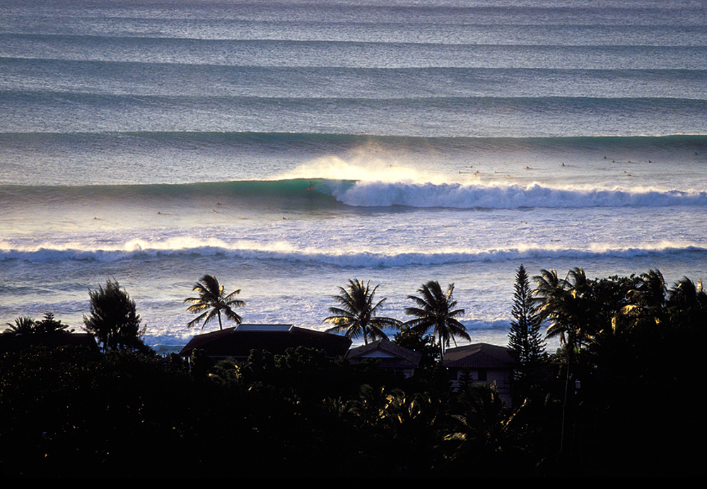
Out at the beaches, the current northerly swell in place will likely hold through Saturday, then steadily lower Sunday into the new week. A combination of this northerly swell holding through Saturday, and a new northwesterly swell filling in through the day, will continue to support warning level surf along north facing shores through Saturday. This new NW source will also likely support advisory level surf along west facing shores by Saturday afternoon…which should hold through Sunday.
The main impacts related to the surf/swells will include additional beach erosion, water sweeping over beaches and possibly over the typically vulnerable roadways. In addition to the surf, breaking waves may impact harbors making navigation more difficult.
Here’s a wind profile…of the offshore waters around the islands – with a closer view
Here’s the Hawaiian Islands Sulfate Aerosol…animated graphic – showing vog forecast
Here in Maui County…It was clear leeward sections, with partly cloudy conditions and a few light showers along the windward sides…early this Friday morning. By the way, there is a huge cloud of smoke in the central valley…caused by a morning sugar cane burn. Here in upcountry Kula, it was mostly clear and calm, with the air temperature 47.1F degrees well before sunrise. The temperature at near the same time was 67 degrees down in Kahului under partly cloudy skies, 64 out in Hana, with light rain, 68 at Maalaea Bay, and 39 atop the Haleakala summit. Meanwhile, Kahoolawe was 63 degrees, 63 at Lanai City, with 65 at the Molokai airport…with partly cloudy skies.
– Maui is getting a lot of rain, at least over on parts of the west side! I can see lots of rainy looking clouds hovering over the West Maui Mountains, and in Wailuku too. Here on the east side of the island, from my place in upcountry Kula, it’s partly sunny and breezy…although dry. / Now at 4pm, the clouds are going away quickly…with a much drier air mass having arrived…at least for the moment.
– Early Friday evening, with lots of clouds still banked-up against the windward coasts and slopes, and sneaking into the central valley at times too. Some of these clouds are dropping showers here and there.
Friday Evening Film: My friends Jeff and Svetlana have just flown back from Boulder, Colorado today, and I haven’t had a chance to speak to them about which film we should see. So, I’ll make an executive decision, and make the choice to see the film called London Has Fallen, starring Gerard Butler, Aaron Eckhart, Morgan Freeman, Melissa Leo, Angela Bassett, and Charlotte Riley…among many others. The synopsis: the sequel to “Olympus Has Fallen.” The story begins in London, where the British Prime Minister has passed away under mysterious circumstances. His funeral is a must-attend event for leaders of the western world. However, what starts out as the most protected event on Earth, turns into a deadly plot to kill the world’s most powerful leaders, devastate every known landmark in the British capital, and unleash a terrifying vision of the future. Only three people have any hope of stopping it: the President of the United States (Aaron Eckhart), his formidable Secret Service head (Gerard Butler), and an English MI-6 agent who rightly trusts no one.
Let me start off by saying that Svetlana gave this film a C grade, Jeff was a little higher, with a B minus rating, and I liked it better, giving it a strong B grade. Now that we’ve got those relatively low impressions out of the way, I should say that I enjoyed it quite a lot. The critics weren’t fond of this film, despite the talented cast. Here’s a few short snippets of what critics were saying: A troubled film with ridiculous story; gives generic action films a bad name; as a pretty average video game this might possibly have passed muster…but as a big-screen movie it’s woeful; ends up as insensitively timed hogwash…and finally – London Has Fallen is Donald Trump in film form! Oh my, I think you have a good idea about what many critics had on their minds. So, how could I have given it a strong B grade, that’s a valid question, and I’m sticking to my guns…and there were plenty of those being fired in this film! If after all that you would still like to take a quick peek…here’s the trailer.
World-wide tropical cyclone activity:
>>> Atlantic Ocean: The last regularly scheduled Tropical Weather Outlook of the 2015 Atlantic hurricane season…has occurred. Routine issuance of the Tropical Weather Outlook will resume on June 1, 2016. During the off-season, Special Tropical Weather Outlooks will be issued if conditions warrant. Here’s the 2015 hurricane season summary
Here’s a satellite image of the Atlantic Ocean
>>> Caribbean Sea: The last regularly scheduled Tropical Weather Outlook of the 2015 Atlantic hurricane season…has occurred. Routine issuance of the Tropical Weather Outlook will resume on June 1, 2016. During the off-season, Special Tropical Weather Outlooks will be issued if conditions warrant.
>>> Gulf of Mexico: The last regularly scheduled Tropical Weather Outlook of the 2015 Atlantic hurricane season…has occurred. Routine issuance of the Tropical Weather Outlook will resume on June 1, 2016. During the off-season, Special Tropical Weather Outlooks will be issued if conditions warrant.
Here’s a satellite image of the Caribbean Sea…and the Gulf of Mexico
Here’s the link to the National Hurricane Center (NHC)
>>> Eastern Pacific: The last regularly scheduled Tropical Weather Outlook of the 2015 North Pacific hurricane season…has occurred. Routine issuance of the Tropical Weather Outlook will resume on May 15, 2016. During the off-season, Special Tropical Weather Outlooks will be issued if conditions warrant. Here’s the 2015 hurricane season summary
Here’s a wide satellite image that covers the entire area between Mexico, out through the central Pacific…to the International Dateline.
Here’s the link to the National Hurricane Center (NHC)
>>> Central Pacific: The central north Pacific hurricane season has officially ended. Routine issuance of the tropical weather outlook will resume on June 1, 2016. During the off-season, special tropical weather outlooks will be issued if conditions warrant. Here’s the 2015 hurricane season summary
Here’s a link to the Central Pacific Hurricane Center (CPHC)
>>> South Pacific Ocean:
>>> North and South Indian Oceans / Arabian Sea:
Tropical Cyclone 15S (Emeraude) remains active in the South Indian Ocean, with winds of 70 knots and gusts of 85 knots…located approximately 872 NM east-southeast of Diego Garcia. Here’s the JTWC graphical track map, a NOAA satellite image, a near real time wind profile…and what the computer models are showing.
Here’s a link to the Joint Typhoon Warning Center (JTWC)
Interesting: Winter storms strongest to hit western Europe since 1948, study shows – The repeated storms which battered Europe’s Atlantic coastline during the winter of 2013/14 were the most energetic in almost seven decades, new research has shown.
And they were part of a growing trend in stormy conditions which scientists say has the potential to dramatically change the equilibrium state of beaches along the western side of the continent, leading to permanent changes in beach gradient, coastal alignment and nearshore bar position.
In a study accepted for publication in Geophysical Research Letters, a journal of the American Geophysical Union, researchers compared modeled and measured data from sites across Scotland, Ireland, England, France, Portugal, Spain and Morocco, and showed the extreme weather conditions were the most energetic since at least 1948.
It showed that along exposed open-coast sites in the UK and France, there had been extensive beach and dune erosion due to offshore sediment transport with sediment losses of up to 200 m3 for every 1m strip of beach. At some of the other sites, the balance between the different alongshore sediment transport contributions was disrupted, causing changes in the coastal alignment, referred to as beach rotation.
The research was led by Plymouth University in conjunction with scientists from the Centre National de la Recherche Scientifique, l’Université de Bordeaux, l’Institut Universitaire Européen de la Mer and Ulster University.
Gerd Masselink, Professor of Coastal Geomorphology at Plymouth University and the study’s lead author, said: “We have previously conducted research showing the devastating effects caused to the UK by the stormy winter of 2013/14. But the damage caused to coastal communities there was replicated — and in some cases exceeded — across western France. All but one of the sites assessed for this study reached their most depleted state at the end of the 2014 winter, and it will take many years for them to fully recover.”
For the study, researchers used a combination of modeled and measured wave data from the eastern Atlantic, stretching from Morocco to northwest Scotland, and also analyzed long-term beach profile data from sites in Ireland, UK and France.
It showed that extreme wave conditions occurred up to five times more frequently in 2013/14, and winter wave heights were up to 40% higher, than on average.
Dr Tim Scott, Lecturer in Ocean Exploration at Plymouth University, added: “The extreme winter of 2013/14 is in line with historical trends in wave conditions and is also predicted to increasingly occur due to climate change according to some of the climate models, with the winter of 2015/16 also set to be among the stormiest of the past 70 years. Whether due to more intense and/or more frequent storms, it should undoubtedly be considered in future coastal and sea defense planning along the Atlantic coast of Europe.”