


Air Temperatures – The following maximum temperatures (F) were recorded across the state of Hawaii Tuesday…along with the minimums Tuesday:
76 – 63 Lihue, Kauai
79 – 66 Honolulu, Oahu
78 – 62 Molokai AP
81 – 63 Kahului AP, Maui
81 – 69 Hilo AP, Hawaii
Here are the latest 24-hour precipitation totals (inches) for each of the islands, as of Tuesday evening:
0.12 Moloaa Dairy, Kauai
0.10 Kii, Oahu
0.02 Puu Alii, Molokai
0.00 Lanai
0.00 Kahoolawe
0.05 Hana AP, Maui
0.72 Laupahoehoe, Big Island
The following numbers represent the strongest wind gusts (mph)…as of Tuesday evening:
17 Mana, Kauai – NW
13 Oahu Forest NWR, Oahu – NW
10 Molokai – SE
10 Lanai – SW
14 Kahaloowe – SE
16 Kaupo Gap, Maui – SE
15 Upolu AP, Big Island – NE
Hawaii’s Mountains – Here’s a link to the live web cam on the summit of near 13,800 foot Mauna Kea on the Big Island of Hawaii. This web cam is available during the daylight hours here in the islands…and when there’s a big moon shining down during the night at times. Plus, during the nights you will be able to see stars, and the sunrise and sunset too…depending upon weather conditions.
Aloha Paragraphs

Two deep storms are spinning far north of Hawaii…with the
next cold front approaching from the northwest

Lots of more or less west-southwest to east-northeast
cloud bands stretched across the central Pacific – the
next thin cold front is approaching from the northwest

Partly to mostly cloudy skies across the state…with a few
cloud free areas here and there

Just a few showers locally – looping radar image
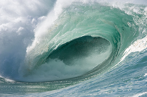
High Surf Warning…along north and west shores of Kauai, Oahu
and Molokai, and north shores of Maui and the Big Island
High Surf Advisory…along west shores of Maui and the Big Island
Small Craft Advisory…coasts and channels statewide
~~~ Hawaii Weather Narrative ~~~
Light breezes will prevail into mid-week, with returning trade winds beginning Thursday. Here’s the latest weather map, showing the Hawaiian Islands, and the rest of the North Pacific Ocean. We find high pressure systems far east-northeast and far west-northwest of Hawaii. In addition, there are two major storm low pressure systems far to the north of Hawaii. One of these storms sent a weak cold front through the islands recently. Our winds will remain on the light side into mid-week. The next weak cold front will try and push towards the islands Thursday, although it’s still not clear about how much success it will have in that regard. The forecast shows trade winds arriving in its wake during the second half of the week. Looking even further ahead, yet another cold front is slated to arrive next Monday or Tuesday, with a blast of chilly winter weather arriving into the middle of next week…in its wake.
Here’s a wind profile…of the offshore waters around the islands – with a closer view
Here’s the Hawaiian Islands Sulfate Aerosol…animated graphic – showing vog forecast
A few showers through Thursday, then drier Friday into the weekend…before a robust cold front brings showers early next week. The minor showers that will be around will fall along the windward sides…and over the interior sections locally during the afternoon hours into Wednesday. These few showers will be on the light side for the most part. Generally quiet and uneventful weather conditions will stick around through mid-week…followed by another weak cold front late Wednesday into Thursday. It’s not yet clear just how far into the state this cold front will make it, or if it will stall before arriving. The returning trade winds in the wake of this second cold front will bring a few windward showers…although not all that many are expected into the weekend. The latest models continue showing a potentially rather strong cold front arriving early next week – stay tuned.
Special Surf Statement: Another very large warning level northwest swell is expected to arrive Wednesday night, peak on Thursday, then lower gradually Friday into Saturday. Wave heights are expected to be similar to the recent extra large northwest swell, and will again make for very dangerous conditions along our north and west facing shores. Please use extreme caution when going near our exposed beaches Thursday into early in the upcoming weekend!
Here in Maui County…It’s partly to mostly cloudy early this Tuesday morning. Here in upcountry Kula we have an air temperature of 49.8F degrees well before sunrise. The temperature at near the same time was 65 degrees down in Kahului, and 46 degrees up at the summit of the Haleakala Crater. Meanwhile, Kahoolawe was 68 degrees, 61 at Lanai City, with 63 at the Molokai airport. / 840am, skies have cleared nicely this morning, although there are still a few clouds around the edges.
– Early afternoon, it continues to be partly to mostly cloudy in most areas across the County. The winds are light, which is helping the daytime heating of the islands to develop clouds overhead. The atmosphere remains quite dry and stable however, so that showers will remain quite limited for the time being. By the way, as I look down towards the central valley, from up here in Kula, I can see lots of haze down there. / 230pm, it’s still very cloudy in upcountry Maui, although I see more sunshine down along the beaches now.
– Early evening, with still lots of clouds around, although not many showers falling from them today. As the temperatures cool after dark, many of these clouds will likely evaporate, making way for mostly clear to partly cloudy conditions into early Wednesday morning. Meanwhile, this persistent haze is sticking around, which is definitely restricting air quality! / Now at 905pm, the skies have cleared of clouds, and the air temperature here at my weather tower in upper Kula is showing 49.4 degrees…while at near the same time down near sea level in Kahului, it was 73 degrees.
I’ll be back with many more updates on all of the above and below, I hope you have a great Tuesday night wherever you’re spending it! Aloha for now…Glenn
World-wide tropical cyclone activity:
>>> Atlantic Ocean: The last regularly scheduled Tropical Weather Outlook of the 2015 Atlantic hurricane season…has occurred. Routine issuance of the Tropical Weather Outlook will resume on June 1, 2016. During the off-season, Special Tropical Weather Outlooks will be issued if conditions warrant. Here’s the 2015 hurricane season summary
Here’s a satellite image of the Atlantic Ocean
>>> Caribbean Sea: The last regularly scheduled Tropical Weather Outlook of the 2015 Atlantic hurricane season…has occurred. Routine issuance of the Tropical Weather Outlook will resume on June 1, 2016. During the off-season, Special Tropical Weather Outlooks will be issued if conditions warrant.
>>> Gulf of Mexico: The last regularly scheduled Tropical Weather Outlook of the 2015 Atlantic hurricane season…has occurred. Routine issuance of the Tropical Weather Outlook will resume on June 1, 2016. During the off-season, Special Tropical Weather Outlooks will be issued if conditions warrant.
Here’s a satellite image of the Caribbean Sea…and the Gulf of Mexico
Here’s the link to the National Hurricane Center (NHC)
>>> Eastern Pacific: The last regularly scheduled Tropical Weather Outlook of the 2015 North Pacific hurricane season…has occurred. Routine issuance of the Tropical Weather Outlook will resume on May 15, 2016. During the off-season, Special Tropical Weather Outlooks will be issued if conditions warrant. Here’s the 2015 hurricane season summary
Here’s a wide satellite image that covers the entire area between Mexico, out through the central Pacific…to the International Dateline.
Here’s the link to the National Hurricane Center (NHC)
>>> Central Pacific: The central north Pacific hurricane season has officially ended. Routine issuance of the tropical weather outlook will resume on June 1, 2016. During the off-season, special tropical weather outlooks will be issued if conditions warrant. Here’s the 2015 hurricane season summary
Here’s a link to the Central Pacific Hurricane Center (CPHC)
>>> South Pacific Ocean:
Tropical Cyclone 11P (Winston) remains active in the Southwest Pacific Ocean, located 459 NM south-southwest of Suva, Fiji, with sustained winds of 52 mph…with gusts to 63 mph. Here’s the JTWC graphical track map, along with a satellite image of this system…and what the computer models are showing
>>> North and South Indian Oceans / Arabian Sea: There are no active tropical cyclones
Here’s a link to the Joint Typhoon Warning Center (JTWC)
Interesting: For Russian Farmers, Climate Change Is Nyet So Great – The National Oceanic and Atmospheric Administration says last month was the warmest January on record. That sets off alarm bells for climate scientists, but for the average person living in a northern climate, it might not sound so bad.
That’s what many people are saying these days in Russia, where the expected icy winter has failed to materialize this year – to widespread joy. Of course, any climate scientist will tell you that an unusually warm month — or even a whole warm winter — doesn’t mean much. It’s the long-term trend that counts.
But that’s not how it appears to the popular imagination, says George Safonov, who heads the Center for Environmental and Natural Resource Economics at the Higher School of Economics in Moscow. He says there’s a big temptation in northern countries to believe that warmer weather can bring economic opportunities, such as improving conditions for farming.
“Before 2010, we had a rising harvest rate for crops, and that was explained as a very positive impact of climate change,” he says. “It was not easy to convince people that this is not correct.”
The problem, Safonov says, is that while warmer weather might open up more land in cold regions such as Siberia, it’s already causing havoc on existing farmland in the south.
Some of Russia’s most productive farmland, the fertile steppes around Rostov-on-Don, has been facing a series of droughts.
“We had one-third of all harvests lost in 2010, one-fourth of all crops lost in 2012. And if you calculate, that was about $12 -$15 billion damage,” he says. In other words, a huge loss for Russian farmers.
We went to the Rostov region to see what farmers are doing about all this.
There’s nothing growing there now, but driving through the miles of plowed fields, you can see why this area is called the breadbasket of Russia.
The writer Anton Chekhov said it was so fertile, you could poke a stick into the ground and it would take root and grow.
Vladimir Dvornik runs an agricultural cooperative called Progress, a former Soviet collective farm. He says he and his fellow growers have had to change their crops to deal with drier conditions.
“We gave up growing some kinds of grain, soy and some vegetables, like peppers and tomatoes,” Dvornik says. Now, he says he has switched to winter wheat and other crops that do well in drier weather.
He says it’s not a catastrophe for local growers, because they’ve had time to adapt, but drought could cause severe problems if it keeps getting warmer.
As for moving Russian farming to Siberia, Dvornik says that’s nonsense, and so does economist Safonov.
There’s no infrastructure for farming there, Safonov says, no expertise and no population of potential farm workers. Between losing farmland in the south, and starting large-scale farming in the north, the costs would be huge.
“Overall, I would estimate these potential losses as a few dozens of billions of dollars per year if we don’t do anything,” Safonov says.
Judy Eagle Says:
Glenn,
Any chance you might train someone to do what you do? Even your travels away from your Kula eagle-eye view alert many to how great the need is for your so-helpful skills.
You can imagine how reassuring your aloha paragraphs can be. The spot-on analyses can inform the vog-sensitive about what bodies expeirence. For instance, verification of haze generally comes along with perception of such things as diminished breathing, thinking, probably less disease resistance, even an increase in nausea.
As time goes on, finding more ways to counter vog is likely. Meanwhile, your work is vastly revealing of when to implement steps we can now take. That goes along with the comforting ability better to understand experience.
Thank you.
J.
~~~ Hi Judy, thanks for your very nice note to me, I appreciate it!
It would be difficult to find someone whose willing, or able to take over when I occasionally go on vacation. I appreciate your request however, of course.
As for the vog, I know many folks are touched by these volcanic emissions. At least now the agricultural businesses have stopped burning sugar cane, which is a huge relief.
I’ll do my best to let you know when the vog will arrive, how thick it is when it’s here, at least from my vantage point, and when it will go away.
Best of luck to you Judy,
Aloha, Glenn