


Air Temperatures – The following maximum temperatures (F) were recorded across the state of Hawaii Wednesday…along with the minimums Wednesday:
80 – 62 Lihue, Kauai
80 – 65 Honolulu, Oahu
83 – 59 Molokai
84 – 59 Kahului AP, Maui
81 – 69 Kona Int’l AP
83 – 62 Hilo, Hawaii
Here are the latest 24-hour precipitation totals (inches) for each of the islands, as of Wednesday evening:
0.01 Lihue, Kauai
0.05 PTWC, Oahu
0.00 Molokai
0.00 Lanai
0.00 Kahoolawe
0.01 Hana AP, Maui
0.08 Kulani NWR, Big Island
The following numbers represent the strongest wind gusts (mph)…as of Wednesday evening:
14 Makaha Ridge, Kauai – SW
14 Wheeler AAF, Oahu – NW
13 Molokai – NE
12 Lanai – SW
22 Kahoolawe – ENE
17 Kaupo Gap, Maui – SE
18 South Point, Big Island – NNE
Hawaii’s Mountains – Here’s a link to the live web cam on the summit of near 13,800 foot Mauna Kea on the Big Island of Hawaii. This web cam is available during the daylight hours here in the islands…and when there’s a big moon shining down during the night at times. Plus, during the nights you will be able to see stars, and the sunrise and sunset too… depending upon weather conditions.
Aloha Paragraphs

The winter storm track remains north of Hawaii…
with a parade of cold fronts moving by to our north
Here’s a wind profile…of the offshore waters
around the islands – with a closer view

The next cold front is pushing in our direction…northwest

Mostly clear skies

Mostly dry over the islands – looping radar image
High Surf Advisory…north and west shores Kauai to Maui
~~~ Hawaii Weather Narrative ~~~
Light and variable breezes…extensive volcanic haze locally. Here’s the latest weather map, showing the Hawaiian Islands, and the rest of the North Pacific Ocean. We find a high pressure system not far to our northwest, with others far west and east-northeast…with an associated ridge of high pressure stretched across the state. Meanwhile, we see storm and gale low pressure systems far to our north through northwest. The tail-end of a cold front is located just offshore to the north of the islands, with another front well to our northwest. Our winds will remain light and variable in direction for the time being, and then we’ll see cool northerly breezes arriving Friday into the weekend…perhaps finally ventilating away the long lasting volcanic haze (vog), at least temporarily. Light winds will return early next week, which may bring back more volcanic haze then.
We see patches of clouds over the islands locally…along with clear areas as well. The overlying atmosphere remains dry and stable, as it has been for an extended period of time. Thus, the few clouds that are around now, aren’t dropping any significant rainfall by any means. Looking ahead, periodic cold fronts are expected to continue moving by just to our north, with the continued chance of occasionally sliding down into the state with a few showers…as is common during an El Nino winter. One such weak cold front may slip into the state Thursday night, reaching as far as Maui County by Friday night into Saturday…although only a modest increase in showers is expected. Looking even further ahead, yet another weak cold front will approach our area by next Tuesday or so.
Here in Maui County…We have mostly clear skies early Wednesday morning before sunrise…along with volcanic haze in the air. Here in upcountry Kula we have a cool air temperature of 47.3 F degrees at 540am. The temperature was a cool 60 degrees down near sea level in Kahului, with 66 out in Hana, 61 at Maalaea Bay…and 45 atop the Haleakala Crater at the same time. Meanwhile, Kahoolawe’s highest elevation was reporting 64 degrees, with 64 degrees at Lanai City, and 63 at the Molokai airport.
– 410pm, under clear to partly cloudy conditions, light winds, and light to almost moderately thick volcanic haze. The air temperature here at my place in Kula is 70.5 degrees, which feels just about perfect.
– 540pm, under partly cloudy skies, with continued light winds and vog. I can see some wispy high cirrus clouds arriving fro the north, which should light up a nice pink or orange around sunset. Most of the low clouds will clear overnight, making way for yet another chilly morning Thursday. At 555pm, here in Kula, it was 61.7 degrees and falling, with a warmer 79 degrees down in Kahului at the same time. At 610pm it was 58.9 degrees here at my place. / 845pm – 51.2
I’ll be back with many more updates on all of the above and below, I hope you have a great Wednesday night wherever you’re spending it! Aloha for now…Glenn
World-wide tropical cyclone activity:
>>> Atlantic Ocean: The last regularly scheduled Tropical Weather Outlook of the 2015 Atlantic hurricane season…has occurred. Routine issuance of the Tropical Weather Outlook will resume on June 1, 2016. During the off-season, Special Tropical Weather Outlooks will be issued if conditions warrant. Here’s the 2015 hurricane season summary
Out of season Hurricane Alex remains active, located about 490 miles south of the Faial Island in the central Azores. Here’s the NHC graphical track map, along with a satellite image...and finally what the computer models are showing.
Here’s a satellite image of the Atlantic Ocean
>>> Caribbean Sea: The last regularly scheduled Tropical Weather Outlook of the 2015 Atlantic hurricane season…has occurred. Routine issuance of the Tropical Weather Outlook will resume on June 1, 2016. During the off-season, Special Tropical Weather Outlooks will be issued if conditions warrant.
>>> Gulf of Mexico: The last regularly scheduled Tropical Weather Outlook of the 2015 Atlantic hurricane season…has occurred. Routine issuance of the Tropical Weather Outlook will resume on June 1, 2016. During the off-season, Special Tropical Weather Outlooks will be issued if conditions warrant.
Here’s a satellite image of the Caribbean Sea…and the Gulf of Mexico
Here’s the link to the National Hurricane Center (NHC)
>>> Eastern Pacific: The last regularly scheduled Tropical Weather Outlook of the 2015 North Pacific hurricane season…has occurred. Routine issuance of the Tropical Weather Outlook will resume on May 15, 2016. During the off-season, Special Tropical Weather Outlooks will be issued if conditions warrant. Here’s the 2015 hurricane season summary
Here’s a wide satellite image that covers the entire area between Mexico, out through the central Pacific…to the International Dateline.
Here’s the link to the National Hurricane Center (NHC)
>>> Central Pacific: The central north Pacific hurricane season has officially ended. Routine issuance of the tropical weather outlook will resume on June 1, 2016. During the off-season, special tropical weather outlooks will be issued if conditions warrant. Here’s the 2015 hurricane season summary
Out of season Tropical Depression 01C (Pali) remains active, located about 1650 miles Honolulu, Hawaii…. Here’s the CPHC graphical track map, along with a satellite image...and finally what the computer models are showing.
Here’s a link to the Central Pacific Hurricane Center (CPHC)
>>> South Pacific Ocean:
>>> North and South Indian Oceans / Arabian Sea: There are no active tropical cyclones
Here’s a link to the Joint Typhoon Warning Center (JTWC)
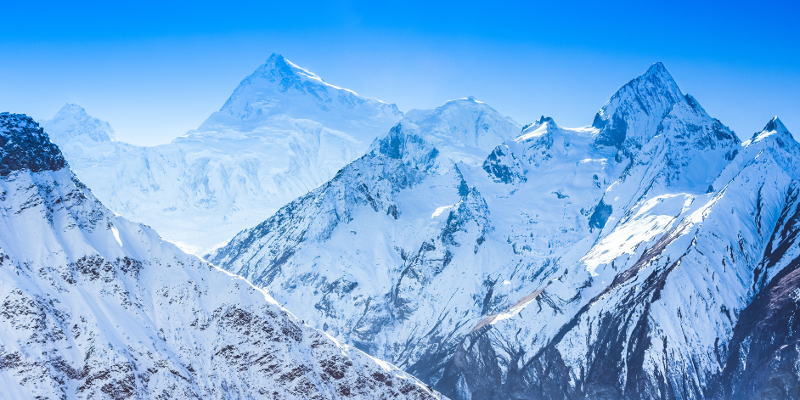
Interesting: Why the Himalayas keep growing – An international team of scientists has shed new light on the earthquake that devastated Nepal in April 2015, killing more than 8,000 people.
In a study published in the journal Nature Geoscience, the scientists show that a kink in the regional fault line below Nepal explains why the highest mountains in the Himalayas are seen to grow between earthquakes.
Study co-author Dr Pablo González, from the School of Earth and Environment at the University of Leeds, said: “We successfully mapped the earthquake motion using satellite technology on a very difficult mountainous terrain.
“We developed newly processing algorithms to obtain clearer displacement maps, which revealed the most likely fault geometry at depth to make sense of the puzzling geological observations.”
The researchers, from the UK’s Centre for the Observation and Modelling of Earthquakes, Volcanoes and Tectonics (COMET), as well as academics from the USA and France, also demonstrate that the rupture on the fault stopped 11km below Kathmandu.
This indicates that another major earthquake could take place within a shorter timeframe than the centuries that might be expected for the area.
Lead author Dr John Elliott of Oxford University, a member of the COMET team, said: “We have shown that the fault beneath Nepal has a kink in it, creating a ramp 20km underground.
“Material is continually being pushed up this ramp, which explains why the mountains were seen to be growing in the decades before the earthquake.
“The earthquake itself then reversed this, dropping the mountains back down again when the pressure was released as the crust suddenly snapped in April 2015.
“Using the latest satellite technology, we have been able to precisely measure the land height changes across the entire eastern half of Nepal. The highest peaks dropped by up to 60cm in the first seconds of the earthquake.”
Mount Everest, at more than 50km east of the earthquake zone, was too far away to be affected by the subsidence in this event.
Another key finding of the study shows that the rupture in the fault stopped 11km below Kathmandu, leaving an upper portion that remains unbroken and will build up more pressure over time as India continues to collide with Nepal.
Dr Elliott said: “As this part of the fault is nearer the surface, the future rupture of this upper portion has the potential for a much greater impact on Kathmandu if it were to break in one go in a similar sized event to that of April 2015.
“Work on other earthquakes has suggested that when a rupture stops like this, it can be years or decades before it resumes, rather than the centuries that might usually be expected.”
Doug Weigel Says:
Glenn,
Been enjoying your reports for 20+ years (my wife says I’m addicted) and have been to Maui from Indiana 14 times in 23 years. We’ve visited in El Nino years before. Typically what does this do to water temps beyond average? Higher on the Leeward sides vs. Windward? Thanks and looking forward to our trip next week.
Doug
~~~ Doug, 20 years, that’s right at the beginning of my website! I’m pleased that you are addicted to weather, rather than something else…I’m right here with you – hooked on weather!
Typically, the water temperatures are higher than normal, higher than the climatological averages. They are about equal on the leeward and windward sides…especially because the trade winds often are gone for long stretches during El Nino.
Sounds like you will be here on Maui for the 15th time, arriving soon in fact…nice!
I hope you and your wife have an especially good time, having everything be just the way you like it!
Aloha, Glenn
Douglas MacDougal Says:
Hi Glen
The VOG sure looks thick on the Kula webcam, looking North. I noticed in your weather product today, on the wind profile, that TC “PALI” at 8 degrees North, seems to be feeding into former TC “ULA” at 25 degrees South! What effect does the Coriolis force have on that?
~~~ Hi Douglas, good to hear from you again.
Yes indeed, the vog is thick, although today is less so than most days during the past week or so. I’m hoping that this weak cold front, that will arrive early Friday into Saturday…will help to clear our skies further! I expect some cooler northerly winds with the front, and if so, they should get rid of this hazy reality.
Actually, Hurricane Pali is at 3.4 degrees north of the equator, at least at the time of this writing.
Pali is way closer to the equator than is normal for a tropical cyclone. Usually, they spin up north and south of 5 degrees of the equator. As the coriolis force typically ends over the tropical doldrums.
This is why the hurricane, at least until recently, has been nearly stationary over the past several days. It looks like Pali will begin to move westward now, gaining a bit of latitude…and at the same time drop back down into the tropical storm status.
Aloha, Glenn