


Air Temperatures – The following maximum temperatures (F) were recorded across the state of Hawaii Friday…along with the minimum temperatures Friday:
84 – 66 Lihue, Kauai
78 – 71 Honolulu, Oahu
80 – 61 Molokai AP
82 – 60 Kahului, Maui
82 – 68 Kailua Kona
83 – 66 Hilo, Hawaii
Here are the latest 24-hour precipitation totals (inches) for each of the islands, as of Friday evening:
0.32 Lihue AP, Kauai
1.29 Makaha Stream, Oahu
0.01 Molokai
0.00 Lanai
0.00 Kahoolawe
0.00 Maui
0.00 Big Island
The following numbers represent the strongest wind gusts (mph)…as of Friday evening:
15 Waimea Heights, Kauai – NE
13 Kii, Oahu – W
09 Molokai – SE
12 Lanai – SW
09 Kahoolawe – SSW
12 Hana, Maui – E
15 PTA West, Big Island – NW
Hawaii’s Mountains – Here’s a link to the live web cam on the summit of near 13,800 foot Mauna Kea on the Big Island of Hawaii. This web cam is available during the daylight hours here in the islands…and when there’s a big moon shining down during the night at times. Plus, during the nights you will be able to see stars, and the sunrise and sunset too… depending upon weather conditions.
Aloha Paragraphs

A cold front has moved over Kauai…towards Oahu

Clouds from a cold front over Kauai and its channel…
with a pre-frontal cloud band over Oahu to Maui

Showers locally…over Oahu and Kauai
~~~ Hawaii Weather Narrative ~~~
High Surf Advisory…most north and west shores
Small Craft Advisory…Kauai through Maui County
into parts of the Big Island
Generally light and variable winds…becoming light easterlies later in the weekend into early next week. Here’s the latest weather map, showing the Hawaiian Islands, and the rest of the North Pacific Ocean, along with a real-time wind profiler of the central Pacific. We find high pressure systems far to the east-northeast and west…with a ridge of high pressure over the islands. At the same time, we have low pressure systems to the north, with the tail-end of an associated cold front draping southwestward…near Kauai. We’ll find light winds from varying directions, along with daytime sea breezes. Meanwhile, those areas that are exposed to light southeasterly breezes will continue to see volcanic haze (vog). It looks like the trade winds will return very briefly Sunday. As we move into later Monday, we’ll find more light winds through most of the rest of next week. This will bring more volcanic haze to many parts of the state. Thereafter, a stronger cold front will approach the state….bringing clouds and showers Friday into next Saturday. This cold front may bring locally heavy rains, and perhaps even a few thunderstorms, along with possible gusty winds. Typically, these kinds of cold fronts can also usher in chilly weather for a day or two in their wake…stay tuned.
Rainfall will remain very limited over Maui County and the Big Island, although a cold front and its associated prefrontal cloud band…will keep showers somewhat active on the Kauai end of the state. Here’s the looping radar image showing a few showers across our area, especially over Oahu at the time of this writing. The light winds will prompt late morning through afternoon upcountry clouds from Maui County to the Big Island…although any light showers will be spotty at best. A high pressure ridge remains stalled over the islands, continuing the light winds, and keeping a light rainfall weather pattern over the eastern islands. The cold front, and the cloud band out ahead of it, will keep some showers falling over Oahu and Kauai today. It appears that the front will stall or dissipate somewhere just short of Oahu, rather than pushing down through the rest of the state. I’ll be back with more updates on all of the above, I hope you have a great Friday night wherever you’re spending it! Aloha for now…Glenn.
Here in Kula, Maui: It’s still dark as I write this first observation, so I can’t see the nature of the cloud cover…or the thickness of the volcanic haze. The air temperature has bottomed out at 48.9 degrees. It’s now light enough that I can see clear skies, with still this moderately thick vog. Now that it’s 9am, and it’s way sunnier, I can look down into the central valley, and see that the vog is actually much lighter than it has been lately! ~~~ The cloud free morning hours have given way to increasing clouds on the slopes of the mountains here on Maui. The vog is still with us, in no uncertain terms! I went up to the ~5,500′ elevation here on the slopes of the Haleakala Crater today, did some nice skateboarding, and sat around reading poetry…and drinking earl grey tea. It was so quiet up there, other than the visitors going up and down the mountain in their rental cars. ~~~ We’re just moving into the early evening hours, with cloudy skies, and thick volcanic haze still interrupting our usual good air visibilities. The air temperature was 66.2 degrees, which is down from a high temperature of around 71 during the day. ~~~ I just got home from the film, it was relatively warm in Kahului, while here in Kula at 1035pm…it was a cooler 52.7 degrees.
Friday Evening Film: Once again there are many new films that I’m interested in seeing, so I’ll let them slide by, and pick off one of the older ones I haven’t seen yet. The one that I’ll be seeing this evening is called The Imitation Game, which several of my friends have given high marks. The stars in this film include Benedict Cumberbatch, Keira Knightley, Rory Kinnear, Matthew Beard, Allen Leech, and Tuppence Middleton…among many others. The synopsis: during the winter of 1952, British authorities entered the home of mathematician, cryptanalyst and war hero Alan Turing (Benedict Cumberbatch) to investigate a reported burglary. They instead ended up arresting Turing himself on charges of ‘gross indecency’, an accusation that would lead to his devastating conviction for the criminal offense of homosexuality – little did officials know, they were actually incriminating the pioneer of modern-day computing. Famously leading a motley group of scholars, linguists, chess champions and intelligence officers, he was credited with cracking the so-called unbreakable codes of Germany’s World War II Enigma machine. An intense and haunting portrayal of a brilliant, complicated man, THE IMITATION GAME follows a genius who under nail-biting pressure helped to shorten the war and, in turn, save thousands of lives.
This film was astonishingly well done, deep and heavy, with such character, it was brilliant in my opinion. The film excelled, thanks to the quality of the acting, entertaining script, and a true story ta boot. Cumberbatch and Knightley were superb, they delivered rich performances. In the end, a machine was created to help win a war, and in the process…set the stage for the modern computers. Simply put, I am thoroughly comfortable giving it a solid A grade. I suggest you at least take a peek at what I was lucky enough to see…here’s the trailer.
World-wide tropical cyclone activity:
>>> Atlantic Ocean: The last regularly scheduled Tropical Weather Outlook of the 2014 Atlantic hurricane season…has occurred. Routine issuance of the Tropical Weather Outlook will resume on June 1, 2015. During the off-season, Special Tropical Weather Outlooks will be issued as conditions warrant.
Here’s a satellite image of the Atlantic Ocean
>>> Caribbean Sea: The last regularly scheduled Tropical Weather Outlook of the 2014 Atlantic hurricane season…has occurred. Routine issuance of the Tropical Weather Outlook will resume on June 1, 2015. During the off-season, Special Tropical Weather Outlooks will be issued as conditions warrant.
>>> Gulf of Mexico: The last regularly scheduled Tropical Weather Outlook of the 2014 Atlantic hurricane season…has occurred. Routine issuance of the Tropical Weather Outlook will resume on June 1, 2015. During the off-season, Special Tropical Weather Outlooks will be issued as conditions warrant.
Here’s a satellite image of the Caribbean Sea…and the Gulf of Mexico.
>>> Eastern Pacific: The last regularly scheduled Tropical Weather Outlook of the 2014 North Pacific hurricane season…has occurred. Routine issuance of the Tropical Weather Outlook will resume on May 15, 2015. During the off-season, Special Tropical Weather Outlooks will be issued as conditions warrant.
Here’s a wide satellite image that covers the entire area between Mexico, out through the central Pacific…to the International Dateline.
Here’s the link to the National Hurricane Center (NHC)
>>> Central Pacific: The central north Pacific hurricane season has officially ended. Routine issuance of the tropical weather outlook will resume on June 1, 2015. During the off-season, special tropical weather outlooks will be issued as conditions warrant.
Here’s a link to the Central Pacific Hurricane Center (CPHC)
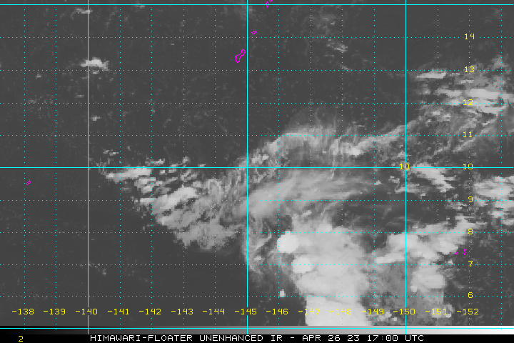
>>> Northwest Pacific Ocean: Typhoon 01W (Mekkhala) remains active in the Philippine Sea. Here’s the JTWC graphical track map for this slowly strengthening tropical system. Here’s the NOAA satellite image of this system…to the east of the Philippines.
>>> South Pacific Ocean: There are no active tropical cyclones
>>> North and South Indian Oceans: Tropical cyclone 05S (Bansi) remains active in the south Indian Ocean. Here’s the JTWC graphical track map for this strengthening tropical cyclone. Here’s the NOAA satellite image of this system…to the northeast of La Reunion Island.
Tropical cyclone 06S (Chedza) remains active in the south Indian Ocean. Here’s the JTWC graphical track map for this briefly strengthening tropical cyclone. Here’s the NOAA satellite image of this system…in the Mozambique Channel.
Here’s a link to the Joint Typhoon Warning Center (JTWC)
Interesting: New data suggests sea levels are rising faster than previously thought – The acceleration in global sea level from the 20th century to the last two decades has been significantly larger than scientists previously thought, according to a new Harvard study.
The study, co-authored by Carling Hay, a post-doctoral fellow in the Department of Earth and Planetary Sciences (EPS), and Eric Morrow, a recent PhD graduate of EPS, shows that previous estimates of global sea-level rise from 1900-1990 had been over-estimated by as much as 30 percent.
The report, however, confirms previous estimates of sea-level change since 1990, suggesting that the rate of sea-level change is increasing more quickly than previously believed.
“What this paper shows is that sea-level acceleration over the past century has been greater than had been estimated by others,” Morrow said. “It’s a larger problem than we initially thought.”
“Scientists now believe that most of the world’s ice sheets and mountain glaciers are melting in response to rising temperatures.” Hay added. “Melting ice sheets cause global mean sea level to rise. Understanding this contribution is critical in a warming world.”
Previous estimates had placed sea-level rise at between 1.5 and 1.8 millimeters annually over the 20th century. Hay and Morrow, however, suggest that from 1901 until 1990, the figure was closer to 1.2 millimeters per year. But everyone agrees that global sea level has risen by about 3 millimeters annually since that time, and so the new study points to a larger acceleration in global sea level.
“Another concern with this is that many efforts to project sea-level change into the future use estimates of sea level over the time period from 1900 to 1990,” Morrow said. “If we’ve been over-estimating the sea-level change during that period, it means that these models are not calibrated appropriately, and that calls into question the accuracy of projections out to the end of the 21st century.”
To obtain their improved estimate of 20th century global sea level, Hay and Morrow approached the challenge of estimating sea-level rise from a completely new perspective.
Typically, Hay said, estimates of sea-level rise are created by dividing the world’s oceans into sub-regions, and gathering records from tide gauges – essentially yard-sticks used to measure ocean tides – from each area. Using records that contain the most complete data, researchers average them together to create estimates of sea level for each region, then average those rates together to create a global estimate.
bob raimo Says:
glen you might want to look out the window when at work regarding the surf. i can hear it from my living room. the kihei boat ramp is ripping and the barbers point buoy is at eight feet and fourteen seconds. maybe bring a board to work. have fun.~~~Hi Bob, thanks for that timely report, I’m working from home these days, so won’t be getting wet. I understand Hookipa is smaller than expected, and it’s good to know Kihei is picking up this more westerly swell. Aloha, Glenn