


Air Temperatures – The following maximum temperatures (F) were recorded across the state of Hawaii Saturday:
86 Lihue, Kauai
89 Honolulu, Oahu
85 Molokai
89 Kahului, Maui
87 Kona, Hawaii
87 Hilo, Hawaii
Air Temperatures ranged between these warmest and coolest spots near sea level – and on the highest mountain tops on Maui and the Big Island…as of 743pm Saturday evening:
Kailua Kona – 82
Hana airport, Maui – 77
Haleakala Summit – 46 (near 10,000 feet on Maui)
Mauna Kea Summit – 39 (13,000+ feet on the Big Island)
Hawaii’s Mountains – Here’s a link to the live web cam on the summit of near 13,800 foot Mauna Kea on the Big Island of Hawaii. This web cam is available during the daylight hours here in the islands…and when there’s a big moon shining down during the night at times. Plus, during the nights you will be able to see stars, and the sunrise and sunset too… depending upon weather conditions. Here’s the Haleakala Crater webcam on Maui – if it’s working.
Aloha Paragraphs
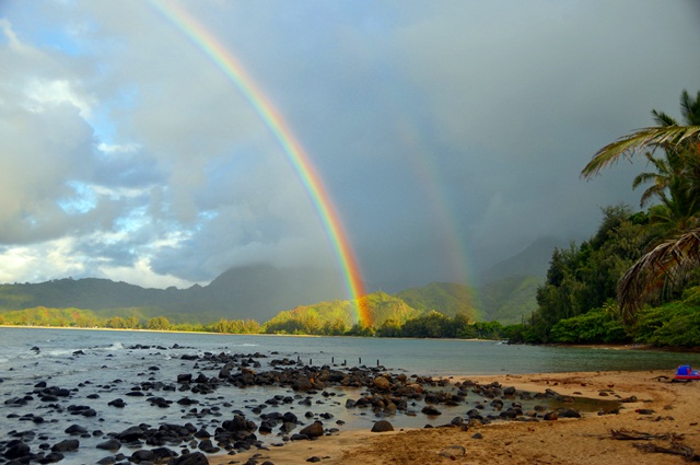
We’ll find windward showers tonight into Sunday – locally at times
Our trade winds will remain active…strengthening
The following numbers represent the most recent top wind gusts (mph), along with directions as of Saturday evening:
24 Port Allen, Kauai – ENE
28 Kuaokala, Oahu – ENE
21 Molokai – NE
24 Lanai – NE
16 Kahoolawe – NE
16 Lipoa, Maui – NE
16 South Point – NE
Here are the latest 24-hour precipitation totals (inches) for each of the islands as of Saturday evening:
1.33 Mount Waialeale, Kauai
0.31 Waihee Pump, Oahu
0.03 Molokai
0.00 Kahoolawe
0.00 Lanai
0.43 Kula 1, Maui
1.55 Ahumoa, Big Island
We can use the following links to see what’s going on in our area of the north central Pacific Ocean. Here’s the latest NOAA satellite picture – the latest looping satellite image… and finally the latest looping radar image for the Hawaiian Islands.
~~~ Hawaii Weather Narrative ~~~
The trade winds will continue…then increase some right after the weekend. Here’s a weather chart showing lots of low pressure systems, and cold fronts to the northwest and north of the state. At the same time, we find the tail-end of a trough of low pressure, over the ocean just to the east of the Big Island. The trade winds are forecast to last well into the future.
A few windward showers locally, with a few elsewhere at times into Sunday. Satellite imagery shows low clouds both offshore, and over the islands in places too. There’s a thunderstorms, dropping heavy rains over the ocean to the west and northwest of Kauai. Here’s the looping radar image, showing light-moderate showers moving across the the windward sides of the islands…with a few more expected.
It’s the weekend…Saturday was a lovely day, with all the ingredients associated with a trade wind weather pattern. The breezes of course were a big part of the scene, along with the common puffy cumulus clouds gathering here and there…and a few showers falling from their bases at times. Looking ahead, we’re moving into a period of stronger trade winds going forward, along with a fairly typical windward shower regime. I’ll be back early Sunday morning with your next new weather narrative, I hope you have a great Saturday Saturday night wherever you’re spending it! Aloha for now…Glenn.
Friday Evening Film: There’s a film that I thought I was going to pass over, although my neighbor Jeff liked it enough, that he’s talked me into seeing it. It’s called 2 Guns, starring Denzel Washington, Mark Wahlberg, and Paula Patton…among many others.
The synopsis: Contraband director Baltasar Kormákur and star Mark Wahlberg reteam for this all-star thriller centered on the fragile alliance between two operatives from rival bureaus, neither of whom realize that the other is working undercover. For the past year, U.S. naval intelligence officer Marcus Stigman (Wahlberg) and DEA agent Bobby Trench (Denzel Washington) have been on a covert mission to infiltrate a powerful narcotics syndicate. In the criminal underworld, trust comes in short supply. Stigman and Trench have been forced to work as partners, but continue to eye one another with an air of suspicion. Both men realize their only hope for survival is to stick together, however, after a sensitive mission involving a Mexican drug cartel goes horribly awry. Their identities compromised as their respective agencies deny any knowledge of their existence, Stigman and Trench must now elude capture by the authorities while using their acute criminal know-how to also strike back at the ruthless gangsters who would sooner see them six-feet underground, rather than rotting away behind bars.
~~~ This film was great, and I’m glad I followed the guidance of my neighbor to see it. It had all the necessary fighting and such, to keep the edge going throughout this action film…no lack of that. I typically don’t see films with these two particular actors in them, although this time around, I enjoyed their interactions quite a bit. If you enjoy these kinds of rough films, with lots of macho stuff being thrown at you, I think you would enjoy seeing this one. As far as a grade goes, I’m going with a B+ in terms of entertainment value. Here’s the trailer, just in case you have any curiosity about what I saw.
World-wide tropical cyclone activity: There are no active tropical cyclones
POST-TROPICAL CYCLONE HUMBERTO IS LOCATED ABOUT 1000 MILES SOUTHWEST
OF THE AZORES. THE CYCLONE CONTINUES TO PRODUCE SOME DISORGANIZED
SHOWER ACTIVITY…BUT UPPER-LEVEL WINDS ARE CURRENTLY NOT CONDUCIVE
FOR REDEVELOPMENT. CONDITIONS ARE FORECAST TO BECOME MORE
FAVORABLE FOR REGENERATION DURING THE NEXT DAY OR TWO AS THE SYSTEM
MOVES WEST-NORTHWESTWARD AT AROUND 15 MPH. THIS SYSTEM HAS A HIGH
CHANCE…70 PERCENT…OF BECOMING A TROPICAL CYCLONE AGAIN DURING
THE NEXT 48 HOURS…AND A HIGH CHANCE…90 PERCENT…OF BECOMING A
TROPICAL CYCLONE IN FIVE DAYS.
Caribbean Sea: There are no active tropical cyclones
Gulf of Mexico: Hurricane 10L (Ingrid) remains active in the southwest Gulf of Mexico…very near Mexico. Here’s the National Hurricane Center’s graphical track map…along with a NOAA satellite image.
Here’s a satellite image of the Caribbean Sea…and the Gulf of Mexico.
Here’s the link to the National Hurricane Center (NHC)
Eastern Pacific: Tropical storm 13E (Manuel) is active in the northeast Pacific…offshore from the Mexican coast. Here’s the National Hurricane Center’s graphical track map…along with a NOAA satellite image.
Here’s a wide satellite image that covers the entire area between Mexico, out through the central Pacific…to the International Dateline.
Central Pacific Ocean: There are no active tropical cyclones
Here’s a link to the Central Pacific Hurricane Center (CPHC)
Western Pacific Ocean: Tropical storm 16W (Man-yi) remains active in the western Pacific. Here’s the JTWC graphical track map…along with a NOAA satellite image.
South Pacific Ocean: There are no active tropical cyclones
North and South Indian Oceans: There are no active tropical cyclones
Here’s a link to the Joint Typhoon Warning Center (JTWC)