


Air Temperatures – The following maximum temperatures were recorded across the state of Hawaii Tuesday:
84 Lihue, Kauai
85 Honolulu, Oahu
84 Molokai
89 Kahului, Maui
86 Kona, Hawaii
83 Hilo, Hawaii
Air Temperatures ranged between these warmest and coolest spots near sea level – and on the highest mountain tops around the state…as of 810pm Tuesday evening:
Kailua Kona – 80
Hilo, Hawaii – 73
Haleakala Summit – 43 (near 10,000 feet on Maui)
Mauna Kea Summit – 34 (13,000+ feet on the Big Island)
Hawaii’s Mountains – Here’s a link to the live web cam on the summit of near 13,800 foot Mauna Kea on the Big Island of Hawaii. This web cam is available during the daylight hours here in the islands…and when there’s a big moon shining down during the night at times. Plus, during the nights you will be able to see stars, and the sunrise and sunset too… depending upon weather conditions. Here’s the Haleakala Crater webcam on Maui – if it’s working.
Aloha Paragraphs
Small Craft Wind Advisory…coastal and channel waters
around Maui County and the Big Island
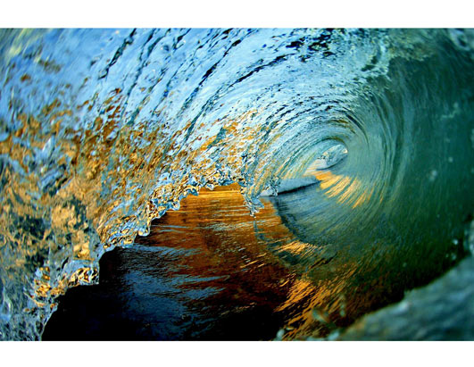
High Surf Advisory…south facing shores
Wind Advisory…on the Big Island summits and
the summit on the Haleakala Cratre on Maui
Locally strong and gusty trade winds, dry weather
prevails…other than just a few windward showers
during the nights mostly
The following numbers represent the most recent top wind gusts (mph), along with directions as of Tuesday evening:
24 Waimea Heights, Kauai – W
40 Kuaokala, Oahu – NE
30 Molokai – NE
39 Lanai – NE
35 Kahoolawe – ENE
35 Kahului, Maui – NE
30 Kealakomo, Big Island – NE
Here are the latest 24-hour precipitation totals (inches) for each of the islands as of Tuesday evening:
0.14 Mount Waialeale, Kauai
0.05 Moanalua, Oahu
0.10 Molokai
0.00 Kahoolawe
0.04 Hana airport, Maui
0.33 Kealakekua, Big Island
We can use the following links to see what’s going on in our area of the north central Pacific Ocean. Here’s the latest NOAA satellite picture – the latest looping satellite image… and finally the latest looping radar image for the Hawaiian Islands.
~~~ Hawaii Weather Narrative ~~~
Rather strong and gusty trade winds, right on through the rest of this week…and beyond. Here’s a weather chart showing two near 1025 millibar high pressure systems located well to the northeast of our islands, which are responsible for keeping our trade winds going. A late season cold front is moving by to the north of the state, although won’t make it close to our islands.
A fairly typical trade wind weather pattern, albeit on the windy side, remaining generally dry through Friday…with some increase in windward showers by the weekend. Satellite imagery shows patchy stable looking low clouds to the east through northeast, being carried along in the trade wind flow, arriving along our windward sides. Here’s the looping radar image, showing hardly any showers pushing through the state. The windward sides may find a few very light misty showers arriving overnight, although accumulations will remain light. The leeward sides should remain very dry statewide, with more good weather gracing those south and west facing beaches again on Wednesday. Speaking of the leeward beaches, there will high surf breaking there, watch out for those larger than normal waves!
Here at my Kula weather tower on Maui, it was partly cloudy and near calm…the air temperature was 69.1F degrees – at 818pm this evening. I’ll be back with your next new weather narrative from paradise, early Wednesday morning, have a great Tuesday night until then! Aloha for now…Glenn
World-wide tropical cyclone activity:
Atlantic Ocean/Caribbean Sea: There are no active tropical cyclones / Here’s a link to the National Hurricane Center in Miami…which covers tropical cyclone activity in the Atlantic, Caribbean Sea…and the Gulf of Mexico.
A BROAD AREA OF LOW PRESSURE OVER THE CENTRAL GULF OF MEXICO IS PRODUCING A LARGE AREA OF DISORGANIZED THUNDERSTORMS AND STRONG GUSTY WINDS OVER THE SOUTHEASTERN GULF OF MEXICO. ALTHOUGH THE THUNDERSTORM ACTIVITY ASSOCIATED WITH THE LOW HAS INCREASED OVERNIGHT…THE CIRCULATION REMAINS POORLY-DEFINED. ENVIRONMENTAL CONDITIONS COULD BECOME A LITTLE MORE CONDUCIVE FOR DEVELOPMENT DURING THE NEXT DAY OR SO…AND A TROPICAL DEPRESSION OR STORM COULD FORM BEFORE THE SYSTEM MOVES NORTHEASTWARD OVER NORTHERN FLORIDA LATE THURSDAY OR THURSDAY NIGHT. THIS SYSTEM HAS A MEDIUM CHANCE…50 PERCENT…OF BECOMING A SUBTROPICAL OR TROPICAL CYCLONE DURING THE NEXT 48 HOURS. AN AIR FORCE RESERVE RECONNAISSANCE AIRCRAFT IS SCHEDULED TO INVESTIGATE THIS DISTURBANCE THIS AFTERNOON…IF NECESSARY. REGARDLESS OF DEVELOPMENT…LOCALLY HEAVY RAINS AND GUSTY WINDS ARE LIKELY OVER PORTIONS OF CENTRAL AND WESTERN CUBA…THE FLORIDA KEYS…AND THE FLORIDA PENINSULA DURING THE COUPLE OF DAYS.
Here’s a satellite image showing this tropical disturbance.
Here’s what the forecast models are doing with this tropical disturbance
ELSEWHERE, TROPICAL CYCLONE FORMATION IS NOT EXPECTED DURING THE NEXT 48 HOURS.
Gulf of Mexico: There are no active tropical cyclones
Eastern Pacific: There are no active tropical cyclones
Tropical cyclone formation is not expected during the next 48 hours
Here’s a wide satellite image that covers the entire area between Mexico, out through the central Pacific…to the International Dateline.
Central Pacific Ocean: There are no active tropical cyclones / Here’s a link to the Central Pacific Hurricane Center (CPHC)…covering our central Pacific.
No Tropical cyclones are expected through Thursday night
Western Pacific Ocean: There are no active tropical cyclones / Here’s a link to the Joint Typhoon Warning Center (JTWC), which covers tropical cyclone activity in the western Pacific, and the North and South Indian Ocean…and adjacent Seas.
South Pacific Ocean: There are no active tropical cyclones
North and South Indian Oceans: There are no active tropical cyclones
Glenn Says:
Interesting. http://www.mauinews.com/page/content.detail/id/573294/Where-have-the-trade-winds-gone-.html?nav=5031
Glenn in South Jersey~~~Hi Glenn, thanks for pointing this article out! Aloha, Glenn