


Air Temperatures – The following maximum temperatures were recorded across the state of Hawaii Thursday:
Lihue, Kauai – 77
Honolulu airport, Oahu – 80
Molokai airport – 80
Kahului airport, Maui – 81
Kona airport, Hawaii – 81
Hilo airport, Hawaii – 79
Air Temperatures ranged between these warmest and coolest spots near sea level – and on the highest mountain tops around the state…as of 530am Friday morning:
Kaneohe, Oahu – 72
Kahului, Maui – 60
Haleakala Summit – 41 (near 10,000 feet on Maui)
Mauna Kea Summit – 30 (13,000+ feet on the Big Island)
Hawaii’s Mountains – Here’s a link to the live web cam on the summit of near 13,800 foot Mauna Kea on the Big Island of Hawaii. This web cam is available during the daylight hours here in the islands…and when there’s a big moon shining down during the night at times. Plus, during the nights you will be able to see stars, and the sunrise and sunset too…depending upon weather conditions. Here's the Haleakala Crater webcam on Maui – if it's working.
Tropical Cyclone activity in the eastern and central Pacific – Here’s the latest weather information coming out of the National Hurricane Center, covering the eastern north Pacific. You can find the latest tropical cyclone information for the central north Pacific (where Hawaii is located) by clicking on this link to the Central Pacific Hurricane Center. A satellite image, which shows the entire ocean area between Hawaii and the Mexican coast…can be found here. The 2012 hurricane season is over in the eastern and central Pacific…resuming on May 15th and June 1st 2013.
Aloha Paragraphs
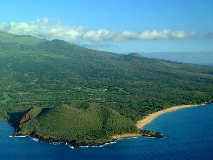
Makena Beach, Maui
Cool Friday morning, a few showers Friday afternoon
in the upcountry areas, increasing showers Saturday
afternoon – lighter winds from the southwest to
southeast…with volcanic haze Friday
A cold front will bring rainfall to the state Saturday
evening through Sunday, locally heavy…first on
Kauai, and then the rest of the state
~~~538am HST Friday morning: clear and calm
at my upcountry Kula, Maui weather tower,
the air temperature was 51.1F degrees~~~
The following numbers represent the most recent top wind gusts (mph), along with directions as of Thursday evening:
16 Puu Opae, Kauai – SW
15 Waianae Valley, Oahu – SW
22 Molokai – S
24 Kahoolawe – E
16 Kaupo Gap, Maui – NW
20 Upolu airport, Big Island – NE
Here are the latest 24-hour precipitation totals (inches) for each of the islands as of Thursday evening:
0.88 Anahola, Kauai
0.47 Kahuku Trng, Oahu
0.03 Molokai
0.00 Lanai
0.00 Kahoolawe
0.17 Puu Kukui, Maui
0.58 Kawainui Stream, Big Island
We can use the following links to see what’s going on in our area of the north central Pacific Ocean. Here's the latest NOAA satellite picture – the latest looping satellite image…and finally the latest looping radar image for the Hawaiian Islands.
~~~ Hawaii Weather Narrative ~~~
Our winds have turned lighter from the southeast to southwest…which will prevail into the weekend. Here's a weather chart showing high pressure systems to the northeast of Hawaii. At the same time, we see an extended cold front to our northwest…whose parent low is a deep, near 954 millibar storm far north. Our local winds have become much lighter, having veered to the southeast and south, locally even southwest. This has occurred thanks to a late winter cold front, as it continues to advance towards the islands now. This front will move down through the state this weekend. Cooler north to northeast breezes will fill in behind the frontal passage…late Sunday into early next week.
Satellite imagery shows low clouds generally over the interior sections of the islands, with some light cirrus to the north of the state. The overlying atmosphere remains on the dry and stable side, which will continue to limit the intensity, and overall bearing of any showers. This condition should begin to change, with showers becoming heavier by Saturday afternoon. This larger satellite picture shows an area of bright white, high level cloudiness to the north, with another area to our southeast. We're also able to see the cold front to our northwest, which will reach the state this weekend…bringing showers as it rides into the state later Saturday into Sunday. There's a chance that some of these frontal showers will become quite heavy.
The models, at least some of them, want to stall the front over Maui and the Big Island later Sunday into Monday. If this were to happen, those eastern islands in the chain would remain showery into early next week. The Kauai end of the chain would be drier, which could include Oahu as well. Thereafter, the winds will turn slightly cooler from the north in the wake of the frontal passage, helping to ventilate the atmosphere of the voggy conditions. The trades will follow these northerly breezes, becoming moderately strong for several days. I'll have more information on all of the above, when I issue my next weather narrative early Friday morning. I hope you have a great Thursday night wherever you happen to be spending it! Aloha for now…Glenn.
World-wide tropical cyclone activity:
Atlantic Ocean/Caribbean Sea: There are no active tropical cyclones
Gulf of Mexico: There are no active tropical cyclones
Eastern Pacific Ocean: There are no active tropical cyclones
Central Pacific Ocean: There are no active tropical cyclones
Western Pacific Ocean: There are no active tropical cyclones
South Pacific Ocean: Tropical cyclone 19P (Sandra) remains active in the southwest Pacific, located approximately 645 NM northwest of Noumea, New Caledonia. TC 19P has 60 knot sustained winds, with gusts to near 75 knots. Here's the Joint Typhoon Warning Center (JTWC) graphical track map, along with a satellite image.
North and South Indian Oceans: There are no active tropical cyclones
Interesting: A new study looking at 11,000 years of climate temperatures shows the world in the middle of a dramatic U-turn, lurching from near-record cooling to a heat spike. Research released Thursday in the journal Science uses fossils of tiny marine organisms to reconstruct global temperatures back to the end of the last ice age. It shows how the globe for several thousands of years was cooling until an unprecedented reversal in the 20th century.
Scientists say it is further evidence that modern-day global warming isn't natural, but the result of rising carbon dioxide emissions that have rapidly grown since the Industrial Revolution began roughly 250 years ago.
The decade of 1900 to 1910 was one of the coolest in the past 11,300 years — cooler than 95 percent of the other years, the marine fossil data suggest. Yet 100 years later, the decade of 2000 to 2010 was one of the warmest, said study lead author Shaun Marcott of Oregon State University. Global thermometer records only go back to 1880, and those show the last decade was the hottest for this more recent time period.
"In 100 years, we've gone from the cold end of the spectrum to the warm end of the spectrum," Marcott said. "We've never seen something this rapid. Even in the ice age the global temperature never changed this quickly." Using fossils from all over the world, Marcott presents the longest continuous record of Earth's average temperature.
One of his co-authors last year used the same method to look even farther back. This study fills in the crucial post-ice age time during early human civilization. Marcott's data indicates that it took 4,000 years for the world to warm about 1.25 degrees from the end of the ice age to about 7,000 years ago.
The same fossil-based data suggest a similar level of warming occurring in just one generation: from the 1920s to the 1940s. Actual thermometer records don't show the rise from the 1920s to the 1940s was quite that big and Marcott said for such recent time periods it is better to use actual thermometer readings than his proxies.
Before this study, continuous temperature record reconstruction only went back about 2,000 years. The temperature trend produces a line shaped like a "hockey stick" with a sudden spike after what had been a fairly steady line. That data came from tree rings, ice cores and lake sediments. Marcott wanted to go farther back, to the end of the last ice age in more detail by using the same marine fossil method his colleague used.
That period also coincides with a "really important time for the history of our planet," said Smithsonian Institution research anthropologist Torben Rick. That's the time when people started to first domesticate animals and start agriculture, which is connected to the end of the ice age. Marcott's research finds the climate had been gently warming out of the ice age with a slow cooling that started about 6,000 years ago. Then the cooling reversed with a vengeance.
The study shows the recent heat spike "has no precedent as far back as we can go with any confidence, 11,000 years arguably," said Pennsylvania State University professor Michael Mann, who wrote the original hockey stick study but wasn't part of this research. He said scientists may have to go back 125,000 years to find warmer temperatures potentially rivaling today's.
However, another outside scientist, Jeff Severinghaus of the Scripps Institution of Oceanography thinks temperatures may have been notably warmer just 12,000 years ago, at least in Greenland based on research by some of his colleagues.
Several outside scientists praised the methods Marcott used, but said it might be a bit too oriented toward the Northern Hemisphere. Marcott said the general downward trend of temperatures that reversed 100 years ago seemed to indicate the Earth was heading either toward another ice age or little ice age from about 1550 to 1850.
Or it was continuing to cool naturally until greenhouse gases from the burning of fossil fuels changed everything. The reason the globe warmed after the ice age and then started cooling about 6,000 years ago has to do with the tilt of the Earth and its distance from the sun, said Marcott and Severinghaus.
Distance and angle in the summer matter because of heat absorption and reflection and ground cover. "We have, through human emissions of carbon dioxide and other heat-trapping gases, indefinitely delayed the onset of the next ice age and are now heading into an unknown future where humans control the thermostat of the planet," said Katharine Hayhoe, an atmospheric scientist at Texas Tech University, responding in an email.
Laura Says:
Good morning Glenn,
Cheers from Calgary! It's a bright beautiful morning here, relatively speaking of course. Not really up on my farenheit anymore but probably around 28 degrees or so?? We aren't able to do our annual spring break trip this year so are coming in May instead. What can you tell me about west Maui weather at this time of the year? Looking so forward to a beautiful, relaxing quiet beach. Have a great weekend.
Laura Fortier
Calgary, CAN~~~Hi Laura, west Maui in the spring is lovely, warm and sunny, quiet and relaxing…you got it! I hope you have another wonderful vacation this time around, and I’m sure you will! Aloha, Glenn