


Air Temperatures – The following maximum temperatures were recorded across the state of Hawaii Wednesday afternoon:
Lihue, Kauai – 80
Honolulu airport, Oahu – 73
Molokai airport – 82
Kahului airport, Maui – 82
Kona airport – 83
Hilo airport, Hawaii – 80
Air Temperatures ranged between these warmest and coolest spots near sea level – and on the highest mountain tops around the state…as of 630pm Wednesday evening:
Kailua-kona – 77
Hana airport, Maui – 72
Haleakala Summit – M (near 10,000 feet on Maui)
Mauna Kea Summit – 37 (near 13,800 feet on the Big Island)
Hawaii’s Mountains – Here’s a link to the live web cam on the summit of near 13,800 foot Mauna Kea on the Big Island of Hawaii. This web cam is available during the daylight hours here in the islands…and when there’s a big moon shining down during the night at times. Plus, during the nights you will be able to see stars, and the sunrise and sunset too…depending upon weather conditions. Here's the Haleakala Crater webcam on Maui.
Tropical Cyclone activity in the eastern and central Pacific – Here’s the latest weather information coming out of the National Hurricane Center, covering the eastern north Pacific. You can find the latest tropical cyclone information for the central north Pacific (where Hawaii is located) by clicking on this link to the Central Pacific Hurricane Center. A satellite image, which shows the entire ocean area between Hawaii and the Mexican coast…can be found here.
Aloha Paragraphs
Winds coming in from the southeast…locally voggy
Cool mornings, cloudy afternoons
interior sections…just a few showers
Nice colorful sunrise this morning
The following numbers represent the most recent top wind gusts (mph), along with directions as of Wednesday evening:
20 Waimea Heights, Kauai – SE
20 Kahuku, Oahu – SE
18 Molokai – E
23 Kahoolawe – ESE
21 Lipoa, Maui – SE
12 Lanai – SE
18 Upolu airport, Big Island – ESE
Here are the latest 24-hour precipitation totals (inches) for each of the islands as of Wednesday evening:
0.48 Mount Waialeale, Kauai
0.14 St. Stephens, Oahu
0.00 Molokai
0.00 Lanai
0.00 Kahoolawe
0.06 Puu Kukui, Maui
0.32 Kawainui Stream, Big Island
We can use the following links to see what’s going on in our area of the north central Pacific Ocean. Here's the latest NOAA satellite picture – the latest looping satellite image…and finally the latest looping radar image for the Hawaiian Islands.
~~ Hawaii evening commentary ~~
Our winds are now veering to the southeast, which will bring volcanic haze over some parts of the Aloha state. We currently have a weak high pressure system (weather map), located to the north of Hawaii…moving southeast. As this high gets closer, bringing its associated ridge over the state, our winds will slow way down. Meanwhile, we find multiple low pressure systems to our west, northwest, north and northeast! Our local winds will come up from the south and southeast Thursday into Friday. As we get into the weekend, we'll find our winds blowing from the south to southwest, ahead of a cold front expected to arrive over Kauai and then Oahu…later on Sunday.
As we look at this satellite image, we see a new batch of high cirrus clouds approaching from the southwest…with fairly minor low level clouds over the ocean in some directions. Nights will be clear and cold, alright tropically cool then…necessitating those extra blankets tonight. If those high clouds move in Thursday, we'll see some localized dimming of our sunshine. Otherwise, Thursday should start off clear, with warming sunshine into the noon hour. As we push into the afternoon, we'll see more of those upcountry clouds forming, although with just a few showers here and there through Friday.
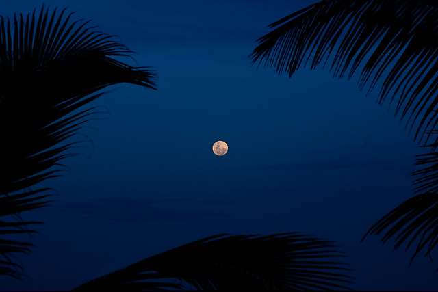
As we get into the weekend time frame, we'll find a cold front approaching from the west and northwest. The weather models are still trying to sort out the specifics, although we'll see showers arriving over Kauai, and probably Oahu during the second half of the weekend. Until then, our overlying atmosphere will remain quite dry and stable, with just a few showers around here and there. Conditions will moisten up as the frontal cloud band enters our area, prompting an increase in showers. Whether the front will push down into Maui County and the Big Island, is still a question. So, a relatively dry convective weather pattern will exist now into Saturday, which will provide generally nice weather, especially for our beaches. Looking further ahead, it looks like a modestly unsettled weather will prevail into the first half of next week, with fairly light winds, and afternoon convective showers around then. I'll be back early Thursday morning with your next new weather narrative. The just past full moon will still be very bright by the way. I hope you have a great Wednesday night wherever you're spending it! Aloha for now…Glenn.
World-wide tropical cyclone activity:
Atlantic Ocean/Caribbean Sea: There are no active tropical cyclones
Gulf of Mexico: There are no active tropical cyclones
Eastern Pacific Ocean: There are no active tropical cyclones
Central Pacific Ocean: There are no active tropical cyclones
Western Pacific Ocean: Tropical cyclone Bopha (26W) remains active in the western Pacific…located approximately 815 NM east-southeast of Palau. Sustained winds were 50 knots, with gusts to near 65 knots. The JTWC indicates that this system will reach typhoon status in 24 hours, as it moves well south of Guam and Yap, and then near to, or over Palau…onwards into the central Philippine Islands. Here's the JTWC graphical track map…along with a satellite image.
South Pacific Ocean: There are no active tropical cyclones
North and South Indian Oceans: There are no active tropical cyclones
Interesting: The Intergovernmental Panel on Climate Change (IPCC) projected an annual sea level rise last year in 2011 of 2 millimeters per year. According to new satellite data, there appears to be a stark difference between their projections and reality. Sea-levels are rising 60 percent faster than predicted, at a rate of 3.2 millimeters per year.
Global temperatures, on the other hand, are continuing to rise at the consistent pace which IPCC predicted. The study shows that the increased rate in sea-level rise is not significantly affected by internal variability in Earth's climate system, but is rather reflective of a general trend.
The research was published in the Institute of Physics' journal, Environmental Research Letters, and conducted by researchers from the Potsdam Institute for Climate Impact Research, Tempo Analytics, and Labatoire d'Etudes en Geophysique et Oceanographie Spatiales.
They believe that their findings will shed a light on the importance of tracking past predictions, especially since these IPCC predictions are frequently used by decision makers. Satellite data from the last 20 years on global temperatures and sea-levels were analyzed and compared with the IPCC prediction.
The general warming trend of 0.16 degrees C per decade was in line with the IPCC projection. This was even after short-term phenomena were excluded, such as solar variations, volcanic eruptions, and El Nino/Southern Oscillation.
To measure sea-level, satellites bounced radar off the water surface. This is a much more accurate method than tide gauges because the satellites have near-global coverage, and the tide gauges are only along the coast. The tide gauges are also influenced by non-climate factors like ocean currents and wind.
The result of their analysis was a sea-level rise rate that is 60 percent faster than previously predicted. According to lead author of the study, Stefan Rahmstorf, "This study shows once again that the IPCC is far from alarmist, but in fact has under-estimated the problem of climate change. That applies not just for sea-level rise, but also to extreme events and the Arctic sea-ice loss."