


Air Temperatures – The following maximum temperatures were recorded across the state of Hawaii Saturday afternoon:
Lihue, Kauai – 84
Honolulu airport, Oahu – 86
Molokai airport – 83
Kahului airport, Maui – 89
Kona airport – 85
Hilo airport, Hawaii – 85
Air Temperatures ranged between these warmest and coolest spots near sea level – and on the highest mountain tops around the state…as of 530pm Saturday evening:
Barking Sands, Kauai – 82
Hilo, Hawaii – 79
Haleakala Summit – 55 (near 10,000 feet on Maui)
Mauna Kea Summit – 46 (near 13,800 feet on the Big Island)
Hawaii’s Mountains – Here’s a link to the live web cam on the summit of near 13,800 foot Mauna Kea on the Big Island of Hawaii. This web cam is available during the daylight hours here in the islands…and when there’s a big moon shining down during the night at times. Plus, during the nights you will be able to see stars, and the sunrise and sunset too…depending upon weather conditions. Here's the Haleakala Crater webcam on Maui…although this webcam is not always working correctly.
Tropical Cyclone activity in the eastern and central Pacific – Here’s the latest weather information coming out of the National Hurricane Center, covering the eastern north Pacific. You can find the latest tropical cyclone information for the central north Pacific (where Hawaii is located) by clicking on this link to the Central Pacific Hurricane Center. A satellite image, which shows the entire ocean area between Hawaii and the Mexican coast…can be found here.
Aloha Paragraphs
Lighter winds into the new week
Afternoon interior showers…and
locally voggy skies through Tuesday
Good sunset today in some areas
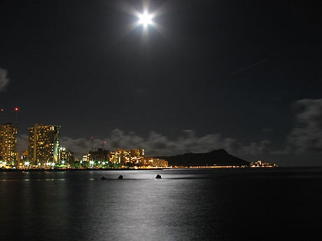
Big Full September Moon!
As this weather map shows, we have moderately strong high pressure systems located far to the northeast of the islands. At the same time, we have a near 1003 millibar developing gale low pressure system to our north, with its associated cold front moving south and southeast towards Hawaii. Our local winds will be easing up, and turning to the southeast Sunday from Kauai down to Oahu, perhaps still light trade winds around the Big Island…into the first part of the new work week.
The following numbers represent the most recent top wind gusts (mph), along with directions as of Saturday evening:
23 Port Allen, Kauai – SE
23 Kahuku Trng, Oahu – ESE
27 Molokai – N
30 Kahoolawe – ESE
32 Kahului, Maui – NE
22 Lanai – NE
28 Pali 2, Big Island – NE
We can use the following links to see what’s going on in our area of the north central Pacific Ocean. Here's the latest NOAA satellite picture – the latest looping satellite image…and finally the latest looping radar image for the Hawaiian Islands.
Here are the latest 24-hour precipitation totals (inches) for each of the islands as of Saturday evening:
0.03 Mount Waialeale, Kauai
0.12 Manoa Lyon Arboretum, Oahu
0.11 Molokai
0.00 Lanai
0.03 Kahoolawe
0.09 Puu Kukui, Maui
0.03 Mountain View, Big Island
~~ Hawaii Sunset Commentary ~~
Our trade winds will give way to east to southeast, or even southerly breezes…into the first half of the new week. We find moderately strong high pressure systems (weather map), located to the northeast of the islands this evening. At the same time we find a low pressure system moving by to our north…with its associated cold front dropping south and southeastward towards Hawaii. It's presence will turn our winds lighter through Wednesday…although the Big Island, and perhaps east Maui…may remain in a trade wind flow. We'll see the south to southeast breezes carry volcanic haze over parts of the island chain by Sunday for a couple of days. At the same time, aided by daytime heating of the islands…we'll likely see a afternoon showers in the leeward upcountry areas each afternoon through Tuesday or Wednesday. The trade winds will bring a few showers to the windward sides in the eastern part of the island chain. The trade winds will rebound around the middle of the new week, although the models keep them light to moderate. The latest models show another early season cold approaching the state towards next weekend, which will tamp down our trade winds again, and perhaps turn them southeast again then.
As we look at this satellite image, it shows scattered clouds upwind to the east and northeast, which will bring a few showers our way tonight. These lower level clouds will bring a few showers to our windward sides, although the leeward sides will remain dry in most areas. At the same time, there's a large area of high cirrus clouds to the north and northeast of the state, and another to our southwest, which will make for nice sunset colors locally.
Saturday evening film: several friends and I are heading down to Kahului soon, and then to see a new film. This is one that everyone seems to be taking about, called The Master, starring Joaquin Phoenix, Amy Adams, and Philip Seymour Hoffman…among many others. The synopsis: a Naval veteran arrives home from war unsettled and uncertain of his future – until he is tantalized by The Cause and its charismatic leader. This dramatic film is getting good reviews, and based on those, as well as the trailer, I'm excited about seeing it. I'll let you know what we all thought Sunday morning.
Here in Kula, Maui at 525pm Saturday evening, it was partly to mostly cloudy…with an air temperature of 69.3F degrees. As mentioned above, we'll see a few windward showers falling at times, mostly during the night and early morning hours on the Big Island and perhaps Maui. As we move through the rest of this weekend, our winds will gradually veer to the southeast and even south and become lighter, in response to an area of low pressure developing to our north. This developing gale low pressure system has an associated cold front, which will push a ridge of high pressure down closer to our islands…and eventually right over Kauai and Oahu. As this happens, we'll find the resultant lighter winds, and the daytime heating of the islands, combining to trigger afternoon clouds and showers over the upcountry leeward slopes. There's a good chance of volcanic haze spreading up from the Big Island vents, to other parts of the state later Sunday into the first part of the new week. This lighter wind regime, with locally hazy skies, afternoon upcountry showers…will prevail perhaps until Tuesday or Wednesday. Thereafter, the ridge will move northward again, allowing light to moderately strong trade winds to return, along with those common windward biased showers.
~~~ I got up even earlier than I usually do this morning, because I took the drive over to Kihei well before dawn, joining a good friend of mine to surf. I hadn't surfed for a while, so it was great to get back in the water! Later in the day I went down to Paia to see a Zen Master friend of mine, who lives in the Sierra Nevada foothills of California. He gave a talk at the Buddhist Mission down on the beach there. I'm now heading down to Kahului with my neighbor Jeff, and several other friends, to see this new film called The Master…which looks very good! By the way, last evening I went down to the Astronomy Institute for their annual open house in Pukalani. It was fun to socialize in such a big crowd, although the main event was a talk Jeff gave, on the Roundness of the Sun…which was great. I'll be back Sunday morning with your next new weather narrative, I hope you have a great Saturday night wherever you're spending it! Aloha for now…Glenn.
Extra: youtube music video, Coldplay…Yellow live in Sydney 2003 (best in full screen view)
World-wide tropical cyclone activity:
Atlantic Ocean/Caribbean Sea: Hurricane Nadine remains active, located about 640 miles west of the Azores. Sustained winds were 90 mph, moving northwest at 9 mph. Here's the NHC graphical track map, along with the satellite image showing long lasting Nadine's position.
Gulf of Mexico: There are no active tropical cyclones
Eastern Pacific Ocean: There are no active tropical cyclones
Central Pacific Ocean: There are no active tropical cyclones
Western Pacific Ocean: Tropical storm Jelawat (19W) remains active…located about 70 NM west of Yokosuka, Japan. This tropical cyclone currently has sustained winds of 55 knots, with gusts to near 70 knots. The JTWC shows Jelawat continuing to slowly weaken. Here's a graphical track map, along with a satellite image.
Tropical depression 20W is now active about 305 NM northeast of Guam. This tropical cyclone has 25 knot sustained winds, with gusts to near 35, and will be strengthening into a tropical storm later today…and then to a typhoon within 48 hours. Here's a JTWC graphical track map, along with a satellite image of this depression.
South Pacific Ocean: There are no active tropical cyclones
North and South Indian Oceans: There are no active tropical cyclones
Interesting: The first traces of plastic debris have been found in the once pristine environment of the Southern Ocean, according to a new study. The findings come after a 2.5-year, 70,000-mile voyage by the French scientific research vessel Tara, which has been sailing the world's oceans to investigate the impacts of climate change. Samples from locations in the Southern Ocean and Antarctica revealed traces of plastic waste at a rate comparable to the global average.
This came as a surprise to the researchers, who had expected levels some ten times lower. "Discovering plastic at these very high levels was completely unexpected because the Southern Ocean is relatively separated from the world's other oceans and does not normally mix with them," said Chris Bowler, scientific coordinator of Tara Oceans.
In addition to large items of waste, such as plastic bags, bottles and other plastic items, the world's oceans also contain microscopic fragments that result from the degradation of larger items through years of exposure to seawater and sunlight. The researchers were surprised to find that synthetic fibers, largely made up of clothing residues from washing machines, also comprised a significant portion of the plastic fragments they found.
Plastic pollution has many long-lasting and even fatal impacts on marine life. Birds, fish and other animals are known to regularly consume plastic waste, mistaking it for jellyfish or other prey, but it cannot be digested and remains in the stomach. Plastics also slowly release toxins and other chemicals, which can build up in the food chain.
Although it is difficult to identify the main source of the waste in the Southern Ocean, much of it is thought to originate from Africa, South America, or Australia. Sadly, the fact that plastic debris has reached the Southern Ocean shows that our throw-away culture now has impacts around the globe. Talking about the findings in the Southern Ocean, Chris Bowler said, "We had always assumed that this was a pristine environment, very little touched by human beings.
The fact that we found these plastics is a sign that the reach of human beings is truly planetary in scale." According to Bowler, it is too late to do much about the plastic already circulating in our oceans, as it will take thousands of years to degrade. However, we can take action against future pollution, for example by advocating the use of biodegradable materials and by changing consumer attitudes and behavior.
The research ship Tara will continue its marine research in 2013, when it will travel to the Arctic to investigate the impacts of melting sea ice, a result of global climate change.
Jean Tappan Says:
Aloha Glenn. Here you are talking about going to the beach for some sunning and surfing and we had our first snowfall yesterday. I am so envious! This seems pretty early for snow, even for the tried and true Alaskans, especially since we had very little summer this year. The snow didn't stick but it was a reminder of what's to come in the very near future.
Enjoy your vacation and I hope you'll post updates. Best regards. Jean~~~Hi Jean, wow, already some flurries coming down up there at your place in Alaska! I can certainly understand your envy, as when I was coming back from surfing in Kihei, after breakfast with a friend, around 1030am…my car thermometer said 91F degrees on the road! I will of course be doing the same thing as I do each year, and adding my travel notes to this page while I’m away. You and your husband be well Jean, best wishes, Aloha, Glenn