


Air Temperatures – The following maximum temperatures were recorded across the state of Hawaii Thursday:
Lihue, Kauai – 79
Honolulu airport, Oahu – 81
Kaneohe, Oahu – 79
Molokai airport – 80
Kahului airport, Maui – 82 (record high for the date – 89 – 1953)
Kona airport – 80
Hilo airport, Hawaii – 80
Air Temperatures ranged between these warmest and coolest spots near sea level – and on the highest mountain tops…as of 5pm Thursday evening:
Kalaeloa, Oahu – 80
Kapalua, Maui – 72
Haleakala Crater – 41 (near 10,000 feet on Maui)
Mauna Kea – 30 (near 13,800 feet on the Big Island)
Hawaii’s Mountains – Here’s a link to the live web cam on the summit of near 13,800 foot Mauna Kea on the Big Island of Hawaii. This web cam is available during the daylight hours here in the islands…and when there’s a big moon shining down during the night at times. Plus, during the nights you will be able to see stars, and the sunrise and sunset too…depending upon weather conditions. Here's the Haleakala Crater webcam on Maui.
Aloha Paragraphs
Trade winds easing up in strength some –
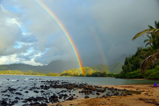
localized showers…especially windward sides –
rough surf along our east facing beaches –
increasing high cirrus clouds from the northwest
As this weather map shows, we have high pressure systems to the north and northeast of the islands. At the same time we have a weakening cold front to the north of Kauai…and a trough of low pressure to the west of Kauai. Our winds will gradually relax in strength from the trade wind direction.
The following numbers represent the strongest wind gusts (mph), along with directions Thursday evening:
14 Princeville, Kauai – ENE
21 Bellows, Oahu – NE
25 Molokai – NE
35 Kahoolawe – ENE
30 Kahului, Maui – NE
00 Lanai
29 South Point, Big Island – NE
We can use the following links to see what’s going on in our area of the north central Pacific Ocean Thursday evening. Looking at this NOAA satellite picture we see an area of high and middle level clouds over the ocean to the east. We can use this looping satellite image to see those brighter white clouds to the east…in addition to another large area of high and middle level clouds to the northwest…associated with an approaching cold front. Checking out this looping radar image we see light to moderate showers being carried into the islands in places…especially near and to the south of Kauai at the time of this writing.
Here are the 24-hour precipitation totals (inches) for each of the islands as of Thursday afternoon:
4.13 Mount Waialeale, Kauai
1.34 Nuuanu Upper, Oahu
0.04 Molokai
0.00 Kahoolawe
1.54 Puu Kukui, Maui
1.48 Waikii, Big Island
Sunset Commentary: Our winds will remain active, generally from the trade wind direction. The forecast continues to suggest that these trade winds will ease up some as we get into Friday and the weekend…in response to an approaching cold front. The computer models have been all over the map the last several days, suggesting kona winds with a cold front for the weekend…and then pointing towards trade winds with lots of windward biased showers. The latest forecast is sticking with trade winds Saturday and Sunday, continuing into next week.
Meanwhile, the locally gusty winds, which will become at least somewhat south of east, will carry showers our way at times. We continue to find an atmospheric destabilizing cold pool of air aloft, associated with an upper level low pressure system near the islands. Its presence is helping to keep our atmosphere more shower prone than usual…especially near the Kauai end of the island chain. The primary areas of shower activity will continue to be the windward coasts and slopes, although they will fall elsewhere at times too.
Here in Kula, Maui at 540pm HST, we had calm winds, cloudy skies, with an air temperature of 66F degrees. As noted above, most of our shower activity will be concentrated along the windward sides of the islands, with a few showers elsewhere at times. The trade winds are gradually declining in strength, although will remain in the light to moderately strong category, along with those occasional stronger gusts locally. As we move forward from here, we're expecting an upper level low pressure to settle into the area northwest of the state. This placement of a cold pool of air in association with this upper low…will make for potentially more showers to fall over the west end of the chain. Winds will veer somewhat to the south of east over Kauai and potentially Oahu, while further from the trough of low pressure, the Big Island and Maui will likely have more of a typical trade wind pattern, with windward biased showers into this weekend. ~~~ I'm just about ready to head out for my long fast evening walk, and will look forward to catching up with you in the morning, with more updates and my sunrise commentary then too. I just got back from that walk, and was pushing through dense fog and light showers, I found it very energizing. I hope you have a great Thursday night! Aloha for now…Glenn.
Interesting: The March 11, 2011 Tohoku earthquake is a grim reminder of the potential for another strong-motion mega-earthquake along the Pacific Northwest coast, geophysicist John Anderson of the University of Nevada, Reno told members of the American Association for the Advancement of Science in a lecture at their annual conference in Vancouver, B.C. February 19. "The Cascadia fault line, which runs from southern Canada all the way to Northern California, could have much stronger ground-motions than those observed in Japan," Anderson, a professor of geophysics, said.
"The Tohoku earthquake, while only half the length of Cascadia, is an analog for an earthquake that could happen here in the northwestern United States and southwestern British Columbia." Both Japan and Cascadia sit above subduction zones that dip at a low angle beneath the land. One might consider them roughly mirror images, he said.
"In this mirror image, one can see that if the same earthquake occurred in Cascadia, the fault would rupture to a significant distance inland, since the Cascadia trench sits much closer to the coastline than the trench off the coast of Japan, Anderson said.
"Some models predict that a Cascadia earthquake will not rupture so far under the land, but if it does, the data from the Tohoku earthquake predict stronger ground motions along our west coast than those seen in Japan. In any case, the ground motions from Tohoku are critical for understanding the seismic hazard here in Vancouver, and in Seattle, and Portland, and Eureka and all points in between."
In Cascadia, the last great earthquake occurred on January 26, 1700. Based on the size of the tsunami, the magnitude of that earthquake was about magnitude 9.0. "Although the average interval is apparently larger, earthquakes of this size in the past may have recurred with intervals of as small as about 300 years. So it would not be a scientific surprise if such an event were to occur in the near future," Anderson said.
"If you live in the Pacific northwest, look at the videos of Tohoku as a reminder to be prepared for an earthquake and tsunami." Anderson, who studies strong ground-motions, spent nine months recently as a visiting research professor at the Tokyo University, home of one of the world's premier seismology programs. Before coming to the University of Nevada, Reno in 1998, he earned his doctorate in geophysics from Columbia University and has held appointments at the California Institute of Technology, University of Southern California and the University of California at San Diego.
In his presentation at the AAAS conference, about the strong ground motions in the Tohoku earthquake, he discusses the significance of the data, the effects of the source on the nature of the data, the effects of site response, and some discussion of the engineering effects. "There have of course been other mega-earthquakes, but this is by far the best-recorded," he said.
"The Japanese event will undoubtedly stand as the best-recorded megaquake for a long time to come, both because megaquakes are rare and because no place is as well instrumented as the islands of Japan." For instance, the strong ground motions that could be generated along Cascadia, unfortunately, might not be observed nearly as thoroughly, since the strong motion instrumentation in most of the Cascadia region is sparse compared to Japan.
Stephen Godwin Says:
To the hawaiiweathertoday.com owner, Thanks for the well-researched and well-written post!
~~~ Hi Stephen, you’re very welcome, I appreciate your positive feedback!
Aloha, Glenn