June 2010
Monthly Archive
Posted by Glenn
No Comments
June 20-21, 2010
Air Temperatures – The following maximum temperatures were recorded across the state of Hawaii Sunday afternoon:
Lihue, Kauai – 84
Honolulu, Oahu – 86
Kaneohe, Oahu – 82
Kaunakakai, Molokai – 84
Kahului, Maui – 87
Hilo, Hawaii – 79
Kailua-kona – 81
Air Temperatures ranged between these warmest and coolest spots near sea level around the state – and on the highest mountains…as of 5pm Sunday evening:
Port Allen, Kauai – 84
Hilo, Hawaii – 76
Haleakala Crater – missing (near 10,000 feet on Maui)
Mauna Kea summit – 45 (near 14,000 feet on the Big Island)
Precipitation Totals – The following numbers represent the largest precipitation totals (inches) during the last 24 hours on each of the major islands, as of Sunday afternoon:
0.63 Mount Waialaele, Kauai
0.10 Moanalua RG, Oahu
0.01 Molokai
0.00 Lanai
0.00 Kahoolawe
0.13 West Wailuaiki, Maui
0.79 Waiakea Uka, Big Island
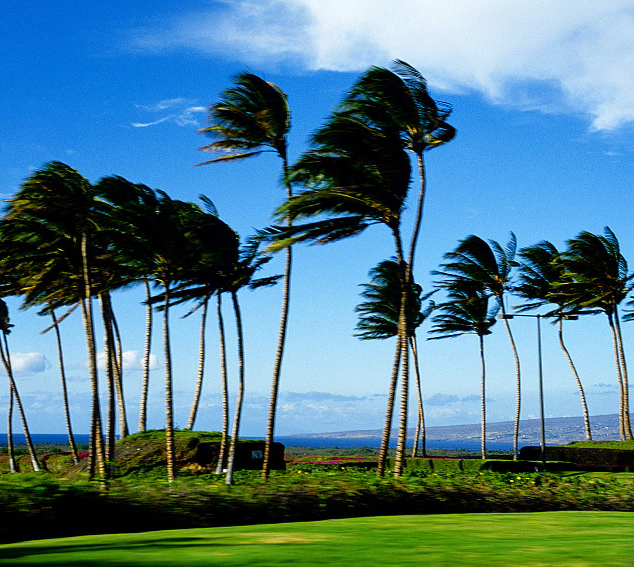
Marine Winds – Here’s the latest (automatically updated) weather map showing a large 1032 millibar high pressure system far to the northeast of the islands. This will keep moderately strong trade winds blowing through Tuesday…locally stronger and gusty during the afternoons.
Satellite and Radar Images: To view the cloud conditions we have here in Hawaii, please use the following satellite links, starting off with this Infrared Satellite Image of the islands to see all the clouds around the state during the day and night. This next image is one that gives close images of the islands only during the daytime hours, and is referred to as a Close-up visible image. This next image shows a larger view of the Pacific…giving perspective to the wider ranging cloud patterns in the Pacific Ocean. Finally, here’s a Looping IR satellite image, making viewable the clouds around the islands 24 hours a day. To help you keep track of where any showers may be around the islands, here’s the latest animated radar image.
Hawaii’s Mountains – Here’s a link to the live webcam on the summit of near 14,000 foot Mauna Kea on the Big Island of Hawaii. The tallest peak on the island of Maui is the Haleakala Crater, which is near 10,000 feet in elevation. These two webcams are available during the daylight hours here in the islands…and when there’s a big moon rising just after sunset for an hour or two! Plus, during the nights and early mornings you will be able to see stars, and the sunrise too…depending upon weather conditions.
Tropical Cyclone activity in the eastern and central Pacific – Here’s the latest weather information coming out of the National Hurricane Center, covering the eastern north Pacific. You can find the latest tropical cyclone information for the central north Pacific (where Hawaii is located) by clicking on this link to the Central Pacific Hurricane Center. Here’s a tracking map covering both the eastern and central Pacific Ocean. A satellite image, which shows the entire ocean area between Hawaii and the Mexican coast…can be found here. Of course, as we know, our hurricane season won’t begin again until June 1st here in the central Pacific.
Aloha Paragraphs

Trade wind weather continues…on Fathers Day
The trade winds will continue to blow across our islands, with a gradual strengthening Tuesday through Thursday. Small craft wind advisories remain active in those windiest areas in the southern part of the state Sunday night. The NWS forecast office in Honolulu may expand this advisory over other areas of the state, as the trade winds increase further by Tuesday. This latest weather map shows a moderately strong 1032 millibar high pressure system to the northeast of the Hawaiian Islands…the source of our moderately strong winds now.
The windward sides will see a few showers…most notably during the night and early morning hours. As this IR satellite image shows, there are relatively few clouds around the islands…most of which are taking aim on the Big Island and Maui’s windward sides. This looping radar image shows scattered showers moving through the state…on the easterly trade winds. This larger view of the central Pacific shows just a few minor thunderstorms in the deeper tropics. Otherwise, we’ll find lots of daytime sunshine, and good weather at our local beaches.
It’s Sunday evening as I begin writing this last section of today’s narrative update. We’ll find fairly normal weather conditions here in the islands Sunday into Monday. Moving into Tuesday, we’ll see generally good weather conditions, with gradually increasing wind speeds…along with a modest increase in windward biased showers for several days.
~~~ The eastern Pacific Ocean has its third and fourth tropical cyclones of the 2010 hurricane season. This satellite image shows their presence, along with a graphical track map. The National Hurricane Center in Miami is showing tropical depression Blas on a weakening trend, while hurricane Celia is strengthening. The good news is that neither of these tropical cyclones will have any bearing on the Hawaiian Islands…here in the central Pacific through at least the next week.
~~~ Sunday is the last full day of spring, as we move into the first day of summer early Monday morning. This transition into our summer season will be transparent, with little change expected in our local weather conditions. We will be getting a bit windier as we move through the upcoming week, and could see some increase in our windward showers through the mid-week period. Otherwise steady as she goes, with no end to our trade wind weather pattern in sight.
~~~ Last but certainly not least, here’s wishing all of you Dad’s out there a wonderful Father’s Day! This goes out especially to my own Dad, Ed James, who lives with my Mom Dorothy…in Long Beach, California. I hope you all have a great Sunday on this special day of the year! I’ll meet you here early Monday morning with your next new weather narrative. Aloha for now…Glenn.
Interesting: More than five tons of illegal bush meat is being smuggled in personal luggage each week through one of Europe’s busiest airports, reveals new research published in Conservation Letters. Working alongside customs officials at France’s Roissy-Charles de Gaulle airport, researchers from the Zoological Society of London (ZSL), The Royal Veterinary College (RVC) and The National Veterinary School and the Natural History Museum of Toulouse identified eleven bush meat species from confiscated luggage, including species of primate, crocodiles and pangolins.
This study quantifies for the first time the illegal trade of bush meat through a European airport. 134 passengers were searched from 29 flights over a period of 17 days. The single largest confiscation was of 51kg of bush meat carried by a single passenger with no other luggage.
"Our results estimate that around 270 tons of potentially contaminated illegal bush meat is passing unchecked through a single European airport per year, posing a huge potential risk to public health," says lead author Dr Anne-Lise Chaber, from ZSL and the RVC. The Central African Republic, Cameroon and the Democratic Republic of Congo were identified as the main sources of bush meat.
The researchers conducted conversations with three traders in Paris revealing that, as well as street trading, traders take orders in advance and arrange delivery of the goods to the customer. Co-author Dr Marcus Rowcliffe from ZSL says: "Our results show that this is a lucrative, organized trade feeding into a luxury market; a 4kg monkey will cost around €100 in France, compared with just €5 in Cameroon."
He adds: "Importing bush meat is relatively easy as customs officials are given no financial incentives to uncover illegal meat imports, compared with the bonuses they’re awarded for drug and counterfeit seizures. Also, penalties are very low for people caught carrying illegal meat." 39 per cent of the confiscated bush meat was identified as being listed under the Convention for the Trade in Endangered Species (CITES), highlighting the unsustainable nature of the trade and its potential impact on species of conservation concern.
In addition to wildlife conservation concerns, the illegal trade of such large quantities of bush meat raises serious questions about the importation of pathogens into Europe. "Surveillance methods need to be more robust and deterrents more severe if we’re to have any chance of halting this illegal trade," says co-author Dr Andrew Cunningham, from ZSL.
This is the first systematic study of the volume and nature of the international bush meat trade. The researchers now wish to undertake a wider-scale study with greater geographic coverage to determine the overall volume of the illegal bush meat trade into Europe.
Interesting2: New research by scientists funded by the Biotechnology and Biological Sciences Research Council (BBSRC) shows that malaria is tens of thousands of years older than previously thought. An international team, led by researchers at Imperial College London, have found that the potentially deadly tropical disease evolved alongside anatomically modern humans and moved with our ancestors as they migrated out of Africa around 60-80,000 years ago.
The research is published in the journal Current Biology. The findings and the techniques in the study could be important in informing current control strategies aimed at reducing the prevalence of malaria. There are an estimated 230 million cases each year, causing between 1 and 3 million deaths, and around 1.4bn people are considered to be at risk of infection.
Dr Francois Balloux from the Medical Research Council (MRC) Centre for Outbreak Analysis and Modelling at Imperial College London was lead researcher on the project. He said: "Most recent work to understand how malaria has spread across the tropics has worked on the premise that the disease arose alongside the development of agriculture around 10,000 years ago.
Our research shows that the malaria parasite has evolved and spread alongside humans and is at least as old as the event of the human expansion out of Africa 60-80,000 years ago." The international team worked on the largest collection of malaria parasites ever assembled. By characterising them by DNA sequencing they were able to track the progress of malaria across the tropics and to calculate the age of the parasite.
The scientists discovered clear correlation of decreasing genetic diversity with distance from sub-Saharan Africa. This accurately mirrored the same data for humans suggesting strong evidence of co-evolution and migration. Dr Balloux said: "The genetic sequencing of the malaria parasite shows a geographic spread pattern with striking similarities to studies on humans.
This points to a shared geographic origin, age and route of spread around the world. This understanding is important because despite the prevalence and deadly impact of malaria little research has previously been done to understand the genetic variation of the parasite. The genetic diversity of malaria parasites is central to their threat as it helps them to overcome the immune system and to develop drug resistance, making this research vital in informing new and more effective control strategies."
Interesting3: The Gulf of Mexico: what role will the Mississippi River play in oil washing ashore and into delta wetlands? One of the spill’s greatest environmental threats is to Louisiana’s wetlands, scientists believe. But there may be good news ahead. Scientists affiliated with the National Center for Earth-surface Dynamics (NCED), a National Science Foundation (NSF) Science and Technology Center headquartered at the University of Minnesota, are using long-term field plots in Louisiana’s Wax Lake Delta to measure the baseline conditions of, and track the effects of the oil spill on, coastal Louisiana wetlands.
Robert Twilley and Guerry Holm of Louisiana State University (LSU) are investigating the degree to which two delta wetland characteristics may help mitigate oil contamination. Fresh water head, as it’s called, the slope of the water’s surface from a river delta to the sea, and residence time of river-mouth wetlands, the time it takes water to move through a wetland at a river’s mouth, are important to understanding how delta wetlands will respond to the oil spill, say the researchers.
"Since the Mississippi River is currently at a relatively high stage, we expect the river’s high volume of freshwater to act as a hydrologic barrier, keeping oil from moving into the Wax Lake Delta from the sea," says Twilley. Twilley and Holm are performing baseline and damage assessments on the plants and soils of, and comparing oil degradation processes in, freshwater and saltwater Louisiana wetlands.
"The Mississippi River’s ‘plumbing’ provides a potential benefit to reducing the movement of oil onshore from shelf waters," says Twilley. The Mississippi’s flow has been altered for flood control to protect people and infrastructure in this working delta. River diversion structures–concrete gates built within the levees of the river–may be operated, however, to allow water to flow to specific coastal basins and floodways, says Twilley, "as a way to provide controlled floods."
The operational features of this system "downriver to the control structure near Venice, Louisiana," he says, "may provide a second line of defense against oil washing in." But any strategy using Mississippi River hydrology must be one of clear options and tradeoffs, says H. Richard Lane, program director in NSF’s Division of Earth Sciences, which funds NCED.
"As the river stage falls and protection diminishes," says Lane, "it becomes a question of how best to distribute this freshwater resource to defend the coast from the movement of oil onshore." The answer, Twilley says, lies in the delicate balance of river, coastal and Gulf of Mexico processes "that must work in concert to benefit the incredible ‘ecosystem services’ this region provides to the nation."
Louisiana wetlands "play a vital role in protecting New Orleans from hurricane damage, providing habitat for wildlife, supporting economically important fisheries, and maintaining water quality," says Efi Foufoula-Georgiou, director of NCED. "We must look at all options for protecting them for the future.
Posted by Glenn
1 Comment
June 19-20, 2010
Air Temperatures – The following maximum temperatures were recorded across the state of Hawaii Saturday afternoon:
Lihue, Kauai – 83
Honolulu, Oahu – 86
Kaneohe, Oahu – 82
Kaunakakai, Molokai – 85
Kahului, Maui – 88
Hilo, Hawaii – 81
Kailua-kona – 83
Air Temperatures ranged between these warmest and coolest spots near sea level around the state – and on the highest mountains…as of 5pm Saturday evening:
Barking Sands, Kauai – 85
Hilo, Hawaii – 77
Haleakala Crater – 55 (near 10,000 feet on Maui)
Mauna Kea summit – 41 (near 14,000 feet on the Big Island)
Precipitation Totals – The following numbers represent the largest precipitation totals (inches) during the last 24 hours on each of the major islands, as of Saturday afternoon:
0.35 Hanalei River, Kauai
0.14 Nuuanu Upper, Oahu
0.04 Molokai
0.00 Lanai
0.00 Kahoolawe
0.32 West Wailuaiki, Maui
0.22 Pahoa, Big Island
Marine Winds – Here’s the latest (automatically updated) weather map showing a large 1034 millibar high pressure system far to the northeast of the islands. This will keep moderately strong trade winds blowing through Monday…locally stronger and gusty during the afternoons.
Satellite and Radar Images: To view the cloud conditions we have here in Hawaii, please use the following satellite links, starting off with this Infrared Satellite Image of the islands to see all the clouds around the state during the day and night. This next image is one that gives close images of the islands only during the daytime hours, and is referred to as a Close-up visible image. This next image shows a larger view of the Pacific…giving perspective to the wider ranging cloud patterns in the Pacific Ocean. Finally, here’s a Looping IR satellite image, making viewable the clouds around the islands 24 hours a day. To help you keep track of where any showers may be around the islands, here’s the latest animated radar image.
Hawaii’s Mountains – Here’s a link to the live webcam on the summit of near 14,000 foot Mauna Kea on the Big Island of Hawaii. The tallest peak on the island of Maui is the Haleakala Crater, which is near 10,000 feet in elevation. These two webcams are available during the daylight hours here in the islands…and when there’s a big moon rising just after sunset for an hour or two! Plus, during the nights and early mornings you will be able to see stars, and the sunrise too…depending upon weather conditions.
Tropical Cyclone activity in the eastern and central Pacific – Here’s the latest weather information coming out of the National Hurricane Center, covering the eastern north Pacific. You can find the latest tropical cyclone information for the central north Pacific (where Hawaii is located) by clicking on this link to the Central Pacific Hurricane Center. Here’s a tracking map covering both the eastern and central Pacific Ocean. A satellite image, which shows the entire ocean area between Hawaii and the Mexican coast…can be found here. Of course, as we know, our hurricane season won’t begin again until June 1st here in the central Pacific.
Aloha Paragraphs

Soaking those warm rays…Maui
The trade winds will continue to blow across our islands, with a gradual strengthening…into the new work week ahead. Small craft wind advisories have raised in those windiest areas in the southern part of the state Saturday. The NWS forecast office in Honolulu may expand it over other areas of the state, as the trade winds increase further into the new week. This latest weather map shows a moderately strong 1034 millibar high pressure system to the northeast of the Hawaiian Islands Saturday night.
The windward sides will see a few showers…most notably during the night and early morning hours. As this IR satellite image shows, there are relatively few clouds around the islands at the time of this writing. This looping radar image shows just a few scattered showers moving through the state…on the east-northeast trade winds. This larger view of the central Pacific shows several streaks of high clouds coming off thunderstorms in the deeper tropics…which may reach us at times this weekend. Otherwise, we’ll find lots of daytime sunshine, and good weather at our beaches.
It’s Saturday evening as I begin writing this last section of today’s narrative update. We’ll find fairly normal weather conditions here in the islands through Sunday, with gradually increasing trade wind speeds, along with a few passing showers. Moving into the new week, we’ll continue to see generally good weather conditions, with gradually increasing wind speeds.
~~~ The eastern Pacific Ocean has its third and fourth tropical cyclones of the 2010 hurricane season. This satellite image shows their presence, along with a graphical track map. The National Hurricane Center in Miami is calling them tropical storms Blas and Celia…which will have no bearing on the Hawaiian Islands.
~~~ Friday evening after work I went to see a new film in Kahului, called The A-Team (2010), starring Liam Neeson, Bradley Cooper, Quinton Jackson and Sharlto Copley…among others. This film is a big screen remake of the 1980’s action show. The critcs are giving it a C+ grade, while viewers are giving it a better A- grade. I will give it a B, as I found it to be entertaining, and quick paced. It played in one of the smaller theatres at the the megaplex, although most of the seats were full. Here’s a trailer for this film, for those of you who may be interested.
~~~ We have one more full day of late spring, before we reach the summer solstice early Monday morning…the first day of summer. I don’t see anything unusual on the horizon in terms of weather at this point. I went down to the coast today, and did some putting (like in golf) at a local country club. There was hardly anyone around, so it felt like I had the whole place to myself. I didn’t get any hole in ones. although had a good time. I then went over to Baldwin Beach, and sat around the beach there and enjoyed the sights, and took a nice swim. It was then shopping at the health food store in Paia, before having a late lunch at the Fresh Mint restaurant. I was the only person in there, and once again very much enjoyed the vegetarian Vietnamese meal. I’m now home, and just had some chocolate and vanilla ice cream, with a sliced banana too. I’m not sure what the rest of the day has in store, although I’ll stay home and perhaps do some reading. I’ll catch up with you Sunday morning, I hope you have a great Saturday night until then! Aloha for now…Glenn.
Interesting: More than five tons of illegal bush meat is being smuggled in personal luggage each week through one of Europe’s busiest airports, reveals new research published in Conservation Letters. Working alongside customs officials at France’s Roissy-Charles de Gaulle airport, researchers from the Zoological Society of London (ZSL), The Royal Veterinary College (RVC) and The National Veterinary School and the Natural History Museum of Toulouse identified eleven bush meat species from confiscated luggage, including species of primate, crocodiles and pangolins.
This study quantifies for the first time the illegal trade of bush meat through a European airport. 134 passengers were searched from 29 flights over a period of 17 days. The single largest confiscation was of 51kg of bush meat carried by a single passenger with no other luggage.
"Our results estimate that around 270 tons of potentially contaminated illegal bush meat is passing unchecked through a single European airport per year, posing a huge potential risk to public health," says lead author Dr Anne-Lise Chaber, from ZSL and the RVC. The Central African Republic, Cameroon and the Democratic Republic of Congo were identified as the main sources of bush meat.
The researchers conducted conversations with three traders in Paris revealing that, as well as street trading, traders take orders in advance and arrange delivery of the goods to the customer. Co-author Dr Marcus Rowcliffe from ZSL says: "Our results show that this is a lucrative, organized trade feeding into a luxury market; a 4kg monkey will cost around €100 in France, compared with just €5 in Cameroon."
He adds: "Importing bush meat is relatively easy as customs officials are given no financial incentives to uncover illegal meat imports, compared with the bonuses they’re awarded for drug and counterfeit seizures. Also, penalties are very low for people caught carrying illegal meat." 39 per cent of the confiscated bush meat was identified as being listed under the Convention for the Trade in Endangered Species (CITES), highlighting the unsustainable nature of the trade and its potential impact on species of conservation concern.
In addition to wildlife conservation concerns, the illegal trade of such large quantities of bush meat raises serious questions about the importation of pathogens into Europe. "Surveillance methods need to be more robust and deterrents more severe if we’re to have any chance of halting this illegal trade," says co-author Dr Andrew Cunningham, from ZSL.
This is the first systematic study of the volume and nature of the international bush meat trade. The researchers now wish to undertake a wider-scale study with greater geographic coverage to determine the overall volume of the illegal bush meat trade into Europe.
Interesting2: New research by scientists funded by the Biotechnology and Biological Sciences Research Council (BBSRC) shows that malaria is tens of thousands of years older than previously thought. An international team, led by researchers at Imperial College London, have found that the potentially deadly tropical disease evolved alongside anatomically modern humans and moved with our ancestors as they migrated out of Africa around 60-80,000 years ago.
The research is published in the journal Current Biology. The findings and the techniques in the study could be important in informing current control strategies aimed at reducing the prevalence of malaria. There are an estimated 230 million cases each year, causing between 1 and 3 million deaths, and around 1.4bn people are considered to be at risk of infection.
Dr Francois Balloux from the Medical Research Council (MRC) Centre for Outbreak Analysis and Modelling at Imperial College London was lead researcher on the project. He said: "Most recent work to understand how malaria has spread across the tropics has worked on the premise that the disease arose alongside the development of agriculture around 10,000 years ago.
Our research shows that the malaria parasite has evolved and spread alongside humans and is at least as old as the event of the human expansion out of Africa 60-80,000 years ago." The international team worked on the largest collection of malaria parasites ever assembled. By characterising them by DNA sequencing they were able to track the progress of malaria across the tropics and to calculate the age of the parasite.
The scientists discovered clear correlation of decreasing genetic diversity with distance from sub-Saharan Africa. This accurately mirrored the same data for humans suggesting strong evidence of co-evolution and migration. Dr Balloux said: "The genetic sequencing of the malaria parasite shows a geographic spread pattern with striking similarities to studies on humans.
This points to a shared geographic origin, age and route of spread around the world. This understanding is important because despite the prevalence and deadly impact of malaria little research has previously been done to understand the genetic variation of the parasite. The genetic diversity of malaria parasites is central to their threat as it helps them to overcome the immune system and to develop drug resistance, making this research vital in informing new and more effective control strategies."
Interesting3: The Gulf of Mexico: what role will the Mississippi River play in oil washing ashore and into delta wetlands? One of the spill’s greatest environmental threats is to Louisiana’s wetlands, scientists believe. But there may be good news ahead. Scientists affiliated with the National Center for Earth-surface Dynamics (NCED), a National Science Foundation (NSF) Science and Technology Center headquartered at the University of Minnesota, are using long-term field plots in Louisiana’s Wax Lake Delta to measure the baseline conditions of, and track the effects of the oil spill on, coastal Louisiana wetlands.
Robert Twilley and Guerry Holm of Louisiana State University (LSU) are investigating the degree to which two delta wetland characteristics may help mitigate oil contamination. Fresh water head, as it’s called, the slope of the water’s surface from a river delta to the sea, and residence time of river-mouth wetlands, the time it takes water to move through a wetland at a river’s mouth, are important to understanding how delta wetlands will respond to the oil spill, say the researchers.
"Since the Mississippi River is currently at a relatively high stage, we expect the river’s high volume of freshwater to act as a hydrologic barrier, keeping oil from moving into the Wax Lake Delta from the sea," says Twilley. Twilley and Holm are performing baseline and damage assessments on the plants and soils of, and comparing oil degradation processes in, freshwater and saltwater Louisiana wetlands.
"The Mississippi River’s ‘plumbing’ provides a potential benefit to reducing the movement of oil onshore from shelf waters," says Twilley. The Mississippi’s flow has been altered for flood control to protect people and infrastructure in this working delta. River diversion structures–concrete gates built within the levees of the river–may be operated, however, to allow water to flow to specific coastal basins and floodways, says Twilley, "as a way to provide controlled floods."
The operational features of this system "downriver to the control structure near Venice, Louisiana," he says, "may provide a second line of defense against oil washing in." But any strategy using Mississippi River hydrology must be one of clear options and tradeoffs, says H. Richard Lane, program director in NSF’s Division of Earth Sciences, which funds NCED.
"As the river stage falls and protection diminishes," says Lane, "it becomes a question of how best to distribute this freshwater resource to defend the coast from the movement of oil onshore." The answer, Twilley says, lies in the delicate balance of river, coastal and Gulf of Mexico processes "that must work in concert to benefit the incredible ‘ecosystem services’ this region provides to the nation."
Louisiana wetlands "play a vital role in protecting New Orleans from hurricane damage, providing habitat for wildlife, supporting economically important fisheries, and maintaining water quality," says Efi Foufoula-Georgiou, director of NCED. "We must look at all options for protecting them for the future.
Posted by Glenn
[2] Comments
June 18-19, 2010
Air Temperatures – The following maximum temperatures were recorded across the state of Hawaii Friday afternoon:
Lihue, Kauai – 83
Honolulu, Oahu – 81
Kaneohe, Oahu – 82
Kaunakakai, Molokai – 83
Kahului, Maui – 88
Hilo, Hawaii – 81
Kailua-kona – 80
Air Temperatures ranged between these warmest and coolest spots near sea level around the state – and on the highest mountains…as of 5pm Friday evening:
Kahului, Maui – 83
Molokai AP – 78
Haleakala Crater – 54 (near 10,000 feet on Maui)
Mauna Kea summit – 46 (near 14,000 feet on the Big Island)
Precipitation Totals – The following numbers represent the largest precipitation totals (inches) during the last 24 hours on each of the major islands, as of Friday afternoon:
1.62 Mount Waialaele, Kauai
1.88 Manoa Valley, Oahu
0.15 Molokai
0.00 Lanai
0.00 Kahoolawe
1.55 Puu Kukui, Maui
0.99 Kawainui Stream, Big Island
Marine Winds – Here’s the latest (automatically updated) weather map showing a large 1034 millibar high pressure system far to the northeast of the islands. This will keep moderately strong trade winds blowing through Sunday…locally stronger and gusty during the afternoons.
Satellite and Radar Images: To view the cloud conditions we have here in Hawaii, please use the following satellite links, starting off with this Infrared Satellite Image of the islands to see all the clouds around the state during the day and night. This next image is one that gives close images of the islands only during the daytime hours, and is referred to as a Close-up visible image. This next image shows a larger view of the Pacific…giving perspective to the wider ranging cloud patterns in the Pacific Ocean. Finally, here’s a Looping IR satellite image, making viewable the clouds around the islands 24 hours a day. To help you keep track of where any showers may be around the islands, here’s the latest animated radar image.
Hawaii’s Mountains – Here’s a link to the live webcam on the summit of near 14,000 foot Mauna Kea on the Big Island of Hawaii. The tallest peak on the island of Maui is the Haleakala Crater, which is near 10,000 feet in elevation. These two webcams are available during the daylight hours here in the islands…and when there’s a big moon rising just after sunset for an hour or two! Plus, during the nights and early mornings you will be able to see stars, and the sunrise too…depending upon weather conditions.
Tropical Cyclone activity in the eastern and central Pacific – Here’s the latest weather information coming out of the National Hurricane Center, covering the eastern north Pacific. You can find the latest tropical cyclone information for the central north Pacific (where Hawaii is located) by clicking on this link to the Central Pacific Hurricane Center. Here’s a tracking map covering both the eastern and central Pacific Ocean. A satellite image, which shows the entire ocean area between Hawaii and the Mexican coast…can be found here. Of course, as we know, our hurricane season won’t begin again until June 1st here in the central Pacific.
Aloha Paragraphs

The Big City…Honolulu, Oahu
The trade winds will continue to blow across our islands, with a gradual strengthening through the weekend…into the new work week ahead. The small craft wind advisory, over those windiest areas in the southern part of the state, have been going up and coming down…on just about a daily basis the last few days. The NWS forecast office in Honolulu has taken it down Friday, although it could go up again by Saturday afternoon…and likely remain up through much of the new week ahead. This latest weather map shows a moderately strong 1034 millibar high pressure system to the northeast.
The overlying atmosphere is less stable Friday night, making it more shower prone…thanks to a trough of low pressure aloft. There has been more precipitation falling than usual, given the fact that June is the driest month of the year in many parts of the Hawaiian Islands. As this IR satellite image shows, there are cloud patches around the islands, especially over the Kauai and Oahu at the time of this writing. This looping radar image shows scattered showers moving through the state…on the east-northeast trade winds. We have what looks like a new area of high cirrus clouds just to the southeast of the Big Island too. This larger view of the central Pacific shows the source of these high clouds, which are thunderstorms…in an area of disturbed weather to the south-southeast of Hawaii.
It’s Friday evening as I begin writing this last paragraph of today’s narrative update. The overlying air mass has become more showery now, as shown on the looping radar image in the paragraph above. This will provide more than the ordinary shower activity across the state tonight into Saturday. This is good news, as many areas of the state are exceptionally dry, especially in the leeward areas. ~~~ The eastern Pacific Ocean has its third tropical cyclone of the 2010 hurricane season. This satellite image shows its presence, along with a graphical track map. The National Hurricane Center in Miami is calling it tropical storm Blas…which will have no bearing on the Hawaiian Islands. Meanwhile, a second new tropical cyclone may spin up near the Mexican coast soon too. This would be called tropical depression 04E, and if it were to strengthen into a tropical storm…be called Celia. ~~~ I’m getting ready to go see a new film in Kahului, called The A-Team (2010), starring Liam Neeson, Bradley Cooper, Quinton Jackson and Sharlto Copley…among others. This film is a big screen remake of the 1980’s action show. The critcs are giving it a C+ grade, while viewers are giving it a better A- grade. It seems like there are only comedy films or action films here on Maui, hardly anything inbetween. At any rate, I’ll let you know my impression early Saturday morning, when I’ll be back online with your next new weather narrative. Oh yeah, here’s a trailer for this film, that is if you are interested. Aloha for now…Glenn.
Interesting: More than five tons of illegal bush meat is being smuggled in personal luggage each week through one of Europe’s busiest airports, reveals new research published in Conservation Letters. Working alongside customs officials at France’s Roissy-Charles de Gaulle airport, researchers from the Zoological Society of London (ZSL), The Royal Veterinary College (RVC) and The National Veterinary School and the Natural History Museum of Toulouse identified eleven bush meat species from confiscated luggage, including species of primate, crocodiles and pangolins.
This study quantifies for the first time the illegal trade of bush meat through a European airport. 134 passengers were searched from 29 flights over a period of 17 days. The single largest confiscation was of 51kg of bush meat carried by a single passenger with no other luggage.
"Our results estimate that around 270 tons of potentially contaminated illegal bush meat is passing unchecked through a single European airport per year, posing a huge potential risk to public health," says lead author Dr Anne-Lise Chaber, from ZSL and the RVC. The Central African Republic, Cameroon and the Democratic Republic of Congo were identified as the main sources of bush meat.
The researchers conducted conversations with three traders in Paris revealing that, as well as street trading, traders take orders in advance and arrange delivery of the goods to the customer. Co-author Dr Marcus Rowcliffe from ZSL says: "Our results show that this is a lucrative, organized trade feeding into a luxury market; a 4kg monkey will cost around €100 in France, compared with just €5 in Cameroon."
He adds: "Importing bush meat is relatively easy as customs officials are given no financial incentives to uncover illegal meat imports, compared with the bonuses they’re awarded for drug and counterfeit seizures. Also, penalties are very low for people caught carrying illegal meat." 39 per cent of the confiscated bush meat was identified as being listed under the Convention for the Trade in Endangered Species (CITES), highlighting the unsustainable nature of the trade and its potential impact on species of conservation concern.
In addition to wildlife conservation concerns, the illegal trade of such large quantities of bush meat raises serious questions about the importation of pathogens into Europe. "Surveillance methods need to be more robust and deterrents more severe if we’re to have any chance of halting this illegal trade," says co-author Dr Andrew Cunningham, from ZSL.
This is the first systematic study of the volume and nature of the international bush meat trade. The researchers now wish to undertake a wider-scale study with greater geographic coverage to determine the overall volume of the illegal bush meat trade into Europe.
Interesting2: New research by scientists funded by the Biotechnology and Biological Sciences Research Council (BBSRC) shows that malaria is tens of thousands of years older than previously thought. An international team, led by researchers at Imperial College London, have found that the potentially deadly tropical disease evolved alongside anatomically modern humans and moved with our ancestors as they migrated out of Africa around 60-80,000 years ago.
The research is published in the journal Current Biology. The findings and the techniques in the study could be important in informing current control strategies aimed at reducing the prevalence of malaria. There are an estimated 230 million cases each year, causing between 1 and 3 million deaths, and around 1.4bn people are considered to be at risk of infection.
Dr Francois Balloux from the Medical Research Council (MRC) Centre for Outbreak Analysis and Modelling at Imperial College London was lead researcher on the project. He said: "Most recent work to understand how malaria has spread across the tropics has worked on the premise that the disease arose alongside the development of agriculture around 10,000 years ago.
Our research shows that the malaria parasite has evolved and spread alongside humans and is at least as old as the event of the human expansion out of Africa 60-80,000 years ago." The international team worked on the largest collection of malaria parasites ever assembled. By characterising them by DNA sequencing they were able to track the progress of malaria across the tropics and to calculate the age of the parasite.
The scientists discovered clear correlation of decreasing genetic diversity with distance from sub-Saharan Africa. This accurately mirrored the same data for humans suggesting strong evidence of co-evolution and migration. Dr Balloux said: "The genetic sequencing of the malaria parasite shows a geographic spread pattern with striking similarities to studies on humans.
This points to a shared geographic origin, age and route of spread around the world. This understanding is important because despite the prevalence and deadly impact of malaria little research has previously been done to understand the genetic variation of the parasite. The genetic diversity of malaria parasites is central to their threat as it helps them to overcome the immune system and to develop drug resistance, making this research vital in informing new and more effective control strategies."
Interesting3: The Gulf of Mexico: what role will the Mississippi River play in oil washing ashore and into delta wetlands? One of the spill’s greatest environmental threats is to Louisiana’s wetlands, scientists believe. But there may be good news ahead. Scientists affiliated with the National Center for Earth-surface Dynamics (NCED), a National Science Foundation (NSF) Science and Technology Center headquartered at the University of Minnesota, are using long-term field plots in Louisiana’s Wax Lake Delta to measure the baseline conditions of, and track the effects of the oil spill on, coastal Louisiana wetlands.
Robert Twilley and Guerry Holm of Louisiana State University (LSU) are investigating the degree to which two delta wetland characteristics may help mitigate oil contamination. Fresh water head, as it’s called, the slope of the water’s surface from a river delta to the sea, and residence time of river-mouth wetlands, the time it takes water to move through a wetland at a river’s mouth, are important to understanding how delta wetlands will respond to the oil spill, say the researchers.
"Since the Mississippi River is currently at a relatively high stage, we expect the river’s high volume of freshwater to act as a hydrologic barrier, keeping oil from moving into the Wax Lake Delta from the sea," says Twilley. Twilley and Holm are performing baseline and damage assessments on the plants and soils of, and comparing oil degradation processes in, freshwater and saltwater Louisiana wetlands.
"The Mississippi River’s ‘plumbing’ provides a potential benefit to reducing the movement of oil onshore from shelf waters," says Twilley. The Mississippi’s flow has been altered for flood control to protect people and infrastructure in this working delta. River diversion structures–concrete gates built within the levees of the river–may be operated, however, to allow water to flow to specific coastal basins and floodways, says Twilley, "as a way to provide controlled floods."
The operational features of this system "downriver to the control structure near Venice, Louisiana," he says, "may provide a second line of defense against oil washing in." But any strategy using Mississippi River hydrology must be one of clear options and tradeoffs, says H. Richard Lane, program director in NSF’s Division of Earth Sciences, which funds NCED.
"As the river stage falls and protection diminishes," says Lane, "it becomes a question of how best to distribute this freshwater resource to defend the coast from the movement of oil onshore." The answer, Twilley says, lies in the delicate balance of river, coastal and Gulf of Mexico processes "that must work in concert to benefit the incredible ‘ecosystem services’ this region provides to the nation."
Louisiana wetlands "play a vital role in protecting New Orleans from hurricane damage, providing habitat for wildlife, supporting economically important fisheries, and maintaining water quality," says Efi Foufoula-Georgiou, director of NCED. "We must look at all options for protecting them for the future.
Posted by Glenn
[2] Comments
June 17-18, 2010
Air Temperatures – The following maximum temperatures were recorded across the state of Hawaii Friday afternoon:
Lihue, Kauai – 83
Honolulu, Oahu – 81
Kaneohe, Oahu – 82
Kaunakakai, Molokai – 83
Kahului, Maui – 88
Hilo, Hawaii – 81
Kailua-kona – 80
Air Temperatures ranged between these warmest and coolest spots near sea level around the state – and on the highest mountains as of 5am Friday morning:
Barking Sands, Kauai – 73
Molokai AP – 69
Haleakala Crater, Maui – 43 (near 10,000 feet on Maui)
Mauna Kea summit, Big Island – 39 (near 14,000 feet on the Big Island)
Precipitation Totals – The following numbers represent the largest precipitation totals (inches) during the last 24 hours on each of the major islands, as of Friday afternoon:
1.62 Mount Waialaele, Kauai
1.88 Moanalua RG, Oahu
0.15 Molokai
0.00 Lanai
0.00 Kahoolawe
1.55 Puu Kukui, Maui
0.99 Kawainui Stream, Big Island
Marine Winds – Here’s the latest (automatically updated) weather map showing a very large and strong 1034 millibar high pressure system far to the northeast of the islands. This will keep moderately strong trade winds blowing through Friday…locally stronger and gusty during the afternoons.
Satellite and Radar Images: To view the cloud conditions we have here in Hawaii, please use the following satellite links, starting off with this Infrared Satellite Image of the islands to see all the clouds around the state during the day and night. This next image is one that gives close images of the islands only during the daytime hours, and is referred to as a Close-up visible image. This next image shows a larger view of the Pacific…giving perspective to the wider ranging cloud patterns in the Pacific Ocean. Finally, here’s a Looping IR satellite image, making viewable the clouds around the islands 24 hours a day. To help you keep track of where any showers may be around the islands, here’s the latest animated radar image.
Hawaii’s Mountains – Here’s a link to the live webcam on the summit of near 14,000 foot Mauna Kea on the Big Island of Hawaii. The tallest peak on the island of Maui is the Haleakala Crater, which is near 10,000 feet in elevation. These two webcams are available during the daylight hours here in the islands…and when there’s a big moon rising just after sunset for an hour or two! Plus, during the nights and early mornings you will be able to see stars, and the sunrise too…depending upon weather conditions.
Tropical Cyclone activity in the eastern and central Pacific – Here’s the latest weather information coming out of the National Hurricane Center, covering the eastern north Pacific. You can find the latest tropical cyclone information for the central north Pacific (where Hawaii is located) by clicking on this link to the Central Pacific Hurricane Center. Here’s a tracking map covering both the eastern and central Pacific Ocean. A satellite image, which shows the entire ocean area between Hawaii and the Mexican coast…can be found here. Of course, as we know, our hurricane season won’t begin again until June 1st here in the central Pacific.
Aloha Paragraphs

Akaka Falls…Big Island
Trade winds blowing across the islands will remain active through the rest of this week, decreasing a tad over the weekend…increasing again as we move into early next week. Here’s a weather map, showing a large 1035 millibar high pressure system far to the north-northeast of our islands…the source of our trades Thursday night. The small craft wind advisory has been reissued in the southern part of the state. As usual, the trade winds become strongest during the afternoon hours, calming down during the night.
A few showers will occur along our windward sides, while the leeward sections will remain generally dry. As this satellite image shows, we find an area of high cirrus clouds moving over the state from the southwest, which will remain over Maui County to the Big Island Thursday night. Here is a looping radar image showing a few showers being carried our way on the east-northeast trade wind flow, taking aim on Oahu and Kauai mostly…although the other islands will find some showers too. As is typical, showers increase some during the cooler night hours, and decrease again during the warmer day times.
It’s Thursday evening as I begin writing this last paragraph of today’s narrative. The trade winds will persist well into the future, which is normal for this late spring season. At the same time, we’ll find those occasional showers spilling onto the windward sides. This trade wind weather pattern will last through the rest of this week into next week. ~~~ The eastern Pacific Ocean has its third tropical cyclone of the 2010 hurricane season. This satellite image shows its presence, along with a graphical track map. The National Hurricane Center in Miami is calling it tropical storm Blas. Meanwhile, there are no tropical cyclones here in the central Pacific Ocean at this time. ~~~ The ongoing drought conditions continue, and the danger of wild fires remains high. Everyone should be careful, especially along the leeward coasts and slopes. As a matter of fact, there was a small wild fire that broke out in Kihei Thursday afternoon. ~~~ I anticipate that we’ll see another fine sunset this evening over the Big Island…watch for some nice color. Otherwise, we’ll find about as normal as normal can be, in relation to the weather far into the future. I’m about ready to drive back upcountry to Kula now, and will meet you here again early Friday morning, with your next new weather narrative from paradise. Aloha for now…Glenn.
Interesting: The Deepwater Horizon disaster caused headlines around the world, yet the people who live in the Niger delta have had to live with environmental catastrophes for decades. We waded into the warm tropical water and began swimming, cameras and notebooks held above our heads. We could smell the oil long before we saw it – the stench of garage forecourts and rotting vegetation hanging thickly in the air.
The farther we travelled, the more nauseous it became. Soon we were swimming in pools of light Nigerian crude, the best-quality oil in the world. One of the many hundreds of 40-year-old pipelines that crisscross the Niger delta had corroded and spewed oil for several months. Forest and farmland were now covered in a sheen of greasy oil.
Drinking wells were polluted and people were distraught. No one knew how much oil had leaked. "We lost our nets, huts and fishing pots," said Chief Promise, village leader of Otuegwe and our guide. "This is where we fished and farmed. We have lost our forest. We told Shell of the spill within days, but they did nothing for six months."
That was the Niger delta a few years ago, where, according to Nigerian academics, writers and environment groups, oil companies have acted with such impunity and recklessness that much of the region has been devastated by leaks.
In fact, more oil is spilled from the delta’s network of terminals, pipes, pumping stations and oil platforms every year than has been lost in the Gulf of Mexico, the site of a major ecological catastrophe caused by oil that has poured from a leak triggered by the explosion that wrecked BP’s Deepwater Horizon rig last month.
That disaster, which claimed the lives of 11 rig workers, has made headlines round the world. By contrast, little information has emerged about the damage inflicted on the Niger delta. Yet the destruction there provides us with a far more accurate picture of the price we have to pay for drilling oil today.
On 1 May this year a ruptured ExxonMobil pipeline in the state of Akwa Ibom spilled more than a million gallons into the delta over seven days before the leak was stopped. Local people demonstrated against the company but say they were attacked by security guards. Community leaders are now demanding $1bn in compensation for the illness and loss of livelihood they suffered.
Few expect they will succeed. In the meantime, thick balls of tar are being washed up along the coast. Within days of the Ibeno spill, thousands of barrels of oil were spilled when the nearby Shell Trans Niger pipeline was attacked by rebels. A few days after that, a large oil slick was found floating on Lake Adibawa in Bayelsa state and another in Ogoniland. "We are faced with incessant oil spills from rusty pipes, some of which are 40 years old," said Bonny Otavie, a Bayelsa MP.
This point was backed by Williams Mkpa, a community leader in Ibeno: "Oil companies do not value our life; they want us to all die. In the past two years, we have experienced 10 oil spills and fishermen can no longer sustain their families. It is not tolerable." With 606 oilfields, the Niger delta supplies 40% of all the crude the United States imports and is the world capital of oil pollution.
Life expectancy in its rural communities, half of which have no access to clean water, has fallen to little more than 40 years over the past two generations. Locals blame the oil that pollutes their land and can scarcely believe the contrast with the steps taken by BP and the US government to try to stop the Gulf oil leak and to protect the Louisiana shoreline from pollution.
"If this Gulf accident had happened in Nigeria, neither the government nor the company would have paid much attention," said the writer Ben Ikari, a member of the Ogoni people. "This kind of spill happens all the time in the delta." "The oil companies just ignore it. The lawmakers do not care and people must live with pollution daily. The situation is now worse than it was 30 years ago.
Nothing is changing. When I see the efforts that are being made in the US I feel a great sense of sadness at the double standards. What they do in the US or in Europe is very different." "We see frantic efforts being made to stop the spill in the US," said Nnimo Bassey, Nigerian head of Friends of the Earth International.
"But in Nigeria, oil companies largely ignore their spills, cover them up and destroy people’s livelihood and environments. The Gulf spill can be seen as a metaphor for what is happening daily in the oilfields of Nigeria and other parts of Africa. "This has gone on for 50 years in Nigeria. People depend completely on the environment for their drinking water and farming and fishing.
They are amazed that the president of the US can be making speeches daily, because in Nigeria people there would not hear a whimper," he said. It is impossible to know how much oil is spilled in the Niger delta each year because the companies and the government keep that secret.
However, two major independent investigations over the past four years suggest that as much is spilled at sea, in the swamps and on land every year as has been lost in the Gulf of Mexico so far. One report, compiled by WWF UK, the World Conservation Union and representatives from the Nigerian federal government and the Nigerian Conservation Foundation, calculated in 2006 that up to 1.5m tons of oil – 50 times the pollution unleashed in the Exxon Valdez tanker disaster in Alaska – has been spilled in the delta over the past half century.
Last year Amnesty calculated that the equivalent of at least 9m barrels of oil was spilled and accused the oil companies of a human rights outrage. According to Nigerian federal government figures, there were more than 7,000 spills between 1970 and 2000, and there are 2,000 official major spillages sites, many going back decades, with thousands of smaller ones still waiting to be cleared up.
More than 1,000 spill cases have been filed against Shell alone. Last month Shell admitted to spilling 14,000 tonnes of oil in 2009. The majority, said the company, was lost through two incidents – one in which the company claims that thieves damaged a wellhead at its Odidi field and another where militants bombed the Trans Escravos pipeline.
Shell, which works in partnership with the Nigerian government in the delta, says that 98% of all its oil spills are caused by vandalism, theft or sabotage by militants and only a minimal amount by deteriorating infrastructure. "We had 132 spills last year, as against 175 on average.
Safety valves were vandalised; one pipe had 300 illegal taps. We found five explosive devices on one. Sometimes communities do not give us access to clean up the pollution because they can make more money from compensation," said a spokesman. "We have a full-time oil spill response team.
Last year we replaced 197 miles of pipeline and are using every known way to clean up pollution, including microbes. We are committed to cleaning up any spill as fast as possible as soon as and for whatever reason they occur." These claims are hotly disputed by communities and environmental watchdog groups.
They mostly blame the companies’ vast network of rusting pipes and storage tanks, corroding pipelines, semi-derelict pumping stations and old wellheads, as well as tankers and vessels cleaning out tanks. The scale of the pollution is mind-boggling.
The government’s national oil spill detection and response agency (Nosdra) says that between 1976 and 1996 alone, more than 2.4m barrels contaminated the environment. "Oil spills and the dumping of oil into waterways has been extensive, often poisoning drinking water and destroying vegetation.
These incidents have become common due to the lack of laws and enforcement measures within the existing political regime," said a spokesman for Nosdra. The sense of outrage is widespread. "There are more than 300 spills, major and minor, a year," said Bassey. "It happens all the year round.
The whole environment is devastated. The latest revelations highlight the massive difference in the response to oil spills. In Nigeria, both companies and government have come to treat an extraordinary level of oil spills as the norm."
A spokesman for the Stakeholder Democracy Network in Lagos, which works to empower those in communities affected by the oil companies’ activities, said: "The response to the spill in the United States should serve as a stiff reminder as to how far spill management in Nigeria has drifted from standards across the world."
Other voices of protest point out that the world has overlooked the scale of the environmental impact. Activist Ben Amunwa, of the London-based oil watch group Platform, said: "Deepwater Horizon may have exceed Exxon Valdez, but within a few years in Nigeria offshore spills from four locations dwarfed the scale of the Exxon Valdez disaster many times over.
Estimates put spill volumes in the Niger delta among the worst on the planet, but they do not include the crude oil from waste water and gas flares. Companies such as Shell continue to avoid independent monitoring and keep key data secret." Worse may be to come.
One industry insider, who asked not to be named, said: "Major spills are likely to increase in the coming years as the industry strives to extract oil from increasingly remote and difficult terrains. Future supplies will be offshore, deeper and harder to work. When things go wrong, it will be harder to respond."
Judith Kimerling, a professor of law and policy at the City University of New York and author of Amazon Crude, a book about oil development in Ecuador, said: "Spills, leaks and deliberate discharges are happening in oilfields all over the world and very few people seem to care." There is an overwhelming sense that the big oil companies act as if they are beyond the law.
Bassey said: "What we conclude from the Gulf of Mexico pollution incident is that the oil companies are out of control. "It is clear that BP has been blocking progressive legislation, both in the US and here. In Nigeria, they have been living above the law. They are now clearly a danger to the planet. The dangers of this happening again and again are high. They must be taken to the international court of justice.
Posted by Glenn
No Comments
June 16-17, 2010
Air Temperatures – The following maximum temperatures were recorded across the state of Hawaii Wednesday afternoon:
Lihue, Kauai – 83
Honolulu, Oahu – 87
Kaneohe, Oahu – 82
Kaunakakai, Molokai – 84
Kahului, Maui – 87
Hilo, Hawaii – 81
Kailua-kona – 84
Air Temperatures ranged between these warmest and coolest spots near sea level around the state – and on the highest mountains as of 5pm Wednesday:
Barking Sands, Kauai – 85
Hilo, Hawaii – 77
Haleakala Crater, Maui – 52 (near 10,000 feet on Maui)
Mauna Kea summit, Big Island – 45 (near 14,000 feet on the Big Island)
Precipitation Totals – The following numbers represent the largest precipitation totals (inches) during the last 24 hours on each of the major islands, as of Wednesday afternoon:
.94 Mount Waialaele, Kauai
.04 Oahu Forest NWR, Oahu
.00 Molokai
.00 Lanai
.00 Kahoolawe
.12 Oheo Gulch, Maui
.46 Kawainui Stream, Big Island
Marine Winds – Here’s the latest (automatically updated) weather map showing high pressure systems far to the northeast and northwest of the islands. This will keep moderately strong trade winds blowing through Friday.
Satellite and Radar Images: To view the cloud conditions we have here in Hawaii, please use the following satellite links, starting off with this Infrared Satellite Image of the islands to see all the clouds around the state during the day and night. This next image is one that gives close images of the islands only during the daytime hours, and is referred to as a Close-up visible image. This next image shows a larger view of the Pacific…giving perspective to the wider ranging cloud patterns in the Pacific Ocean. Finally, here’s a Looping IR satellite image, making viewable the clouds around the islands 24 hours a day. To help you keep track of where any showers may be around the islands, here’s the latest animated radar image.
Hawaii’s Mountains – Here’s a link to the live webcam on the summit of near 14,000 foot Mauna Kea on the Big Island of Hawaii. The tallest peak on the island of Maui is the Haleakala Crater, which is near 10,000 feet in elevation. These two webcams are available during the daylight hours here in the islands…and when there’s a big moon rising just after sunset for an hour or two! Plus, during the nights and early mornings you will be able to see stars, and the sunrise too…depending upon weather conditions.
Tropical Cyclone activity in the eastern and central Pacific – Here’s the latest weather information coming out of the National Hurricane Center, covering the eastern north Pacific. You can find the latest tropical cyclone information for the central north Pacific (where Hawaii is located) by clicking on this link to the Central Pacific Hurricane Center. Here’s a tracking map covering both the eastern and central Pacific Ocean. A satellite image, which shows the entire ocean area between Hawaii and the Mexican coast…can be found here. Of course, as we know, our hurricane season won’t begin again until June 1st here in the central Pacific.
Aloha Paragraphs

Hawaiian Paradise
Our local trade winds are on the increase as we push into the second half of this week. Here’s a weather map, showing a strong high pressure system far to the northeast of our islands. The increase in wind speeds Wednesday evening has triggered a small craft wind advisory to become active from Molokai southward to the Big Island…in those windiest places. These moderately strong trade winds will continue through the rest of this week, then increase a notch as we get into early next week.
Showers carried our way on the trade winds will bring a few showers to the windward sides, a few of which may be somewhat generous locally. As this satellite image shows, we have an intrusion of high cirrus clouds moving over the state from the southwest, which may dim our sunshine Thursday…and provide colorful sunset and sunrise colors too. Here is a looping radar image to keep abreast of where any showers may be falling. The night and early morning hours, along the windward sides, will be where most showers fall.
It’s Wednesday evening as I begin writing this last paragraph of today’s narrative. It appears that our fairly normal late spring trade wind weather pattern will continue well into the future. This will keep generally good weather conditions intact, with the gusty trade winds the major player. ~~~ The eastern Pacific Ocean has it’s second tropical cyclone of the 2010 hurricane season active now. This satellite image shows its presence, while this graphical track map shows its motion. This system, currently being called 02E, will be referred to as tropical storm Blas soon. Meanwhile, there are no tropical cyclones here in the central Pacific Ocean at this time. ~~~ I got home to Kula, Maui, from my week long vacation to Long Beach, California Wednesday afternoon. I’m tired although otherwise in good spirits, and ready to get back to work on Thursday. I had a very good time visiting with my Mom and Dad, and my brother and sisters too.I’ll look forward to getting back over there again this autumn. ~~~ I’ll be back here early Thursday morning with your next weather narrative, I hope you have a great Wednesday night until then! Aloha for now…Glenn.
Posted by Glenn
[5] Comments
June 9-16, 2010
Glenn is on vacation from June 9th through the 16th…he will resume updating this page when he returns. There is additional information in the Aloha Paragraphs below.
Air Temperatures – The following maximum temperatures were recorded across the state of Hawaii Wednesday afternoon:
Lihue, Kauai – 83
Honolulu, Oahu – 87
Kaneohe, Oahu – 82
Kaunakakai, Molokai – 84
Kahului, Maui – 87
Hilo, Hawaii – 81
Kailua-kona – 84
Air Temperatures ranged between these warmest and coolest spots near sea level around the state – and on the highest mountains as of 5pm Wednesday:
Barking Sands, Kauai – 85
Hilo, Hawaii – 77
Haleakala Crater, Maui – 52 (near 10,000 feet on Maui)
Mauna Kea summit, Big Island – 45 (near 14,000 feet on the Big Island)
Precipitation Totals – The following numbers represent the largest precipitation totals (inches) during the last 24 hours on each of the major islands, as of Wednesday afternoon:
.94 Mount Waialaele, Kauai
.04 Oahu Forest NWR, Oahu
.00 Molokai
.00 Lanai
.00 Kahoolawe
.12 Oheo Gulch, Maui
.46 Kawainui Stream, Big Island
Marine Winds – Here’s the latest (automatically updated) weather map showing high pressure systems far to the northeast and northwest of the islands. This will keep moderately strong trade winds blowing through Friday.
Satellite and Radar Images: To view the cloud conditions we have here in Hawaii, please use the following satellite links, starting off with this Infrared Satellite Image of the islands to see all the clouds around the state during the day and night. This next image is one that gives close images of the islands only during the daytime hours, and is referred to as a Close-up visible image. This next image shows a larger view of the Pacific…giving perspective to the wider ranging cloud patterns in the Pacific Ocean. Finally, here’s a Looping IR satellite image, making viewable the clouds around the islands 24 hours a day. To help you keep track of where any showers may be around the islands, here’s the latest animated radar image.
Hawaii’s Mountains – Here’s a link to the live webcam on the summit of near 14,000 foot Mauna Kea on the Big Island of Hawaii. The tallest peak on the island of Maui is the Haleakala Crater, which is near 10,000 feet in elevation. These two webcams are available during the daylight hours here in the islands…and when there’s a big moon rising just after sunset for an hour or two! Plus, during the nights and early mornings you will be able to see stars, and the sunrise too…depending upon weather conditions.
Tropical Cyclone activity in the eastern and central Pacific – Here’s the latest weather information coming out of the National Hurricane Center, covering the eastern north Pacific. You can find the latest tropical cyclone information for the central north Pacific (where Hawaii is located) by clicking on this link to the Central Pacific Hurricane Center. Here’s a tracking map covering both the eastern and central Pacific Ocean. A satellite image, which shows the entire ocean area between Hawaii and the Mexican coast…can be found here. Of course, as we know, our hurricane season won’t begin again until June 1st here in the central Pacific.
Aloha Paragraphs

Hawaiian Paradise
Our local trade winds have calmed down as we’ve gotten into this new work week. Here’s a weather map, so that you may keep track of the pressure configurations here in the Pacific Ocean. The expectations are that our trade winds will continue well into the future, certainly through the period that I am away on vacation. The trade winds blow on average 91% of the time during the month of June.
Showers carried our way on the trade winds will bring a few showers to the windward sides, although nothing unusual is indicated. Here is a satellite image so that you can keep track of the clouds around the islands. Here is a looping radar image to keep abreast of where any moisture may be falling. The computer models don’t suggest any rainy periods over the next few days. June is the driest month of the year, so generally dry weather will continue.
I will be in California visiting my family the 9th of June…returning to the islands on the 16th. My Mom just turned 88 years old, while my Dad has his 88th birthday soon too. My brother is flying in from Texas for the occasion, while one of my sisters lives at home…and the other lives in the general area. So, this will be a great family reunion! I’ll come back online occasionally, to check back in and let you know what’s going on in Long Beach. I’ll keep an eye on the weather in Hawaii too, and if something other than the common trade winds, with a few windward showers happens, I’ll say a few words about that too. Otherwise, I’ll fly back to Maui the afternoon of the 16th, and will get right back into updating this website on a daily basis then. ~~~ You may get the daily forecasts for each of the islands by going to the upper left hand corner of any page on this website – they will remain current. I’ll catch up with you again once I get to California. Aloha for now…Glenn.
Friday, June 10th, hi everyone, made it Long Beach, having a great time with my family. My brother and I have a long list of things that we’ve determined that need our attention. We’re working our way through these items, and are enjoying each other’s company while doing the work. My sister gets home later from work, and my other sister is coming over with her husband, and her daughter is joining us too around then as well. I’m getting take out food for us, and I’m sure we’ll have a great visit. Glancing quickly at the weather back in Hawaii, it looks like the trade winds are still going strongly, along with generally dry weather. The models point out a possible increase in showers, especially along the windward sides of the islands Friday night, with another possible increase in showers Sunday afternoon or evening into Tuesday coming up. The weather here in southern California is great, with quite a few clouds, and abnormally cool weather for this time of year…great for working outside. I’ll catch up with you in a day or two, trust things are going well for all of you until then! Aloha for now…Glenn.
Sunday, June 12th, hi again, just got back from a long walk with my Mom early this morning. It’s funny that my sister’s two cats follow us up to the end of the block, a long block, and then wait in the bushes until we come by to pick them up on the way back. Yesterday was another productive day, as my brother and I, along with my other sister’s husband, all fixed the back fence, which was leaning over. The job entailed getting cement, and a post hole digger, and all sorts of other things. The fence looks straight again, and my Mom and Dad are very happy that the fence doesn’t lean over into the neighbors driveway now. My brother likes to drive out early in the morning, each morning, and get coffee and donuts, while he drives down to the beach and looks around. He lives in Texas now, so it brings back fond memories of when he used to live here in Long Beach. He and I have lots of fun throwing the ball back and forth to each other in the driveway each day…just like we used to do way back when. We still have lots of things to accomplish before we head out on Wednesday, so we’ll be at it again today. I’ll likely come back another time or two before I fly back to Maui, take care of yourselves. Aloha, Glenn
.
Wednesday, June 16th, just wrapping up the last few things before heading back to Maui. Since I wrote last, lots of activity on the home front. My brother and I have worked our way through the list of things that we had determined needed doing. He flies back to Houston, Texas today, while I fly back to Maui. I have what’s called a super shuttle coming to the house here in Long Beach to pick me up, and drop me off at the Los Angeles airport. As hard as it is to leave the family, it will be good to be home, get back to work in Kihei Thursday morning. I see that there may be a new tropical cyclone or two, developing in the eastern Pacific over the next day or two, I’ll write more about that when I get back to Kula. I’d better get to having a quick breakfast, and pack up now. I’ll catch up with you again later today, from my home computer. I hope you have a great Wednsday until then! Aloha for now…Glenn.
Posted by Glenn
1 Comment
June 8-9, 2010
Air Temperatures – The following maximum temperatures were recorded across the state of Hawaii Tuesday afternoon:
Lihue, Kauai – 83
Honolulu, Oahu – 86
Kaneohe, Oahu – 82
Kaunakakai, Molokai – 84
Kahului, Maui – 87
Hilo, Hawaii – 84
Kailua-kona – 82
Air Temperatures ranged between these warmest and coolest spots near sea level around the state – and on the highest mountains…at 5pm Tuesday evening:
Barking Sands, Kauai – 85F
Princeville, Kauai – 77
Haleakala Crater – 57 (near 10,000 feet on Maui)
Mauna Kea summit – 43 (near 14,000 feet on the Big Island)
Precipitation Totals – The following numbers represent the largest precipitation totals (inches) during the last 24 hours on each of the major islands, as of Tuesday afternoon:
0.47 Mount Waialaele, Kauai
0.24 Manoa Valley, Oahu
0.06 Molokai
0.00 Lanai
0.01 Kahoolawe
0.15 West Wailuaiki, Maui
0.72 Kawainui Stream, Big Island
Marine Winds – Here’s the latest (automatically updated) weather map showing high pressure systems to the northeast of our islands. Trade wind speeds will be locally strong and gusty through Thursday.
Satellite and Radar Images: To view the cloud conditions we have here in Hawaii, please use the following satellite links, starting off with this Infrared Satellite Image of the islands to see all the clouds around the state during the day and night. This next image is one that gives close images of the islands only during the daytime hours, and is referred to as a Close-up visible image. This next image shows a larger view of the Pacific…giving perspective to the wider ranging cloud patterns in the Pacific Ocean. Finally, here’s a Looping IR satellite image, making viewable the clouds around the islands 24 hours a day. To help you keep track of where any showers may be around the islands, here’s the latest animated radar image.
Hawaii’s Mountains – Here’s a link to the live webcam on the summit of near 14,000 foot Mauna Kea on the Big Island of Hawaii. The tallest peak on the island of Maui is the Haleakala Crater, which is near 10,000 feet in elevation. These two webcams are available during the daylight hours here in the islands…and when there’s a big moon rising just after sunset for an hour or two! Plus, during the nights and early mornings you will be able to see stars, and the sunrise too…depending upon weather conditions.
Tropical Cyclone activity in the eastern and central Pacific – Here’s the latest weather information coming out of the National Hurricane Center, covering the eastern north Pacific. You can find the latest tropical cyclone information for the central north Pacific (where Hawaii is located) by clicking on this link to the Central Pacific Hurricane Center. Here’s a tracking map covering both the eastern and central Pacific Ocean. A satellite image, which shows the entire ocean area between Hawaii and the Mexican coast…can be found here. Of course, as we know, our hurricane season won’t begin again until June 1st here in the central Pacific.
Aloha Paragraphs
Blustery trade wind weather pattern
Our local trade winds increased during the day Tuesday, which will remain on the blustery side through Friday…calming down a touch by the weekend. As we glance at this weather map, we find several high pressure systems spread out to our northeast Tuesday night. These high pressure cells have an elongated ridge extending westward, running by our islands to the north. The models suggest that by this weekend into early next week, our local trade winds will be easing up again somewhat. The increased wind speeds now however have triggered a small craft wind advisory in those coastal and channel waters around Maui and the Big Island. In addition, stronger winds atop the Big Island summits, and now the Haleakala Crater too…have triggered an active wind advisory.
The expected increase in windward showers didn’t happen as expected, despite the presence of a trough of low pressure which recently passed across the island chain. As this IR satellite image shows, we see no lack of low clouds, and some middle level clouds over the Big Island, moving towards Maui County. Although, by shifting over to this looping radar image, despite whatever cloudiness we see, there aren’t many showers falling. There’s still a chance of having some showers, although less so than previously thought. We sure could have used the moisture, although considering that June is the driest month of the year here in the islands…it’s not all that surprising. Interesting enough, the computer models are suggest again, that we might see an increase in windward showers early next week.
It’s Tuesday evening as I begin writing the last section of today’s narrative. The trade winds are strong enough now, that the NWS forecast office is keeping a small craft wind advisory active in the southern part of the island chain. The winds atop the two highest summits on the Big Island, and Maui too, have gotten windy enough, that the NWS has issued a wind advisory up there through Thursday morning. As noted above, the rainfall that we expected seems to be letting us down. ~~~ Wednesday I will be taking off for a week long visit to see my family in Long Beach, California. I’ll fly back to Maui the following Wednesday. I look forward to seeing my Mom and Dad, and my sisters and brother too. ~~~ Looking out the window of my office here in Kihei, Maui this evening, I can see smoke in the air, coming from two wild fires that are burning upslope from the Maalaea Bay. The winds are still strong enough to really be whipping these flames along. Speaking of strong winds,
these are strongest gusts at around 6pm on each of the islands:
Kauai – 32 mph
Oahu – 38
Molokai – 37
Kahoolawe – 44
Maui – 46
Lanai – 00 – blocked from the gusty trade winds
Big Island – 39
Other than the smokey air, and strong and gusty winds here in Maui County, skies are actually quite cloud free. I’ll return early Wednesday morning to sign off for a week, as I go to visit my family. I hope you have a great Tuesday night until then! Aloha, Glenn
Posted by Glenn
No Comments
June 7-8, 2010
Air Temperatures – The following maximum temperatures were recorded across the state of Hawaii Monday afternoon:
Lihue, Kauai – 83
Honolulu, Oahu – 86
Kaneohe, Oahu – 82
Kaunakakai, Molokai – 84
Kahului, Maui – 87
Hilo, Hawaii – 85
Kailua-kona – 82
Air Temperatures ranged between these warmest and coolest spots near sea level around the state – and on the highest mountains…at 5pm Monday evening:
Barking Sands, Kauai – 85F
Hilo, Hawaii – 77
Haleakala Crater – 66 (near 10,000 feet on Maui)
Mauna Kea summit – 46 (near 14,000 feet on the Big Island)
Precipitation Totals – The following numbers represent the largest precipitation totals (inches) during the last 24 hours on each of the major islands, as of Monday afternoon:
0.80 Mount Waialaele, Kauai
0.40 Manoa Valley, Oahu
0.00 Molokai
0.00 Lanai
0.00 Kahoolawe
0.07 West Wailuaiki, Maui
0.07 Kealakekua, Big Island
Marine Winds – Here’s the latest (automatically updated) weather map showing a long ridge of high pressure to the north of our islands…extending out of a far away 1028 millibar high to the northeast. The trade wind flow will be strengthening Tuesday into Wednesday.
Satellite and Radar Images: To view the cloud conditions we have here in Hawaii, please use the following satellite links, starting off with this Infrared Satellite Image of the islands to see all the clouds around the state during the day and night. This next image is one that gives close images of the islands only during the daytime hours, and is referred to as a Close-up visible image. This next image shows a larger view of the Pacific…giving perspective to the wider ranging cloud patterns in the Pacific Ocean. Finally, here’s a Looping IR satellite image, making viewable the clouds around the islands 24 hours a day. To help you keep track of where any showers may be around the islands, here’s the latest animated radar image.
Hawaii’s Mountains – Here’s a link to the live webcam on the summit of near 14,000 foot Mauna Kea on the Big Island of Hawaii. The tallest peak on the island of Maui is the Haleakala Crater, which is near 10,000 feet in elevation. These two webcams are available during the daylight hours here in the islands…and when there’s a big moon rising just after sunset for an hour or two! Plus, during the nights and early mornings you will be able to see stars, and the sunrise too…depending upon weather conditions.
Tropical Cyclone activity in the eastern and central Pacific – Here’s the latest weather information coming out of the National Hurricane Center, covering the eastern north Pacific. You can find the latest tropical cyclone information for the central north Pacific (where Hawaii is located) by clicking on this link to the Central Pacific Hurricane Center. Here’s a tracking map covering both the eastern and central Pacific Ocean. A satellite image, which shows the entire ocean area between Hawaii and the Mexican coast…can be found here. Of course, as we know, our hurricane season won’t begin again until June 1st here in the central Pacific.
Aloha Paragraphs

Windward Kauai…Pierre Bouret
The trade winds have remained active through the last week, and are forecast to remain so through this week…right on into next week. Wind speeds have qualified for the light to moderately strong classification of late, although are forecast to bump up a notch Tuesday. As we glance at this weather map, we spot a 1028 millibar high pressure system far to our northeast, offshore from the California/Oregon border…moving northward towards the Gulf of Alaska. This departing high pressure cell has an elongated ridge extending south and then westward, running by our islands to the north. The models suggest that by this weekend into early next week, our local trade winds will be easing up again some. June is a month typically filled with trade winds, which blow on average 91% of the time.
As we know, our weather has been dry, exceptionally dry this spring. Our winter rainy season wasn’t very productive at all, which helped set the stage for the extreme drought conditions we find now. The few showers that we’ve found lately, as usual, have fallen along the windward coasts and slopes. The next few days are expected to see some increase in showers, again most often along those north and east facing areas. The reason for this possible increase is that an upper level trough of low pressure is edging in our direction from the east. Since it’s migrating towards the west, the Big Island is expected to find the first sign of showers. As this IR satellite image shows, we see the leading edge of those showers right on the Big Island’s front porch now. Although, by shifting over to this looping radar image, there aren’t many showers falling just yet. This large view shows some middle level clouds moving towards the islands too, as this upper trough, with its colder air aloft pushes into the state. This precipitation isn’t expected to be enough to influence our drought situation all that much, although every drop helps at this point. As the trade winds ramp up over the next few days, the trade winds may be strong enough to carry a few of these windward biased showers over into the leeward sides.
It’s Monday evening as I begin writing the last section of today’s narrative. The trade winds will be strong enough soon, that the NWS forecast office has issued a small craft wind advisory in the southern part of the island chain, in anticipation. As that satellite image above shows, we have showers heading into the Big Island and then Maui, along with some middle level clouds too. Despite all the mention of strong winds, and increased showers, many areas of the island chain will remain quite nice. ~~~ Wednesday I will be taking off for a week long visit to see my family in Long Beach, California. I’ll fly back to Maui the following Wednesday. I look forward to seeing my Mom and Dad, and my sisters and brother too. ~~~ Here in Kihei, Maui early this evening, its mostly clear, especially over the Wailea beaches. The winds are up, and becoming gusty, which should get even more so Tuesday. I’m looking forward to taking the drive back upcountry, and getting home to Kula. I can hardly wait to get out for my evening walk, which always feels so good, after sitting at a desk all day. I’ll have your next new weather narrative available here come early Tuesday morning, have a great Monday night until then! Aloha for now…Glenn.
Interesting: The mystery of how the world’s largest living reptile — the estuarine crocodile — has come to occupy so many South Pacific islands separated by huge stretches of ocean despite being a poor swimmer has at last been solved by a group of Australian ecologists. Publishing their new study in the British Ecological Society’s Journal of Animal Ecology, they say that like a surfer catching a wave, the crocodiles ride ocean currents to cross large areas of open sea.
The estuarine crocodile (Crocodylus porosus) is a semi-aquatic reptile, living mainly in rivers, mangroves and estuaries. Its geographical range extends over 10,000 km2 of the South-East Pacific, from East India to Fiji and from southern China to North Australia. Although it spends most of its life in salt-water, it cannot be considered a marine reptile in the same way as a turtle is, for example, because it relies on land for food and water.
Many anecdotal accounts exist of large crocodiles being sighted far out to sea, but this is the first study to show — using underwater acoustic tags and satellite tracking — that estuarine crocodiles ride surface currents during long-distance travel, which would enable them to voyage from one oceanic island and another.
The results explain why, despite occupying such a large range, species diversification of the estuarine crocodile has not occurred. Working in the remote Kennedy River in North Queensland, Australia, Dr Hamish Campbell from University of Queensland and colleagues from Queensland Parks and Wildlife Service and Australia Zoo tagged 27 adult estuarine crocodiles with sonar transmitters and used underwater receivers to track their every move over 12 months.
During that time they recorded 1.2 million data packets and found that both male and female adult crocodiles undertook long-distance journeys, regularly travelling more than 50km from their home area to the river mouth and beyond into open sea. The data showed that crocodiles always began long-distance travel within an hour of the tide changing, allowing them to go with the flow, and that they halted their journeys by hauling out on to the river bank when the tide turned against them.
The team — which included the late Steve Irwin ("The Crocodile Hunter") — also re-analyzed archival data from the few crocodiles that have been satellite tracked whilst undertaking ocean travel. By overlaying the crocodiles’ movements with surface current estimates they found that ocean swimming crocodiles showed a similar behavioral strategy when at sea.
One satellite-tagged crocodile — a 3.84 meter-long male — left the Kennedy River and travelled 590 km over 25 days down the west coast of Cape York Peninsula timing its journey to coincide with a seasonal current system that develops in the Gulf of Carpentaria.
A second crocodile — a 4.84 meter-long male — travelled more than 411 km in only 20 days from the east coast of Cape York Peninsula through the Torres Straits to the Wenlock River on the west coast of Cape York.
The Torres Straits are notorious for strong water currents, and when the crocodile arrived the currents were moving opposite to its direction of travel. It waited in a sheltered bay for four days and only passed through the Straits when the currents switched to favor its journey.
According to Dr Campbell: "The estuarine crocodile occurs as island populations throughout the Indian and Pacific ocean, and because they are the only species of salt-water living crocodile to exist across this vast area, regular mixing between the island populations probably occurs.
"Because these crocodiles are poor swimmers, it is unlikely that they swim across vast tracts of ocean. But they can survive for long periods in salt-water without eating or drinking, so by only travelling when surface currents are favorable, they would be able to move long distances by sea.
This not only helps to explains how estuarine crocodiles move between oceanic islands, but also contributes to the theory that crocodilians have crossed major marine barriers during their evolutionary past."
Interesting2: The oil crisis in the Gulf of Mexico has steadily taken its toll on the waters of the gulf and surrounding coastlines. However, the prevailing currents will not allow the oil to be stationary. The Loop Current, which is a clockwise current in the Gulf that originates from Caribbean waters that flow north along the Yucatan, around the Gulf, and out to the Atlantic, will bring the oil around the southern tip of Florida.
Then, the stronger Gulf Stream current will take it along the eastern seaboard and deep into the North Atlantic by as early as mid-July. The National Center for Atmospheric Research (NCAR) constructed a detailed computer model which outlines the possible trajectory of oil from the moment of the Deepwater Horizon rig sinking to late August.
The model is not meant to be a forecast, but merely a possible scenario for the oil dispersal. The NCAR project was funded by the National Science Foundation and was managed by the University Corporation of Atmospheric Research. The results of the research show the scope of the problem to be much vaster than many predicted.
"I’ve had a lot of people ask me, ‘Will the oil reach Florida?’" says NCAR scientist Synte Peacock, who worked on the study. "Actually, our best knowledge says the scope of this environmental disaster is likely to reach far beyond Florida, with impacts that have yet to be understood."
The computer modeling used is analogous to dropping virtual dye into the water and watching its pathway. However, the virtual dye does not have the same characteristics of oil. It has the same weight and density as water, does not coagulate, and cannot be broken down by bacteria or other forces.
This is why the research team emphasized that this model is not a true forecast, just a possible scenario. On the other hand, the prediction of the range of the oil dispersal is more confident because the existing ocean currents are well understood. The timing for the model relies greatly on the configuration of the Loop Current as well as the overlying atmosphere which determines the wind intensity.
Once the Loop Current brings the oil around Florida, the Gulf Stream will pick it up and spread the oil throughout the North Atlantic. The reason the oil has not moved much in the one and a half months since the spill began is because it occurred in a stagnant area of the Gulf.
However, the model predicts that the dispersal speed will increase to 40 miles per day in the Loop Current. The Gulf Stream Current will carry it at 100 miles per day. Studies of what will happen to the oil once it is in the Atlantic are under way, such as whether or not it will affect the shores of Europe.
According to Martin Visbeck, member of the research team, the oil should biodegrade and be dispersed enough through lateral mixing, that its levels should be reduced below harmful concentrations along European beaches. Concentrations of oil in the Gulf Stream, particularly the further north it goes, should be much less than that found currently in the Gulf of Mexico.
Posted by Glenn
[3] Comments
June 6-7, 2010
Air Temperatures – The following maximum temperatures were recorded across the state of Hawaii Sunday afternoon:
Lihue, Kauai – 82
Honolulu, Oahu – 87
Kaneohe, Oahu – 82
Kaunakakai, Molokai – 83
Kahului, Maui – 86
Hilo, Hawaii – 83
Kailua-kona – 82
Air Temperatures ranged between these warmest and coolest spots near sea level around the state – and on the highest mountains…at 4pm Sunday afternoon:
Kahului, Maui – 85F
Molokai airport – 79
Haleakala Crater – 55 (near 10,000 feet on Maui)
Mauna Kea summit – 50 (near 14,000 feet on the Big Island)
Precipitation Totals – The following numbers represent the largest precipitation totals (inches) during the last 24 hours on each of the major islands, as of Sunday afternoon:
0.15 Mount Waialaele, Kauai
0.42 Moanalua RG, Oahu
0.01 Molokai
0.00 Lanai
0.05 Kahoolawe
0.45 West Wailuaiki, Maui
1.33 Kawainui Stream, Big Island
Marine Winds – Here’s the latest (automatically updated) weather map howing a long ridge of high pressure to the north of our islands. The trade wind flow will remain light to moderately strong Monday…gradually strengthening Tuesday.
Satellite and Radar Images: To view the cloud conditions we have here in Hawaii, please use the following satellite links, starting off with this Infrared Satellite Image of the islands to see all the clouds around the state during the day and night. This next image is one that gives close images of the islands only during the daytime hours, and is referred to as a Close-up visible image. This next image shows a larger view of the Pacific…giving perspective to the wider ranging cloud patterns in the Pacific Ocean. Finally, here’s a Looping IR satellite image, making viewable the clouds around the islands 24 hours a day. To help you keep track of where any showers may be around the islands, here’s the latest animated radar image.
Hawaii’s Mountains – Here’s a link to the live webcam on the summit of near 14,000 foot Mauna Kea on the Big Island of Hawaii. The tallest peak on the island of Maui is the Haleakala Crater, which is near 10,000 feet in elevation. These two webcams are available during the daylight hours here in the islands…and when there’s a big moon rising just after sunset for an hour or two! Plus, during the nights and early mornings you will be able to see stars, and the sunrise too…depending upon weather conditions.
Tropical Cyclone activity in the eastern and central Pacific – Here’s the latest weather information coming out of the National Hurricane Center, covering the eastern north Pacific. You can find the latest tropical cyclone information for the central north Pacific (where Hawaii is located) by clicking on this link to the Central Pacific Hurricane Center. Here’s a tracking map covering both the eastern and central Pacific Ocean. A satellite image, which shows the entire ocean area between Hawaii and the Mexican coast…can be found here. Of course, as we know, our hurricane season won’t begin again until June 1st here in the central Pacific.
Aloha Paragraphs

Kahului, Maui…the West Maui Mountains behind
The trade winds will continue, blowing in the light to moderately strong range…gradually increasing later Monday into Tuesday for several days. As the winds are on the lighter side now, there are no small craft advisories active anywhere in the coastal or channel waters Sunday night. As this weather map shows, we have a ridge of high pressure running more or less east to west, north of our islands. The relatively close proximity will keep our trade winds a bit lighter than normal Sunday night, then accelerate some as we push into the new work week. The trade winds will slow down again Friday into next weekend.
The relatively dry and stable conditions will give way to more active shower activity along our windward sides over the next several days. If we take a look at this satellite image, we can see quite a few low clouds to our east. There are also some fairly thin high cirrus clouds to our southeast as well. There will finally be an increase in windward showers, although not all that much rainfall, as we move into the new week…associated with upper level troughs in our area. As the trade winds pick up, some of these showers may get carried over into the leeward sides.
It’s Sunday evening as I begin writing the last section of today’s narrative. The trade winds remain active, and will become more notable soon. As the ridge of high pressure to our north migrates further in that direction during the new week, our trade winds will increase some. As noted above, we should see some increase in showers over the next few days, although certainly not enough to push back the severe drought conditions, which prevail in most areas of the state now. ~~~ As we move into the new week, I will be taking off for a week long visit to see my family in Long Beach, California. I’ll leave on Wednesday, and fly back to Maui the following Wednesday. I look forward to seeing my Mom and Dad, and my sisters and brother too. ~~~ Here in Kula, Maui early this evening, we actually had a light shower falling…the first in a long time. An area of low pressure moving towards the state will make our overlying atmosphere more shower prone going forward, which is a good thing. Just about every place in the state could use some moisture about now. At 515pm the air temperature here at my place was 68.5F degrees, while at the same time, it was 81 degrees down in Kahului, at sea level. I’ll be back early Monday morning with your next new weather narrative, I hope you have a great Sunday night until then! Aloha for now…Glenn.
Posted by Glenn
[2] Comments
June 5-6, 2010
Air Temperatures – The following maximum temperatures were recorded across the state of Hawaii Saturday afternoon:
Lihue, Kauai – 82
Honolulu, Oahu – 87
Kaneohe, Oahu – 82
Kaunakakai, Molokai – 83
Kahului, Maui – 86
Hilo, Hawaii – 83
Kailua-kona – 82
Air Temperatures ranged between these warmest and coolest spots near sea level around the state – and on the highest mountains…at 4pm Saturday afternoon:
Honolulu, Oahu – 84F
Hilo, Hawaii – 79
Haleakala Crater – 61 (near 10,000 feet on Maui)
Mauna Kea summit – 48 (near 14,000 feet on the Big Island)
Precipitation Totals – The following numbers represent the largest precipitation totals (inches) during the last 24 hours on each of the major islands, as of Saturday afternoon:
0.19 Mount Waialaele, Kauai
0.08 Manoa Valley, Oahu
0.05 Molokai
0.00 Lanai
0.00 Kahoolawe
0.05 Oheo Gulch, Maui
0.53 Kawainui Stream, Big Island
Marine Winds – Here’s the latest (automatically updated) weather map showing a 1023 millibar high pressure system to our east-northeast…with its ridge extending westward to the north of Kauai. The trade wind flow will remain light to moderately strong Sunday and Monday.
Satellite and Radar Images: To view the cloud conditions we have here in Hawaii, please use the following satellite links, starting off with this Infrared Satellite Image of the islands to see all the clouds around the state during the day and night. This next image is one that gives close images of the islands only during the daytime hours, and is referred to as a Close-up visible image. This next image shows a larger view of the Pacific…giving perspective to the wider ranging cloud patterns in the Pacific Ocean. Finally, here’s a Looping IR satellite image, making viewable the clouds around the islands 24 hours a day. To help you keep track of where any showers may be around the islands, here’s the latest animated radar image.
Hawaii’s Mountains – Here’s a link to the live webcam on the summit of near 14,000 foot Mauna Kea on the Big Island of Hawaii. The tallest peak on the island of Maui is the Haleakala Crater, which is near 10,000 feet in elevation. These two webcams are available during the daylight hours here in the islands…and when there’s a big moon rising just after sunset for an hour or two! Plus, during the nights and early mornings you will be able to see stars, and the sunrise too…depending upon weather conditions.
Tropical Cyclone activity in the eastern and central Pacific – Here’s the latest weather information coming out of the National Hurricane Center, covering the eastern north Pacific. You can find the latest tropical cyclone information for the central north Pacific (where Hawaii is located) by clicking on this link to the Central Pacific Hurricane Center. Here’s a tracking map covering both the eastern and central Pacific Ocean. A satellite image, which shows the entire ocean area between Hawaii and the Mexican coast…can be found here. Of course, as we know, our hurricane season won’t begin again until June 1st here in the central Pacific.
Aloha Paragraphs
Ripe mangoes hanging…ready for the picking
The trade winds will continue, blowing in the light to moderately strong range through the weekend…into the new week ahead. The forecast calls for a bump-up in strength towards into Wednesday. As the winds are on the lighter side now, there are no small craft advisories active anywhere in the coastal or channel waters. However, the winds atop the summits on the Big Island remain stronger than usual…thus a wind advisory is active up there into Sunday morning. As this weather map shows, we a 1023 high pressure system, more or less to the east-northeast of our islands. This high’s ridge extends westward, passing by to the north of Hawaii. The relatively close proximity will keep our trade winds a bit lighter than normal, before they accelerate with time.
Besides the somewhat lighter winds now, we find a very dry and stable atmosphere overhead, which in turn is greatly limiting our precipitation activity. There has been hardly any rainfall through the last 24 hours…with little increase expected Sunday. If we take a look at this satellite image, we can see that despite the lack of rainfall, there certainly isn’t any lack of low clouds to our east. There are also some fairly thin high cirrus clouds to our west as well…which appears to be disappearing. This larger view of the tropics shows an area high icy clouds to our southeast. Meanwhile, there may be a couple of modest opportunities for added windward showers, although not all that much rainfall, over the next 4-6 days…associated with upper level troughs in our area. These potential showers would fall generally along the windward sides, leaving the leeward sides alone for the most part.
It’s Saturday evening as I begin writing the last section of today’s narrative.
The trade winds remain active, although as noted above, somewhat less strong than would normally be expected in early June. As has been the case most of this week so far, the generally dry low clouds increase during the nights. These stratocumuls clouds have been evaporating during the days, under the influence of the warm sunshine’s influence. ~~~ As we move into the new week, I will be taking off for a week long visit to visit with my family in Long Beach, California. I’ll leave on Wednesday, and fly back to Maui the following Wednesday. I look forward to seeing my Mom and Dad, and my sisters and brother too. I’ll remind you of this a couple more times before I leave the islands. ~~~ I’m getting ready to head down to the beach again, as I did late in the day Friday. I can see clear blue skies over towards Paia, while it’s cloudy up here in Kula. I’ll go down there and talk a nice walk, and more than likely jump in the warm ocean again too. I’ll be back Sunday morning with your next new weather narrative, I hope you have a great Saturday night until then! Aloha for now…Glenn.
Interesting: Things have gotten quiet at Iceland’s Eyjafjallajokull volcano. The silence is good news for European airlines and passengers who suffered through weeks of travel chaos earlier this year when the Icelandic volcano erupted and spewed ash into the skies over Europe. Scientists monitoring Eyjafjallajokull indicate that the volcano’s magma chambers are nearly empty and ash production has stopped.
The volcano’s temperature has dropped and only steam is puffing benignly from the crater. Forecasting volcanic activity is not an exact science, but experts think that Eyjafjallajokull has gone dormant, for the time being. In the future, volcanic eruptions may not cause the air traffic chaos that followed this spring’s ash clouds from Iceland’s Eyjafjallajokull.
European airline EasyJet has installed an experimental Airborne Volcanic Object Identifier and Detector (Avoid) system on one of its Airbus jets. If it works, the system could allow pilots to see and avoid areas of airborne volcanic ash. Ironically, the new system will have to be tested elsewhere since the skies over Europe are currently ash-free.
Interesting2: The health of a waterway is entirely dependent on the status of its riparian zone, the area of land from which storm water flows. In urban environments, which are typically found along a waterway, that land is altered, and the flow of water to the stream or river is affected. These changes can have a devastating effect on the populations of aquatic life that reside there.
As development increases, impervious surfaces like roads, buildings, and parking lots cover more of the riparian zone. During a storm, the water is unable to penetrate the ground surface to recharge the aquifer. Instead it rapidly flows over the surface in the direction gravity takes it. Storm water drains aid in its precipitous movement to the nearby stream or river.
This massive influx of storm water into river systems can spell trouble for its native species. According to Tom Cuffney, biologist for the United States Geological Survey (USGS), when the area of impervious cover reaches ten percent, one can expect many types of pollution-sensitive aquatic insects to decline by up to one third.
He says, "We learned that there is no ‘safezone,’ meaning that even minimal or early stages of development can negatively affect aquatic life in urban streams." There are several reasons why excess storm water runoff is detrimental to riverine ecosystems. First of all, in urban environments, storm water is a major source of water pollution.
Human activities result in the deposition of environmental contaminants onto the ground in the riparian zone. Fertilizer is used widespread on lawns, parks, and golf courses. While the fertilizer helps the growth of grass, its chemicals can be toxic when ingested by other organisms. Another human source is ice melt, which is strewn intentionally over impervious surfaces, often in liberal quantities.
The rock salt and calcium chloride pellets can change the chemical composition of water systems, which can affect sensitive species. Another source that comes from our roadways is spilled gasoline and leaks of other automotive fluids. In a storm, these petroleum chemicals are whisked directly to the nearest stream.
This all does not even include litter and other industrial pollutants that make their way into storm drains. Secondly, stream/river systems are damaged by the amount of water itself. The rapid rise and fall in the water level can alter the temperature of the water and completely alter the natural flow regime. A steady flow regime is critical for the spawning, juvenile development, and migration of aquatic species.
The increase in water flow can also lead to increased erosion of the stream/river banks and encourage the spread of invasive weeds. The USGS studied the effects of urbanization of nine metropolitan areas. They looked at the effects on algae, aquatic insects, fish, habitat, and chemistry. After comparison, they found that not all the streams react the same way to urbanization.
A lot of this depends on the surrounding land use prior to urbanization, whether it was forested or agricultural. Forested streams were degraded more than agricultural streams. The reason for this is that the streams in agricultural riparian zones were already degraded from fertilizer runoff. The differences also stem from a number of other factors such as population density, soils, hydrology, and climate.
The management of storm water has become a priority for many state and local officials like Tom Schueler, coordinator for the Chesapeake Stormwater Network. Schueler says of the USGS study, "The information has been useful in helping us to predict and manage the future impacts of urban development on streams and reinforces the importance of having green infrastructure to control storm water runoff and protect aquatic life."
There are several methods used for storm water management. Retention ponds can be built near impervious surfaces to capture the runoff and gradually let it evaporate or infiltrate the ground. Systems can be constructed that remove contaminants before they enter the surface water such as drain filters and skimmers.
Wetlands, ponds, or swales can be built using existing drainage structures like pipes and concrete channels. Source control can be implemented to prevent the release of hazardous substances from being released in the first place. And of course, community education about pollution and improving water quality is important.
The USGS studies are helpful in meeting the challenge of urban storm water runoff because they represent an integrated approach. They take into account urbanization’s effects on the physical, chemical, and biological characteristics of river/stream systems. This information is useful to develop strategies for stream protection in varying geographic locations, and can be used to evaluate the effectiveness of those strategies down the road.
« Previous Page — Next Page »


