February 2008
Monthly Archive
Posted by Glenn
[2] Comments
February 9-10 2008
Air Temperatures – The following maximum temperatures were recorded across the state of Hawaii Saturday:
Lihue, Kauai – 78
Honolulu, Oahu – 82
Kaneohe, Oahu – 77
Kahului, Maui – 79
Hilo, Hawaii – 77
Kailua-Kona, Hawaii – 80
Temperatures ranged between these warmest and coolest spots near sea level at 6 a.m. Saturday morning:
Lihue, Kauai – 72F
Barking Sands, Kauai – 65
Precipitation Totals – The following numbers represent the largest precipitation totals (inches) during the last 24 hours on each of the major islands, as of Saturday afternoon:
0.86 MOUNT WAIALEALE, KAUAI
2.03 MANOA LYON ARBORETUM, OAHU
0.00 MOLOKAI
0.00 LANAI
1.67 KAHOOLAWE
1.19 WEST WAILUAIKI, MAUI
3.03 HONAUNAU, BIG ISLAND
Weather Chart – Here’s the latest (automatically updated) weather map. High pressure systems to the NE will keep light-moderately strong trade winds blowing…gradually picking up a little in strength Sunday into the new week ahead. Here’s a Weather Map Symbol page for clarification about what all those weather symbols mean on the map.
Satellite and Radar Images: To view the cloud conditions we have here in Hawaii, please use the following satellite links, starting off with the Infrared Satellite Image of the islands to see all the clouds around the state during the day and night. This next image is one that gives close images of the islands only during the daytime hours, and is referred to as a Close-up visible image. This next image shows a larger view of the Pacific…giving perspective to the wider ranging cloud patterns in the Pacific Ocean…out from the islands. To help you keep track of where any showers may be around the islands, here’s the latest animated radar image.
Hawaii’s Mountains – Here’s a link to the live webcam on the summit of near 14,000 foot Mauna Kea on the Big Island of Hawaii. The tallest peak on the island of Maui is the Haleakala Crater, which is near 10,000 feet in elevation. These two webcams are available during the daylight hours here in the islands…and when there’s a big moon rising just after sunset for an hour or two! Plus, during the nights and early mornings you will be able to see stars, and the sunrise too…depending upon cloud conditions.
Aloha Paragraphs

Our famous Hawaiian sunshine is finally back
The long lasting low pressure trough over the islands is moving eastward, clearing the state soon. The axis of the upper trough was near the Big Island Saturday night. To the west of the trough, nice weather prevailed, while to the east, over the Big Island and points east…rain was still falling in places. There was enough rain in fact Saturday evening, that a flash flood advisory was still in effect. Those rains were falling primarily along the windward sides of the Big Island…although will end soon. As the trough moves eastward, the entire state will find good weather, which will extend into the new week ahead.
The long lasting trade winds will continue, although rather than being strong and gusty…have settled into the light to moderately strong realms. The latest weather map shows an area of high pressure well established far to the northeast of Hawaii. Forecast weather charts suggest that the trade winds will continue on into the new week ahead. These winter trade winds will likely get just strong enough to trigger a small craft wind advisory for those windiest areas around the Big Island and Maui Sunday. Actually, small craft advisories already exist Saturday evening, although they cover the NW swell activity that is passing through the islands now, rather than the winds at the moment.
It’s Saturday evening as I begin updating this last paragraph of today’s narrative. Besides the Big Island, where some flooding rainfall occurred in places Saturday, the rest of the state returned to the good side of the weather specrum. The Big Island lagged behind the rest of the islands, although will fall into line Sunday. As mentioned above, the departing trough of low pressure will be east of the Big Island soon, with greatly improved weather prospects in the offing. Maui through Kauai started Saturday with mostly clear skies, which was a nice thing. As this satellite picture shows…with the clouds associated with the departing trough continue steadily moving eastward away from the Aloha state. In sum, we’re heading into a prolonged period of great winter weather! ~~~ Last evening I went to see a film called I am Legend (2007). Will Smith stars in this post-apocalyptic thriller as the last human survivor on earth after a terrible mutating virus wipes out humanity. It received pretty good ratings, I had put off seeing it, but with nothing else playing that I wanted to see, or hadn’t already seen, I decided try it out. It turned out to be a fine film, which was very engaging. I liked it much more than I thought I was going to. I was scared at times, definitely a few edge of your seat parts, but also thought provoking too. It certainly wouldn’t interest most people in the main stream, although there are people like myself who enjoy this kind of stuff. If you’re interested, here’s a trailer for this thriller. ~~~ I’ll be back Sunday morning with a new weather narrative. I hope you have a great Saturday night wherever you happen to be spending it! Aloha for now…Glenn.
Weekend poem, this time written by Robert Bly, called The Third Body…
A man and a woman sit near each other, and they do
not long
At this moment to be older, or younger, or born
In any other nation, or any other time, or any other
place.
They are content to be where they are, talking or not
talking.
Their breaths together feed someone whom we do
not know.
The man sees the way his fingers move;
He sees her hands close around a book she hands to
him.
They obey a third body that they share in common.
They have promised to love that body.
Age may come; parting may come; death will come!
A man and a woman sit near each other;
As they breathe they feed someone we do not know,
Someone we know of, whom we have never seen.
Glenn’s TV Weather show is back online again now. The colors aren’t perfect, although they are close enough. One day’s show will replaced with the next new days show at around 9am HST (11am PST – 2pm EST)…Monday through Friday. Thanks to the folks at the Maui Media Lab in Paia for making this happen!
Posted by Glenn
[2] Comments
February 8-9 2008
Air Temperatures – The following maximum temperatures were recorded across the state of Hawaii Friday:
Lihue, Kauai – 78
Honolulu, Oahu – 81
Kaneohe, Oahu – 77
Kahului, Maui – 78
Hilo, Hawaii – 79
Kailua-Kona, Hawaii – 80
Temperatures ranged between these warmest and coolest spots near sea level at 6 a.m. Saturday morning:
Lihue, Kauai – 72F
Barking Sands, Kauai – 65
Precipitation Totals – The following numbers represent the largest precipitation totals (inches) during the last 24 hours on each of the major islands, as of Saturday morning:
0.72 MOUNT WAIALEALE, KAUAI
1.75 MANOA LYON ARBORETUM, OAHU
0.01 MOLOKAI
0.03 LANAI
1.67 KAHOOLAWE
1.28 OHEO GULCH, MAUI
2.97 HONAUNAU, BIG ISLAND
Weather Chart – Here’s the latest (automatically updated) weather map. High pressure systems, one to the NNE and another to the NE, will merge to the NE soon. This pressure configuration will keep light-moderately strong trade winds blowing…gradually picking up a little in strength Sunday into the new week ahead. Here’s a Weather Map Symbol page for clarification about what all those weather symbols mean on the map.
Satellite and Radar Images: To view the cloud conditions we have here in Hawaii, please use the following satellite links, starting off with the Infrared Satellite Image of the islands to see all the clouds around the state during the day and night. This next image is one that gives close images of the islands only during the daytime hours, and is referred to as a Close-up visible image. This next image shows a larger view of the Pacific…giving perspective to the wider ranging cloud patterns in the Pacific Ocean…out from the islands. To help you keep track of where any showers may be around the islands, here’s the latest animated radar image.
Hawaii’s Mountains – Here’s a link to the live webcam on the summit of near 14,000 foot Mauna Kea on the Big Island of Hawaii. The tallest peak on the island of Maui is the Haleakala Crater, which is near 10,000 feet in elevation. These two webcams are available during the daylight hours here in the islands…and when there’s a big moon rising just after sunset for an hour or two! Plus, during the nights and early mornings you will be able to see stars, and the sunrise too…depending upon cloud conditions.
Aloha Paragraphs
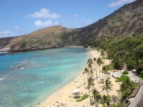
Hanama Bay, Oahu
An atmospheric destabilizing upper level trough of low pressure is shifting south and SE now…with a much anticipated improvement in the weather right around the corner for the islands. We are finally moving back into what looks like a bonafide classic trade wind weather pattern. Drier air, less cloudiness, and certainly fewer showers will be the name of the game as we move through the weekend. The forecast models are being kind to us in their outlook for the new week ahead as well, with generally fine and pleasant weather prevailing…finally!
The trade winds, after a day or two of being quite light, will gradually increase a notch this weekend. The latest weather map shows a 1031 millibar high pressure system located far to the northeast of Hawaii now. A new high pressure cell will reinforce the one already in the eastern Pacific soon. Forecast weather charts suggest that the trade winds will continue right on into the new week ahead. They won’t be too strong, nor will they be too light…turning out to be light to moderate, which is just about perfect during the month of February.
It’s Friday evening as I begin updating this last paragraph of today’s narrative. Today the trade winds picked up a little more speed than expected, which took the edge off the afternoon convective rainfall…at least a little. Nonetheless, the Big Island still took a pretty big hit in terms of localized downpours. The NWS forecast office in Honolulu kept flood watches and warnings up most of the day. Let’s just put it this way, it has been excessively wet over many areas on the Big Island lately, to say the least! This doesn’t come unexpectedly however, as typically a La Nina winter here in the islands includes wetter than normal weather. By the way, La Nina is simply cooler than normal sea water temperatures in the eastern and central tropical Pacific…which influences weather worldwide. The ENSO forecast calls for continued La Nina conditions prevailing through the rest of this winter, into the spring months. ~~~ As pointed out in the two paragraphs above, we are close to being back into better weather, very close folks! This weekend into the new week ahead should prove to be much nicer, with the Chamber of Commerce folks finally remembering how to smile again ~~~ This evening I’m going to see a film called I am Legend (2007). Will Smith stars in a post-apocalyptic thriller as the last human survivor on earth after a terrible mutating virus wipes out humanity. It actually received pretty good ratings, I had put off seeing it, but with nothing else playing that I want to see, or haven’t already seen, I’ll try it out. If you’re interested, here’s a trailer for this thriller. To tell you the truth, one of the main reasons I didn’t want to seen this film was because it looks like German Shephard, Will’s side kick, gets killed in the end. I can take humans getting knocked off in films, but watching animals going down is another story! I’ll have to advert my eyes during that scene. I’ll let you know what I thought about it when I come back Saturday with your next new weather narrative from paradise. I hope you have a great Friday night wherever you happen to be spending it! Aloha for now…Glenn.
Glenn’s TV Weather show is back online again now. The colors aren’t perfect, although they are close enough. One day’s show will replaced with the next new days show at around 9am HST (11am PST – 2pm EST). Thanks to the folks at the Maui Media Lab in Paia for making this happen!
Posted by Glenn
[5] Comments
February 7-8 2008
Air Temperatures – The following maximum temperatures were recorded across the state of Hawaii Thursday:
Lihue, Kauai – 79
Honolulu, Oahu – 80
Kaneohe, Oahu – 77
Kahului, Maui – 79
Hilo, Hawaii – 79
Kailua-Kona, Hawaii – 83
Temperatures ranged between these warmest and coolest spots near sea level at 4 a.m. Friday morning:
Kaneohe, Oahu – 71F
Kahului, Maui – 61
Precipitation Totals – The following numbers represent the largest precipitation totals (inches) during the last 24 hours on each of the major islands, as of Friday morning:
3.55 MOUNT WAIALEALE, KAUAI
3.19 OAHU FOREST NWR, OAHU
1.23 MOLOKAI
0.00 LANAI
0.00 KAHOOLAWE
2.11 OHEO GULCH, MAUI
4.04 HILO AIRPORT, BIG ISLAND
Weather Chart – Here’s the latest (automatically updated) weather map. A 1034 millibar high pressure system is located far to the NE of the islands…with its associated ridge extending westward…to the north of Hawaii Friday. This pressure configuration will keep light winds around, gradually picking up in strength this weekend into next week. Here’s a Weather Map Symbol page for clarification about what all those weather symbols mean on the map.
Satellite and Radar Images: To view the cloud conditions we have here in Hawaii, please use the following satellite links, starting off with the Infrared Satellite Image of the islands to see all the clouds around the state during the day and night. This next image is one that gives close images of the islands only during the daytime hours, and is referred to as a Close-up visible image. This next image shows a larger view of the Pacific…giving perspective to the wider ranging cloud patterns in the Pacific Ocean…out from the islands. To help you keep track of where any showers may be around the islands, here’s the latest animated radar image.
Hawaii’s Mountains – Here’s a link to the live webcam on the summit of near 14,000 foot Mauna Kea on the Big Island of Hawaii. The tallest peak on the island of Maui is the Haleakala Crater, which is near 10,000 feet in elevation. These two webcams are available during the daylight hours here in the islands…and when there’s a big moon rising just after sunset for an hour or two! Plus, during the nights and early mornings you will be able to see stars, and the sunrise too…depending upon cloud conditions.
Aloha Paragraphs

A nice sunset on the upper west side of Maui
The cloud and shower producing upper trough of low pressure over the islands…will stick around for another day or two. This upper level trough of low, had been moving eastward, and was expected to provide improving weather conditions…but has now stalled. This in turn will keep our overlying atmosphere at least somewhat moist and unstable, with still the chance of localized heavy showers, or even a random thunderstorm…mostly during the afternoon hours. All of the islands got into the act Thursday afternoon, when locally heavy, and in places…flooding rainfall occurred. We will see a repeat performance again Friday, with improved weather forecast for the weekend.
The trade winds have eased in strength recently, remaining on the light side through Friday…then pick up a notch again this weekend. The latest weather map shows a very strong 1040 millibar high pressure system located far to the northeast of Hawaii Thursday evening. Storms moving by to our north have weakened our trade wind producing high pressure ridge, which in turn has softened our local trade winds temporarily. The long range computer forecast models show the trade winds persisting into next week, which continues the unusually long lasting spell of winds this winter.
It’s Thursday evening as I begin updating last paragraph of today’s narrative. The high and middle level clouds, which greatly limited Hawaii’s famous sunshine during the last week, have finally moved away! This allowed more sunshine to prevail in most areas, especially during the morning hours…which was good thing! On the other hand, that sunshine, with its daytime heating, in turn caused afternoon cloud buildups to form. As noted above, the air mass over the islands is still somewhat unstable. This instability allowed clouds to develop vertically, to grow higher than normal. Those deep dark clouds, dropped localized heavy showers, with even a few thunderstorms noted. At one point Thursday afternoon, there was a waterspout reported dropping down from one such cloud! A waterspout is simply a tornado over water. The focus for these showers was mostly over and around the mountains may be showers falling along the windward sides in places too. The good news here, is that the leeward beaches saw better weather in general, with lots of sunshine beaming down! ~~~ Despite the chance of more showers, I think the general outlook remains upbeat. We are more than likely going to see a repeat performance Friday afternoon, after a sunny start to the day in most areas. This weekend should be quite nice, with just a normal trade wind weather pattern prevailing. Looking further away, like around next Tuesday, we could see the chance of another increase in showers, but lets hold off on getting too overly serious about that just yet. ~~~ I’ll be back very early Friday morning with your next new weather narrative. I hope you have a great Thursday night wherever you happen to be spending it. Aloha for now…Glenn.
Glenn’s TV Weather show is back online again now. The colors aren’t perfect, although they are close enough. One day’s show will replaced with the next new days show at around 9am HST (11am PST – 2pm EST). Thanks to the folks at the Maui Media Lab in Paia for making this happen!
Posted by Glenn
No Comments
February 6-7 2008
Air Temperatures – The following maximum temperatures were recorded across the state of Hawaii Wednesday:
Lihue, Kauai – 79
Honolulu, Oahu – 82
Kaneohe, Oahu – 77
Kahului, Maui – 75
Hilo, Hawaii – 77
Kailua-Kona, Hawaii – 78
Temperatures ranged between these warmest and coolest spots near sea level at 4 a.m. Thursday morning:
Lihue, Kauai – 72F
Hilo, Hawaii – 66
Precipitation Totals – The following numbers represent the largest precipitation totals (inches) during the last 24 hours on each of the major islands, as of Thursday morning:
2.43 MOUNT WAIALEALE, KAUAI
3.77 MANOA LYON ARBORETUM, OAHU
0.00 MOLOKAI
0.00 LANAI
0.00 KAHOOLAWE
0.65 HANA AIRPORT, MAUI
0.87 PAHOA, BIG ISLAND
Weather Chart – Here’s the latest (automatically updated) weather map. A 1035 millibar high pressure system is located far to the NE of the islands…with its associated ridge extending westward…to the north of Hawaii Thursday. This pressure configuration will keep light to moderately strong trade winds blowing through the rest of this week. Here’s a Weather Map Symbol page for clarification about what all those weather symbols mean on the map.
Satellite and Radar Images: To view the cloud conditions we have here in Hawaii, please use the following satellite links, starting off with the Infrared Satellite Image of the islands to see all the clouds around the state during the day and night. This next image is one that gives close images of the islands only during the daytime hours, and is referred to as a Close-up visible image. This next image shows a larger view of the Pacific…giving perspective to the wider ranging cloud patterns in the Pacific Ocean…out from the islands. To help you keep track of where any showers may be around the islands, here’s the latest animated radar image.
Hawaii’s Mountains – Here’s a link to the live webcam on the summit of near 14,000 foot Mauna Kea on the Big Island of Hawaii. The tallest peak on the island of Maui is the Haleakala Crater, which is near 10,000 feet in elevation. These two webcams are available during the daylight hours here in the islands…and when there’s a big moon rising just after sunset for an hour or two! Plus, during the nights and early mornings you will be able to see stars, and the sunrise too…depending upon cloud conditions.
Aloha Paragraphs

A picture of the top of the Haleakala Crater on Maui, when it was covered
with snow last week…looking down towards Maalaea Bay
Cloudy weather will perist for the time being, with improved conditions Thursday…through the rest of the week. The upper level trough of low pressure, which has kept inclement weather conditions around since this last weekend, will continue moving eastward. This in turn will allow the copious amounts of high and middle level clouds to finally clear island skies. This transformation won’t be immediate, but happen soon. As the weekend gets here, there’s a good chance that our local weather will be quite nice…although there will still be a few passing showers along the windward sides.
Our local trade winds will stick around through the rest of this week, although be lighter than anytime during the last week. The latest weather map shows a strong 1037 millibar high pressure system located far to the northeast of Hawaii Wednesday night. The long range computer forecast models show the trade winds persisting into next week, which continues the unusually long lasting spell of winds from the east. The long lasting small craft wind advisories will likely be taken down by the NWS office in Honolulu at some point soon…as we settle into light to moderately strong trade winds well into the future.
It’s Wednesday evening as I begin updating this last paragraph of today’s narrative. A low pressure system, with its associated trough, is finally beginning to lose its grip in our Hawaiian Island weather picture. This trough continues to funnel moist air into our area, but most of it now is confined to the higher altitudes of the atmosphere. These high cirrus clouds are steadily moving east, having already cleared Niihau, Kauai, and most of Oahu, with Maui County next in line…and the Big Island not far behind. This looping satellite image shows those clouds being carried over us. As the trough finally moves off to the east of the Big Island, we will see relief from the mostly cloudy weather of late, with drier weather expected, and yes, even lots of sunshine beaming down soon too. ~~~ It actually looks like we might be digging ourselves out of the adverse weather conditions that have held sway over the islands lately! This is none too soon, believe me, as pretty much everyone is tired of the cloudy and locally wet to very wet weather lately. ~~~ By the way, there were enough breaks in the overcast today, that sunshine finally returned enough, especially on Kauai and Oahu, that air temperatures warmed some. Case in point, the Honolulu airport reached up into the 80F’s, snagging a pleasantly warm 82F degree high temperature for the day. The rest of the major airport weather stations were stuck in the upper 70F’s. ~~~ I’ll be back very early Thursday morning with your next new weather narrative from paradise, I hope you have a nice Wednesday night wherever you happen to be spending it! Aloha…Glenn.
Glenn’s TV Weather show is back online again now. The colors aren’t perfect, although they are close enough. One day’s show will replaced with the next new days new show at around 9am HST (11am PST, 1pm EST). Thanks to the folks at the Maui Media Lab in Paia for making this happen!
Posted by Glenn
[6] Comments
February 5-6 2008
Air Temperatures – The following maximum temperatures were recorded across the state of Hawaii Tuesday:
Lihue, Kauai – 78
Honolulu, Oahu – 79
Kaneohe, Oahu – 74
Kahului, Maui – 73
Hilo, Hawaii – 71
Kailua-Kona, Hawaii – 79
Temperatures ranged between these warmest and coolest spots near sea level at 4 a.m. Wednesday morning:
Lihue, Kauai – 73F
Kahului, Maui – 64
Precipitation Totals – The following numbers represent the largest precipitation totals (inches) during the last 24 hours on each of the major islands, as of Wednesday morning:
5.72 MOUNT WAIALEALE, KAUAI
2.06 MANOA LYON ARBORETUM, OAHU
0.01 MOLOKAI
0.10 LANAI
0.13 KAHOOLAWE
5.37 PUU KUKUI, MAUI
4.20 HILO AIRPORT, BIG ISLAND
Weather Chart – Here’s the latest (automatically updated) weather map. A 1034 millibar high pressure system is located far to the NE of the islands…with its associated ridge extending westward…to the north of Hawii. This pressure configuration will keep moderately strong trade winds blowing Wednesday…getting lighter Thursday. Here’s a Weather Map Symbol page for clarification about what all those weather symbols mean on the map.
Satellite and Radar Images: To view the cloud conditions we have here in Hawaii, please use the following satellite links, starting off with the Infrared Satellite Image of the islands to see all the clouds around the state during the day and night. This next image is one that gives close images of the islands only during the daytime hours, and is referred to as a Close-up visible image. This next image shows a larger view of the Pacific…giving perspective to the wider ranging cloud patterns in the Pacific Ocean…out from the islands. To help you keep track of where any showers may be around the islands, here’s the latest animated radar image.
Hawaii’s Mountains – Here’s a link to the live webcam on the summit of near 14,000 foot Mauna Kea on the Big Island of Hawaii. The tallest peak on the island of Maui is the Haleakala Crater, which is near 10,000 feet in elevation. These two webcams are available during the daylight hours here in the islands…and when there’s a big moon rising just after sunset for an hour or two! Plus, during the nights and early mornings you will be able to see stars, and the sunrise too…depending upon cloud conditions.
Aloha Paragraphs
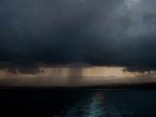
This shot was taken near Hilo, on the Big Island
photo credit: flickr.com
The trade winds, still quite strong and gusty, will keep blowing across our tropical latitudes of the north central Pacific, gradually getting lighter over the next couple of days…only to increase again this weekend. The latest weather map shows two high pressure systems located to the northeast of Hawaii Tuesday night. The pressure gradient is still quite steep in Hawaii, which simply means that our local winds are still rather strong. There will be blustery winds in those areas exposed to the easterly breezes, although the more protected leeward sides will see less of it. The long lasting small craft wind advisories remain enforce over the windiest areas around the state for the time being.
Just when it started to look like we’d see a possible break in the showery weather, showers, even locally heavy ones…may continue through Friday. The incoming showery clouds don’t seem to want to stop, marching along our windward sides like nobody’s business! Since the trade winds prevail, there will be continued passing showers, unfortunately focusing their efforts most effectively over the windward sides of the Big Island and Maui, although Oahu and Kauai won’t be immune. As the weekend gets here, there’s a good chance that our local weather will transform itself back towards the sunnier side of the weather spectrum.
It’s Tuesday evening as I begin updating last paragraph of today’s narrative. Today was anything but a banner day for sunshine, with lots of high clouds, not to mention the middle and low varieties, hiding our famous Hawaiian sunshine once again.
This looping satellite image shows the situation well. Those cirrus clouds will hold back the sun for the time being, although these icy clouds up high aren’t rain producers at least. Speaking of precipitation, there is still lots of water falling from the sky around…some of which has become locally heavy again. A flash flood watch has been reinstituted for the already soggy Big Island. This looping radar image shows waves of showers impacting the Big Island…stretching up over parts of Maui and Oahu as well. The Big Island does not need anymore rainfall, especially from Kau to Puna and up along the windward sides! ~~~ Most of Tuesday was totally cloudy, with showers not uncommon. Tuesday evening heavy rain was once again falling along the windward sides of the Big Island, this is getting to be really out of hand. The windward sides of Maui too, are exceptionally soggy and wet. Oahu, up the island chain, isn’t fairing much better, with copious rainfall a common visitor along the east and north facing slopes of the Koolau Mountains. The big question of course becomes: when will it stop! Well, it looked like it might back off there yesterday and earlier today, but now, well, it looks like we’ll have to wait until Friday or the weekend for some substantial relief. ~~~ I hope it’s drier where you are, as even here in Kihei, Maui, we had some brief showers around Tuesday. When it rains in Kihei, you know it’s a wet period! At any rate, I’ll be back with your next new weather narrative from our less than perfect paradise very early Wednesday morning. I hope you have a great Tuesday night wherever you happen to be spending it! Aloha for now…Glenn.
Interesting: To help figure out how to create a flapping wing plane that will stand up to extreme wind and weather scientists are turning to nature for the answer.
Natural flyers like birds, bats and insects outperform man-made aircraft in aerobatics and efficiency. University of Michigan engineers are studying these animals as a step toward designing flapping-wing planes with wingspans smaller than a deck of playing cards.
A Blackbird jet flying nearly 2,000 miles per hour covers 32 body lengths per second. But a common pigeon flying at 50 miles per hour covers 75.
The roll rate of the aerobatic A-4 Skyhawk plane is about 720 degrees per second. The roll rate of a barn swallow exceeds 5,000 degrees per second.
Select military aircraft can withstand gravitational forces of 8-10 G. Many birds routinely experience positive G-forces greater than 10 G and up to 14 G.
Interesting2: It’s National Weatherman’s Day Tuesday! "National Weatherman’s Day honors weathermen, and woman who work hard to accurately predict the often fickle weather. Despite major technological advances and supercomputers, forecasting the weather is still a tricky, and ever changing business.
According to the Air Force News, Weatherman’s Day "commemorates the birth of John Jeffries, one of America’s first weathermen". Jeffries was born on Feb 5, 1744. He kept weather records from 1774 to1816.
If you see a weatherman today, give them your appreciation for a job well done.
Posted by Glenn
No Comments
February 4-5 2008
Air Temperatures – The following maximum temperatures were recorded across the state of Hawaii Monday:
Lihue, Kauai – 75
Honolulu, Oahu – 78
Kaneohe, Oahu – 75
Kahului, Maui – 75
Hilo, Hawaii – 75
Kailua-Kona, Hawaii – 81
Temperatures ranged between these warmest and coolest spots near sea level at 4 a.m. Tuesday morning:
Kailua-kona – 73F
Hilo, Hawaii – 65
Precipitation Totals – The following numbers represent the largest precipitation totals (inches) during the last 24 hours on each of the major islands, as of Tuesday morning:
3.66 MOUNT WAIALEALE, KAUAI
1.63 KAHUKU TRAINING AREA, OAHU
0.04 MOLOKAI
0.00 LANAI
0.00 KAHOOLAWE
1.93 PUU KUKUI, MAUI
4.81 WAIAKEA UKA, BIG ISLAND
Weather Chart – Here’s the latest (automatically updated) weather map. High pressure systems, two of them, are located far to the NE of the islands…with their associated ridge extending westward…to the north of Hawii. This pressure configuration will keep moderately strong trade winds blowing through Wednesday. Here’s a Weather Map Symbol page for clarification about what all those weather symbols mean on the map.
Satellite and Radar Images: To view the cloud conditions we have here in Hawaii, please use the following satellite links, starting off with the Infrared Satellite Image of the islands to see all the clouds around the state during the day and night. This next image is one that gives close images of the islands only during the daytime hours, and is referred to as a Close-up visible image. This next image shows a larger view of the Pacific…giving perspective to the wider ranging cloud patterns in the Pacific Ocean…out from the islands. To help you keep track of where any showers may be around the islands, here’s the latest animated radar image.
Hawaii’s Mountains – Here’s a link to the live webcam on the summit of near 14,000 foot Mauna Kea on the Big Island of Hawaii. The tallest peak on the island of Maui is the Haleakala Crater, which is near 10,000 feet in elevation. These two webcams are available during the daylight hours here in the islands…and when there’s a big moon rising just after sunset for an hour or two! Plus, during the nights and early mornings you will be able to see stars, and the sunrise too…depending upon cloud conditions.
Aloha Paragraphs

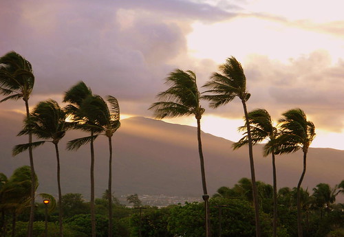
Front row seat
photo credit: flickr.com
The trade winds will continue to blow through the week, although finally come back down into the moderately strong realms now. The latest weather chart continues to show a hefty 1036 millibar high pressure system located to the northeast of Hawaii Monday night. As usual, those places sheltered from the gusty wind flow, will have lighter winds. Small craft wind advisories remain active in the windiest areas around the state.
The heaviest rains have recently fallen on Kauai and the Big Island…with perhaps one more day of this heavy rain threat. The incoming showery clouds will be getting less frequent now, carried in our direction by the steady trade winds. There remains the chance that some of these showers will cause localized flooding…thus, the statewide flash flood watch remains in place Monday night. Looking further ahead, we should see some relief from these heavy rains by the time we reach mid-week and beyond.
It’s Monday evening as I begin updating this last paragraph of today’s narrative.
The combination of lots of moisture being carried our way on the gusty trade winds, and an upper level low pressure system, with its cold air aloft…has made our overlying atmosphere unstable and very shower prone the last several days. The upper low with its associated troughing, will be gradually moving away soon. This will take the threat of heavy showers with it, although, with the trade winds still blowing this week, we’ll continue to see at least some passing showers along those soggy windward coasts and slopes. ~~~ Monday remained on the cloudy side in most areas of the state. Although the rainfall definitely backed off to a large degree. There were some showers falling locally, although for the most part they remained over the offshore waters. As this looping satellite image shows, there remains a conveyor belt like flow of high and middle level clouds streaming over Hawaii from the tropics to our SW. It shows towering cumulus and thunderstorms to the SW of Oahu for the most part. The icy tops of these thunderstorms are moving up over the central islands. The actual thunderstorms and attendant heavy showers themselves, seem to be staying safely offshore at the time of this writing. This looping radar image shows an area of showers still looming offshore of the Big Island. The Big Island does not need anymore rainfall, especially from Kau to Puna and up along the windward sides! Here’s why ~~~ As I mentioned this morning, I’ve been having trouble with my internet connectivity at home. I had to drive down to the Maui Community College to update this webpage early Monday morning, along with the rest of my website. I’m not sure when this problem will be corrected, so there may be some irregularities over the next few days. I will be back very early Tuesday morning if all goes well, otherwise I’ll get the next new narrative out to you as soon as possible, one way or the other. (When I got home Monday evening, my computer worked just fine, and by the way it was pea soup foggy up here on the slopes of the Haleakala Crater, in Kula, Maui, one of my favorite weather types) I hope you have a great Monday night wherever you happen to be spending it! Aloha for now…Glenn.
Interesting:
"Take a hike!" isn’t just a rebuff. Now it’s also a plea from environmental scientists. Researchers have found that people are enjoying the outdoors less than they used to, which may lead to decreased interest in protecting the environment.
Over the past 20 years, trips to U.S. parks have declined about 20 percent. In 2006, about 273,000 Americans visited a state or national park, down from about 287,000 people in 1987, according to a new study by conservation scientists Oliver Pergams of the University of Illinois at Chicago and Patricia Zaradic of Bryn Mawr College in Pennsylvania. This averages out to roughly 0.9 visits per person a year now, compared to 1.2 visits 20 years ago.
And it’s not just park visits that are down, but almost every form of outdoor recreation, including camping, hunting and fishing.
The researchers blame this outdoor decline on a phenomenon they’ve termed videophilia — a pervasive preference for experiencing the world through electronic media rather than actually leaving the house.
Famous aviation quotes: ‘You know that your landing gear is up and locked when it takes full
power to taxi to the terminal.’
‘Airspeed, altitude and brains. Two are always needed to complete the flight successfully.’
‘The only time you have too much fuel is when you’re on fire.’
Posted by Glenn
No Comments
February 2-3 2008
Air Temperatures – The following maximum temperatures were recorded across the state of Hawaii Saturday:
Lihue, Kauai – 74
Honolulu, Oahu – 80
Kaneohe, Oahu – 76
Kahului, Maui – 70
Hilo, Hawaii – 70
Kailua-Kona, Hawaii – 79
Temperatures ranged between these warmest and coolest spots near sea level at 6 a.m. Sunday morning:
Kaneohe, Oahu – 73F
Barking Sands, Kauai – 66
Precipitation Totals – The following numbers represent the largest precipitation totals (inches) during the last 24 hours on each of the major islands, as of Sunday morning:
5.38 MOUNT WAIALEALE, KAUAI
4.51 POAMOHO 2, OAHU
0.39MOLOKAI
0.00 LANAI
0.00 KAHOOLAWE
5.28 WEST WAILUAIKI, MAUI
11.82 WAIAKEA UKA, BIG ISLAND!
Weather Chart – Here’s the latest (automatically updated) weather map. A dynamic 1036 millibar high pressure system remains in the area north-northeast of the islands, which will keep moderate to locally strong and gusty trade winds blowing across our area for the time being…gradually getting lighter as we move into the new week ahead. Here’s a Weather Map Symbol page for clarification about what all those weather symbols mean on the map.
Satellite and Radar Images: To view the cloud conditions we have here in Hawaii, please use the following satellite links, starting off with the Infrared Satellite Image of the islands to see all the clouds around the state during the day and night. This next image is one that gives close images of the islands only during the daytime hours, and is referred to as a Close-up visible image. This next image shows a larger view of the Pacific…giving perspective to the wider ranging cloud patterns in the Pacific Ocean…out from the islands. To help you keep track of where any showers may be around the islands, here’s the latest animated radar image.
Hawaii’s Mountains – Here’s a link to the live webcam on the summit of near 14,000 foot Mauna Kea on the Big Island of Hawaii. The tallest peak on the island of Maui is the Haleakala Crater, which is near 10,000 feet in elevation. These two webcams are available during the daylight hours here in the islands…and when there’s a big moon rising just after sunset for an hour or two! Plus, during the nights and early mornings you will be able to see stars, and the sunrise too…depending upon cloud conditions.
Aloha Paragraphs
Winter weather in the Hawaiian Islands this weekend!
photo credit: flickr.com
The trade winds will remain locally strong and gusty across the Hawaiian Islands into Sunday. The latest weather map shows a strong 1035 millibar high pressure system located to the north-northeast of Hawaii Saturday night. As usual, those places sheltered from the gusty wind flow, will have lighter winds. Small craft wind advisories remain active, with gale warnings posted in the channels around Maui and the Big Island. A trough of low pressure in our area, may turn our winds to the ESE or even SE in a couple of days. Later in the new week ahead, our trade winds will actually get quite a bit lighter…finally.
Incoming showers, carried by the trade winds, will keep the windward sides wet…with some showers spreading over to the leeward sides locally. These incoming showery clouds will be numerous…some of which will be heavy. Local showers will be more active than normal through the weekend, some of which will bring flooding…thus the statewide flash flood watch into Sunday. Looking further ahead, the latest computer models show more showers heading our way, especially on the windward sides on Maui and the Big Island.
It’s Saturday evening as I begin updating this last paragraph of today’s narrative. As noted in the two paragraphs above, its going to continue to be rather windy and locally wet…especially along the windward coasts and slopes of Maui and the Big Island. As we move into the new week ahead, we will see more showers arriving along the already wet windward sides. There is the chance of localized flooding, with thunderstorms now included in the forecast. ~~~ Saturday was definitely one of the cloudier and wet days of the year, short year that its been so far. This isn’t totally unexpected though, as often La Nina years bring wetter than normal weather to the Hawaiian Islands. This has been an unusually wet period however, as the just under 20.00 inches of rain, during the last 24 hours, that has fallen along the wettest areas on the windward side of the Big Island shows! ~~~ I want to keep this looping radar image active, which shows the considerable amount of showers being carried in over the windward sides of the islands now. For added perspective, here’s an IR satellite image, showing all the clouds congregating around the islands…which there is no lack! ~~~ It’s just around sunset here in Kula, Maui, as I get near the end of this long paragraph. The sun is poking through the long lasting overcast finally, which is shining brightly orange in my weather tower. At the moment, I’m listening to Erik Satie’s piano music, which somehow seems to fit nicely. I hope you have a great Saturday night, I’ll be back Sunday morning with more weather updates, I hope you have a great Saturday night until then! Aloha for now…Glenn.
The following weekend poem was written by a former poet laureate of the United States, Billy Collins. This poem was selected from his book called Questions About Angels….called Pie Man.
I am carrying my homemade pies down a cobblestone road
that winds through a hamlet, balancing one pie
on each palm, traversing a page of fair watercolors
and ink lines, a white baker’s hat collapsed on my head,
a white apron waving over my river blue pants.
Wives call to me from the frames of their cottage windows.
Children skip alongside me, their sunny faces uplifted.
My high jaunty strides show I love my trade.
You may remember the first time you saw me,
sitting in someone’s lap as she turned the pages
of a thin book dropped long ago on the banks of childhood.
You may even remember some details like the rows
of fork holes in the crusts, the rising curlicues of steam,
my buckled shoes, the red lettering on my handcart.
It is a picture that will soon pale as it did before,
the pies, the hat, cobblestones and children breaking
into pieces and drifting off as objects do in space.
This may be the last time you think of me or I of you.
Think of the color of the shutters, the painted bridge,
the shapes of clouds, the wooden sign above the cheese
shop.
Posted by Glenn
No Comments
February 1-2 2008
Air Temperatures – The following maximum temperatures were recorded across the state of Hawaii Friday:
Lihue, Kauai – 73
Honolulu, Oahu – 80
Kaneohe, Oahu – 76
Kahului, Maui – 74
Hilo, Hawaii – 76
Kailua-Kona, Hawaii – 81
Temperatures ranged between these warmest and coolest spots near sea level at 5 a.m. Saturday morning:
Honolulu, Oahu – 73F
Barking Sands, Kauai – 66
Precipitation Totals – The following numbers represent the largest precipitation totals (inches) during the last 24 hours on each of the major islands, as of Saturday morning:
3.80 MOUNT WAIALEALE, KAUAI
1.34 POAMOHO 2, OAHU
0.34 MOLOKAI
0.00 LANAI
0.00 KAHOOLAWE
7.97 PUU KUKUI, MAUI
11.03 WAIAKEA UKA, BIG ISLAND
Weather Chart – Here’s the latest (automatically updated) weather map. A robust 1036 millibar high pressure system remains locked into place north-northeast of the islands, which will keep moderate to locally strong and gusty trade winds blowing across our area through Sunday. Here’s a Weather Map Symbol page for clarification about what all those weather symbols mean on the map.
Satellite and Radar Images: To view the cloud conditions we have here in Hawaii, please use the following satellite links, starting off with the Infrared Satellite Image of the islands to see all the clouds around the state during the day and night. This next image is one that gives close images of the islands only during the daytime hours, and is referred to as a Close-up visible image. This next image shows a larger view of the Pacific…giving perspective to the wider ranging cloud patterns in the Pacific Ocean…out from the islands. To help you keep track of where any showers may be around the islands, here’s the latest animated radar image.
Hawaii’s Mountains – Here’s a link to the live webcam on the summit of near 14,000 foot Mauna Kea on the Big Island of Hawaii. The tallest peak on the island of Maui is the Haleakala Crater, which is near 10,000 feet in elevation. These two webcams are available during the daylight hours here in the islands…and when there’s a big moon rising just after sunset for an hour or two! Plus, during the nights and early mornings you will be able to see stars, and the sunrise too…depending upon cloud conditions.
Aloha Paragraphs
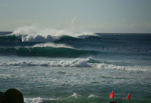
Winter surf in Hawaii
photo credit: flickr.com
The trade winds will remain locally strong and gusty across the Hawaiian Islands through the weekend. The latest weather map shows a strong 1036 millibar high pressure system located to the north-northeast of Hawaii Friday night. As usual, those places sheltered from the gusty wind flow, will have lighter winds. Small craft wind advisories remain active, with even gale warnings posted in the channels around Maui and the Big Island! It will take until early next week for the winds to moderate, when they will change direction to the southeast perhaps…bringing warmer air with them. Later in the new week ahead, our trade winds will actually get quite a bit lighter.
Incoming showers, carried by the trade winds, will keep the windward sides wet…with some showers spreading over to the leeward sides locally. These incoming showery clouds will be numerous…some of which may be briefly heavy. The upper level low pressure system, which brought snow to the mountains recently, has moved away to the northeast. It’s associated trough however, will remain near the islands. This in turn will keep the trade wind inversion high or non-existent…which means thicker clouds. Thus, showers will be more active than normal through the weekend. Looking further ahead, the latest computer models show a low pressure system developing to the southwest of Hawaii, which may pull up deep moisture from the SE, keeping rain in the forecast into the new week, especially on the windward sides on Maui and the Big Island.
It’s Friday evening as I begin updating this last paragraph of today’s narrative. As noted in the two paragraphs above, its going to continue to be rather windy and locally wet along the windward coasts and slopes. The latest forecast models are locking onto the distinct possibility of continued wet conditions there even after the weekend. I’ve held off on saying too much about this increase in showers early in the new week ahead, but since the models are becoming more aligned in there solutions, we have to take this threat more seriously. As we move into the new week ahead, we could likely see more showers arriving along the already wet windward sides. There is the chance of localized flooding, although thunderstorms aren’t in the forecast at this point…fortunately. We’ll need to keep an eye on this situation, as tropical moisture from the SE moves up over Maui and the Big Island end of the chain. ~~~ I’m about to leave Kihei, and head over to Wailuku, where I’m meeting some friends. The occasion is something called First Friday, which simply means a social occasion on the 1st Friday of the month. I hadn’t heard of this before, but will check it out…not sure what to expect. It would be nice to have a drink, and be able to do some dancing! ~~~ Before I leave however, I want to put a link to this looping satellite image, which shows the copious amount of high cirrus clouds being drawn over the islands now. They may stick around through the weekend, giving great sunset and sunrise colors, although will dim and filter our sunshine during the days. I hope you have a great Friday night, I’ll of course be back on Saturday with your next weather narrative from paradise! Aloha for now…Glenn.
Interesting: China is beginning to take advantage of an unusual energy source – cow gas. Cows emit a significant amount of methane, a powerful greenhouse gas, when they belch and flatulate. According to People’s Daily, the world’s largest cow-dung methane power plant started operation on January 21 in China’s Inner Mongolia region. With an investment of roughly $US5.7 million from the country’s largest milk producer, Mengniu Dairy, the plant is able to supply 10 million kilowatt-hours of electricity to the national power grid. Using equipment and technology from Germany, the plant processes the dung, urine, and waste water from some 10,000 cows on Mengniu’s farm. The facility is able to produce 12,000 cubic meters of methane and generate 30,000 kilowatt-hours of electricity daily. The heat derived from the power generation will be used for daily heating at the farm, and the water will be recycled for irrigation. The facility also produces 200,000 tons of organic fertilizers a year, a practice that will save 5,000 tons of coal annually. Methane gas is the second-largest contributor to greenhouse gas emissions worldwide after carbon dioxide. An adult cow emits 80 to 110 kilograms of the gas over its lifetime. Worldwide, 1.2 billion large ruminants, including cows, produce an estimated 80 million tons of methane annually, accounting for some 28 percent of global methane emissions from human-related activities, according to the U.S. Environmental Protection Agency. In total, the livestock sector is responsible for 18 percent of global greenhouse gas emissions, according to the United Nations Food and Agriculture Organization.
Interesting2: A 24-year-old German medical student described Friday how she used mouth-to-mouth resuscitation to revive a tiger cub that nearly choked to death on a chunk of meat. Janine Bauer, who was visiting the Berg Zoo in December with her one-year-old son Johann, asked a keeper to let her into the pen and to hold the prone feline down while she cleared its airway, gave heart massage and revived it with the kiss of life. The zoo in Halle, eastern Germany did not make the incident public at the time. Bauer told MDR television in Halle that the young Malayan tiger appeared to have been too greedy to chew its food properly: "I saw him shiver, fall over, twitch a bit and become immobile. "It took three to five minutes, but he revived in the end." In gratitude, the zoo has named the tiger Johann after her son.
« Previous Page


