


Weather Details & Aloha Paragraphs
Posted by GlennAugust 13-14 2007
Air Temperatures – The following maximum temperatures were recorded across the state of Hawaii Monday:
Lihue, Kauai – 86F
Honolulu, Oahu – 87
Kaneohe, Oahu – 84
Kahului, Maui – 87
Hilo, Hawaii – 85
Kailua-Kona, Hawaii – 86
Temperatures early Tuesday morning ranged between these warmest and coolest spots near sea level at the 4 a.m. hour:
Lihue, Kauai – 78F
Hilo, Hawaii – 73
Precipitation Totals – The following numbers represent the largest precipitation totals (inches) during the last 24 hours on each of the major islands, as of Tuesday morning:
0.29 MOUNT WAIALEALE, KAUAI
0.62 SOUTH FORK KAUKONAHUA, OAHU
0.13 MOLOKAI
0.03 LANAI
0.02 KAHOOLAWE
1.56 PUU KUKUI, MAUI
1.11 WAIAKEA UKA, BIG ISLAND
Weather Chart – Here’s the latest (automatically updated) weather map…showing the continued presence of a large 1034 millibar high pressure system located far north of Hawaii Tuesday. The trade winds will be moderately strong over Hawaii’s coastal waters, although locally much stronger and gusty in those usual windiest locations through Thursday. Here’s a Weather Map Symbol page for clarification about what all those weather symbols mean on the map.
Hawaii’s Mountains – Here’s a link to the live webcam on the summit of near 14,000 foot Mauna Kea on the Big Island of Hawaii. The tallest peak on the island of Maui is the Haleakala Crater, which is near 10,000 feet in elevation. These two webcams are available during the daylight hours here in the islands…and when there’s a big moon rising just after sunset for an hour or two! Plus, during the nights and early mornings you will be able to see stars, and the sunrise too…depending upon cloud conditions.
Tropical Cyclone activity in the eastern and central Pacific – Here’s the latest information coming out of the National Hurricane Center, covering the eastern north Pacific. You can find the latest tropical cyclone information for the central north Pacific (where Hawaii is located) by clicking on this link to the Central Pacific Hurricane Center. Here’s a tracking map covering both the eastern and central Pacific Ocean.
Satellite Images – To view the cloud conditions we have here in Hawaii, please use the following satellite links, starting off with the Infrared Satellite Image of the islands to see all the clouds around the state during the day and night. This next image is one that gives close images of the islands only during the daytime hours, and is referred to as a Close-up visible image. This next image shows a larger view of the Pacific…giving perspective to the wider ranging cloud patterns in the Pacific Ocean…out from the islands. To help you keep track of where any showers may be around the islands, here’s the latest animated radar image.

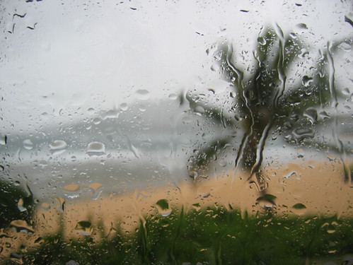
Photo Credit: flickr.com
Increasingly large surf on the Big Island Tuesday, followed by localized tropical storm force winds and torrential flooding rain with the passage of dangerous hurricane Flossie. The other islands will see less intense weather conditions late Tuesday into Thursday.
Our local winds will show a significant increase Tuesday near the Big Island, then elsewhere Wednesday…although less so. Weather maps show the continued presence of an unusually large 1032 millibar high pressure system far to the north of Hawaii Monday evening. This high pressure cell will keep the trade winds active through the next week. As hurricane Flossie moves by just to the south of the state Tuesday, Wednesday into Thursday…we will see our local winds become locally blustery, especially in the southern part of the state around the Big Island and Maui. The Alenuihaha Channel between Maui and the Big Island will see gale warning flags posted Tuesday morning. Winds will return to a more normal trade wind regime after Flossie moves by later Thursday into Friday. For the latest warnings and advisories on Flossie click here.
We will see increasing showers Tuesday as the leading edge of showers associated with hurricane flossie arrives on the Big Island…spreading up the island chain locally Wednesday and Thursday. This satellite image shows hurricane Flossie to the SE of the Aloha state. As Flossie moves by just to our south, there will be a significant increase in showers, mainly on the Big Island…although all the islands may see some increase in showers for several days as well. Local flooding rainfall can be expected in places, especially the southern portion of the Big Island. Drier weather will return later Thursday, spreading westward in the wake of hurricane Flossie.
It’s Monday night here in the islands, as I writie this last paragraph of today’s narrative. Tropical cyclone Flossie continues on a track, taking this weakening hurricane just south of the Big Island Tuesday. Here’s a tracking map, showing the hurricane as it passes by to the south of all the islands…paralleling the leeward sides of the islands. As you can see from the track, Flossie will move by just to the south of the Hawaiian Islands today through Thursday. If the current forecast track remains accurate, with the center of Flossie staying about 85 miles south of the Big Island, we will see a marked increase in our local wind speeds, especially in the southern part of the state. As hurricane Flossie moves by, we will see an increase in tropical showers as well, with most of the torrential rainfall taking aim on the Big Island. Showers will move up the island chain to the other islands into Thursday as well…although to a lesser extent. It is highly recommended that all residents and visitors to Hawaii continue tracking the progress of this storm, as it moves in a west-northwest direction. It should be pointed out that these tropical cyclones can change directions, and could move either further north or south as it gets closer to the islands…prompting a change to the weather expectations noted above. Here’s a looping satellite image of hurricane Flossie, including the Hawaiian Islands. ~~~ I’ll be back early Tuesday morning, with more weather updates, including the latest information on hurricane Flossie. I hope you have a great Monday night wherever you happen to be spending it. Aloha for now…Glenn.